Te Araroa, Part 2
Wanaka to Arthur's Pass
December 2024
This is the second part of my New Zealand adventure. A contrasting few weeks encompassing flat canals and the highest point; days alone and those with a growing trail family; river crossings and avoidings; and moving from a land of (semi) regular shops to the reunion with my first food parcel. << Back to Part 1 | TA Home Page | Onwards to Part 3 >>
Lake Hawea to Ahuriri River
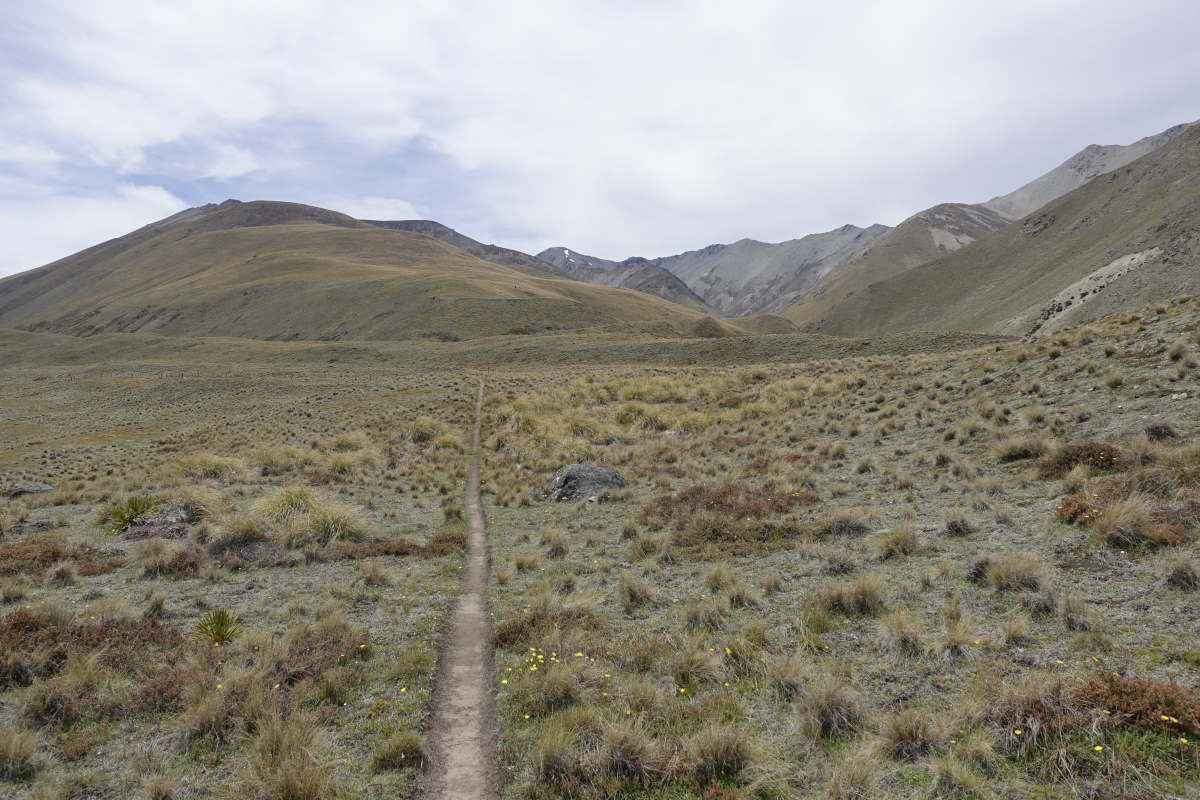
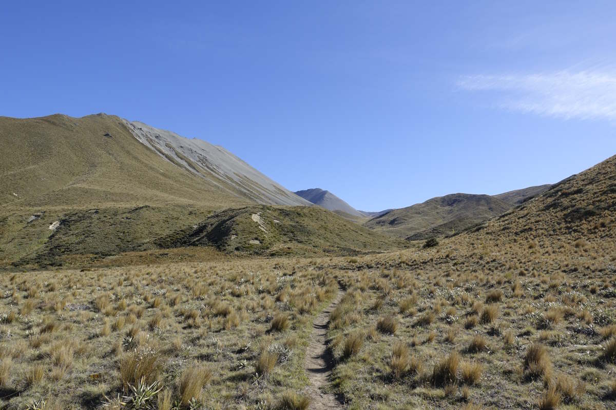
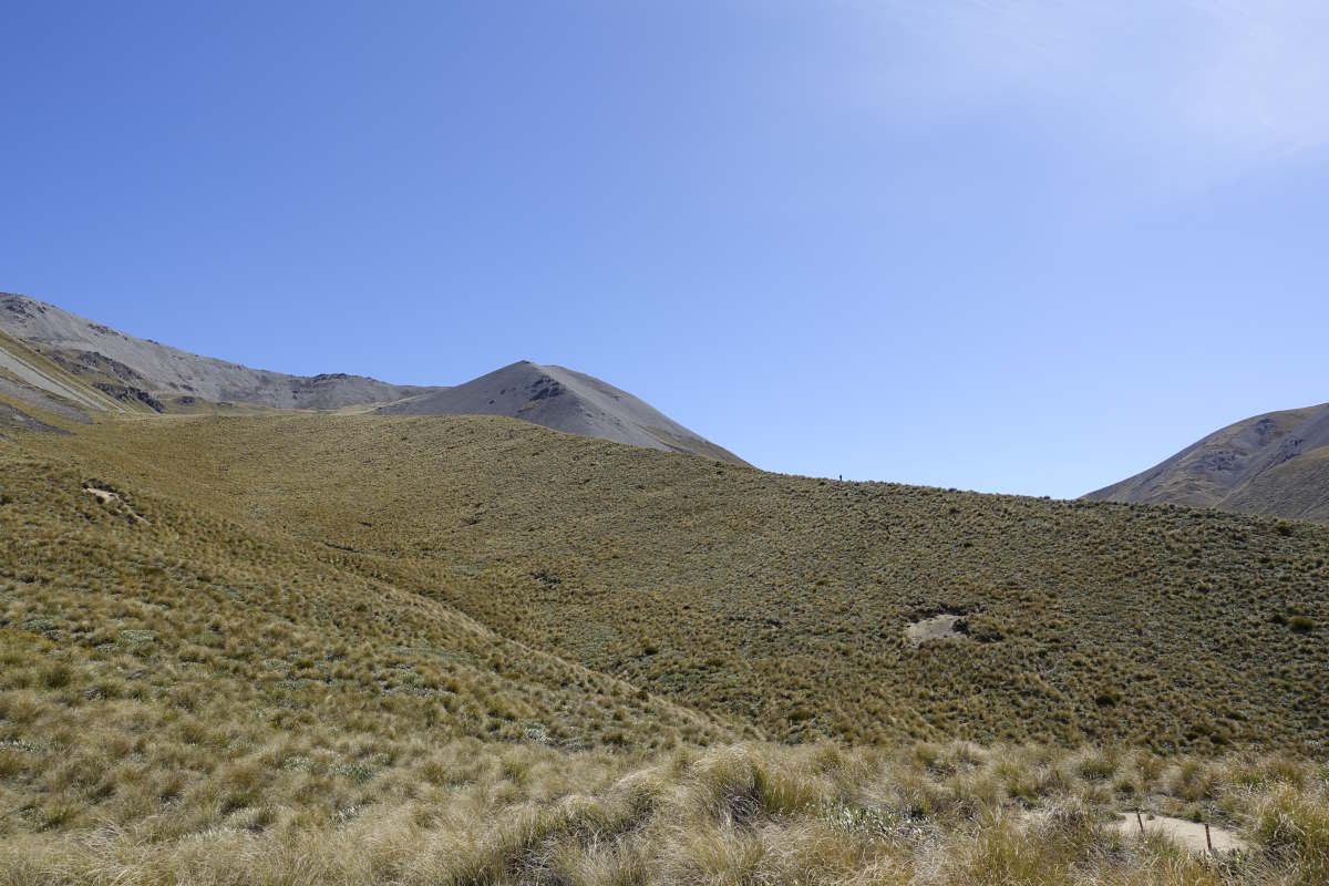
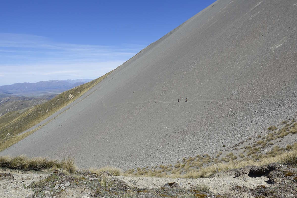
Timaru River and Melina Ridge Tracks, 72km, 3 days
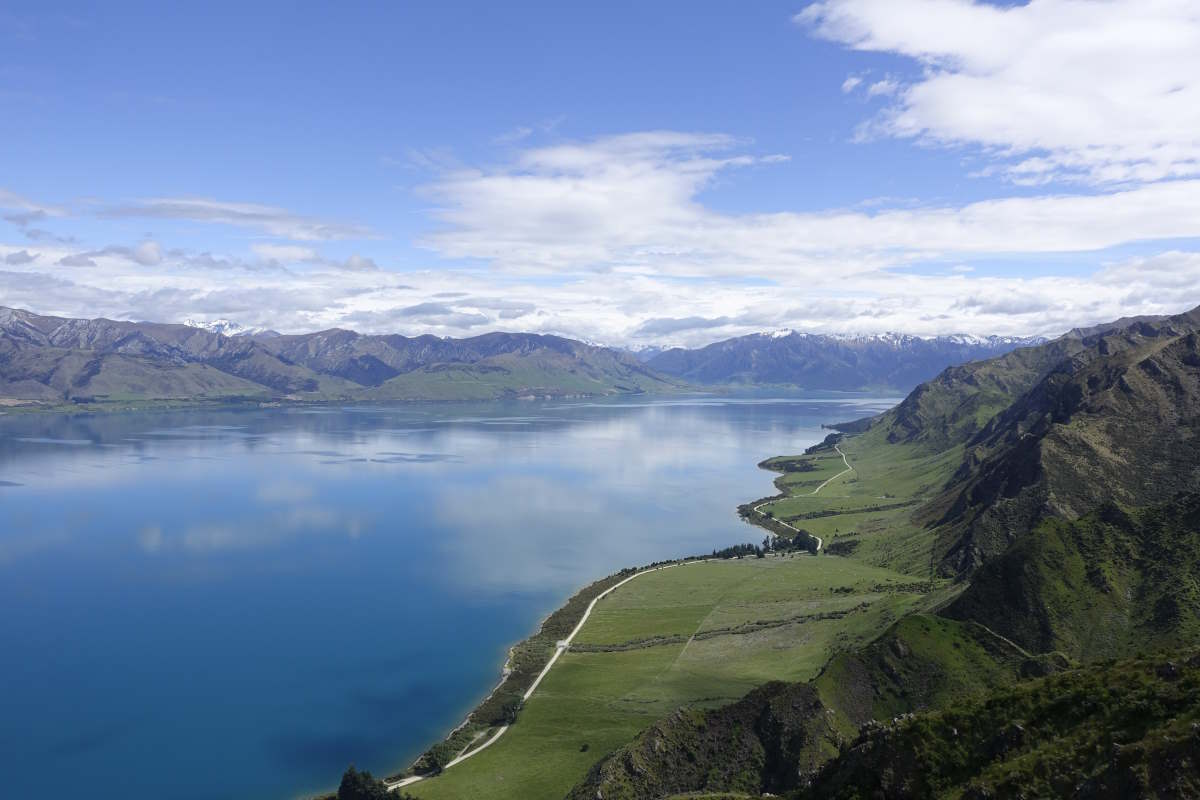
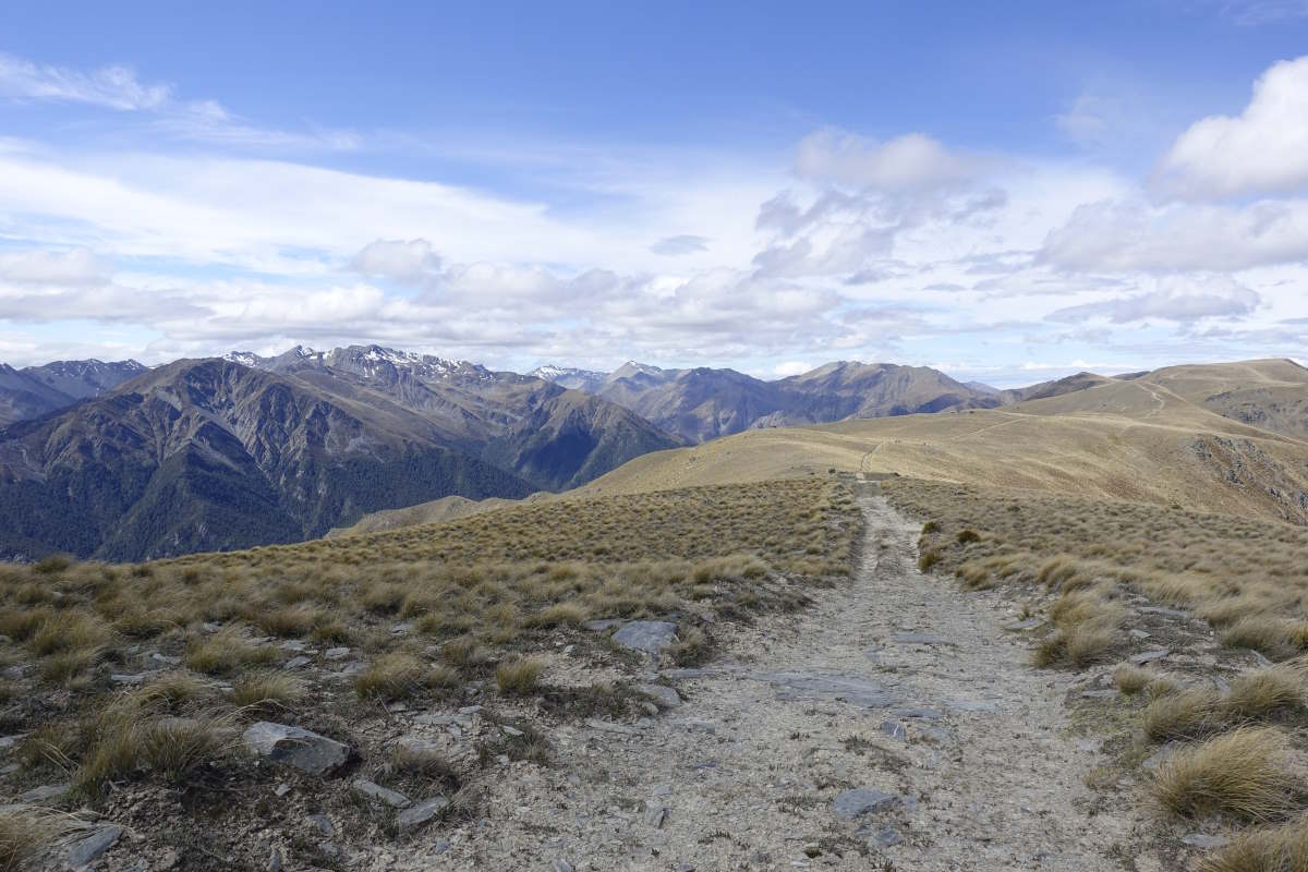
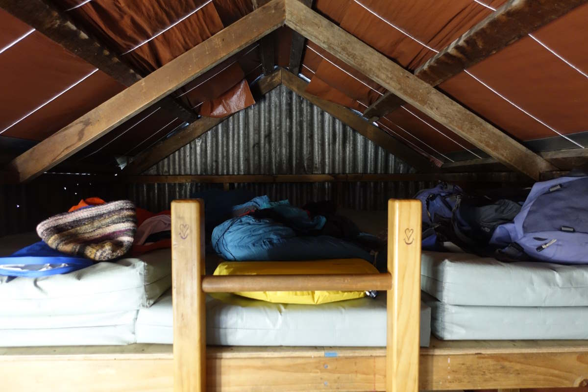
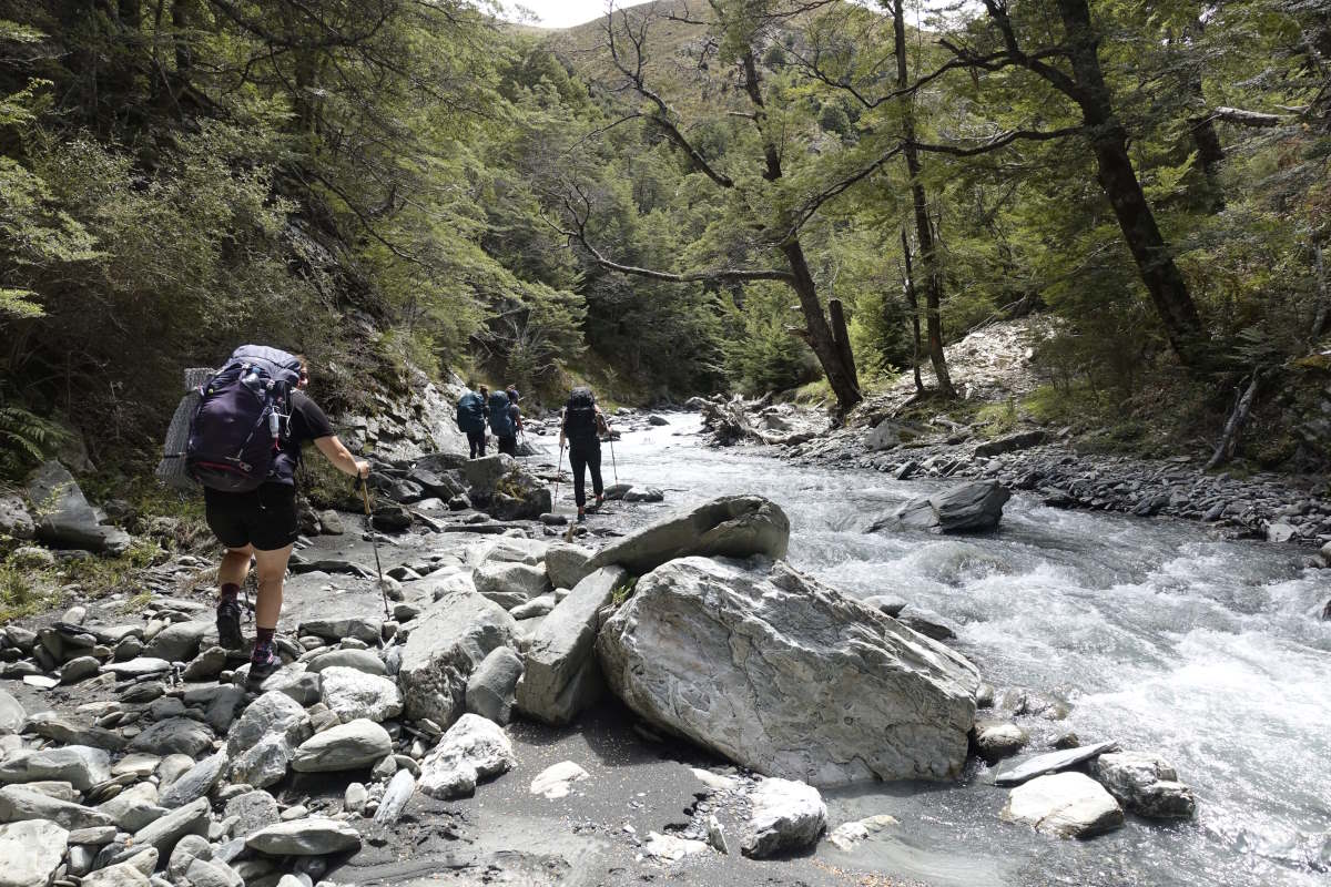
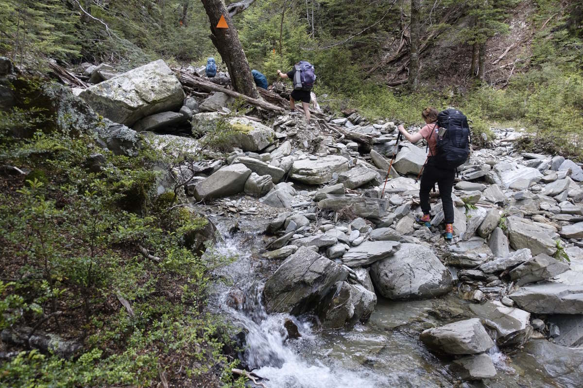
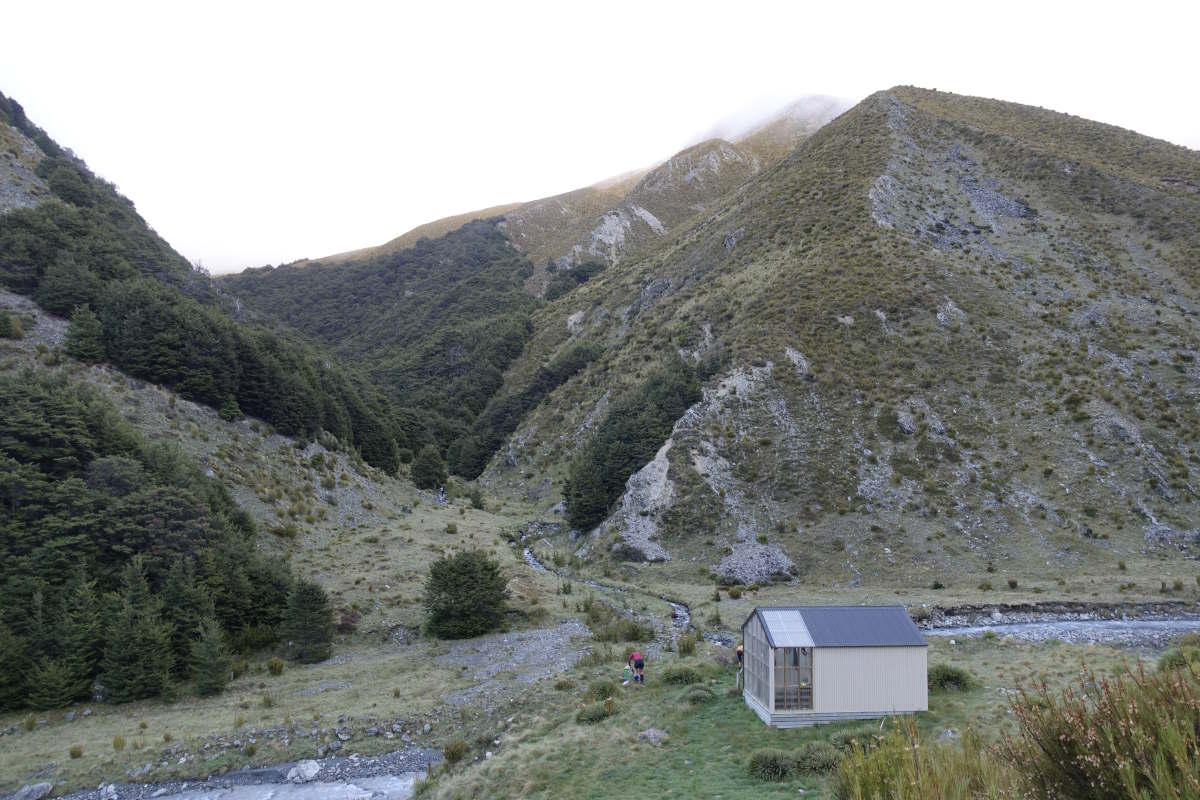
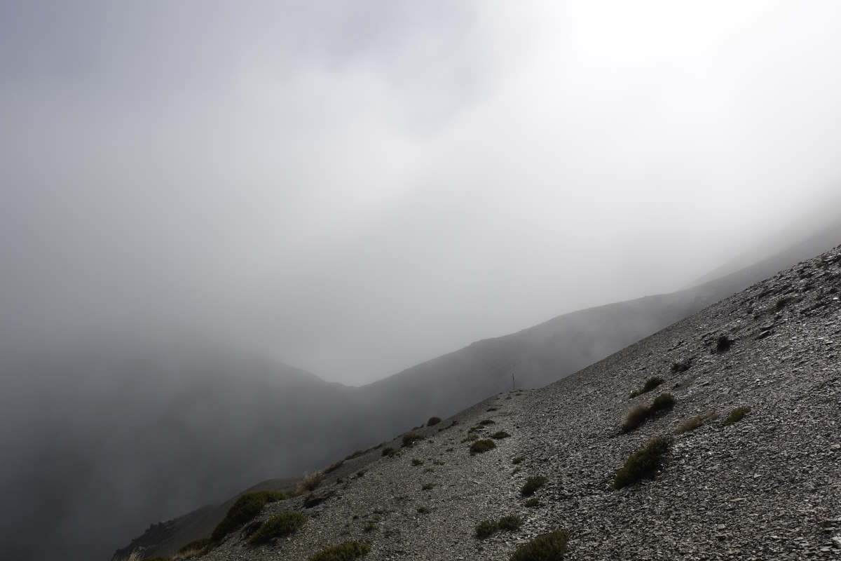
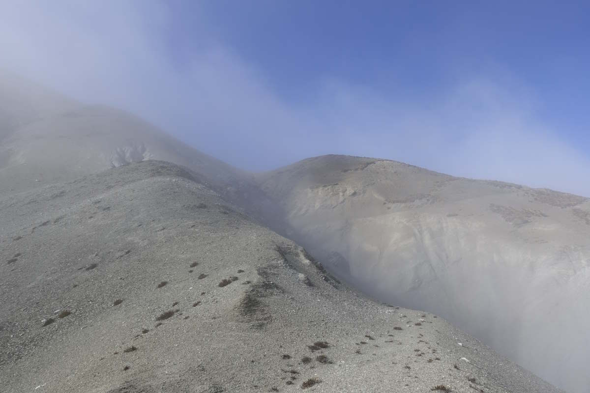
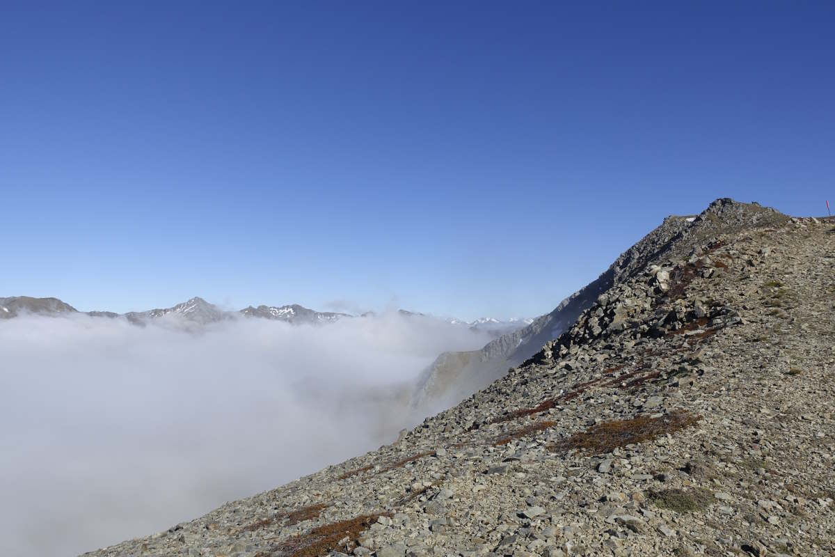
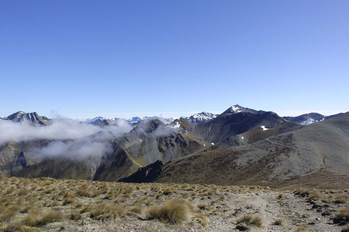
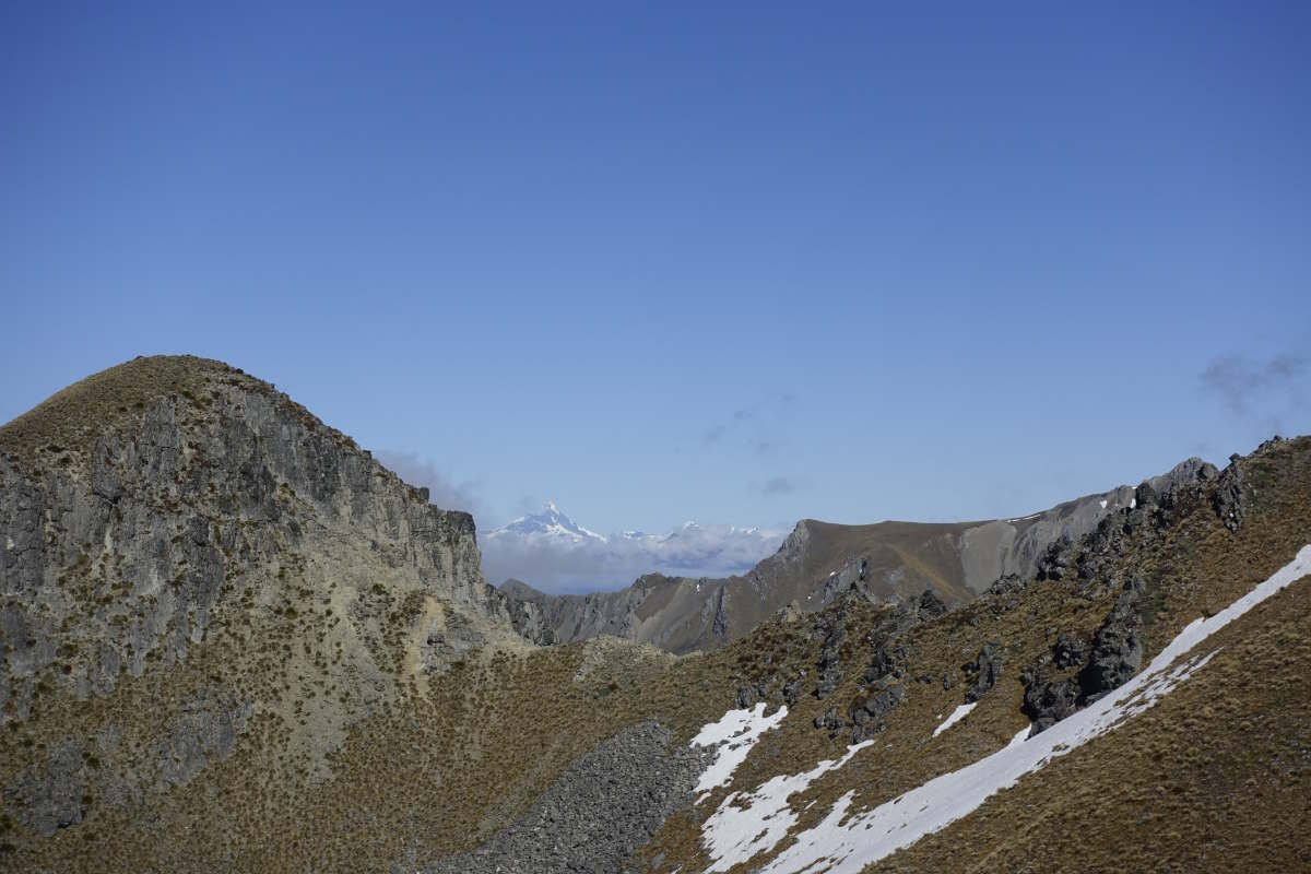
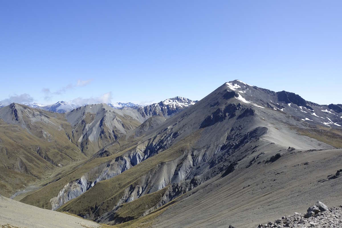
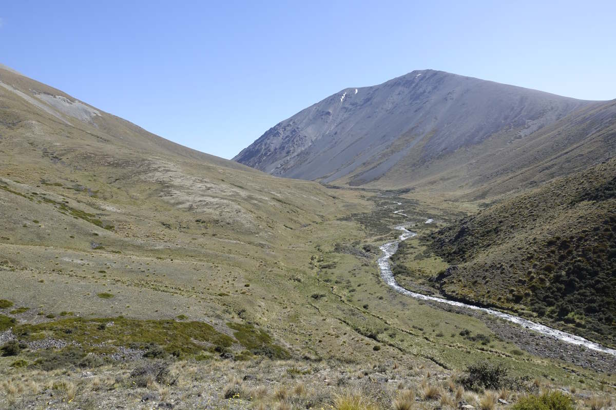
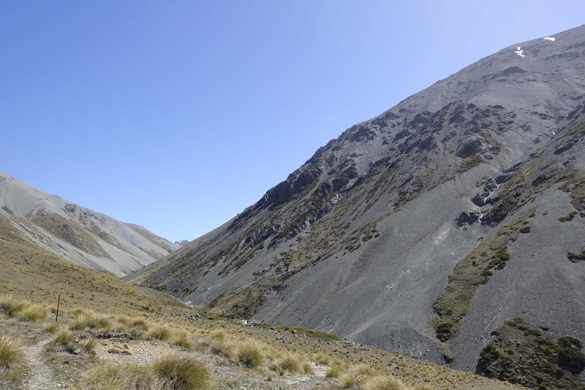
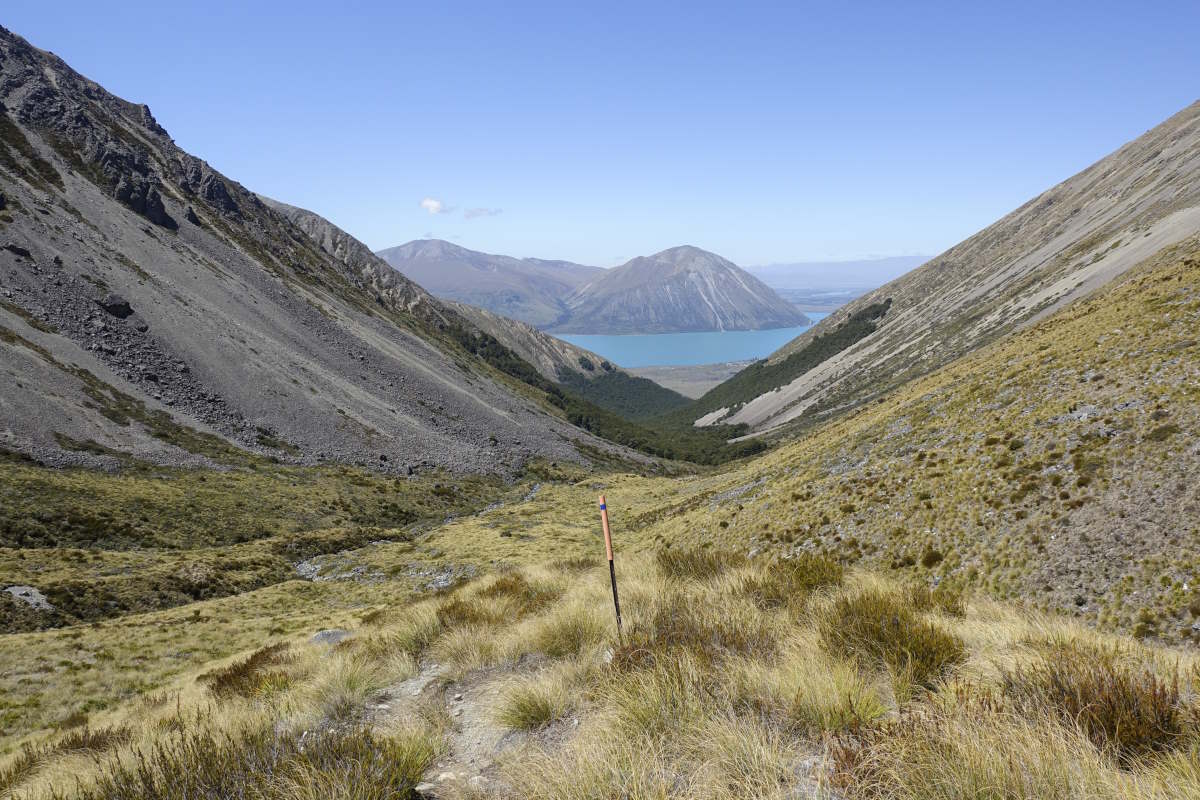
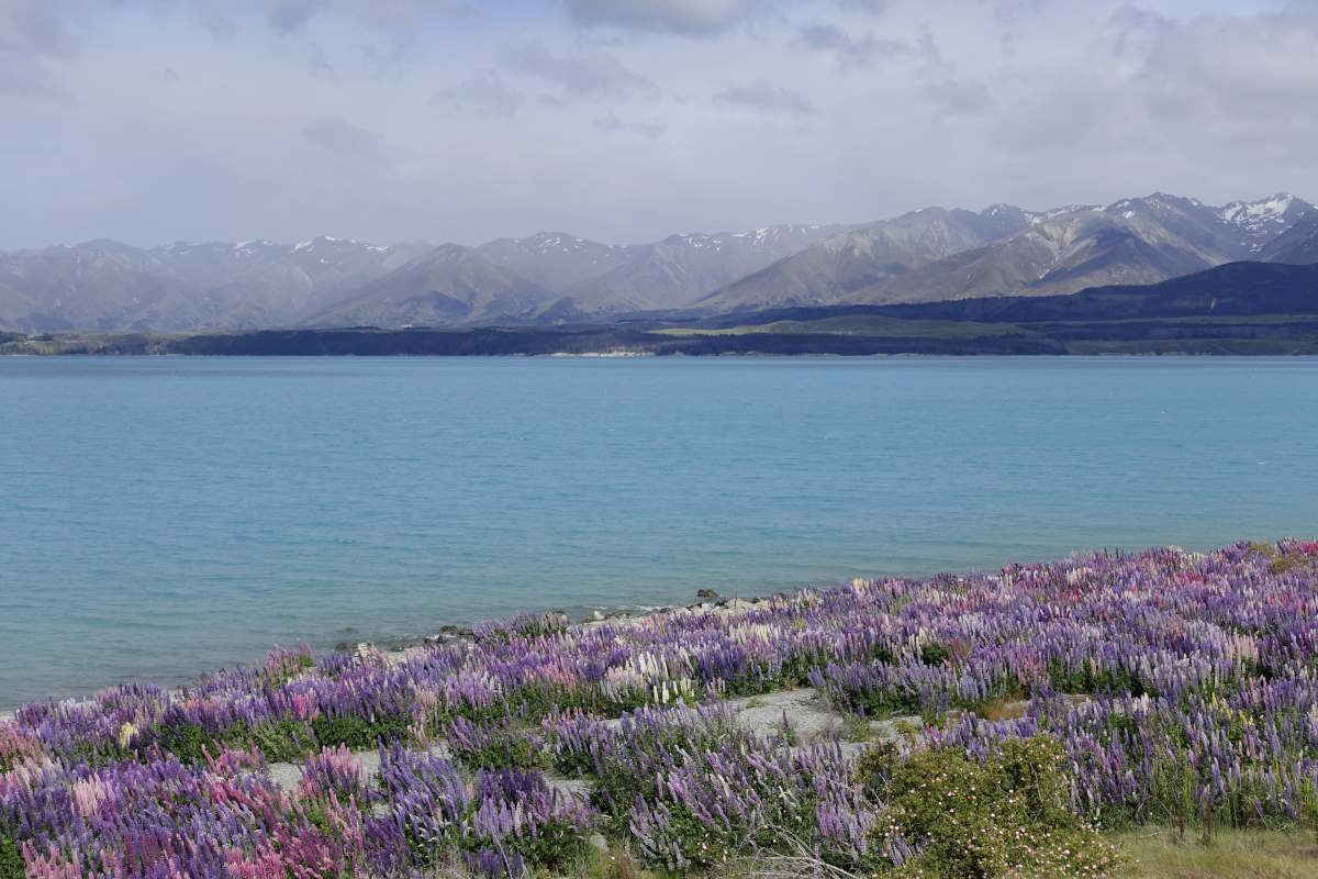
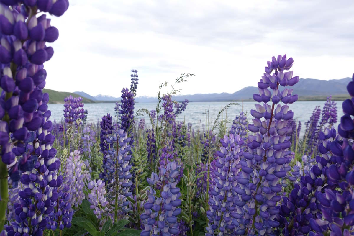
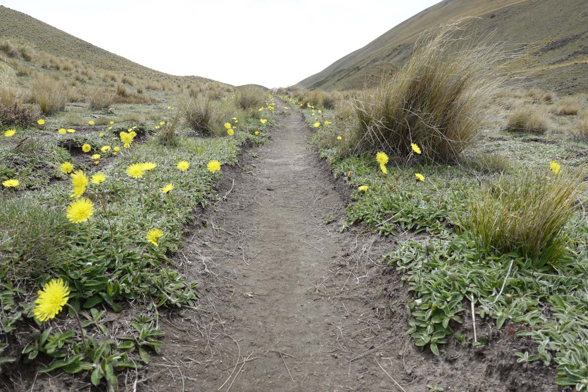
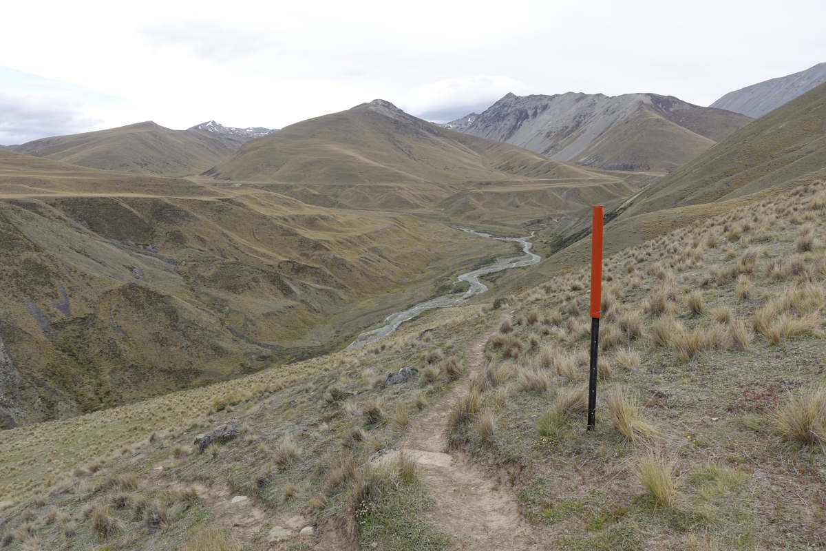
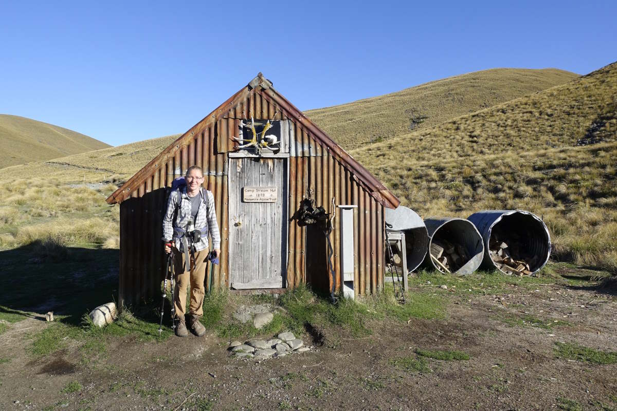
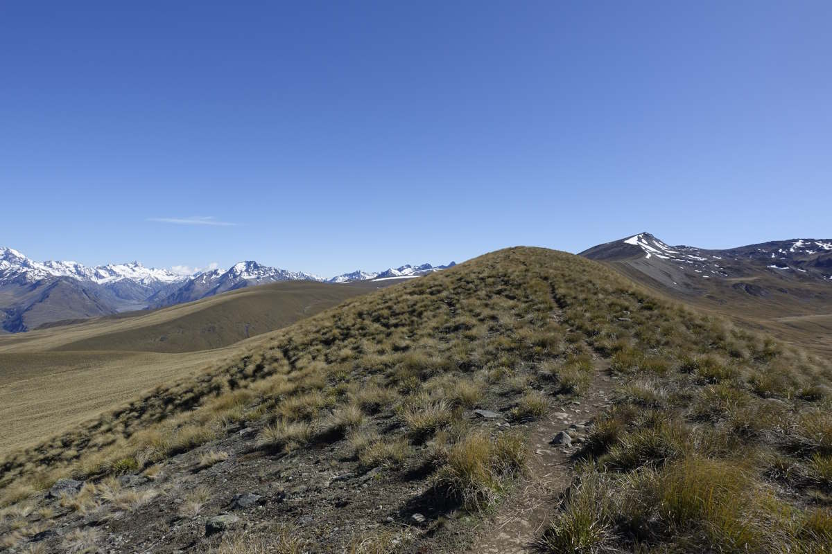
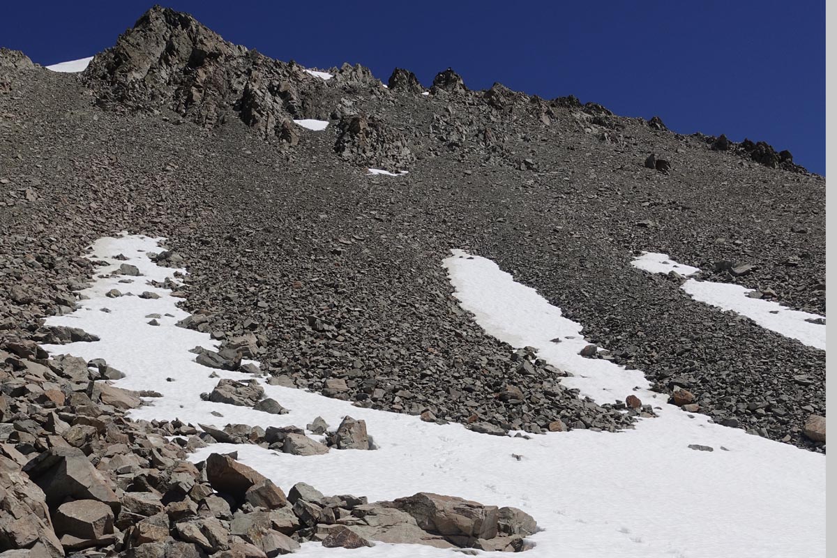
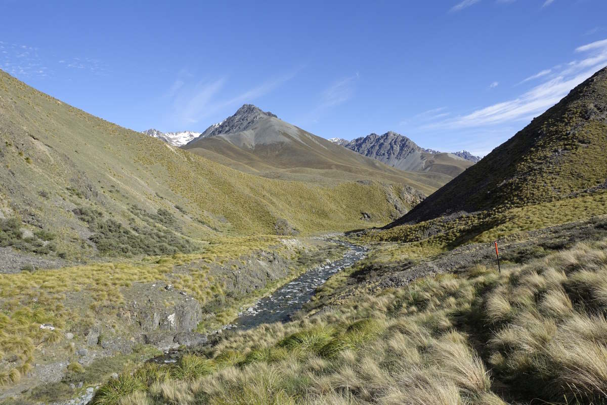
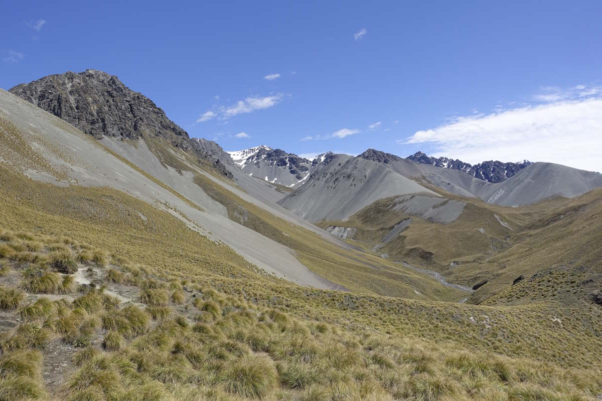
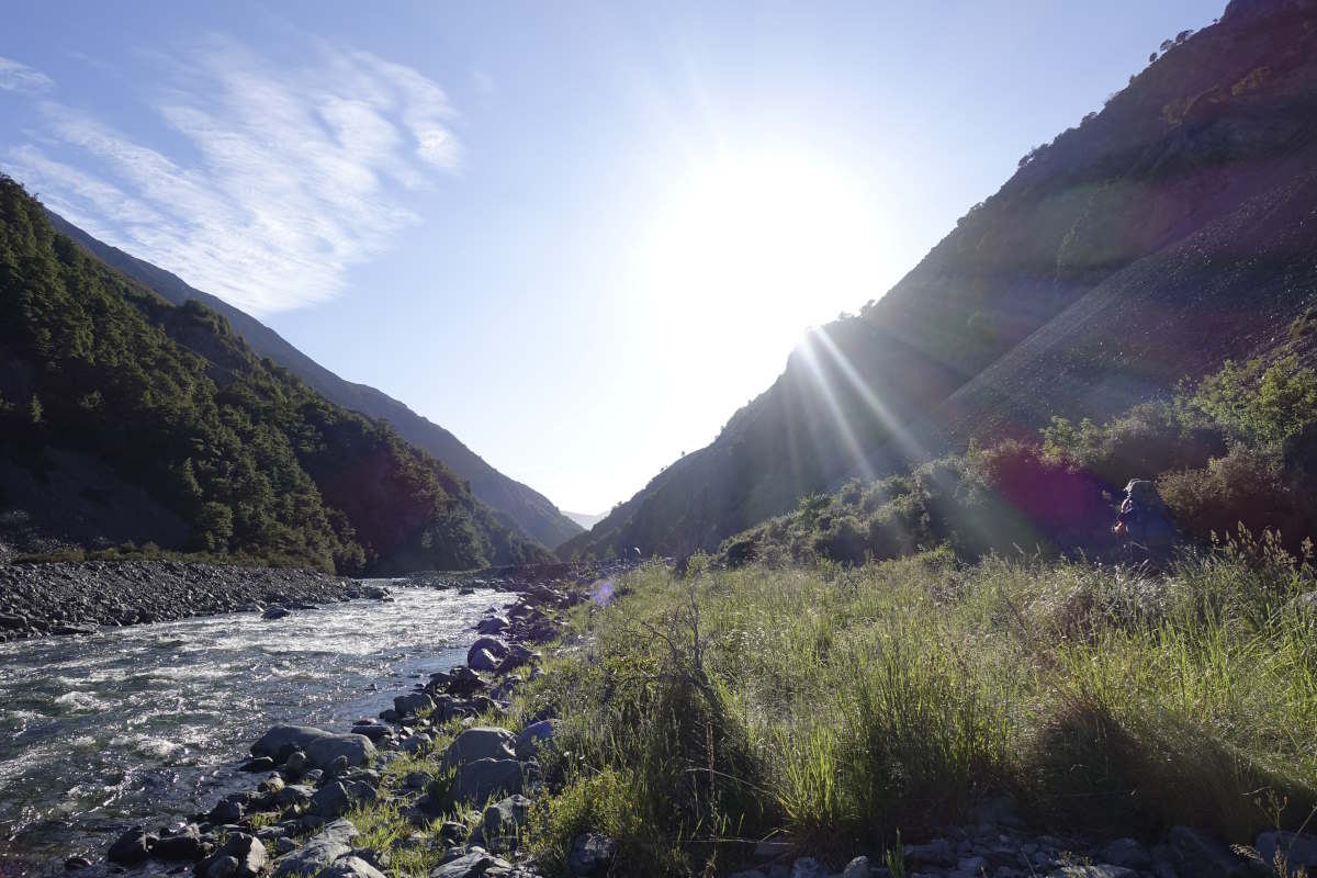
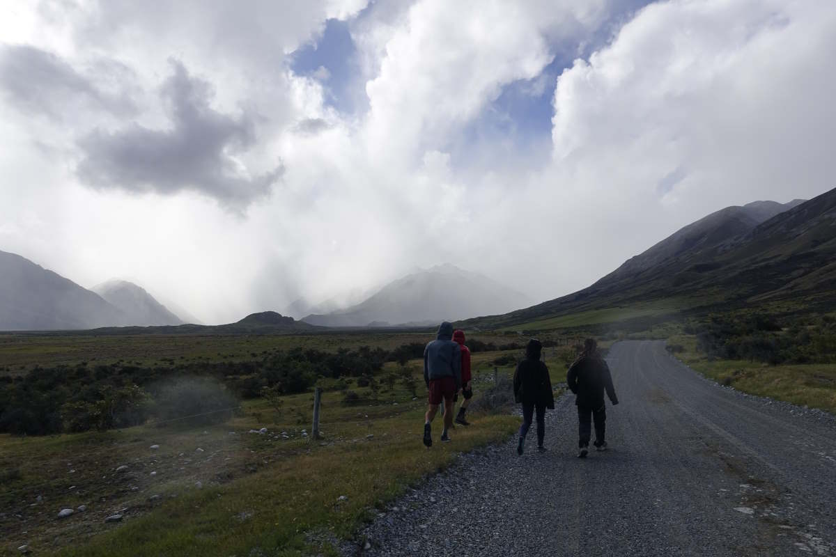
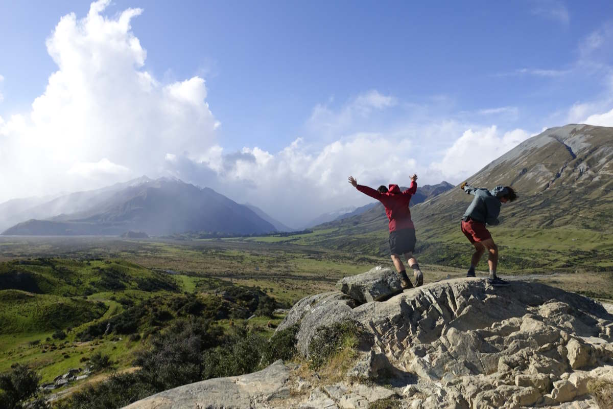
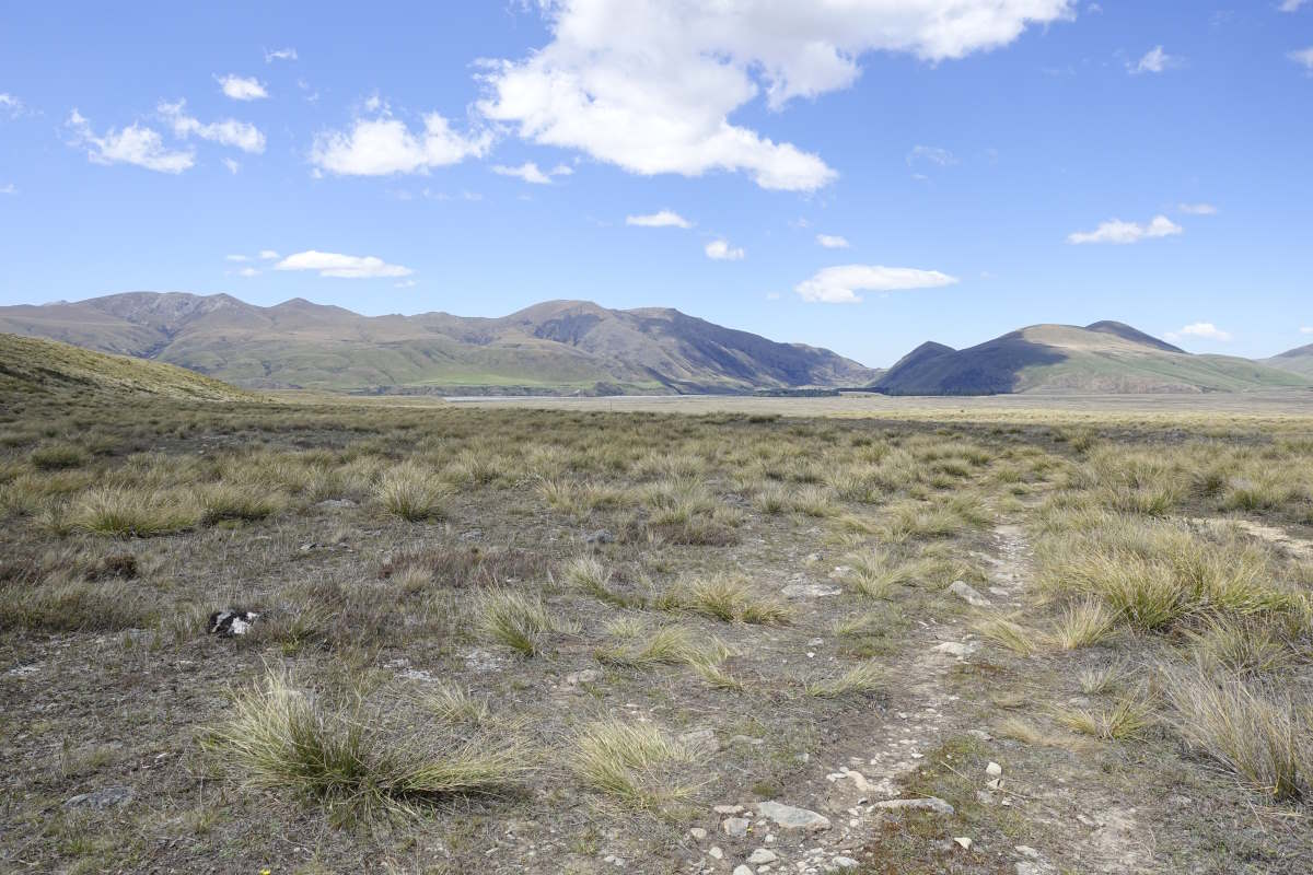
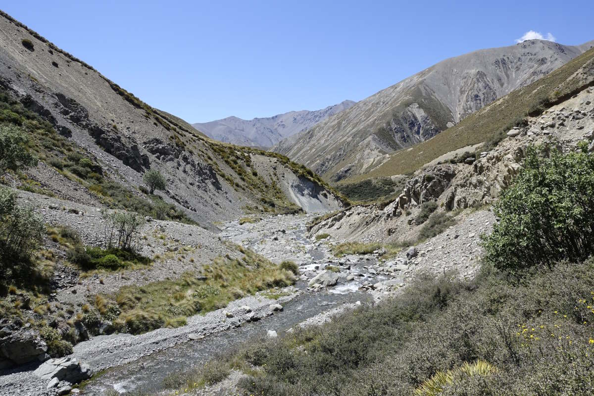
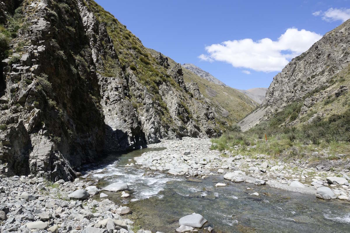
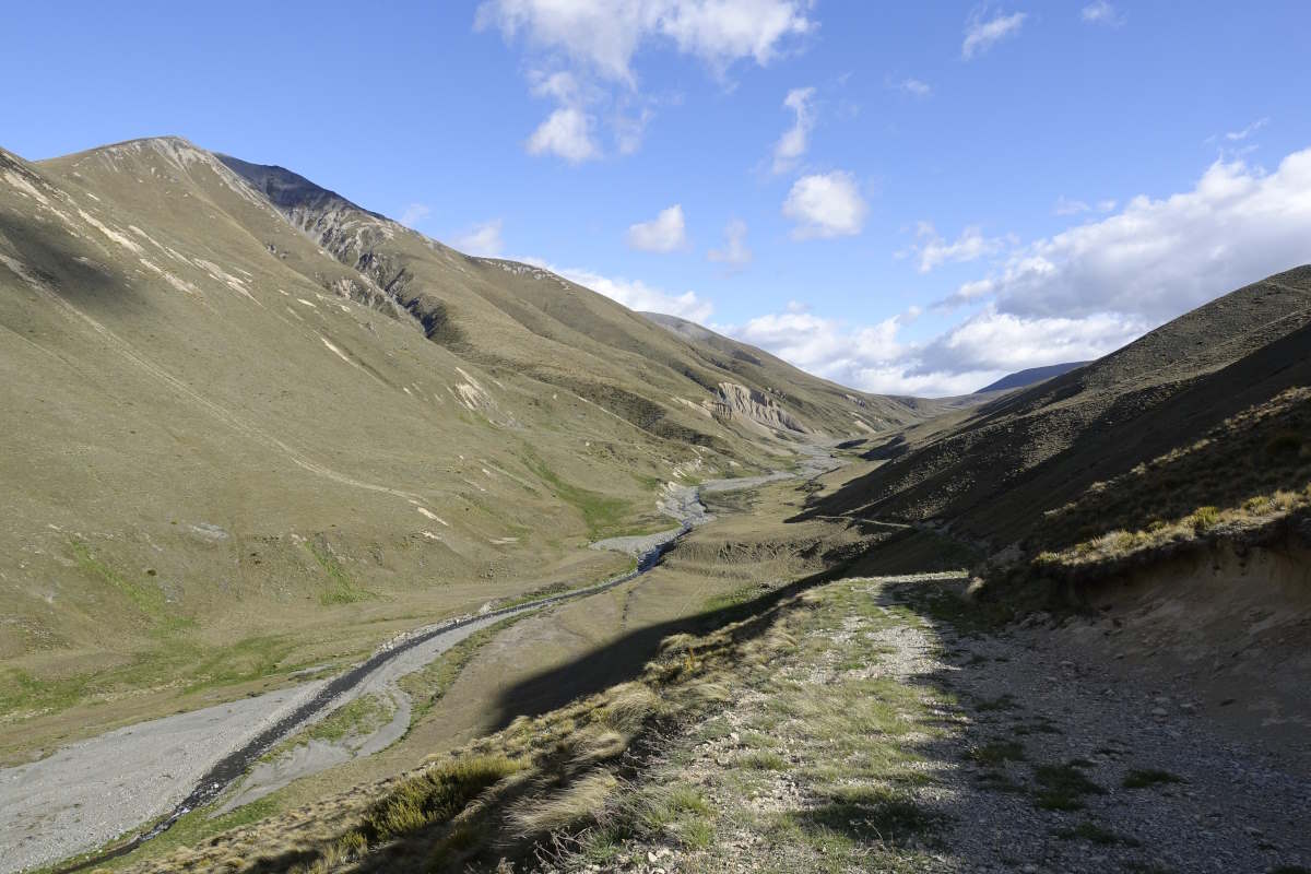
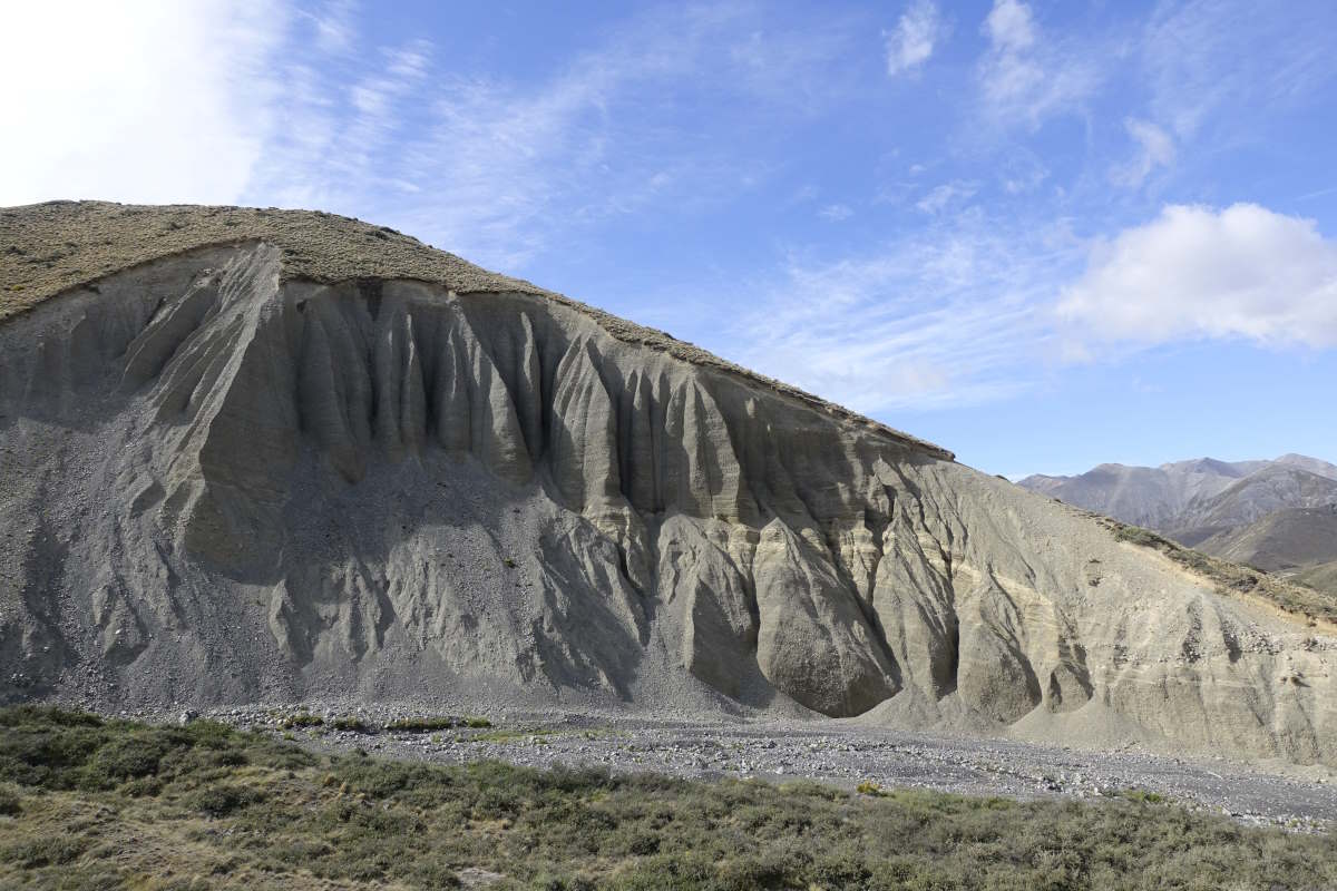
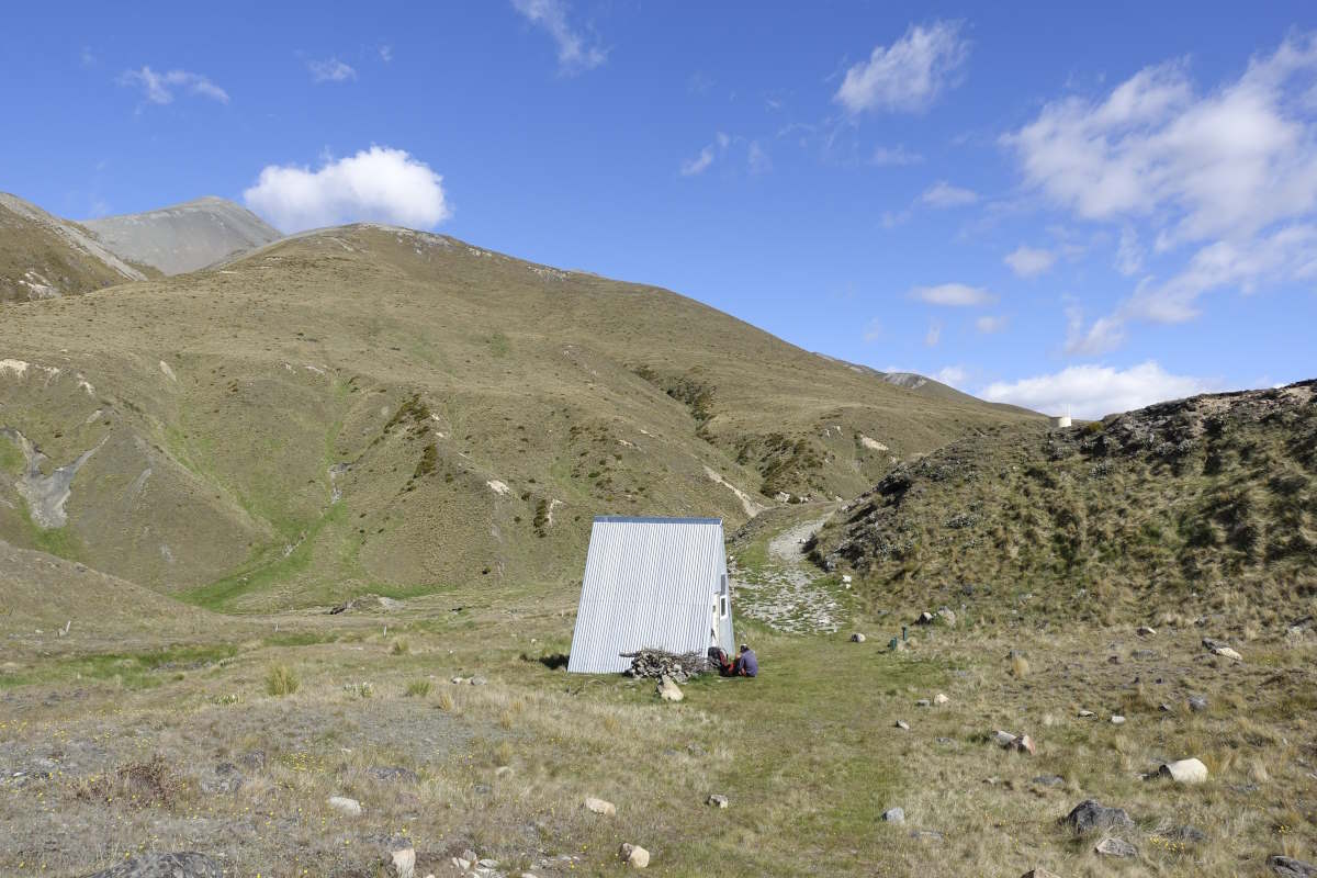
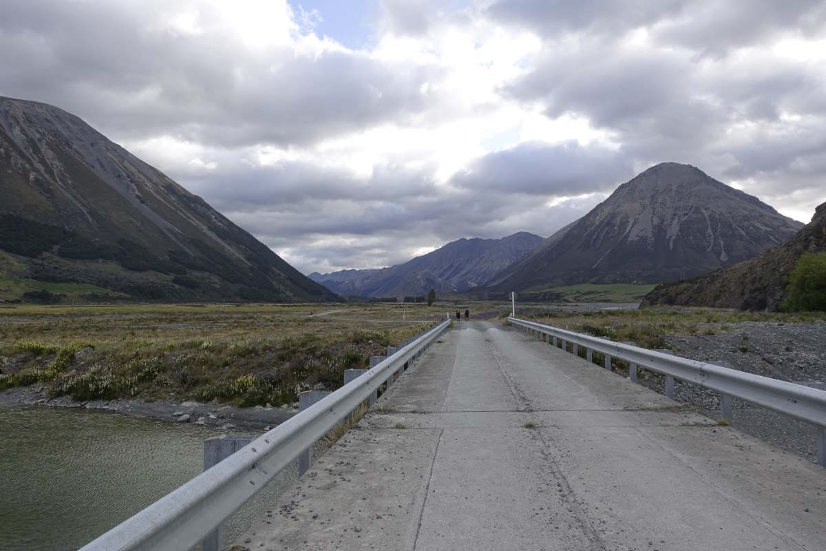
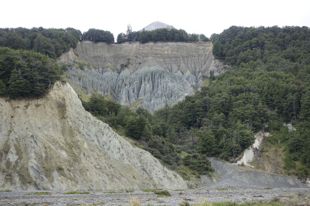
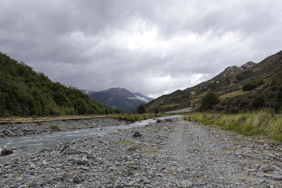
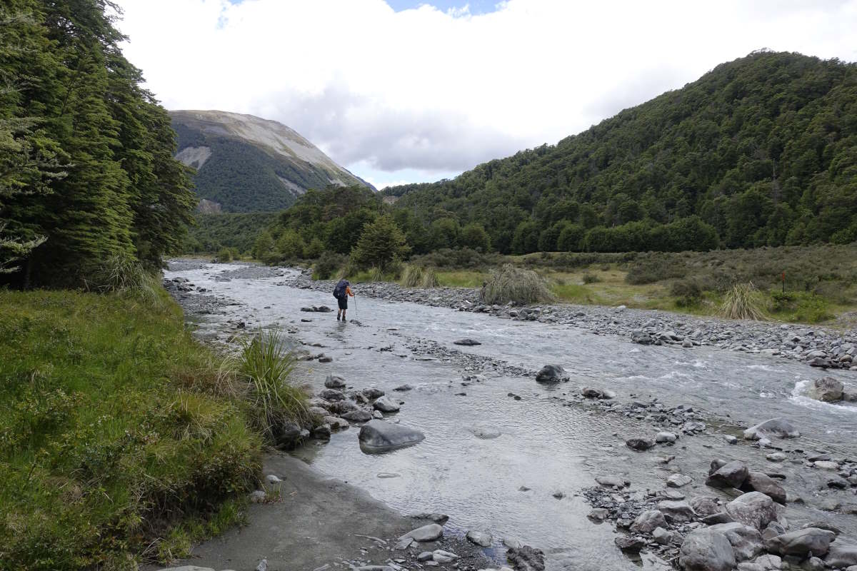
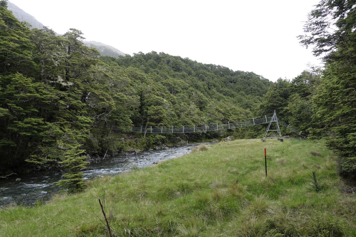
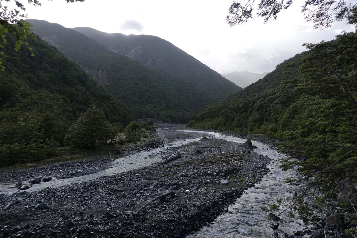
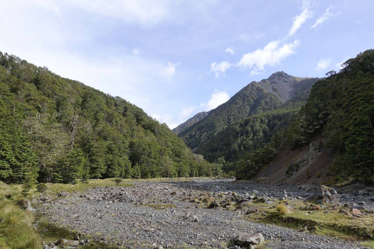
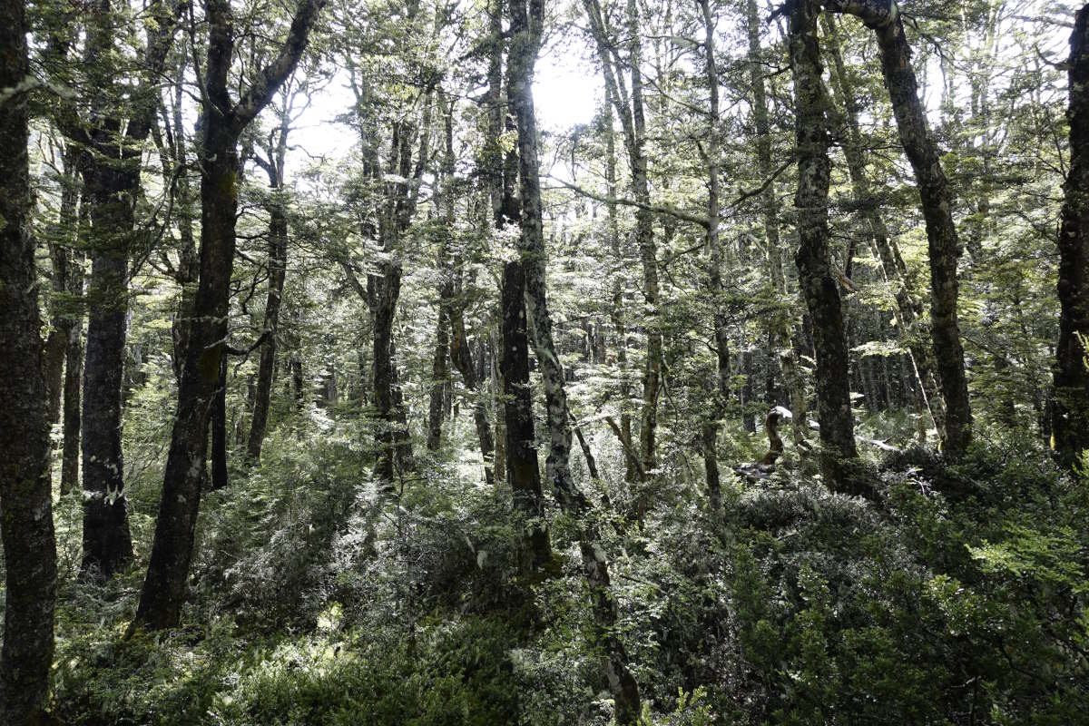
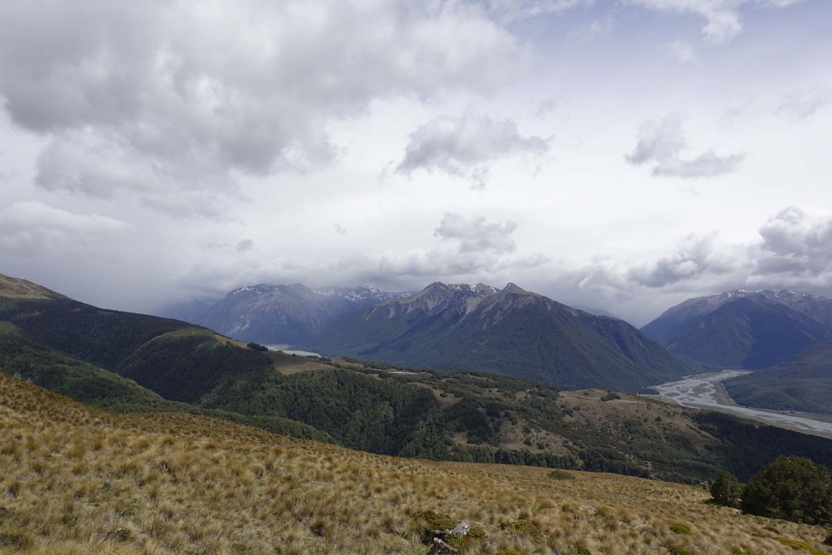
Day 23 (20km): Off again. I get a lift along to the end point of yesterday’s cycle and begin a warm morning with a gentle wander along Lake Hawea. The sun makes it over the mountains just as I start the ascent of Breast Hill and soon the temperature is climbing much faster than I am. I’m slogging my way up to 1500m which, while not the highest point on my trail, I think is the most elevation gain I’ve done in one go. It’s very very warm and the bag has 6 days of food. Sweat drips off my face. There are a lot of “view appreciation stops”, some of which are rather protracted, and also some gasping for air. I’m sitting on my bag at a corner appreciating the view for the second time in 100m when a little thought says “I don’t know if I can do this”. Err, what?! I’m confused, angry, a little scared. Where did that come from? Of course I can do this. I’ve done long walks before; I’ve climbed mountains with heavy bags. I squash the thought thoroughly. Use that anger and stubbornness to make it a whole 200m before next appreciating the view. It is an excellent view. Eventually I reach the first hut which has water and from there the gradient is much less steep and I can finally start to make progress. Anna, Lena, Quentin and Aurore (the four names who have been a day ahead of me for the last week or so) stayed here last night and have noted their intentions for today as Stody’s hut - that’s where I’m going! Am I finally going to meet them? It would be great timing because there is a big river in a few days that would probably be very crossable as a five but less so solo… I carry on over Breast Hill summit, soaking in the views down steep jagged topped cliffs, the lake below a deep turquoise under an endless blue sky. Reaching Stody’s a few hours later I find that it is not to be. They have gone “onwards, to the North!!” There is no point in chasing anyone; I’m knackered from the climb, the bag and the heat. The hut was described as basic and uninspiring but actually is really cosy, and is probably the closest I’ve had so far to a bothy back home. I tuck my sleeping bag up under the rafters. So far just me and the mice. Day 24 (12 km): I’ve marked a little ?? next to the ridge for this section because it seemed silly to descend to a valley and then have to go back up again tomorrow but the forecast is for 90kmph winds and rain so down I go. The trail is even steeper than yesterday’s climb and prone to crumbling away under my feet as I skid and slide my way from tree to tree trying not to look down. It takes most of two hours to reach the valley floor and the river which the trail now follows. The first crossing is OK, though the water is full of silt and it’s impossible to see the bottom to pick a line so each step is a journey into the unknown. My second crossing point is slightly braided, and the main channel only two steps wide but wow they are a hard two steps to make. The water is upper thigh and cold, walking poles vibrating in the pull of the current. I dither long enough that I get attacked by a swarm of sandflies in the middle which is just not OK. The trail twists it’s way along the riverside; sometimes disappearing to become the riverbed, sometimes clambering with varying degrees of desperation along the banks. The next crossings are better and while safe lines take some finding I feel I’m getting my eye in. Also I’m heading up stream so it presumably gets easier? There are footprints on the banks to guide me and then a wet footprint on a rock. Am I catching up? All of a sudden I have this feeling that there are people near but I can’t say why, and then over the next lump there they are: Quentin, Aurore, Anna and Lena, names from books become real people. I’ve been following them for so long I feel I almost know them already but of course they have no idea who I am. We have lunch together and I join them for the rest of the day which includes buddying up for the river crossings. Much easier! The pace is slower than my usual though, and their plan for fairly short days so it looks like having taken weeks to catch up I’m about to blast straight on past. Oh well. We reach Timaru Hut just as the rain starts to find it already occupied by Lily and Guitan - the first SOBOs (South Bound walkers) I have met, and then Alex and Sarah. So Nine of us in a six bunk hut and the rain hammering down outside. It’s a sociable evening, very different to last night alone in Stody’s, and a great chance to swap info about the trail ahead. Day 25 (40km): The hut is definitely not designed for nine bodies and, in my top bunk, it’s a strong contender for the warmest night I’ve ever experienced. We open both windows, risking death by sandfly in doing so, but even then I’m too warm to get into my liner let alone even touch the sleeping bag and all I can do is lie on my back and sweat. An alarm goes off at 5:30 and it’s good to be up and out. It’s cooler, with a light layer of cloud brushing almost to the hut which looks like it will probably burn off in the sun. I cross my fingers, say goodbye to the others and deviate off the trail once more; climbing swiftly into the cloud up a beautifully zigzagging vehicle track towards Mount Prospect. There is no sign left of the wind from yesterday and it’s an easy climb which only takes an hour or so to reach the ridge. Then there’s a silly bit where some overly self-important land owner has decided they don’t want people on Their Track and has built a fence with a big no trespassing sign and you have to pick your way through the bush around the edge following a parallel line about five metres to the side of said track. I’m still in the cloud and am just starting to get nervous about the lack of trail and how much effort the navigation is going to take when suddenly there’s a sign post and a marker and the path reappears underfoot. Maybe everyone else just stayed on the track after all. The trail sidles along, quickly coming to a long eroded slope of very fine scree where the grey of the cloud and the grey of the rock blend smoothly together, as do the eroded gullies and the track. There are a few nerve-wracking steps where little stones slide a very long way and I have to stare straight ahead, press my feet softly into the slope and not breathe too much. I very much hope the rest of the route is clear and I don’t have to come back this way. But then the clouds start to thin around me, blue sky appearing above. I hurry upwards, regaining the ridge, and pop abruptly out of the top of an inversion into a world of fierce sunshine and high mountain summits. Wow. I can confidently say that these are my best TA views so far, and there have been some pretty awesome ones leading up to this point. Mt Aspiring rises as a perfect pinnacle off to the side and there are so many new summits ahead, the Southern Alps rising high above the clouds to bask under a deep blue sky. I wander alone through my mountain world. The track is easy, meandering gently over and along the ridgeline. There are a few more washed out sections but nowhere near as unstable as the first - or maybe I was just being nervous and alone in a cloud. I am so happy I took a chance on the view. Eventually it’s time to descend and I wind downwards to Tin Hut in time for lunch. I wonder about staying. I meet Lewis who has come up to join Lena and co. and give them a lift around the Ahuriri tomorrow. I know that this is a river I’m not crossing alone and if I go on today I’ll have to walk that whole detour. But if I wait until tomorrow they will start late and I will effectively lose a day. In the end I go on. It’s very hot in the valley and the track starts smoothly but it’s not long before the trail is marked away from it and it’s clear the land owner doesn’t want you on their road and would rather you walked in the river. Well, at least it keeps the feet cool. I reach the road and turn right. Lilly, Guitan, Alex and Sarah all agreed the Ahuriri was sketchy as a pair; Lewis said it’s unsafe as a four. There is no point me adding 2km just to look at it. So I plod down the road. It’s 6km of hot hard gravel to the bridge, then 7km of dirt track and field edge up the other side to rejoin the trail. It is such a relief to see the red marker pole 11hrs and 40 after leaving the hut. I drop my bag to the dust and collapse into the tent.
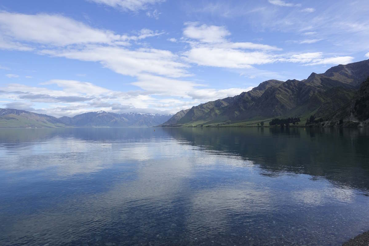
Lake Hawea
Climbing steeply up Breast Hill
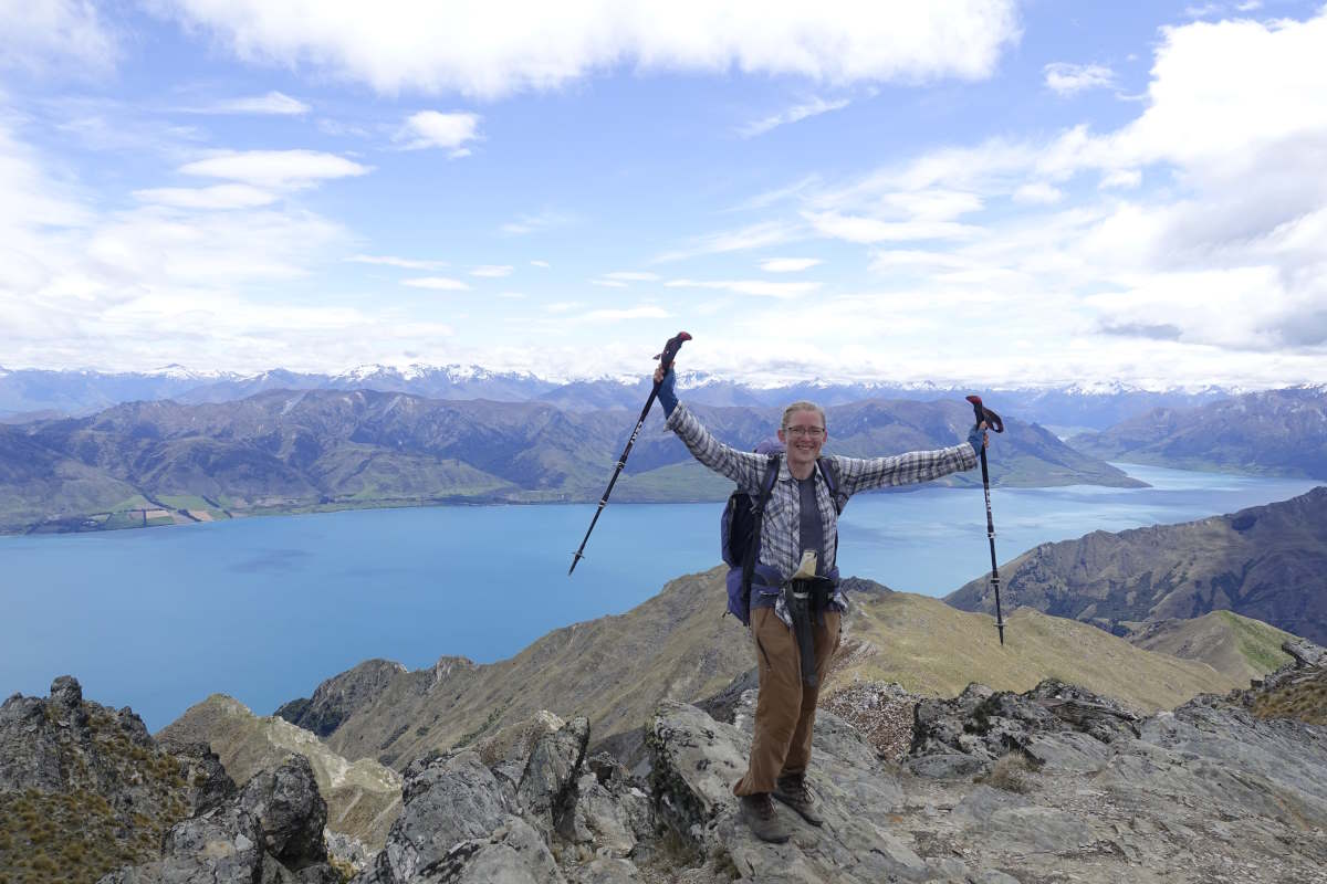
Breast Hill summit
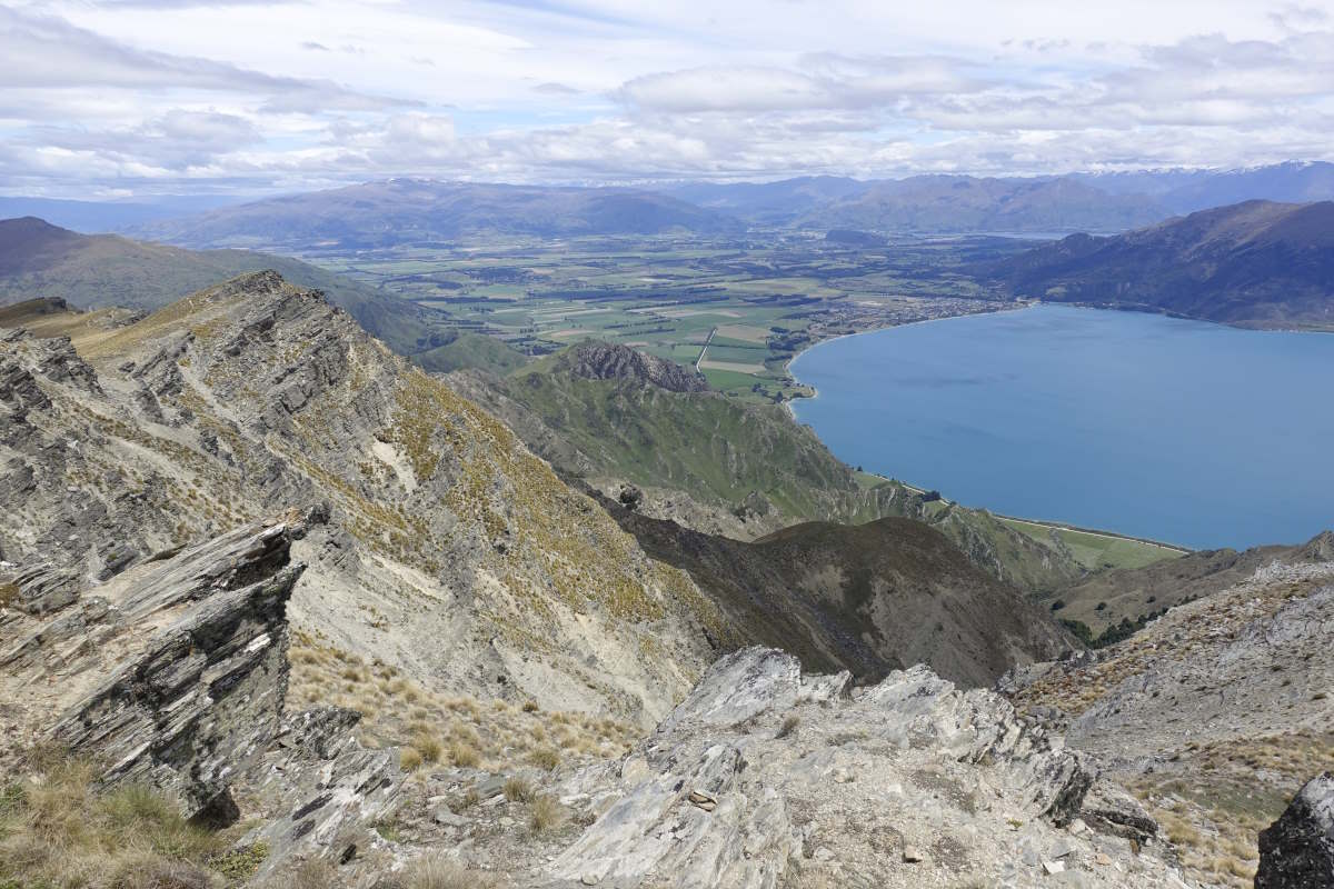
Looking back towards Wanaka
A much easier path ahead
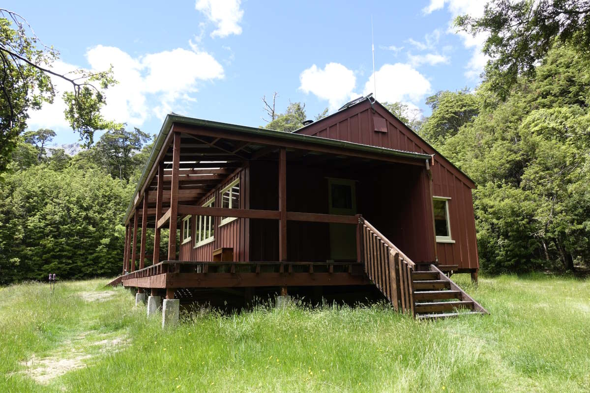
Cosy night in Stody's Hut
A precipitous descent
Spot the next marker
Navigating the river bed
Navigating the river bed
Top Timaru Hut: bit of a squeeze for 9
Clouds thinning on Melina Ridge
Clouds thinning on Melina Ridge
Popping out the top
Mt Melina Track running along the hillsides
Mt Aspiring (zoomed)
Mt Melina and Mt Martha
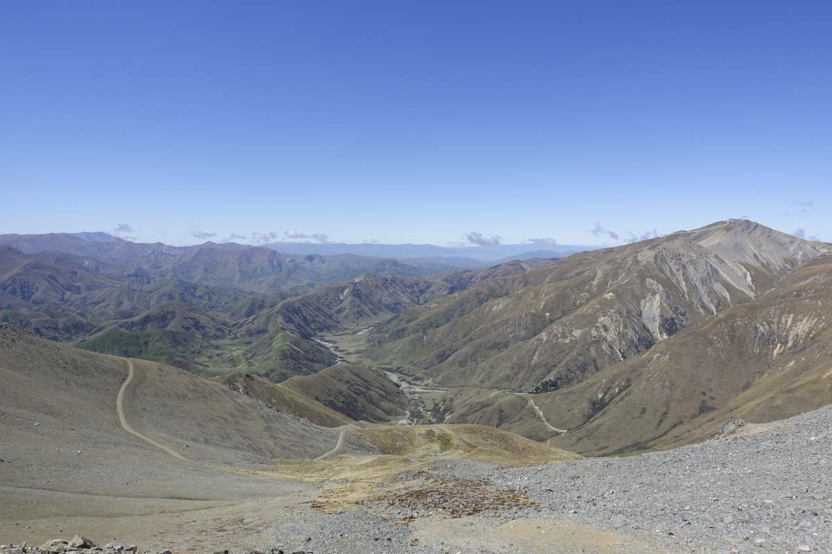
Descent to Tin Hut
Avoiding the Ahuriri
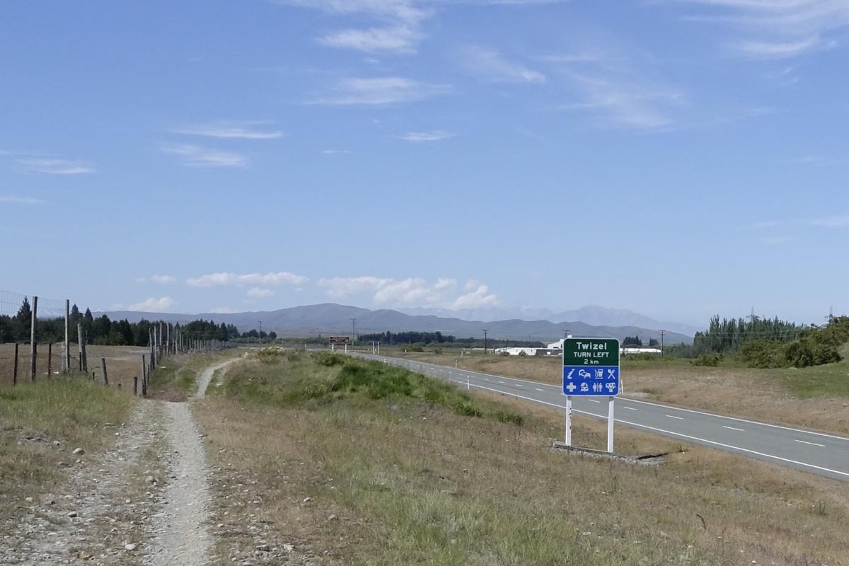
Ahuriri River to Twizel
Ahuriri East Branch and Lake Ohau Tracks, 53km, 2 days
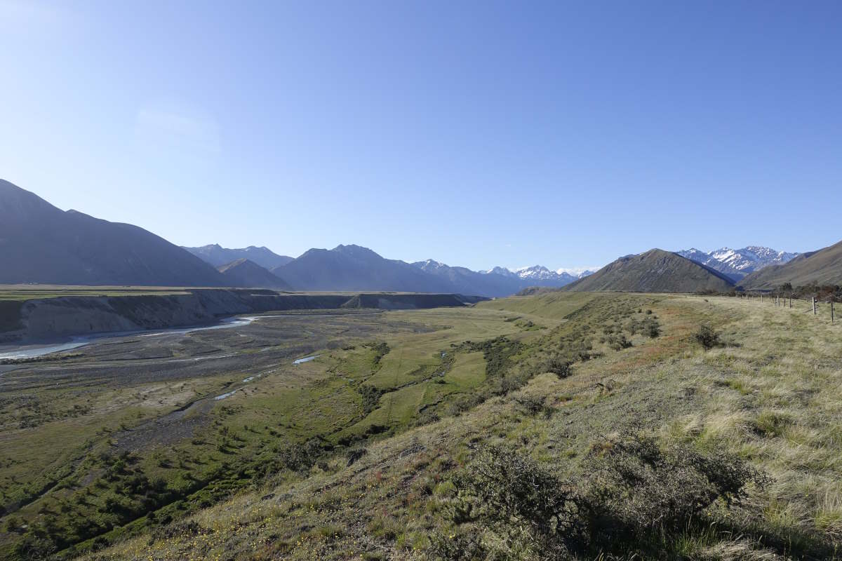
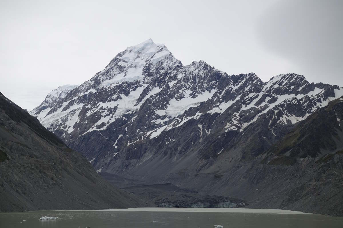
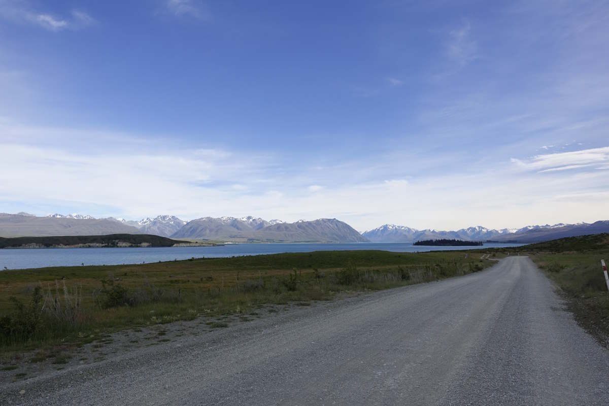
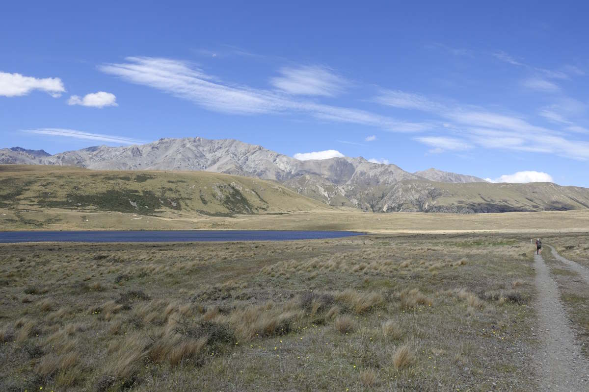
Day 26 (27km): My dry and dusty plain makes an excellent sandfly-free camp and I enjoy breakfast in bed with the door open as I watch the sun rise through the pine plantation to my side. Heading on the trail starts easily but gradually becomes more tussocked and harder to follow. There are not many marker poles and it is easy to end up off the trail by a few steps and then not be able to see it anymore. I pass two pairs of SOBOs then a trio, so a total of seven today! Onwards, upwards, I wind my way over a pass and am re-united with mobile signal and very welcome email to say that yes I can hire a bike for part of the next section. I sit on a rock and try and sort out some form of touristy day out to Aoraki (Mt Cook) but it turns out that the only way to get there is to hitch and the unpredictable nature of that makes me reluctant to make any formal plan for the day. I carry on. Down into woodland the trail steadily improves until I drop out on the shores of Lake Ohau. I meander somewhat flat footedly to Lake Middleton which is a small body of water under a baking sun and consequently approximately bath temperature. I pitch my tent and hop in for a nice long soak. I still have phone signal so manage to sort myself accommodation with showers and electricity for the next three nights in a row (!!) then realise I’ve totally miscalculated my food rations and have an entire surplus bar of Whitakers dark chocolate with almonds to finish before I reach my next shop. Now this is the sort of challenge that I can rise to magnificently. Day 27 (29km): Happy December. I’m awake at 2am and poke my head out of the tent to find the Milky Way stretched vast over my head. The night is warm and the ground bone dry so I lie half out of the tent with my feet still tucked away in my sleeping bag and watch the stars. Probably because of this I then wake up late and don’t get walking until nearly 9am for what the notes says is a quick and easy day along cycle tracks to Twizel. I really should know better by now than to believe that, but set off optimistically along the shore of lake Ohau, a lovely mountain view across the water to my back. I make good progress for the first 11km but then the track turns away from the lake and the rest of the day is not so beautiful. It’s a gravel road along a river but through a pretty flat landscape with no real view, and also far enough from the river that you can’t really see the water. It is also very very hot. I drink a litre of water before leaving camp and carry another and just assume that for a “short” day that will be fine and I can have more when I arrive and that will make it OK. It is absolutely not OK. It is so hot. There is no breeze. No shade. The river is thick with silt and also a fish farm and very definitely Not Drinkable. Occasionally I pass trees but the sun just beats down between them and all the trees do is make the still air thick and heavy. Like soup. But with the water taken out. Quite quickly I have only one mouthful left, and I realise that I need to not drink that mouthful because the thought of having no water left is actually a little frightening. I take regular breaks to sit in tiny pockets of shade and it requires a lot of will power to get up and get moving again. It gets hotter and hotter. I meet one SOBO and remark that at least there are not many days on the trail like this one, and he replies “what, flat and easy?” I attempt to channel some inner flat-and-easy joy but it lasts all of two minutes and then I wish I could run up a 1000m climb because at the top it would be cool and there would be wind and a view. At long last I reach Twizel and stagger into the Foursquare and it feels like everything is just a little bit far away and the lights are a weird colour. I have definitely mashed a few brain cells. I load up on juice and the cheap ice lollies that are mostly ice and go and lie in the shade and concentrate hard on not being sick and slowly return to some semblance of life. Day 28: A rest day. I phone home, then use my breakfast cereal box to make a “Mt Cook” and a “Twizel” sign and go and stand by the side of the road. I’m feeling pessimistic and have visions of myself just standing there in the dust all day but actually I’m picked up after only 15 minutes and get a ride all the way. I’ve been debating a glacier boat trip, and hiking towards Muller hut for the view, and maybe also running round the Hooker valley track but fortunately realise that I’m yet again trying to do far too much and actually need a rest. So I set off up the Hooker valley at a gentle plod and at the view point take a lunch break and a nap. I watch a small iceberg float across the lake, little chunks of glacial ice crashing occasionally from the cliffs above and the abundant mountain lily flowers waving in the breeze. I meander slowly back and realise that that’s all my body has in it today. Turns out it takes more than a single night’s sleep to recover from mild heat stroke. I’m back at the campsite for 1:30pm where I spend the remainder of the day sitting inside drinking lots of liquid and by evening have perked up enough to socialise with the other campers.
Twizel to Camp Stream Hut
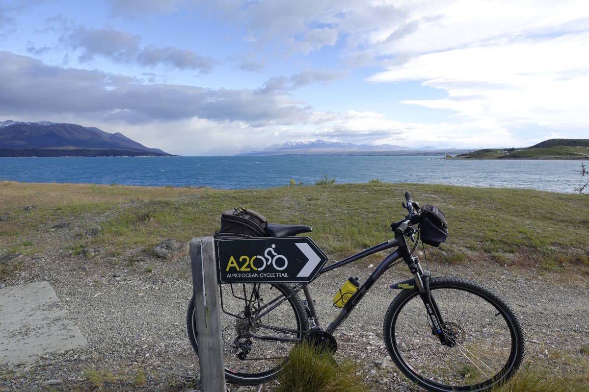
Alps to Ocean Cycle Trail, 87km, 2 days
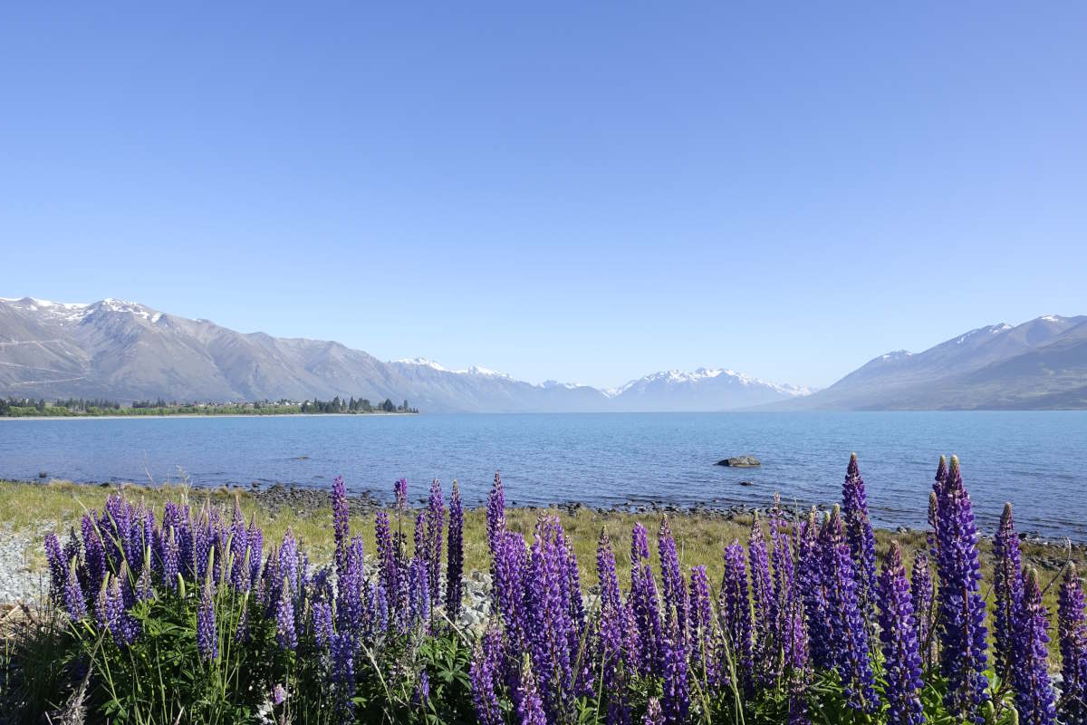
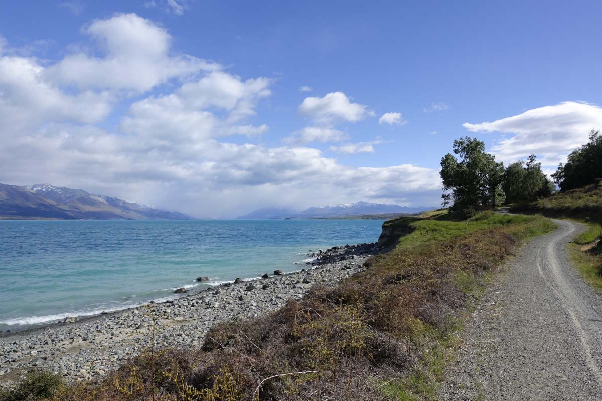
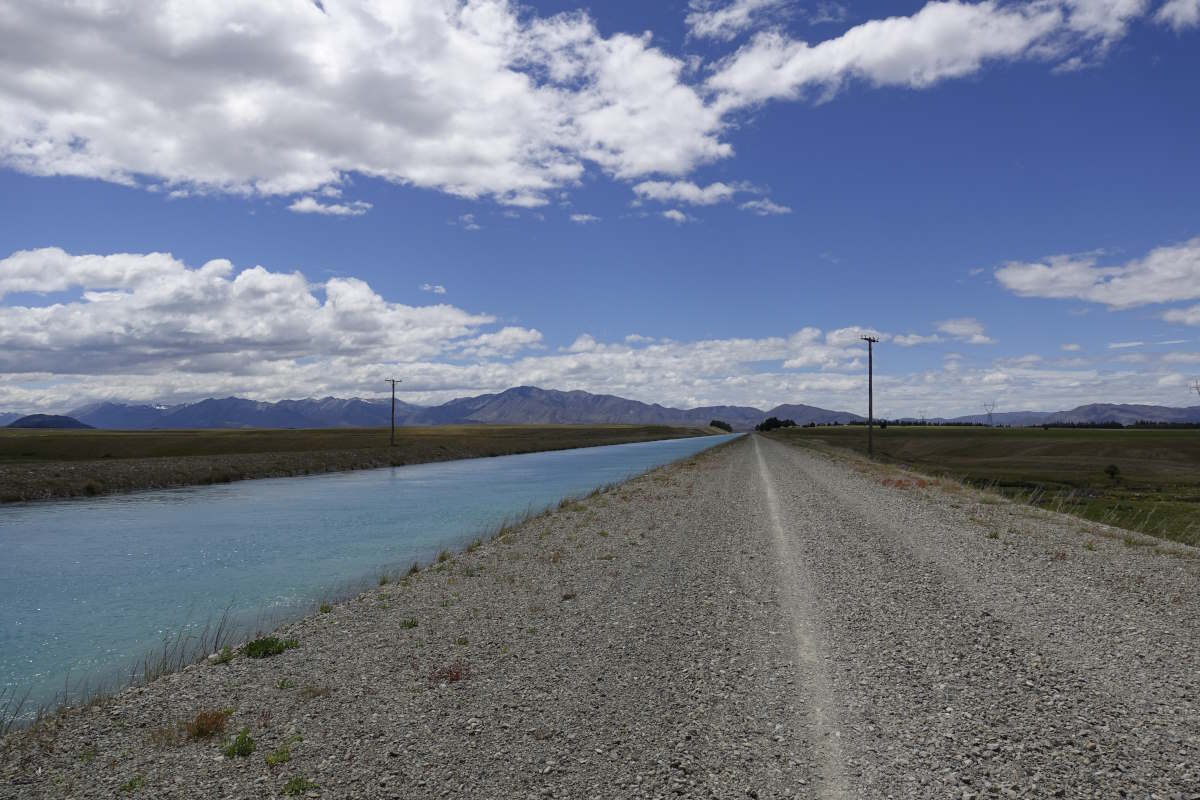
Day 29 (53km): Another bag free day. I’ve hired a bike (and luggage transfer!) to get from Twizel to Tekapo because otherwise it would be two days of walking on a canal path. The forecast is for strong winds so I get an early start and it’s cool and overcast. Pukaki flats are indeed very flat and the view towards Aoraki is obscured by a big blob of rain which fortunately remains stuck over the mountains and never makes it any closer. There’s a very scenic bit past the lupins on the lake shore and I stop for a break and realise I’ve covered 15km in only 1.5 hours. Flying along! I treat myself to some strawberries then have to commit and eat the whole punnet because they are not enjoying the jiggling of the gravel track. Oh the hardships. Onwards, I climb up to the canal path which is where the wind really hits. Fortunately it’s mostly to the side and occasionally behind me. Then there’s a little section where the mounds sheltering the canal to the left drop away and a sign warns cyclists to take the low bypass path in high winds. Nah, I think, it’s not that strong. Not worth going down a hill and back up again. I carry on. I cover about 100m before the wind is so strong that I can’t keep the front wheel straight. It swerves into some deep gravel and the back wheel and me keep going and it’s an almost slow motion sprawling; landing on all fours with the bike on top. There is a farmer watching from the field below and I really hope he laughed. Dusting myself off I rapidly realise that it’s too strong to successfully get back on again and am resigned to pushing the remaining 900m to where the escape track rejoins. The wind moves my feet sideways through the gravel and the back of the bike is wrapped around me skidding more than rolling. I try to stop for a breather and it’s a genuine struggle to brace myself to remain upright. Keep going. Fortunately most of the rest of the way is tarmac and the path wide enough that I can skid wildly from side to side in perfect safety. I make it to Tekapo for 1:30 and get through all the chores (food shopping, sock washing etc.) with plenty of time left to chill out. I’m trying to work out how to get myself around the Rangitata without breaking the bank (private shuttles being rather expensive for one) when I bump into Vicki who I’ve not seen since Te Anau. We have the same hut plan for the next few days and agree to split the cost of a shuttle which is a relief. I also chat briefly to an older man who did the TA years ago as a military training exercise and bestows the wonderful blessing of “have a great time, and may the soles of your boots stay attached”. Day 30 (34km): I don the rucksack again for the first time in three days, but it’s not too bad as only another three until the next shop. It’s a fairly long road plod to reach the trail head and I get an early start and comment to Vicki that if she manages to catch a lift she’s welcome to stop and take my bag. Well she’s true to her word because literally 10 metres before the turn off a car pulls up beside me and she leans out the back window with a cheery smile and a “want me to take your rucksack?” Back onto soft ground again the trail continues easily, gaining height so gently that you barely notice it. The landscape is open, the long rounded shoulder of a mountain ridge to the right and the head of Lake Tekapo down to the left. It remains overcast, with a good breeze, so a perfect temperature for walking and I realise how lucky I’ve been with the cooler weather and relatively short days recently allowing me to recover without needing to take time away from the trail. The day ends with a really cool bit of geography where you can see the flat plains of the glacial valley and the river eroding this huge V shape into the soft moraine. Of course, the trail requires you to drop precipitously down into this, through the water three times and back up the other side but the flow is low enough that I manage to keep my feet dry.
Camp Stream Hut to the Rangitata
Bush Stream Track, 39km, 3 days
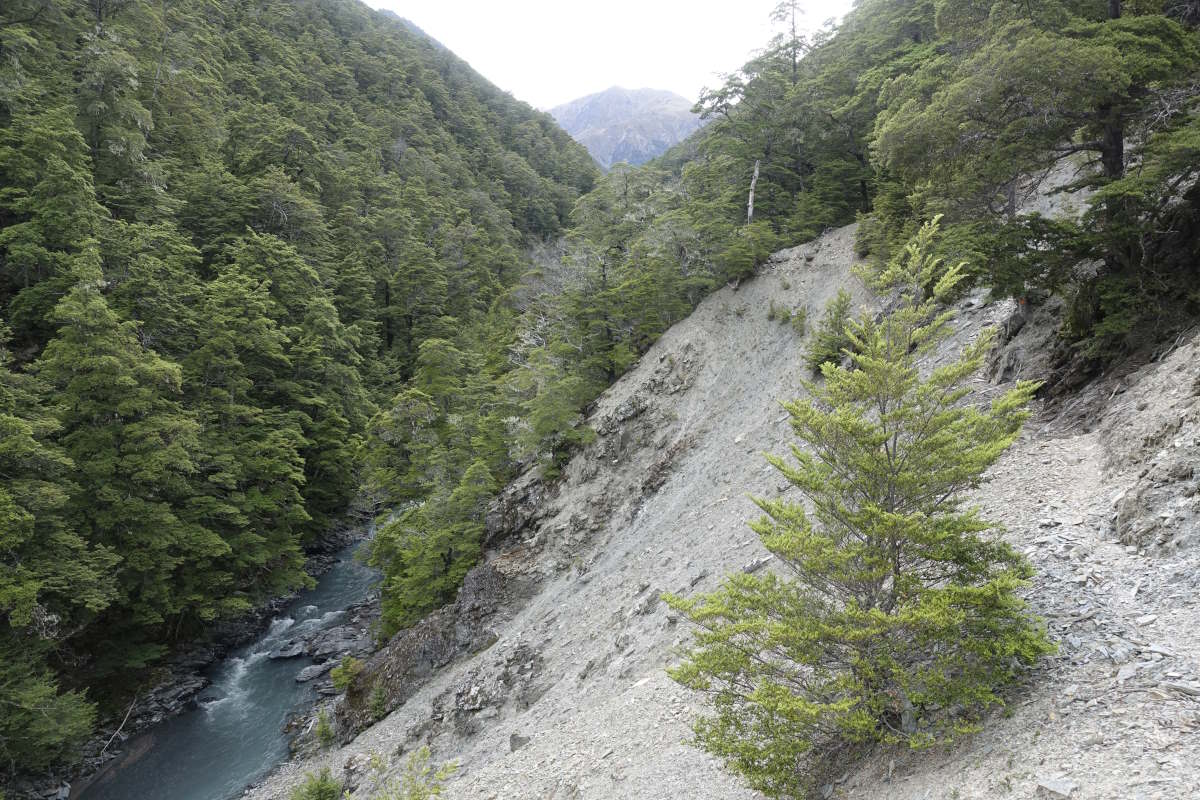
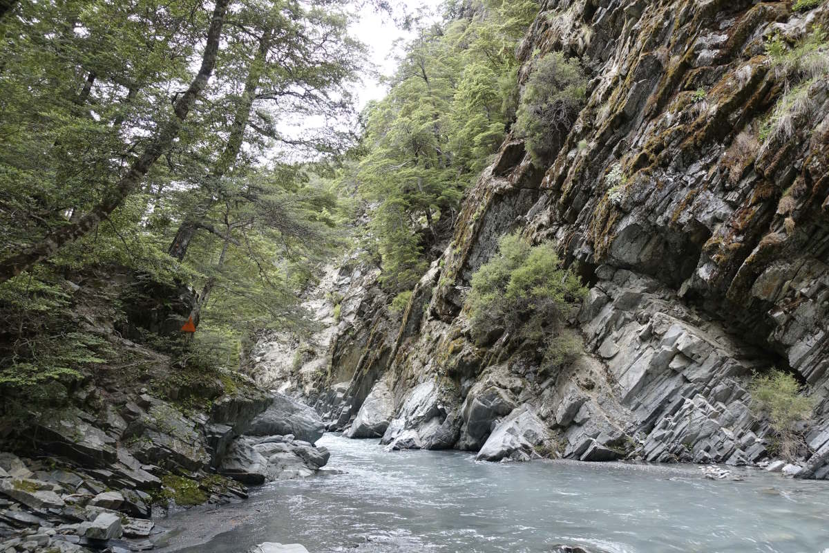
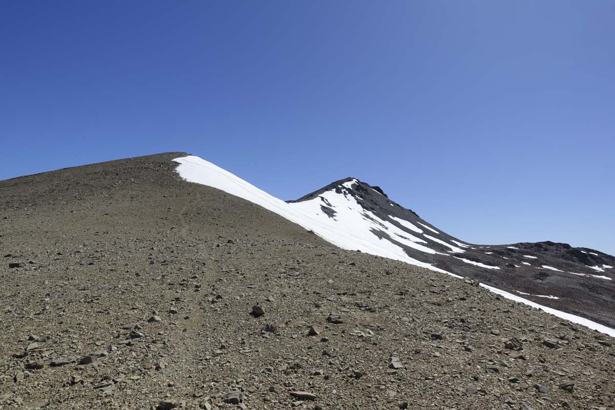
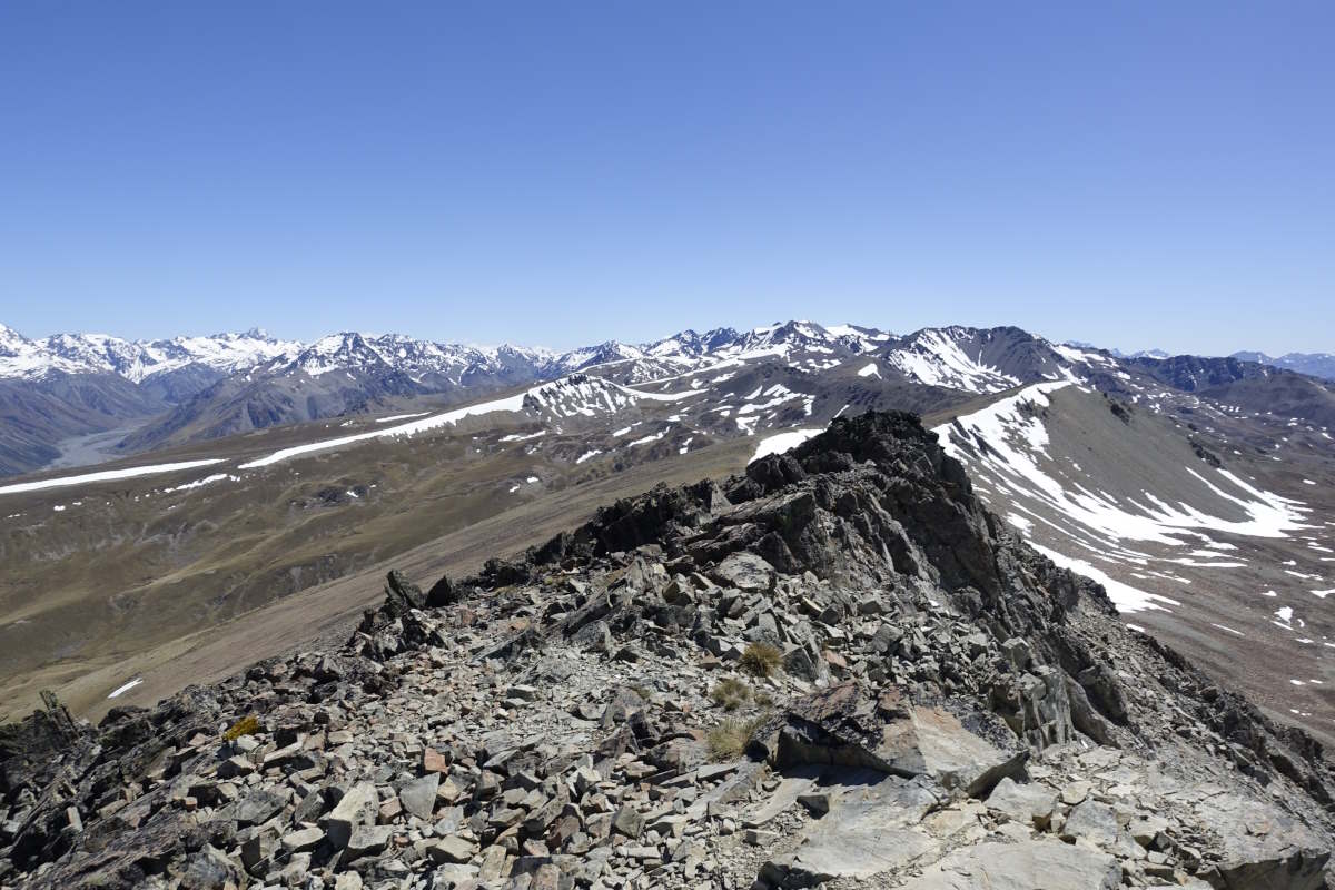
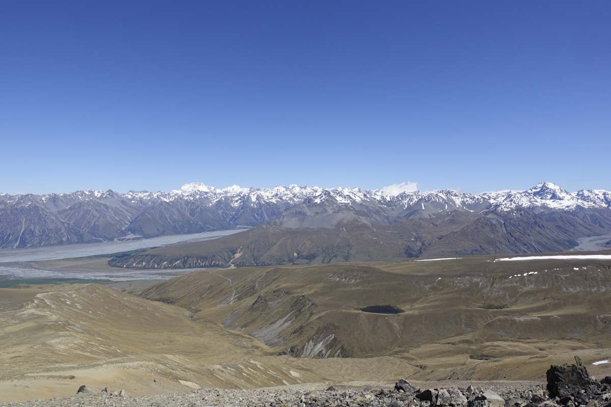
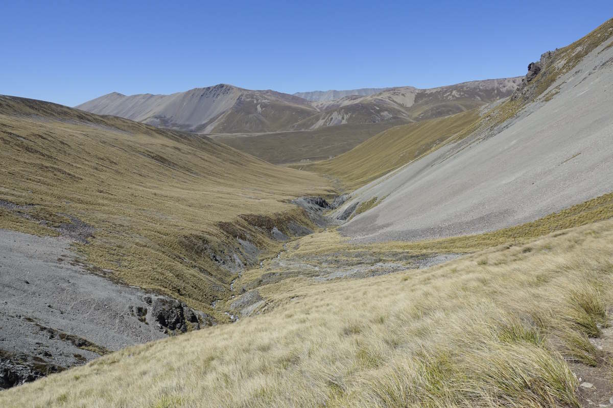
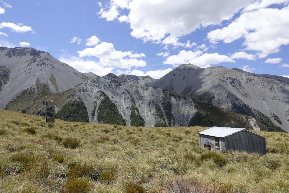
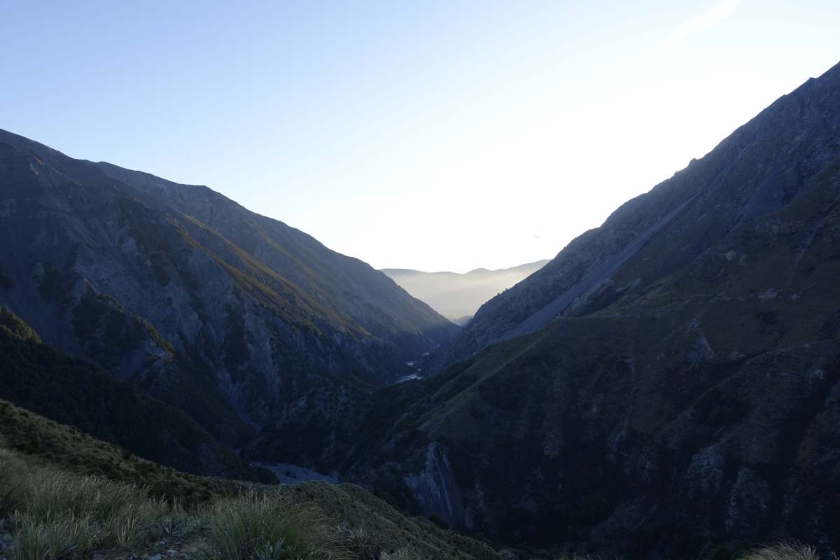
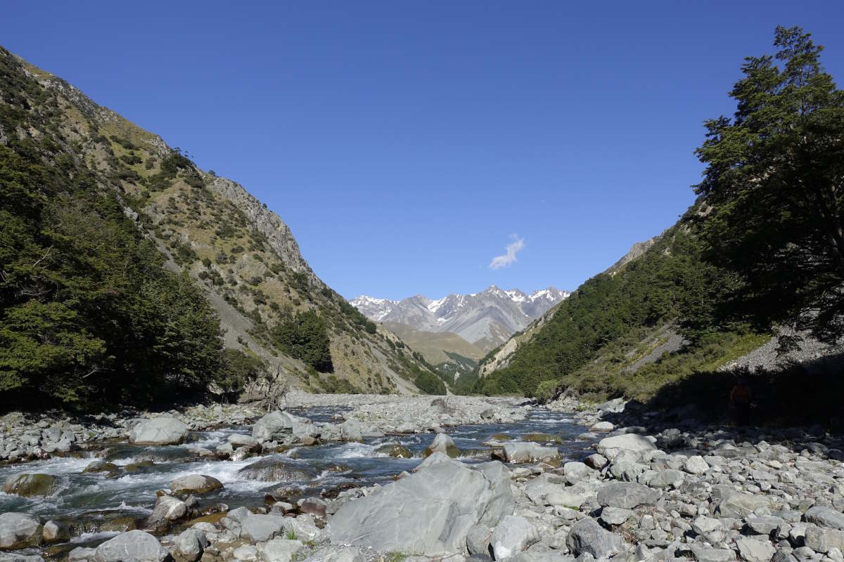
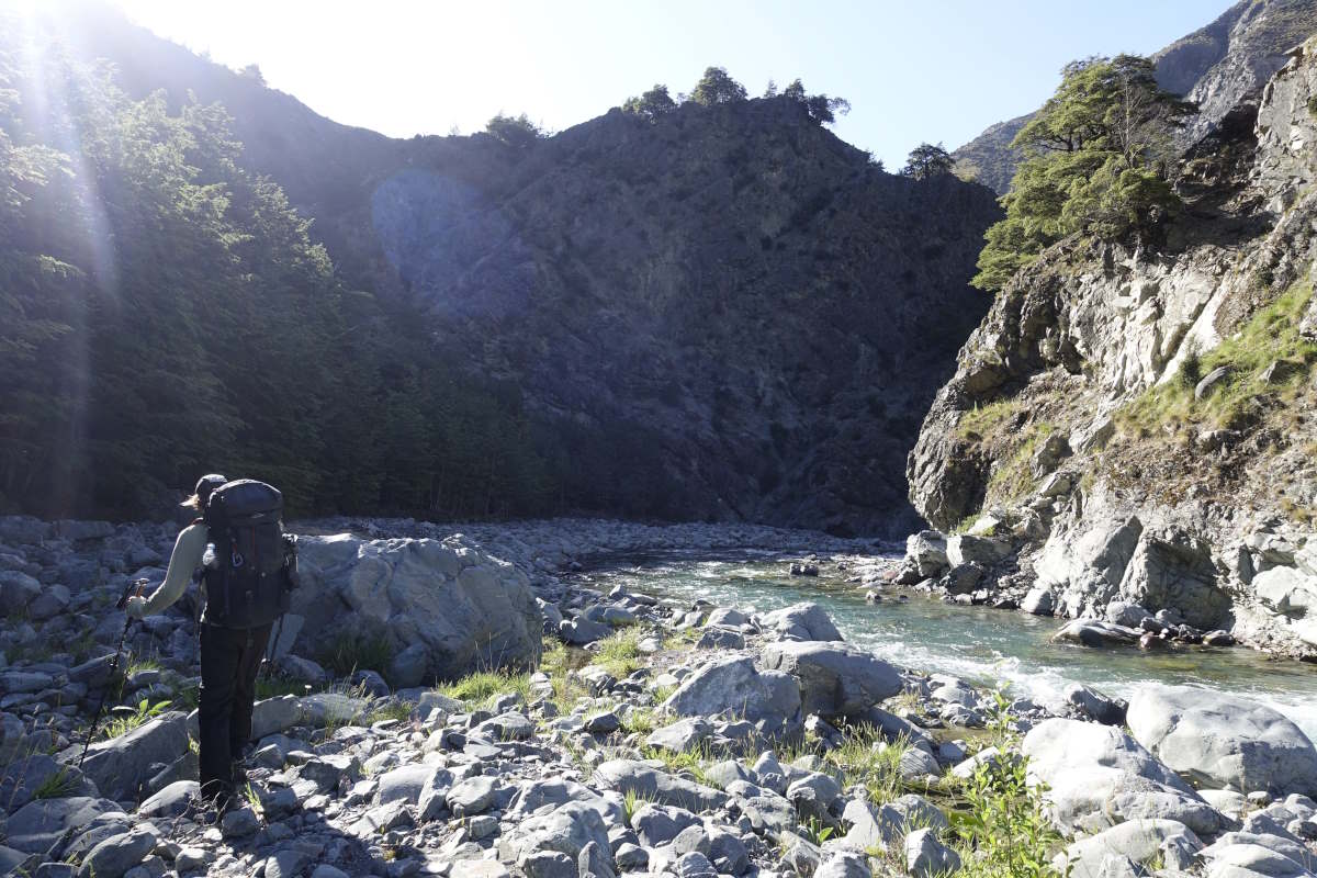
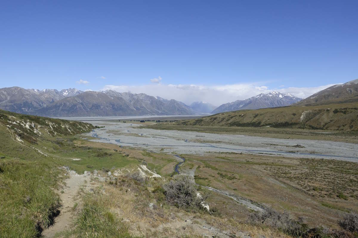
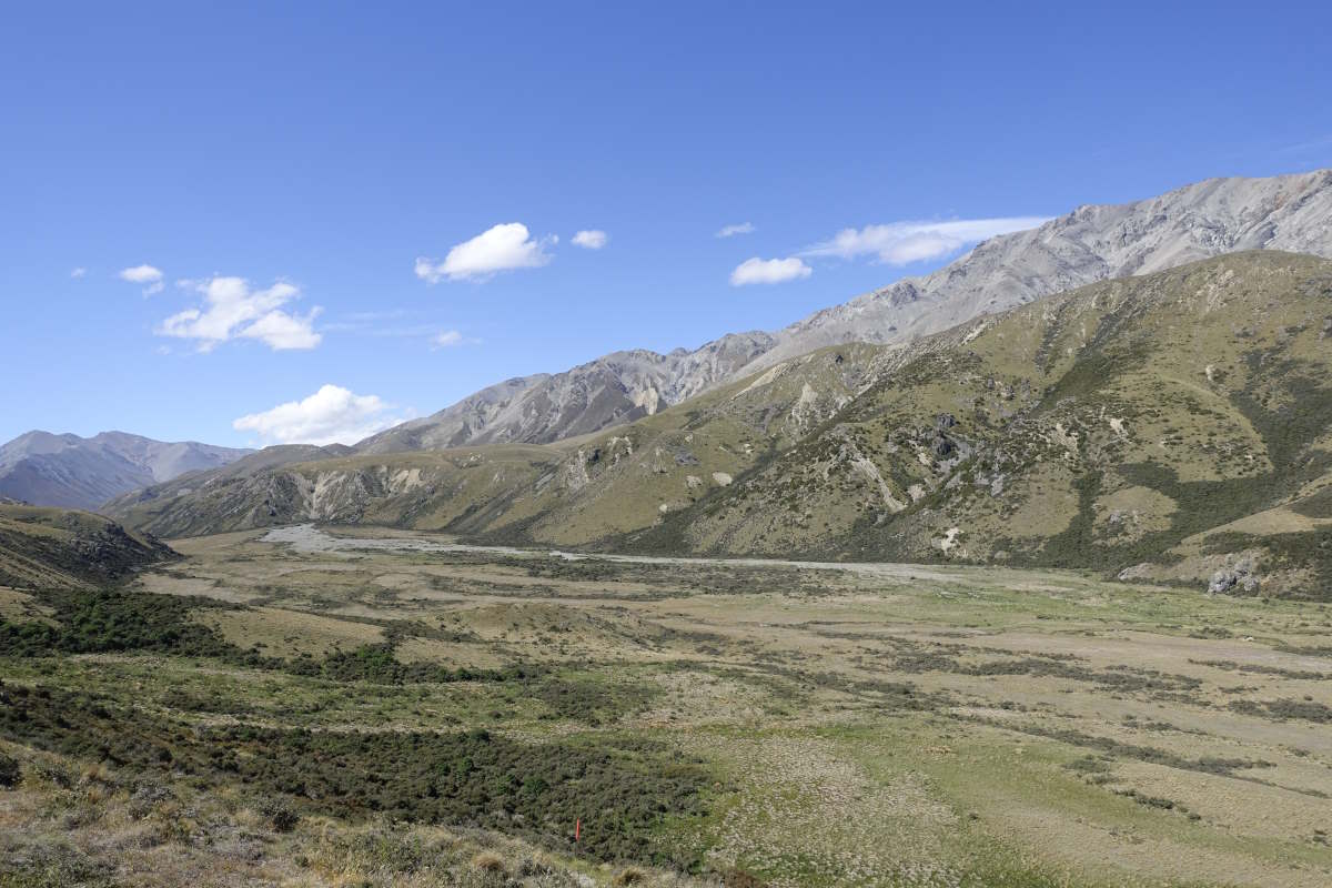
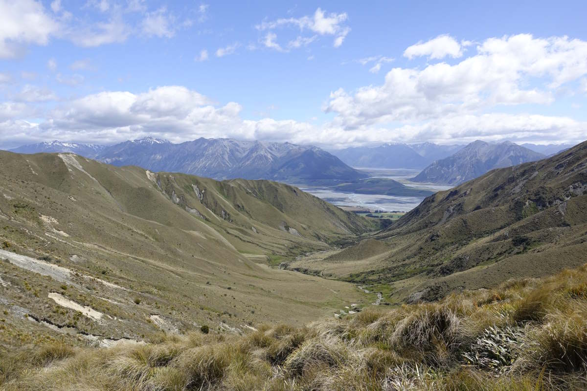
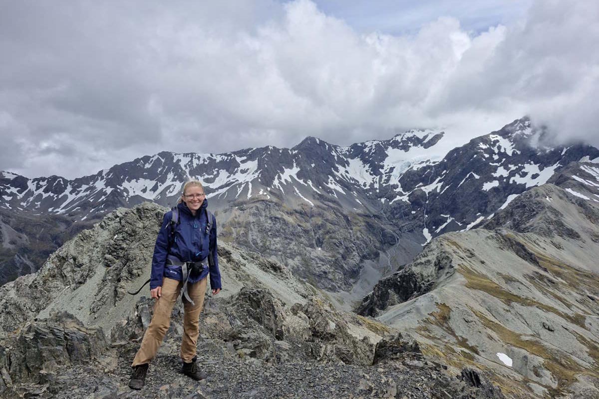
Day 31 (15km): A day for celebrations: one month on trail, the approximate half-way-ish point (because with various add-ons I have no idea how far I’ve walked or have to go) and the highest point! I poke my head out of the hut to be greeted by a perfect clear blue sky and am instantly twitching to be off. I follow the high track up the ridge all the way to the summit of Beuzenberg Peak. It’s remarkably easy walking with a gentle height gain and an increasingly stunning view towards Aoraki which has finally re-appeared from its rain cloud. The mountains seem to rise vertically from a vast braided river valley and you can instantly see why the TA comes out and around - this is not human country. I’m on the summit for 11am and find a little dip to sit out of the wind and soak up the sun and the view for nearly an hour. At last it’s time to get down. Standing up I can feel that the wind has increased considerably and I lower myself carefully off the side onto steep scree. There are a few optimistic footprints at the top but certainly nothing you could call a path. Oh well, nice and slow. I slide carefully downwards, my thoughts doing their best to be calm and reassuring “stand up straight, shoulders back, trust your feet”. Eventually the slope starts to even out. I don the microspikes for a band of hard snow which is completely unnecessary (though saves a small detour around) but feels good having carried them all this way! I take a little break at Stag Saddle then carry on, joining a rough and winding path down a stream to Royal Hut. I’m done by 2pm but no point in hurrying on as the shuttle bus is pre-booked so a lovely chance just to sit and chill. I have a sociable second lunch with an English pair of SOBOs who are carrying on, then a productive afternoon mending a number of small holes in my t-shirt where the rucksack has rubbed. Day 32 (15km): I’m rather proud of my neat and discrete t-shirt mending until I stand up to leave this morning and Vicki points out a 3 inch rip in the back of my trousers. Ah. Heading out, it’s another sunny day and again not far to go. The trail climbs, drops and climbs again mostly through tussock but on a better path than yesterday and I make good progress. There are plenty of stream crossings so I wave goodbye to the dry boots. Most are around knee height and fairly straight forward, but this is only the very highest reaches of the same stream that I’ll be rejoining tomorrow so that might be interesting. I spot a group of grazing animals that I can’t identify - too big for goats but not deer, then turn off onto a long gravel climb up to a pass and over and down. I reach Crooked Spur hut for a late second lunch and find it occupied by Gary, Andrew and Courtney. They have been flown in by helicopter with vast quantities of hunting kit including a heavy metal frying pan which is currently being put to good use cooking up some fresh tahr steaks (tahr turning out to be the not goat not deer animals just encountered). They are very welcoming and happy to share which helps to offset the impression made by the bloody skull sitting propped on a tussock just out front. We’re later joined by Vicki and also Charlie, another north bounder who has seen my note about a shuttle bus in the last hut book and done a long day to catch us. Lachlan, the fourth hunter, arrives after dark; excitedly recounting a full day spent stalking a bull with particularly impressive horns. Day 33 (9km): There is an additional head with fairly large horns sitting propped against the tussock this morning. We set out as a team of three, off with the sunrise as the shuttle is booked for 10am and the notes suggest 3.5 hours for the walk out. The trail drops slightly precipitously down into the valley and straight through the river. The water is quick and cold but with a bit of care finding a spot it’s only knee deep. Back up the other side there’s a steep climb and I manage to inadvertently sneak up on another heard of tahr having a morning munch just above me. Down again, we drop back to the river to stay, the trail following the riverbed and the water out to the Rangitata. There’s no path, except occasional desperation trods up the banks where people have tried to avoid crossings, and the walking is on uneven stones. Each twist and turn of the river erodes into the bank and requires a double crossing so we get a lot of practise in very quickly and I enjoy the challenge of picking out good lines through the water. Charlie has the longest legs so gets the honour of going first - if it’s above his knees it will be approaching my hips. The sun shines brightly and it’s pleasant and engaging walking if not the fastest progress. I’m just reaching the far bank of a particularly tough crossing when Charlie shouts something, and then he’s running back into the water. I twist round, and there’s Vicki: afloat and being carried downstream towards me. Jump out onto the bank. Ditch the rucksack. Step back into the water. Now what? I crossed it slowly and carefully with two poles, there’s no way I can run back in and grab another person out in the middle of the flow. Hold out a pole? She’s metres away. All I can do is stand shin deep in water and feel the most crushing sense of utter uselessness. She manages to grab onto a rock and we can all take a breath; guide her through the line I’ve just followed. We stand together on dry land, Vicki soaking wet but calm, Charlie and I comparatively dry and shaking. We share some therapeutic chocolate and carry on. There’s a shuttle to catch. More crossings, some of them deeper and stronger as we travel downstream. We take a deep one as a pair, in to the waist and powerful. I’m upstream, leading. Trying to remember everything I’ve read about what the kiwis call “mutual support”. With each step my feet are dragged sideways downstream, straight in front of Vicki’s. “Mutual trip over each other?” It is physically impossible to pull them back upstream. Slowly and awkwardly we make it through, the bottom few inches of my rucksack soaked and dripping. In the end we’re only 30 minutes late. Sam, our shuttle driver, has brought a drone and fortunately spotted us almost running the last couple of km and decided to wait. We’re joined by Tom, another name from the hut books that I’ve been slowly gaining on since the start, so are a merry band of four for our river avoiding. It’s a few hours’ drive to the first bridge - one of only two to cross this river in its entire 120km length. We add in a quick re-supply and lunch stop before returning back up the other side to stand and look back at the mountains we’ve just emerged from: 7km and a hundred shifting twisting river braids away.
Camp Stream Hut
A gentle ascent
Beuzenberg Peak
On top of Beuzenberg Peak (2070m)
The Southern Alps (Aoraki on the left)
An interesting descent!
Joining the top of Bush Stream

Sun rising over Royal Hut
A beautiful morning
A beautiful morning
Bush Stream Track
Bush Stream Track
Crooked Spur Hut
Sunrise from Crooked Spur Hut
Bush Stream
Looking back the way we've come
Charlie leading the way
Mt Potts Lodge to the Rakaia River
69km, 3 days
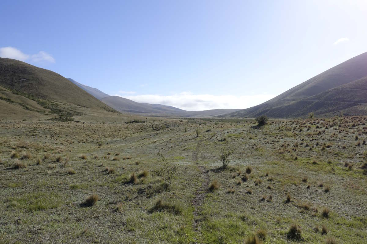
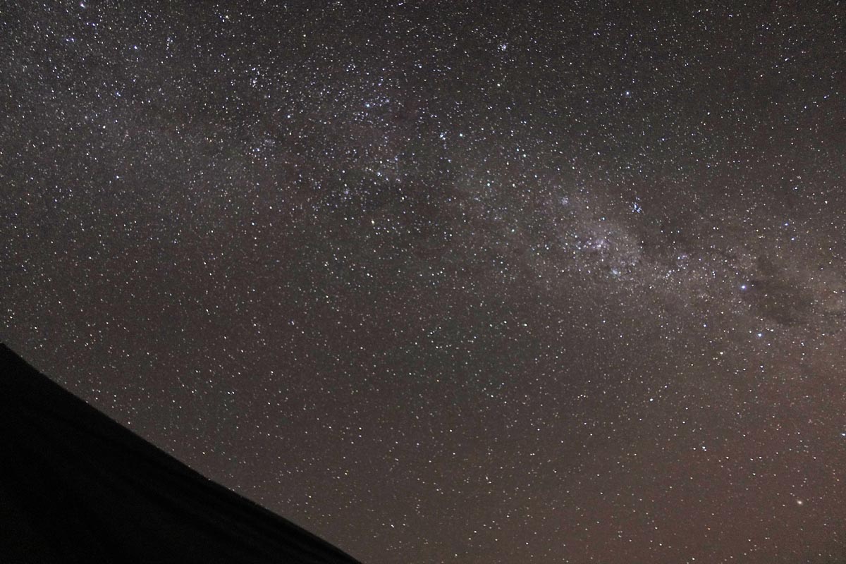
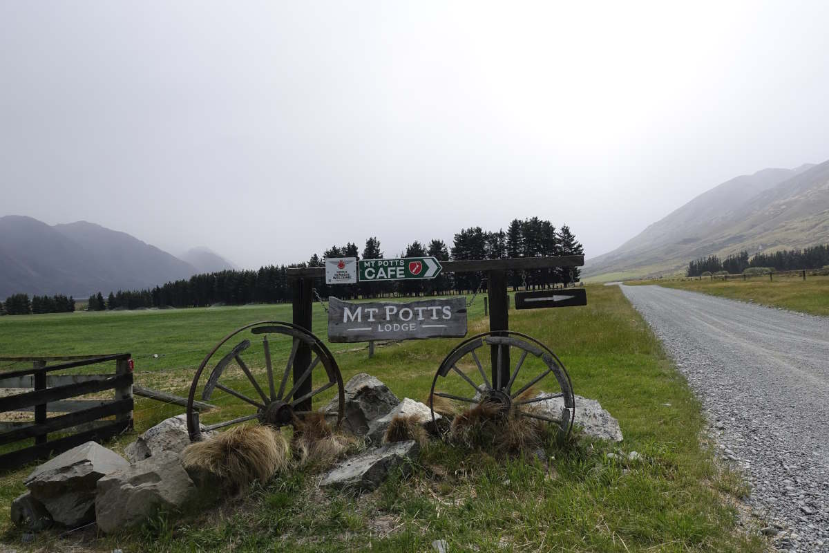
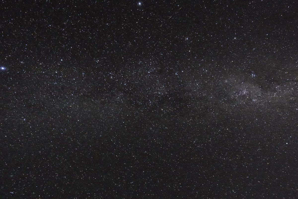
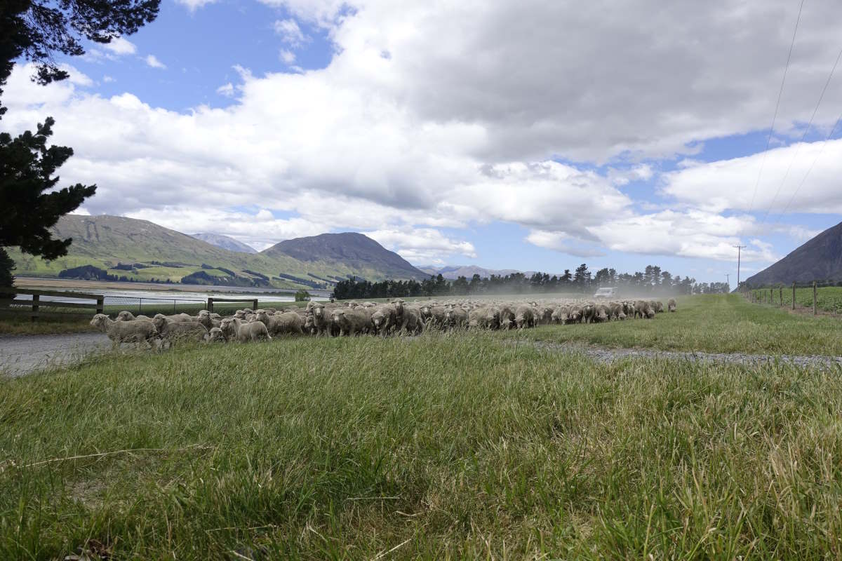
Day 34: A tactical rest day. The forecast has a double severe weather warning for heavy rain and strong winds and we all agree that the day is best spent enjoying the luxuries of Mt Potts Lodge. We are joined mid morning by Aurore and Quentin and between the six of us take over the squashy-sofas-and-pool-table area. We work our way collectively through most of the (excellent) food on the menu and enjoy an impressively windy walk to Edoras (aka Mt St Sunday). It’s lovely after so much time alone to have an actually relaxing rest day with people who have instantly become friends. Day 35 (34km): It’s still impressively windy but the sun is back out, coming and going between stripes of light cloud advancing rapidly across the sky. I set out alone but quite quickly catch up with Vicki, standing on the bank of the silt filled and slightly turbulent Potts River wondering if there is a way to avoid crossing it twice in a very short distance. We have a go at wading up the edge but it gets deep and there is an inconveniently placed rose bush overhanging the bank. Abandoning that plan, I try an ascent of the bank but quickly find myself on an unstable cliff and have to come back down. Crossing remaining the only viable option we realise we’re now in a really bad place for it and so have to backtrack to where we started. What a faff. We find a good first crossing between a couple of little islands, then spend longer over the second, eventually teaming up for what we decide is the least bad option. The water is opaque with silt and the wind strong and gusty but in the end it’s a bit of an anticlimax and barely comes above the knee. Or maybe we’re actually getting better at rivers. Onwards at last it’s an easy but long day through big open landscapes with the wind at my back to push me along. Interesting aside: the TA is notorious for going straight up hills and not having switchbacks, but today I found them all! They’re crammed in tightly on the little climb up to the saddle by Mt Guy. It takes me a while of crossing and re-crossing the hillside between widely spaced markers and gaining fairly pathetic amounts of height until I work out what is going on; then promptly abandon them for the vertical ascent up a fence line instead. Then it’s a long and gradual descent across dry plains to the road and finally a gentle meander around some marshy ground to crest the shoulder of Emily Hill and drop down to Manuka Hut. Charlie’s there already and there’s a rumour that a French couple may have hitched a lift and gone on to the hut ahead. Vicki’s not far behind and we’re also joined by Tamsin (another speedy walker who’s just caught us up) and much later by Tom, who detoured off to Mystery Lake for a short day then decided that wasn’t far enough. Day 36 (21km): (Note: this morning contains animal suffering) I’m awake at 3am needing a wee and stumble out into the darkness to find the sky above me bright with stars. I bring the camera out and have fun playing with the long exposures and getting very cold because fumbling around in the dark of the hut trying not to wake everyone up I couldn’t find my coat. Onwards, the day starts on an easy path, then a gradual climb to the saddle. There are a couple of possum traps (essentially a very large mouse trap on a pole) with their victims from the night hanging silent and still. And then a shuffle, a patch of darker fur and a pair of little eyes, watching. A youngster, unharmed, still clinging to its mum. I watch it grimly. Wonder if I should do something. Do what? Its chances of survival alone seem pretty slim but then so does my chance of achieving anything that could be considered “quick and humane”. I walk on. The trail climbs slowly through a landscape of dry grasses interspersed with pockets of bright flowers. There’s a carpet of little yellow rockets, and from the grass clumps heavy spiked stems so tall they curve over my head. The sun is hot and the sky a deep clear blue. I catch up with Aurore and Quentin, meet Charlie at the saddle for lunch, but for most of the day I’m alone. My mind wanders, dwelling all morning on predator traps. New Zealand is a land of native endangered flightless ground-nesting birds that exist no-where else in the world; and a land of introduced predators that people are, perhaps too late, trying to do something about. Eradicate one to save another. An innocent clinging to the body of its mother. I walk on. Over the saddle the trail joins a stream, winding gently downwards. The path crosses back and forth, picking a line through boulders and a million crossings. I walk in the water. It’s gentle, warm and crystal clear. Lift a foot, let it flow with the current, place it down, repeat. Slow, and slightly mesmerising. I reach the hut for mid afternoon then wander back to a couple of swimming holes. I find a deep pool where the current is strong enough that I can swim hard upstream without moving. Let the water flow over and around me, leaving me clean and cold under the heat of the sun. We spend the evening playing cards, talking. Swapping stories of life on and off the trail. The hut is an interesting metal construction with a distinct meccano style, and I sort out my Christmas card failings with an arty shot of a stocking handing over the fire. Odd in this land of dry heat to think of people at home watching the snow fall and the nights draw in. Day 37 (14km): There’s only a short distance left for today to get out to the road and our next river avoidance. I set out along a 4x4 track which winds its way upwards past some very cool sandy cliff faces. I stop at A frame hut to work through the remainder of my snacks, and then again at the saddle though the wind is fierce and prevents lingering. Downwards I can see out towards the Rakaia: 9km of braided channels that separate us from the next part of the trail. The TA developers are clear: the trail ends here and you go around. Do Not Cross. It’s a gravel road to no-where but fortunately there’s an enterprising school bus that will pick up hikers on its way back from dropping off the kids. There’s a few hours to wait and I’m gradually joined by Tom, then Aurore and Quentin. Minutes later a car comes past. Aurore leaps to her feet, thumb out, and the driver skids to a halt. He can only fit three. But no bags. Or maybe two. But definitely not Tom’s 7ft walking stick. And he looks a bit like he wishes he’d just driven past. In the end it’s me and Tom left to sit by the roadside, then Vicki and Tamsyn. Then a large herd of merino sheep. There are no more cars. Eventually the bus arrives and we’re shuttled in to Methven just in time for a quick dash around the shops before closing. We catch an updated forecast which promises incoming storms and after a bit of debate I abandon my rest day plan and we decide to push on as a team to make it across a couple of larger rivers before the rain.
A tactical rest day
Windy wander to Mt St Sunday
Mt St Sunday
Across the Potts river, looking back to the Rangitata
Crossing dry plains
Crossing dry plains
Lake Emily
Round the back of Emily Hill
So many stars
Towards Clent Hill Saddle
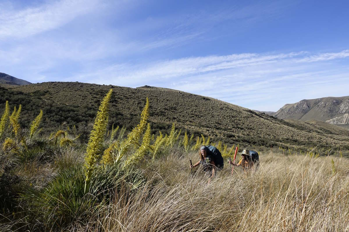
Flower spikes (Aurore and Quentin for scale)
Charlie a little dot on the ridge ahead
A lot of scree
Round Hill Creek
Round Hill Creek
Climbing towards Turtons Saddle
Interesting cliffs
Charlie at A frame hut
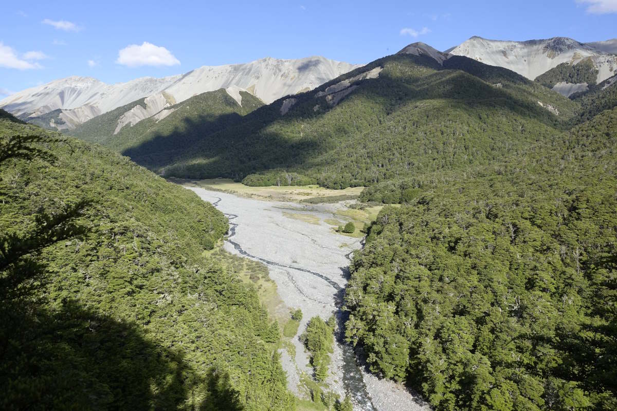
Looking down to the Rakaia
Sheeeep
Lake Colleridge to Arthur's Pass
Harper Valley Track, 64km, 3 days
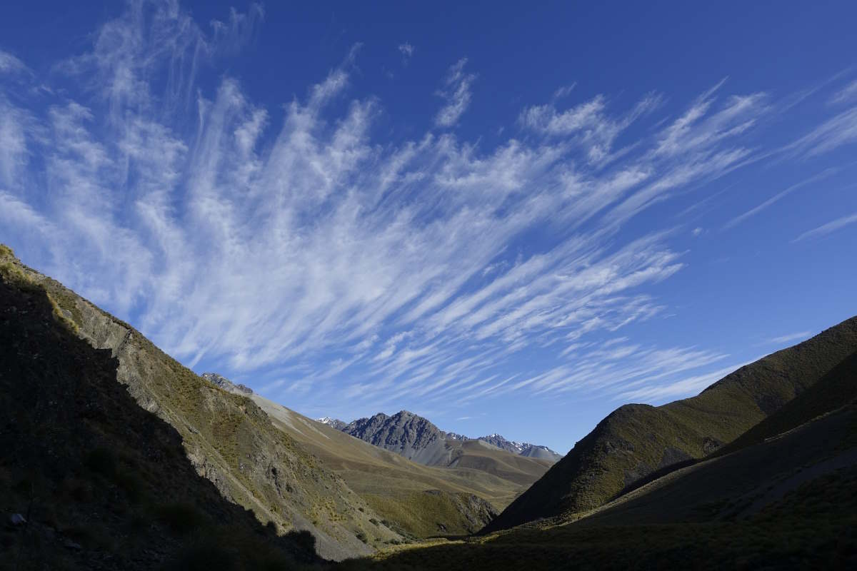
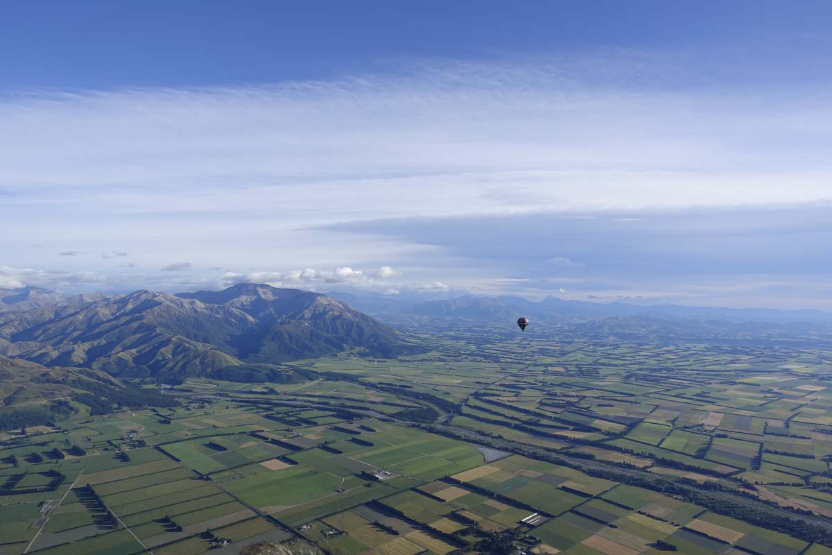
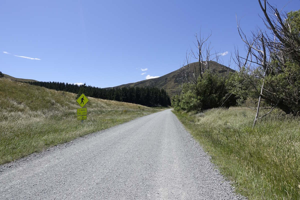
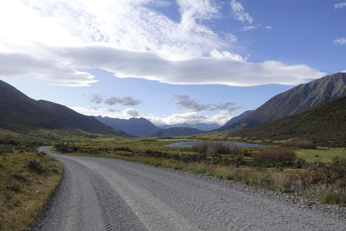
Day 38 (28km): Long distance hikers seem drawn to making rules: do you walk every step, or can you hitch a lift if it’s a tarmac road, or do you just pick the interesting bits. Personally I’m walking most of the steps but also trying to be a tourist as well. So this morning while in Methven I’m off in a hot air balloon. It’s an awesome experience, flying up to over 2000m with a huge open view across the mountains then a gentle descent down over the Canterbury plains. I can see the Rakaia lit by the rising sun stretch all the way out to the sea. I’m back on the ground, packed up and returned to the campsite for 9:30 so plenty of time left for a decadent second breakfast before catching our pre-arranged shuttle up the other side of the river to Lake Coleridge. We arrive around midday and the original plan was for this to be a rest day but the weather dictates movement. The trail climbs steeply through the corner of a large arboretum and up alongside the pipes of a hydroelectric plant. Crossing the top there is a brief but very pleasant view of bright turquoise waters as the path rounds the end of the lake then it’s a long gravel road for the rest of the day. It’s quiet at least. A car passes and I can see Tom waving from the back seat. And then another, and Vicki is at last able to live up to that promise of taking my stuff for me. I give her the tent and all my overnight stuff and suddenly my heavy bag is practically a day pack and the walking much nicer. There is definitely a part of my brain (and also my feet) that says what on earth are you doing turning down a lift just to walk along a road when you’ve just bussed around a massive detour, but something in me would rather walk the whole thing. Something about the completeness and enjoying the challenges - including those that are somewhat monotonous and not just the exciting ones. Offer me a bike and I’d absolutely cycle it, but I don’t want a lift. I stop part way and have my dinner by Lake Selfie, arriving at the campground just as the sun starts to set to find the others have pitched my tent for me! Amazing. Day 39 (19km): I’m tired. I’m up just after 6am to find that the others all have their tents packed up and are eating breakfast. It’s an easy walk along a gravel track for 10km to reach the Avoka river. This is the one that Alex and Sarah (way back on day 24, Top Timaru Hut) identified as their hardest river crossing and told of getting swept off their feet despite crossing together. It’s the reason we’re currently walking as a team of 6. We meet on the bank of the first channel, scope it out and decide it’s fine one by one. Fast and strong but only knee deep. The next channel is ankle deep. And then there’s a few little trickles. Was that it? A few km later the Harper is similar but slower and even less of an issue. It’s all a bit underwhelming but I suppose that’s a good way for a river to be, especially when you need to be on the other side of it. I conclude that “what’s the worse river” is a really silly question and when I eventually start to meet lots of South-bounders and they keep asking it find the best answer to be “the one with the rain in”. We separate out, back to walking alone. There are some really interesting rock formations and a million river fords to negotiate but all remain fairly straightforward and I’m at the hut for mid afternoon to find Charlie has left a goodbye note and some jellybeans. It’s turned sunny and I consider also carrying on (The Rain being due tomorrow) but in the end the hut is just a bit too nice and none of the options further up the valley are particularly inspiring to get stuck in for a day. Tom, Vicki, Aurore and Quentin join and we take a little side trip up to Mirror Lake, then apply some teamwork to the hut radio (Tom being the only one tall enough to see the buttons and Vicki having the clearest kiwi accent) to find that the forecast for tomorrow is still just as bad as it was. We agree to stick our noses out in the morning and make a spontaneous decision as to whether to carry on or stay. Day 40 (17km): I get The Nod from Vicki at 5:30. The rain is pattering gently down on the roof but stops as I step outside and the stream is the same size as yesterday so all bodes well. It’s a couple of hours to Windy/Long Creek which are the crossings that the DOC man on the radio identified as being today’s main obstacles. Heading out the track starts easy with an actual bridge for the first crossing of the Harper, then gets gradually rougher with some bouldery stream bed sections and which are lacking in markers. It stays relatively dry, the only rain passing as drizzle, and both Windy and Long Creek are passed with no concerns. Up on the saddle the wind is impressive and I can see a wall of dark cloud and rain advancing up the valley towards me. Yuck. I move on quickly, making it down to the tree line and almost to Bealey Hut before the heavens open. Tucked inside, the hut comes with phone signal and a forecast which is a little depressing because the one day of rain has now turned into three and there are more rivers ahead. I consider stopping the night in the hut as I have a lot of spare food and don’t want to spend lots of money on consecutive nights of accommodation waiting out rain. But I also want to get up Avalanche Peak tomorrow and there is maybe possibly a weather window in the morning and for that I need to be in Arthur’s Pass tonight. Ultimately I dither long enough that Vicki catches me up and we agree to hitch in together - any morals I may hold about walking the whole way not extending to 12km on a main road in dense rain. We manage a twin room at the backpackers which is one up on my usual dorm style of accommodation and comes with an amazing shower and a fluffy white towel and shampoo and soap. Smelling excellent I send Sam (a friend from home currently working nearby) a quick message and two minutes later get a call to say that she’s just driving into Arthur’s Pass and is planning to go up Avalanche Peak tomorrow. But that was my plan! Day 41: It’s chucking it down at our agreed meeting time so we go to the café for hot beverages instead. Fortunately in the time that takes there’s then a chink in the clouds and just enough blue sky that we think it’s probably worth it so off we go for the ascent of Avalanche Peak. It’s great to spend a day with very little weight in the bag and I feel like I can practically fly uphill. The views are excellent and the weather mostly dry (except a compulsory light shower whenever anyone attempts to take a coat off) with lots of rain falling just to the side of us across what gets called The Divide - the mountain edge that splits New Zealand's weather into East and West. Heavy grey cloud and rain to the left; clear blue skies to the right. Back down at the hostel it’s pouring down and everyone is getting fed up of waiting out the weather. We’ve caught up with Charlie and Tamsyn who have been stuck here now for several days and even Tom and Vicki who arrived with me are getting eager to move on. A plan is forming to hitch to Boyle and continue walking from there which seems a bit drastic to me but apparently the advice from the DOC office is that the next section will remain impassable for a couple more days and then there’s another front coming in. But I’m still ahead of schedule and reluctant to skip ahead until I’ve at least used up all my spare days so Tom and I hatch a plan to lay siege to the Deception River. Sensing the breakup of our little group we arrange to go out for what gets ominously named The Last Supper.
A balloon's eye view
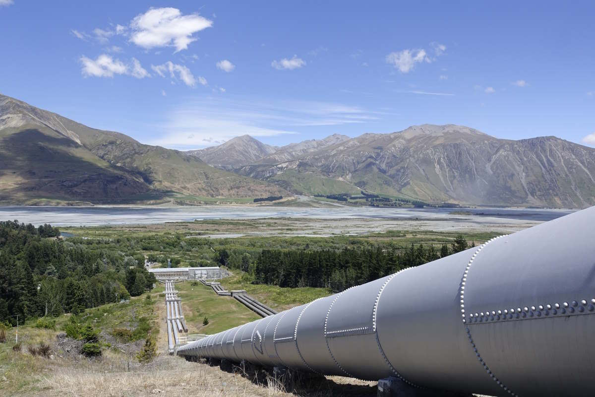
Hydro pipes above Lake Coleridge Lodge
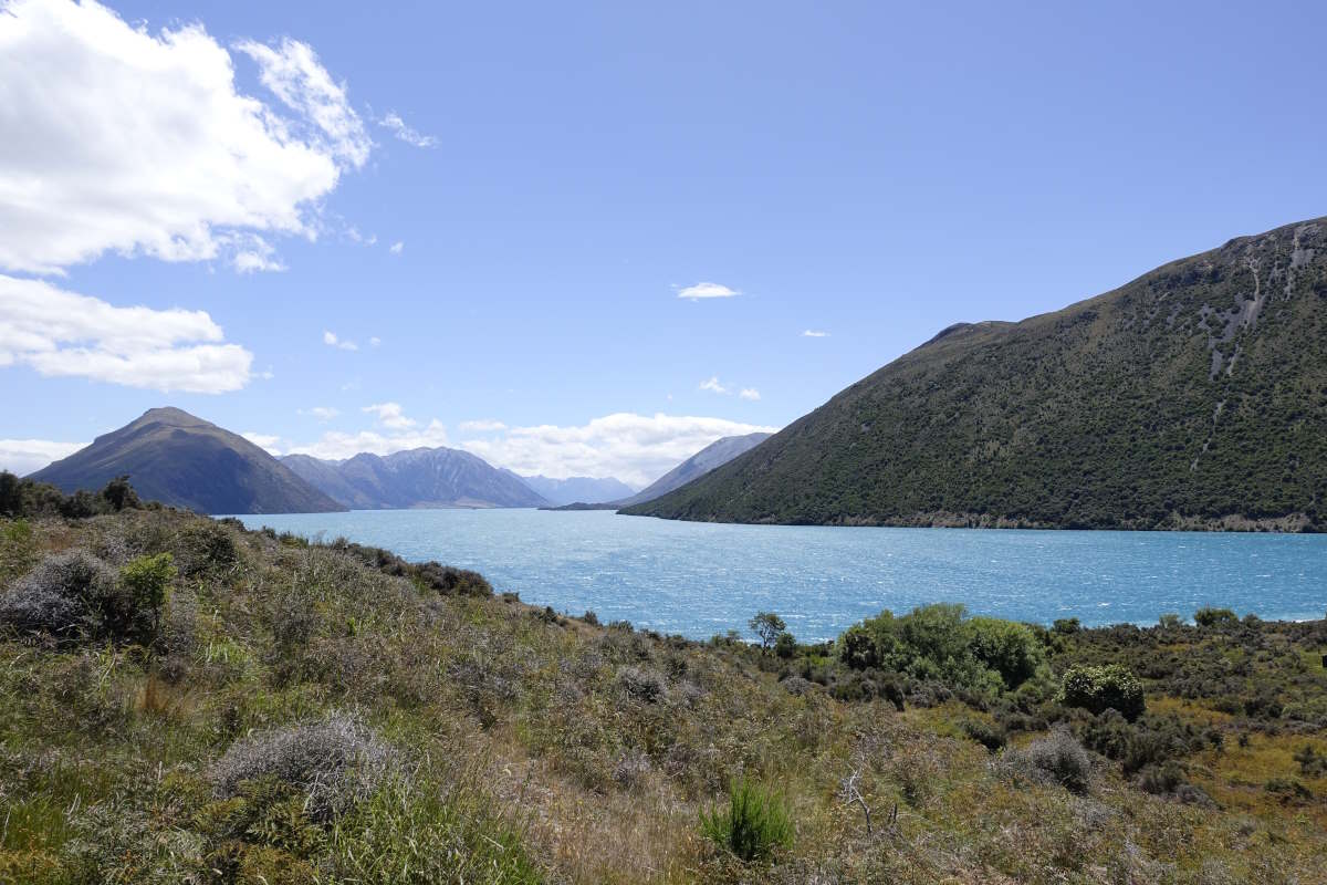
Lake Coleridge
A long road
A long road
Setting off up the Harper valley
The Pinnacles
Harper Valley Track
Vicki preparing to cross the Harper yet again
The luxury of Hamilton Hut
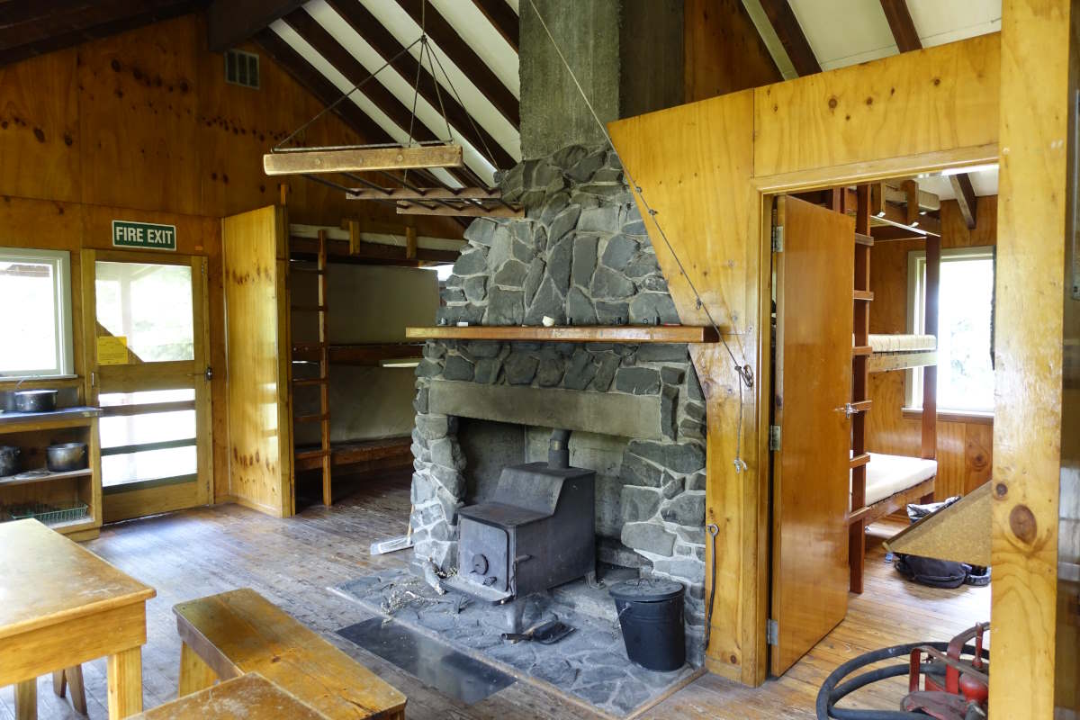
The luxury of Hamilton Hut
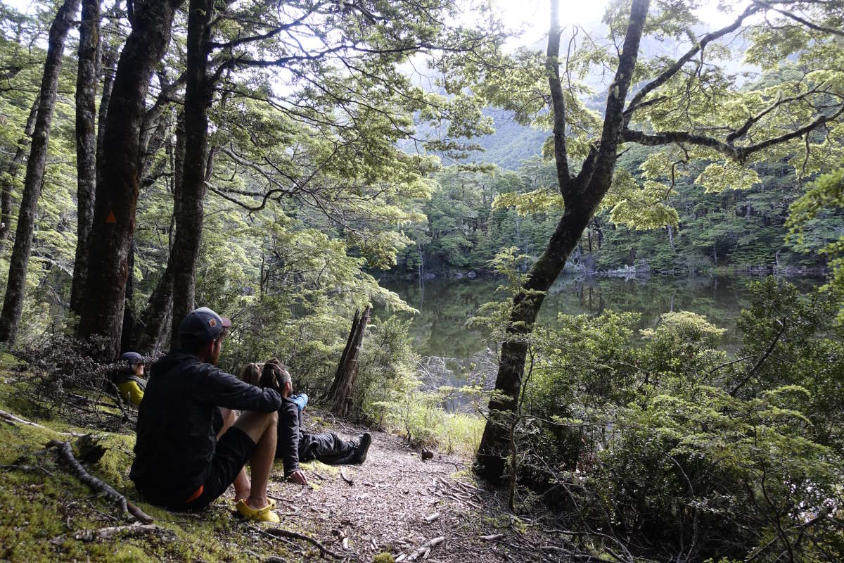
Mystery Lake
Looking back - Hamilton Hut just inside the trees
Rejoining the trail across Hamilton Creek
Following the upper Harper River
Following the upper Harper River
Following the upper Harper River
A wall of incoming rain
Avalanche Peak (1833m)