Te Araroa, Part 1
Stirling Point to Wanaka
November 2024
This is the first part of my adventure crossing the South Island of New Zealand. The early days where the place names told me I was still in Scotland but the plants, the birds and the sunshine said something very different! It’s a story of long beaches, dense forests and open grasslands and a gradual enveloping into a world of high mountains. TA Home Page | Onwards to Part 2 >>
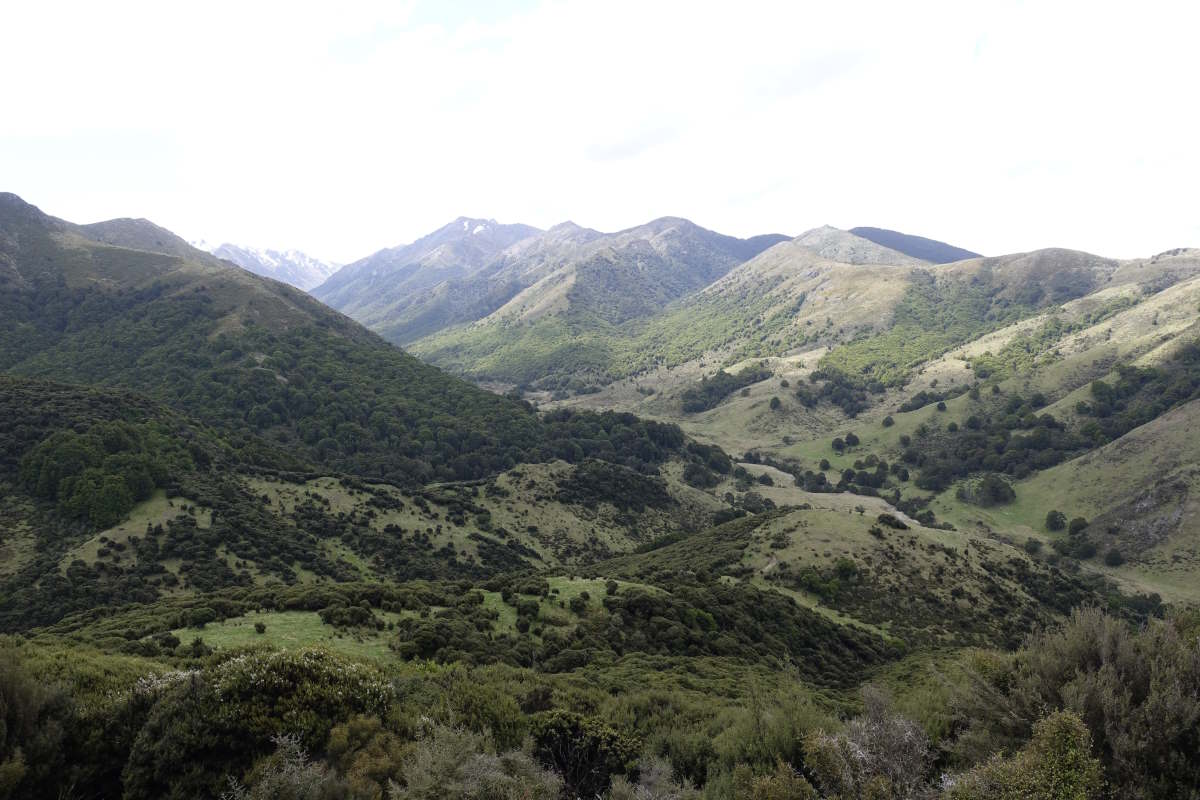
Stirling Point to Otatara
41km, 2 days
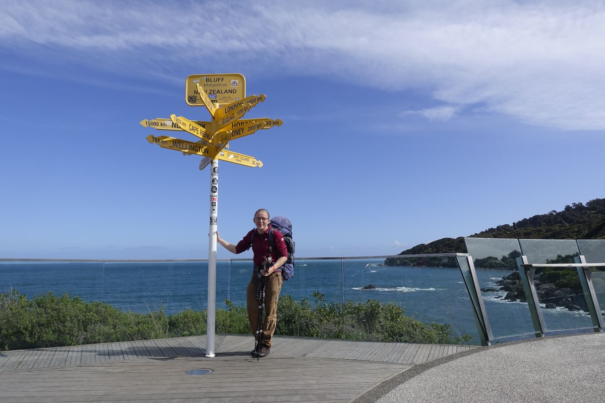
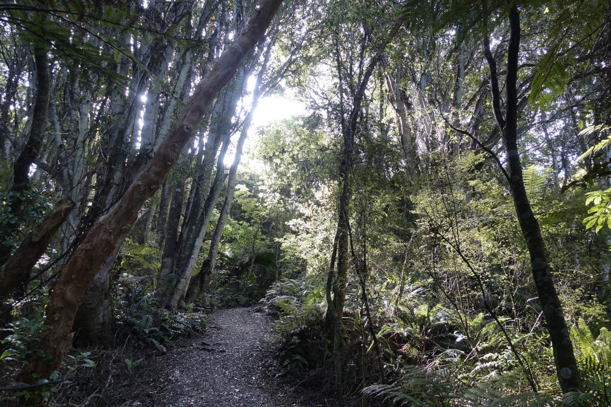
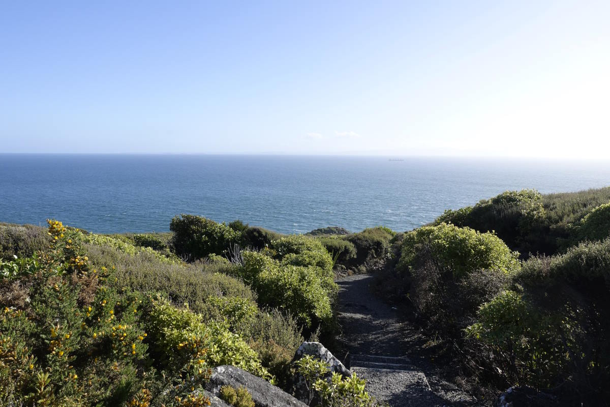
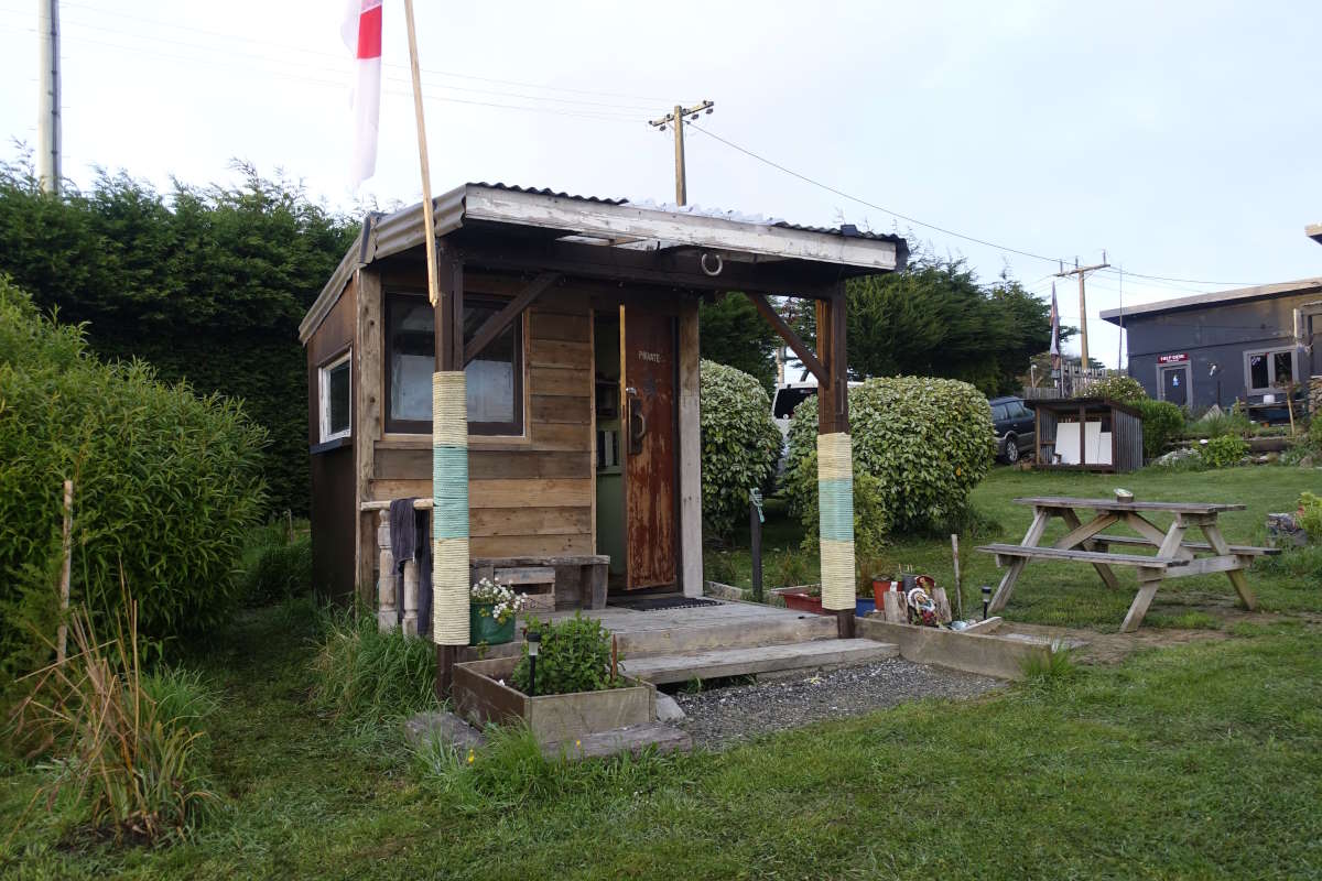
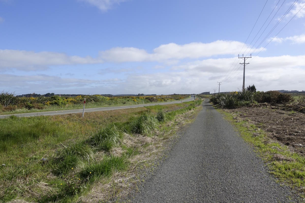
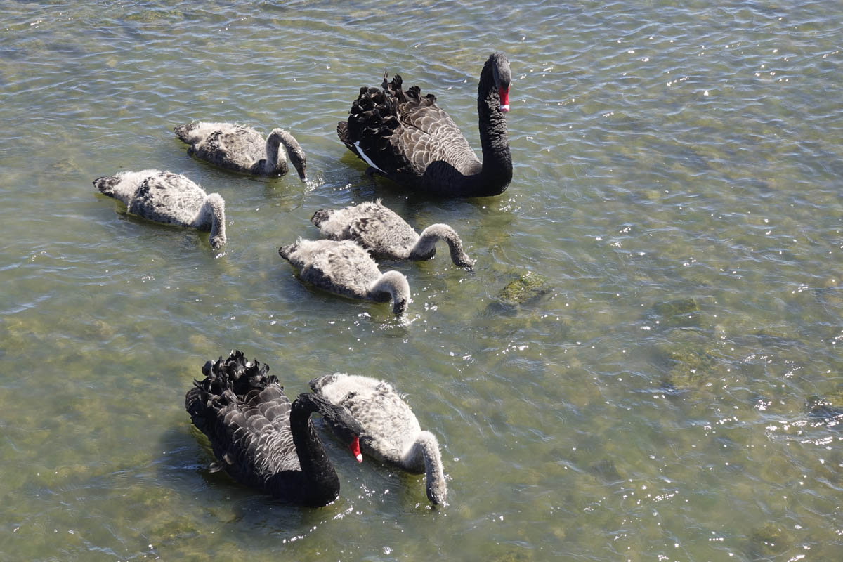
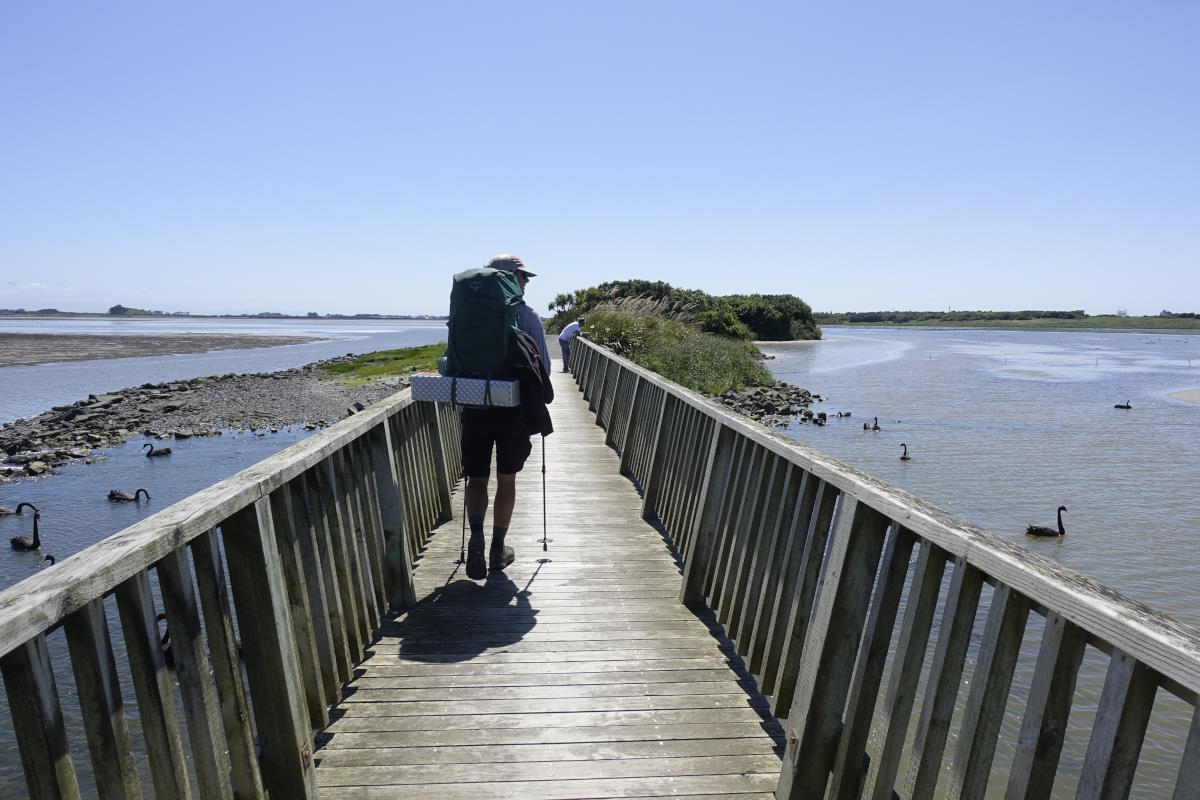
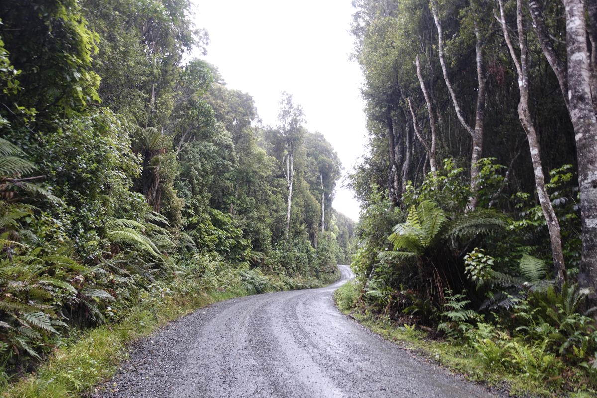
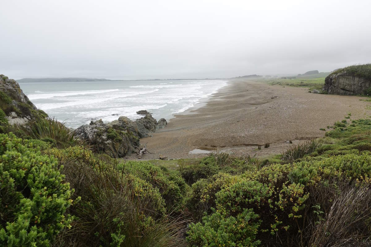
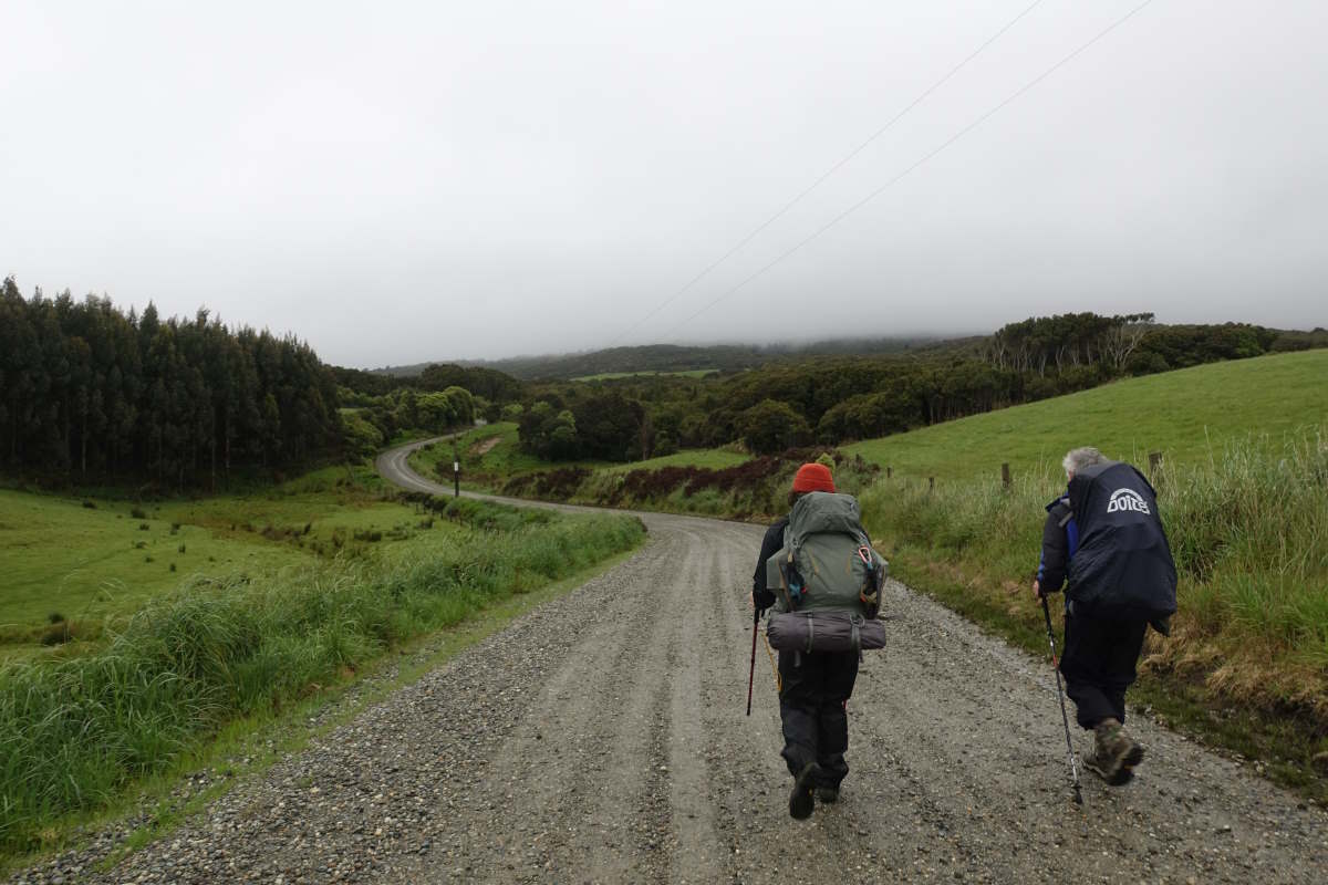
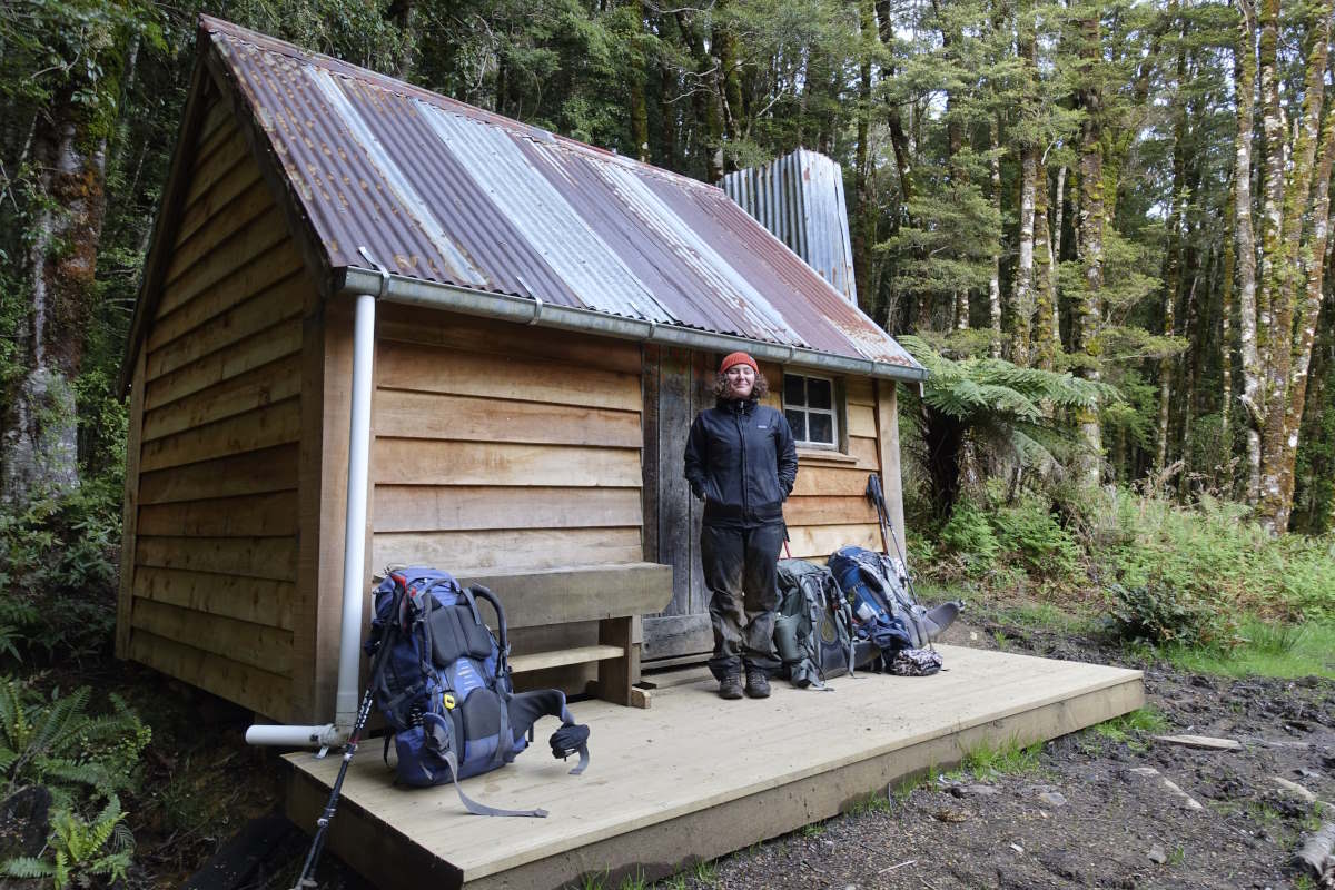
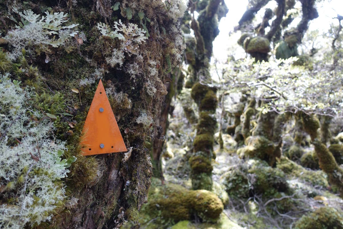
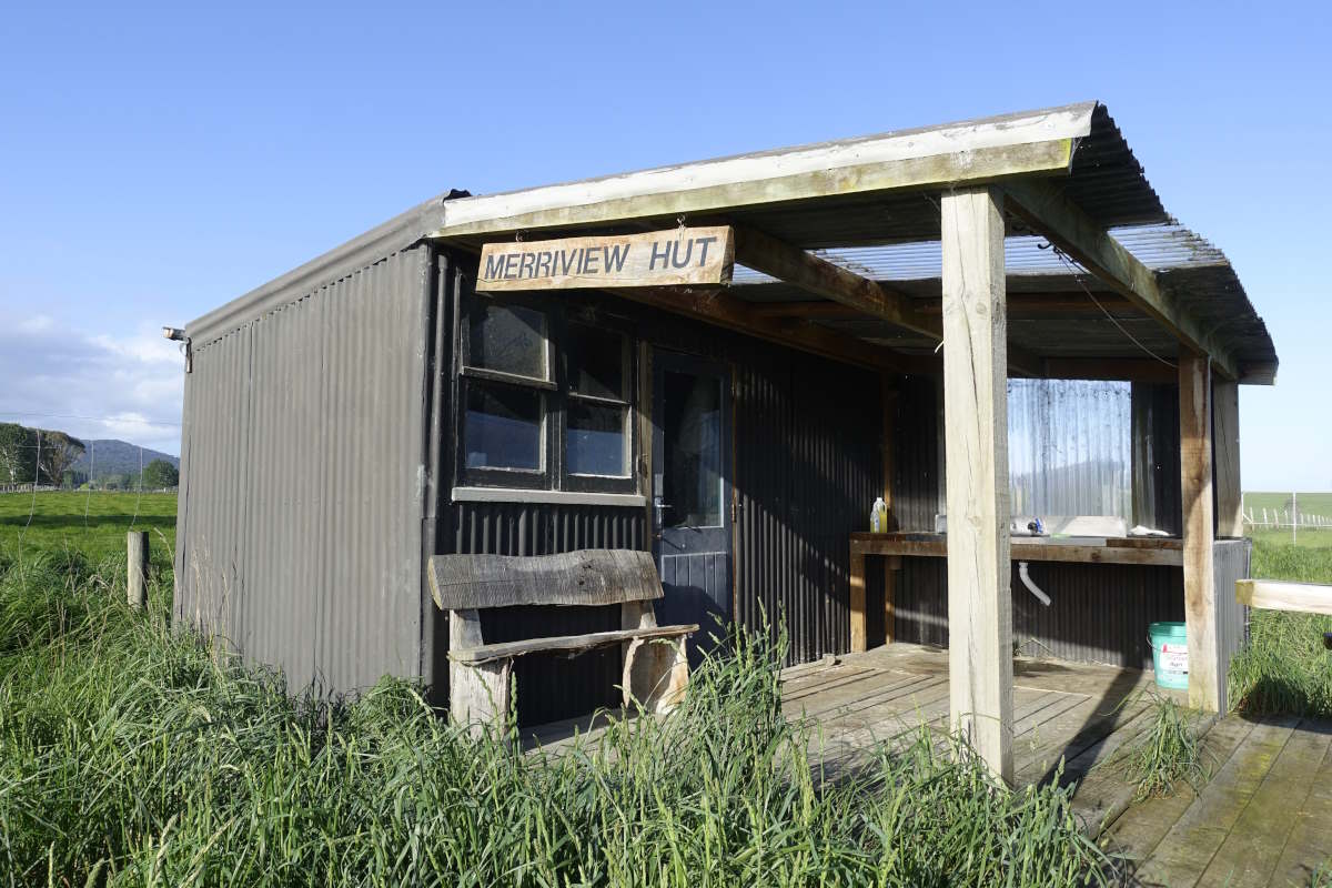
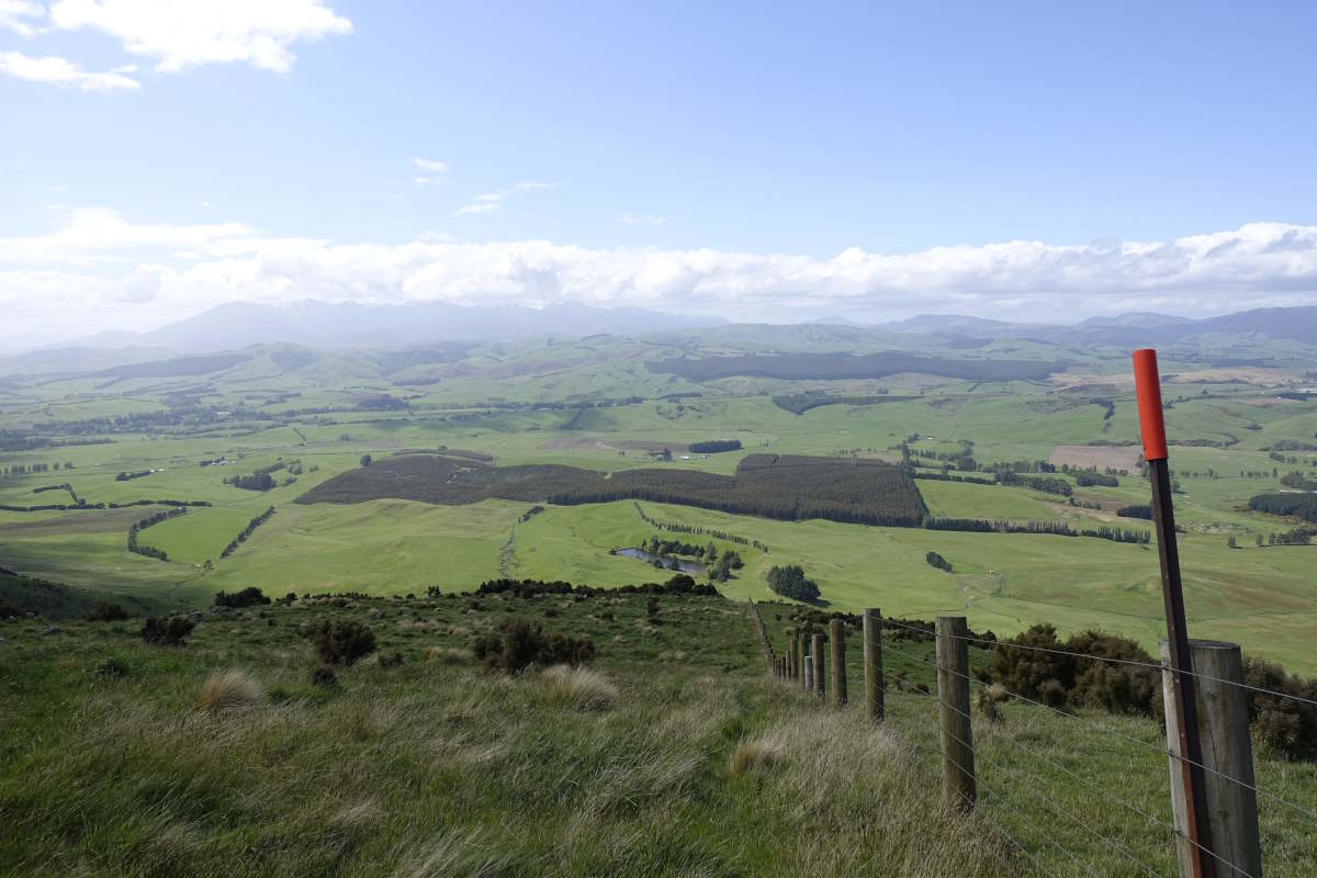
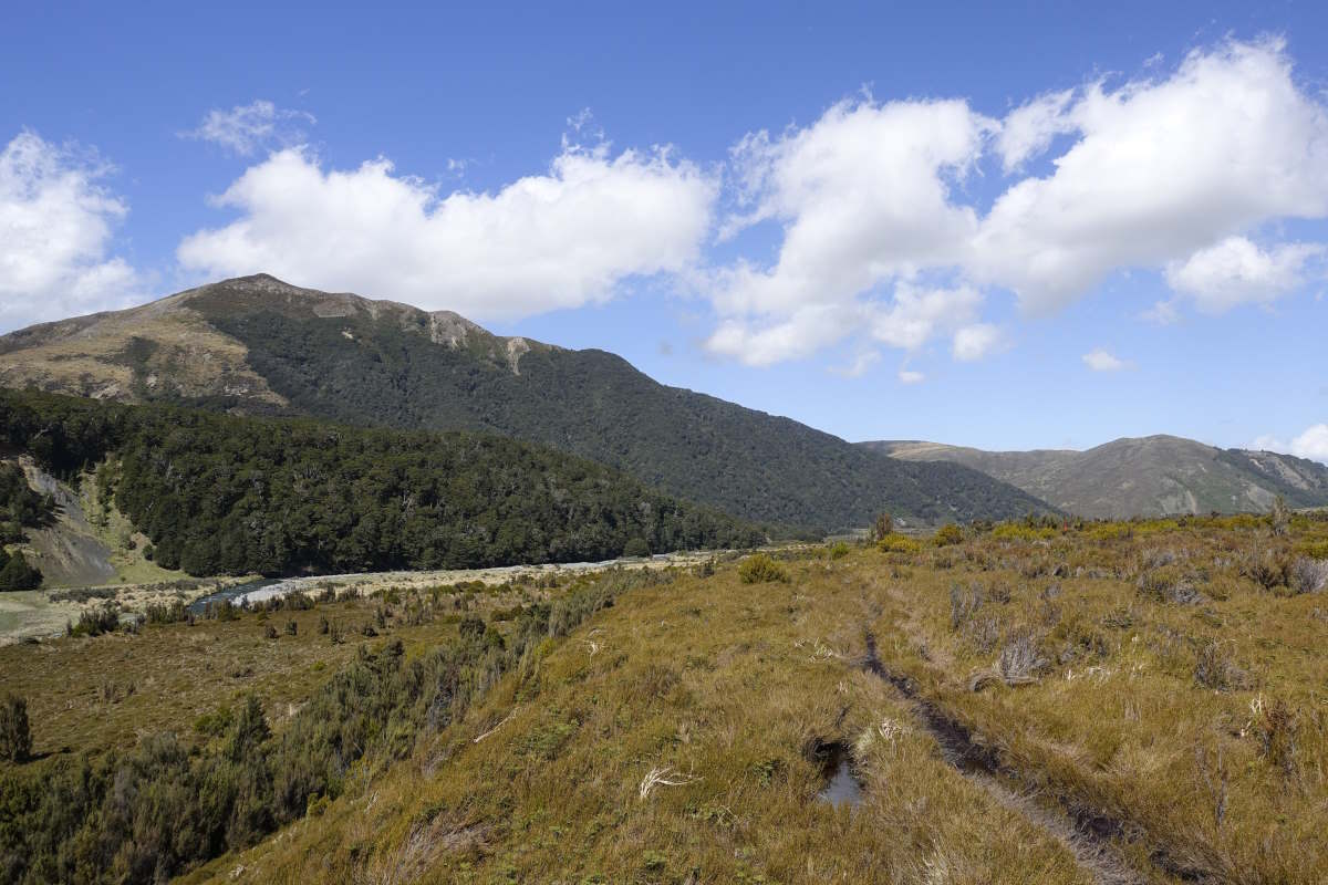
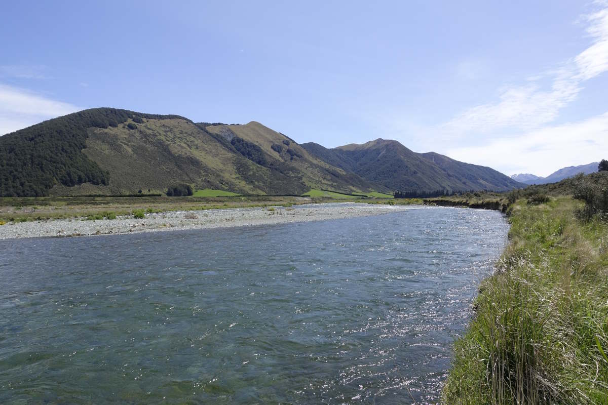
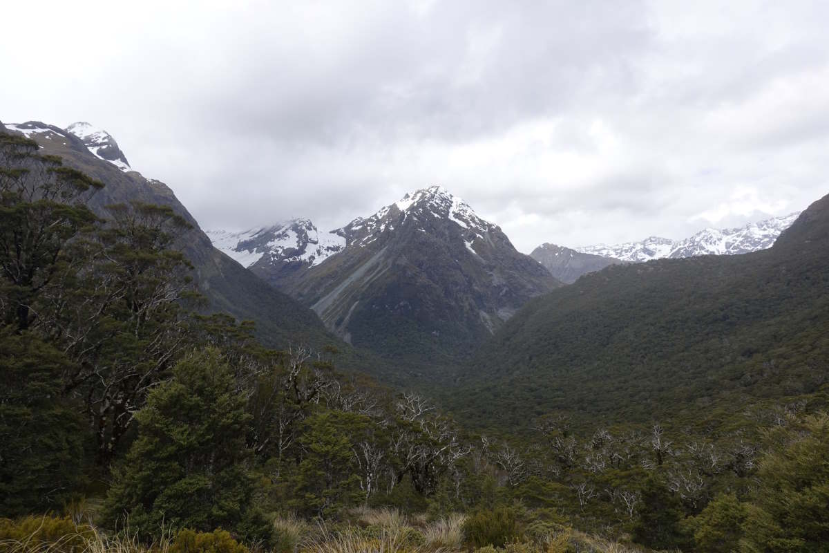
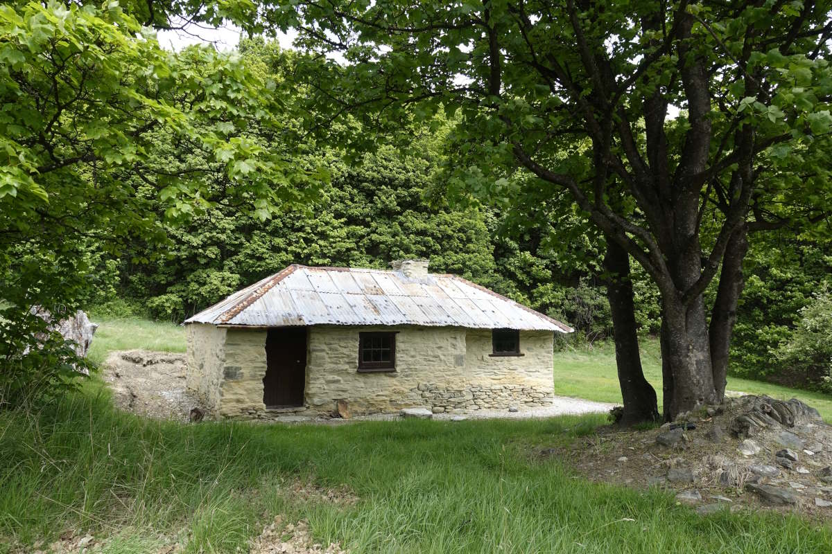
Day 1 (9km): More airports. An internal flight takes me from Auckland down to Invercargill, then it’s a short but busy road walk into town to stock up on food, a plug, camping gas, then a shuttle bus down to Bluff which drops me directly at Stirling Point. I’ve been sitting on trains and planes and in airports and on buses for I think about the last three days, except that the concept of days stops making much sense when you somewhere lose 12 hours in time difference, and something small and primal in the base of my brain is trying really hard to tell me that it’s 3:30am and I’ve been awake all night and is very confused as to why the sun has been shining the whole time. Stop and breathe. I can smell the sea. Feel the sun on my face (probably burning - must add suncream). Hear the rush of the waves, the wind in the leaves. This is where I came here to be. There’s a signpost to touch, and a trail to start. But not far to go today which is fortunate because the trail is beautiful. A forest full of trees I’ve never seen before. Ferns. Tree Ferns. Little top-heavy looking black and white birds. Fat ones that fly overhead in noisy swoops and climbs. Trills, peeps and whistles. A whole new world. I’m so busy stopping to stare at everything that I hardly notice I’m climbing. I pop out the top, and down. The bush is low and windswept and full of little flowers. Then out into long grasses and down to the edge of the sea. I follow the coast around into farmland, and a brief walk along the road to Freedom Farm, where I’m the first person to stay in Jasper’s new Wild West trail cabin. Dinner time. Food, pan, gas, stove, strike fl… … where is the strike flint? OK I’m really really sure I packed this… I turn out the whole rucksack and discover a piece of paper half in Chinese characters informing me that my “magnesium rod” has been removed for security reasons. Oi! Fortunately Jasper is on hand to loan a lighter, and also a basket of fresh eggs which are an excellent if unconventional addition to my tuna pasta, and I finally fall into bed full and content at 10pm Day 2 (32km): Road Time. I grab an early shower and am up and out for 8am for a long slog on a hard surface. It’s not the most inspiring of trail days, and was a fairly major reason for me choosing to do this walk North-bound (because no-one wants to spend their penultimate day on a trail on a 32km road slog). But it’s certainly efficient, and there’s a separate foot/cycle path the whole way which is apparently a pretty new addition. It’s hot, much more so than I was expecting for early November and I have to pace myself carefully to make my water last. Eventually the path leaves the roadside and turns off to cross the wetlands. I find a rock with a view for lunch and am just tucking in to some interesting kumara and butternut hummus (and trying to work out what a kumara is) when I spot another large rucksack gently bobbing its way towards me. Now, the TA is growing in popularity but this being only 6th November and the established direction of travel being South I thought I’d probably have it to myself for at least the first few weeks. Nope. The bearer of the rucksack is Nico from the US who has just started this morning so already blown my 9km head start. We chat over lunch then walk together for the rest of the day which probably results in fewer rest stops. The sun shines brightly and it’s very hot, and there’s water water everywhere and not a drop to drink because I ran out a while ago. But also lots of black swans which is cool. We make it to a small supermarket in Otatara then slump on the tarmac and down ice lollies and juice. Revitalised it’s a short hop to the campsite which comes with a fully equipped kitchen and a big squashy sofa on which to spend the rest of the afternoon.
Otatara to Colac Bay
38km, 2 days
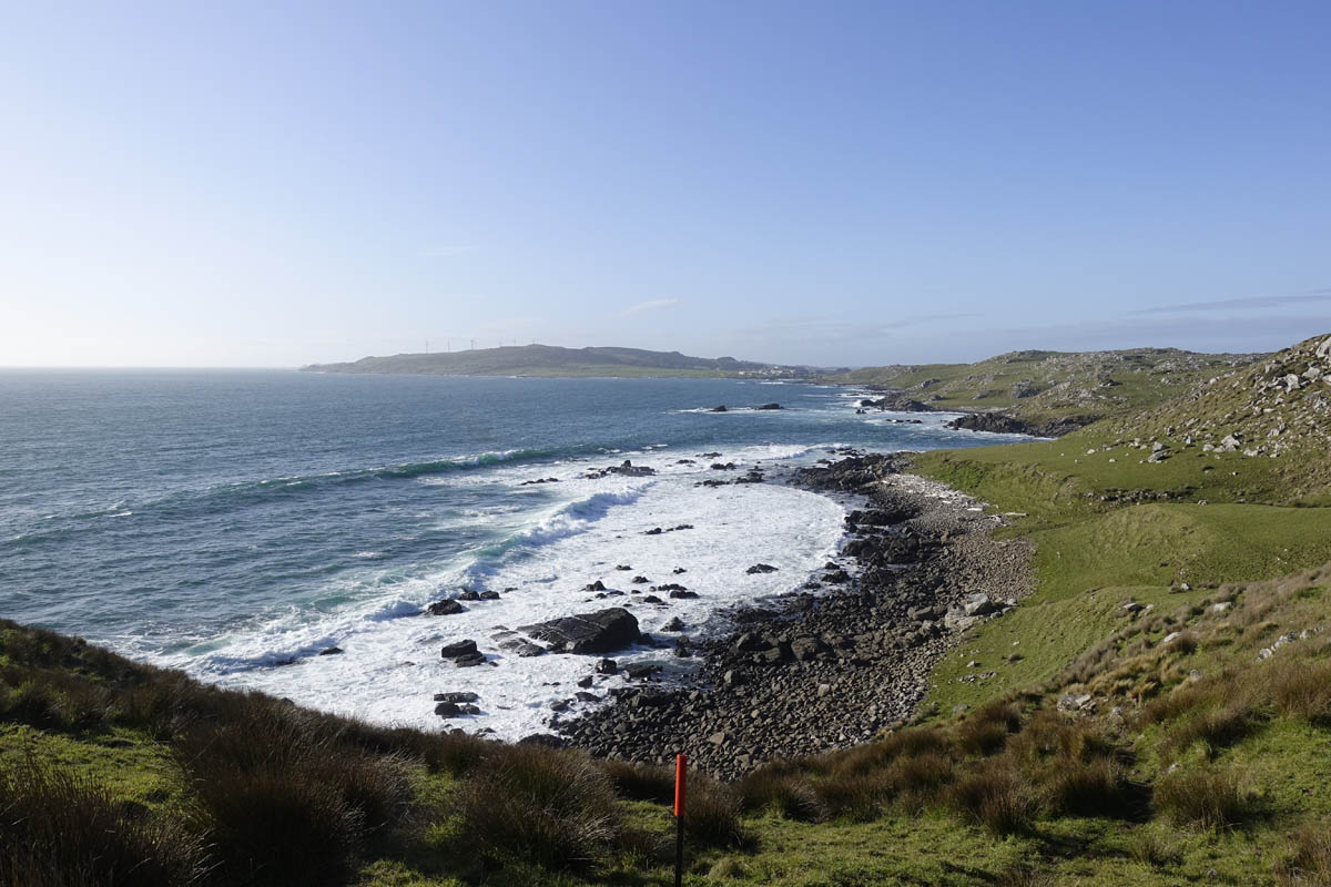
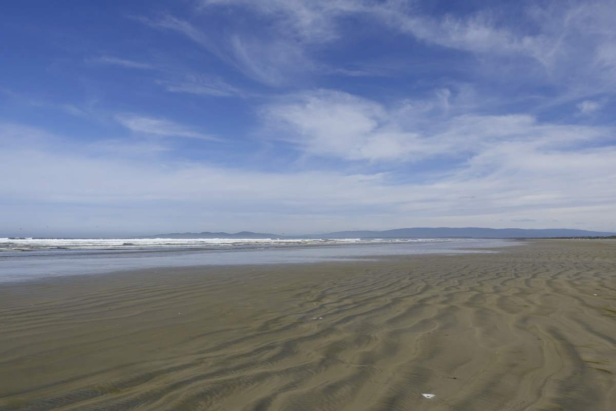
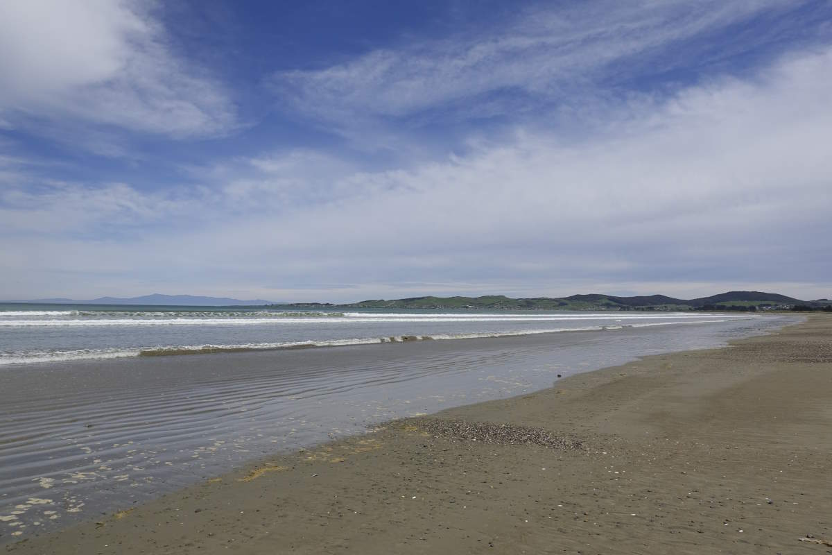
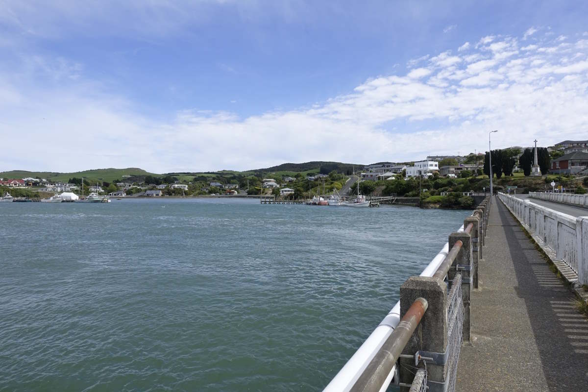
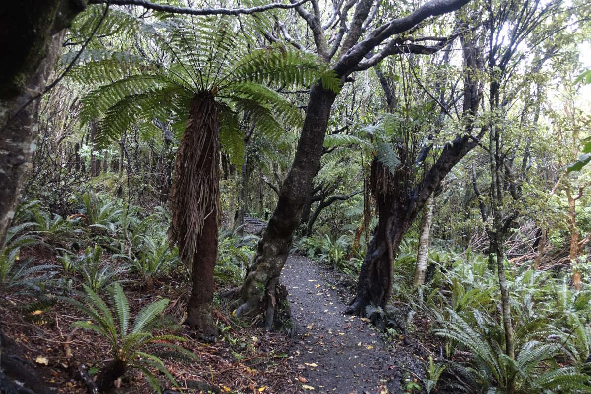
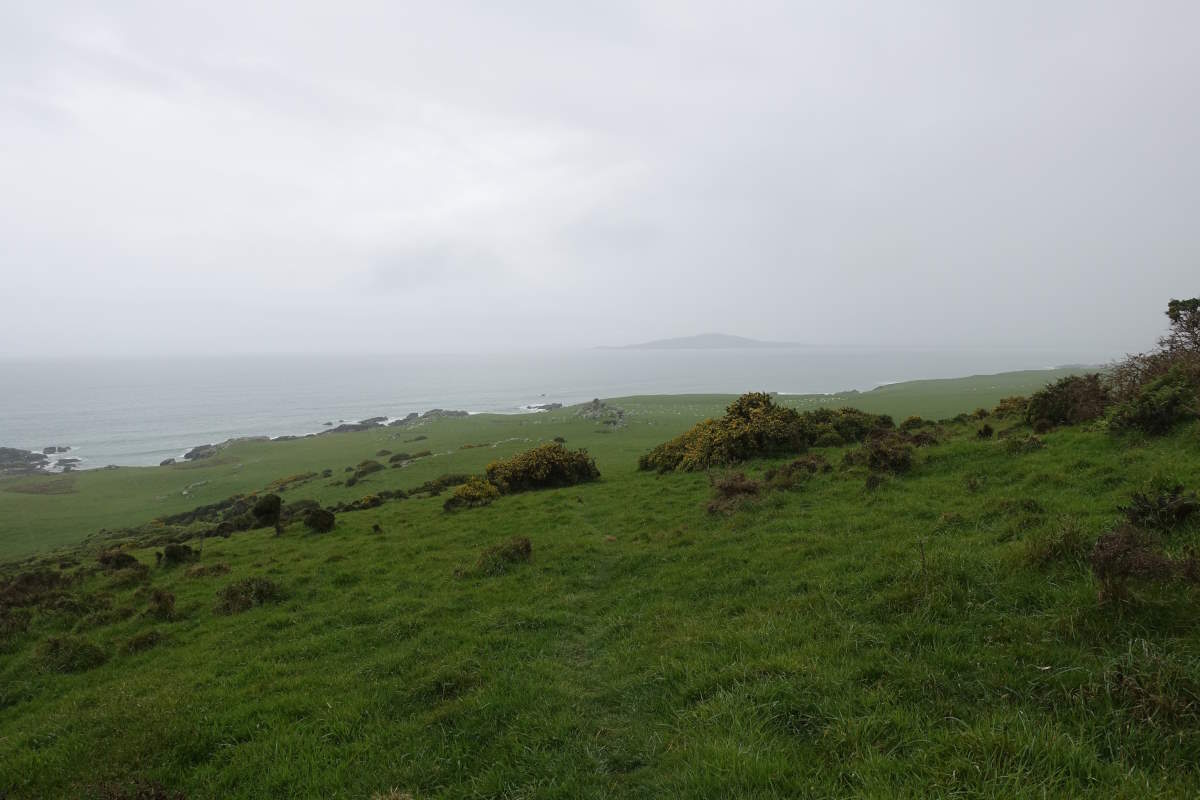
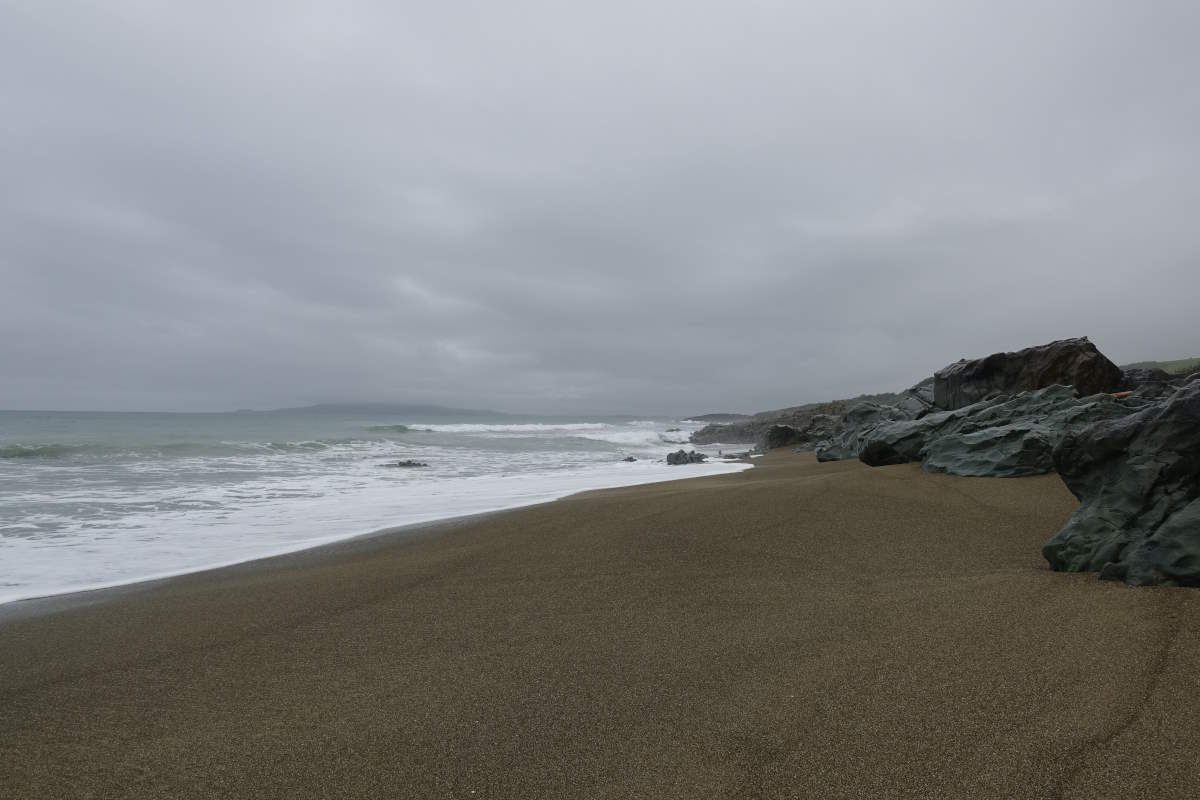
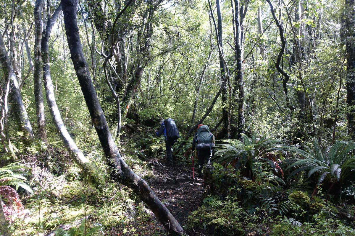
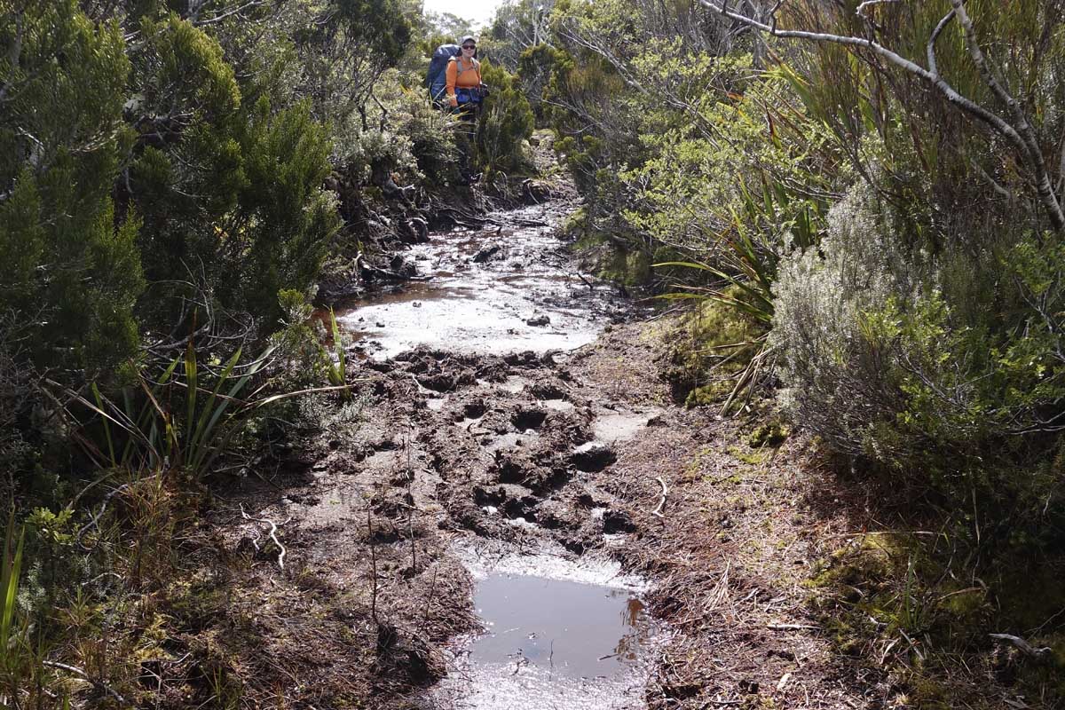
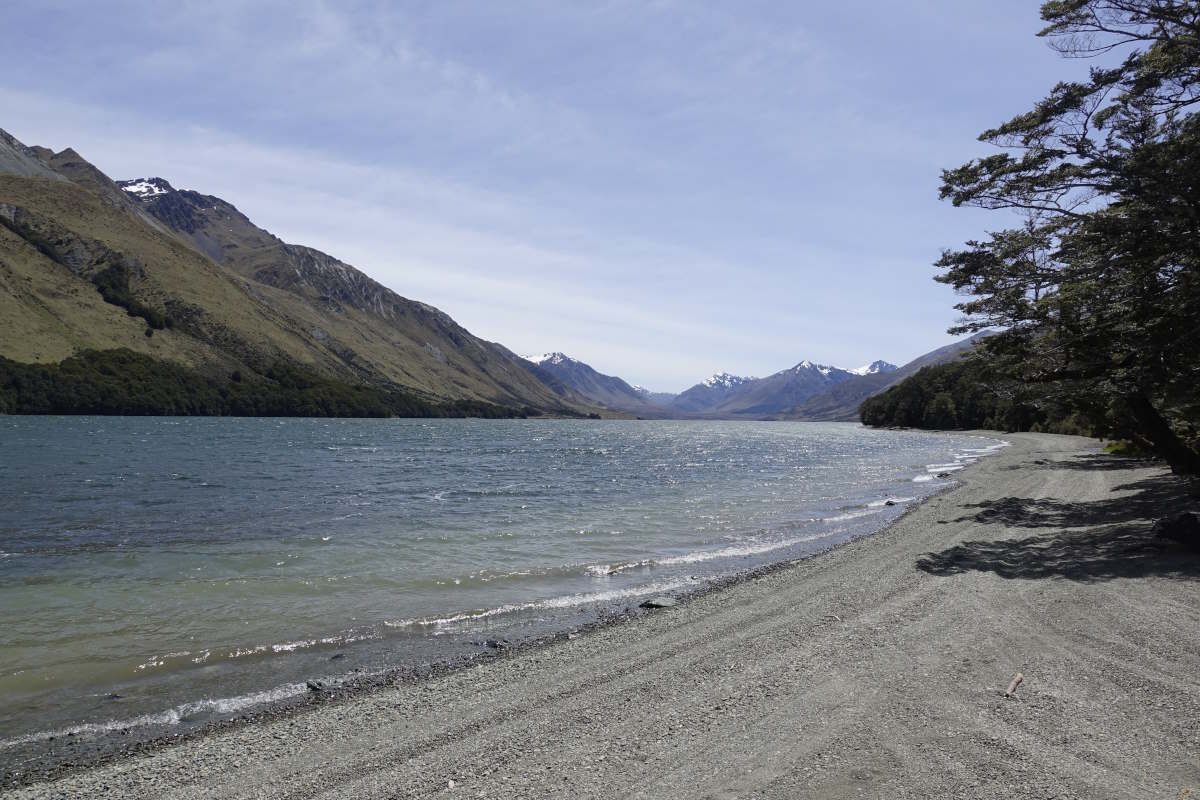
Day 3 (26km): Beach time! I set off about the same time as Nico but encourage him to go on ahead because he’s planning to walk about twice as far as me (and I thought 26km was enough!) My feet are a little flat after yesterday but I stick to the grass verge and come quite quickly onto the beach which I then stay on for pretty much the entire day. There’s the sea on my left, the sand under my feet, the sun to my right. The bay curves gently so that as the sun tracks across the sky so the beach tugs to the left and me, the sea, the sand and the sun essentially enter a limbo where there is no record of the passage of time. Occasionally there’s a driftwood log to sit on for a break. I look out to sea. I spend a while musing over the different speeds that Nico and I will cover this trail. He drifts in and out of view, a little blob on legs a completely incalculable distance into my future. I absolutely cannot imagine walking 50km today. Or any day really. My legs are stiff and my feet sore after the road and the sand is not really helping with that. My rucksack feels heavy and cumbersome. The tops of my knuckles are burnt. Day three and already my body is taking a beating. I remind myself that there is absolutely nothing to gain from comparing myself to anyone else. This is my walk, my time, my memories. Not a race. I make it to Riverton after about 8 hours, the little headland that is Bluff melting away into the haze behind me. I’m tired. I set off over the bridge, then realise that while the campsite is ahead the shops are behind and I should really go and stock up on food first. But the bag is already heavy and my feet hurt and I don’t want to. Well, tough. Back over the bridge. Buy horribly heavy bag of food to last the next 7 days. Trudge over bridge yet again to campsite. Pitch tent. Eat dinner. Wish I’d bought more food. Day 4 (12km): I wake to the gentle patter of drizzle against the tent and can only laugh at the relief that comes with it - I have far too many little bits of random sunburn for another day under that heat. Extracting myself my left calf has seized up completely and I’m limping around the campsite unable to fully flex my ankle. Overall it’s not adding up to a particularly impressive “tough long distance hiker” look. Fortunately it’s only a short day (because the ones after it are going to be long again and there aren’t many overnight options). A gravel road takes me quickly into a dripping misty forest full of tree ferns, many of which seem to be growing out of other trees though it’s difficult to say which was there first. And then equally quickly I’m back out the other side passing through farmland, the trail hugging the coast. I climb down and up through a number of little coves and about midday chance upon another TA walker, Emma, who is coming back the other way and tells me that she’s decided to bypass the Longwoods because she doesn’t think it’s safe to do it alone after all this rain (for context, prior to my arrival and the two days of blazing sunshine just described it’s been apparently been a very very wet spring). She’s expecting a chest deep quagmire, and a risk of getting stuck in mud so deep that she can’t get out. Oh. Well I’m planning to do it alone… I’m not going to not do it just because some random other person I know nothing about is not doing it. Thousands of TA walkers do it every year right? Nico is presumably doing it right now in the rain (hopefully safely…) I carry on onto a beach. The sand is small pebbles and sinks under my feet but the tide is out far enough that I can just get onto some firmer stuff, with the occasional sideways sprint to escape from a larger wave. The sea merges greyly into soft mist. The waves are a roar of water and hiss of foam through pebbles. Time passes, turned to distance under my sand-sinking feet. Eventually I reach Colac Bay campground. Settling in to the common area, I’m immediately pounced on by Shira, yet another TA walker who has waited out today’s rain and is looking for someone to buddy up with for the Longwoods. She’s concerned about the mud and would have skipped them if no-one had come along today. Am I underestimating these? She thinks we’ll in mud up to our knees. Sounds fun, in a type 2 kind of way. I’m reluctant to feel responsible for someone else but we have the same hut plan for the next two days (probably because there are only two huts) and we agree that if someone falls in mud up to their neck the first priority is to laugh and take photos, and only then wonder how the hell to get them out.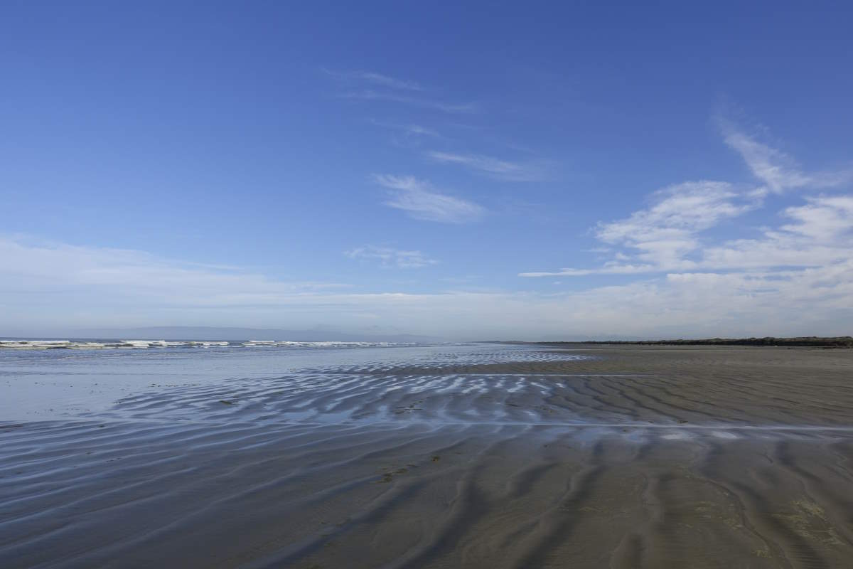
Colac Bay to Merrivale
Longwood Forest, 43km, 2 days
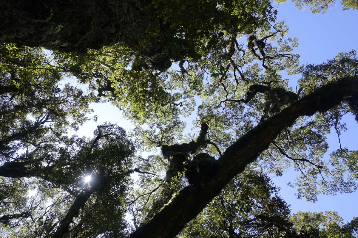
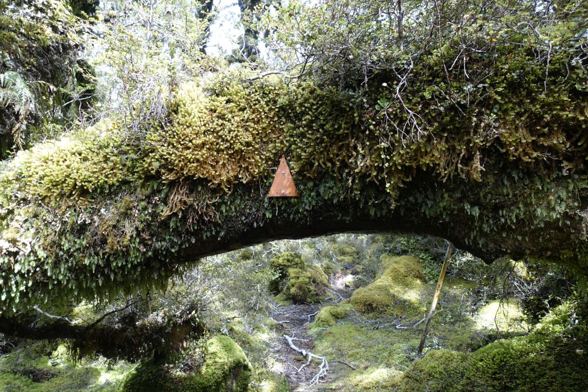
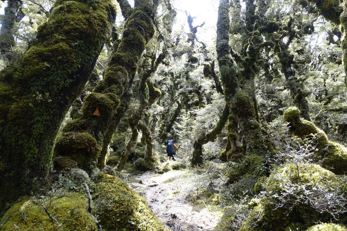
Day 5 (17km): I’m feeling the benefits of my short day yesterday and am limp-free and ready to go! I’ve also gained a team and set out with Shira and Vicki (who came in after me yesterday evening) and a reasonable amount of confidence that whatever awaits it’s just a bit of mud, right? There’s a road plod to start but we’re soon off into the trees with the rain drying up. The forest is amazing. Full of ferns and vines and bird song, and mud. But not yet the apocalyptic levels I was imagining, just ankle deep and largely avoidable. We follow a winding path from arrow to arrow, making steady but pretty slow progress. Our footsteps are tracked by a succession of piwakawaka (fantails) displaying their long tail feathers and hoping that we might disturb them an unlucky meal. I manage to maintain a reasonable state of cleanliness until I try to push under a springy branch and it comes back down on me and somehow tangles itself into and around the rucksack, and also my head and through some slightly convoluted twisting motion pushes me over backwards. It is of course too springy to provide any support no matter how desperately I cling to it. Fortunately the bog accepts the sacrificial offering of my right leg and a moment of balance is reached which lasts long enough for Vicki to appear and help me out. Winding onwards we reach Turnbull hut sitting in a pool of smoothly gleaming mud that looks ready to swallow any potential victims with no trace. There are a few stepping stones which allow a glimpse inside but it’s distinctly uninspiring and I’m glad we’re going on. Slowly and unsteadily we make 1-2km per hour but eventually we make it. Martin’s hut is a lovely old wooden construction with four bunks and a little platform to sit out and watch the afternoon sun shift through the trees and a friendly Tui forage for food. Day 6 (26km): A full day of forest. Up, down, up the vegetation changes with the altitude; dense fern filled rainforest climbing through moss-dripping stunted trees to low bush and open grasslands. Yet all unified by mud. Progress remains slow, beautiful and at times frustrating with an uncountable number of detours around puddles and pools some of which you could probably sink to your waist in. A combination of creative balancing, extended detours and the occasional desperation bush bash (put your hands in front of your face, thrust yourself forwards into dense twiggy stuff and hope you find the other side) keeps me remarkably clean though I do lose one leg (the other one to yesterday). Out on the tops the sun is shining. To my right a wide flat plain that stretches back to the sea and the little distant blip that is Bluff. And left the mountains of Fiordland rise, snow-capped and shining through the haze. We meander on, wisps of high cloud fortunately sparing us from the worst of the heat. The climbs are slow, the descents slower, Shira struggling with a protesting knee. Eventually comes the final descent, the gaps widening as I let gravity pull me gently down. We’re sitting on a fallen tree waiting a suspiciously long time for Shira to catch us when I hear my name being shouted, faintly and distantly and definitely not from the trail we’ve just come down. We call back and over the next few minutes manage to guide her back to us by voice. Then with an nod between us we sandwich her closely, me at the front, Vicki behind and don’t let her out of our sights until we reach the 4WD track and the end of the trees. An easy smooth surface at last. I glide happily and slightly flat footedly along, and eventually make it to Merivale Hut a mere 13.5 hours after leaving Martins. I put my feet up and snuggle into the bliss that is a warm sleeping bag and a hot steaming pouch of rehydrated food.
Merrivale to Telford Campsite
56km, 2 days
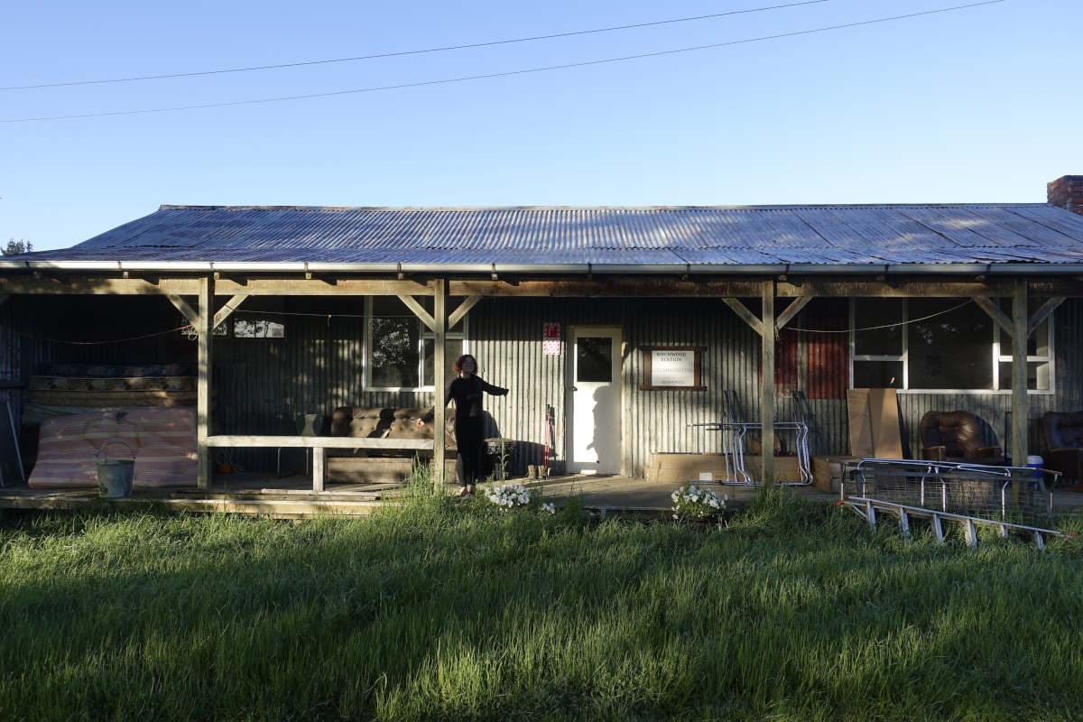
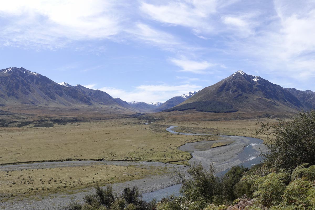
Day 7 (27km): We’ve left the woods behind us but over the last two days we’ve walked at pretty similar speeds and shared the same attitude to frequent snack breaks and it feels only natural to continue walking as a three. It’s another bright and sunny morning but with a cold wind blowing from the mountains which we are drawing closer to. We cross quite a bit of farmland, some forest and a lot of pine plantation which feels very different to the natural stuff of the Longwoods, not least in that it is dry underfoot! A few gravel tracks are hard on the soles of the feet but otherwise I realise the legs are feeling good and definitely warmed up into the walking-every-day life. We cross the tops of some little hills with a remarkably good view and then an impressively steep descent down to Birchwood Station. I take it at a gently rolling jog, letting gravity do the work of pulling me down, the legs just there to guide. When I glance back I’ve left the others far behind. At the bottom Birchwood Station Cabin is a world of luxury with a hot shower, a cooker and multiple sofas. I take the opportunity to de-muddify my socks though the water is still coming out black on the 10th bowl and after that I stop counting. Day 8 (29km): We leave Shira behind this morning (that epic descent being somewhat tough on an already protesting knee) and Vicki and I agree to both walk at our own paces. And these are the same for about 20 minutes but then when I look back the gap is opening and it seems silly to wait and so off I go alone again. It’s good for me I think. Walking with others is easy and comfortable and absolutely not something I want to start to depend on on such a big journey. Anyway, I’m feeling good. The trail is all farm land and well marked and I walk three hours before my first break and discover I’ve done a little over 10km which compared to the last couple of days is a huge distance. On a less positive note the farmland comes with a lot of cows, the first few fields of which definitely want to eat me. So there’s a bit of fence-climbing and walking on the “wrong” sides of fences but I manage to stick fairly close to the marked line and not add too much distance. They get less inquisitive as I carry on which is fortunate because the fields get larger and the cows are harder to avoid. I stick to the edges as best as I can, though there are occasional signs saying "if you go past this point we will call the police immediately" and I get the impression that walkers are not massively welcome here. But, cows aside, there are some remarkably decent views, the mountains ahead getting closer and closer until eventually I can drop down to the river and feel like I’m escaping into the wilds. Except not really because the farms here are enormous, and while the fields are getting wilder they’re still fields. I make it through my first river crossing which is knee deep and a bit slippy underfoot but generally fine and then it’s off round the back of a hill which turns out to be yet another cow field. The track climbs steep hillside and the cows with their rather small calves are (perfectly sensibly) standing in the middle of it. Oh well, I gather up some courage and walk slowly and (I hope) confidently towards them. They walk away. Breathe sigh of relief. But the hillside is a bit too steep for them to want to step off the track, and too steep for me to quickly and easily walk round them, and so forth we go together. This continues for a fairly eternal 20 minutes as the track gets steeper and steeper until most of the heard manage to step away to the side and I’m left following one very fat cow with a limp and a calf that can’t be more than a week old both of which are struggling to make it up the now rather technical and loose surfaced track. And then the rest of the heard files back in behind me. I wasn’t having fun before, but now I’m really not having fun. I hate cows, and I’m caught between a number of rather vocal, sprightly and pissed off looking cows behind me (which are closing the gap rapidly) and the aforementioned fat limping very slow cow with small even slower calf in front. At risk of impending impalement I make a dash for it and then leg it on up the hill, boiling my way through far too many layers of clothes for this sort of speed until finally hallelujah here is the fence and a stile and I’m free! Back down to the river, crossing number two is also successful and I reach the campsite (i.e. bit of flat ground with long drop toilet) for 3:45 which is just after my cut off for staying here and not carrying on over the ridge to the next hut so a night in the tent it will be. I spread all my stuff out to air and have a large dinner and make the acquaintance of my first sandflies but they aren’t too persistent in their efforts to nibble me so we just about coexist. Vicki arrives about 2 hours later just as it starts to drizzle and I snuggle down into my sleeping bag very happy to not be up on a mountain ridge.
Telford Campsite to Highway 94
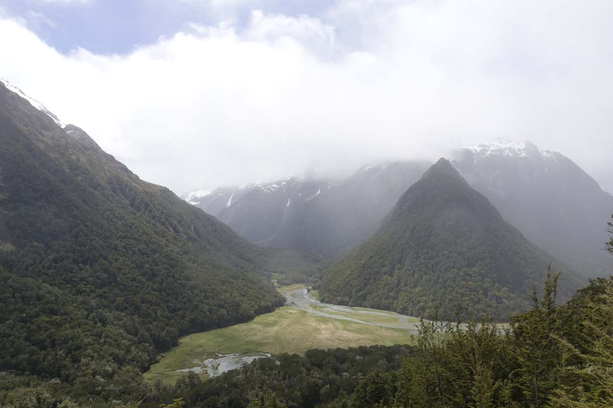
Takitimu Track, 49km, 3 days
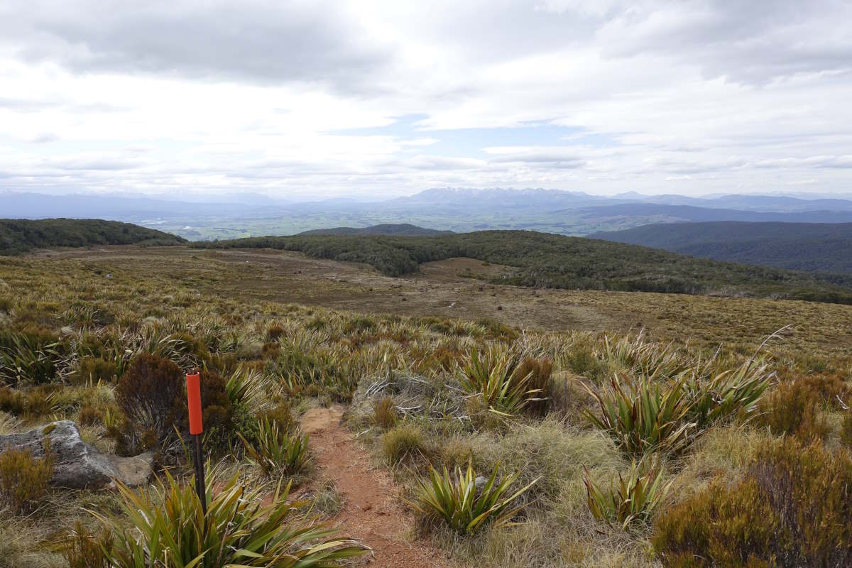
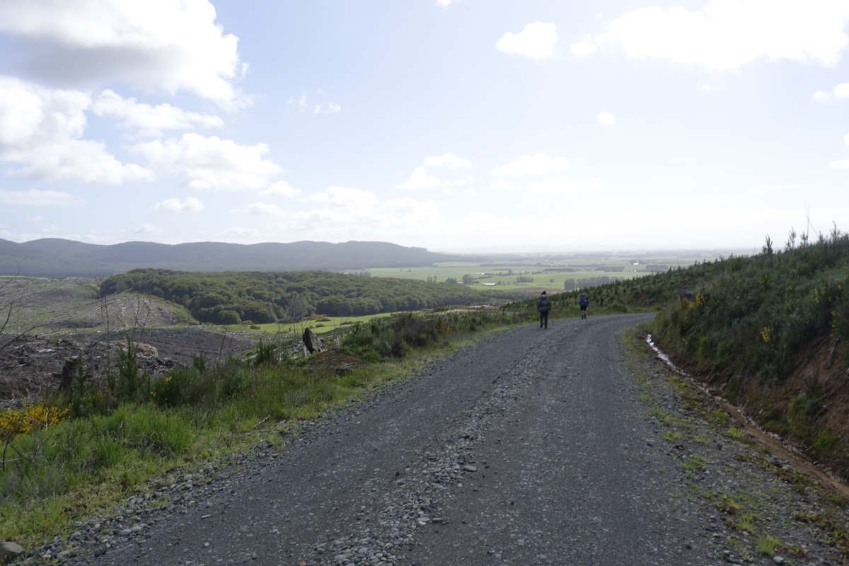
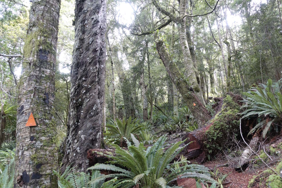
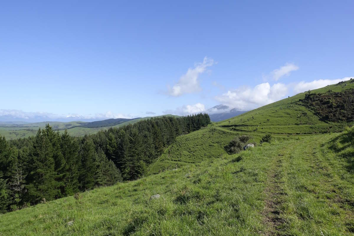
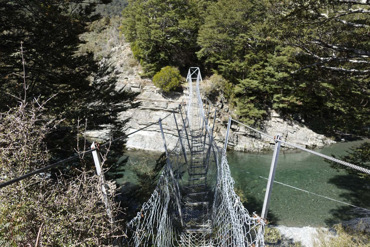
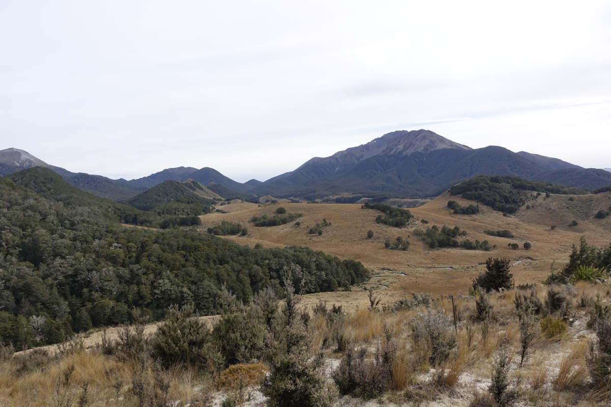
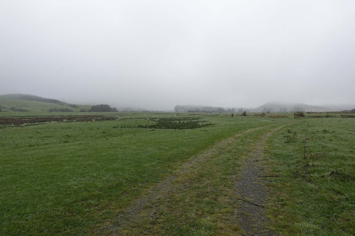
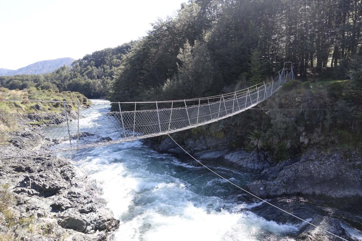
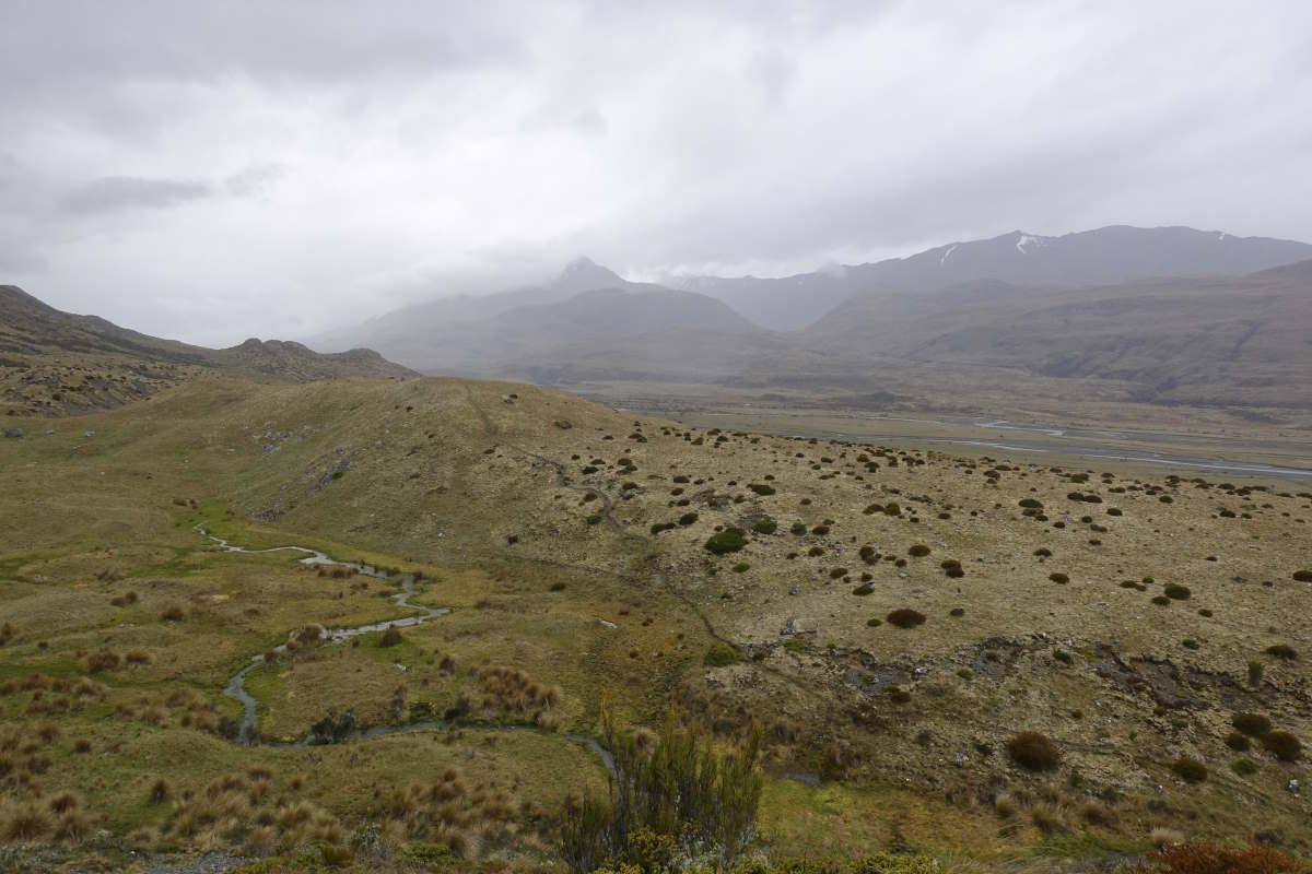
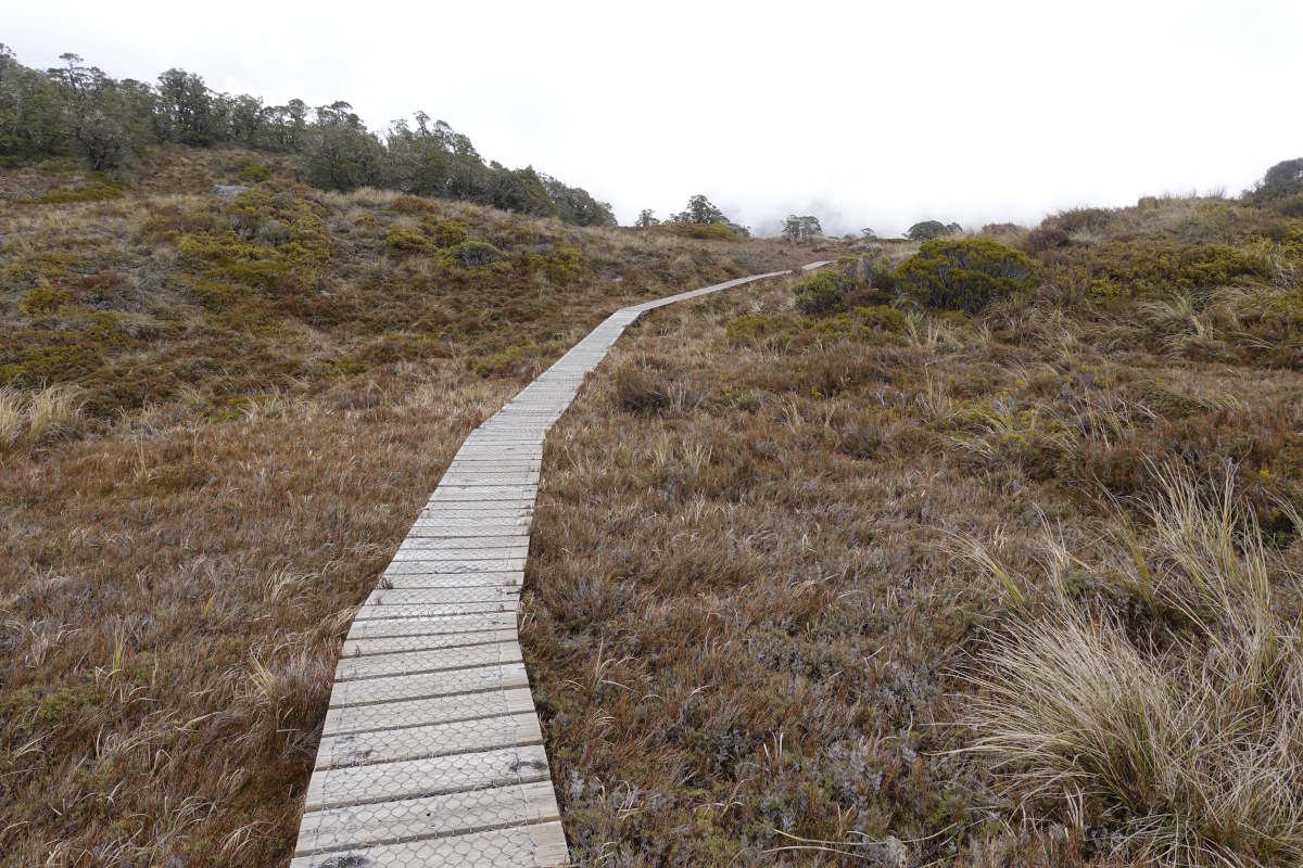
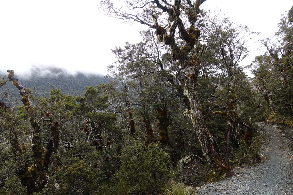
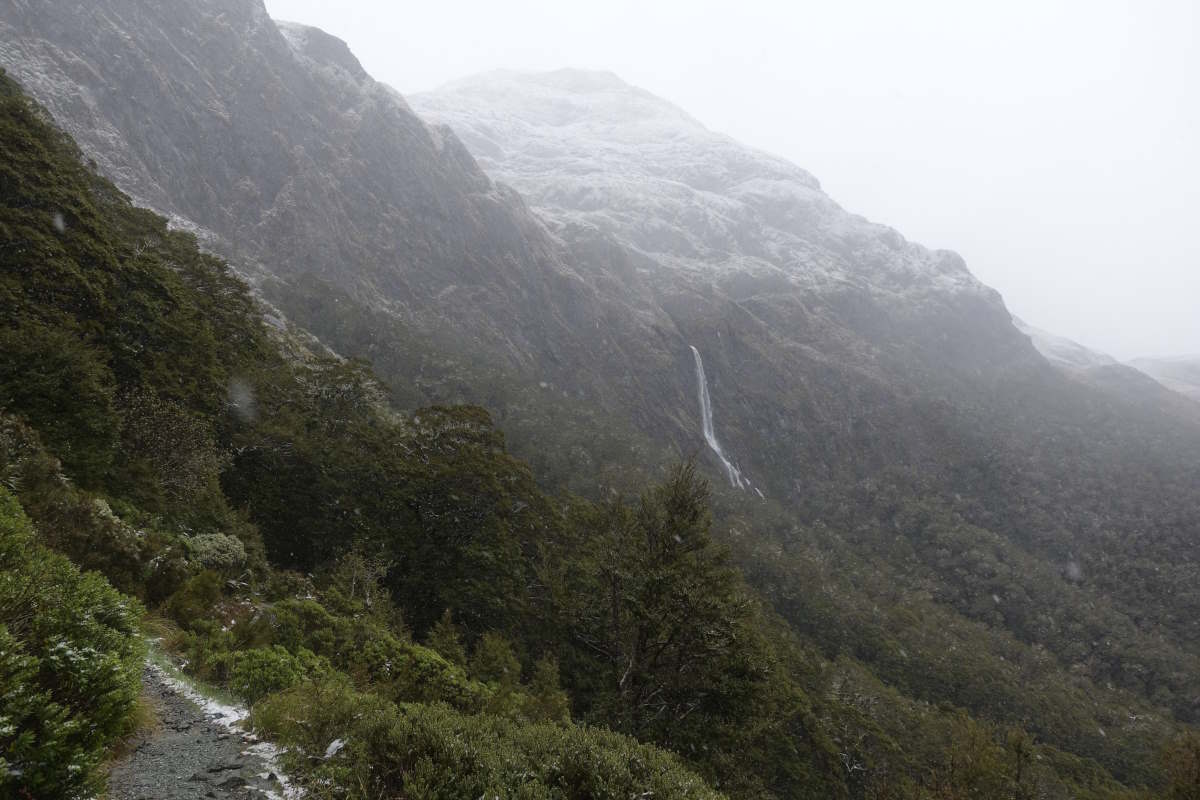
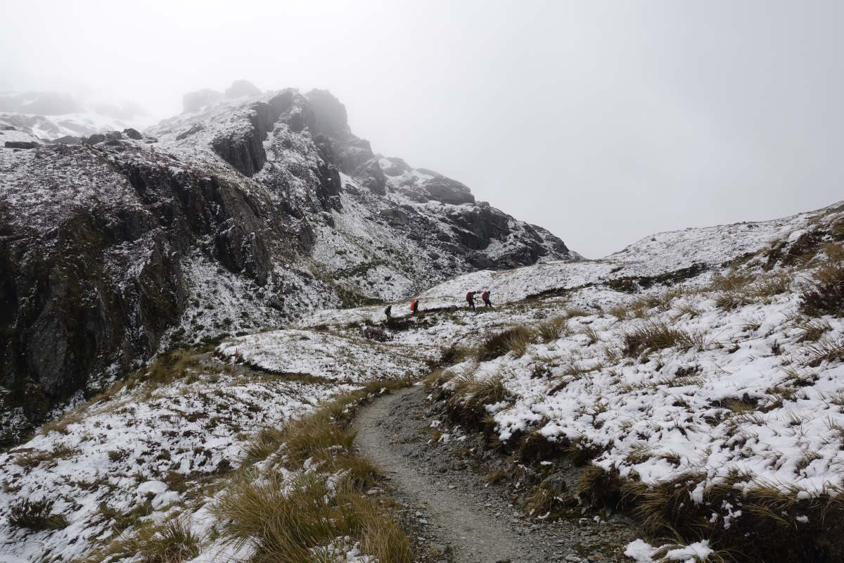
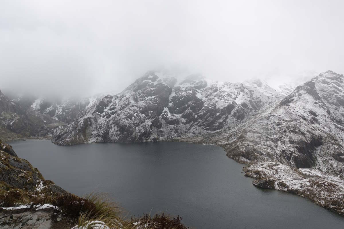
Day 9 (21km): It continues drizzling gently for most of the night but is considerate enough to stop this morning for a cold and almost frosty start. Fortunately all the porch sandflies seem to have drowned in the condensation so I’m able to enjoy breakfast in bed without their presence. Out and off for 7:30 it’s straight up the side of my first mountain, the steep sided valley keeping me in the shade until I reach the ridge. Which is appreciated because it’s pretty rough going and not especially well marked with a fair bit of wandering on and off the trail and I’m a sweaty mess by the time I reach the top. The views are beautiful, with snow streaked tops all around me and I’m so happy to be leaving the farm land and inhabited areas behind. Reaching the summit I’m enveloped in a light cloud and find myself being condensed on rather than blow-dried by the breeze so it’s a brief stop. Then a bit of care to find the forest opening and down quite steeply into woodland. It’s a very different woodland to the Longwoods with a soft carpet of tiny dry leaves, pale barked trees and an open feel that makes spotting the next marker much easier. I make great progress and pop out the bottom at Lower Wairaki hut 3hrs 15 after leaving the camp. For the first time on the trail I’m ahead of the estimated times in the guide (4hrs) and the DOC signs (5hrs). It’s hot and sunny so I use my bonus 45 minutes to spread the tent out to dry and enjoy a leisurely first lunch. Heading on again there is an instant river crossing to soak my feet in unpleasantly cold water and my toes feel numb and clumsy as I stumble my way onwards through the twisted tree roots of the path. It doesn’t take long until I’m far too warm again, though the thick canopy spares me from the worst of the sun and there are lots of tiny streams to drink from meaning I can get away without carrying much water. There’s also not much food left in the bag and it’s getting to a much more acceptable weight, though still doesn’t exactly feel light. I’m getting into the rhythm of daily walking and for the first time on the trail there are no random stiff and sore bits and both legs and feet feel good all day. It is a bit lonely though in the woods, where progress is slow and for the first time I find myself wanting a section to end. But sit and filter some water and listen to the birds and be glad I’m not at work! Yes some days will be tough, but the trail so far has been so amazingly varied and beautiful and all I’ve done is the bit that I thought would be relatively dull and considered cutting out! Meandering on again I’m back to enjoying my solitude when I’m interrupted by the roar of chainsaws right ahead - an alarming sound when you’re alone in the woods. It turns out to be a group of wonderful people doing volunteer maintenance work and removing fallen trees from the track, and from there it’s lovely clear progress all the rest of the way to Aparima hut. The final river even has a bridge! It’s a fun hanging metal construction that sways rather a lot and crosses a very inviting looking clear deep pool. I drop my bag at the hut and return for what ends up being a very brief swim in very cold water, then take the risk of rinsing out all my sweaty clothes and do just about manage to get them dry again before the sun drops behind the trees. Vicki arrives at 7, just as I’ve decided I probably have the place to myself for the night, and it’s good to spend an evening in company. Day 10 (17km): There’s a very large black bull standing on the other side of the fence next to the hut this morning and Vicki spots it and says “that’s a good way to keep walkers out of your fields” and I look at the signpost and the stile, and the second even larger bull wandering around the corner and say “er, I think that’s the way we’re going”. So we stick together for the first km and fortunately they are more interested in the grass than us and we don’t stumble upon any more. It’s a mixed day, with alternating pockets of woodland and open tussock grass. The grass gives big open views of more mountains, but less so of the markers which are the same height as the grass (and also my head). There are moments of easy going, winding my way between tussocks on a firm dry path, but these pass quickly and a lot more time (though possibly less distance) is spent thrusting myself bodily through head high grass with very little idea where my feet are except that they occasionally go squelch and drop into holes. But the trail is very considerate because when I get tired of that it escapes into woodland and I can pick my way through tree roots from triangle to triangle until I start missing the view; and then find myself back in the open again attempting to climb a tussock to play spot the next marker poll. I spot a family of wild pigs busily digging up the hillside but am otherwise alone all day watching the mountains come and go through the trees, progress jumping ahead in little bursts each time I come back out into the open. It’s forecast to rain but fortunately doesn’t start until the afternoon by which time I’m into the woods to stay and it remains light until I reach Princhester Hut. It’s early afternoon and only a short walk out along a vehicle track to the road but I’ve pre-booked my stay in Te Anau for tomorrow so no sense in going on. I sit and listen to my stomach rumble and the rain fall, then decide it’s officially safe to eat all my emergency food as a top up and still have dinner as well. I think the ground has been generally tougher than I was expecting and I didn’t bring enough snacks. I resolve to carry more on the next leg and so enter the cycle of lots of food, complain bag is too heavy, pack less food, get hungry, pack more food, repeat… Day 11 (6km): A short one. I have a lie in and only get going around 8 into a light drizzle. It’s 6km of flat ground on a farm track which I cover in just over an hour and then I’m on the side of the highway sticking my thumb out for my first hitch. The first car stops! And then turns in to the café beside me. Nevermind. I remove some waterproofs and try to look a little less damp and it evidently does the trick because third car lucky I meet Mathij and Stephan who are on their way through to Milford Sound but happy to pull in and drop me in the middle of Te Anau. It’s only 9:30 but I manage to leave my bag in the hostel and spend the morning visiting lots of shops (and meeting Vicki in all of them!) acquiring more food, some just-in-case green hut tickets (the pass isn’t valid for serviced huts), bug spray and fingerless gloves to protect my hands from the sun. I have the afternoon free to be a tourist and hop on the glow worm cave tour which is great fun. Day 12: A "rest" day. I'm up with the sunrise to go kayaking on Milford Sound. It is an absolutely glorious day and doesn't require any input from the legs.
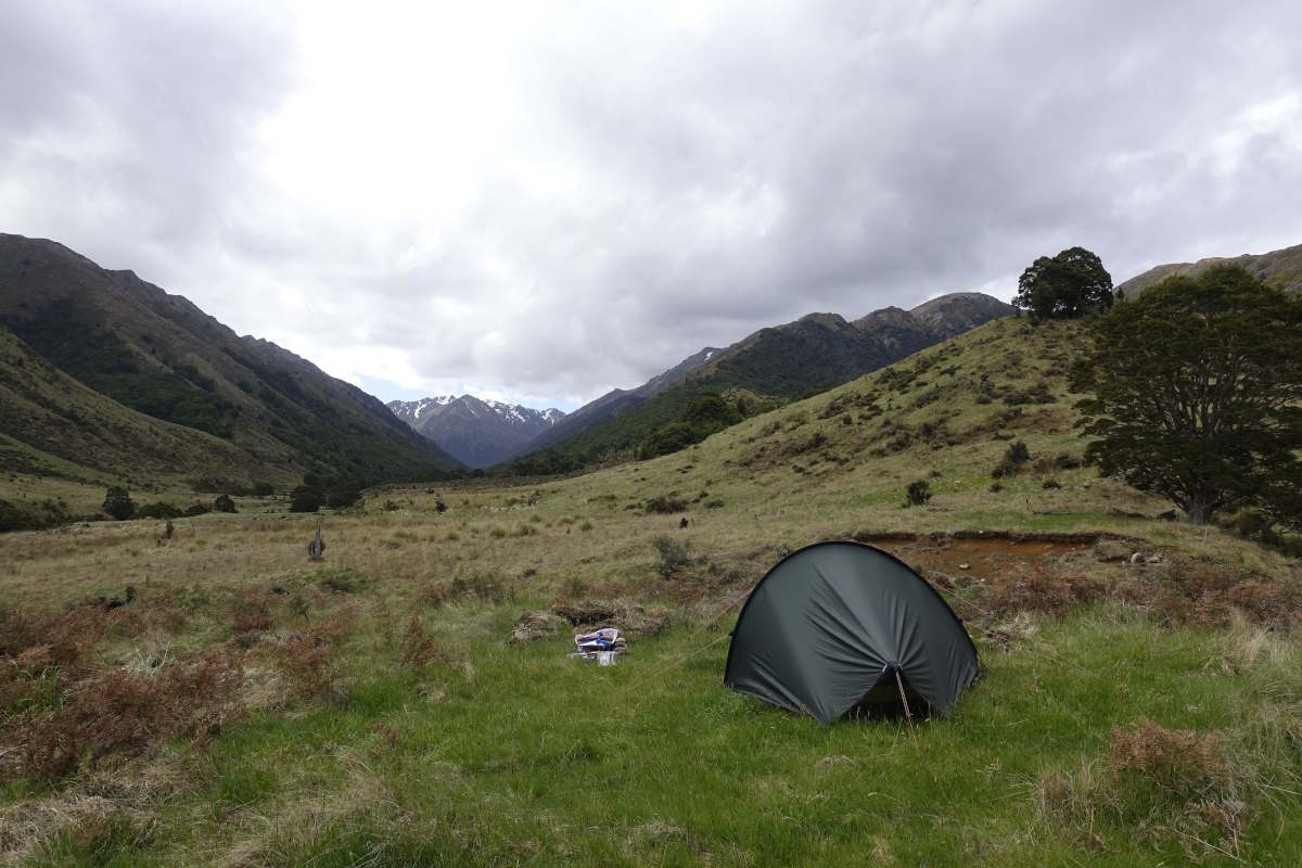
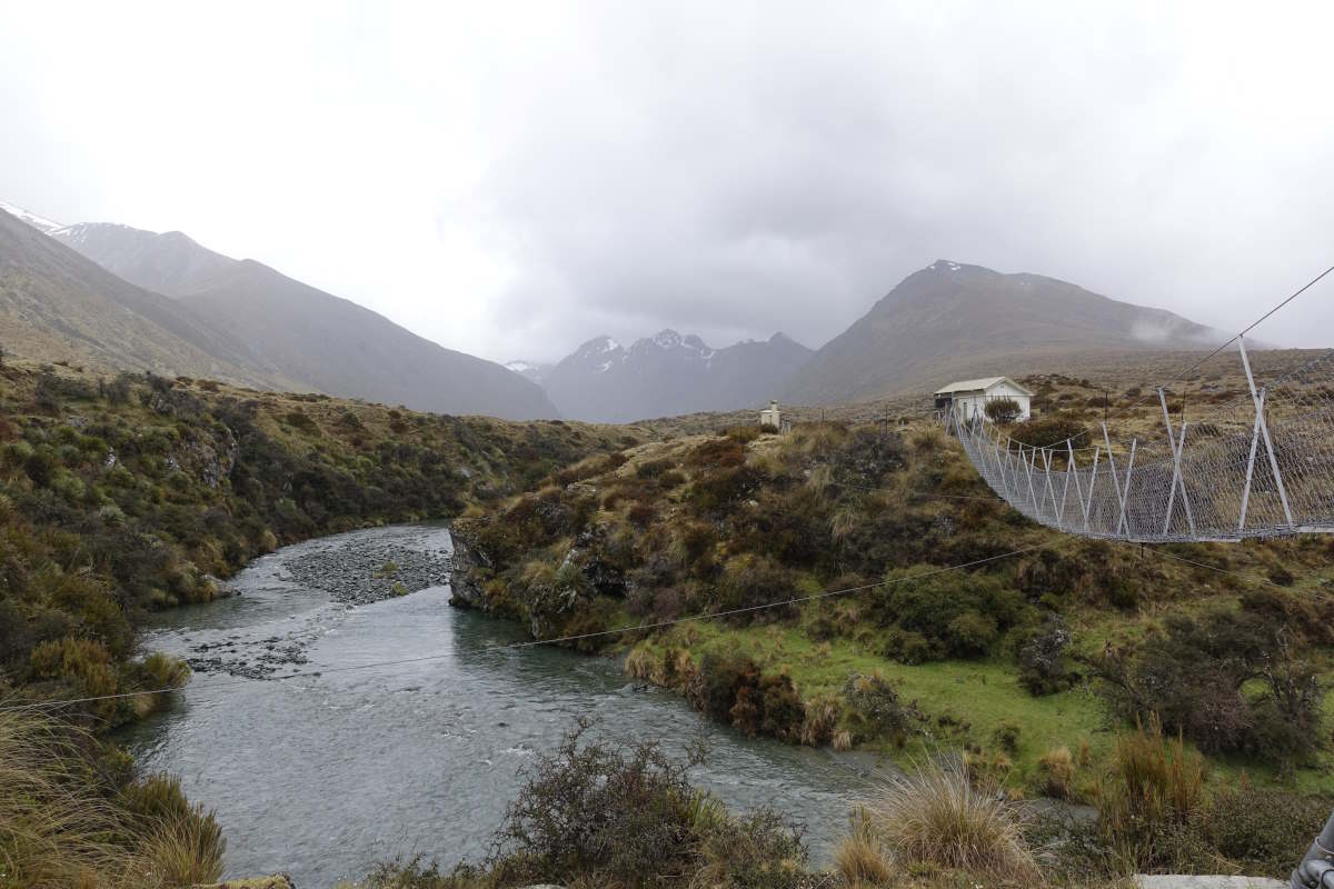
Looking back down towards the camp
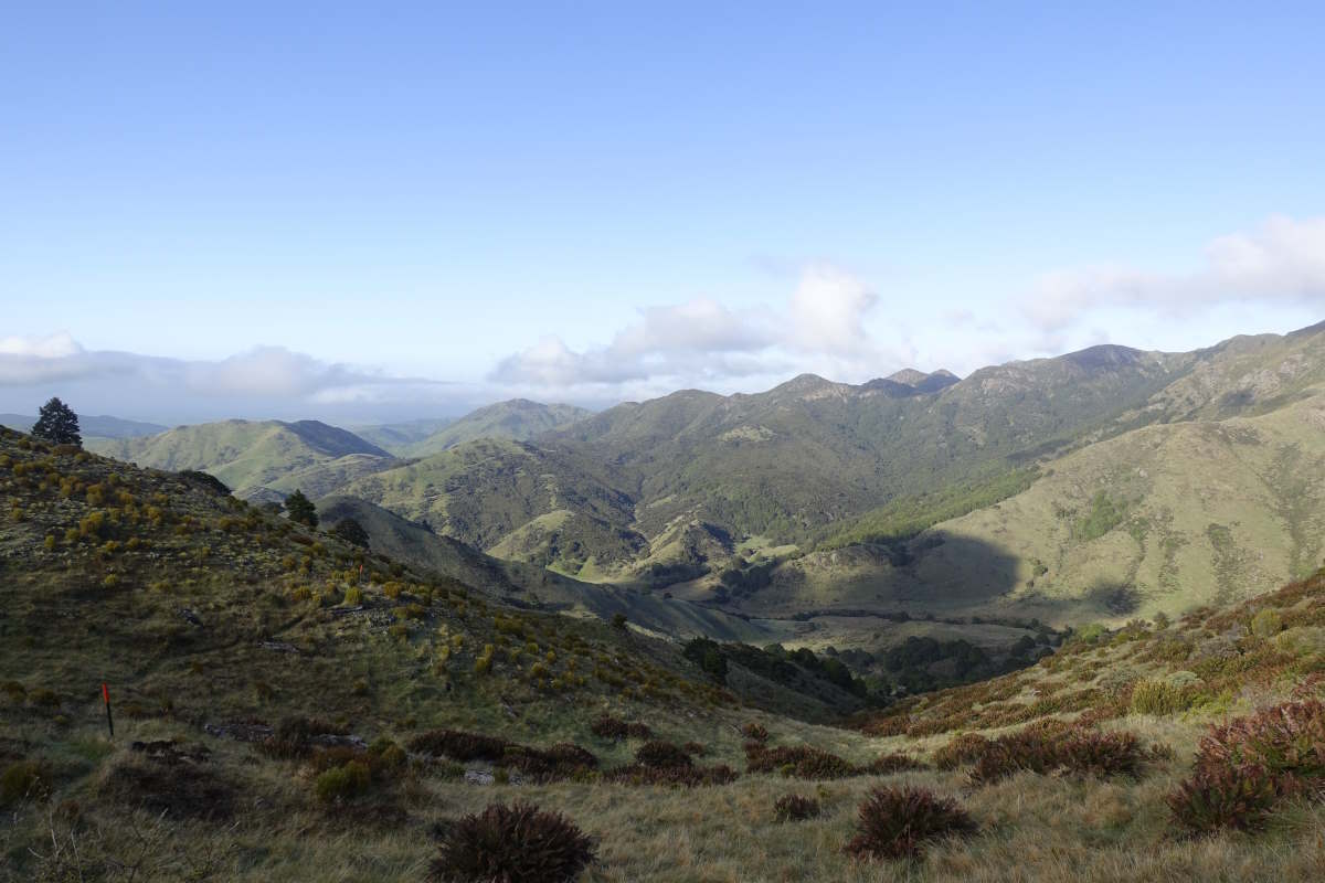
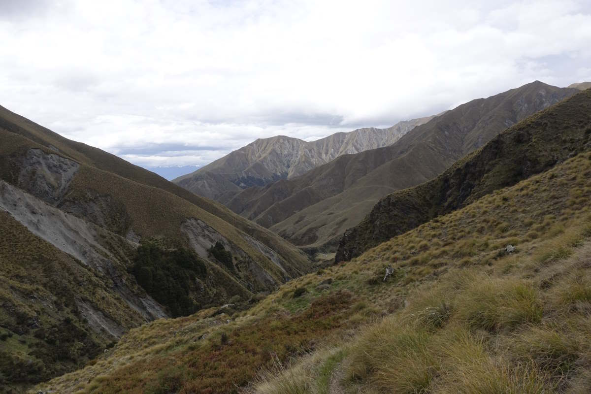
And on towards Spence Peak
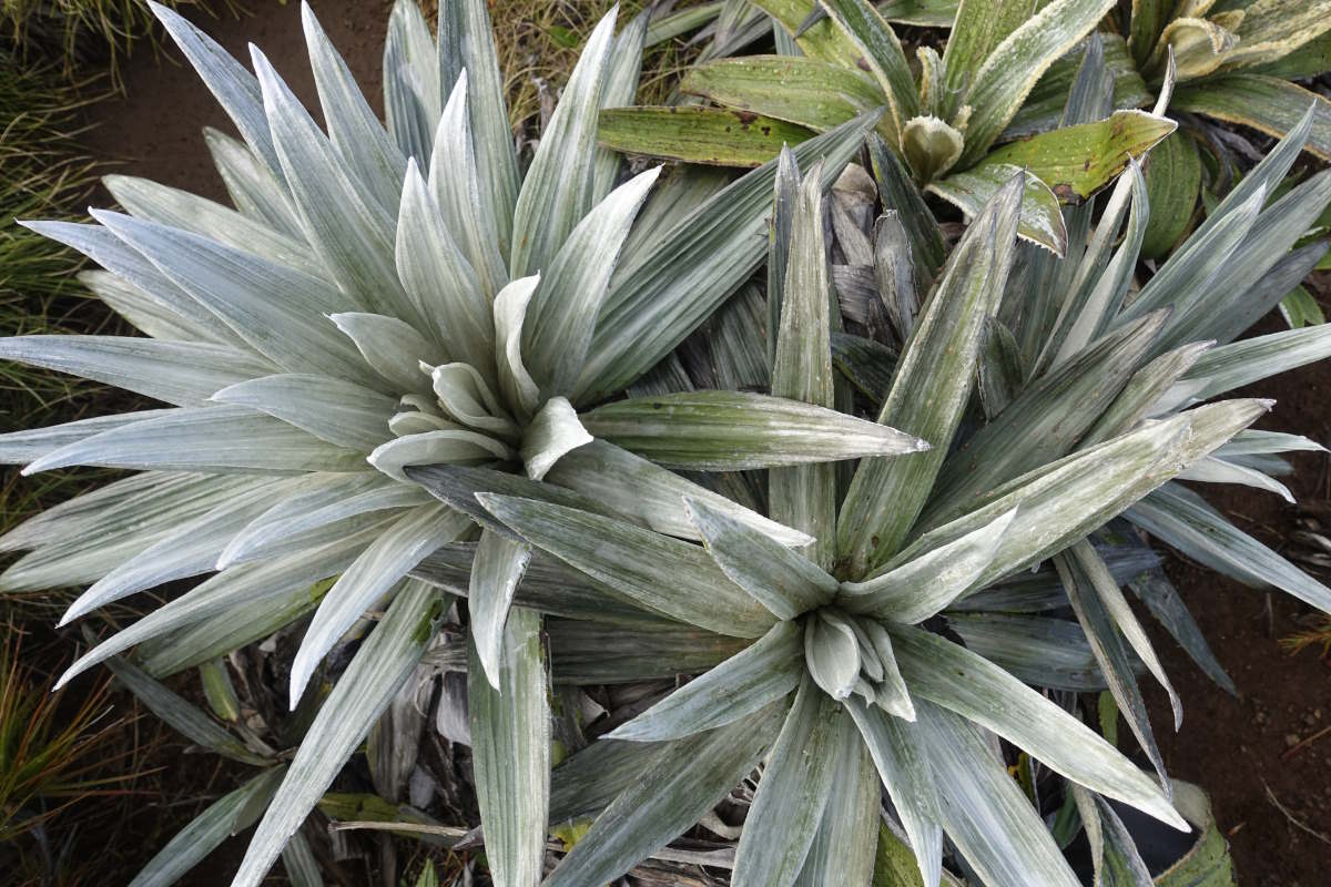
Celmisia
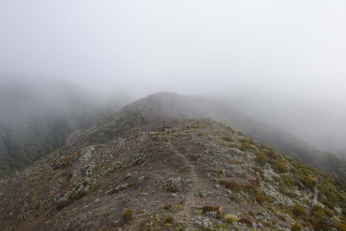
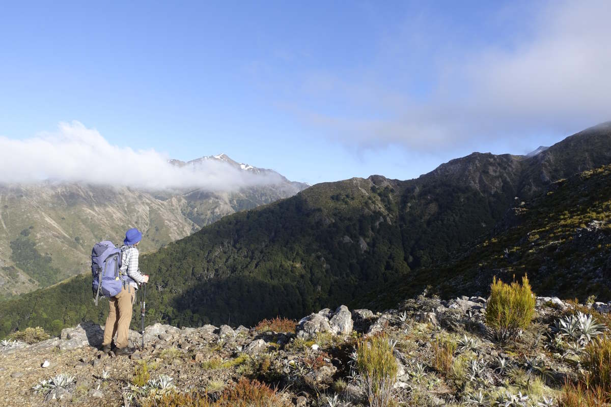
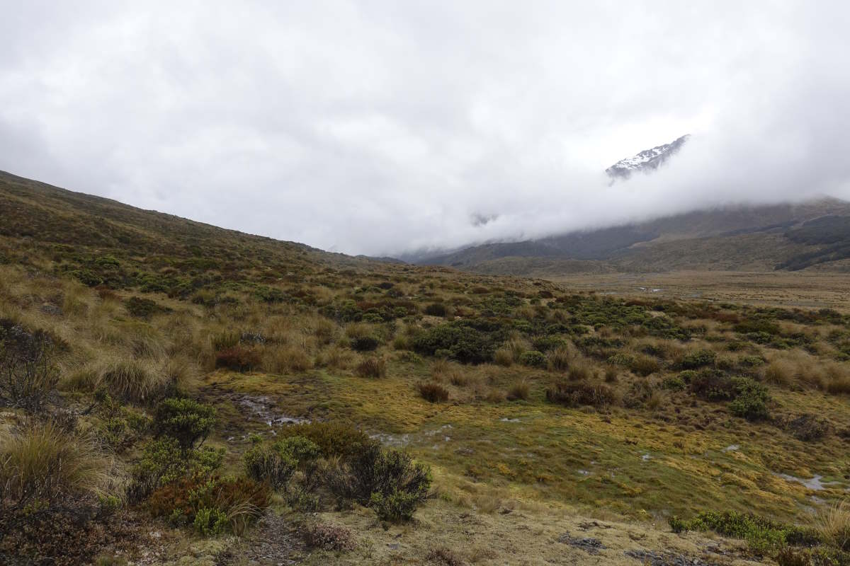
Summit ridge disappearing into the clouds
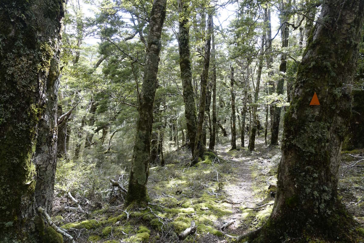
Down through beech forest
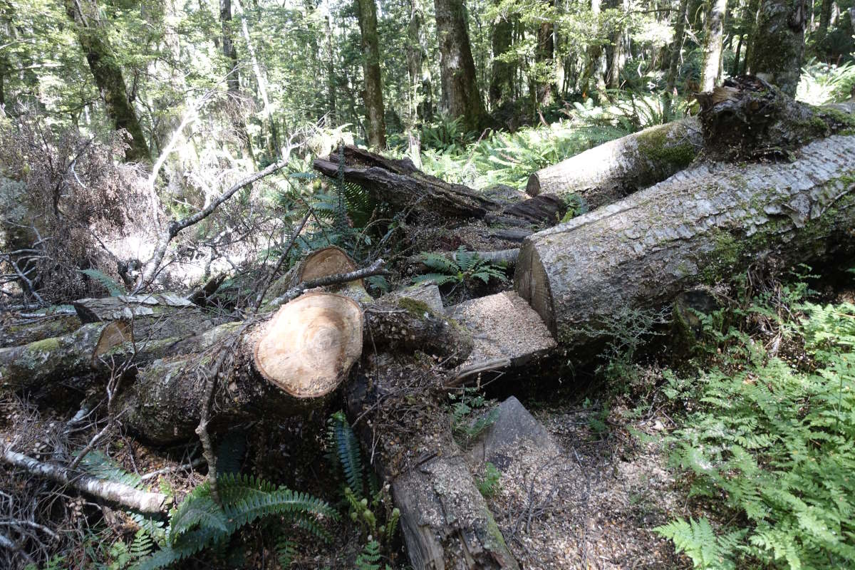
A freshly maintained track
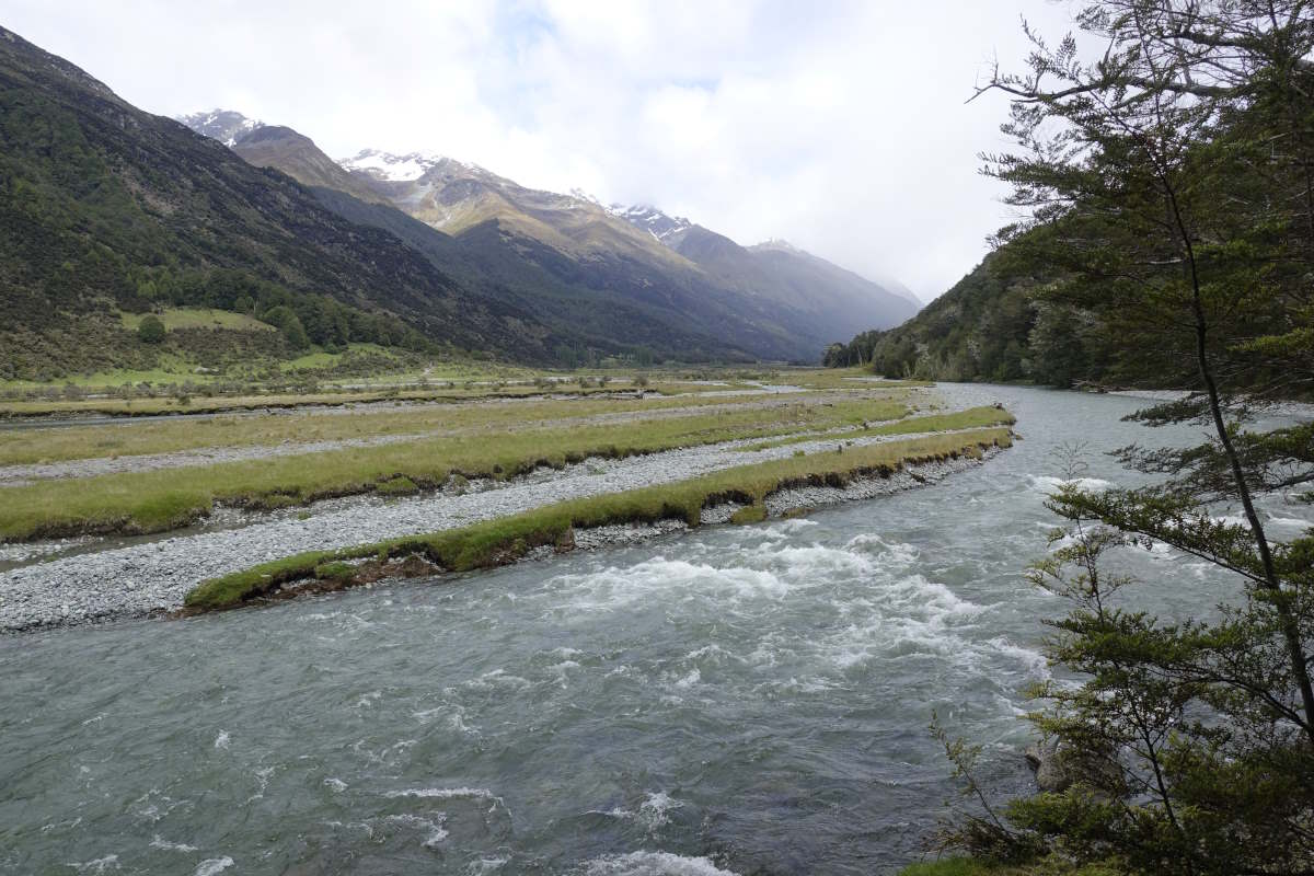
Joining the Aparima River
Aparima bridge and swimming hole
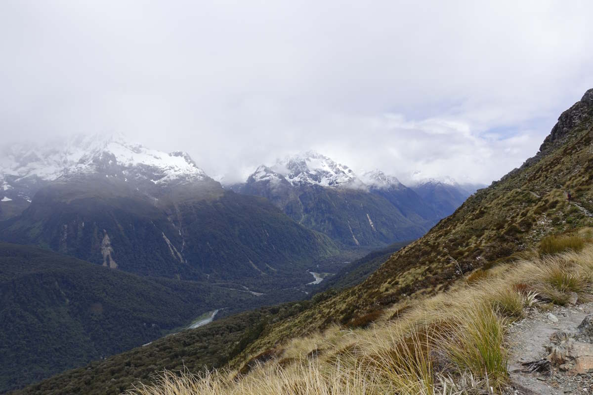
The Takitimu Mountains
Spot the next marker?
Enjoying the open views
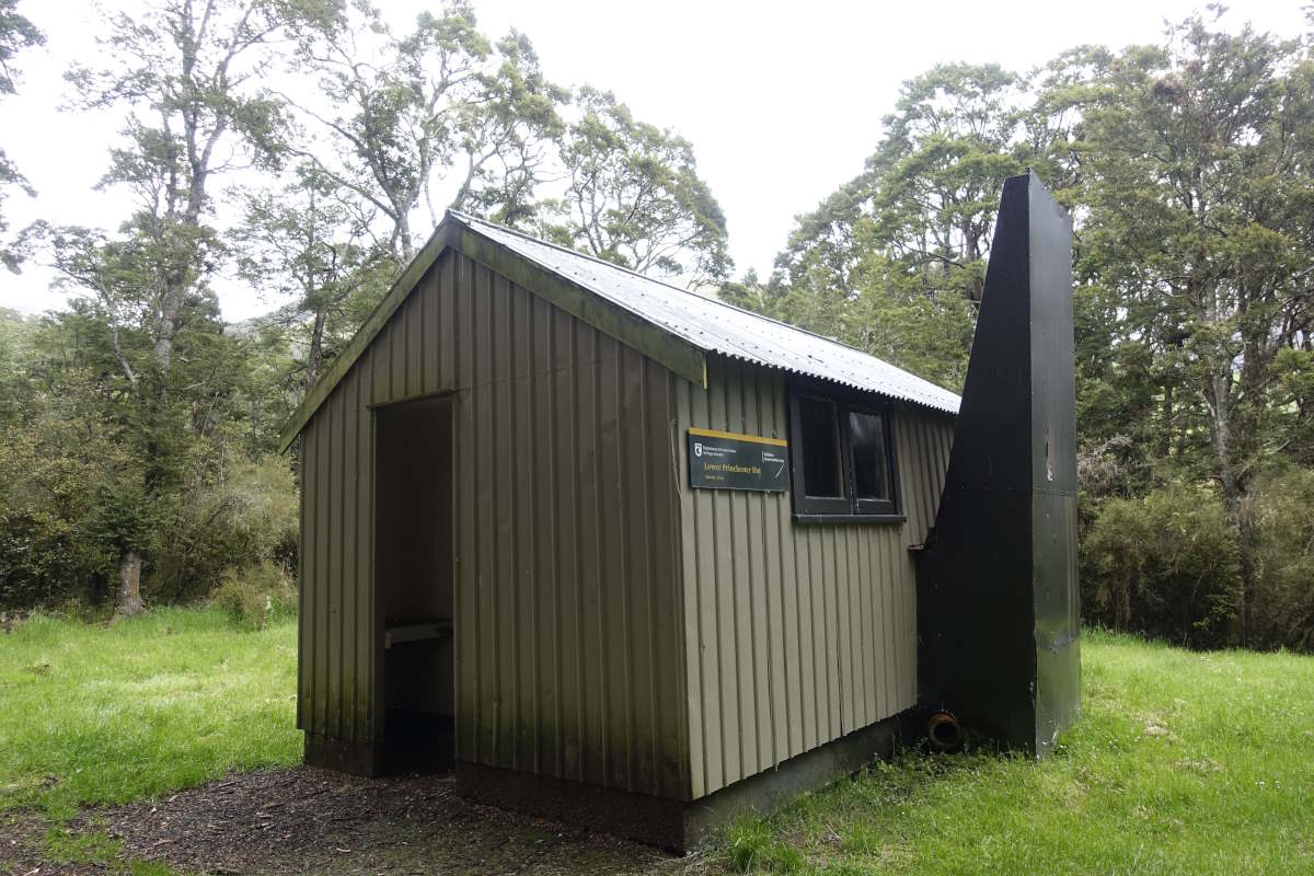
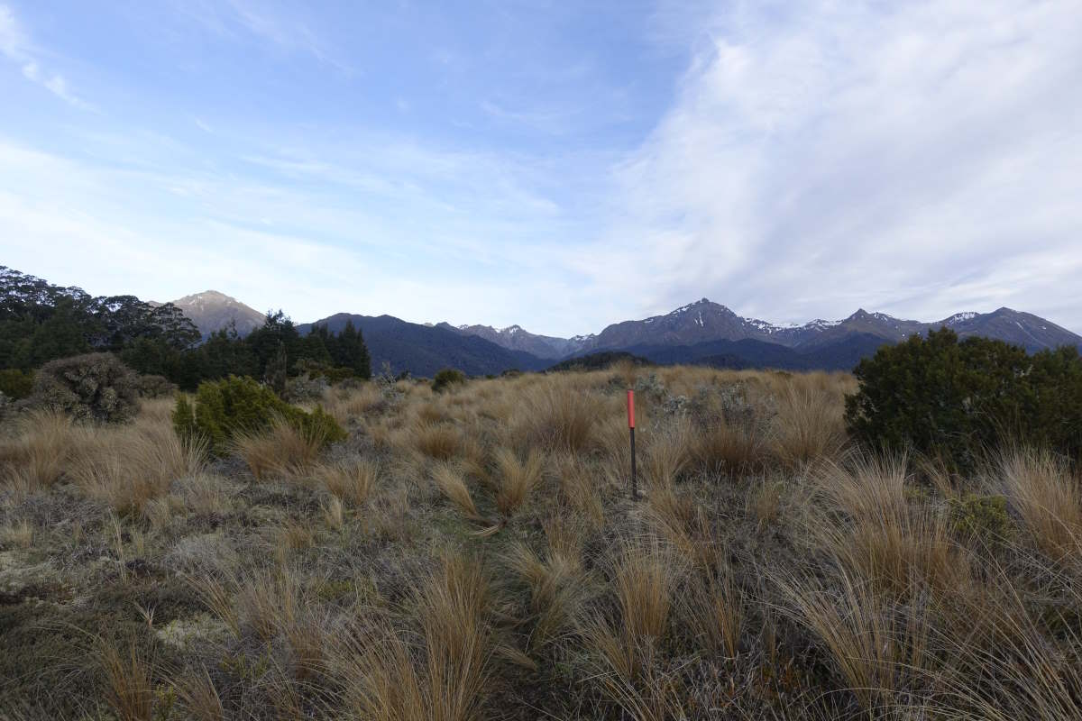
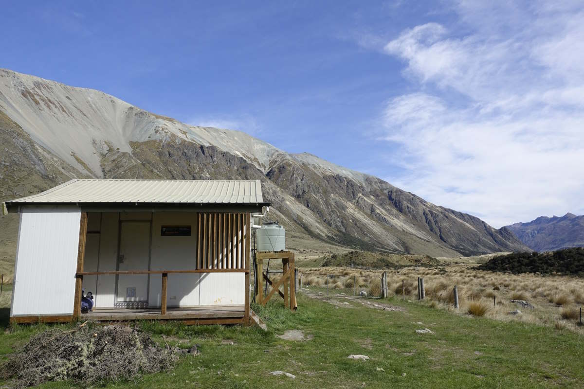
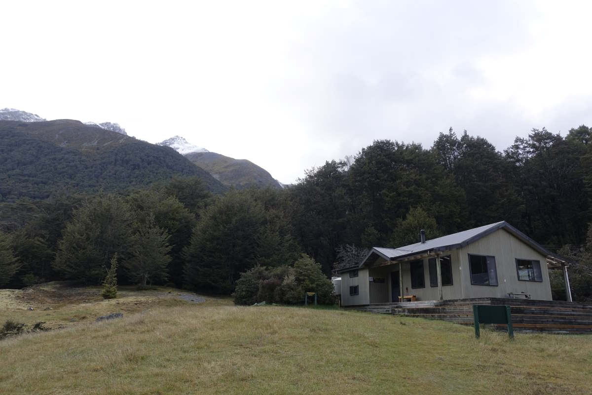
Princhester Hut
A drizzly exit
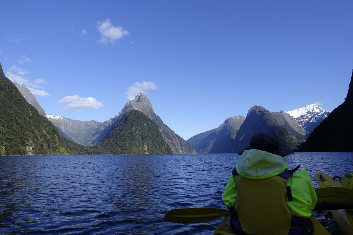
Little detour to Milford Sound
Highway 94 to Greenstone Hut
Mavora Walkway, 78km, 3 days
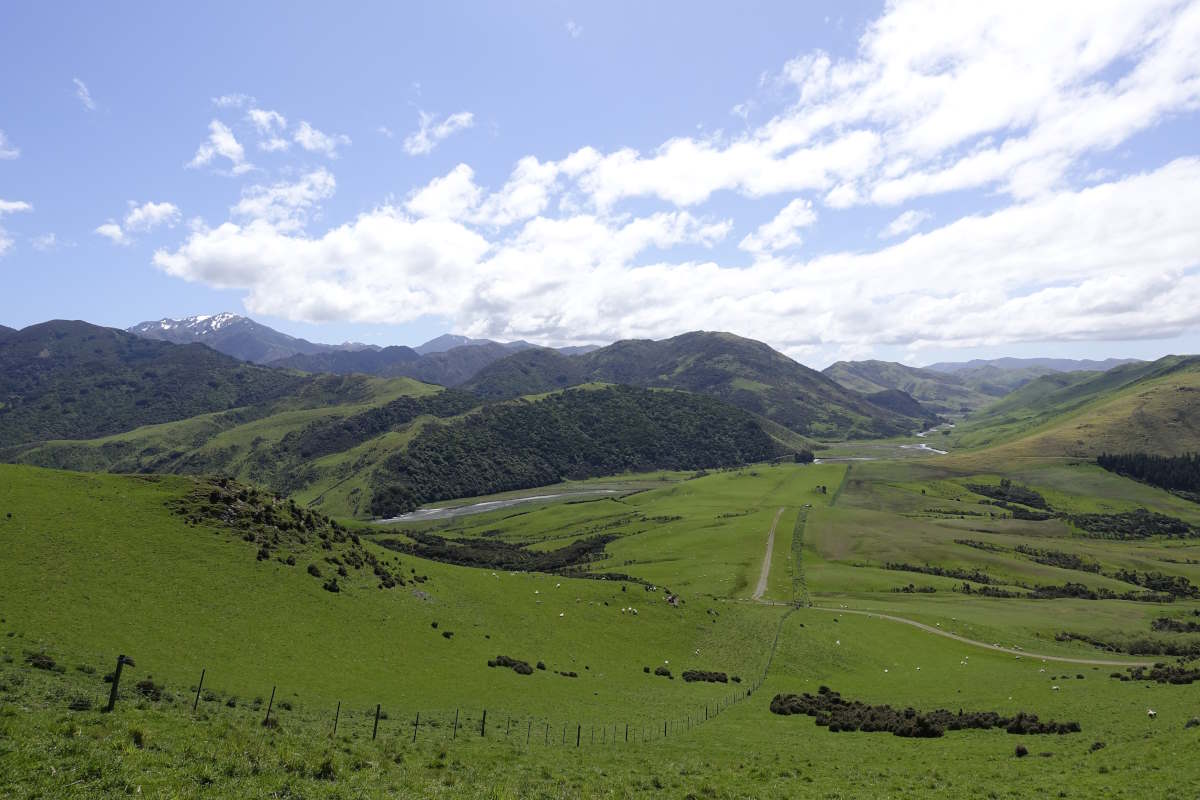
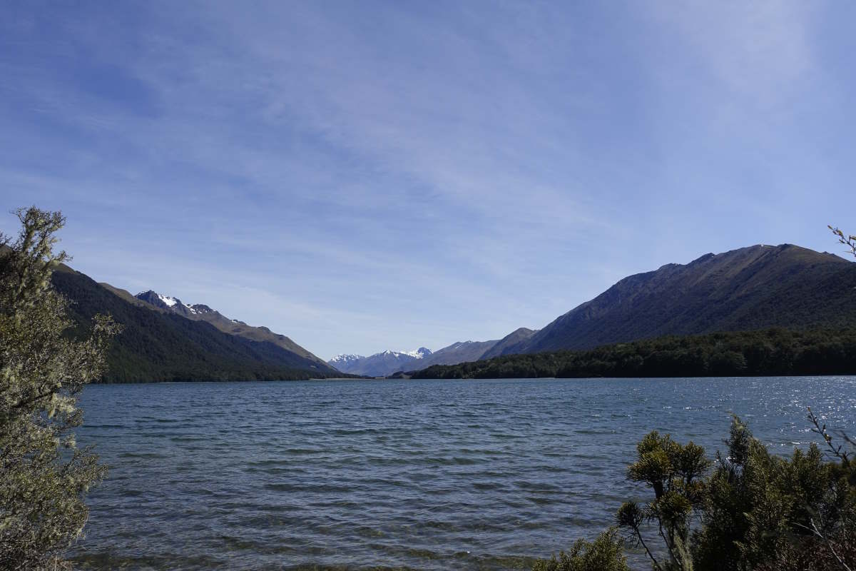
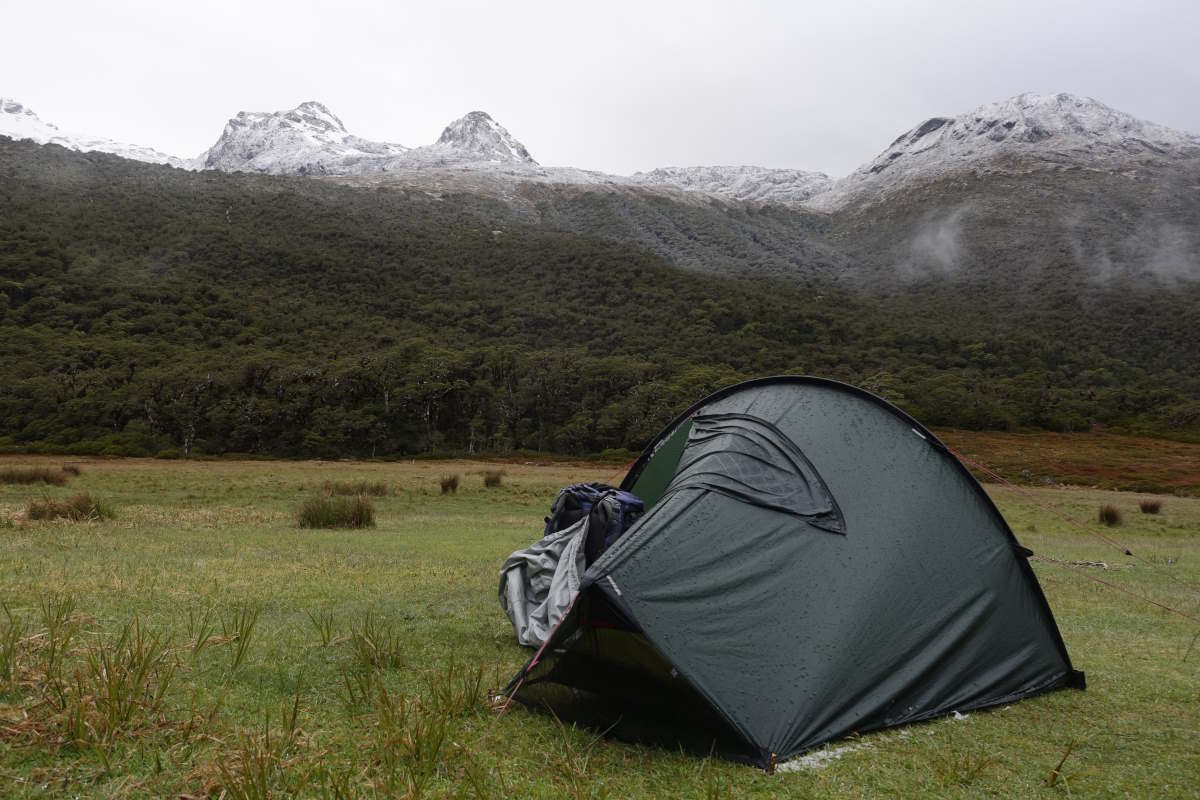
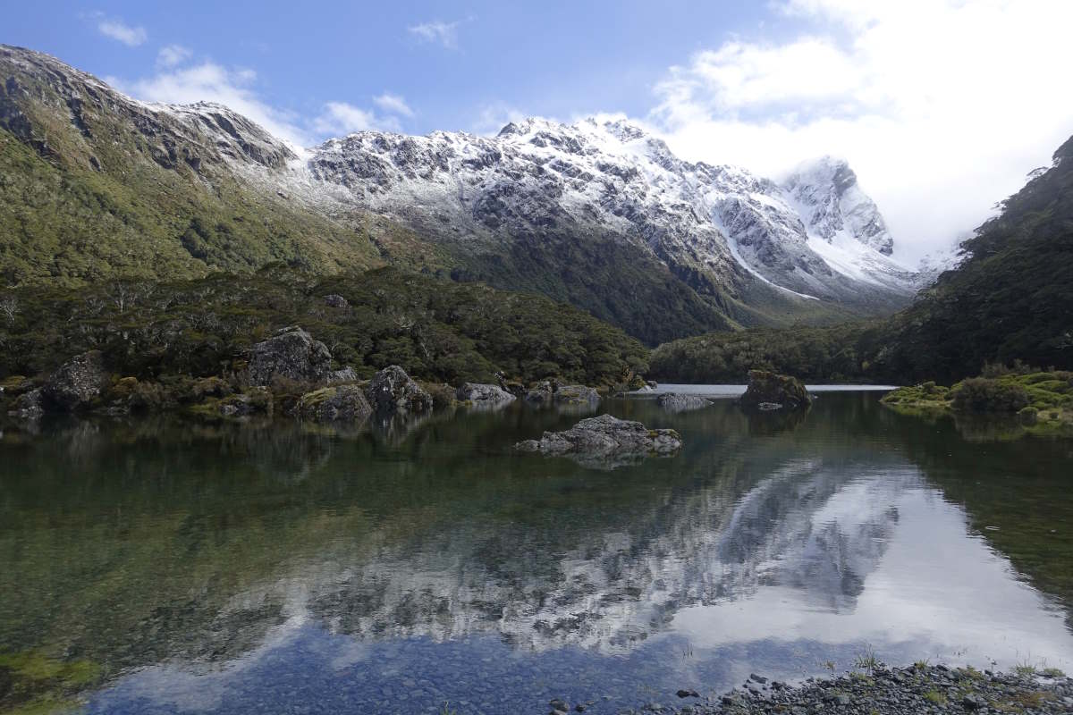
Day 13 (30km): An early morning shuttle bus drops me back at the trail head and takes me all the way to the Mavora turn off rather than the official stop at Princhester road. It saves me 2.5km of verge walking on a main highway which it feels very silly to walk just for the sake of it, especially after detouring into town and back. So there you go, I missed a bit. I’m walking for 7:20 and the air is cool under a clear blue sky and of course it doesn’t take long until it’s roasting again. The notes comment that the trail here is overgrown and it’s better to stay on the road (which runs parallel) so I do that and ignore the turn off - though it’s not actually marked and I can’t see anything to ignore! Unfortunately the road then curves away from the river and the views are not as good. It being a super sunny Sunday it also starts to get fairly busy with lots of cars and campervans kicking up big clouds of dust. A couple stop to offer me a lift which I grit my teeth and decline and then decide to go and have a bash at the river route instead. I use one of the angler access points which starts off as easy track then turns quickly into smelly mud and a deceptive puddle that I step in which goes over the top of my boot. Oh well, I need to cross the river in a few km anyway. Overall I'd say 80% of the path is fine; short grass, dry, easy going, even the occasional marker pole. The other 20% is bush bashing (with spikes) and clambering in and out of flood channels and over barbed wire and questioning your life choices. I eventually reach the intended crossing point to find that it does not instantly inspire confidence. In fact my first thought is ah... The river in general has not been inspiring confidence anywhere else but I was hoping they would have picked a magic shallow bit. It probably is; it’s pretty wide and not too fast but it looks wider and deeper than I'd like. I sit on the bank and do the stop and think. There are no downstream hazards. The water is approximately walking pace (maybe a quick walk - like when you’re late for a train but haven't quite broken into a run because you're still trying to look like you're not late for a train). I can see the bottom all the way across. There is an easy access and exit point. All good so far. I sink a pole and measure it up against myself. It's mid thigh. Not so good. After a bit of dithering (and a quick scout for anywhere better which fails) I decide to stand in it and see how it feels. I find myself double bagging all my electronics and observe that this behaviour alone is probably an indication that I shouldn't be doing this. I stand in it, adjust to the cold. It’s pretty strong but OK. I step one step out from the bank. Moving the poles is hard work. The water rises to my crotch. My doubts are getting stronger not weaker, it is a very long way to the other side. I get out. Don't be a statistic. I rejoin the road and walk 3km upstream to the bridge. It has a toilet and a lovely flat bit under the trees on the far bank so I decide to enjoy my first freedom camp rather than backtracking to the hut. It’s a shame not to be able to look through the book though as I’d really like to see what other people thought of the river. It hasn’t rained for two days but there is still quite a bit of snowmelt so maybe it’s still relatively high? Or maybe that’s just a perfectly standard crossing that I should be able to do?? There are lots more rivers to come and not many of them have convenient bridges 3km upstream. Day 14 (27km): The consequences of yesterday’s river faffings are a pair of unnecessarily soaked boots and a 4.5km head start. I deal with both by enjoying a leisurely breakfast in bed, and am briefly joined by a South Island Robin which pops in under the outer tent to ask what’s cooking. Getting going the path is clear, dry and excellent except for a few chunks of tree fall which without a bag would be fun and with one are awkward but OK. I make it to the Southern Lake still mostly hidden away in the trees and the day is sunny and still. The sunshine lasts, but not the stillness, and as I turn out of the trees along the Northern Lake it’s gusting strongly into my face. Which is unfortunate because it’s a bit too strong to be able to wear my hat and look at the (amazing) view at the same time. In the end I plaster more sun cream on top of my sun cream and opt for the view. My time touristing in Te Anau and Milford has made me think a bit about speed and the views that I’m absorbing. The contrast of driving through a landscape stopping every 30 minutes in a completely different view to snap some quick photos and say done, tick, move on; and walking second by second, step by step. Give and take. Today is beautiful. The mountains rise slowly either side of me, their tops streaked white with snow. Gently the valley twists and turns to block or reveal a new scene. Mountains that were ahead come alongside, their flanks and skylines turning and changing, valleys opening between their peaks, my own path snaking away into the future. The colours drift with the sun and wisps of cloud. There is no need to frantically look around, nothing is bewildering or overwhelming, the land changes at my pace. I listen to the birds, to the wind and the water, the crunch of the track under my feet. The whole day is peaceful. The hut books tell me there are four people (including Vicki) a day ahead, but today the only footprints are my own. Day 15 (21km): It’s a grey start which quickly turns to rain, which was definitely not part of the last forecast I had… But that’s three days out of date and I’m unlikely to get mobile signal again until I reach Queenstown (another four days?). Maybe it will dry up tomorrow, maybe it will rain for the next month. I shrug on my waterproofs and get going; three hours to Taipo hut on a fairly smooth track with low clouds preventing any distraction by the views. I take a prolonged lunch break and watch the rain get heavier. I’ve cooled down and everything feels very slightly damp and clammy and I don’t want to go back outside. I listen to a few chapters of my audio book which feels like it’s nearing an end but the plot twists just keep coming. A couple of hours pass. I consider staying the night. The prospect of camping outside Greenstone hut (because it’s a posh hut that the pass doesn’t cover and I’m a cheapskate) is unappealing, especially as the DOC worker in Te Anau told me that I’ll not even be allowed inside to cook. But the rain might not be any better tomorrow and the hut warden might have a forecast. Eventually I go and stand outside and, as always, it isn’t quite as wet as it sounded on the roof and I decide to go. I push aside any thoughts of dryness and plod straight through the bog, then into woods, over and around fallen trees and in another three hours I’m done. Gareth the ranger confirms that the trail pass covers camping and in complete opposite to what I was told in Te Anau adds that I was supposed to book in advance, and absolutely should come and spend the evening inside and please don’t cook in my tent. OK. The fire is on and the drying rack filled with gently steaming clothes. There are seven others staying, all walking the greenstone-caples track but in different directions and with very different levels of experience, and it’s a wonderfully sociable evening followed by a cosy bed in my own private room (i.e. tent).
Greenstone Hut to Arrowtown
Caples and Routeburn Tracks, 87km, 3 days
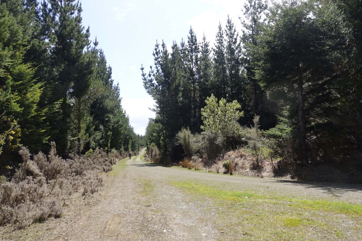
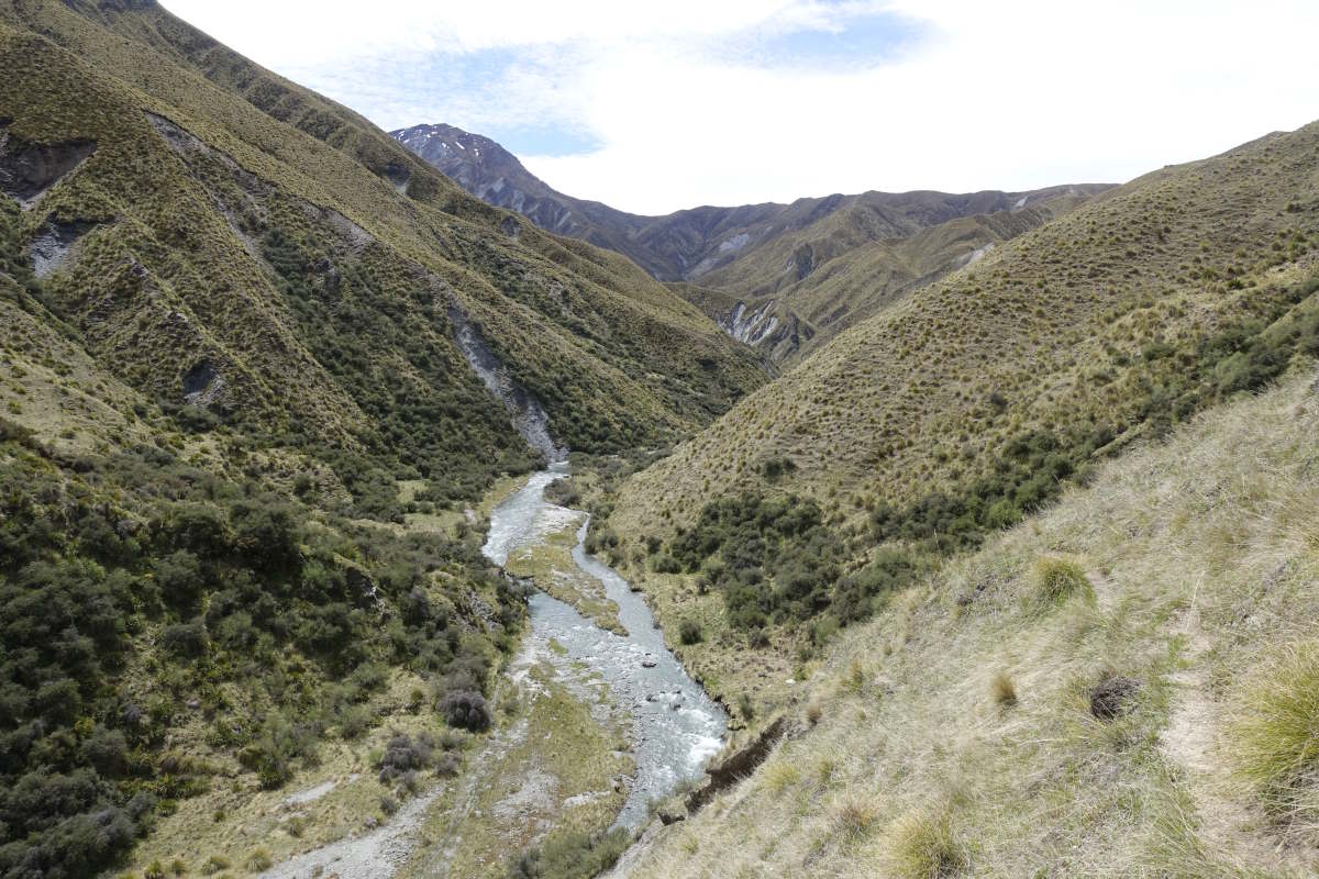
Day 16 (32km): A long, long day leaving the TA behind. So when I was outlining my Caples/Greenstone + Routeburn plan to Gareth yesterday I mentioned the saddle camp and the valley of the trolls camp but somehow the mid caples hut that was also part of the plan didn’t come up. So he assumed I was heading straight to the saddle whichever valley I went up and thought that was a fine strategy, and that as a TA walker once I hit the good trails I’d fly along. Well I wasn’t fully convinced because it’s a very long way but when I get up the rain has stopped and there are some blue bits over the Caples and grey bits over the Greenstone and I decide I’ll just see how far I get. I make it to the “start” in a couple of hours and then, flying along easy tracks (there are culverts and bridges and boardwalks and everything!), find myself at Mid Caples at 11:30. No way am I calling it a day that early! The sun pokes occasionally between scattered clouds and the rain that hovers in the upper valley seems to push back over the day so I never actually meet it until just after the tent is up. There are lots of geese with chicks and lots of beautiful snow capped hills and lots of walking. I climb steadily to the saddle which boasts a stunning view back into Caples valley, then descend into cloud on the other side. The forest is full of ferns again and the light through the low cloud gives everything a golden glow and a very different feel to just a few km ago. The feet are a little sore and my left hip mildly irritable and the last 2km seem to last forever (possibly because the camp spot isn’t actually marked on my map). I’ve never been so happy to see a long drop toilet in the middle of nowhere. The rain starts as I put down my bag and I hide away inside as the cloud and rain thicken bleakly around me. Day 17 (26km): The morning dawns cold and dim and full of condensation. I stick my nose out and find I’m still in a cloud, and there is a little rim of sleety mush slithering softly off the tent. Inspiring… But I get up and out and the cloud lifts a little and it stays dry. I make it to the Routeburn track alone - probably far too early for anyone to be emerging from a nice warm hut yet. The going remains easy and all the streams have wooden bridges which is incredibly civilised. The views come and go, with a tiny morning glimpse between trees and cloud of the whole of Fiordland shining white under a clear blue sky, and then the cloud shifts and it’s gone and I wonder if I imagined it. The cloud thickens and snow starts to fall softly around me, sticking to the trees and the trail. Onwards, I make good progress and reach Lake Mackenzie for 10am which is just after all the slow hikers have left. There is a glorious view of the lake and the mountains under an opening of deep blue sky, and a thin bright orange line which turns out to be a hundred luminous rucksack covers ascending the trail ahead. I sit and have second breakfast and soak in the view, watch a helicopter bringing supplies into the lodge. It’s a very different feel to the last four days which I’ve spent almost entirely alone. Onwards and upwards I start to overtake the stragglers. Round the shoulder the Holyford Valley is beautiful, the clouds clearing away to show the mountains stretching right out to a tiny glimpse of the sea. Up again it’s an easy climb to reach the Harris saddle where the trail brushes back into the cloud and the snow has settled a few inches deep all around me. The trail is clear though, warmed by the passage of many hundreds of feet. Down the other side the clouds are thicker and give only veiled glimpses of tall peaks, heavy and grey in snow. I drop down further, making it out into the flats in the early afternoon where the sun is back and the going stays easy and the idea of camping seems entirely unnecessary. I make it out to the car park for 4pm, remembering that wonderful expression on Vicki’s face when I said I was thinking of doing it in a day and she just froze for a second. There are plenty of day walkers around and the third pair I ask are going to Queenstown and happy to give me a lift. Robyn and her husband, from California, are on the second day of their New Zealand road trip and still getting used to the whole left-hand-side-of-the-road thing which is mildly terrifying but we make it in one piece. They drop me in the middle of town and I locate a last minute bed in a cheap hostel and lots of food and a 2 metre long and very unnecessarily heavy cable that will charge my camera (because the ultra short lightweight one won’t). Day 18 (29km): Not the greatest night’s sleep. There’s some loud music playing in the room below, or possibly outside, and it seem to vibrate up through my bunk and straight into my head. I’ve got too used to the silence. I have a relative lie in (still walking for 8:30) and get out into a day of bright sunshine. I’m indecisive about what to do with my day. I have a spreadsheet of dates which I put together to make sure I’d finish in time for my flight home and I’m now two days ahead of that plan and it’s very sunny. I could have a day off trail and go up Ben Lomond without my bag, but would need to arrange another night in town and move hostel because this one’s full. Or I could walk over Ben Lomond with all my stuff and loop round back to the trail, but that would be another long day after a lot of long days and I’m a bit tired and feeling uninspired. Or I could just follow the trail but it’s a fairly flat path through a built up area that feels like a waste of a sunny day. In the end I just follow the trail. It’s mostly gravel cycle tracks and less industrial than I was expecting but I’m having an energy slump and progress feels tortuous and slow and like the trail is always doubling back on itself. My feet are tired and I feel like I should want to bound up a mountain and soak in the views but actually I’m struggling to plod my way along a flat surface and would relish an afternoon nap. I need a rest day, but the weather is full sunshine for the next week and that makes it really hard to stop.
Caples Valley
Upper Caples, towards the Humbolt Mountains
Boardwalk over McKellar Saddle
Descending into the Greenstone Valley
Greenstone Saddle Camp
Snow on Earland Falls
Lake Mackenzie
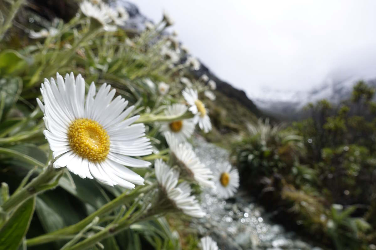
Mountain daisies
Looking out over the Hollyford Valley
Harris Saddle
Lake Harris
Route Burn
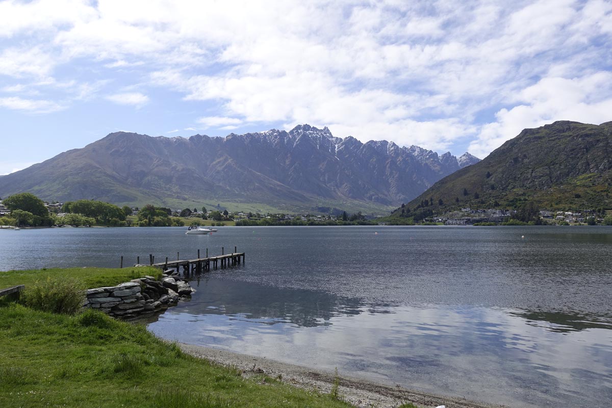
Lake Wakatipu from Queenstown
Shotover Bridge
Lake Hayes
Arrowtown to Wanaka
Montatapu Track, 63km, 3 days
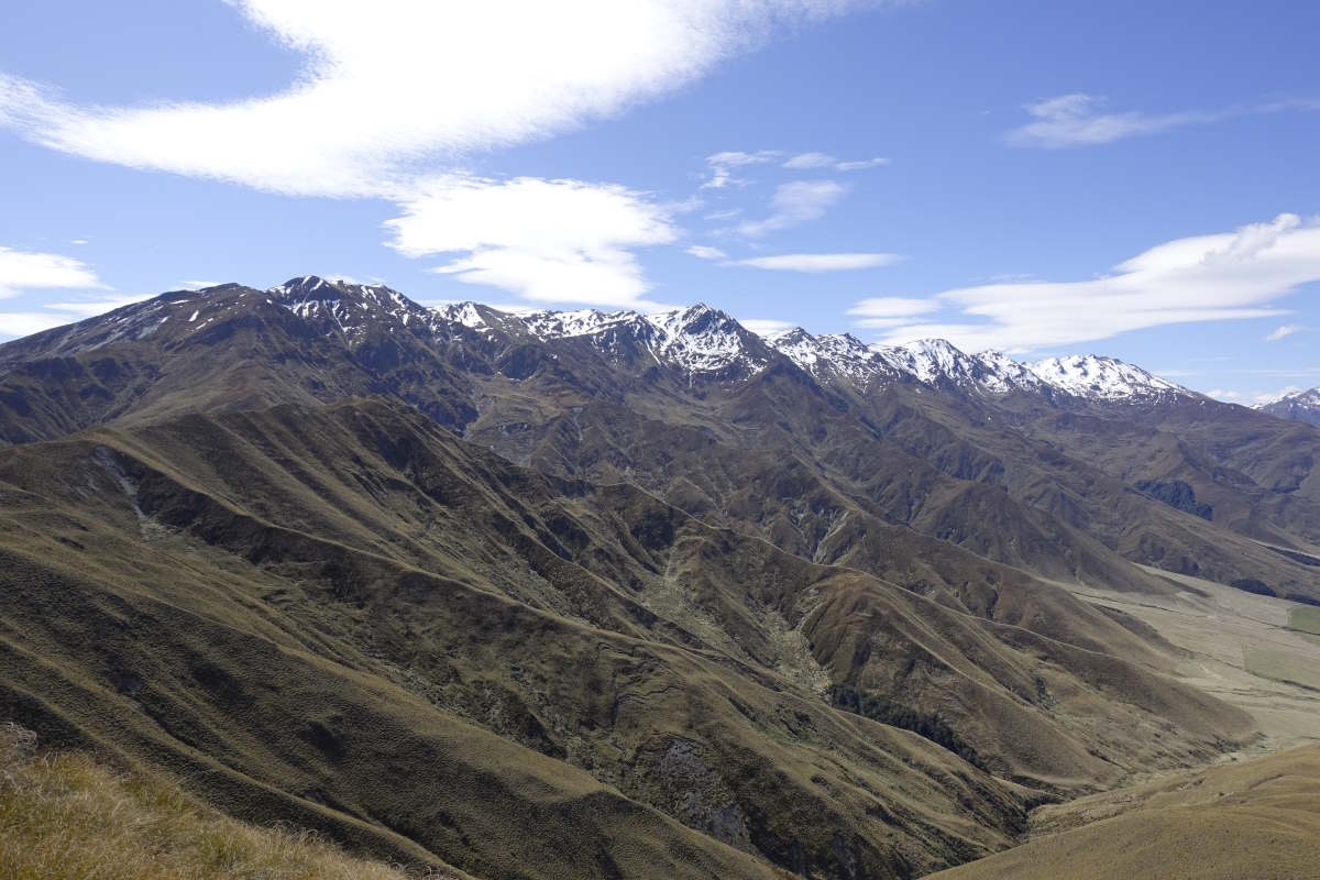
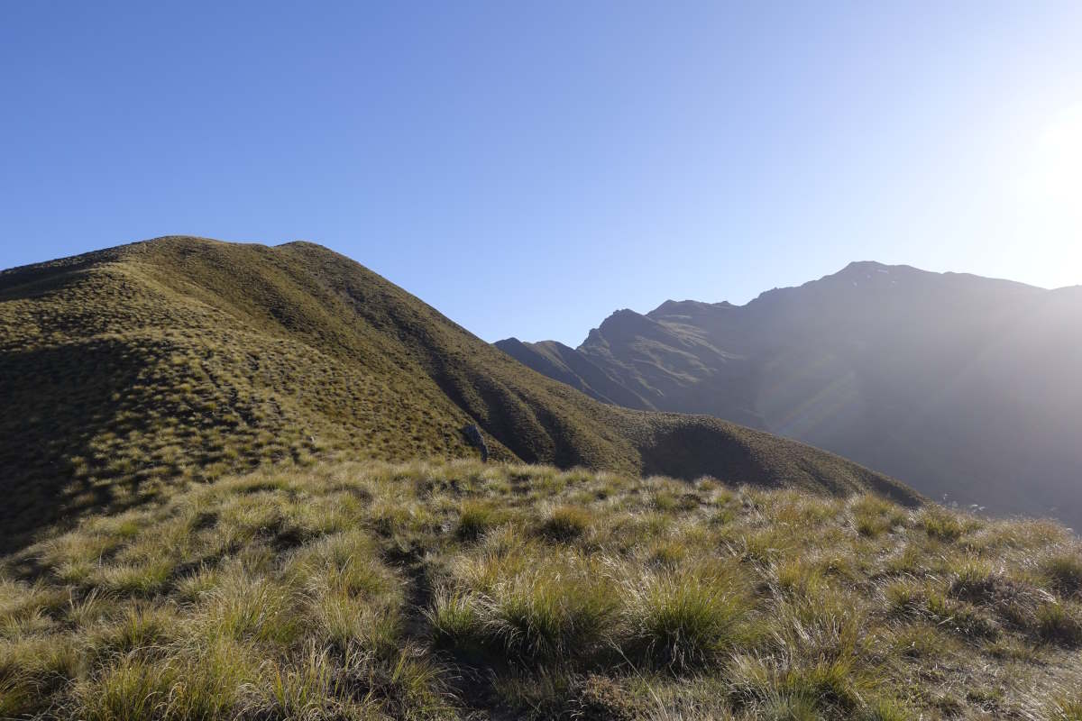
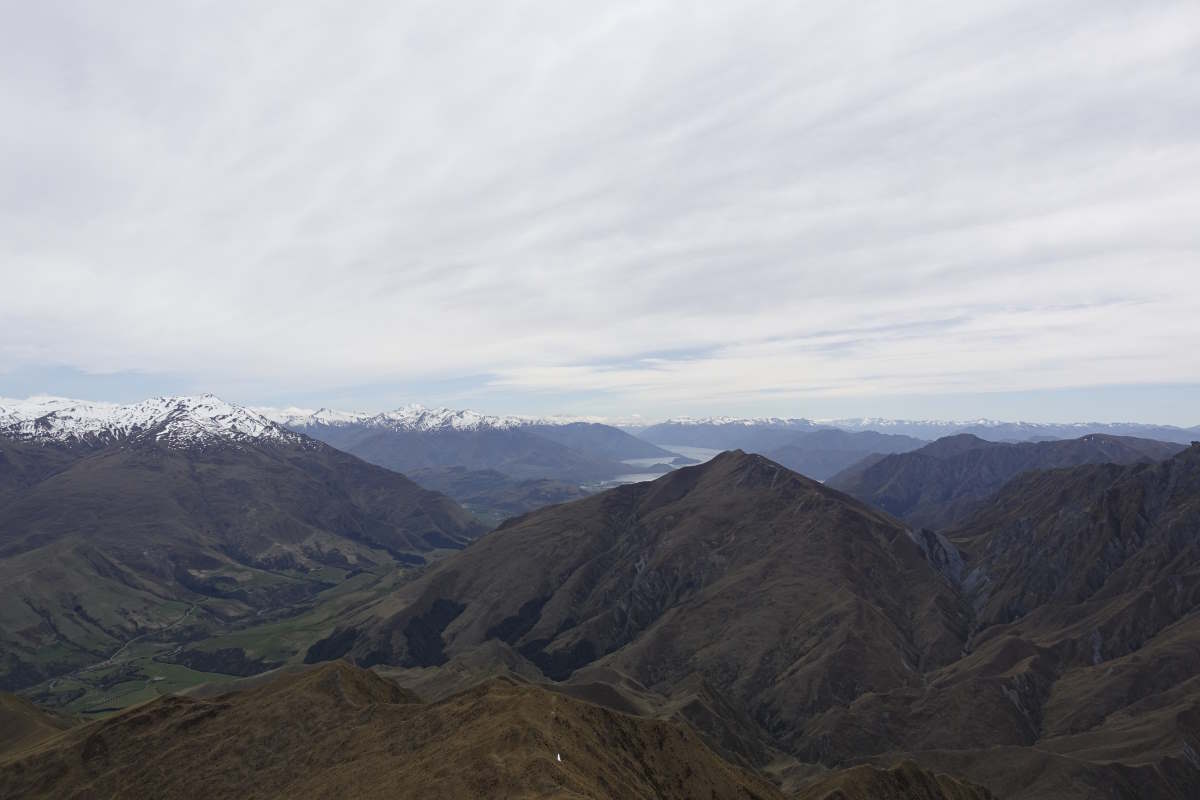
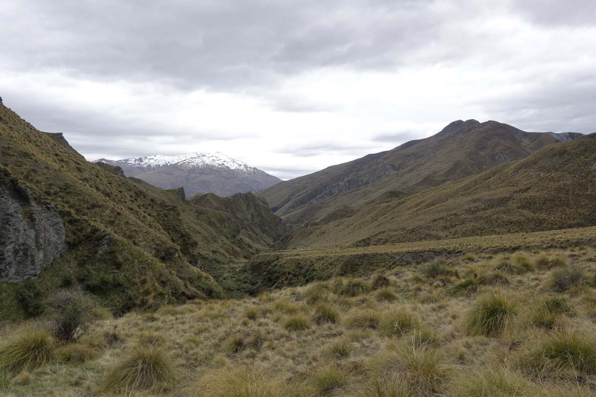
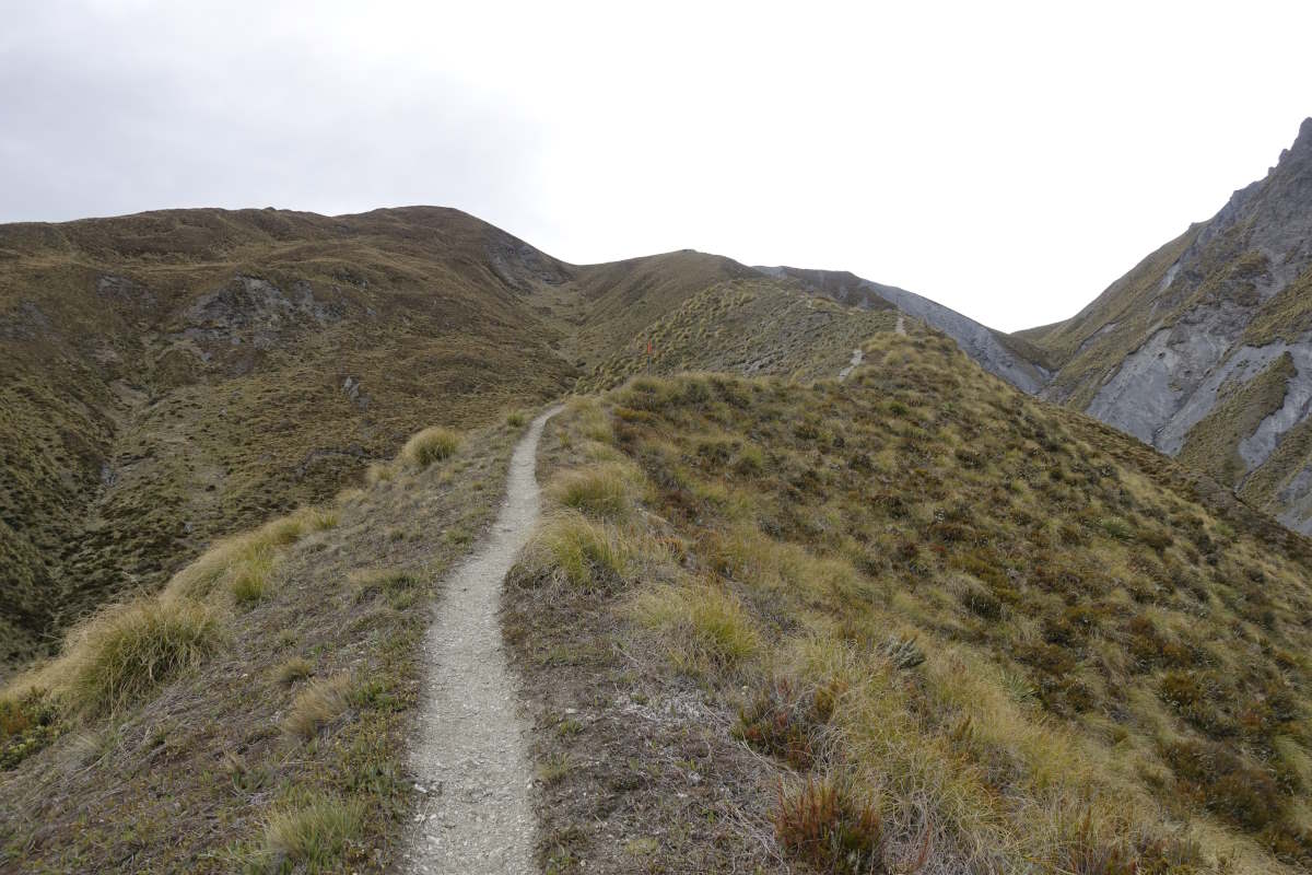
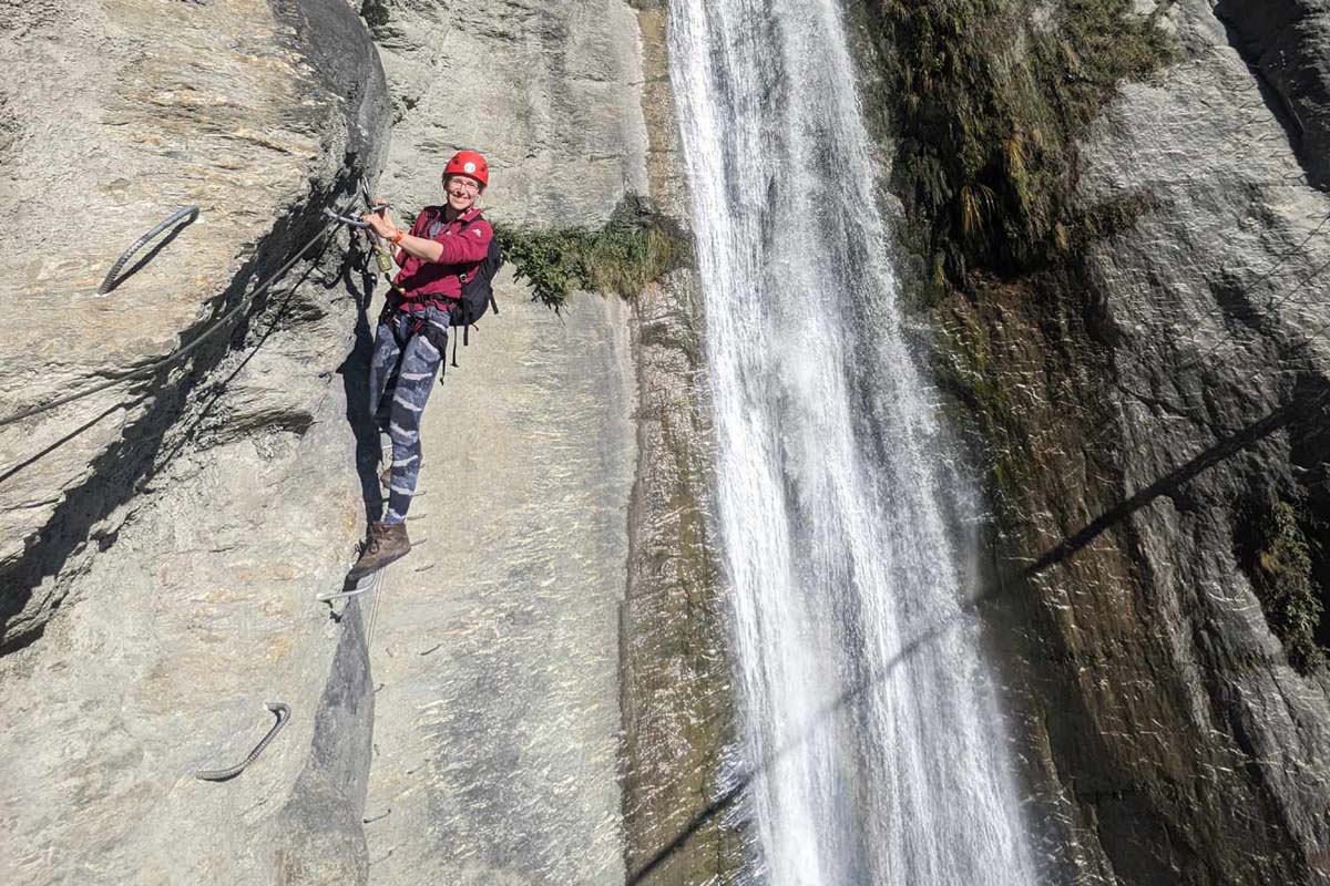
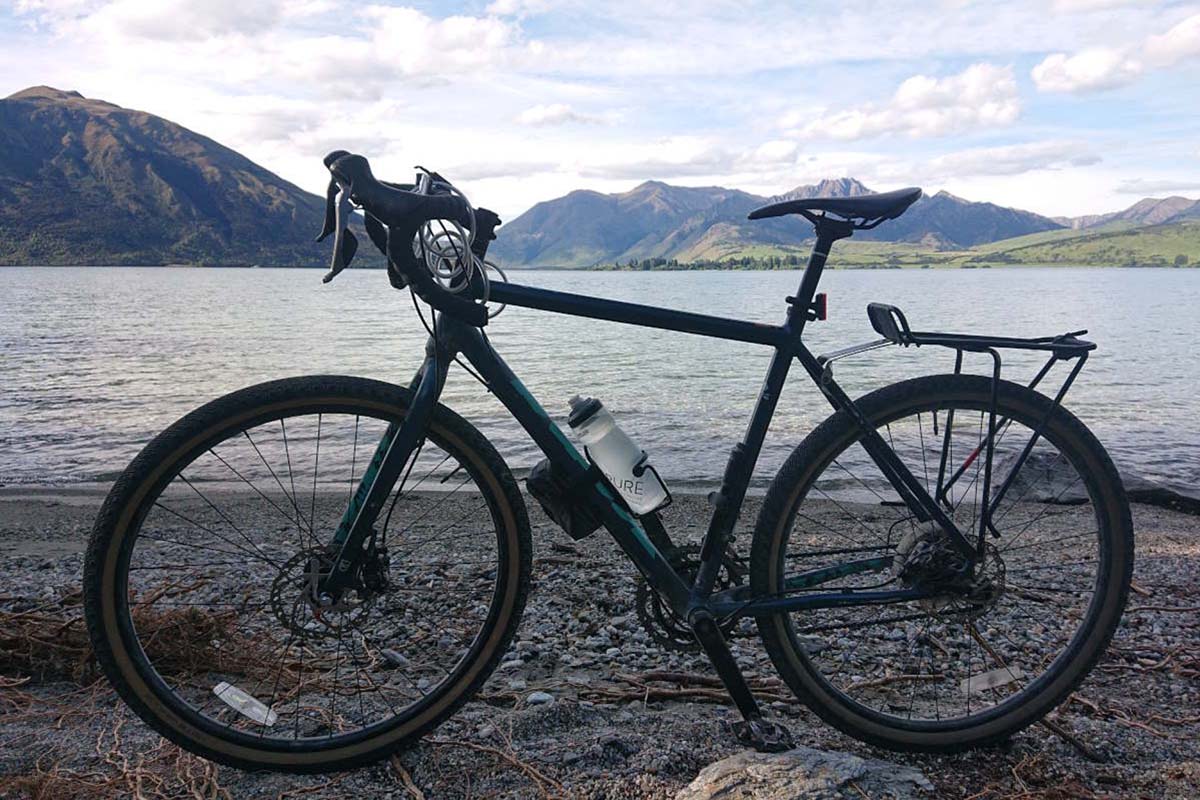
Day 19 (23km): The trail heads straight back up into the mountains. It’s another sunny day but with high wispy clouds to take the edge off the heat and whether it’s the cooler air or the view or something else entirely I’m having a great time. I gain the ridge, drop the bag and run the last 100m up to the summit of Big Hill (what a great name) to catch the view. I feel like I’m flying. Down, down, down I reach Macetown, an old long abandoned gold mining settlement where there are a couple of carefully reconstructed houses and a few info boards to give an insight into the lives of those who lived here. The path follows a 4WD track along the valley floor which means crossing the river many many times (I lose count quite quickly). It’s cold and opaque with silt and my probing feet are numb and clumsy. I opt for the high path up the next valley which cuts along the side of the hills; some of it on a perfectly flat old water race and some of it a precipitous struggle through spiky bush that is great at grabbing my bag and pulling me off balance. Then it’s up, up and up again to Roses saddle and a stunning sun drenched view all around, the geology of the landscape throwing up hundreds of high contrast crags running parallel to the river. Cresting the ridge there are more mountains ahead and I can see the hut nestled into a corner of the valley floor below. I sit a while to enjoy the view then it’s a quick half jog letting gravity pull me down to a beautiful warm and spacious hut which I have all to myself. The book shows five TA walkers stayed last night and another two today have passed through and gone on. I have a relaxed evening and am tucking into dinner when I’m joined by Dave, Wallace, Miles and Graham on a weekend hike. They have walked from Highland Creek Hut with enormous rucksacks and have a great combination of blister plasters, limps and sunburn. We spend an enjoyable evening very predictably chatting hiking and kit and it turns out they have brought essentials like a glass bottle of whiskey, towels, shampoo and some custom "old man tramping" t-shirts but no map. Day 20 (15km): I’m up and off for 6:45 this morning which I think is a record for this walk so far. Why? Well I got it into my head last night that while the trail goes round the side of Knuckle Peak (1804m), maybe I could go up and over it instead. It’s the same distance and actually only an extra 200m of ascent compared to the sidle. There just isn’t a trail. I set off through a river then a long straight slog uphill to where the path dips off the ridge down to the left. It looks OK ahead so I carry on up, quickly coming onto some tricky ground with a series of steep banks which involve two hands and occasionally also a couple of knees to pull myself from grass lump to grass lump up mildly unstable scree. Not the quickest terrain. It’s another hot day and I stupidly leave my fleece on and get far too warm, then can’t bring myself to take it off because I’m soaked in enough sweat that I’m both boiling and a little bit cold. I take a lot of rest stops. I can’t decide if I’m just unfit, or suffering from altitude?? (surely not…), or if as usual I should just blame it all on the bag, but wow it takes a lot of effort. The rest of the ridge eases off a little with some amazing views filling in behind me. The final few metres are some of the steepest yet but with the reassuring addition of some little metal marker sticks so evidently someone else thought this was a good idea too. Touch the top. 1804m. I can see so far, and there are so many mountains. Out across Lake Wanaka. Over to Mount Aspiring. Back to Fiordland. On to so many distant and amazing summits I can’t even begin to name. It’s beautiful. I have two possible descent plans and, not really fancying going back down the final slope I elect to carry on along the ridge. The little markers continue for a short while, then I leave them behind for a nerve wracking descent down what I decide to name Death Grass. It sheds dry silky dead stalks which pile up between each tussock and then slide beautifully over each other when you put weight on them. I also seem to be over some critical slope angle that the two times I slip a little I’m gaining speed not losing it. Terrifying on a steep slope with a steeper edge. The rest of the way is fine and quick with plenty of goat tracks to follow until the last km where I have to scramble through a series of medium sized stream gorges. I continue along goat paths and am halfway down one when it starts to detach and gently collapse underneath me. In amongst mild-moderate panic a little thought at the back of my brain observes “Ah, but you are heavier than the average goat”. The final descent proves goat-track-less and full of Spike Grass (another inspired name) and goes a bit like: “Ow! Ow! Aii, step, argh, ouch, slide… No no no!” and I’m glad there is no-one around to watch me slither/writhe out of the bottom. I make it to the hut for 1pm which is excellent timing and decide to carry on a bit further. Back on a marked path progress feels light and easy despite another hefty climb and I make it quickly to Fern Burn Hut, feeling good about myself and the way my body has adjusted to the trail and the bag. The hut is another lovely bright space and all mine. I manage a sponge wash in the stream and remove the soggy fleece. My legs have gained a concerning petechial/non blanching rash which on closer inspection turns out to be a million tiny stab wounds. Day 21 (25km): I am awoken in the dark by a sound I assume is someone walking up the steps and putting down a heavy bag. Bit late for new arrivals but at least they are being considerate and getting ready outside. I drift off, then realise its taking them a long time to come in, and I also can't see any torch light… I twist around in my sleeping bag. There is just enough star light that I can see the outline of the windows and also that the door, on my right, is slightly open… I twist further and a dark shape sitting on the mattress to my left looms inwards, close enough to touch. Breathing. Definitely not human. I shout at it and it jumps away. What the hell is in the hut?! Staring blindly out into the dark it takes a few minutes for my hands to find my headtorch (which has not yet been needed and is tucked away in a sealed dry bag in a pocket of my rucksack on the floor under my bunk). I turn it on, flooding the room with bright blinding light… and find a possum sitting on the table chewing a candle stump. It is not particularly alarmed by the whole situation and in the end I have to get up and heard it manually out of the door. How did it get in?? My 2am distinctly unsettled brain decides that maybe possums can open doors (my morning brain disagrees and thinks I probably just failed to shut it properly), but can’t find any way of barricading this one shut because it opens outwards and is too far recessed to wedge the broom through the handle. Eventually I sleep again but it is uneasy and there is plenty of noise of a number of animals running around the porch and roof for several hours. Fortunately there is only a short distance left to walk today and the trail winds fairly easily down into Glendu Bay and civilisation. Onwards, I follow a gently meandering cycle track around the lake shore which is bright, beautiful and very very warm. I secluded little pebble beach draws me in for a wonderfully cold dip after which I am blown dry by the warm wind in a matter of minutes. Carrying on I reach Wanaka and an ice cream shop which does an absolutely amazing red fruit sorbet and mango frozen yoghurt which is just everything I ever wanted. Then it’s up into town to stay with Lorna, a friend from school; BBQ dinner, a shower and a clothes wash. Life is good. Day 22 (0/40km): A “rest” day. My stay with Lorna by complete co-incidence also combines with another old school friend Nicola and her partner Richard; so we make the most of it with a morning of via-ferrata at Wild Wire Wanaka (where Lorna works so can take us round almost free). Then I take a moderately stressful break to go and buy 27 days worth of food and pack it into boxes and post it ahead to various points on the trail. Then I realise that tomorrow's section is totally cycleable so I borrow a bike and spend the evening riding a 40km loop to Lake Hawea and back, returning just in time for my scheduled phone calls home. Restful.
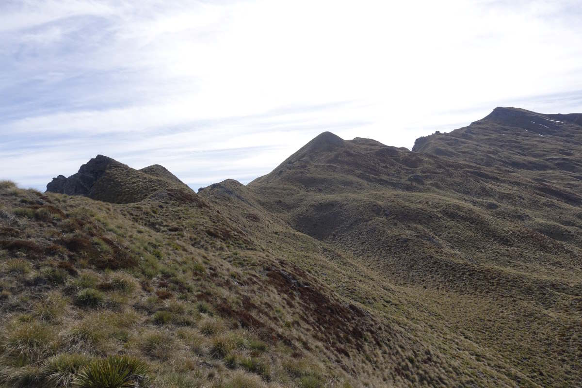
Ascent of Big Hill
Down to the Arrow River
Reconstructed houses in Macetown
Sidling above the upper Arrow river
View from Roses Saddle
Sun rising on the ascent of Knuckle Peak
A long and pathless ascent
And a view worth the climb
Negotiating stream gullies on the descent
What a beautiful path!
Descent to Fern Burn Hut
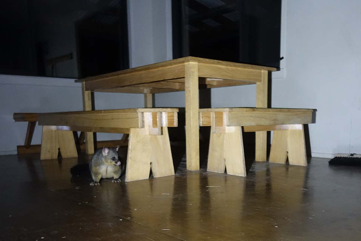
An uninvited guest
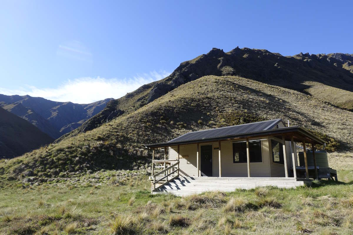
Fern Burn Hut
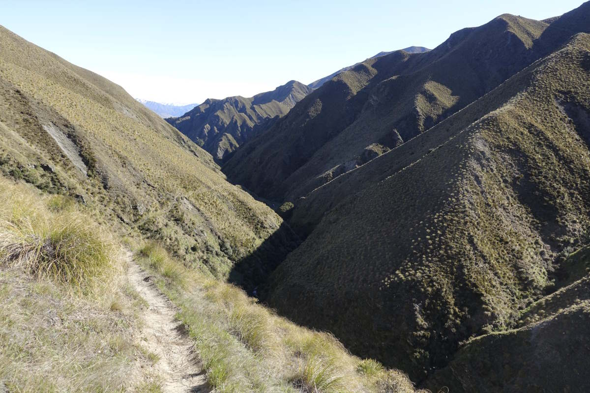
Exiting the Montatapu Hills
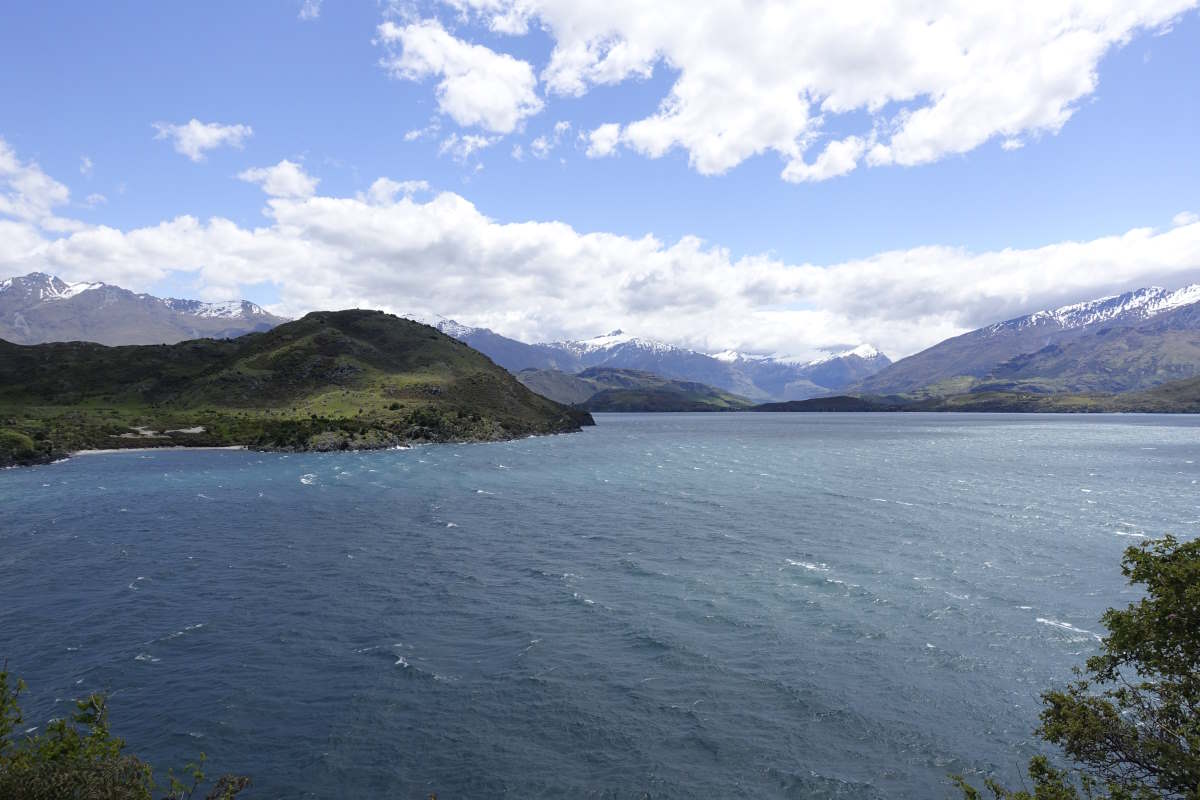
Lake Wanaka
"Resting"
"Resting"