Te Araroa, Part 3
Arthur's Pass to Ship Cove
December 2024 - January 2025
The third and final part of my New Zealand adventure. A journey of high rivers and alpine passes, friendship and solitude, and a very heavy bag. << Back to Part 2 | TA Home Page
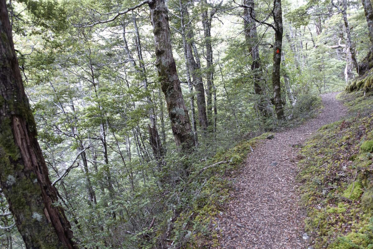
Arthur's Pass to Morrison Footbridge
Mingha/Deception Tracks, 27km, 2 days
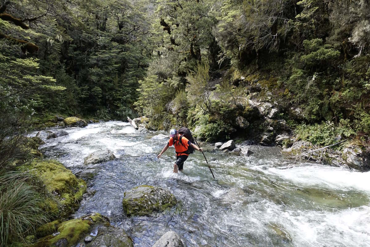
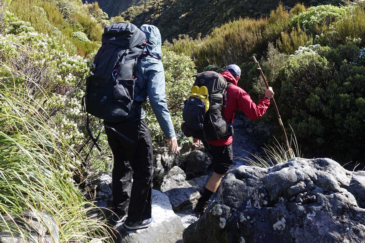
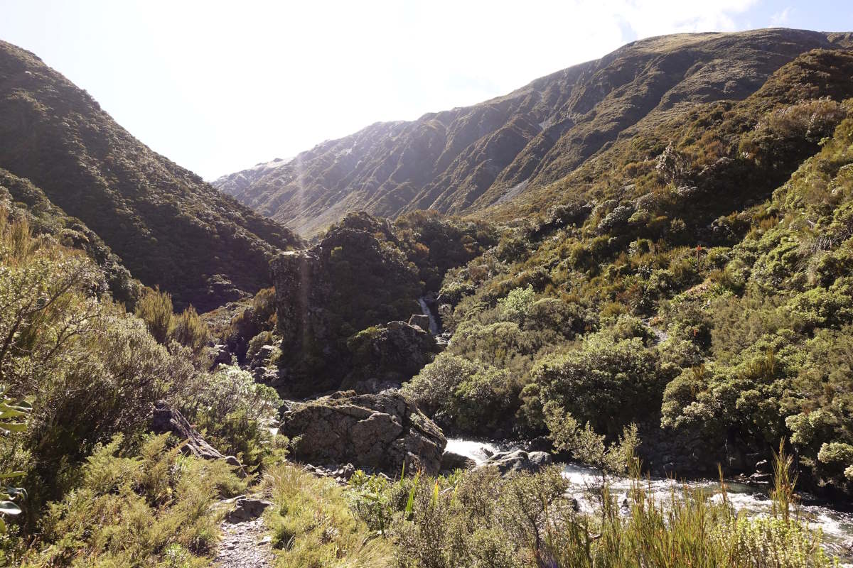
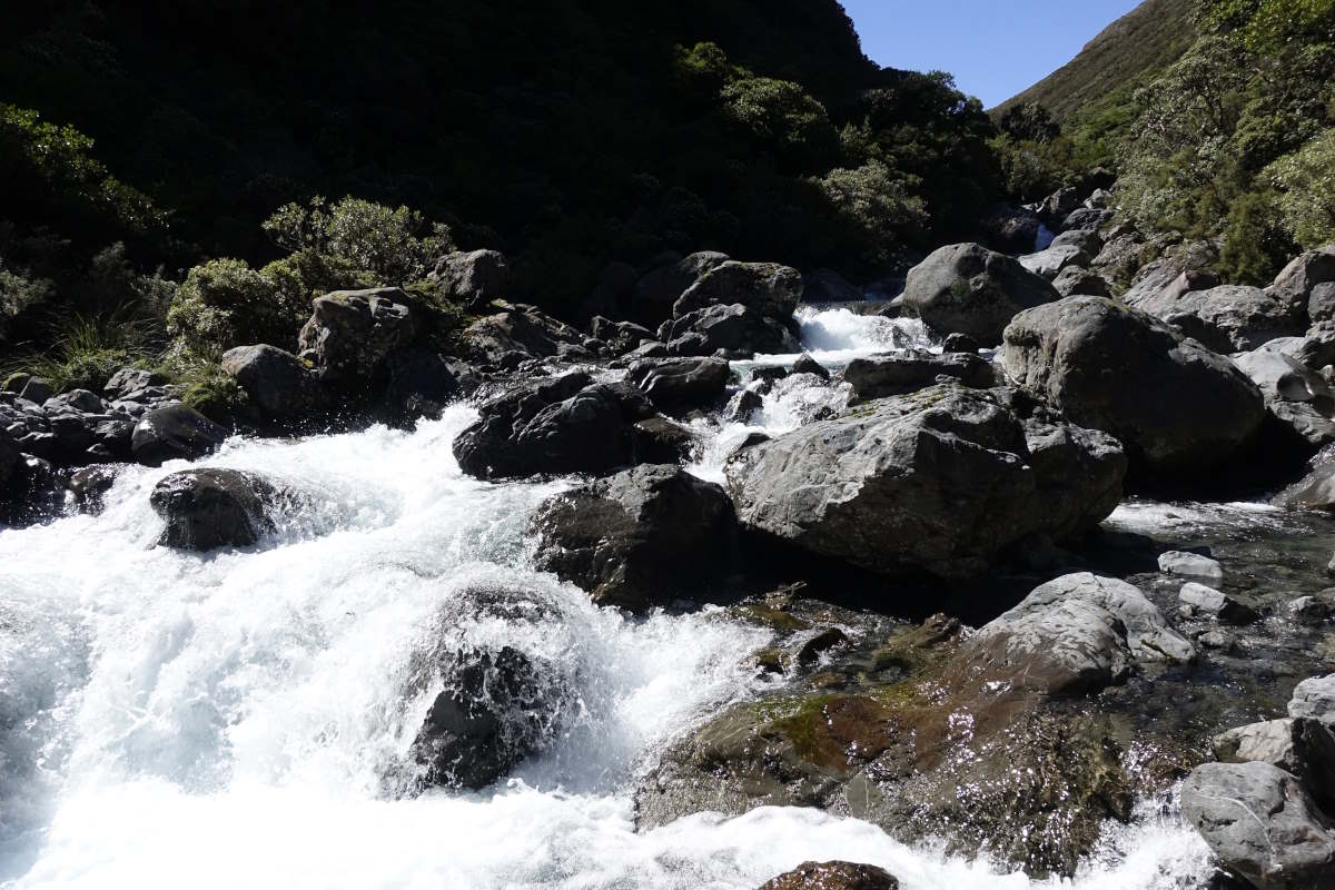
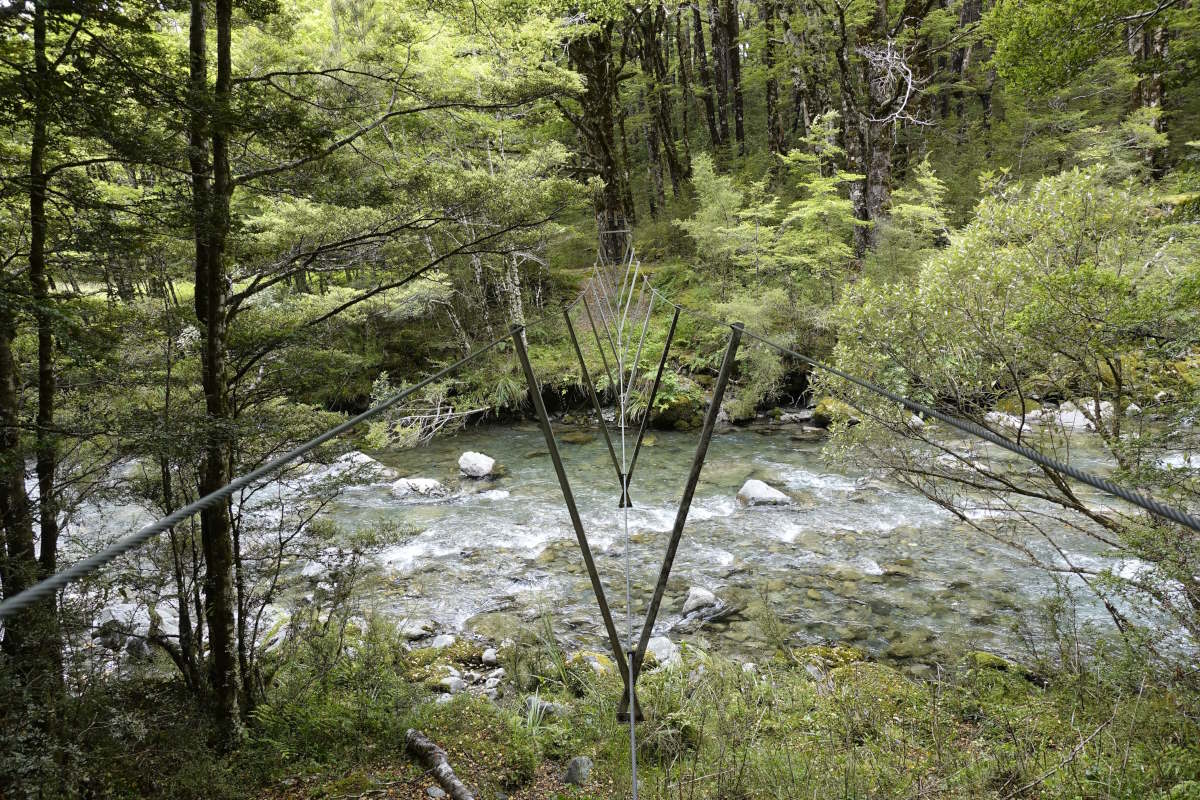
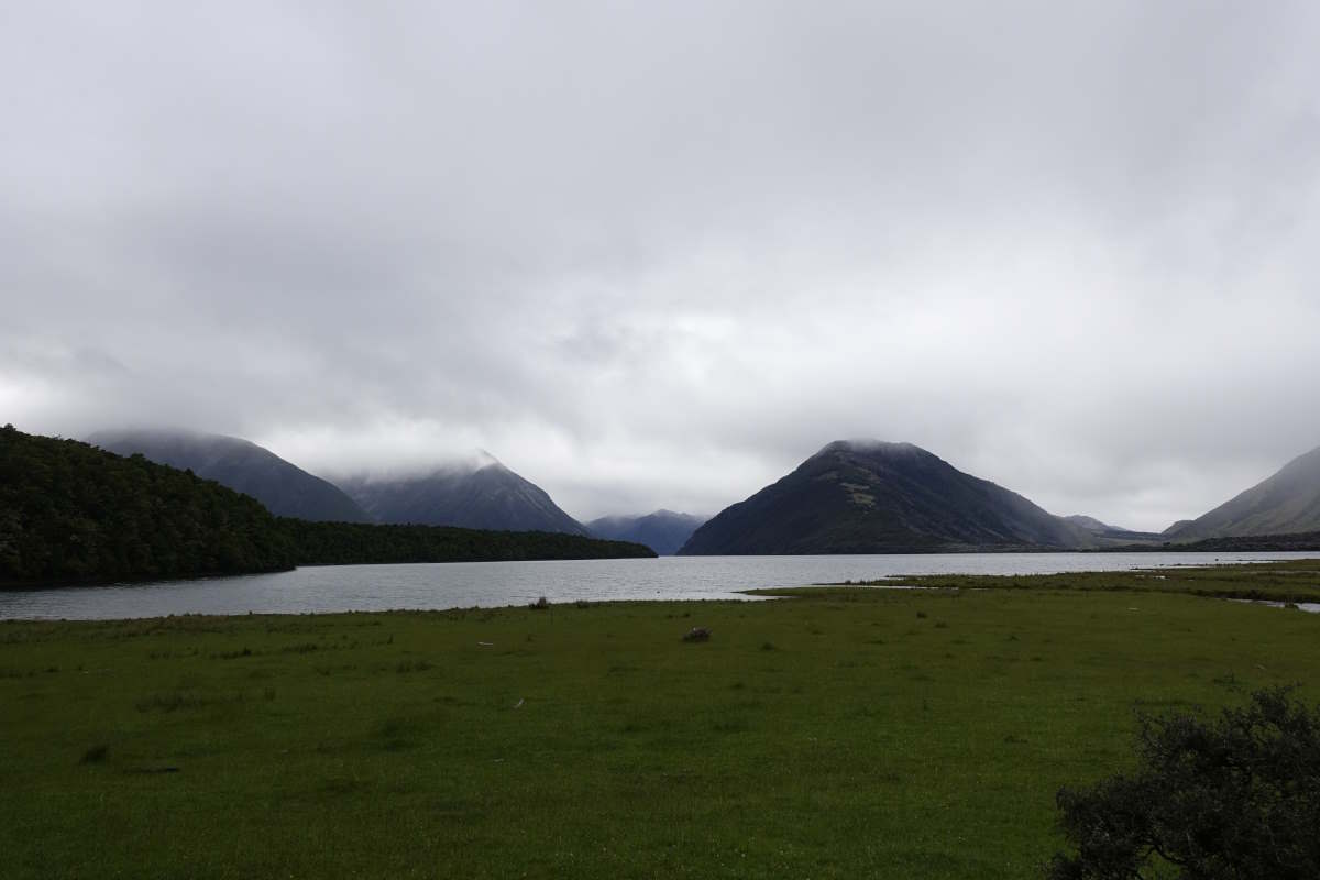
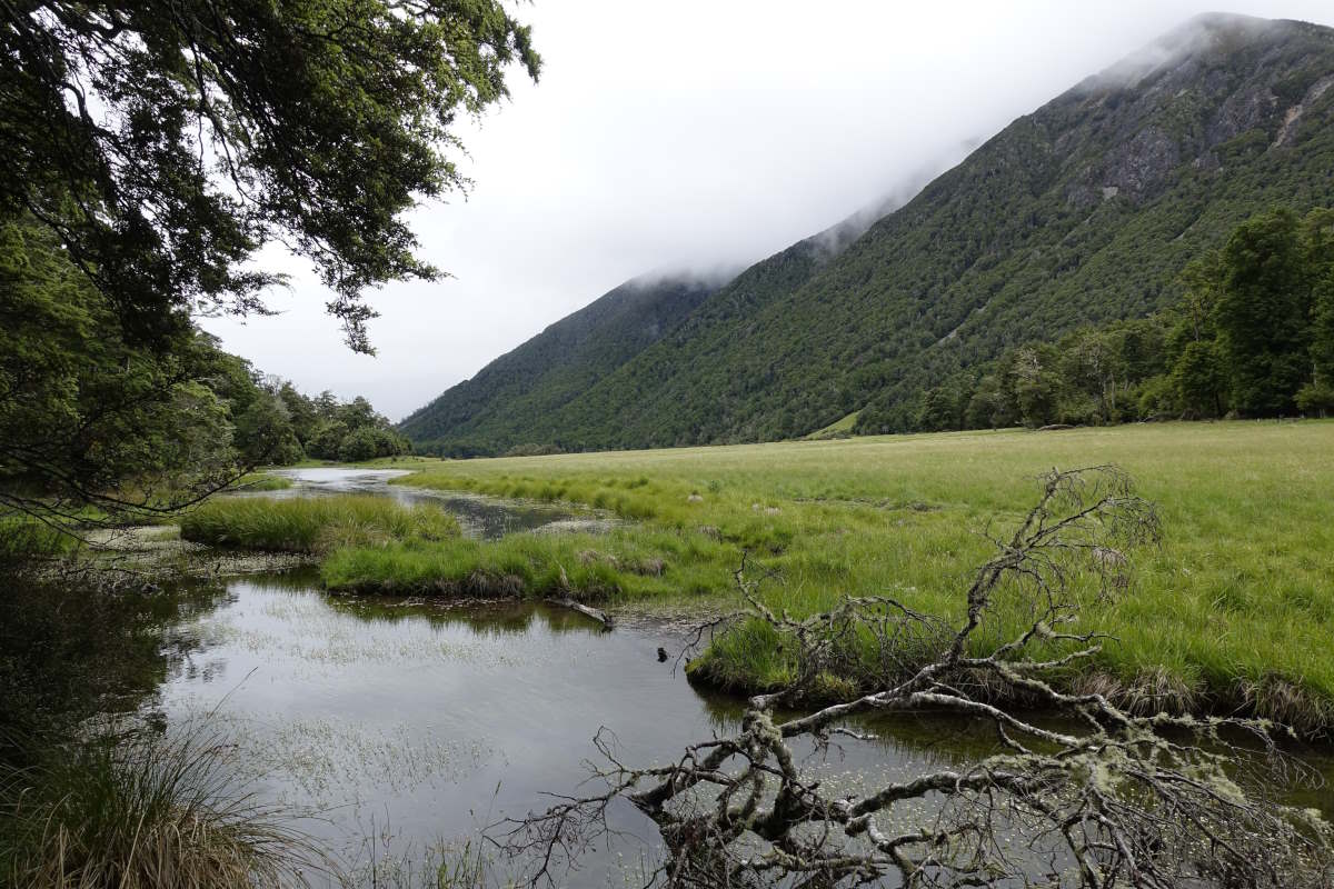
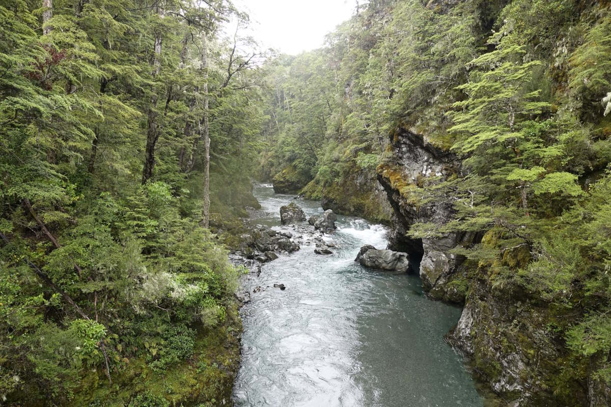
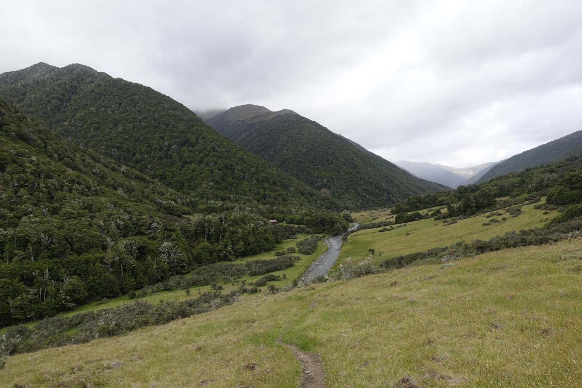
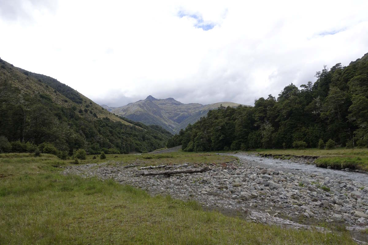
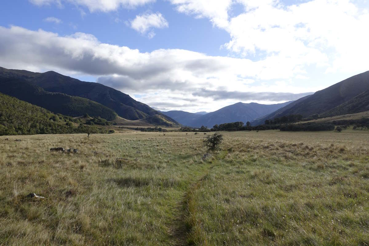
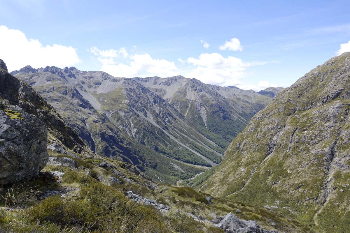
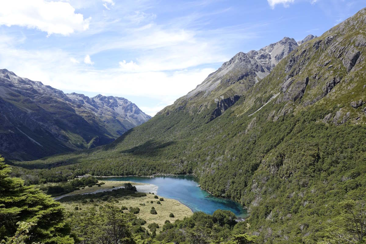
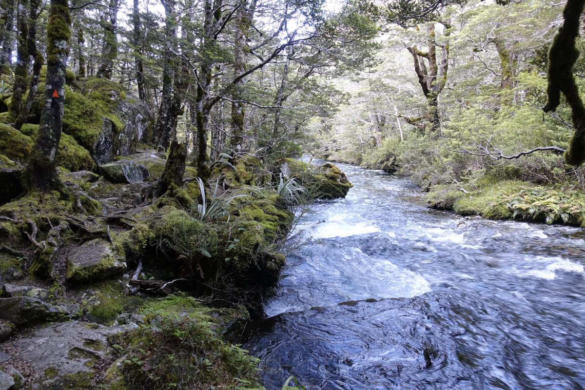
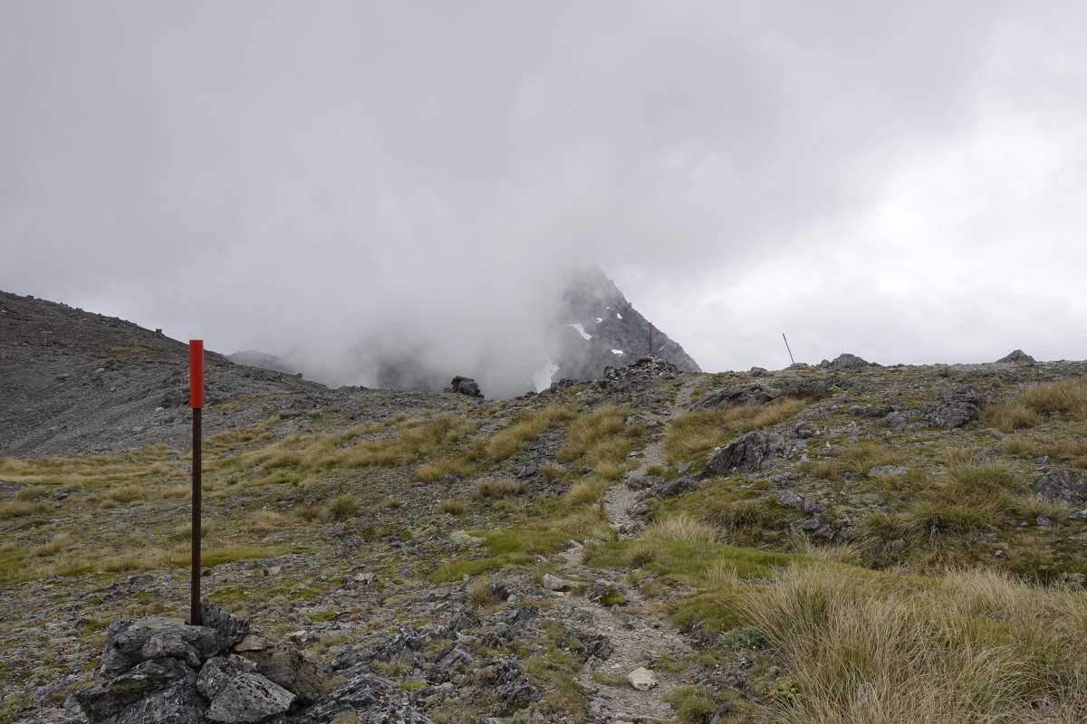
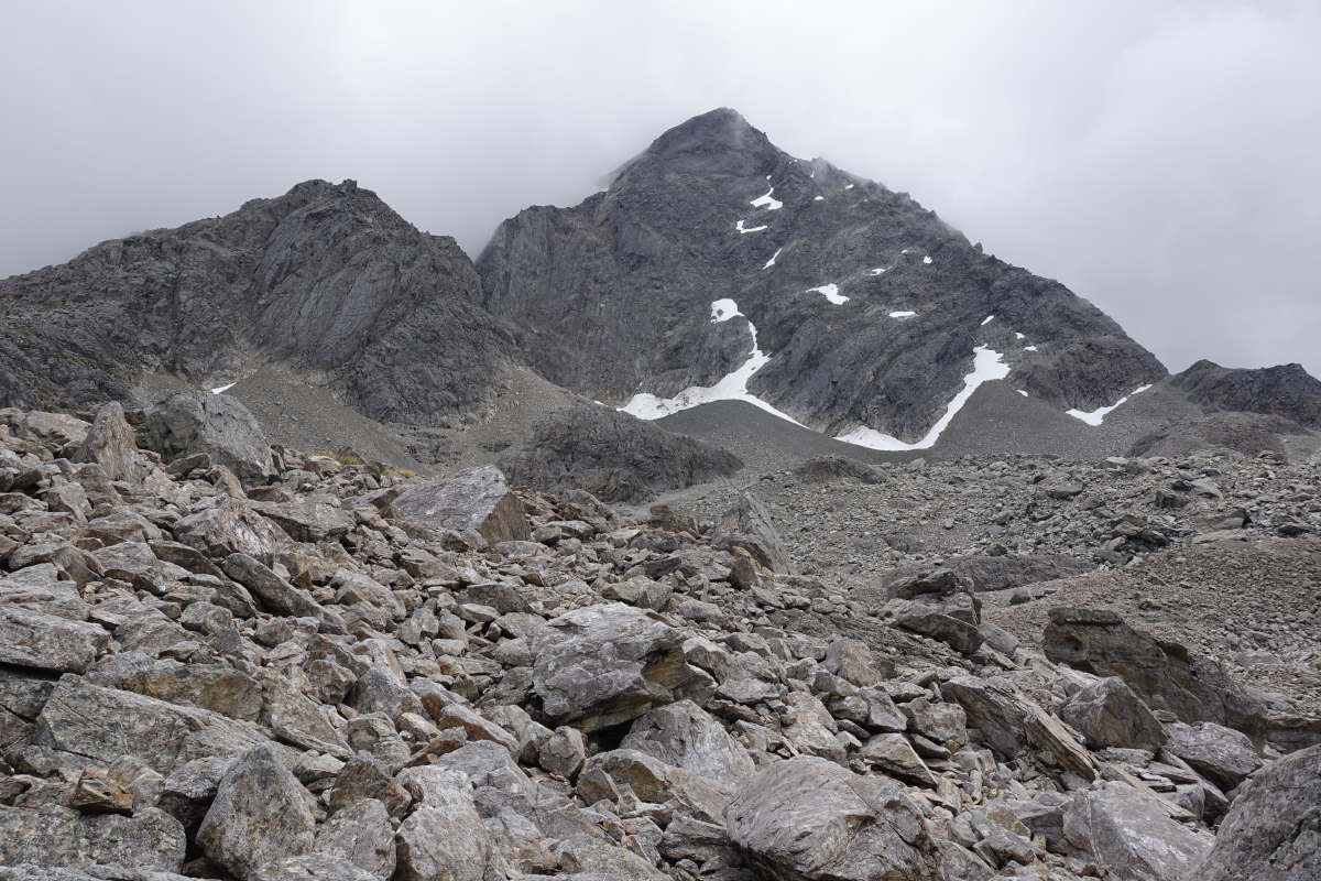
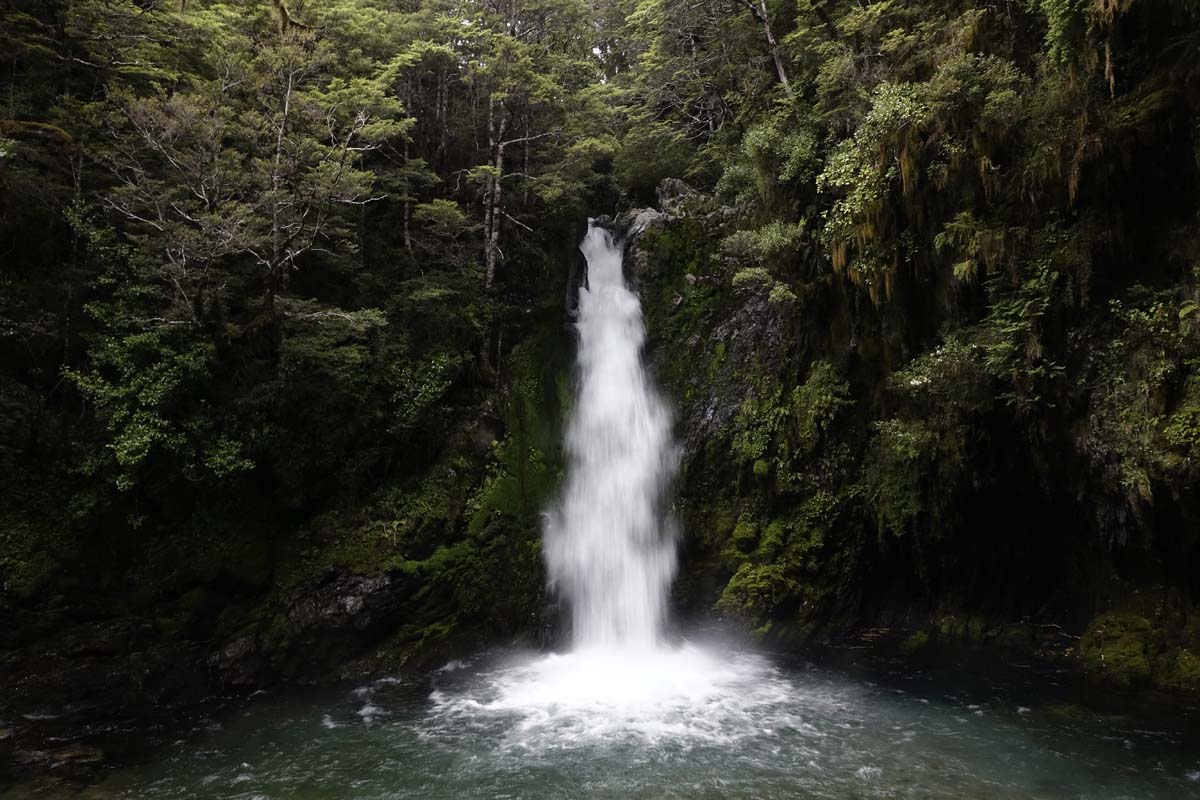
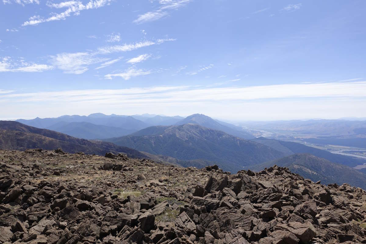
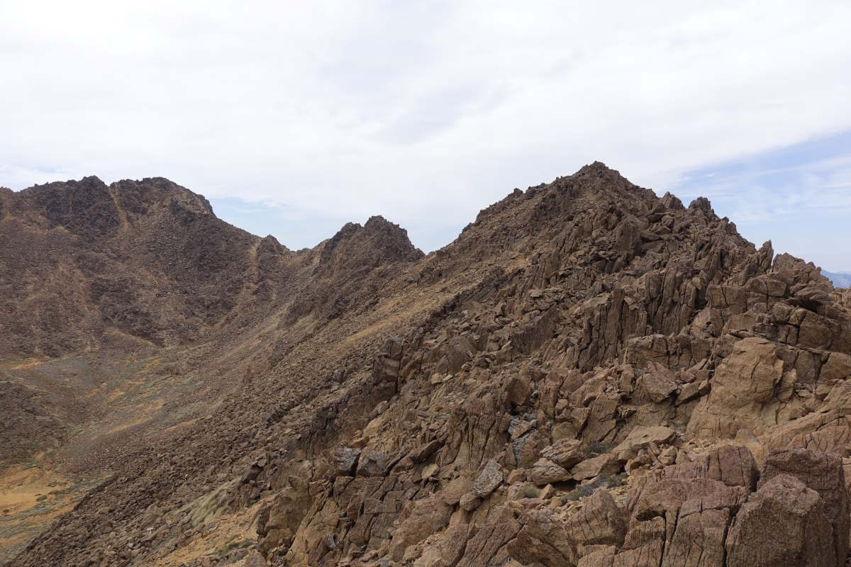
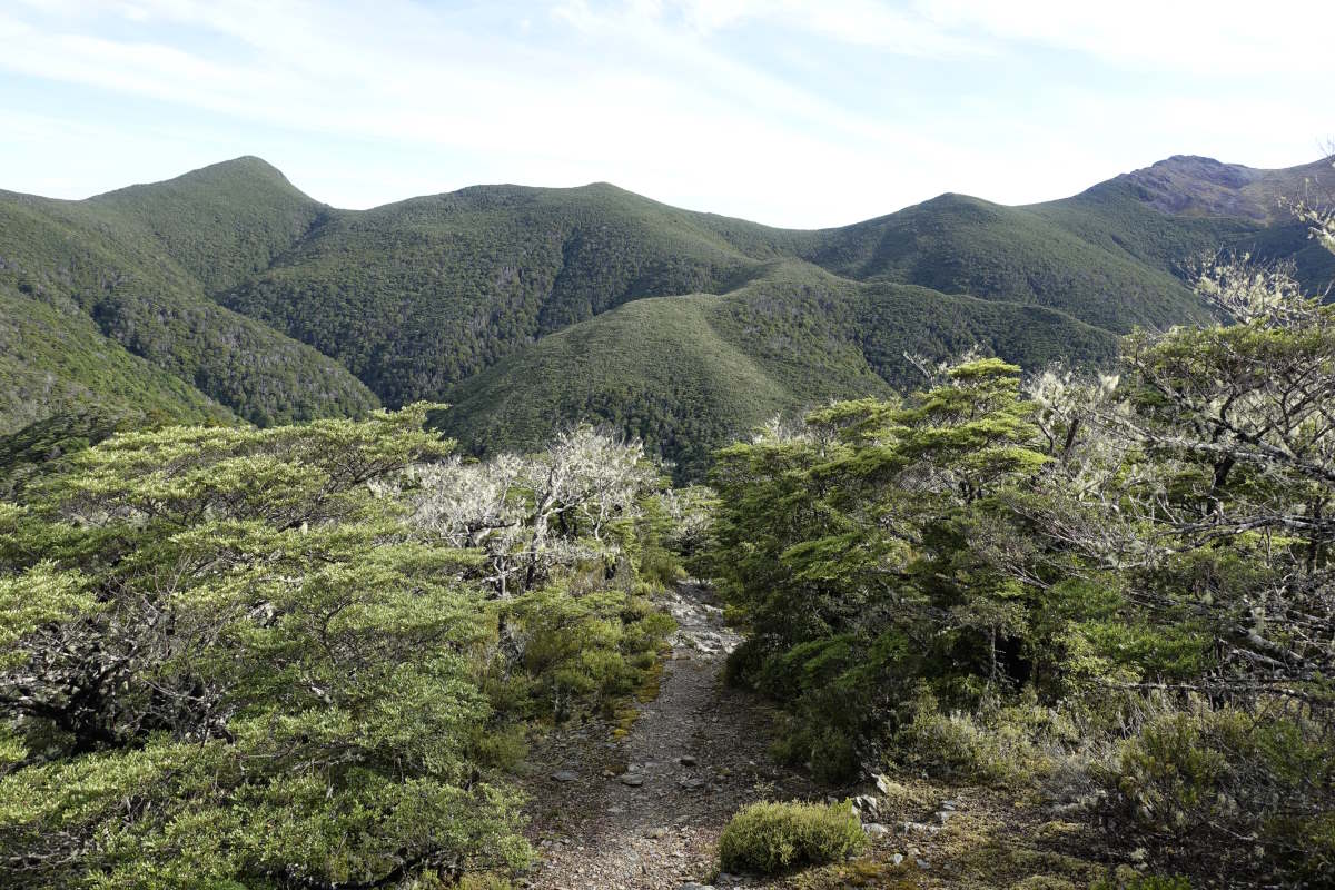
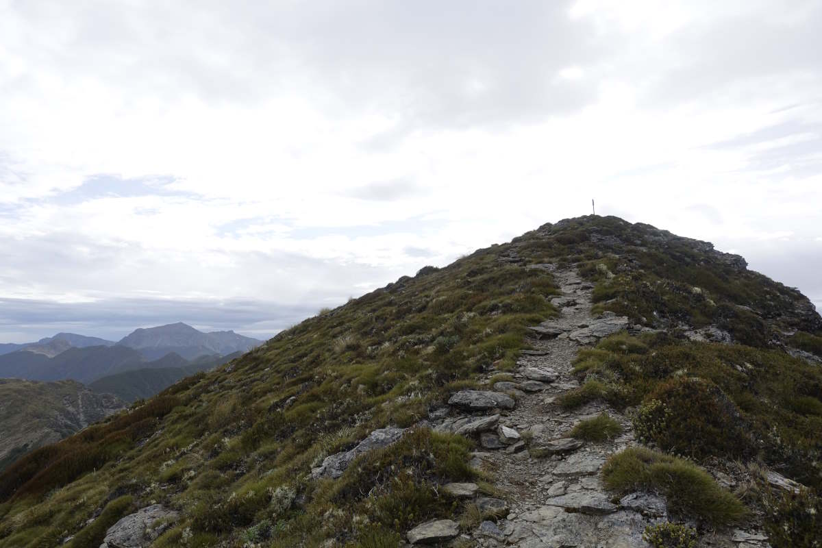
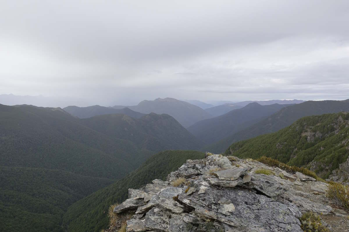
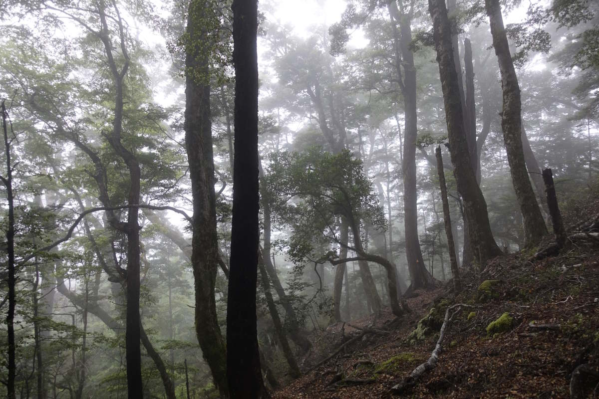
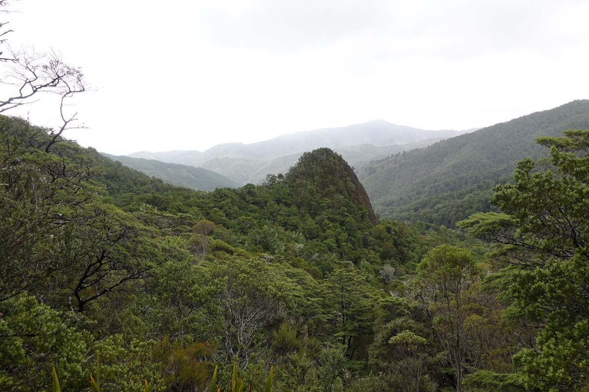
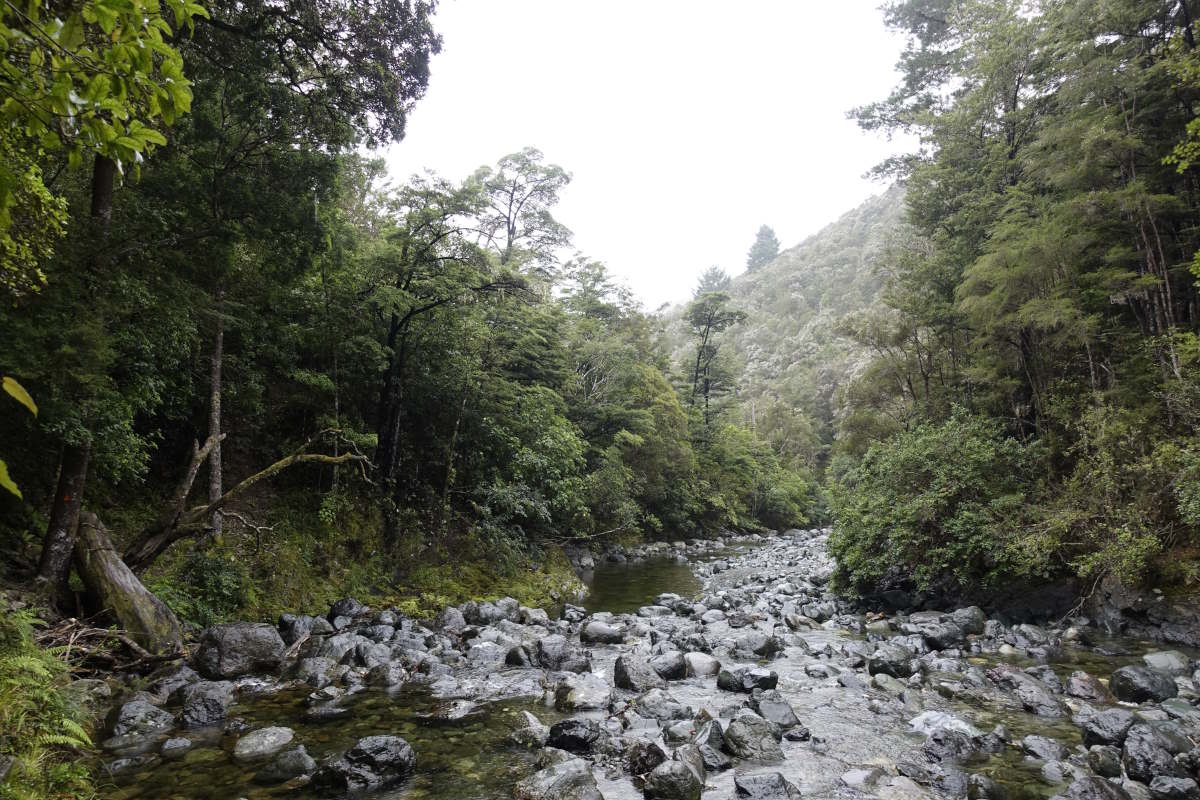
Day 42 (14km): I dream about rivers that are going so fast I can’t even see the water to work out what sort of walking pace it would be. I wake frequently, sleep fitfully. Rain drums loudly on the metal roof. At 6am I decide I’m being stupid. There’s no way I’m getting down the Deception River tomorrow, so why bother spending today walking up the Mingha in yet more rain? I don’t want to let Tom down but I’m on the verge of pulling out when the rain stops and Charlie appears at the window to say he’s been having major (but opposite) doubts and wants to come too. So we’re going for it? My hitching luck seems to be running low and we end up walking 4km down the road back to the trail. The Bealey runs alongside, quick but not overly terrifying in appearance. The marked crossing point is deep but with a bit of searching up and down the bank we manage to find a great diagonal spur of gravel and make it through with only soggy knees. It feels great to be over our first obstacle and that just maybe Plan C (walking all the way back out to here again and hitching round) having already failed plan B (eat all the food and wait) may not be necessary after all. A chink of blue opens in the clouds and then in complete contrast to the forecast the sun comes out and shines brightly on us all the way up the valley. It’s beautiful. The air is crystal clear and cool and the valley filled with lush rainforest; a wonderful contrast after weeks dominated by dry grasslands and beech. We follow the Mingha, winding our way up stream. There are a few pretty full crossings but I get to buddy up with Tom and, after spending some of my sleepless night swotting up on river technique, it’s all feeling ok. Plus I now have the bonus of being the short one and getting the easy downstream position! The bottom of my rucksack gets a good dunking but I’m feeling safe, and well protected from the main strength of the current. And also a bit dependent. And small. And very aware that the others could both do this alone just fine and I probably couldn’t. But what is there to prove? I’m not going to impress myself or anyone else by getting into a mess and needing rescued. We make it up to Goat Pass hut quite early and sit around soaking in the sun and the amazing location. I think it’s my favourite hut so far. Then Tom and I set off for a little side quest up to Lake Mavis which is reputed to have perfect turquoise waters and an even better view. We’re about 20 minutes up a steep and pathless hillside when I glance over my shoulder and spot an enormous black cloud advancing up the valley towards us. We rapidly conclude that Lake Mavis’s perfect waters may not be all that turquoise or tranquil after all and run back to the hut, making it just as the heavens open and the thunder rolls in. Forks of lightning dazzle the darkening hut and the thunder reverberates through the floor making our whole world shake. We exchange nervous glances as the rain pounds down on the roof and new streams spout from the hillsides around us. Day 43 (13km): The morning dawns clear and bright. I shuffle around the hut wrapped in my sleeping bag, watching my breath rise softly through the still air. We get a late start, because every hour that passes might make the Deception a little bit more passable. Also it’s absolutely freezing and none of us can face the idea of standing in cold water before the sun is on our backs. Onwards and downwards we are plunged straight into the water, the track and the river being basically the same thing. It’s high and fast and achingly cold. My feet are transformed rapidly into blocks of ice; numb and clumsy and invisible in the rushing water. Movement is slow. We clamber awkwardly over and between boulders, descending step by step into a lush green valley filled with ferns. Kia fly overhead, their underwings a flash of red against a clear blue sky. Gradually the sun gains heat. After two hours we reach Upper Deception Hut, just under 2km from our start point. We are the first people to write in the book in 6 days. We take a break and reflect on progress. None of us are expecting to get out today, the very last crossing being apparently the hardest, and one option would be just to stay here tonight but we’re managing ok so far. We decide to go on, and hope we can find a camp spot wherever we grind to a halt. On again, the path starts to separate from the river and there are sections that we can clamber awkwardly through bush and avoid some of the crossings. We’ve just finished posting ourselves and our rucksacks through an awkward hole between the top of a boulder and the branch of a tree when we meet three runners coming up towards us. Surprised by their presence we ask about the depth of the final crossing, to which a woman who is distinctly taller than me gestures to her upper chest. Yikes. We carry on. It’s slow going but so beautiful. The sky is a perfect blue and the rocks of the lower valley coated with a bright red lichen, creating a vivid other worldly appearance. As the crossings widen we link together as a three - getting in some practice before the big one. Every time we pass a bit of flattish grass we breathe a sigh of relief that we could camp here, and not have to retreat further back. Eventually we reach the final crossings. There is a couple camped on our side - waist deep they say, but fast, and touch and go. We go and take a look. It looks pretty intimidating and we contemplate setting up tents and waiting for morning but none of us wants another night dreaming about rivers. And there are three of us. After a while we pick a line that looks ok - a good diagonal with no obstacles and fairly consistent depth. We link up and set off. Within a few steps the water is approaching my hips. It is so strong. We do some mutual wobbling and the commentary runs something like: All OK? OK. Nope, wait up there’s a rock … OK. Wait, not OK. I got you, wait wait wait, rock … I'm ok. No, hold up, not OK. Argh. Oh no oh no, no not OK not OK. Tom, upstream, is suddenly facing towards me, twisted round by the current, the full force of the water now catching my exposed back Retreat? No I'm slipping. I'm stable I got you. Oh god, no no no. Got you. Let's go back. We shuffle back to the safety of the bank. The far side is distant and mocking, and we had really only entered the shallows. We go look further downstream but it’s all the same. Then wade down the edge where the water erodes the bank, wondering if it’s possible going with the flow to avoid the crossings completely. It’s not, but there’s a slower bit - deeper but not as wide and you can see the bottom clearly. The water is a soft clear blue and looks so harmless, and the other side so tantalisingly close that almost without voicing it we link up again, step forwards. It’s strong, but not as fast. Over my waist. Hold tight. Keep moving, keep moving! No time for hesitation. Shuffle, shuffle. The ground rises, and there’s a huge smile on my face. We’re still deep in the river but already the flow is less. YES! I’m laughing with the exhilaration. And we’re across!! We pitch camp, it’s 6pm and we’ve taken 9 hours to cover 13km. A solitary weka wanders innocently around the tents looking for interesting objects to nick. I shoo it away, fall into bed exhausted but with a stupid grin still stuck to my face. None of us could have done that alone.
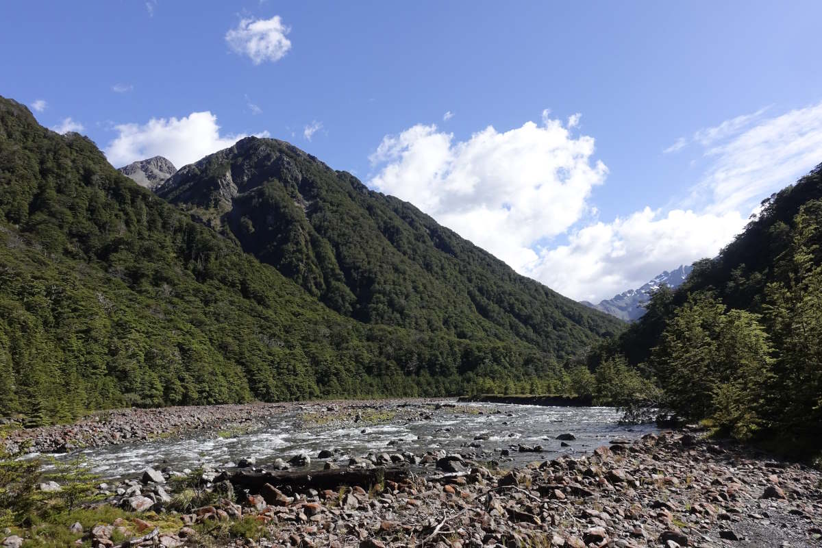
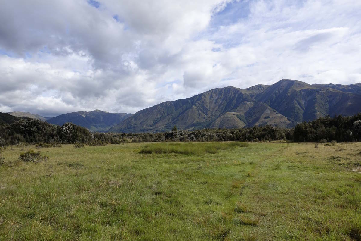
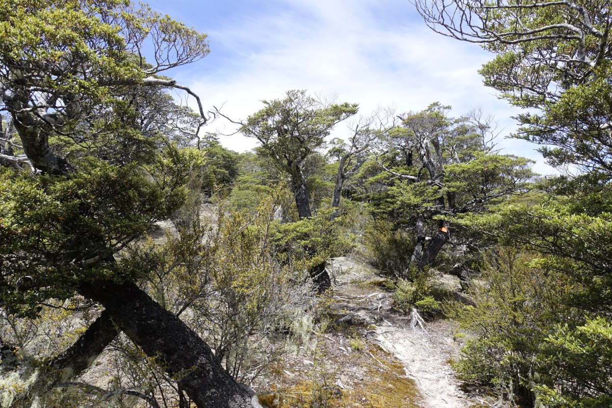
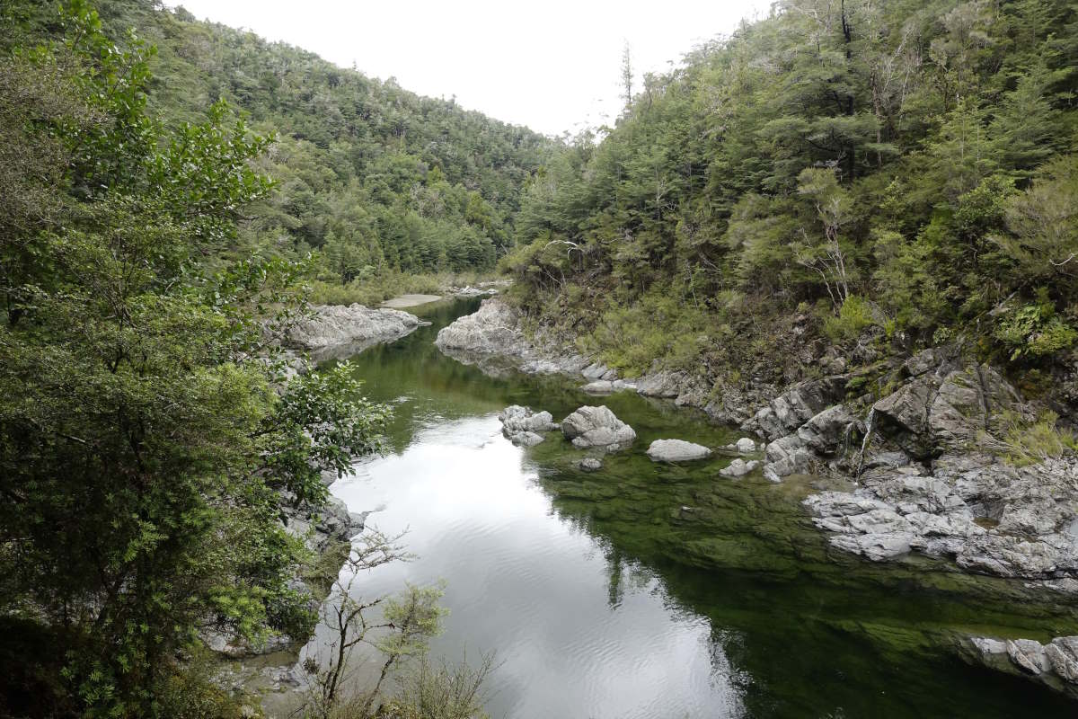
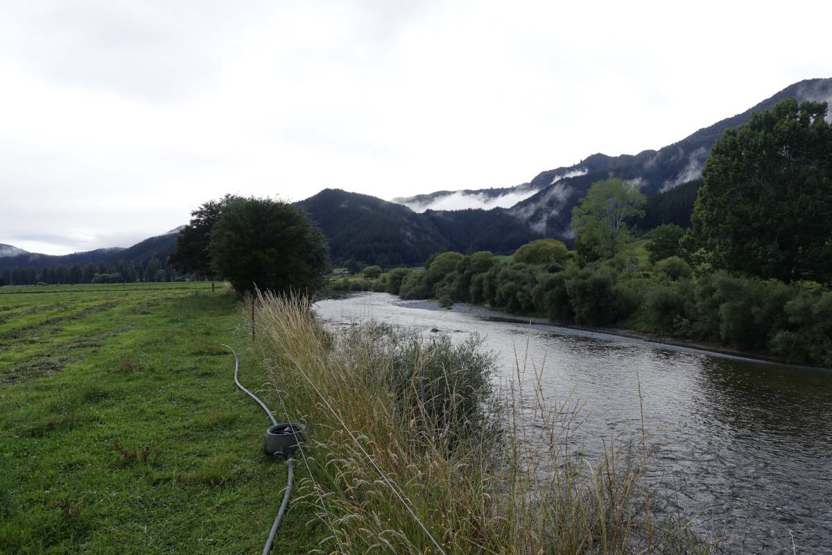
Mingha River Valley
Mingha River Valley
Charlie leading the way
Tom on one of many crossings
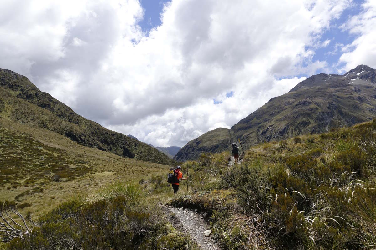
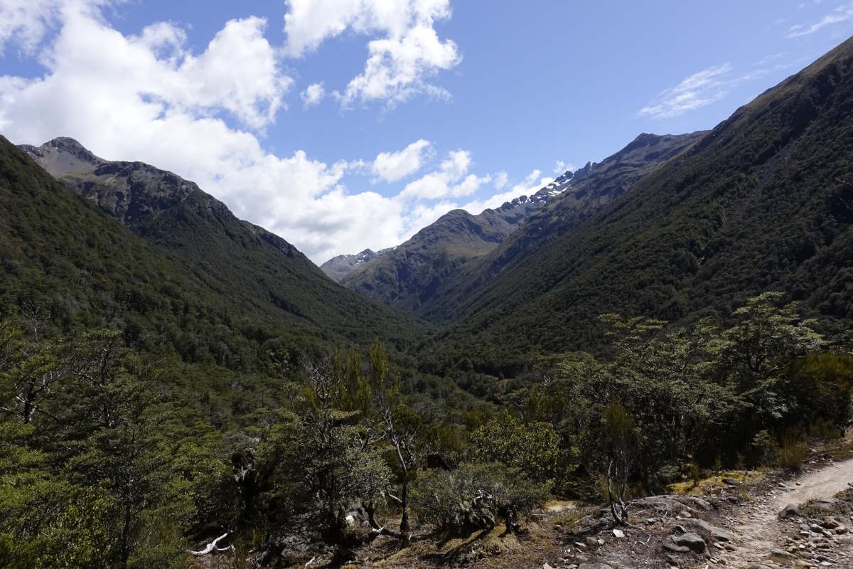
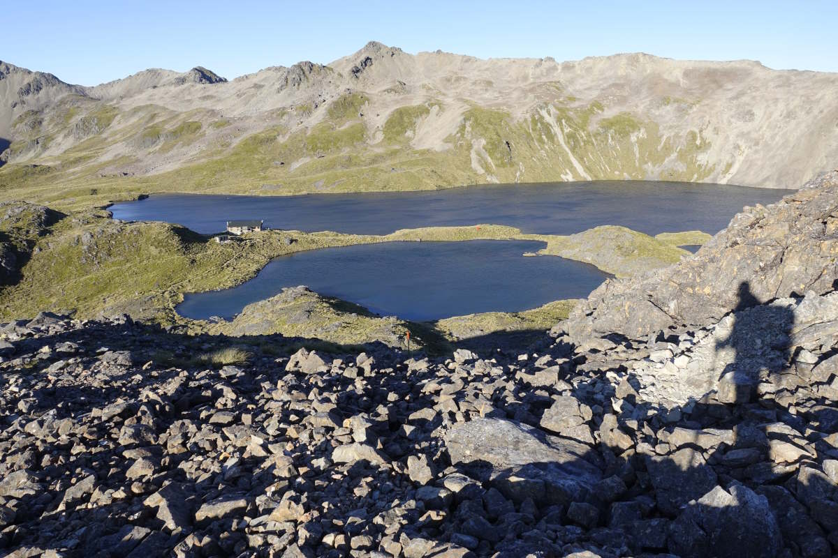
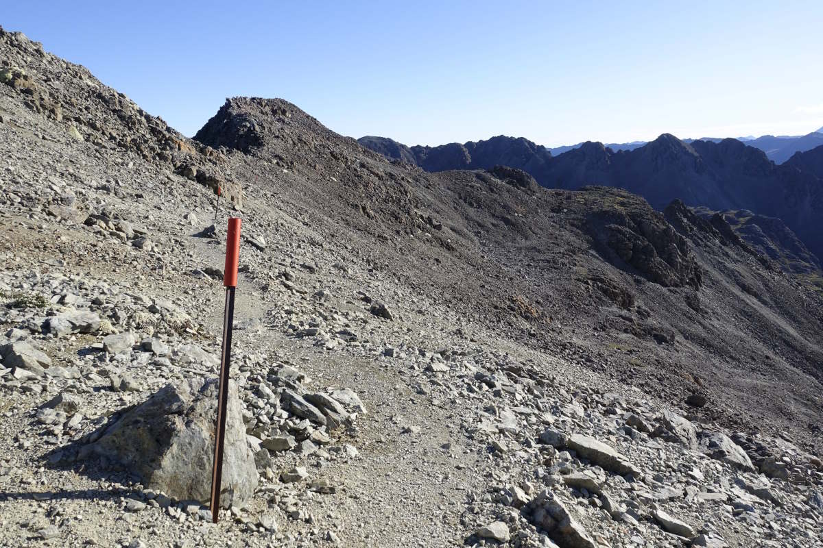
Aproaching Goat Pass
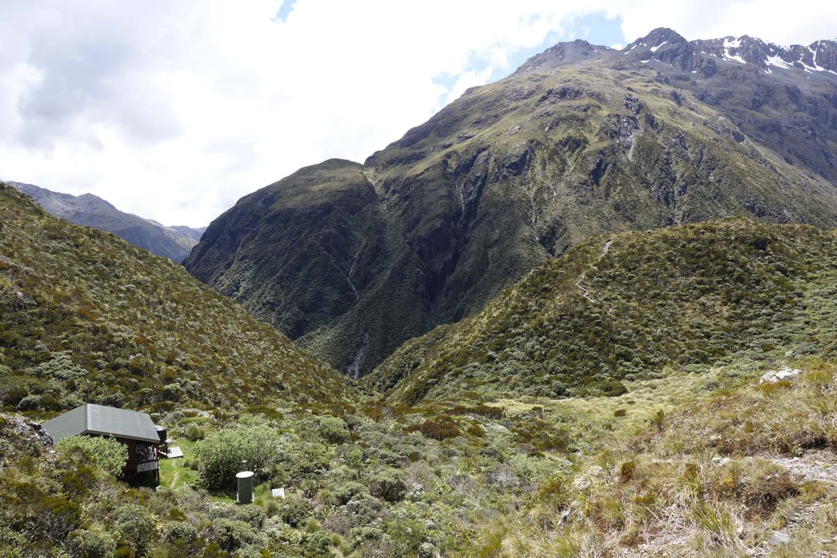
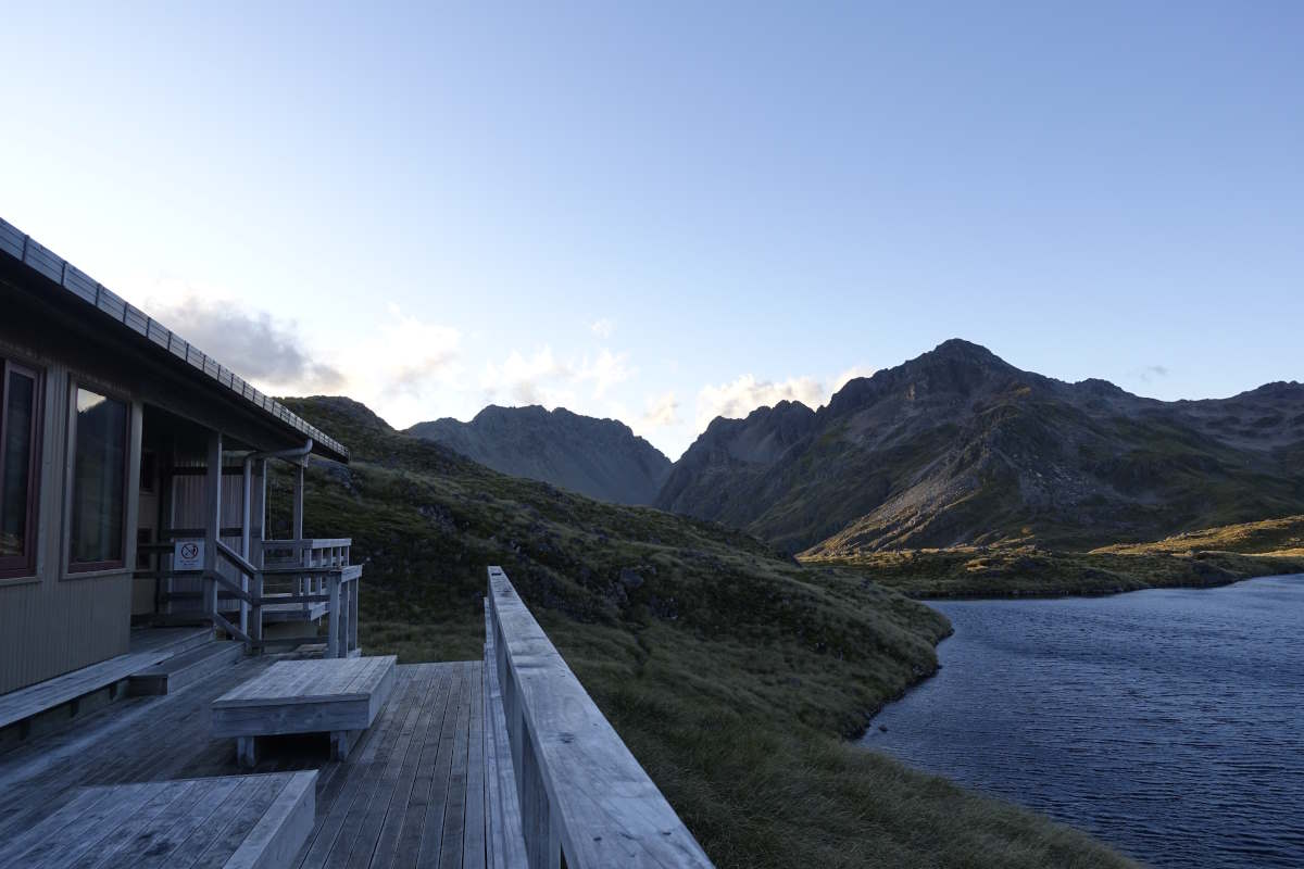
Goat Pass Hut
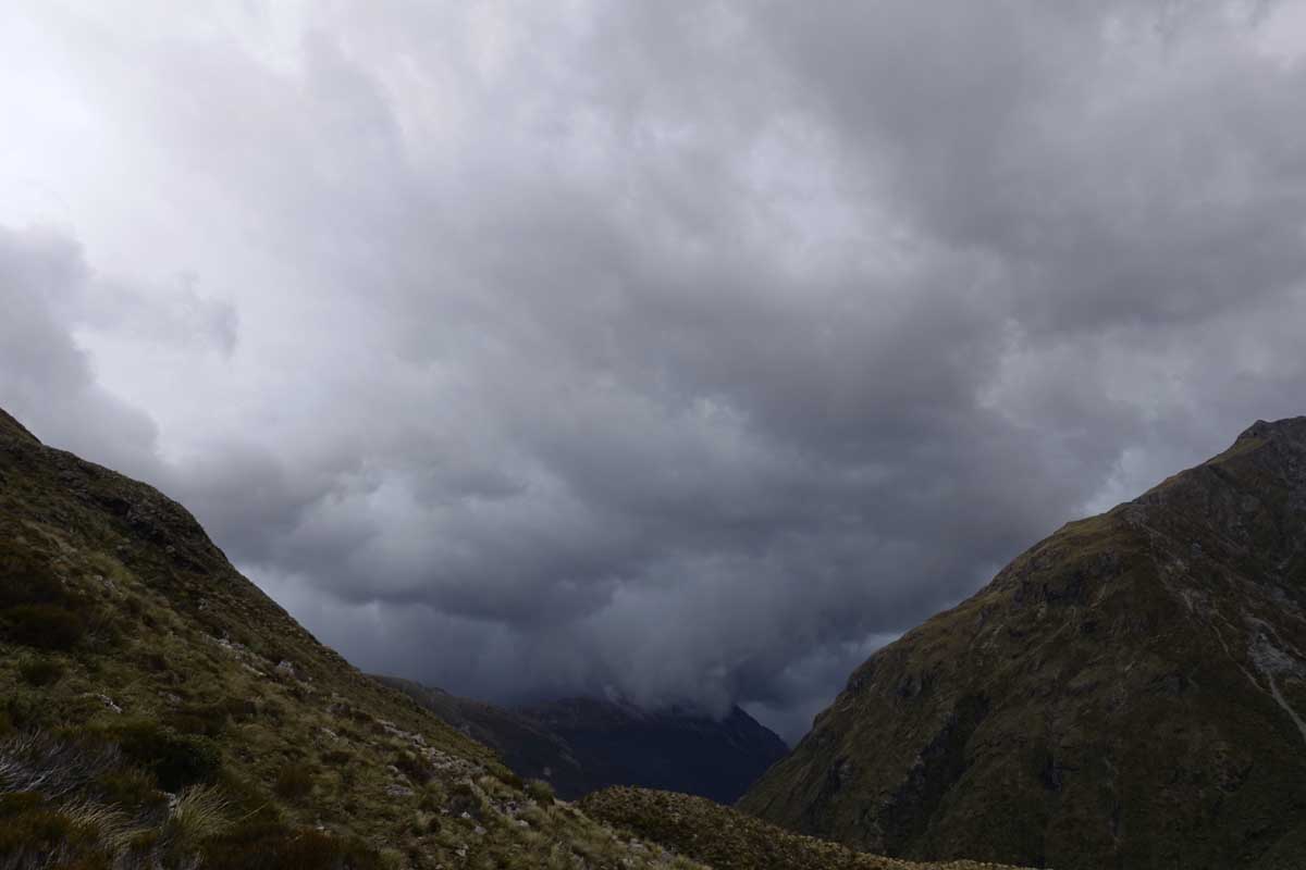
The storm approaches
Setting off straight into the Deception River
A brief moment of terra firma
Slow progress
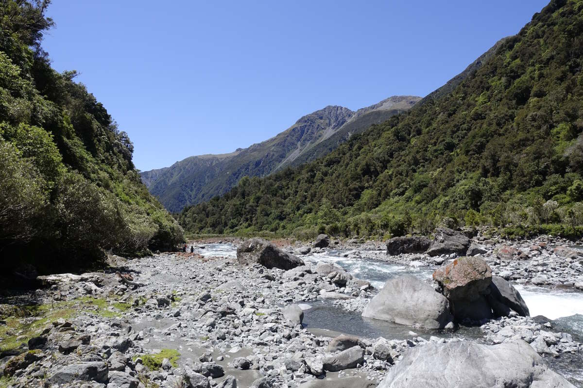
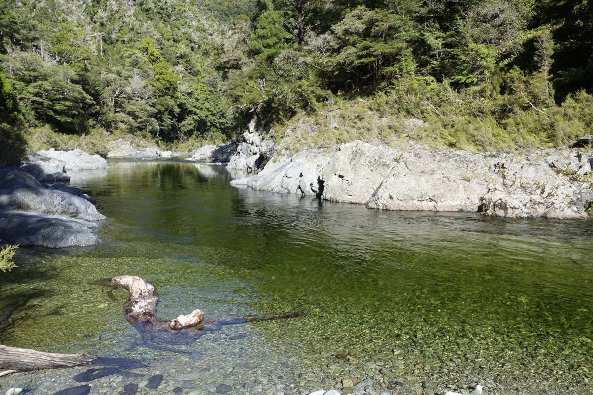
The lower Deception widening out
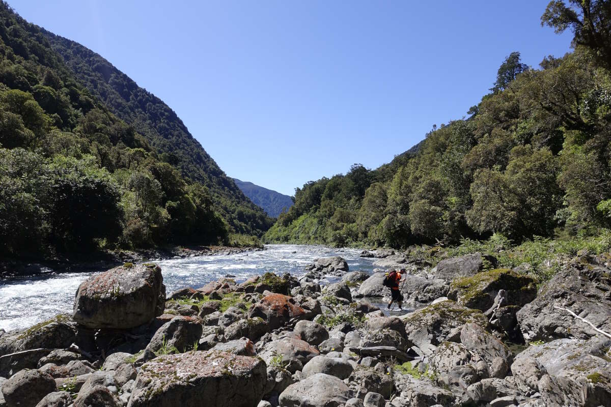
Getting close to the end
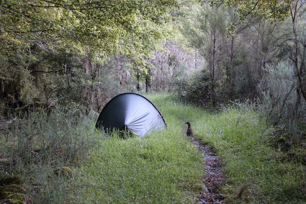
An entirely innocent weka wanders through camp
Morrison Footbridge to Halfway Hut
Harper Pass/Hope Kiwi Tracks, 68km, 3 days
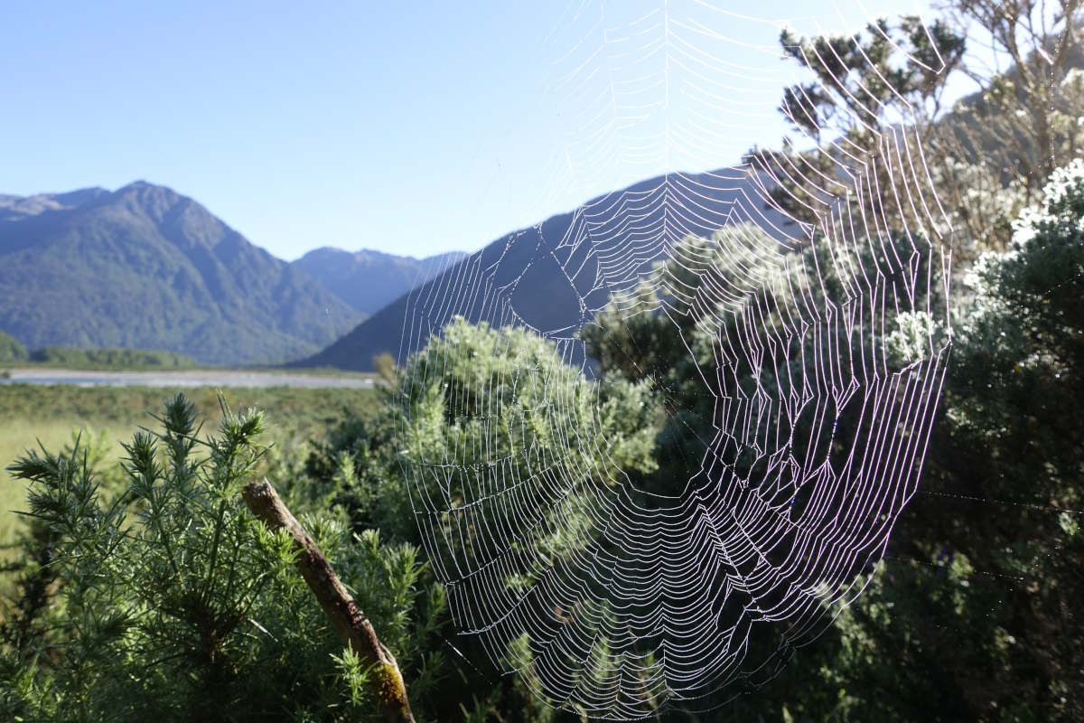
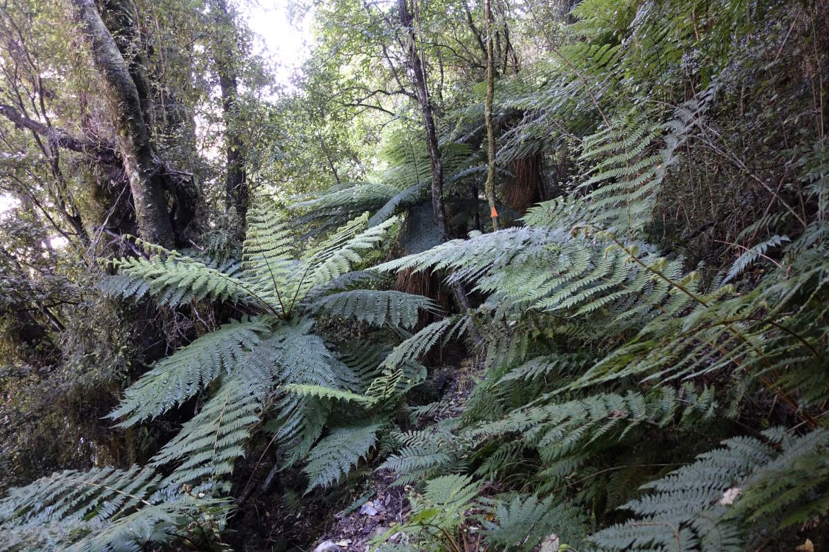
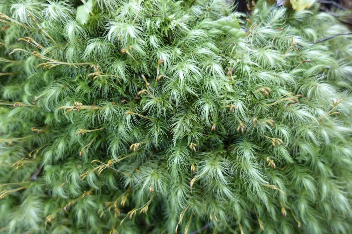
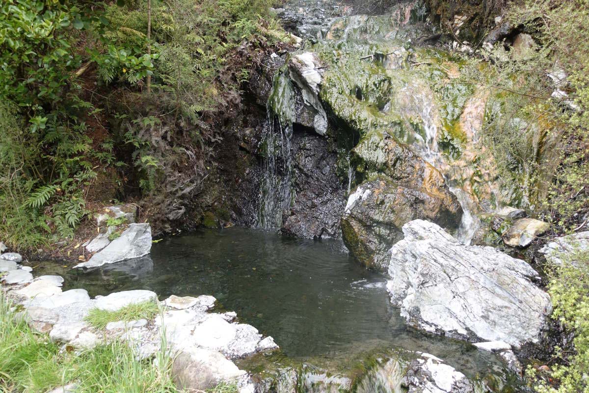
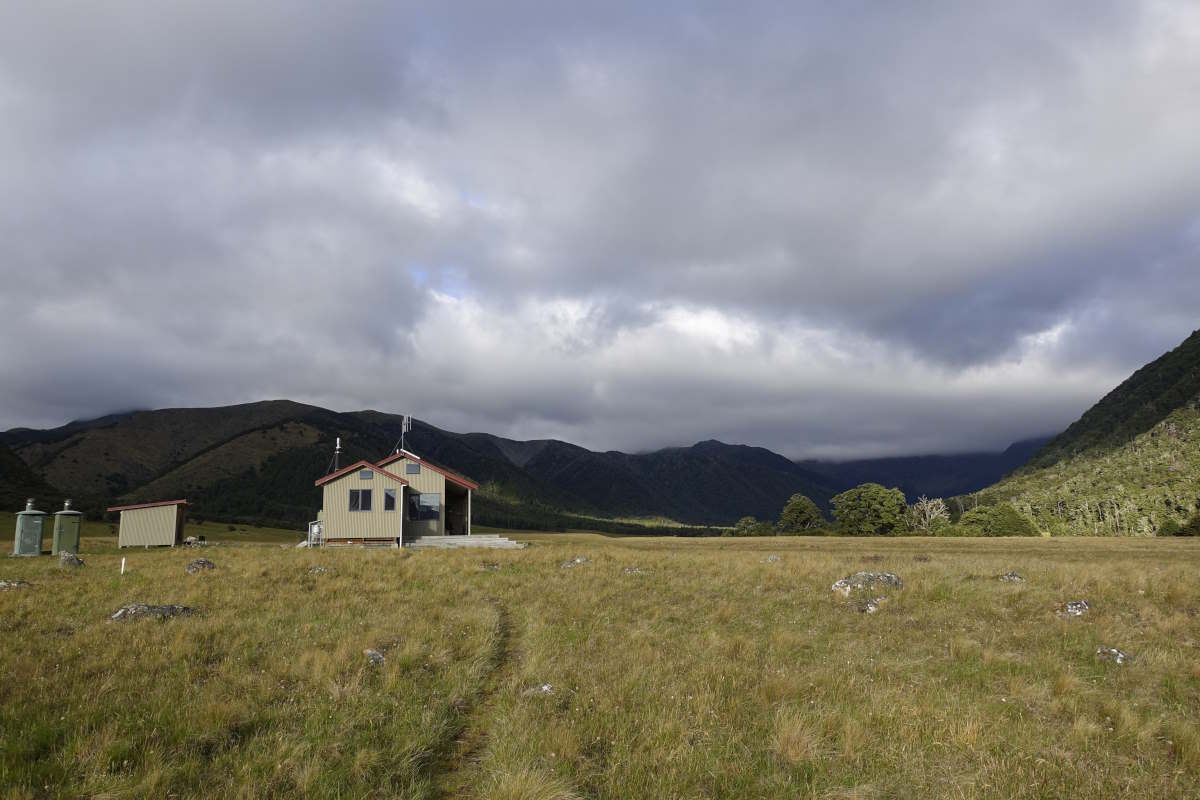
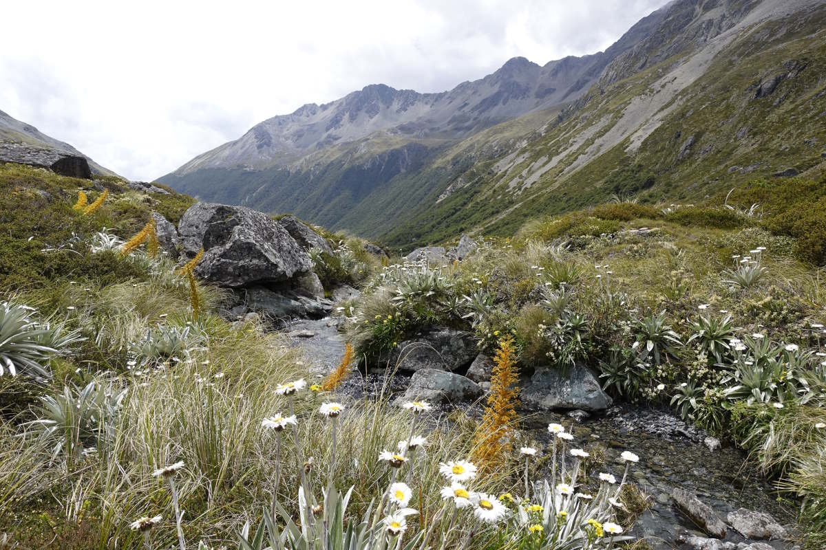
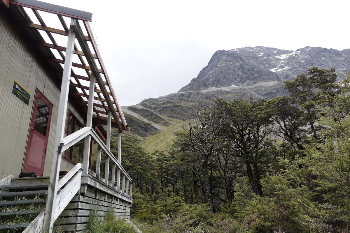
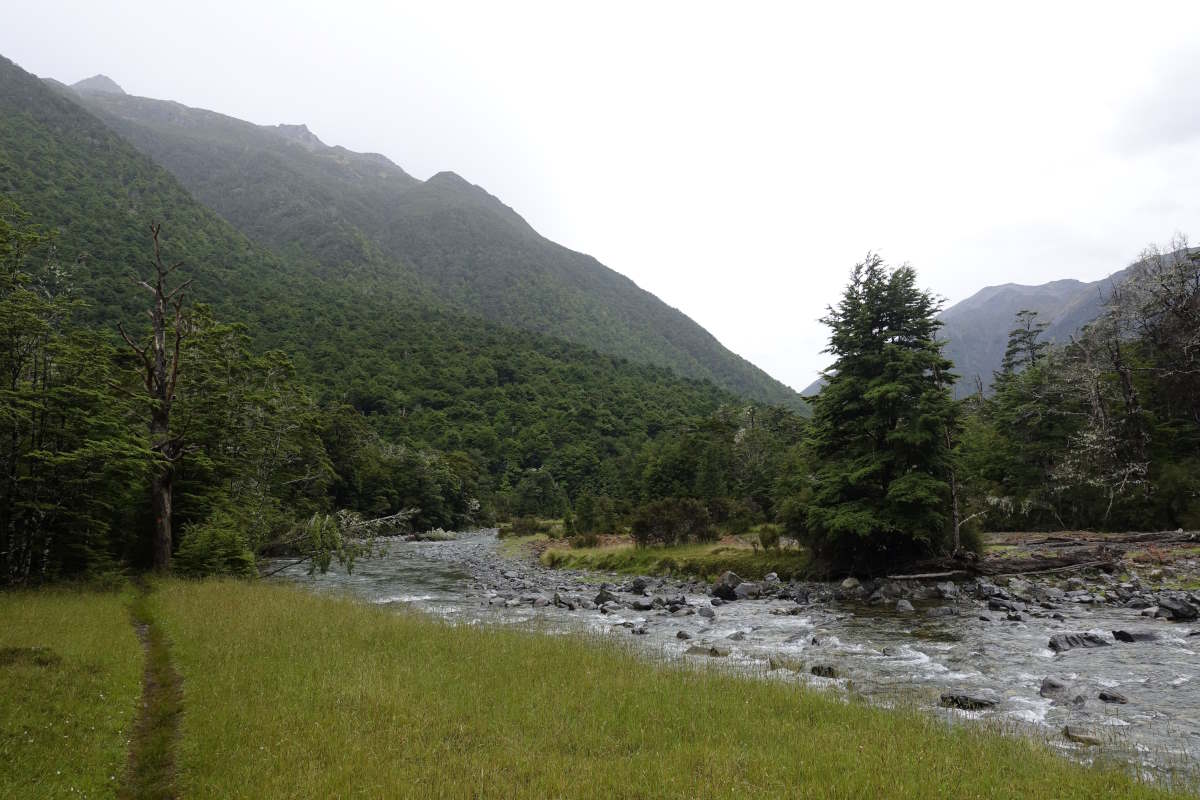
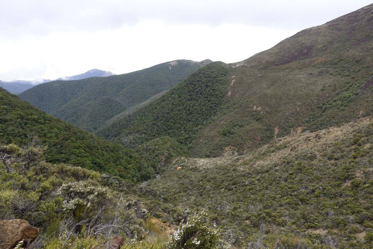
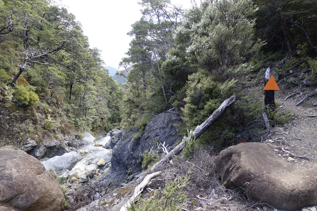
Day 44 (21km): The weka is back. I’m enjoying breakfast in bed when it presses a curious foot up against the outer fabric of the tent, probably wondering where the interesting smells are coming from. I give it a high five which causes brief panic but it’s back again as soon as I set off, casually meandering around the flattened grass which (much to its disappointment) is all I’ve left behind. I’m the first on the trail, breaking a line through the dew and spider webs as the sun rises into another perfect blue sky. The trail winds through forest and, having had the camera packed away in multiple dry bags for most of yesterday, I enjoy stopping and taking huge numbers of photos. I meet more weka; two adults who are grunting away softly as they hunt for food and then a youngster wandering casually down the trail towards me. It gets within two metres before actually spotting me and then running away clumsily with a peep! peep! I can see why these birds are endangered… The trail carrys on, winding up and down, and the forest continues to be beautifully distracting so that after an hour or so when there is an open view of the valley I have to laugh at how little distance I have covered. After a while I reach today's river crossings. Charlie is patiently waiting but on inspection we decide it actually looks OK, and agree that if I can get across solo then we can leave Tom to make his own way. We find a good line at the top of a braid and it’s mid thigh and fairly quick but despite this actually feels smooth and fine. I got this! I know that just a few weeks ago I would have been really nervous about something like that and am proud of myself that I’ve come a long way since then. The next crossing is easier and then we’re at Kiwi hut. I enjoy a second lunch and wave Charlie on ahead, confident that I can make the rest of the crossings alone. I carry on. More river crossings and more weka. Then the trail sort of disappears. The notes say just find your own way, so I do. I’m feeling uncreative and take a straightish line down the middle of the valley and just cross the river every time it gets in the way. The ground is covered with thin long grasses hiding a carpet of stones. The sort of thing that on a look ahead appears really easy but then actually takes a lot of energy to navigate. I’m stumbling along in a not very straight line when I come to the sudden realisation that I’m absolutely exhausted. I stop to remove yet more stones from my shoes (which are perpetually full of gravel from the river crossings) and it’s 20 minutes before I can bring myself to get up and go on. Eventually there are markers again, and the line of a trail. I trudge the last few km to the hut, which appears very abruptly out of the trees, and lie flat on my back on the porch. I’m so happy to be done. Day 45 (24km): Despite a good night’s sleep I’m still feeling pretty tired this morning and note my intentions in the hut book as “a hut north of here, however far I get”. There is plenty of choice! I climb gently up to the pass, watching the forest change from fern filled rainforest to moss covered beech. Downwards, the cloud starts to roll in leaving the sunshine behind. I make it to Harper Pass Bivy for a first snack break and find that I’m actually making progress in time with the guide and the DOC signs which hasn’t been the case for a while. Maybe last night's double dinner helped. I meet a pair of South-bound walkers who tell me that about 20 people ahead of them ended up turning back and skipping this section because of the rain, which explains why the huts and trail have been so empty. I drop slowly into the valley, the trail becoming easier as the day goes on. At 2pm I’m at Hurunuri 3 Hut, which I strongly consider stopping at but I know Charlie and Tom are planning to go further and I’ve been enjoying the evening company. Onwards then. The trail climbs the side of the valley, hugging the edge of the trees to avoid the river plain. Then there’s a little sign “Hot Pool 100m” pointing off to the right, though following your nose would also work. It’s awesome. Steaming, sulphury water trickling down the hillside collecting into a wide shallow pool, the rocks beneath coated in a million colours of slimy fronded algae. Perfect for a dip! There’s a large sign saying don’t get the water up your nose or you might die of amoebic meningitis, but I decide if death was actually likely it would instead say don’t get in. I enjoy a blissful 20 minute soak until everything goes very wrinkly, followed by the fastest clothes change of my life to escape the dark cloud of waiting sandflies. Onwards, the trail continues to improve, eventually becoming a broad open track through the trees. I make it to the hut for 6pm, the threat of heavy grey clouds ahead encouraging continuous walking. As always Charlie’s been here for hours already, but Tom is still a few behind. I find a little stream to wash the smell of sulphur out of my hair and make the acquaintance of a very curious robin which comes and sits on the bank within arm reach and tries to eat my clothes. I can only hope it isn’t finding anything particularly nutritious… Day 46 (23km): Charlie is off first this morning and heading all the way out to the road and a hitch to Hamner Springs so it’s goodbye for now at least. I get going late, then find my way blocked by a large field of cows. I conclude that the others must already have walked straight through them without incident (there are no flattened remains or abandoned rucksacks) and am gathering my confidence to do the same when one starts running straight towards me. Nope. I bail under an electric fence and detour round, taking a while to pick up the path again on the other side. It’s fairly easy walking through old beech trees though there are a few sections of rapid new growth where I have to push myself blindly through millions of tiny saplings and trust that the path will remain somewhere under my feet. I’m just emerging from one when I meet a man scrambling towards me up a stream bank with a bicycle, which seems an optimistic choice at best. Shortly after this the trail pops out into the open and I get to enjoy the view of Hope Kiwi hut away across the grass and never getting any closer for a good hour. Tom has just arrived (as noted by the little orange dot that was about 20 minutes ahead of me), and Aurore and Quentin are here too, enjoying a rest day by a roaring fire. I love how, no matter how far I think I’ve left them behind, they just keep appearing ahead of me, always cooking up a feast and having a great time. We enjoy a long catch up and it’s really hard to then head back out onto the trail and wave them goodbye. Especially as it’s just starting to rain. But I need to be at Boyle before 3pm tomorrow to get my food box and there’s still quite a way to go. Onwards, I pull my hood up, put my head down and make it to Halfway Hut in only 1hr 30 which just goes to show that I can still make good time when motivated (i.e. getting wet). Tom joins shortly after and then two Kiwis who are just out for a couple of days. It’s refreshing to chat to people who aren’t walking the TA for a change, and also quite captivating to watch them get out a frying pan and cook a meal that includes onions, carrots, red pepper and tomatoes. There is even asparagus but that’s for a cheese sauce tomorrow. I eat my pasta and cheese and try not to drool too obviously.
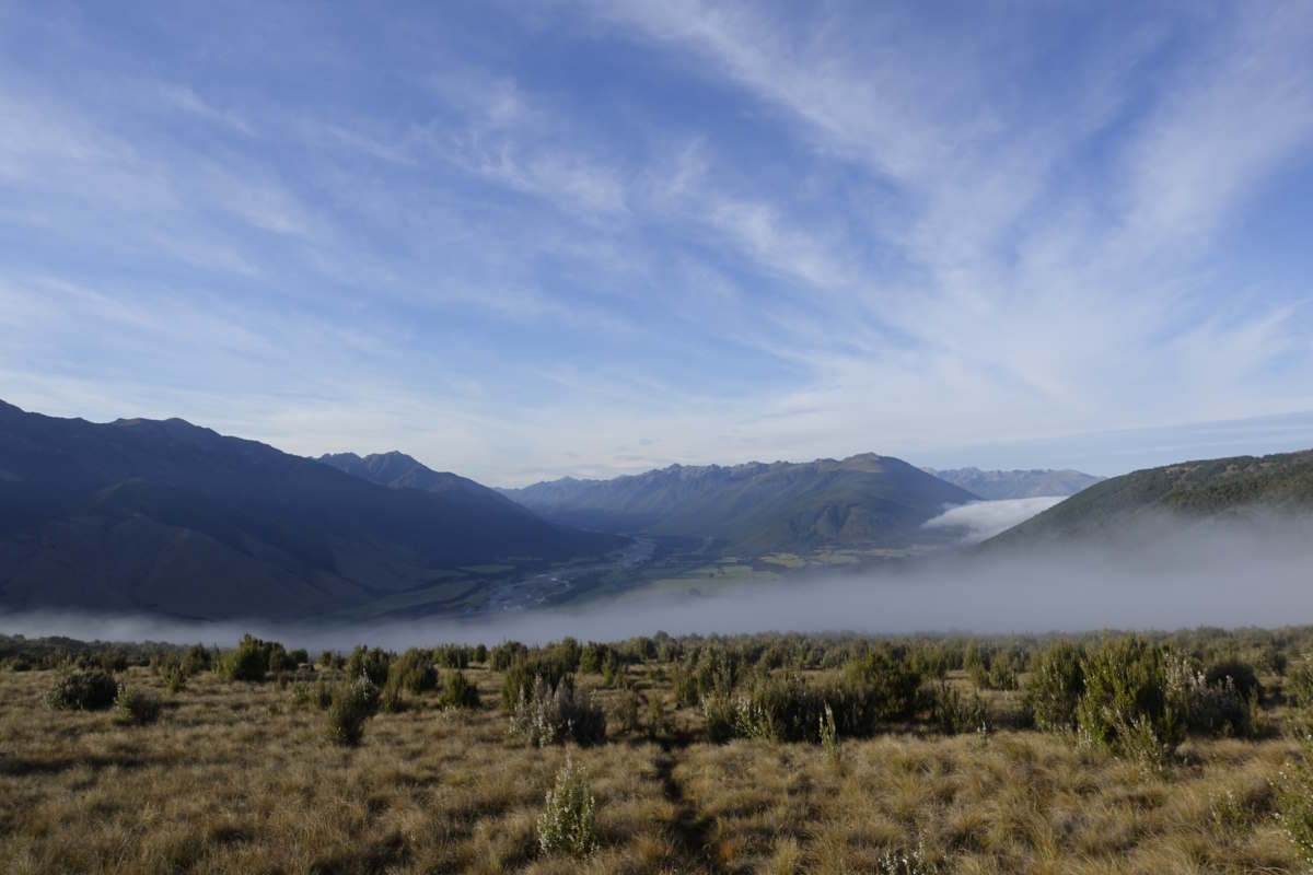
Sun rising through dew in the Taramakau Valley
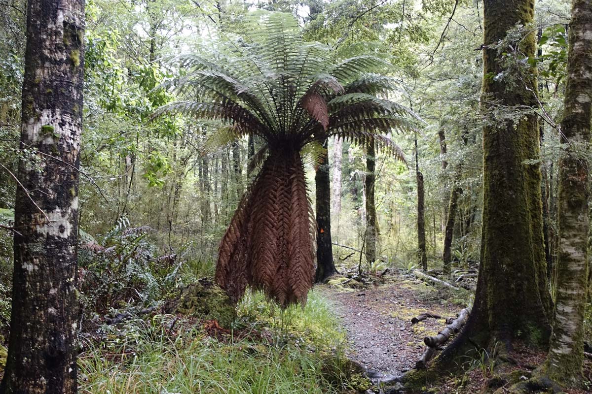
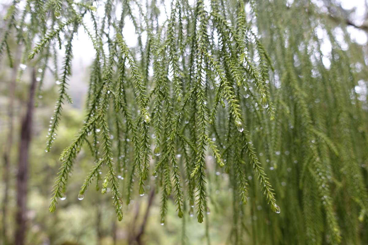
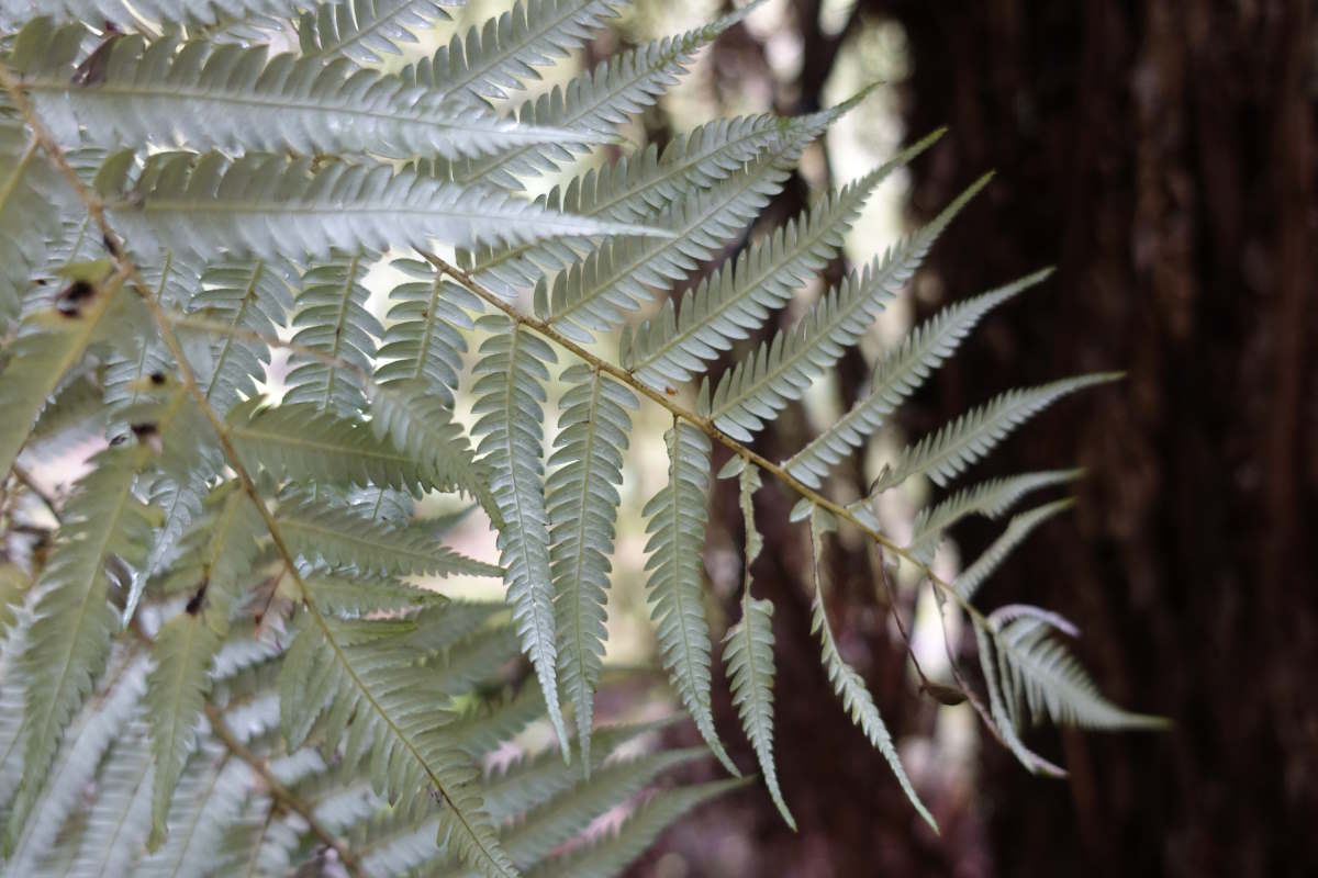
A forest full of ferns
Moss
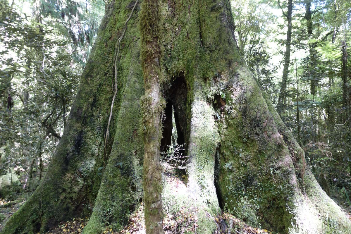
Spy hole
The other-worldly red lichen
Mt Koeti and neighbours (1768m)
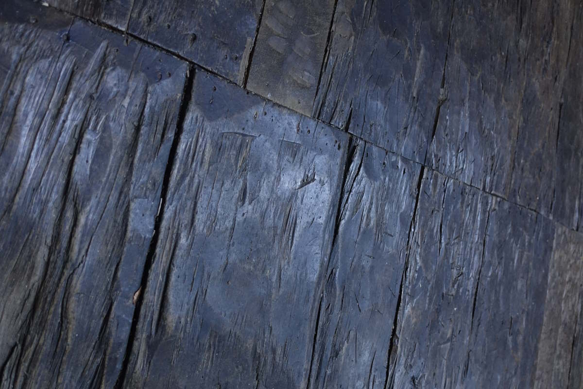
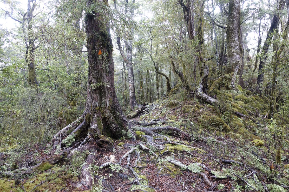
The hand planed floor boards of Locke Stream Hut
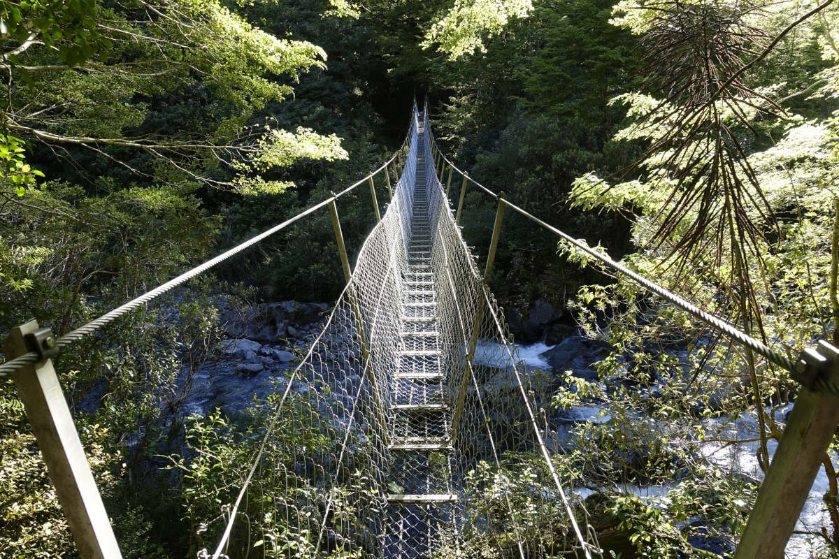
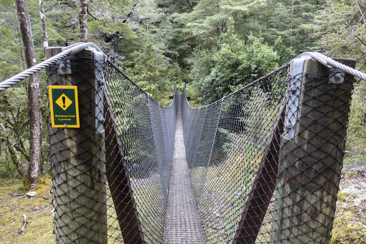
The civilised way to cross rivers
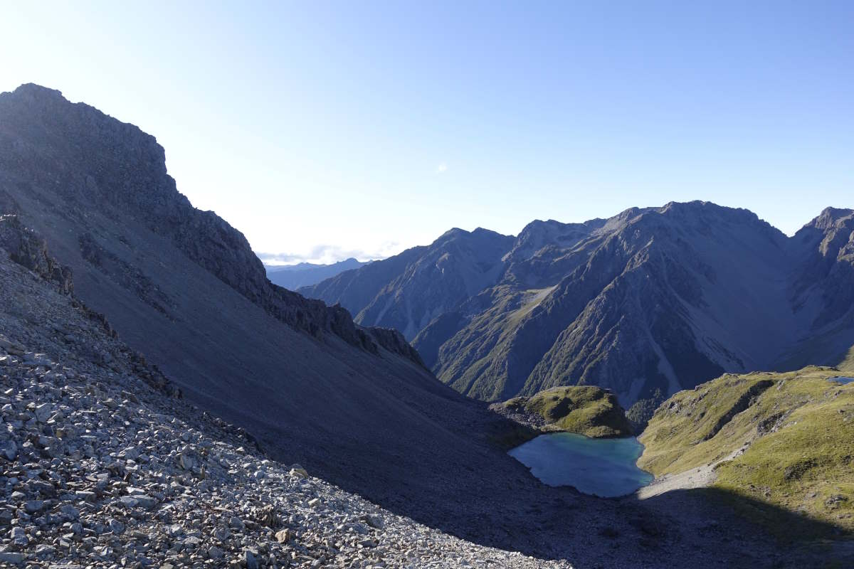
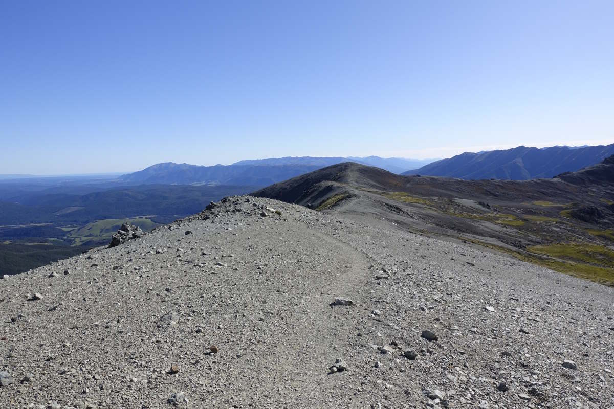
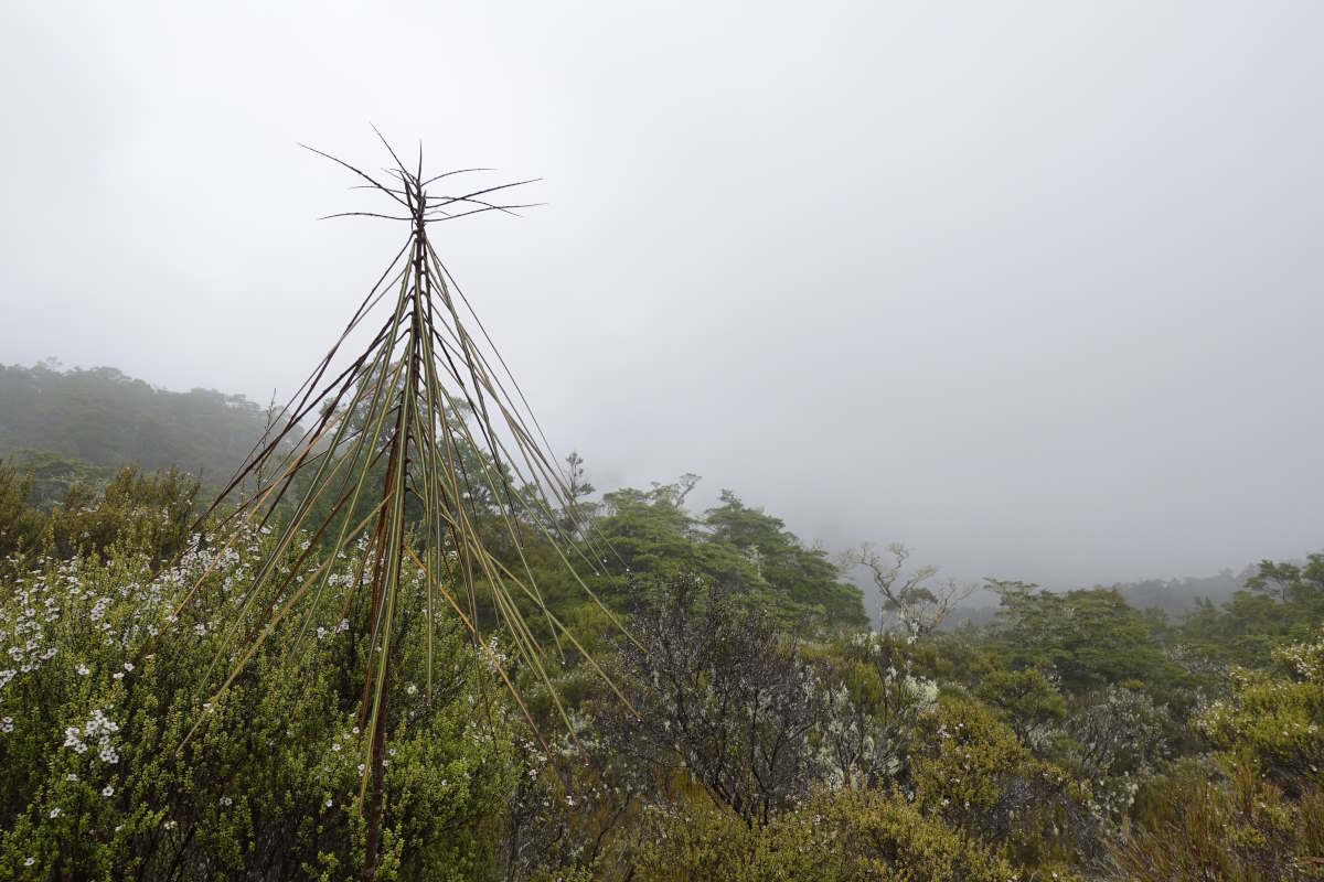
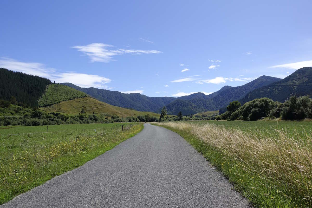
Harper Pass
Harper Pass
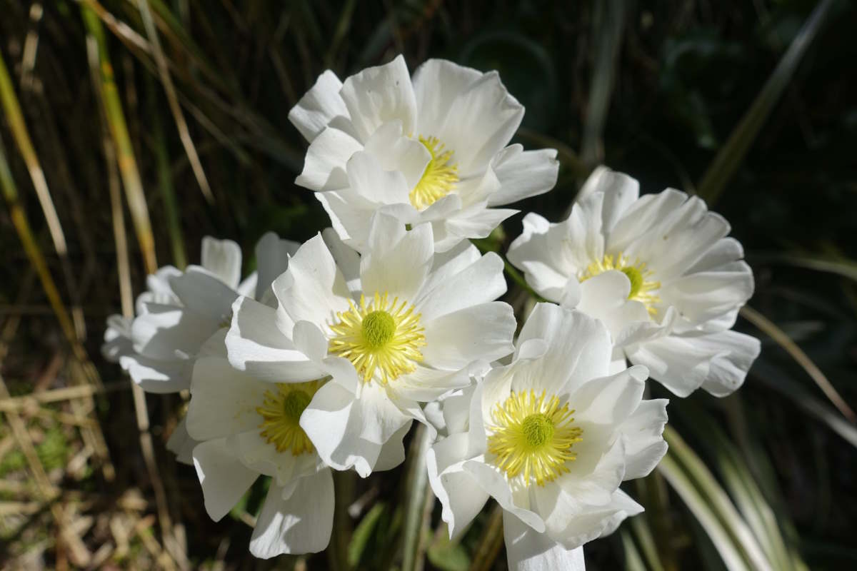
Mountain Buttercups
3 wire bridge over Cameron Stream
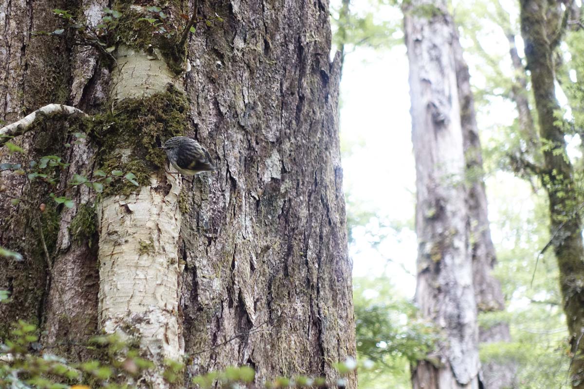
Rifleman (New Zealand's smallest bird)
Hot Pool
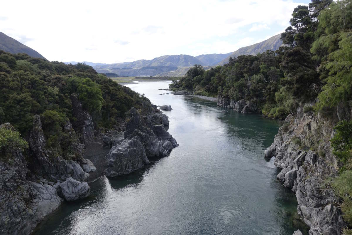
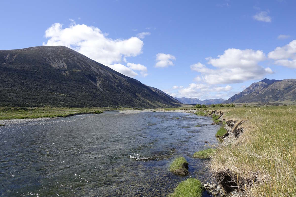
Hurunuri River
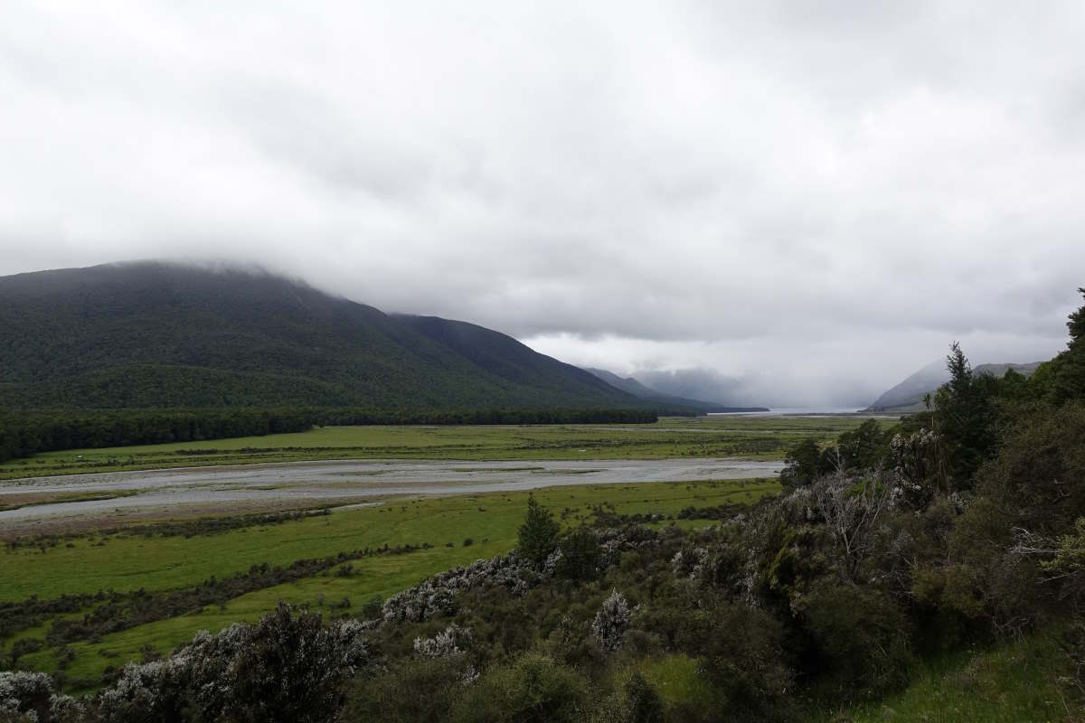
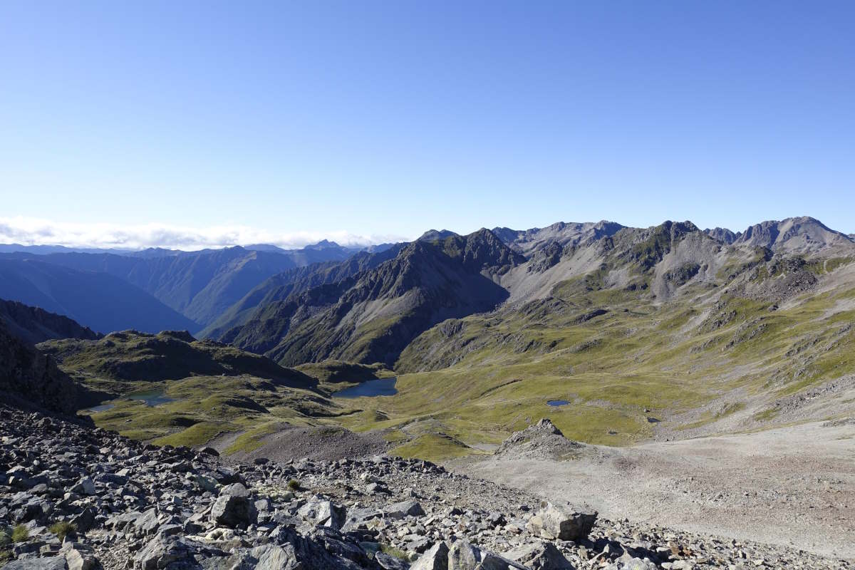
Lake Sumner
Joining the Kiwi River
Hope River
Halfway Hut to Waiau Hut
St James Walkway, 75km, 3 days
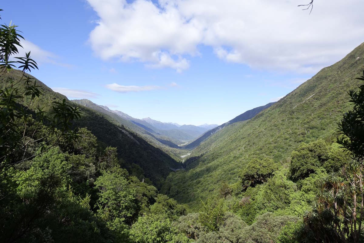
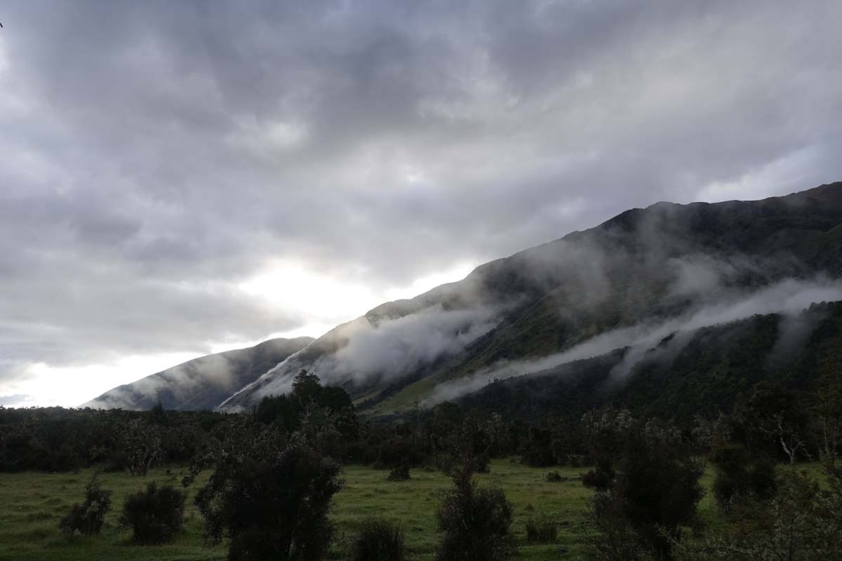
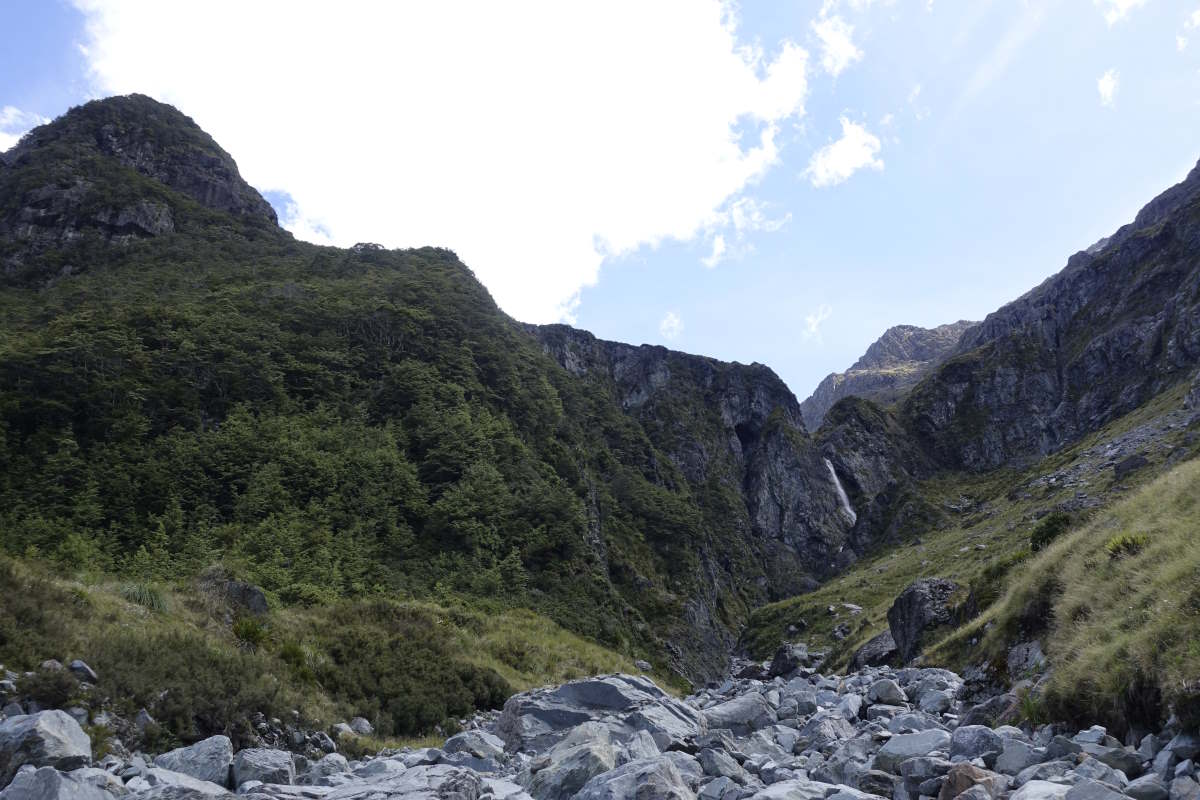
Day 47 (30km): There are beautiful swirls of low cloud hugging the mountainsides this morning as I set off through tall grasses bent heavy with dew. My boots have had holes in the soles for about a week now, and the leather is starting to split along the sides, so they are damp when I put them on and soaked within about two steps of leaving the hut. A couple of hours of easy walking gets me to the road and then a choice of route: stay on a nice soggy track on the left side of the river and wade through it at the end, or cross a bridge now then spend the next 10k on the road. I opt for the road and it’s quite funny how novel it feels to walk on a flat dry surface. My boots dry out, little bits of leather actually changing back to their original colour (not seen that in a while!) and the socks inside them turning nice and crispy. There’s a bit of traffic but enough of a verge that it’s manageable and a good view out over the valley. I make great progress and arrive in Boyle for midday. I pop into the outdoor centre to collect my second resupply box, then sit on a picnic bench and have a massively decadent lunch of tinned chilli and rice, followed by tinned peaches which, six days since my last fresh food, might just be the best thing I’ve ever eaten. It’s also delightfully simple just to put the contents of the box in my bag and not have to visit shops and make choices. I lie back in the sun and feel actually quite full. Far too full for the Faust traverse which is pencilled on my next map as a recommended detour, but I’m longing to get off the TA for a moment and have a night to myself. In the end I opt to stay low and head on to Magdalene hut, which is 1km off the trail, in the hopes that no-one else will join me. I luck out. The hut is positioned in an open clearing by the river and perfectly catches the evening sunlight. It’s modern but small and cosy with six bunks and a neat stack of wood and dry kindling left by the fire. And it’s all mine. Day 48 (20km): Not far to go today so I enjoy a lie in, luxuriating in my solitude as I work through the familiar morning routine of breakfasting, bag packing and thinking of something witty to write in the intentions book. Onwards and outwards it’s overcast and threatening to drizzle but actually stays fairly dry and I manage to do without the waterproofs. The trail follows the St James Walkway with a lovely easy path and several spacious huts to stop at for second and third breakfasts (because my bag currently contains lots of food which is making it heavy). Charlie’s name is in the first book having stayed last night so he has officially escaped ahead of me. Bye Charlie! I doubt I’ll see him again if he keeps walking fast and I keep adding bits. Upwards, it’s a well graded climb to reach Anne Saddle. It’s beautifully quiet, with low cloud muffling sight and sound, and the woods around me thick with lichen and moss. An easy walk down to the hut. I’m done for 3pm which is my shortest day in a long while. The fire is on thanks to Patrick and in complete contrast to yesterday it’s a lovely sociable evening. I chat to Mali and Jeremiah who are taking their kids (Milo 11 and Nicol 8) on their first multi day tramp; and Ross and Babs both in their late 60s who have just started the TA southbound after a huge amount of planning which involved dehydrating all of their own food. They’ve ended up with far too much having had to skip half of the Richmonds so I get gifted a couple of bags of powdered hummus which is a welcome addition to the 1 month old sweaty cheese that was the only “fresh” item in my last box. Tom joins just as I’m settling in for the night, having pulled a long day to get here from Boyle. Day 49 (25km): Another shortish day according to the book. But something about “short” days always gets to me. I think I expect them to be easier than they are and forget that while 7 hours of walking is less than 9 it is actually still quite a long way. The morning is sunny and after an easy couple of hours of good progress I sit on the river bank snacking on nuts and dried fruit, my legs dangling above the crystal clear water. There are no sandflies and so no incentive to move on. Time passes, I continue along an easy grassy track, the miles falling away under my feet. I’m making great progress on easy ground and am well ahead of time with not far to go - which is always a warning that something tough is coming up next! And indeed, the next part is full of fallen trees. I do some clambering and some avoiding and some detouring and at some point manage to lose the trail completely and end up fighting my way out of dense spiky bush to find a steep scree slope leading almost vertically upwards in front of me. Thankfully it’s marked on the map and I can get my bearings and realise that I’m supposed to be the other side of a stream, so the only thing for it is to bash my way back through the spiky bush and get my feet wetter. The boots are frankly falling apart at this point with three big rips along the edges but they do drain water very quickly after river crossings, with little jets of water spurting out of the sides with each step! I regain the track to find that my sunhat is no longer tucked into the side pocket of my bag but just can’t face the prospect of re-entering the bush yet again to search for it. Third degree sunburn sounds better. I carry on, the last 5km feeling somewhat endless, and am very glad to eventually reach the hut. It’s a small one and already nearly full so I take a chance to nab a bunk and then manage a very speedy hair wash in a bucket on the deck outside before the sandflies form a bit of a cloud around me. Tom arrives late with a “hey, I found this hat, is it yours?” must have got lost in the same bush as me.
Swirls of low cloud
Garnet Peak (1776m)
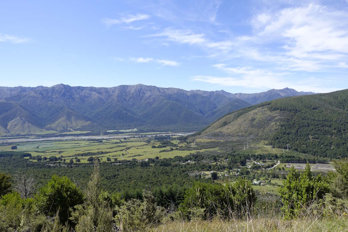
Over the Boyle River
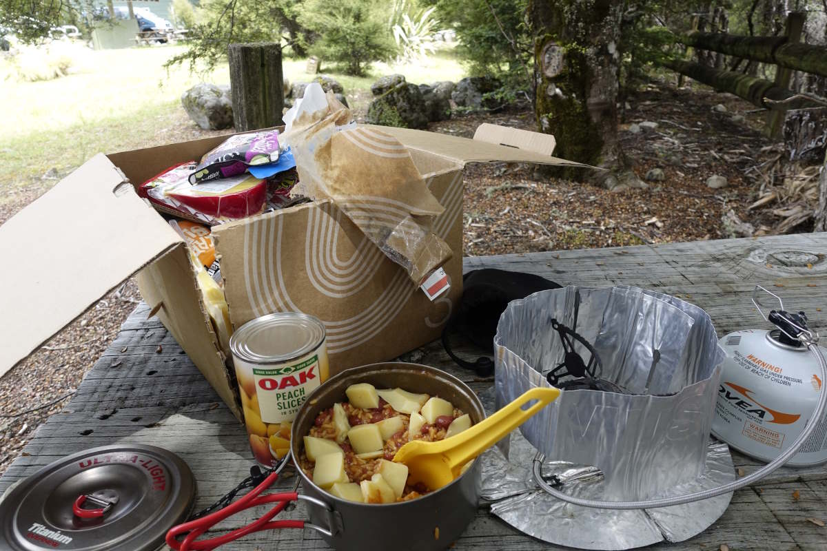
Tucking in to my resupply box
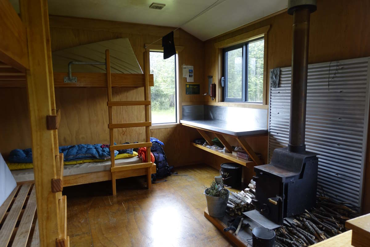
A night alone at Magdalen Hut
Beautiful clear path on the St James Walkway
Descending from Anne Saddle
Anne River
Anne Hut
Joining the Waiau Pass track
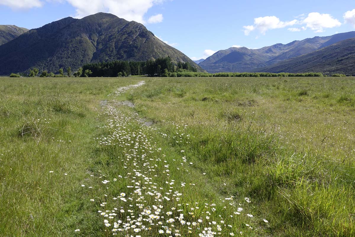
A path of daisies
Ada River
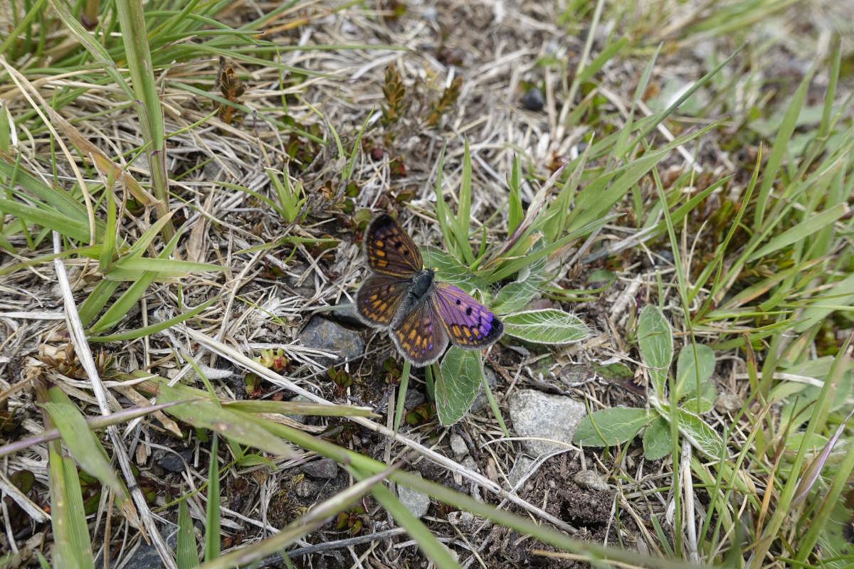
Butterflies enjoying the sun
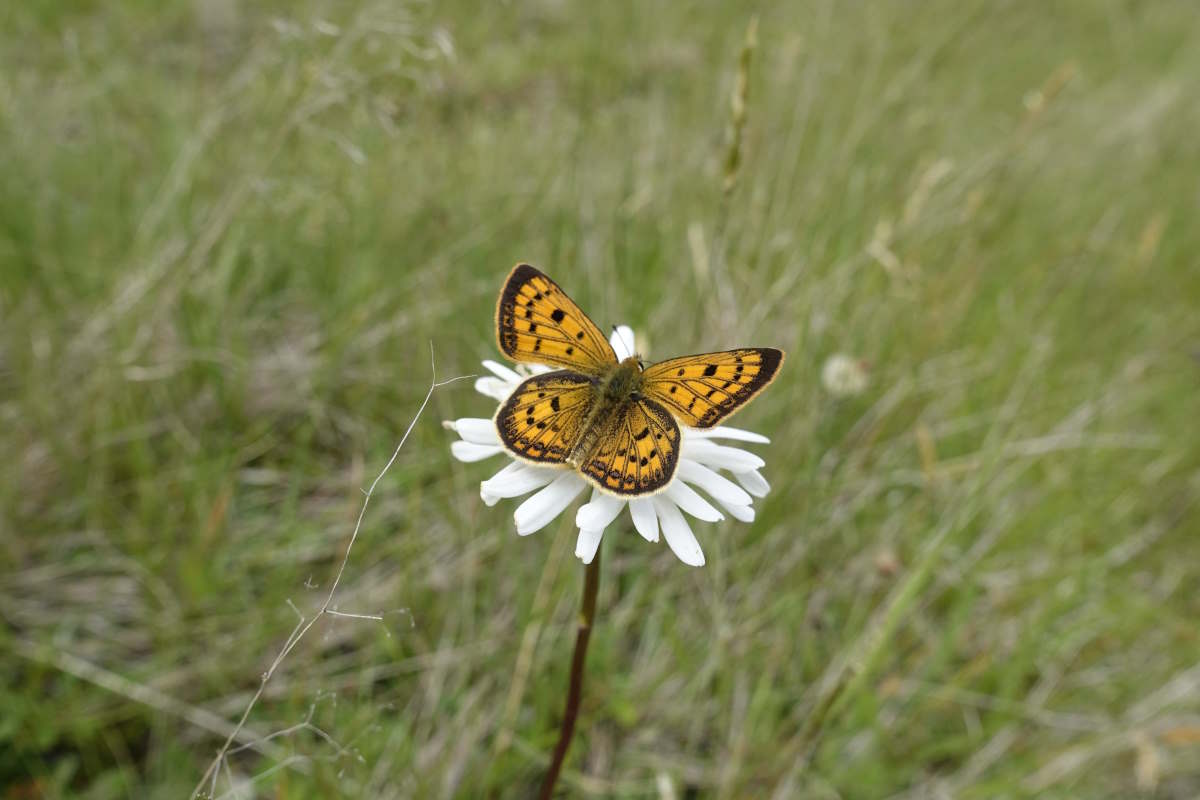
Butterflies enjoying the sun
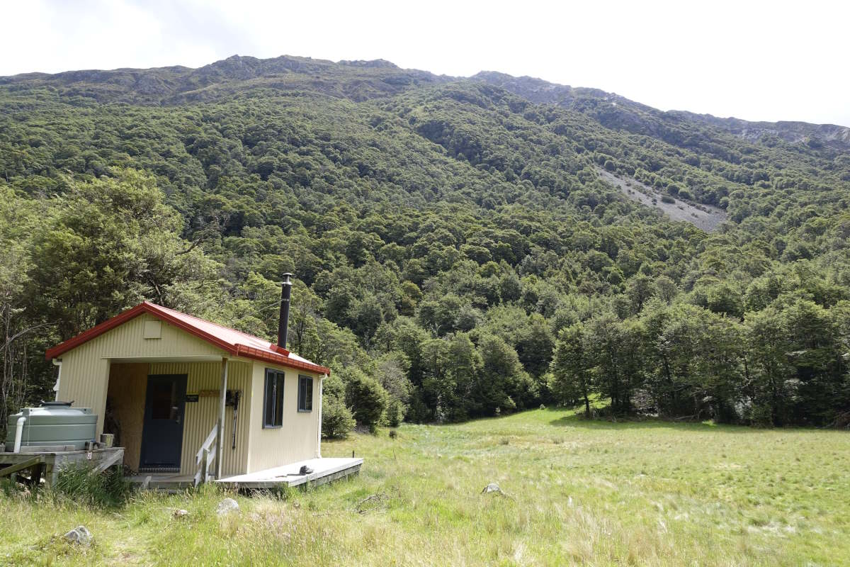
Waiau Hut
Waiau Hut to St Arnaud
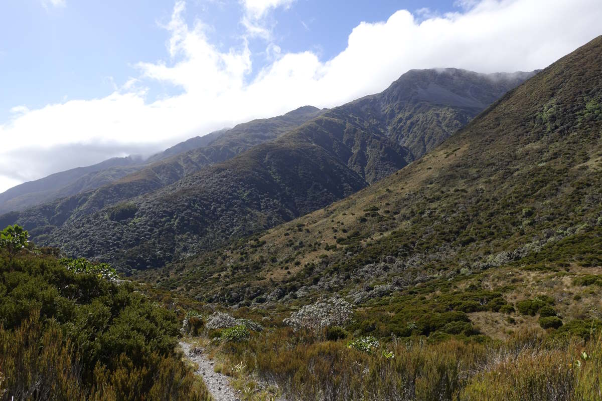
Waiau Pass/Travers Saddle/Robert Ridge Routes, 65km, 4 days
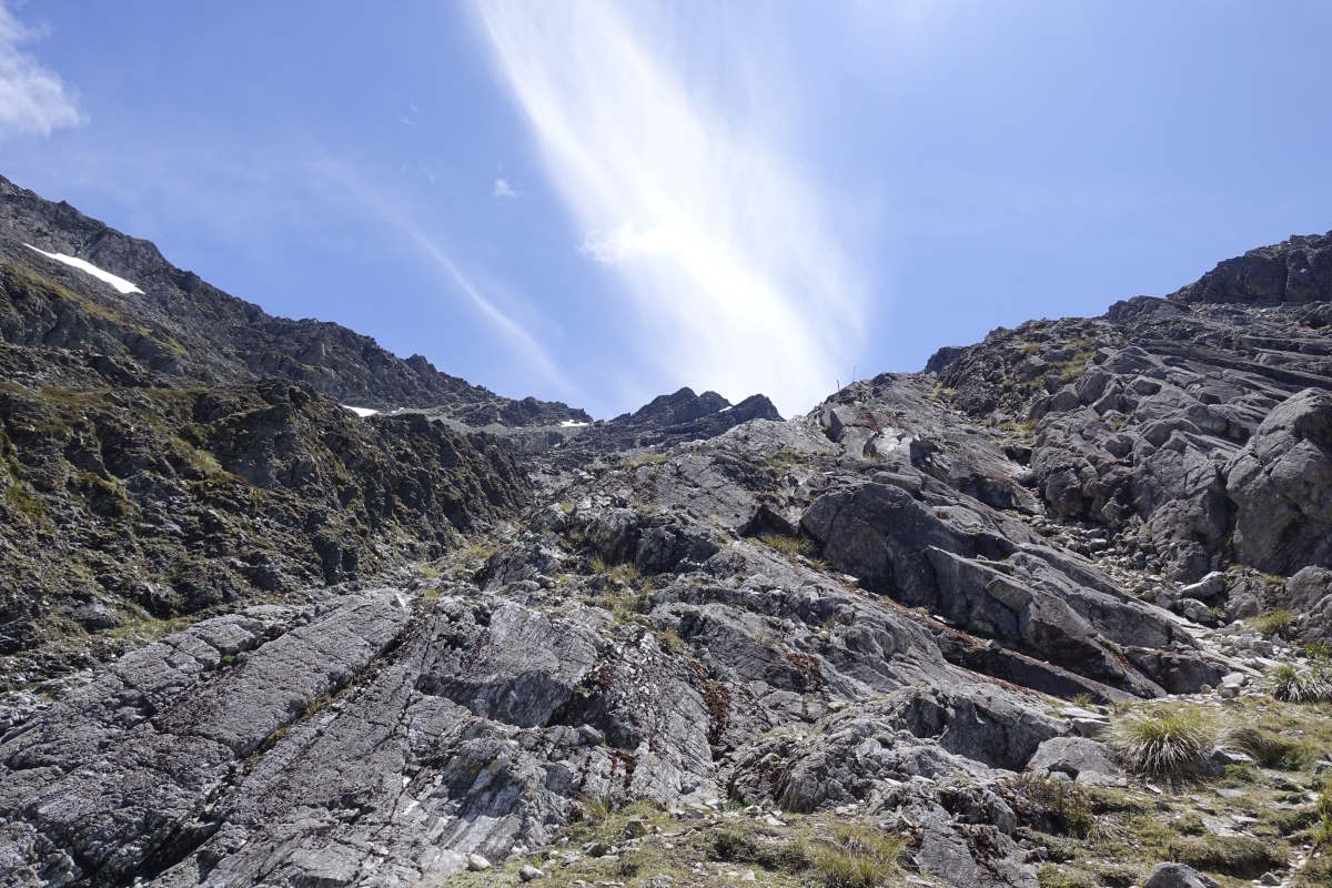
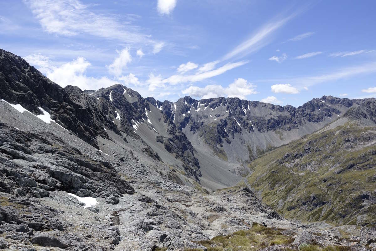
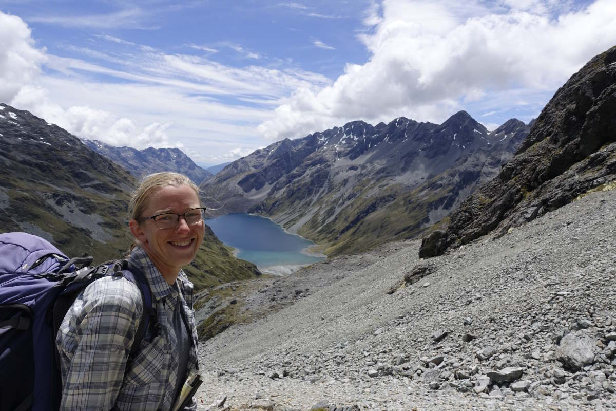
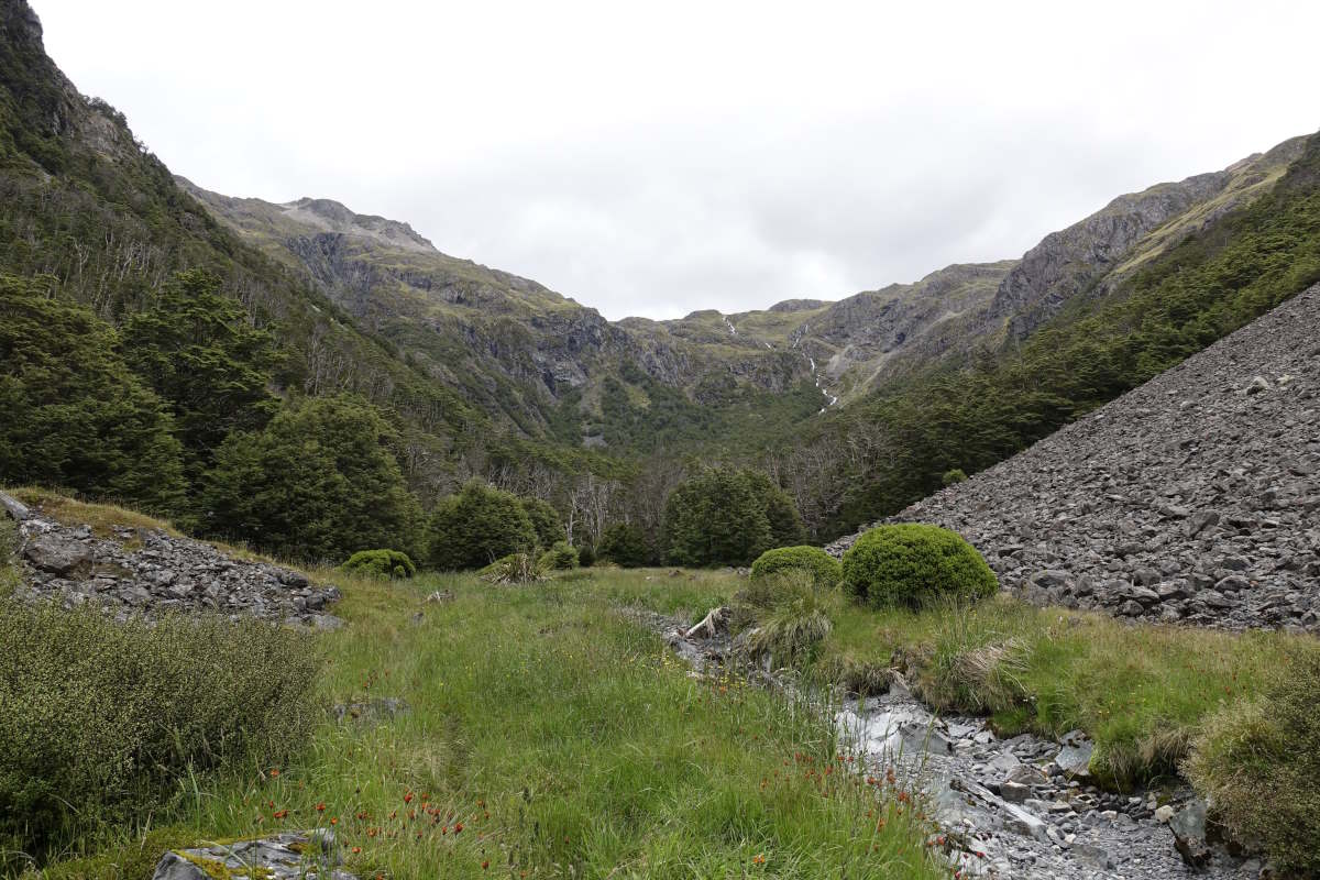
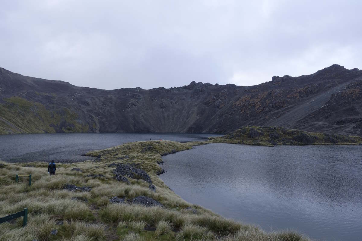
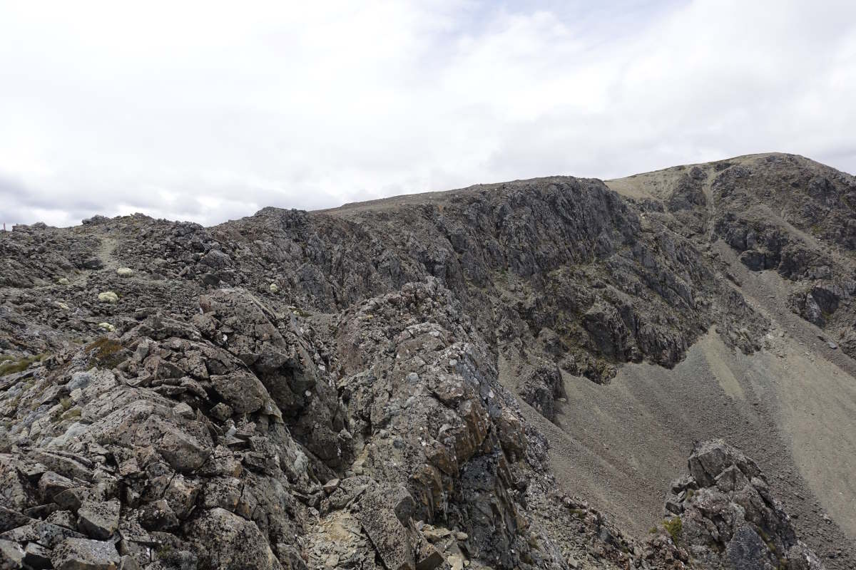
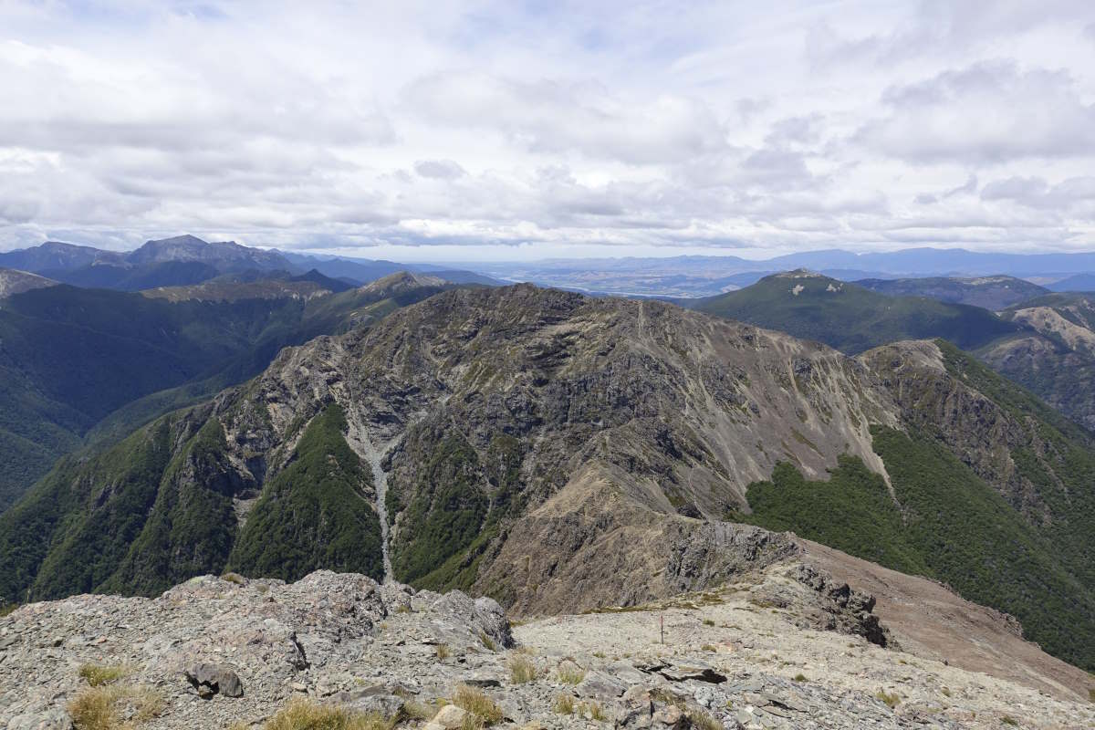
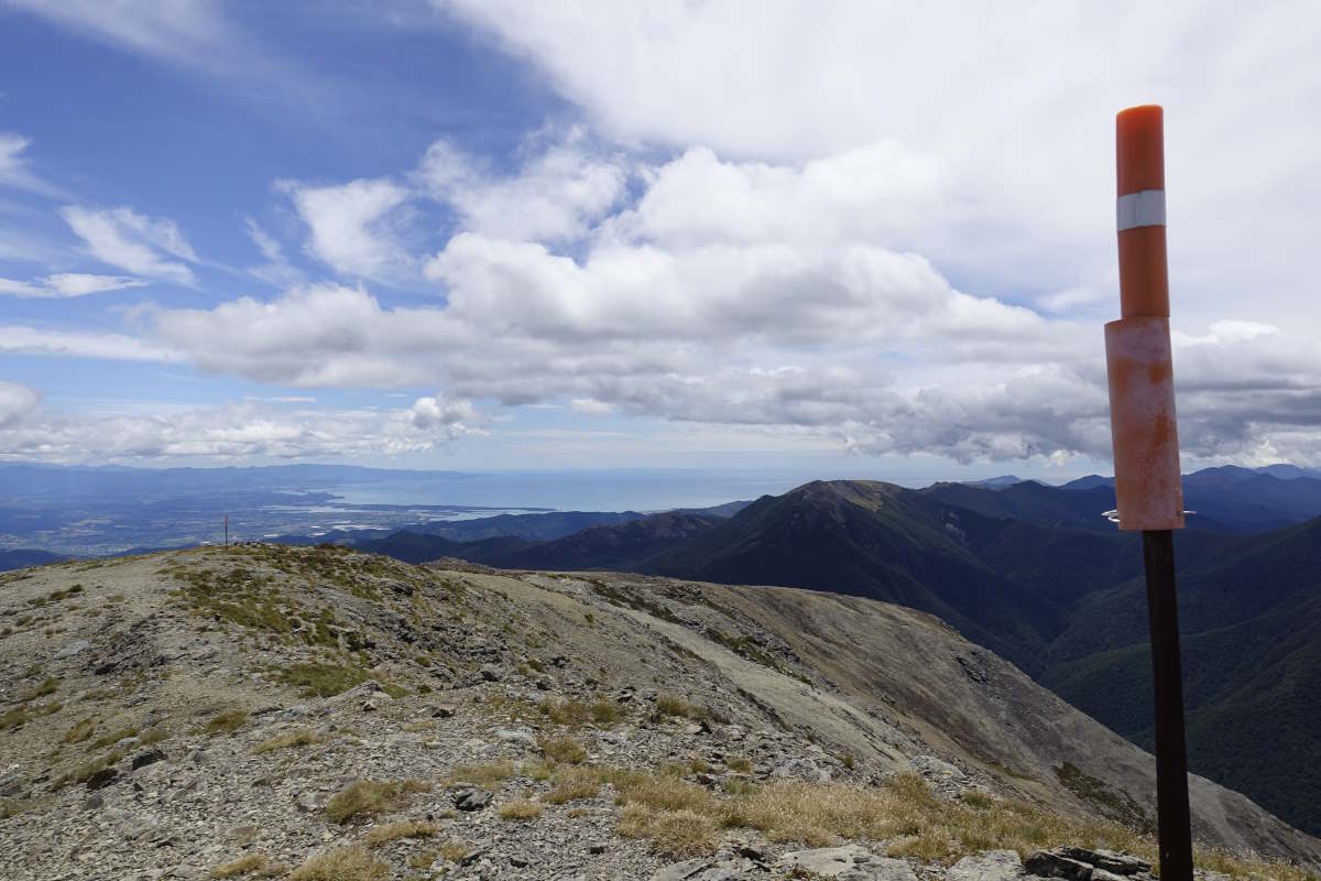
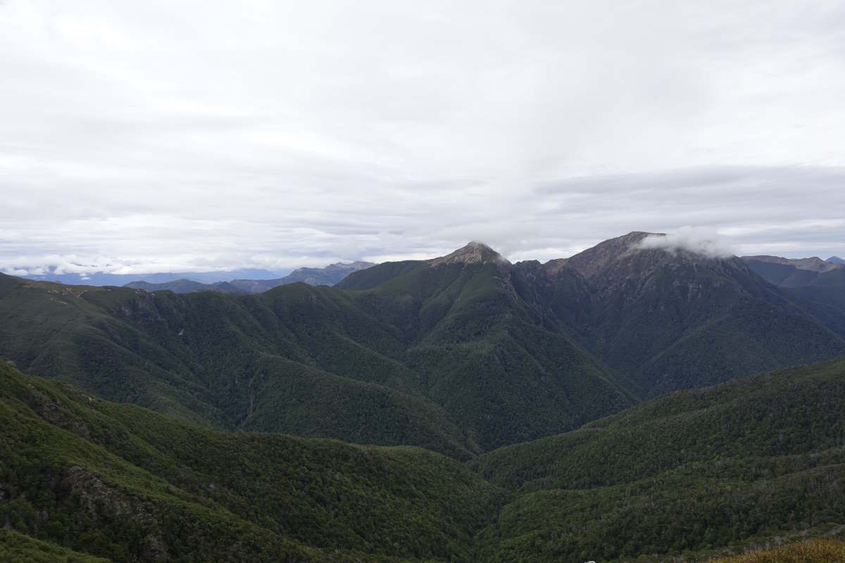
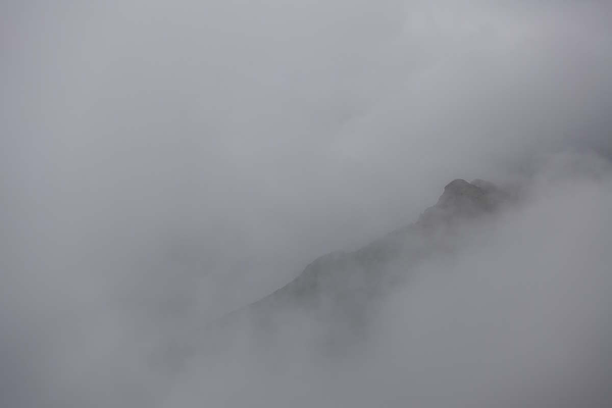
Day 50 (22km): Happy Birthday to me! I have chocolate for breakfast (and porridge too) and get to open the special ultralight card from my parents (which measures about 2 inches and contains a very cute photo of me age about 2 sitting on a mountain). There are lots of well wishes from my hut mates and a whole three squares of Whitakers dark almond chocolate from Tom which must be at least half of what he has left as he is useless at saving it. And then 9 squares of white caramel chocolate from the family of 4 who have very large stocks. I have pretty big plans for what is a gloriously sunny day which means it’s also time for a goodbye. Tom and I have shared (almost) all of our huts and some pretty gnarly rivers over the last 18 days and it’s tough now to disappear on ahead. But I’m ready to be on my own again. Out on the trail the sun is shining brightly and the air crisp and clear. I take a big lungfull of it tell myself it’s going to be a tough day but a fun one. I make good progress, getting all the way to the start of the climb up to Waiau Pass before the sun pops over the tops and the air warms rapidly. Soaking up the heat it suddenly occurs to me that the 9 squares of white caramel chocolate in the top pocket of my bag are in extreme danger. I make an emergency stop and find them already half melted so there is nothing for it but to eat the whole lot in one go. Fuelled by that I skip along rapidly and manage to completely lose the (very obvious) trail in a little camp clearing, then proceed to bash up a stream taking a good hour to cover a few hundred metres to where I can see the path crossing the hillside ahead. A girl coming down gestures at me confused; should she be where I am? She’s standing in the river and there is no way she can hear me so I give her a full pantomime performance of my last hour - bush surfing, grass bashing, boulder hopping and all. It’s extravagant but I think answers the question fully and she’s doubled over laughing by the time I reach the end. I’m grinning too. Maybe it’s the sugar high, or the birthday vibes, or the endlessly amazing views but nothing can get me down today and I carry on up a path that gets steeper and steeper until it’s no longer a path but a scramble up a rocky rib. It’s great fun, and I go out of my way to add in some interesting climbing moves, for once barely noticing the weight of the bag. The hard days are the best days! I top out on Waiau Pass for midday, with stunning views and sunshine in all directions. There’s even a bit of phone signal for birthday messages except that at home it’s 11pm and not even my birthday yet… but an advance one from Dad who clearly thinks of everything. I break out Tom’s chocolate and soak in the view for a bit thinking there’s nowhere I’d rather be. Heading down the stunning views persist, and maybe get even more so with the classic TA photo view of Lake Constance bright under a blue sky. The descent is perilously steep scree and I pause for a welcome break at the water’s edge to top up my chocolate levels with a double decker deluxe TimTam (i.e. two melted together and completely inseparable) which I’ve been saving as a birthday gift to myself. On and more down to Blue Lake, famed for having the clearest fresh water in the world. The guide recommends a night here but the hut is fully booked and my sugar high is going strong so I carry on down to West Sabine Hut, adding three hours through trees while the sun drops back behind the mountains. The hut is full and very warm and consequently smells strongly of warm hikers and socks, but I’m happy to escape the sandflies for dinner, and then even happier to escape the hut for a night in my tent in a lovely little flat spot between the beech trees. An excellent day all round. Amazing what you can do on a week’s supply of chocolate. Day 51 (13km): Merry Christmas! By the time I enter the hut for breakfast half its occupants have packed up and left and the other half are still in bed so I get the table to myself. Getting going today’s objective is another big climb over Harper Pass so I try telling myself it’s going to be another tough but fun day but don’t quite achieve the same boost as yesterday (maybe chocolate beats psychology). I only make it an hour before needing to stop for snacks which is problematic because I’ve already eaten most of them. I break out the dried pineapple which is the last of the fruit that was supposed to do another four days but conclude that it’s Christmas and I deserve it and I can save all my regrets for tomorrow. I carry on to what looks on the map like a stream crossing where I can fill up water and find myself standing on a very small bridge looking down into a chasm that must be at least 100m deep. My ears catch the sound of distant water gushing through the darkness and I watch little side trickles separate into droplets and fall seemingly without end into its depths. Carrying on there’s a lot of up, the forest thick and silent around me. I tell myself that I can have my next break when I clear the trees but they seem to go on nearly forever. Approaching the top I meet two people coming down, 10-15 minutes they reckon to the tree line. I make it in 4. Then another man. He looks me up and down as I sit for my much anticipated break and tells me there is so much climbing still to come. Really steep serious stuff and he got a specially early start and the clouds are gathering and it’s going to rain at 4pm. The map is on my knee. Its less than 1km and maybe 2-300m more ascent to the pass. It’s also 10:30. Am I giving off some sort of slow and helpless vibe? It ends up being very straightforward, and a lot less steep than the woods. At the top the clouds roll in with me but I find a spot to sit that I guess would probably have a view and break out an early lunch and after 20 minutes or so I’m rewarded with the warmth of the sun gradually increasing through the thinning cloud, and the view unveiling all around me. It is beautifully peaceful. A harsh land of rock and ice but in this moment so calm and quiet that there is no need to rush on or be anywhere else. The breeze sighs deeply through soft grasses, the distant crescendo of a waterfall, the piping of a lone bird. I move one, adding the crunch of small stones and the little ping... thwack of crickets jumping away from my descending feet. I pause at Travers Hut for a second lunch then carry on down to John Tait Hut with a little detour down a steep tree root ladder to the very beautiful Travers Falls. I sit and watch the water, the drops at the edges moving slower than those in the middle so that if you focus in a slightly unfocused way it looks like the water is constantly going “weeee, no hands!” Carrying on I’m the first to reach the hut so get my choice of the camp spots (the huts in this section being not covered by the pass). In contrast to last night’s crowds there end up being only three of us and it’s a good quiet evening to catch up with my audiobook and watch a weka wander seemingly innocently through the grass. Day 52 (15km): It’s a light bag day which means I’m getting low on food (especially cheese and TimTams which are the most important food groups) but motivation for throwing in an extra 1000m climb is back so I’m heading off trail again. I make a futile attempt before leaving to sew up one of the holes in my boot which quickly results in a broken needle and no stitches. A sadly predictable outcome. Onwards, there’s a light drizzle falling but it quickly dries up and the day remains overcast but dry. I follow an easy path through the forest then turn off up Cascade Creek to regain the ridge, popping out the top into what feels like the crater of a volcano (but is probably glacial), with Lake Angelus and it’s very nice hut nestled in a basin of scree. Clouds wrap the tops and the air is heavy and damp so I take refuge inside and spend a few hours filling in some sky on a very difficult jigsaw of the Eiffel Tower while low cloud drifts past the windows and the grey of the afternoon darkens into night. Day 53 (15km): A perfect blue sky morning just as the forecast predicted. I watch the sun rise over the lake while having breakfast then head off for the descent of Robert Ridge. The ridge looks technical and jagged from the side, and it’s windy enough that I do pause to wonder if this is a sensible plan, but find that the path actually winds its way very easily between all the obstacles. There are some great views back over the mountains I’ve crossed and the Richmonds ahead and also a glimpse of the sea! I’m nearing the end. Down, I make it into St Arnaud for midday and, after the brief panic of finding the campsite fully booked, manage to grab one of the last dorm beds in the backpackers. I collect my final very heavy food parcel and top it up with fresh cheese from the very small shop, then enjoy a hot shower for the first time in I think 12 days, wash all my clothes and actually succeed in stitching up my boots with a safety pin and half a broken needle. The Richmonds await.
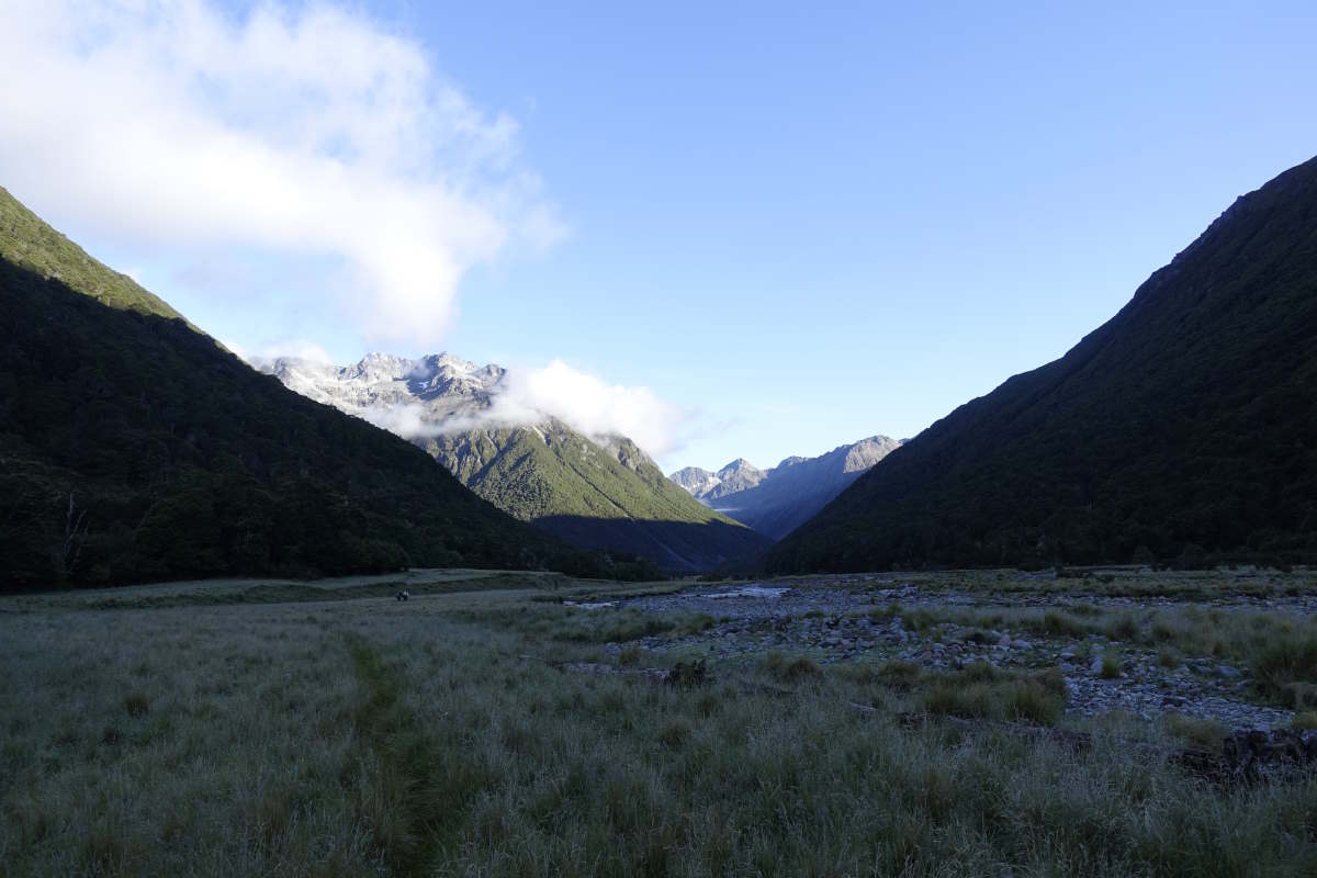
Sunrise over Waiau Valley
Ascending Waiau Pass
Looking back they way I've come
Spot the next marker (on the skyline)
Waiau Pass
Happy Birthday
Blue Lake
Sabine River
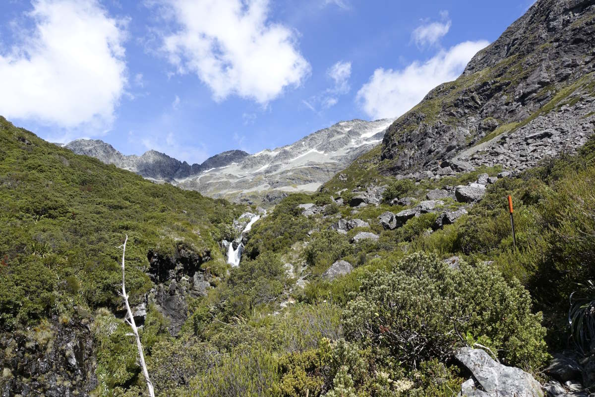
Random side stream waterfall
Up again
Travers Saddle
Mt Travers (2338m) emerging from the clouds
More alpine daisies
Travers Hut
Travers Falls
Travers River
Cascade Creek
Lake Angelus
Sunrise from Lake Angelus Hut
Lake Angelus Hut
Moss
An unnamed tarn
Robert Ridge
The imaginatively named "4th Basin"
Smoothing out before the final descent
St Arnaud to Upper Wairoa Hut
Red Hills Ridge, 40km, 2 days
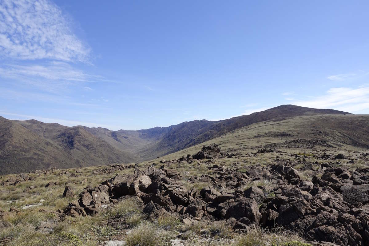
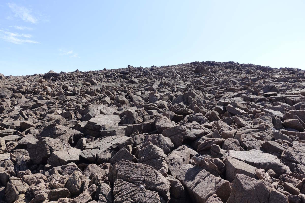
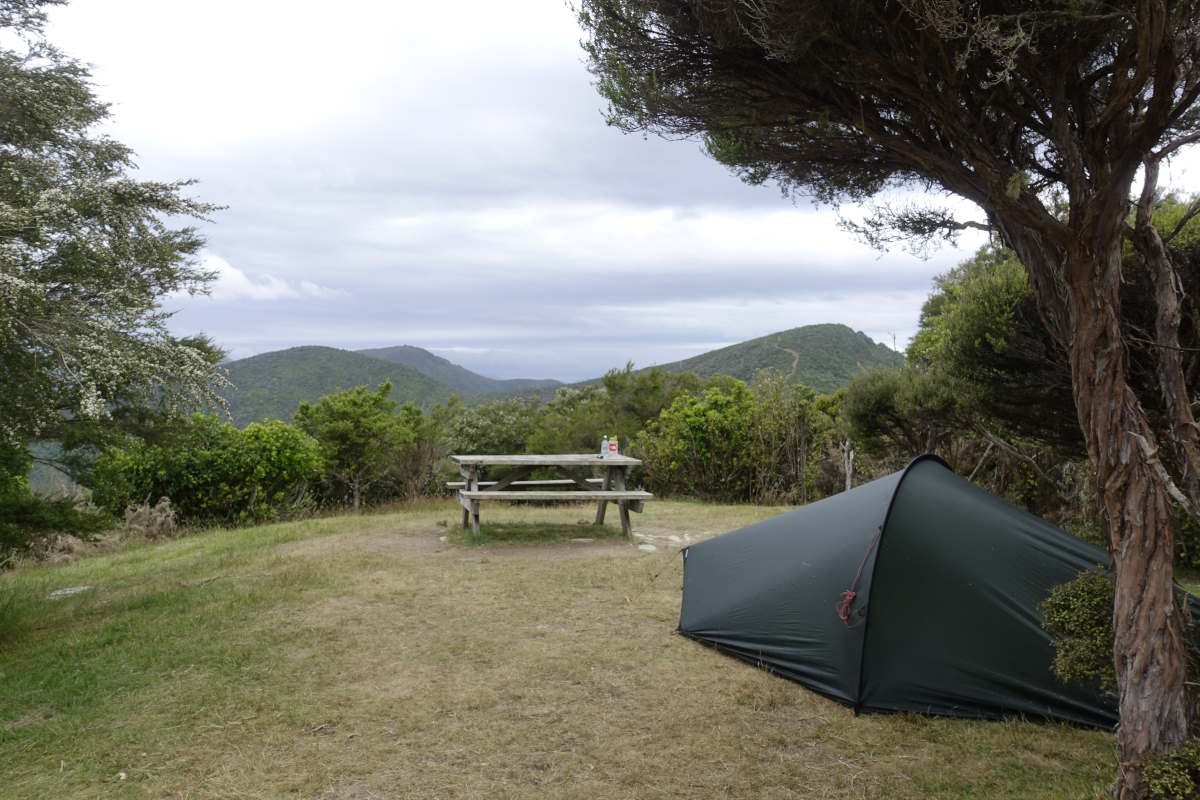
Day 54 (19km): A shortish day with an enormously heavy bag full of 9 days of food plus extra chocolate plus 48 hours of emergency rations that I have to pretend isn’t there and not eat (unless there is an emergency). It feels surprisingly OK to lift and I manage the 10km along the road out of St Arnaud in one push. Perhaps I should have brought more?? Then the path turns off, gaining height on 4x4 tracks and bike paths and I find myself stopping every hour, the bag falling to the dust with a particularly solid sort of thump. It’s seriously hot. I wind my way through short stubby trees, my head at canopy height which is somewhat surreal, and take lots of breaks to appreciate the views. I reach Red Hills Hut in the early afternoon and pass the worst of the heat sitting inside fanning myself gently with a map. Maybe it’s the heat, maybe it was yesterdays 5 meals and a whole pot of cream with desert but for once I don’t actually feel like eating much so the enormous bag of food just sits in the corner and mocks me gently with the knowledge that it will be equally heavy tomorrow. Day 55 (21km): A long and strenuous day with an enormously heavy bag full of 8.5 days of food plus extra chocolate plus 48 hours of emergency rations plus 1.5 litres of water, which definitely weighs more than it did yesterday. I’m off to tackle the Red Hills Ridge, another detour, which the scribbled notes on my map say is a “fun ridgeline scramble”. I drew these (and many other) arrows on about 4 months ago based on various recommendations I found on the internet but this could mean anything from a challenging walk, to something that deserves at least one companion and possibly a rope. My home printed map shows an appropriately narrow ridge with some slightly blurry stacked contours to cross (which with a 20m contour interval is not an encouraging sight), but there are a few mentions in the intentions book of people heading that way so it does seem to be a recognised thing at least. And if it’s all too much I can just turn around again. I get started as the sun rises, quickly burning through the low cloud to welcome in another clear day. A path and a series of cairns leads away from the hut up onto the plateau and then abruptly stops leaving me to wade awkwardly through dense low bush, tussock and occasional concealed rocks. It’s slow and awkward. After a while the vegetation thins and the going becomes rocky and awkward, and then the rocks get bigger and it’s boulder-hopping and awkward, and in hindsight actually the tussock section is probably about the fastest I move all day. It’s very very rough rock, sort of like sandpaper on steroids with a sprinkling of extra sharp crystals. Great for grip, but not kind on tattered old boots, a worn pair of trousers or the skin of my hands! My knees are creaking and I’m definitely feeling older since that birthday I just had. The scramble itself is pretty gnarly but excellent fun. There’s some awkward route finding around a couple of little pinnacles where I opt for a side traverse but decide mid way round that’s not a good idea and have to spend a while clambering up, down and up again to suss out a route through. It’s engaging both physically and mentally with some sections of proper climbing and I’m delighted by how little I notice the bag. It’s also very very slow. The views are amazing in all directions, and the barren red rock gives a totally different landscape to anything I’ve encountered so far. But by the time I prop myself against the summit of Red Hill I’m so ready for it to end. I shuffle my way even more slowly through the final few km of awkwardness, then an abrupt descent to reach, hallejulah, a path, and tiny Top Wairoa Hut. It’s completely full but after a solid 12 hours of rock hopping the floor looks incredibly comfortable and I’m asleep in seconds.
Upper Wairoa Hut to Hacket Hut
Richmond Ranges, 51km, 3 days
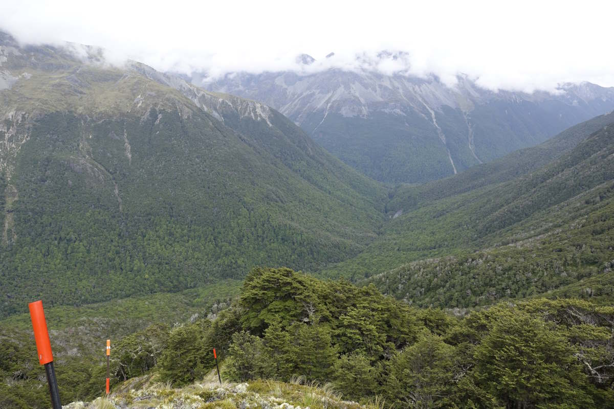
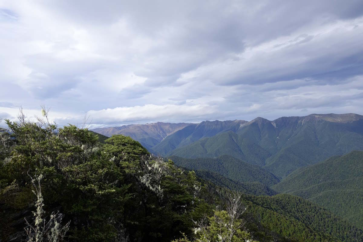
Day 56 (13km): My two day old forecast promises rain in the afternoon so I plan a short day just to Mid Wairoa Hut. It’s great to be back on a path, but even with that the going feels slow and there are lots of stream crossings and some awkward clamberings up and down the banks. I make it to the hut for 11:30 under perfect blue skies to find it occupied by a very large number of bees. I have first lunch and come swiftly to the conclusion that it’s far too hot and bee-ish to rest inside and far too hot and sandfly-ish to rest outside and so the best option is to carry on up the next hill. I’m just cresting the steepest bit of the climb when there is a rumble of distant thunder. I pause. The sky is still completely blue… I take a moment to study the map; the route rises to a ridge but is fully in trees with no summits to cross and only about 1km actually along the ridge line. I decide to carry on, but reasonably rapidly. Up up up. Quick quick. Keep moving. The sky darkens, thick black cloud building but mostly to the side of me. Thunder ahead, then behind. Has it passed? I reach the ridge. The trees are old but weather beaten and stunted and about the same height as my head, and I’m suddenly very aware that my rucksack has a metal back frame, and I’m holding a pair of what might as well be lightning rods in my hands. 1km to the safety of the hut. The sky above me is a deep inky grey of swirled cloud. Behind me a flash of light, one, two, th… a crash of thunder. I break into a jog. More thunder, now directly above, bouncing round the clouds all around me. Run. And then the trail is descending, the trees gaining height to wrap themselves protectively over my head. I reach Tarn Hut just minutes before the sky opens and hail the size of marbles is crashing and bouncing off every surface. Breathe deeply. Laugh. Day 57 (13km): It’s raining when I wake up so I roll over and sleep another hour. Getting started the trail is fairly easy going but the sky is grey and the wind is cold. There’s phone signal on the ridge and the forecast promises a decent day today, then cloud and rain tomorrow so as always that means going further. I’ve got the Rintouls to cross, which are reputed to be one of the hardest parts of the TA. Indeed, there was a man at the St Arnaud hostel who assured me gravely that it will be the hardest walking I’ve ever done in my life. I meander along the ridge line and quickly meet Brian who is walking South. It’s a long way to the next hut so I ask curiously where he set off from this morning to which he gives a nervous laugh and tells the story of getting caught on the summit of Mt Rintoul in the peak of last night’s storm and having lightning strike the ground about 100m from him. He’s a good storyteller and it makes my little adventure feel very tame, though the contest for who can get closest to being struck by lightning is one I’m happy to lose. Carrying on there are plenty more walkers, and I find myself meeting little pulses of people spaced out by which hut they stayed in the previous night. I count 17 South-bound TA walkers many of whom tell me they are pushing on because there is a big group of 30 a day or two behind. I climb up on to Mt Rintoul, it’s fairly steep scree but nothing I would call difficult, and the views as always more than make up for the climb. I can see back to Red Hill, standing stark and barren in contrast to the grey slopes and forests all around it, and further back to Waiau Pass where snow still streaks the mountainsides. There is still a fair bit of mountain ahead too, and it’s not possible yet to see the end. In my head Mt Rintoul marks the last significant/weather dependent challenge and I have to remind myself that there are still 6 days of food in my bag and then the Queen Charlotte Track to follow. I drop steeply down and back up to Little Rintoul from which I can see Old Man Hut, nestled in a little clearing a long way below. It’s a bit of a detour off the ridge and I had wanted to plan my stops to avoid it but tracking the ridgeline round to the next hut looks like a very long way. Old Man it is then. I make it for 3pm, just in time to get the last bunk. It’s New Year’s Eve and more walkers trickle in over the course of the afternoon and evening to make a merry band of 12 strangers, spread across five bunks, the floor and a gathering of tents. We share out bits of chocolate and dried fruit and a microscopic bottle of whiskey then go to bed early. Day 58 (17km): Happy New Year! I get an early start and am back up on the ridge in only 30 minutes. The trail winds along the crest, in and out of trees with forest stretching away on all sides. It’s fairly easy going to Slaty Hut but further than I’d thought and I’m glad I didn’t try to push on last night. On again, I pass the same pulses of South-bounders totalling up 24 and one hunter, and they keep telling me they are ahead of the big wave. I contemplate staying at Starveal Hut. The clouds are just starting to drop but it’s still early afternoon and it doesn’t have the new squishy blue mattresses that have appeared in a couple of other huts so I decide to press on. It’s a long descent down to Hacket and my knees have started to get stiff and sore after stops, so better to face it now while I’m warmed up. I meander somewhat geriatricly downwards into soft cloud and a light drizzle. The trail is straightforward at least. At the bottom of the slope the path becomes river once more though the water is low and the bed a maze of boulders making rock hopping possibly the easiest way forwards. The rocks are slippery in the rain and progress slow with a million billion trillion crossings (i.e. possibly about 10). The air is still. Rain drops ripple the surface of the river and occasionally find the little opening at the back of my neck to run like an icy finger down my spine and add to a general world encompassing dampness. I make it to Hacket Hut, last bunk again but no squishy mattresses. I read through the remainder of the trail notes and work it out at about seven days left to Ship Cove which I hadn’t put a number on until now. Tomorrow will be my last night in a hut.
Descending the Wairoa
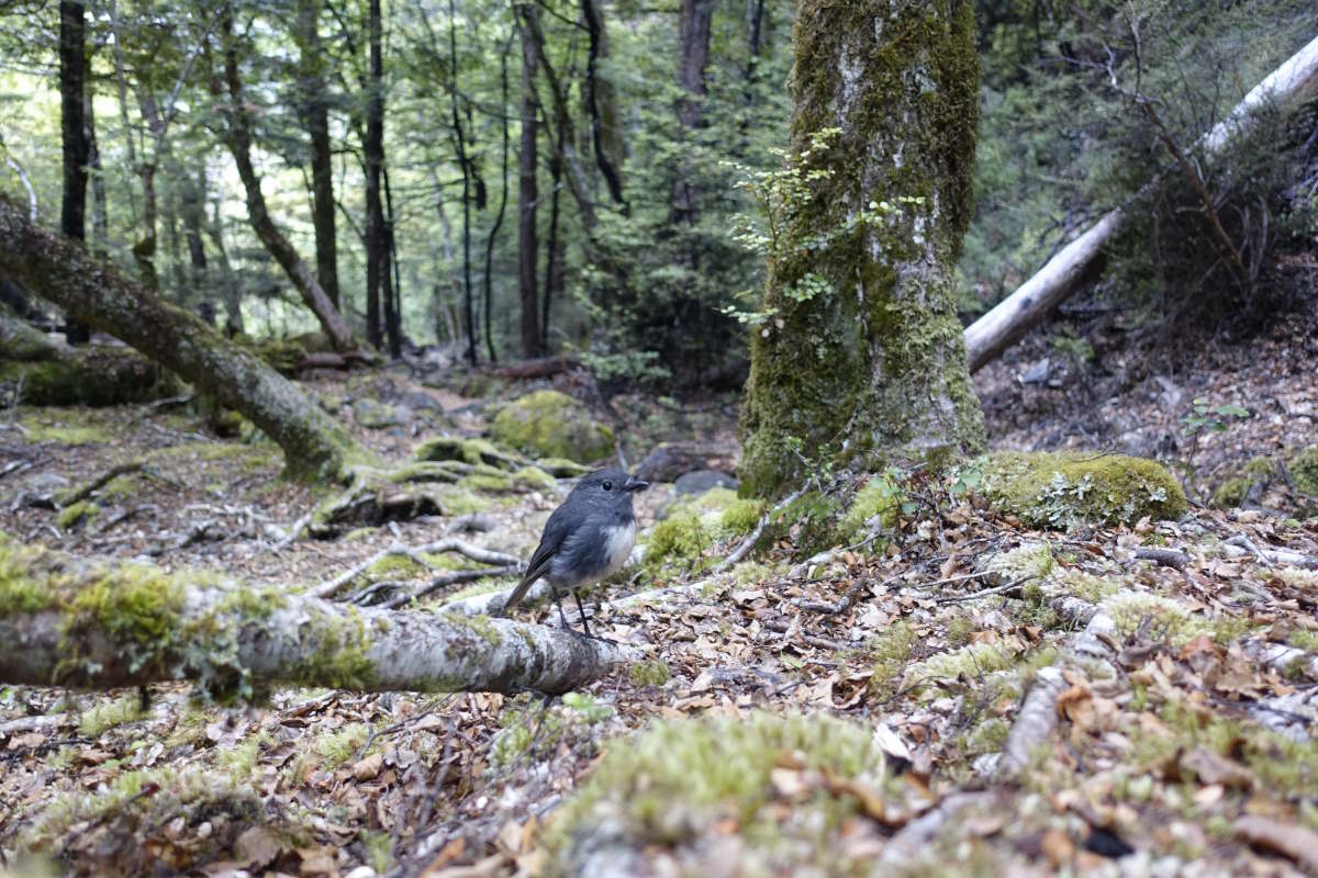
South Island Robin
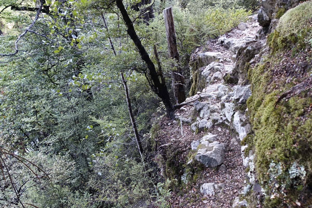
A precipitous path
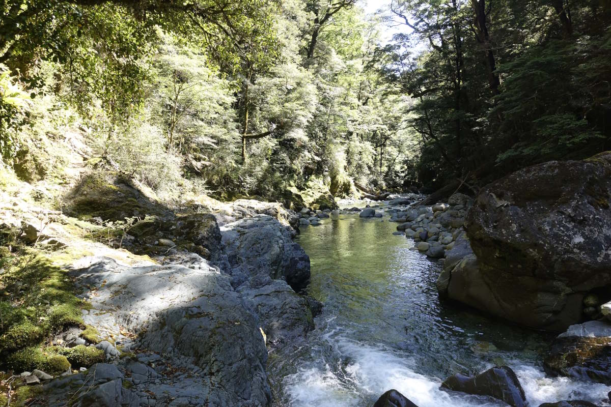
Wairoa River
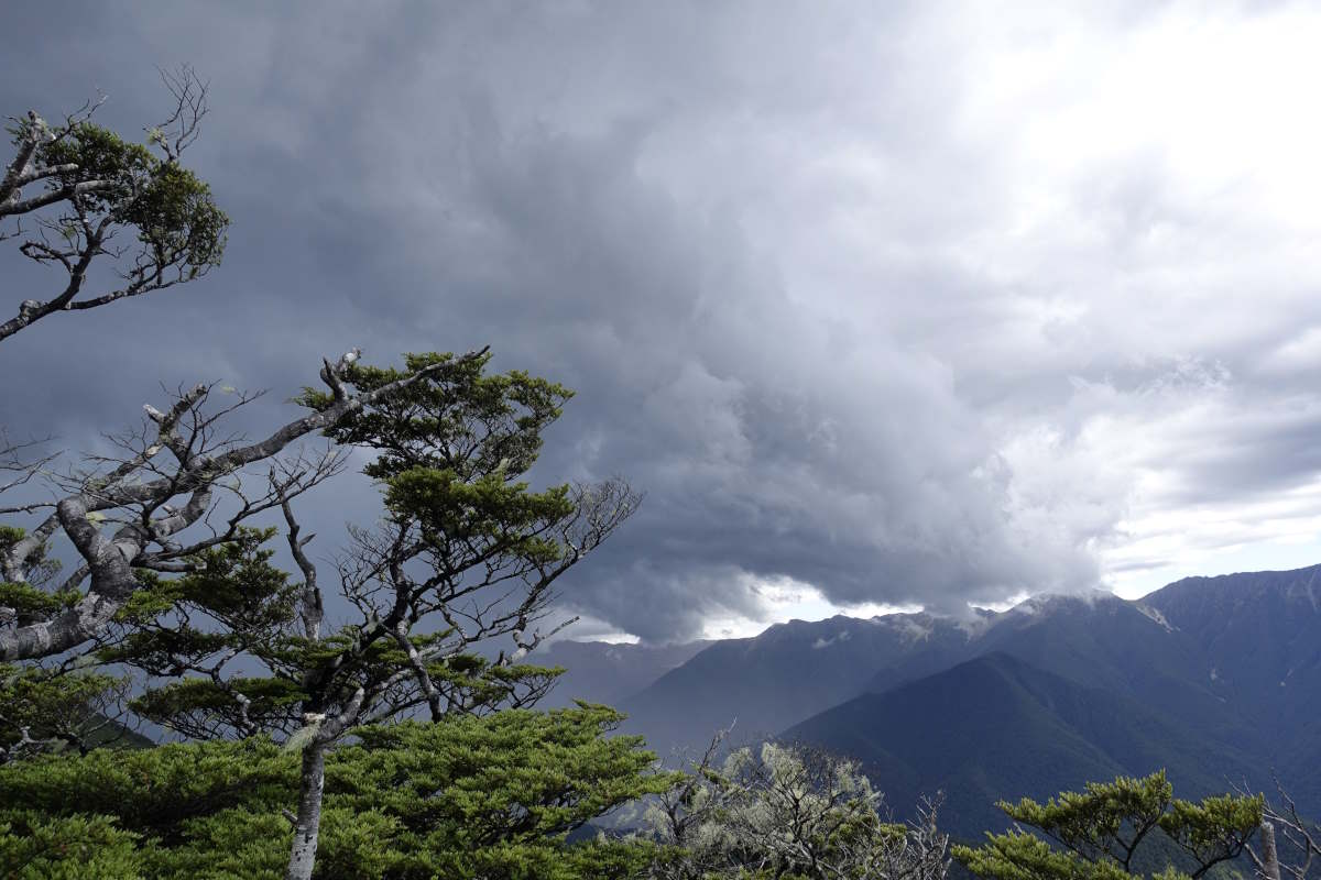
A gathering storm
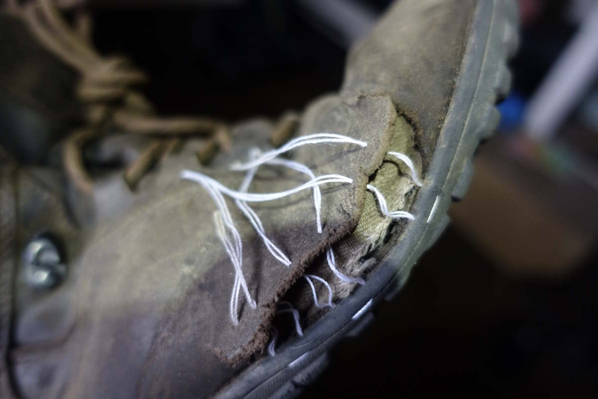
Boot surgery by headtorch
The Tarn of Tarn Hut
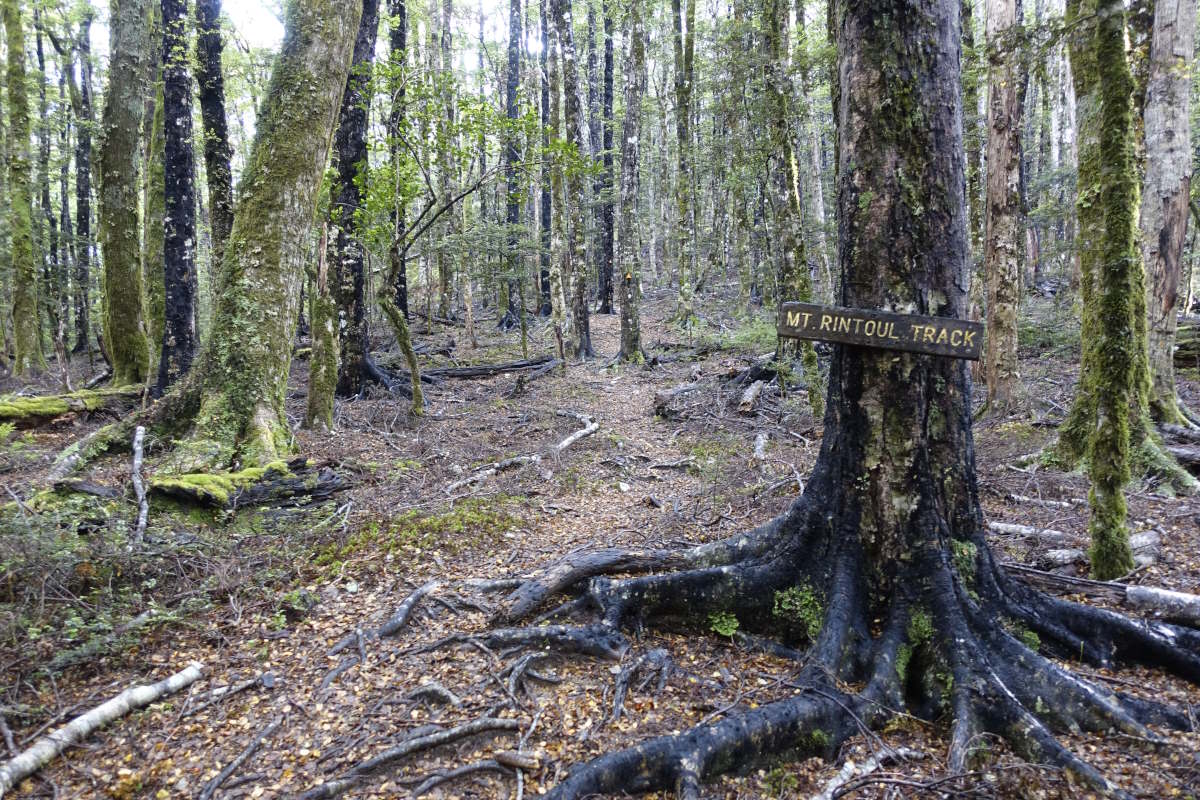
Mt Rintoul Track
Looking back at Red Hill
More head height trees
Mt Rintoul
The down and back up to Little Rintoul
I can see the sea
Old Man Summit
Still plenty of mountains to go
Looking back at Mt Rintoul and Little Rintoul
Down into the clouds
Spot the markers
Pyramid Rock
Slow progress down Hacket Creek
Hacket Hut to Havelock
Pelorus/Daltons Tracks, 62km, 3 days
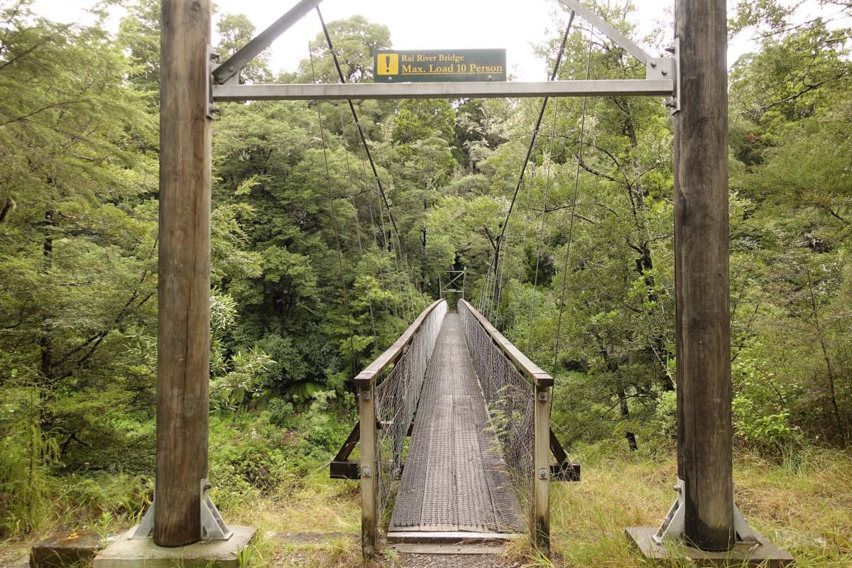
Day 59 (21km): We were 8 in the hut in the end. 6 in bunks, one on the floor and one in the woodshed. Today’s forecast is for sun and it’s my last day on rough ground, the trail following a number of low ridges out towards the end of the mountains. But, frankly I could be anywhere, and there is low cloud and drizzle all morning with no hint of a view. It’s rather atmospheric with all the forest ferns and trees dripping in dense mist. It’s also far too warm for waterproofs so nothing for it but to become one with the sogginess. I pause at Browning Hut and chat to a South bound man who is thinking about quitting this section as he’s not feeling fit enough for the weight and the rough terrain. It’s an odd feature of trails that every time I meet a South-bounder we have between us walked the entire thing, yet don’t have a single step in common. I can tell him how I found the Richmonds, but can’t compare it to anything he has done. Carrying on I eventually conclude that today is pretty straightforward. The trail is thick with tree roots and some growing pools of mud but nothing overly taxing. I stop at Rocks Hut for lunch where there is another on-the-verge-of-quitting South-bounder having a rest day with the fire on and his well blistered feet soaking in a basin of water. I take the chance to air out some damp kit and then there are a few moments of sunshine which is enough to get me moving again and the rest of the day stays dry. The woods are thick with not much of a view but the trail winds along an interesting river creek which even comes with bridges! I can track my return to civilisation by the gradual progression from swaying wire to wood planks to a solid construction rated to take five people at once. I make good progress on steadily better ground and make it to Captains Hut in hot sunshine. It’s a perfect spot for a swim in the river and even has new mattresses for a luxury night of comfort. I chat to the first non-TA walkers that I’ve met in a while and work my way through a triple dinner followed by a small chocolate orgy because I have an embarrassing amount of food left. No regrets. Day 60 (21km): I’m up and off early under a bright blue sky. It’s a peaceful and beautiful walk out along the river past the emerald pools which are indeed a shocking shade of emerald. Then a gravel road with parked cars on it which is rather a novelty, though the novel part wears off quite quickly. I pass the usual waves of South-bound walkers and have a funny moment explaining to one very excited man (I’m the first North-bounder that he’s met) that actually he’s the 17th TA walker I’ve passed this morning and that maybe the trail is not as empty as he thinks it is. It has been feeling distinctly overcrowded for the last couple of weeks and I wonder if I would have escaped that impression travelling South with the flow rather than against it. I’m into Pelorus Bridge for early afternoon and grab myself a spot in the campsite just as the rain starts. Tent up super fast I go and hide in the café and have some excellent fish tacos (with fresh salad!) and lemonade and hot chocolate. So good. Later, I’m sitting about in the camp kitchen listening to a book and watching the rain cascade from the sky when another hiker comes rather flustered to report that the tent field is flooding. I hurry out and find mine sitting in about an inch of water but there isn’t anywhere better to move it. All the stuff inside is fine but my rucksack in the porch is rather sodden. It’s a fairly old bag with the thick shoulder and hip padding that was very much the thing in the early 2000s and said padding has worked wonderfully as a giant sponge… Oh well, not much that can be done about that now. I go cautiously to bed, wondering if my mat might start floating at some point in the night. Day 61 (21km): Another fairly short day. I chatted to a South-bounder yesterday who said it was an awful walk full of wet grass and cow pats and a million stiles and he wished he’s just walked the 16km on the main highway instead so I begin with low expectations. The first part on the circle track is lovely with a proper easy afternoon stroll kind of path and some nice forest, then out into fields which follow the river. Yes there are quite a few stiles and yes the grass is wet so so are my feet but I’m a long way away from wishing I was on a highway instead. Once the day warms and the grass dries I stop and spread out my sopping wet tent and let the rucksack dry. I carry on, reaching a long gravel road where it’s still just about early enough to use up all my remaining phone battery on a call home, and then 2km of car dodging on the highway. I find a bed in the backpackers in Havelock, an obligatory muscle pie for lunch and a shop where finally for the first time in over three weeks I can buy the big pot of fruit yoghurt I’ve been craving and eat it all in one go. Back in civilisation. I’m lounging the afternoon away on a very squishy sofa when I catch a familiar voice and it’s Charlie who should have been long ahead of me but has picked up an eye infection and been stuck here three days waiting for it to get better. We have a good catch up and I sort out washing all my clothes and booking my camp spots and water taxi pick up for the Queen Charlotte Track. Suddenly I have an end date.
Havelock to Ship Cove
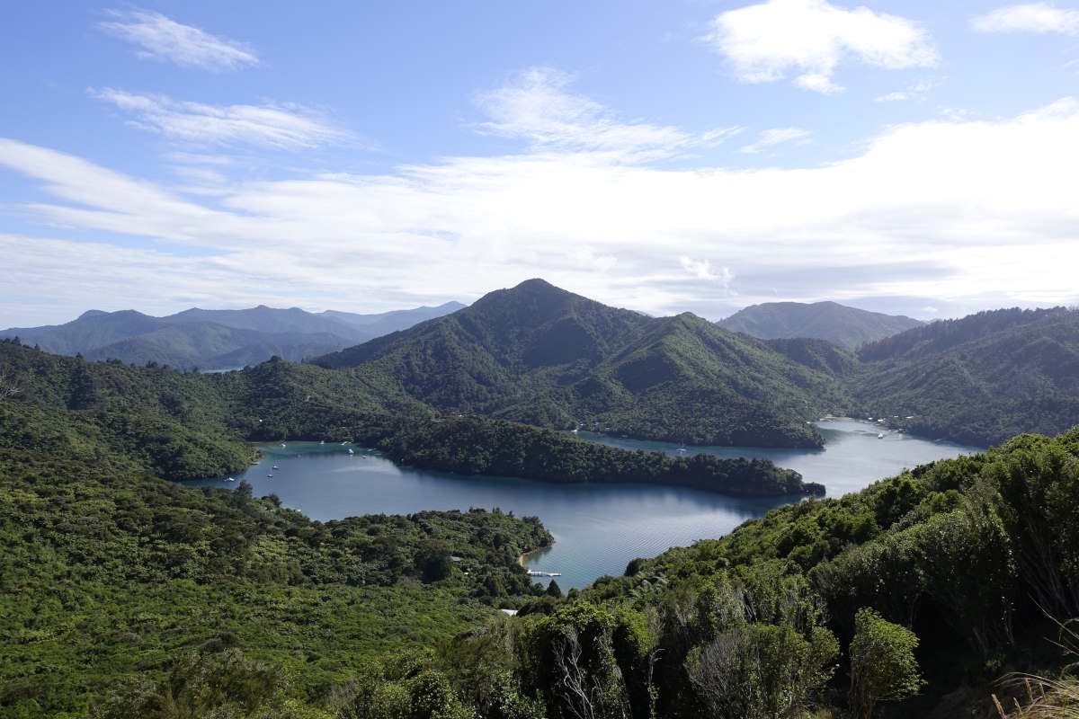
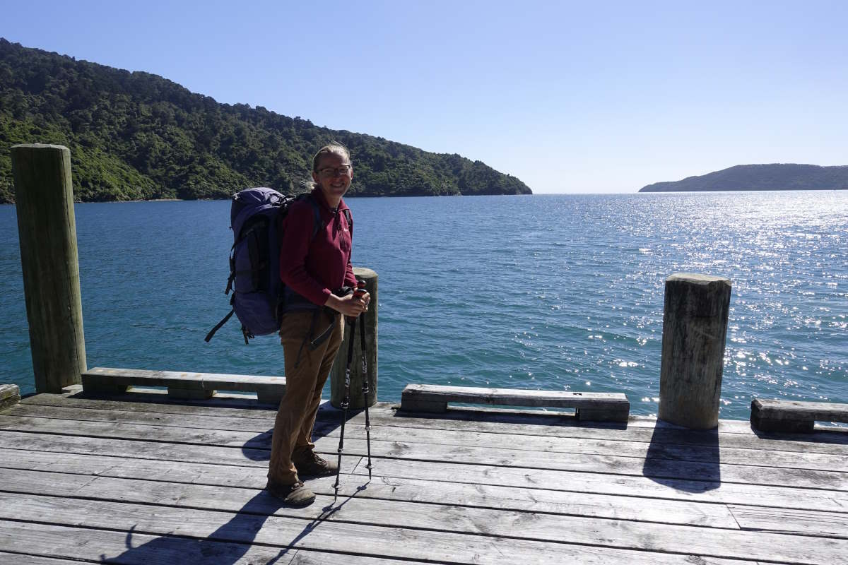
Queen Charlotte Track, 75km, 5 days
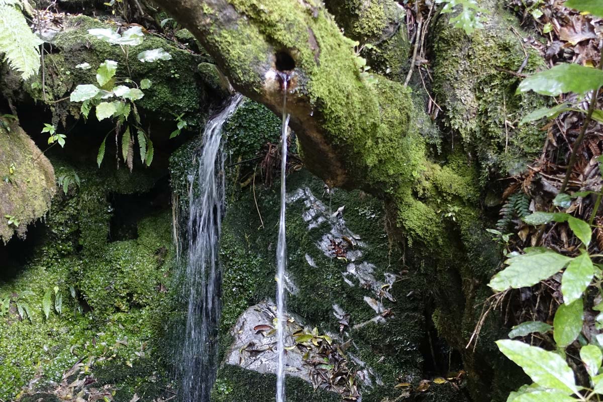
Day 62 (20km): 2 months since departure. I wave goodbye (again) to Charlie who is off to find medical intervention and head out for a short day. I’ve booked all my camps around the weather forecast to hopefully finish in the sunshine and ended up with a very relaxed schedule for my final few days. The Link Pathway proves excellent with lovely easy walking and varied plant life. There are a few little waterfalls including one spouting out of the branch of a tree which I have to take a few minutes to stop and stare at in puzzlement. I can only conclude it is an entirely natural phenomenon and possibly a defiance of the laws of gravity. Down onto the road there is even a pavement and then a stop at the Queen Charlotte tavern for an excellent fish and chips with a big mountain of extra side salad. I have to sit quietly for a good hour of digestion before I can bring myself to put the bag back on again. Onwards, more road and a big group of South-bounders. It’s a heavy bag day once more as, even though I’m only carrying a meagre four days of food I’ve added things like cake and fresh vegetables which probably weighs the equivalent of about eight days of carefully selected dehydratedness. After a reasonable trudge I reach the forest and finally the start of the Queen Charlotte Track. The track is delightfully wide, smooth and easy and there’s not much further to go today. I come quickly to Davies Bay and pitch my tent by the edge of the water. There are remarkably few sandflies and I’m able to lie out on the grass for the evening, listening to my book and mentally editing out the person on a jet ski doing fancy moves. Day 63 (17km): I chat to the family camped next to me this morning and find out that they are doing the TA too, the kids age 11 and 14. I’m suitably impressed but not envious of the weight the parents are carrying. Getting going the walking remains easy and the views beautiful. I take snack stops a plenty and gradually start to reduce the bag back to a more reasonable weight. I found it tricky to judge the stages on this section when I booked my camp spots as all the online guides seem based around a pretty slow average pace, and as a consequence I seem to have ended up with a very relaxed schedule. I reach camp mid afternoon on what was supposed to be “the long day” and it’s rather nice to have a reason to just sit about and relax and not feel the need to push on. Day 64 (16km): Having assured the girl camped beside me last night that I’ve not seen possums in weeks and I doubt they’ll cause bother I am proved very wrong at 1am by a snuffling and scrabbling in the porch of my tent. The offending possum appears to be trying very hard to extract my food bag through a 2 inch gap of open zipper. The outer fabric of my tent which goes all the way to the ground and usually keeps animals out then proves an impenetrable obstacle and we have a bit of a standoff which eventually results in me having to open the door to allow its escape. I close everything more tightly and am just drifting back to sleep when I catch the snuffling of a repeat attempt. I bang a hand against the inner to scare it away, which results in it bolting for the bit of mesh at the end of the tent, and landing directly on my head. We have a small fight, which somehow the ultralight tent fabric between us survives, and it is duly evicted once more. I sleep in late. Luckily it’s another short day, more easy track and beautiful forested bays and sunshine. Camp Bay, my home for the night, turns out to be well positioned with a restaurant just round the corner. I have pizza and a magnum for second lunch followed by a long swim in the sea. It’s another delightful bay, sheltered and shallow enough to soak up the heat of the sun. I’m not the only one enjoying it and find myself sharing the space with a large number of (fortunately non-stinging) jellyfish and a stingray that glides graceful circles between me and the shore. Beautiful. I exit to sit on the pier and listen to the rest of my current book, the sun warm on my back and the sea sparkling below my swinging feet. Day 65 (17km): I lie curled in my sleeping bag and work my way through a steaming pan of porridge while the couple camped beside me start the day with a series of increasingly heated arguments about who should get up to get water, why various things have gotten damp and the precise order that the contents of their tent should be packed away. As I swing my rucksack on to my back and wish them a pleasant day this has progressed to exactly which tent peg must be taken out first. There’s a light drizzle falling from heavy clouds and I meander gently along, more forest and more coves. I take a little detour off the path to lunch under a 1000 year old Remu tree. It’s incredible to think of the changes that have happened in that lifetime; the transition from a land completely untouched by humans, through Maori and European settling to a steady stream of holidaying backpackers snapping photos and reading its info board. I meander on, making it to the tiny shop at Resolution Bay cabins for some supplemental cake and a brief glimpse of a dolphin out in the bay. Onwards, I have schoolhouse bay camp entirely to myself. One final night and only 5km left for the morning. I’m ready to go home, but also sad to be finishing and if feels apt to spend one last night just me and my tent. The wind and the birds and the waves. Peaceful, slightly desolate solitude under a stormy sky. Day 66 (5km): The end. A short walk which the sign says will take 2 hours but actually is just over 1 so I come slightly abruptly out of the trees and here is a pier and the sea and that’s it. A boat has just dropped off the day’s first load of load of tourists so I find somewhere quiet to sit out the way till they’re all gone and I can have the place to myself for a while. It’s warm and sunny and still. Then my boat arrives, bringing more tourists and taking away just me. It does a tour of all the coves I’ve just walked, ferrying bags and occasionally people Southwards along the track. Then finally we’re in Picton. A cotton t-shirt and shorts and an obligatory pair of brightly coloured kiwi socks later and I am become a tourist. But to a brain used to packing up a bag and plodding North, the concept of trying to see all the North Island highlights in just one week is overwhelming. I spend a couple of hours glued to my phone trying to work out how to get the best out of every minute before having to laugh at the irony of what I’m doing. Have I learnt nothing? I call Vicki, and arrange to spend my last few days in her home on the Coromandel Peninsula; swimming, strolling and sharing memories.
Leaving Havelock
Treefall
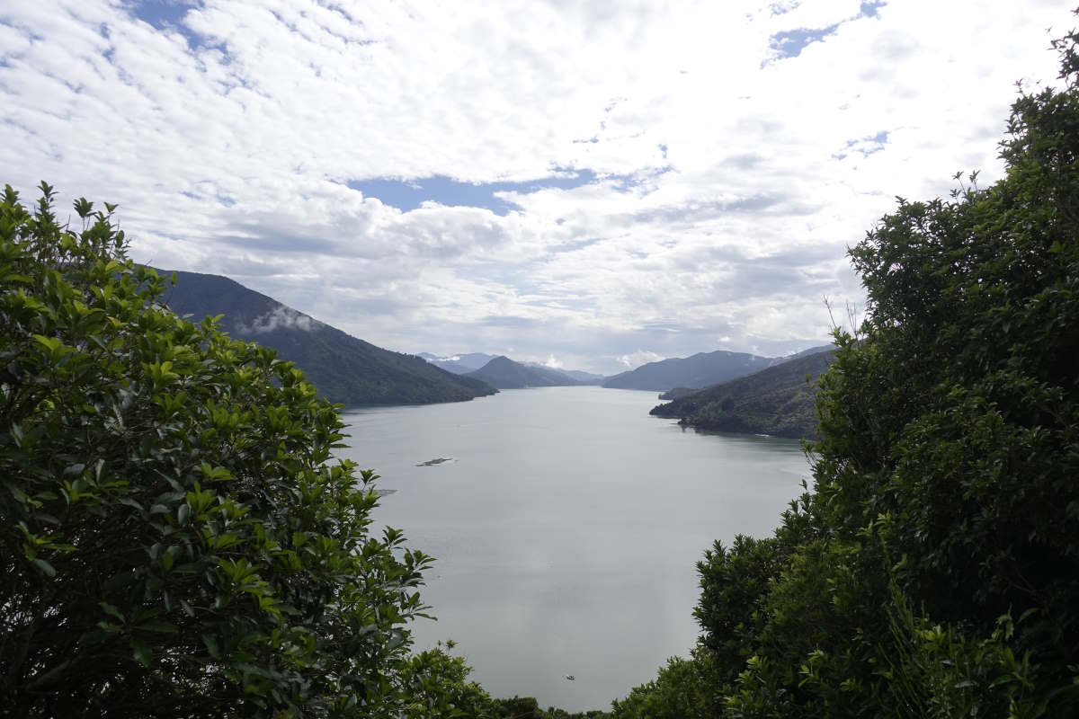
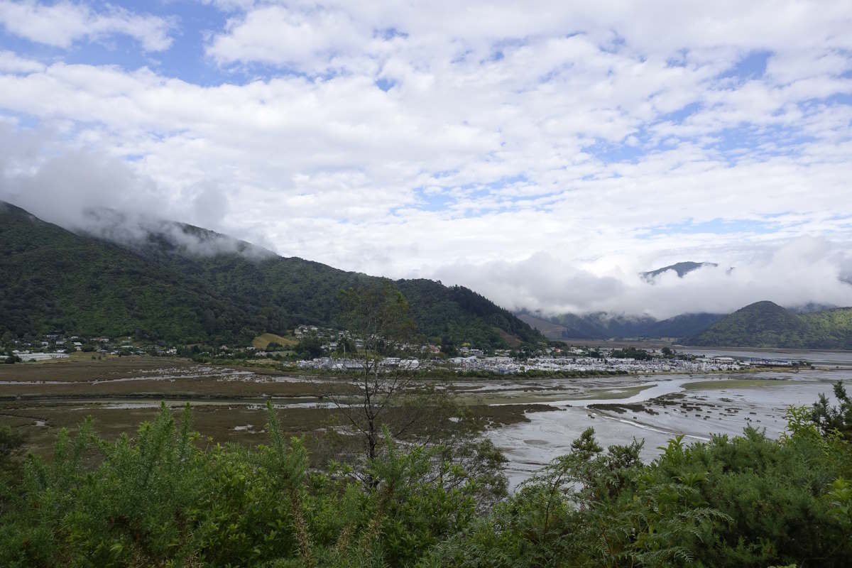
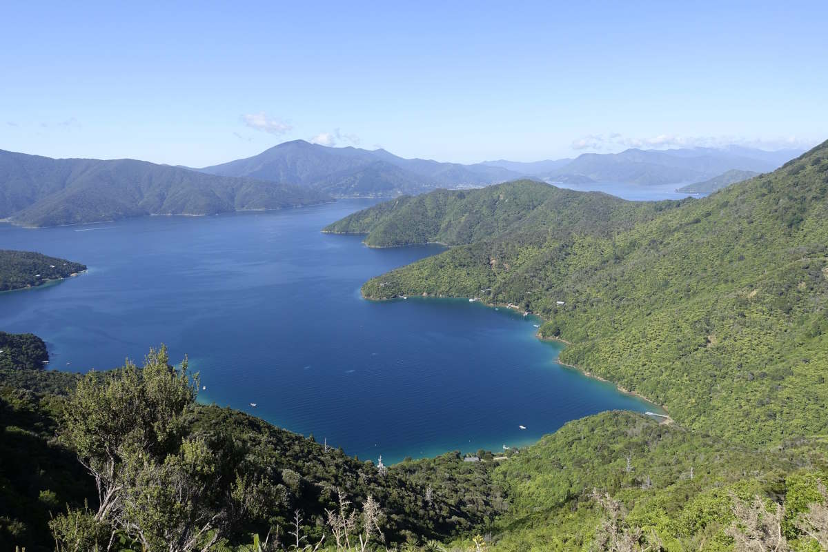
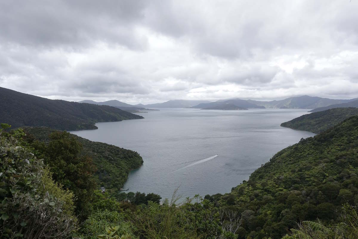
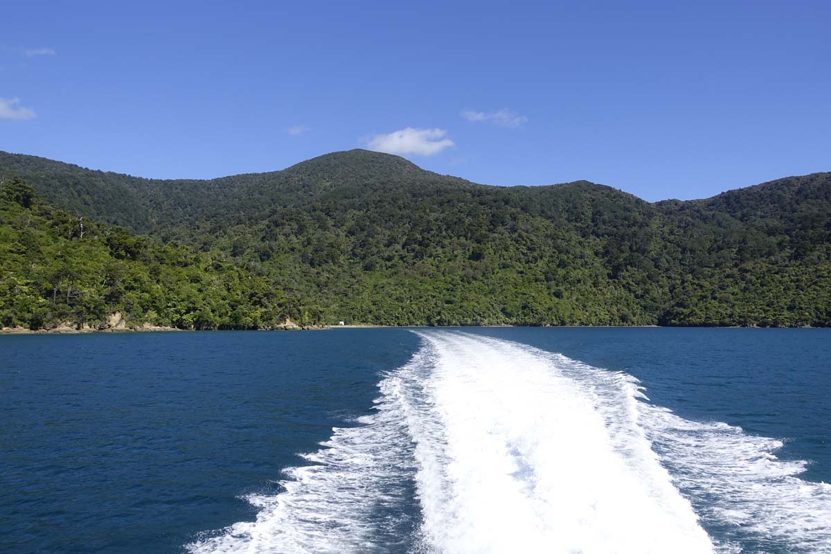
Pelorus Sound
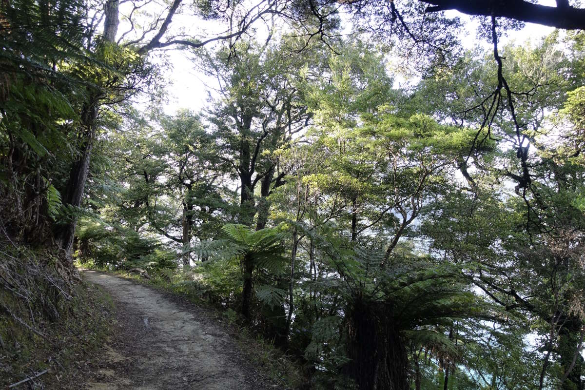
The well manicured Queen Charlotte Track
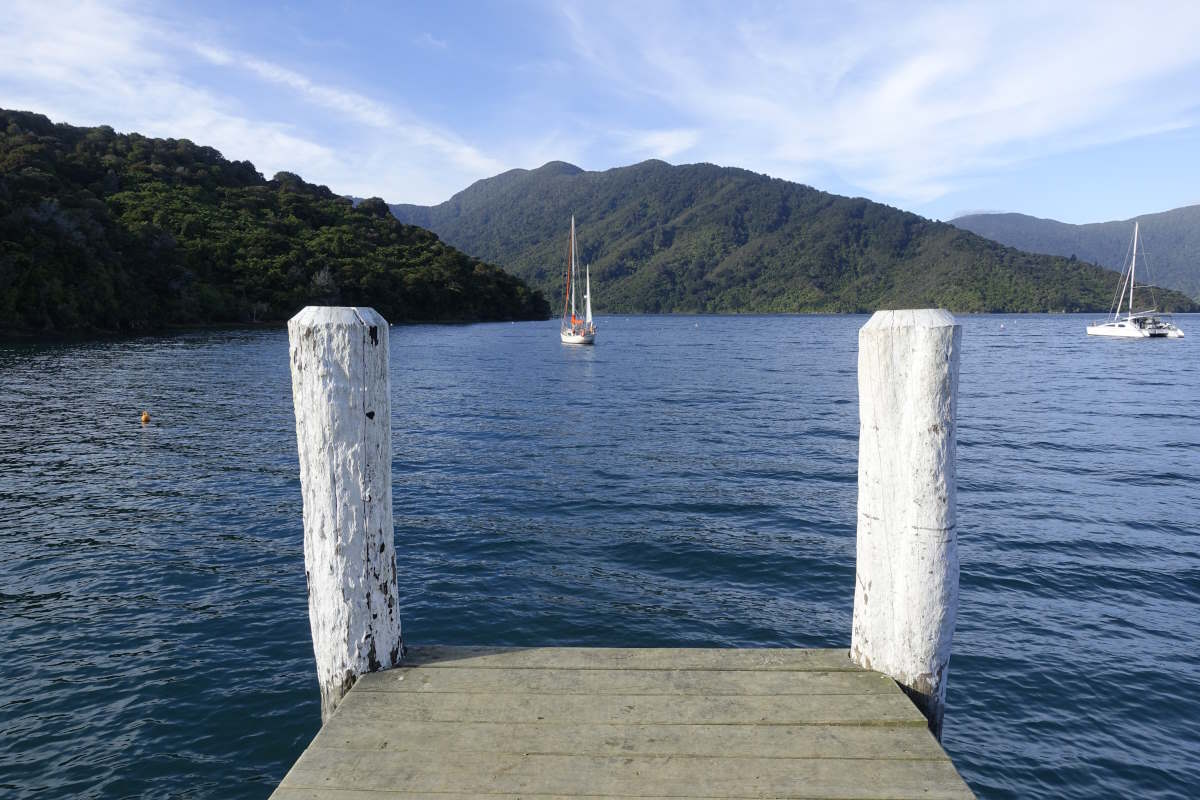
Davies Bay Campsite
Through the forest
Onahau Bay
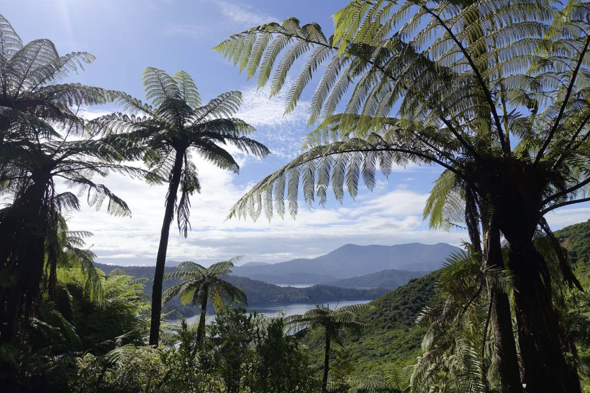
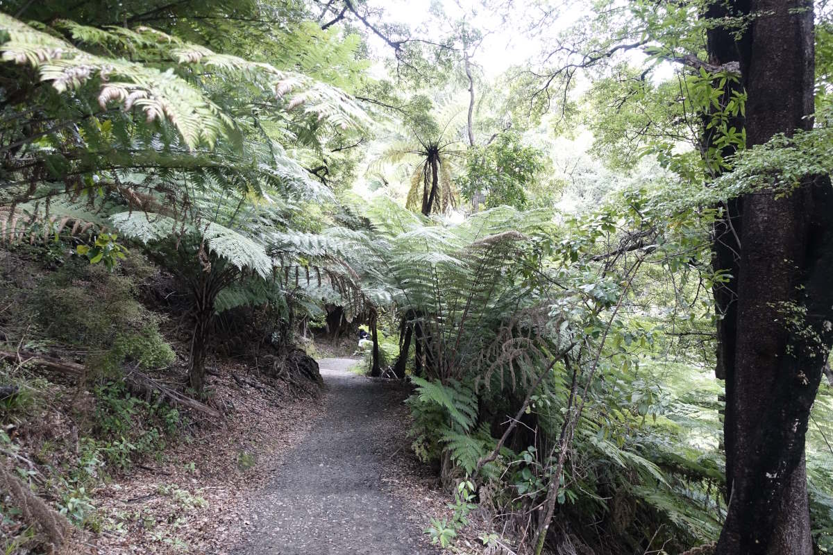
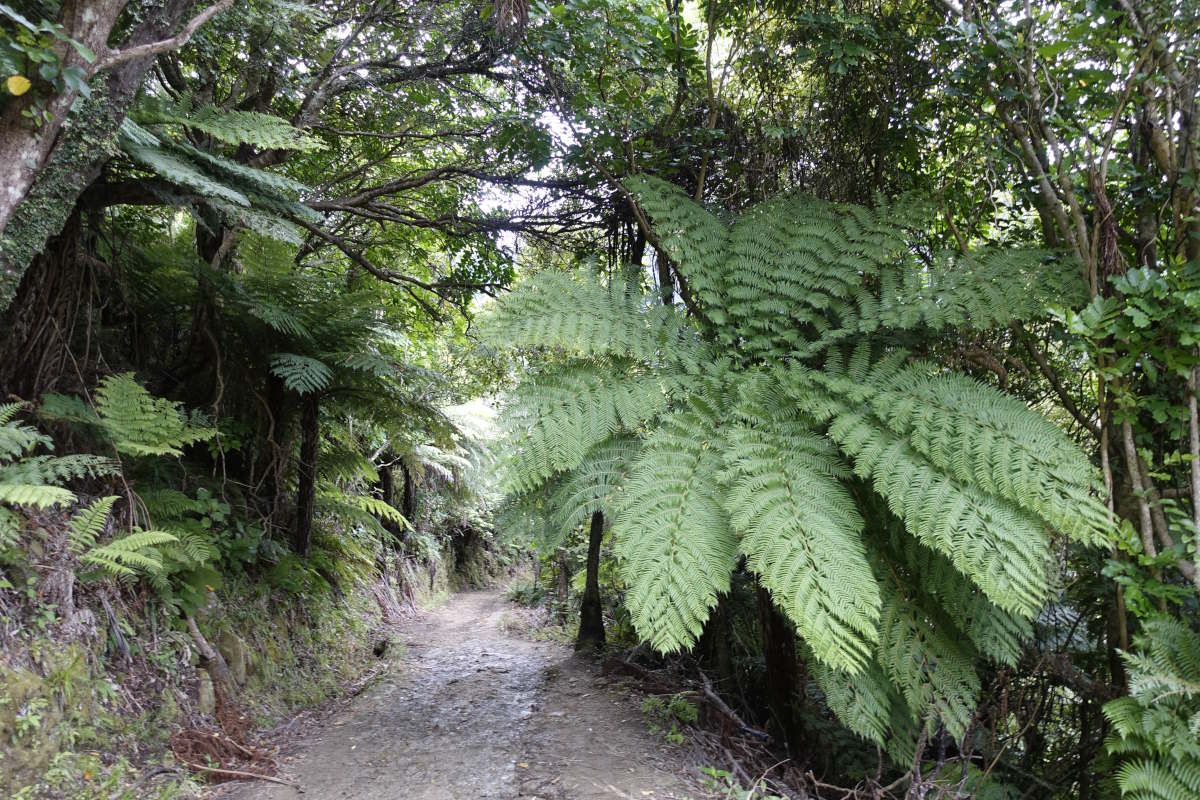
Tree Ferns
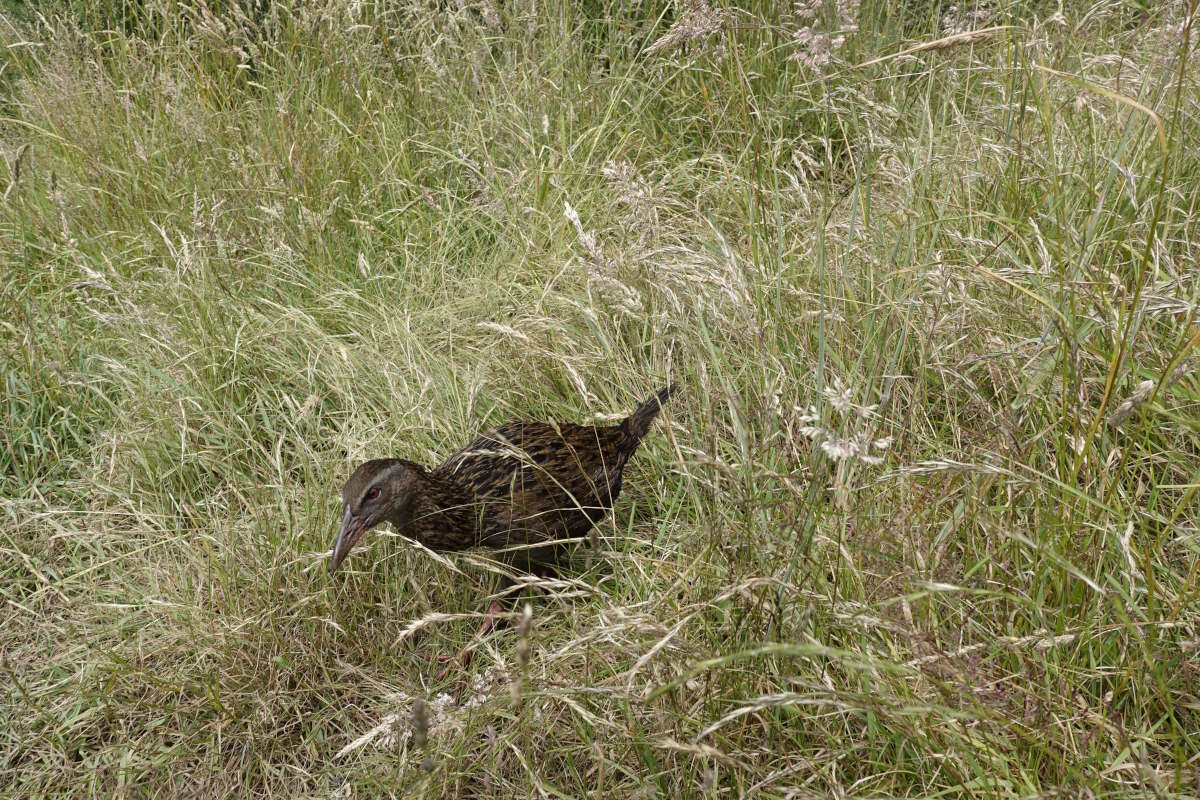
A small dinosaur (weka)
Black Rock Campsite
Tahuahua Bay
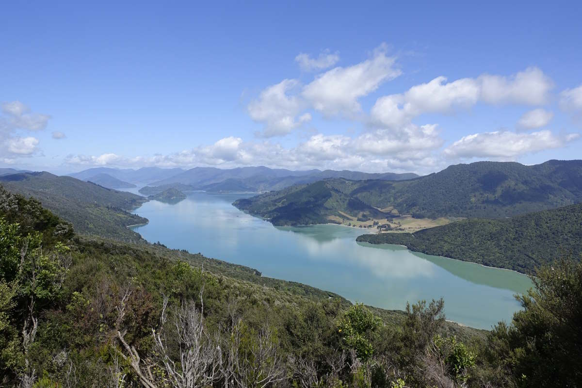
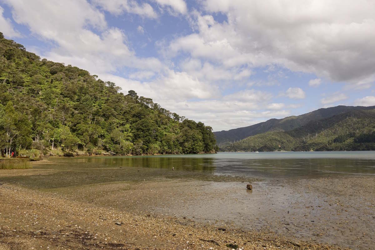
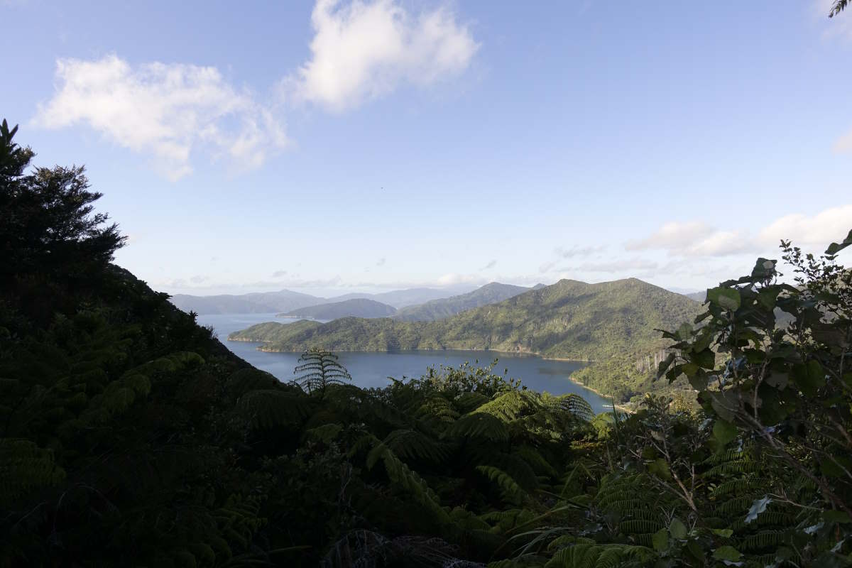
Queen Charlotte Sound
Camp Bay
Big Bay
More ferns
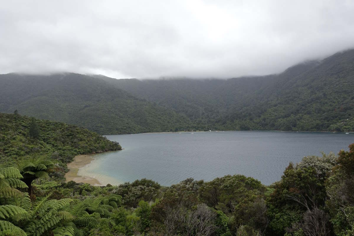
Endeavour Inlet
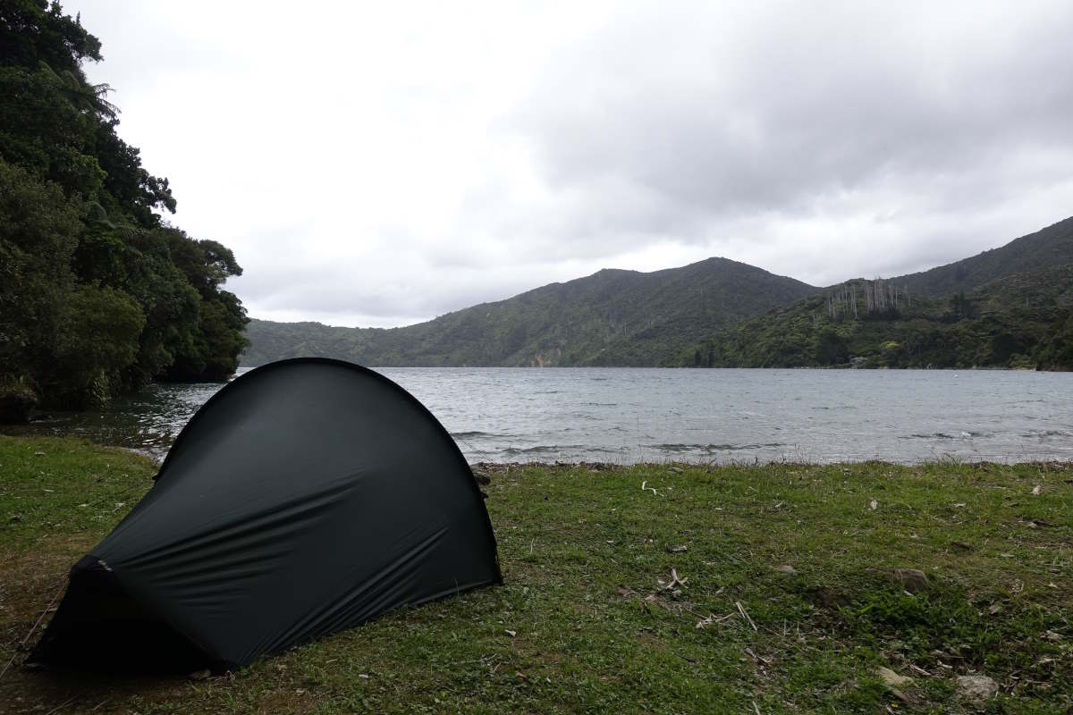
One final camp
Looking back to Resolution Bay
Meretoto, Ship Cove. The End
...