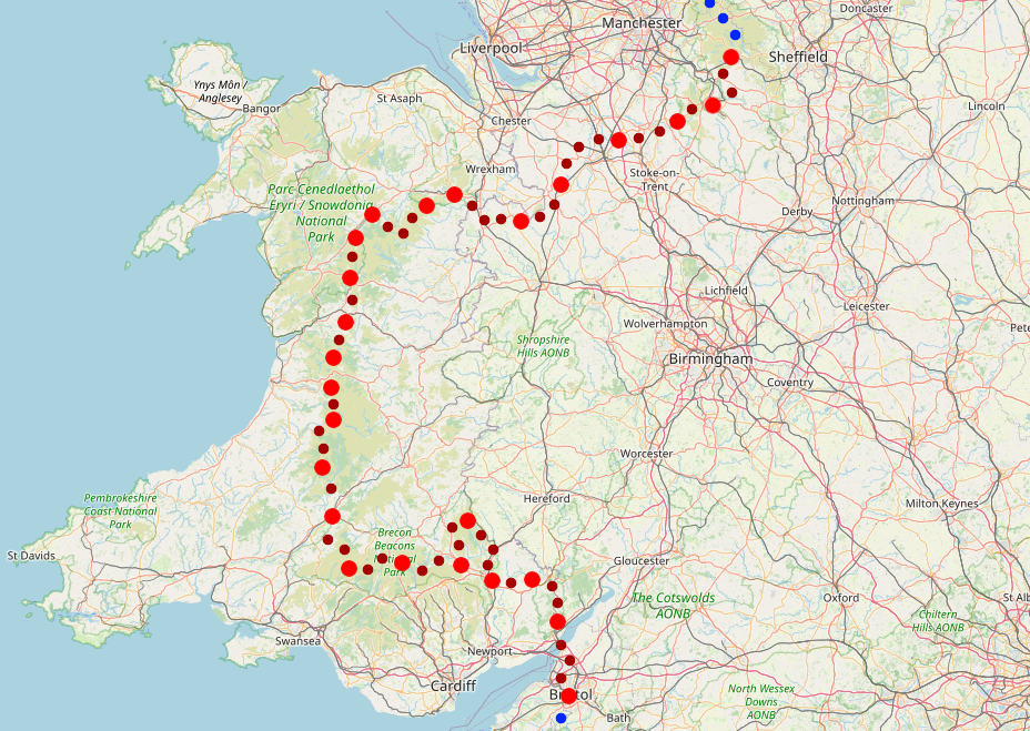
Land's End to Cape Wrath
Part 2: Bristol to Edale
April 2022
This is the second part of my End to End journey, picking up in Bristol and taking me onwards over the Severn into Wales. After a couple of days on Offa’s Dyke I joined the Cambrian Way across the summits of the Brecon Beacons, before heading North to the edge of Snowdonia. Here I turned off and made my own route, following the Aranau and Berwynion ranges to Llangollan where I picked up a series of canal paths to whisk me safely across to the edge of the Peak District. << Back to Part 1 | End to End Home Page | Onwards to Part 3 >>
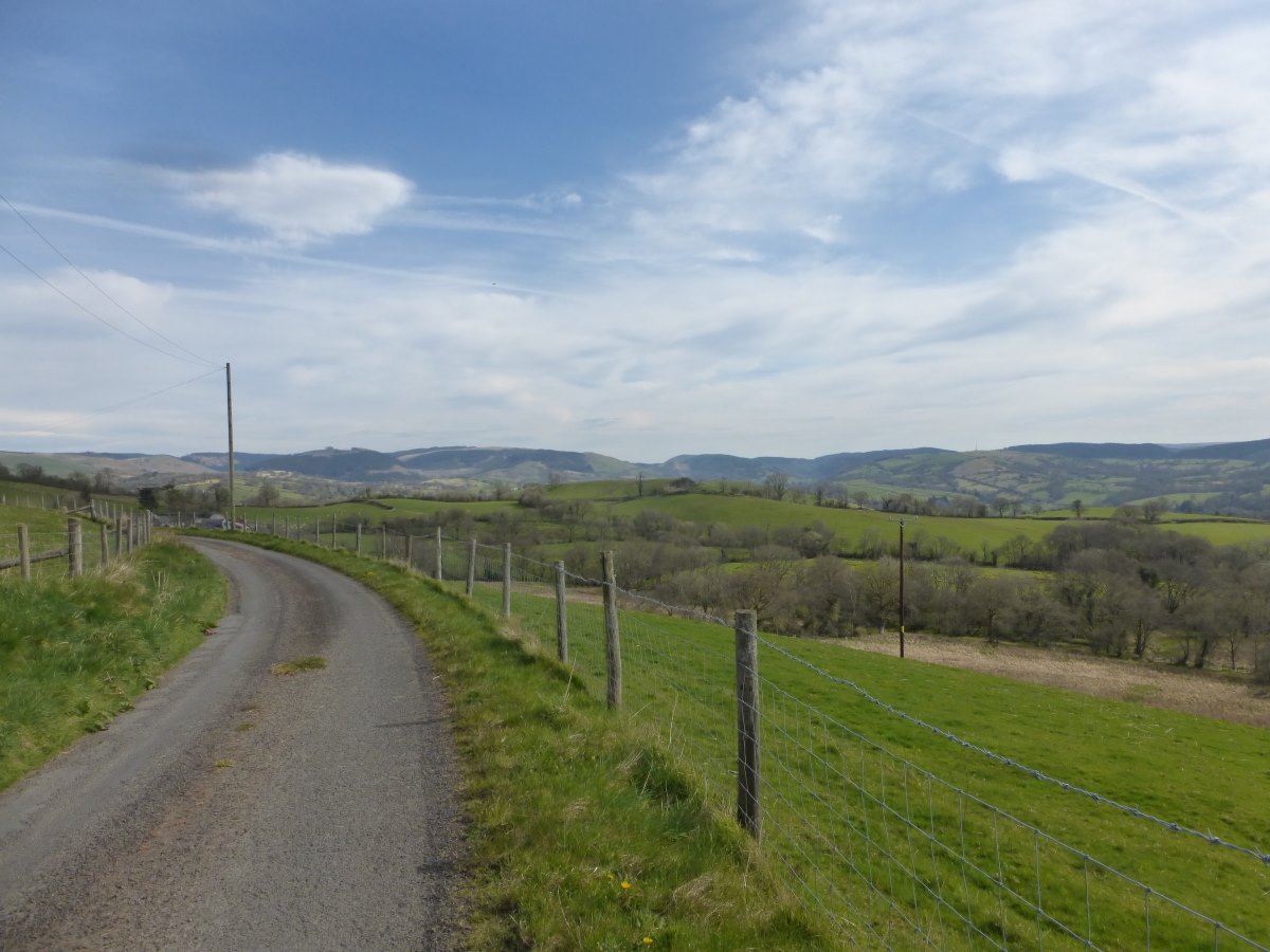
Bristol to Abergavenny
Cycle paths and Offa's Dyke, 52 miles, 3 days
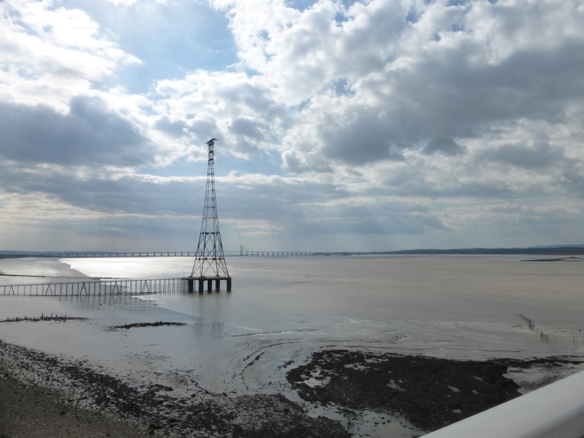
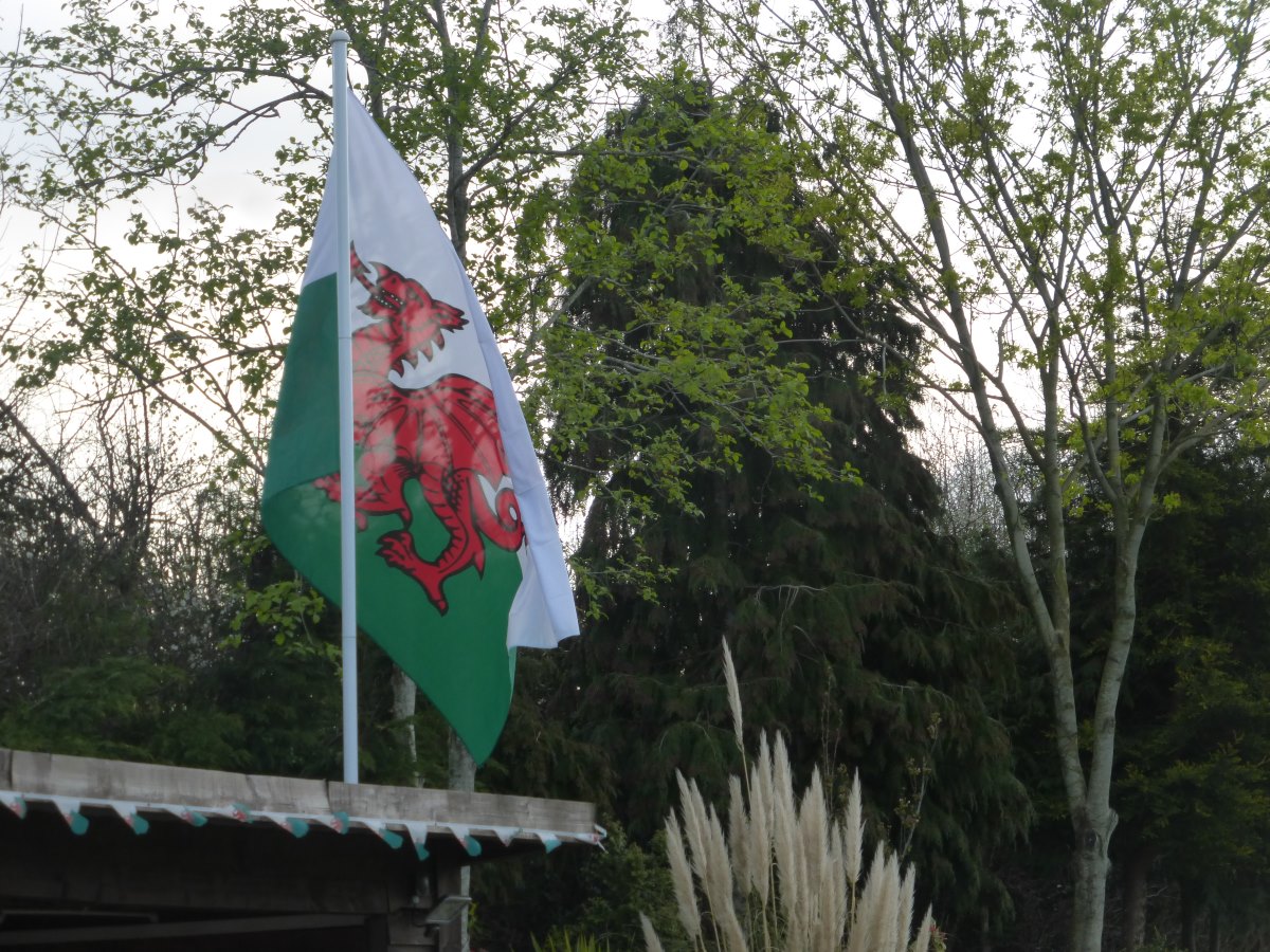
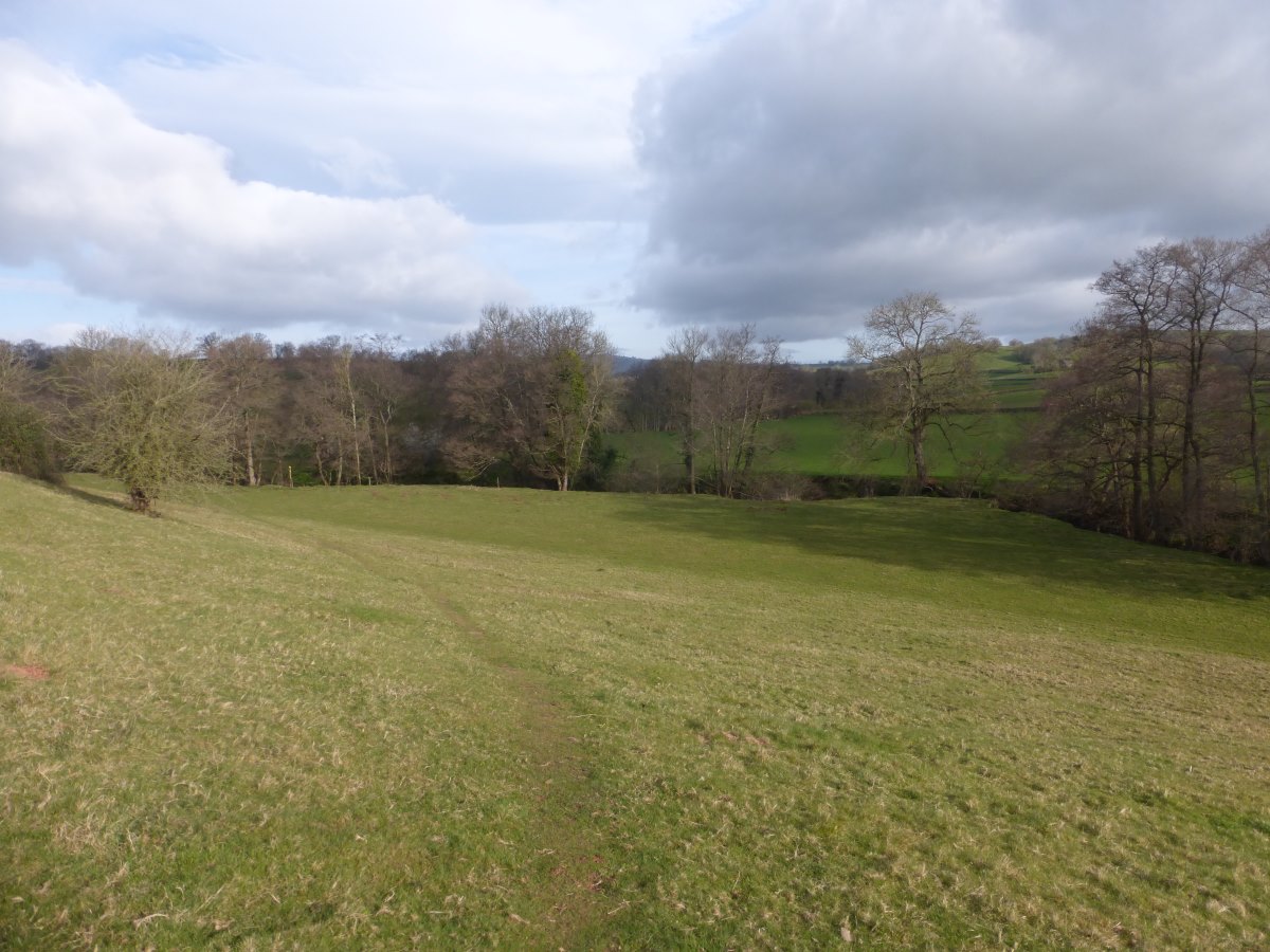
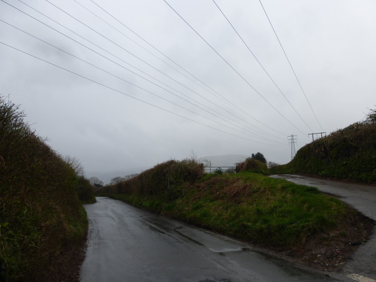
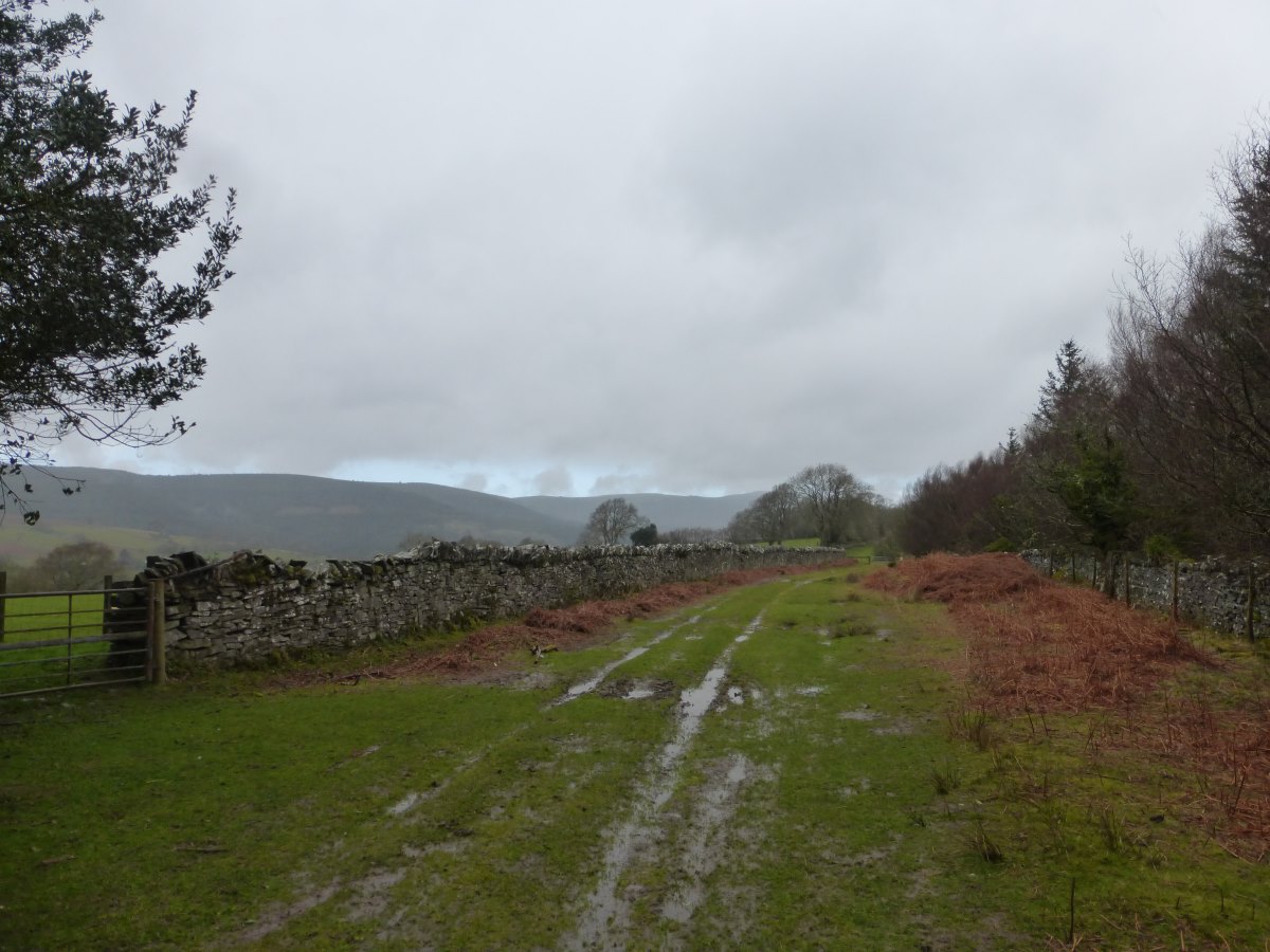
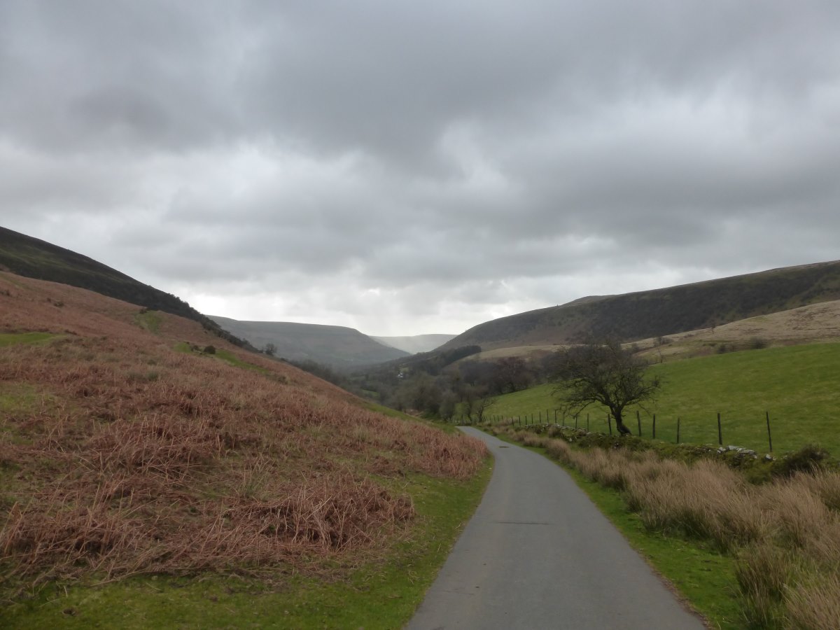
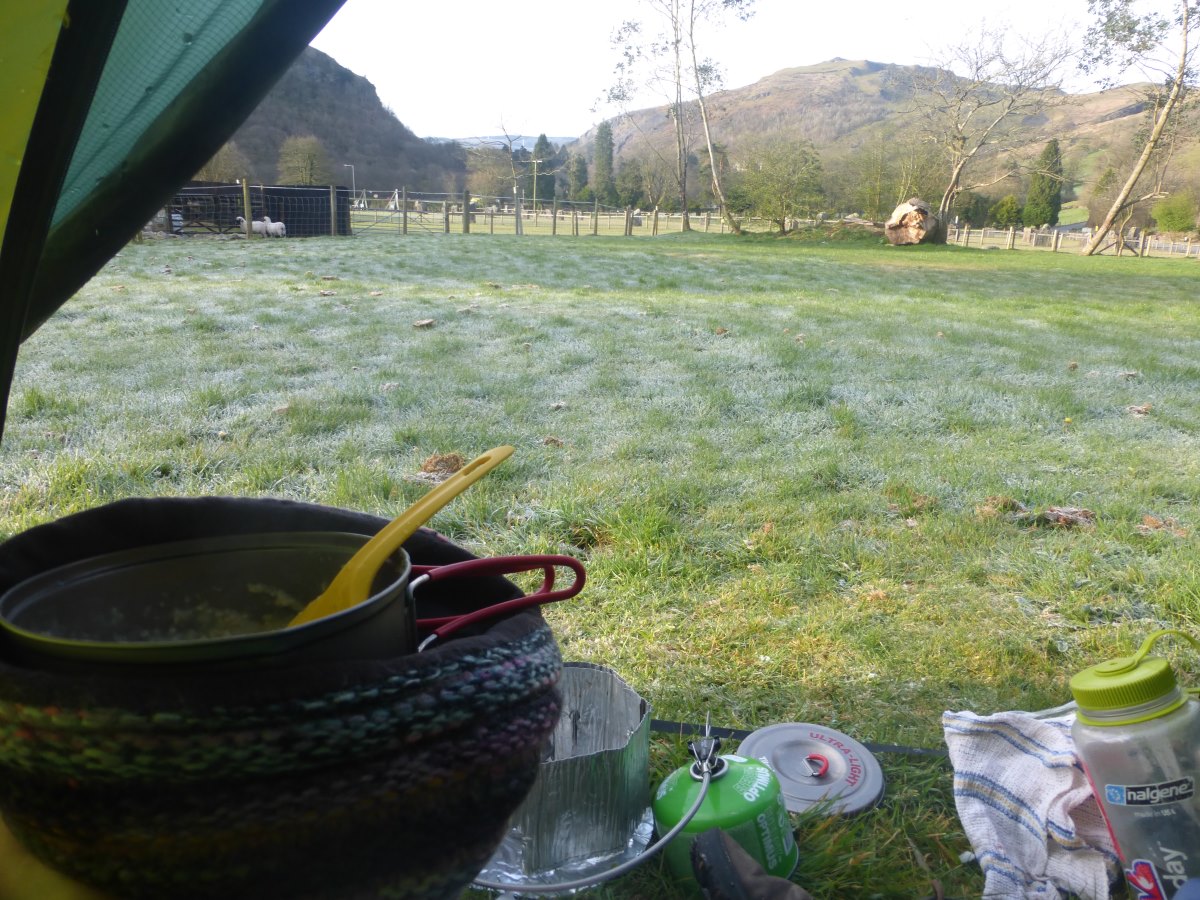
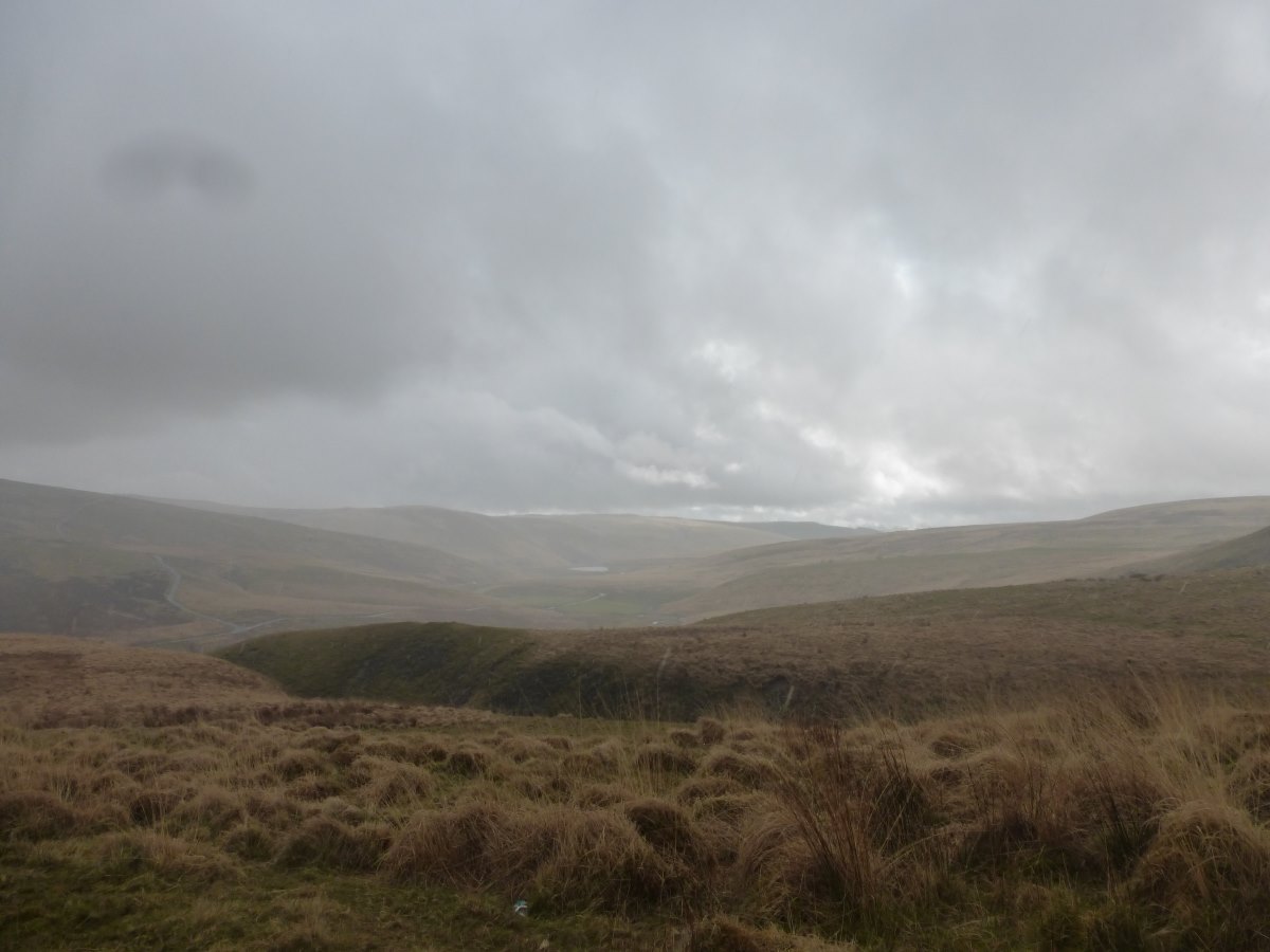
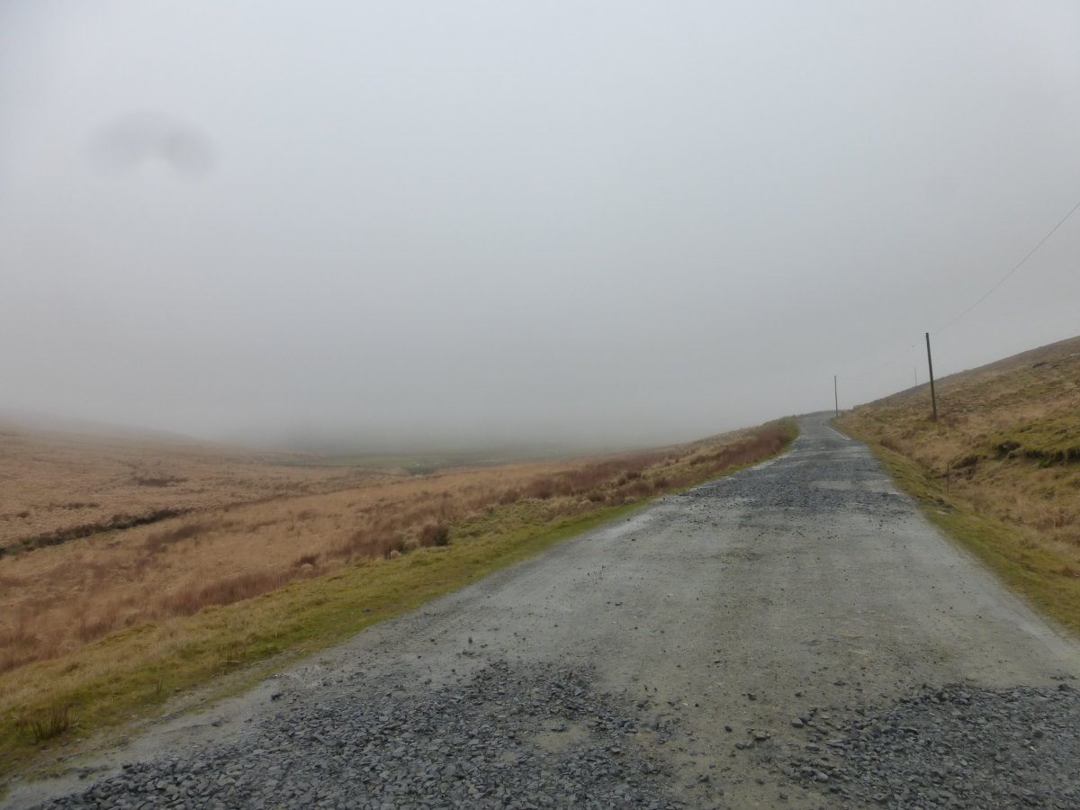
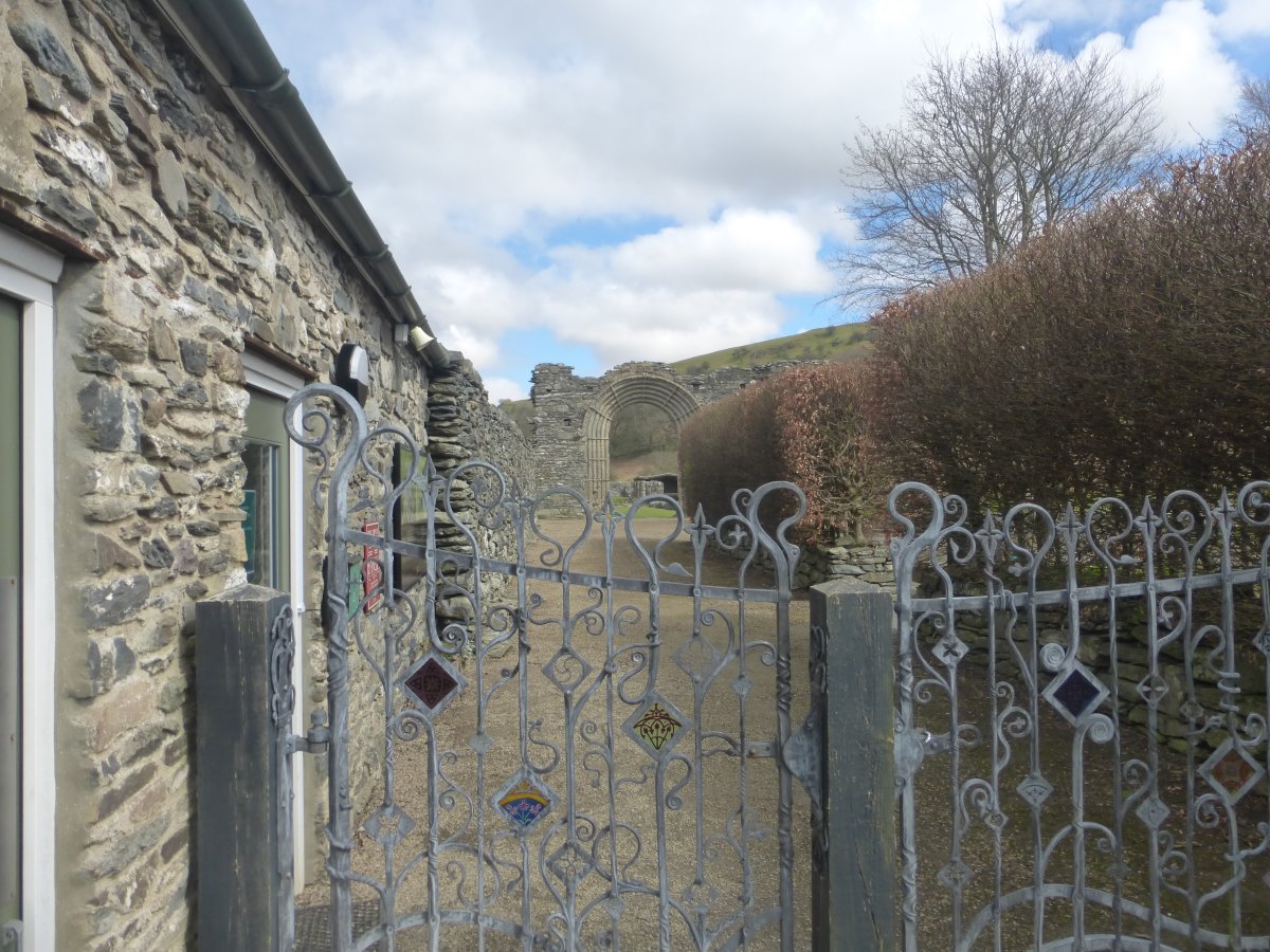
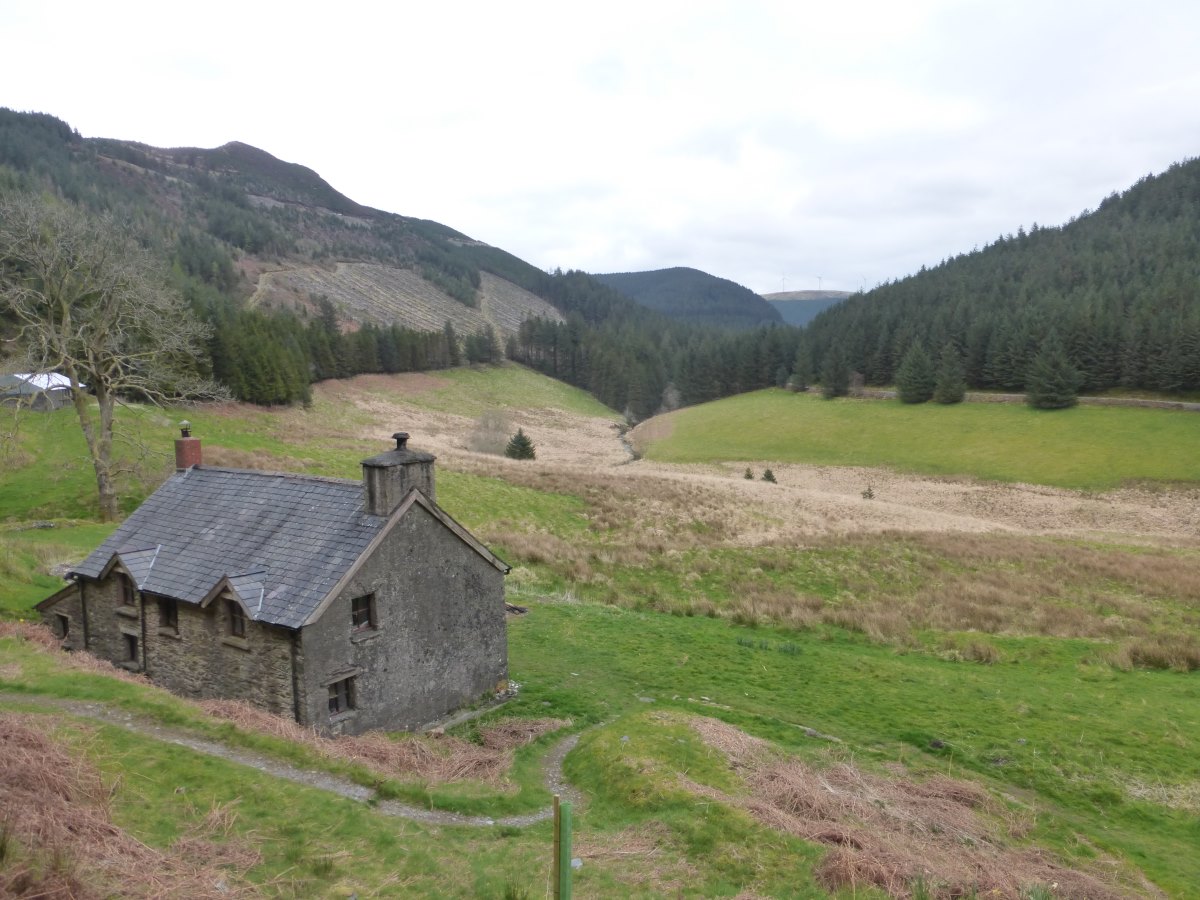
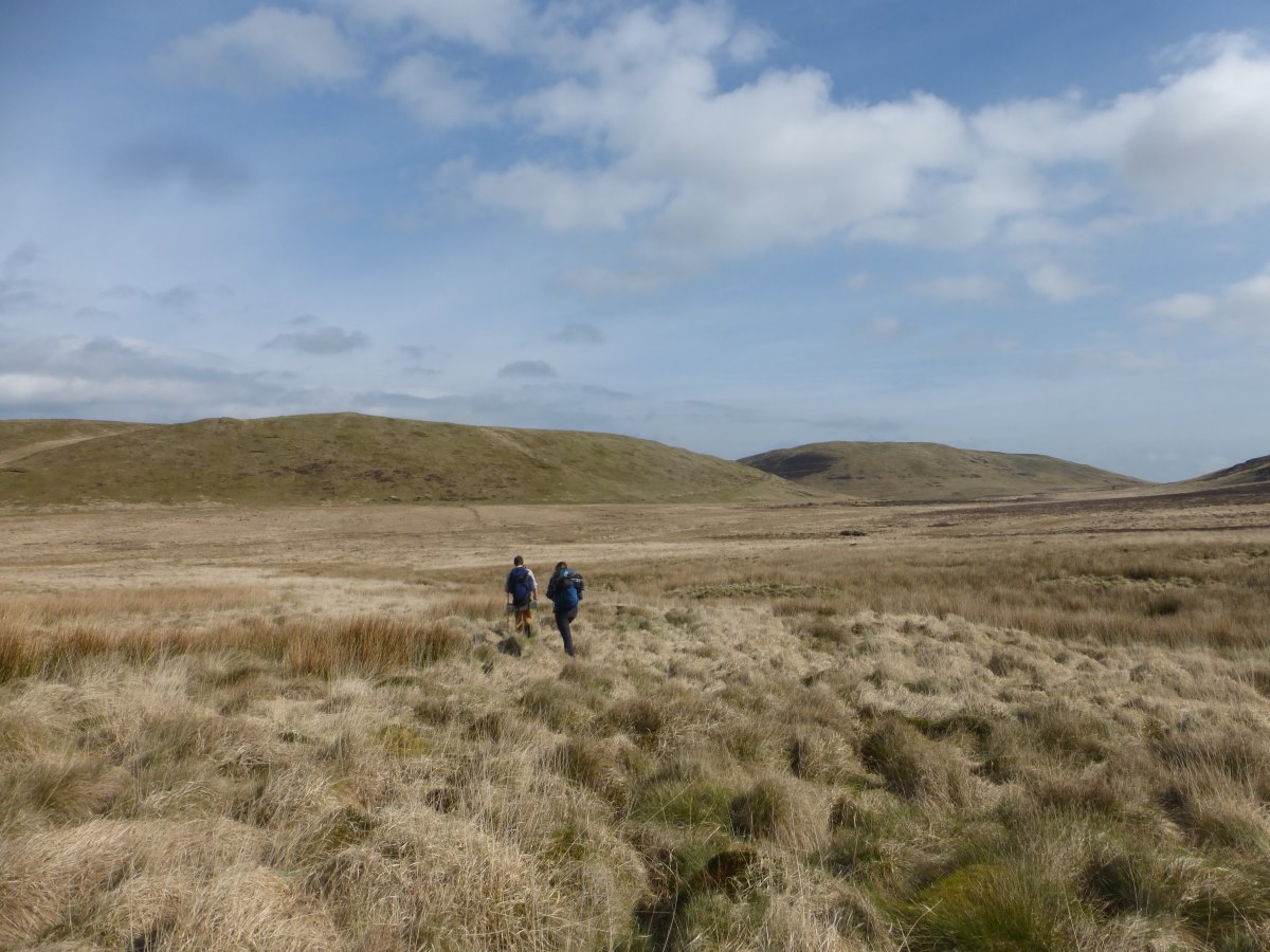
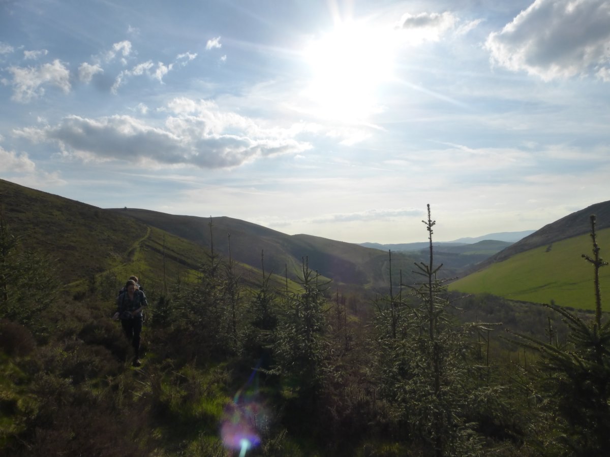
Day 27-29: my first rest days. I experience great excitement washing my clothes in an actual washing machine and opening my resupply box from home. Painting Lizzie’s kitchen and assembling flat-pack furniture is less exciting but satisfying and prevents my legs from seizing up completely. Robbie joins on the last day and we have a lovely few hours (in between furniture assemblies and deliveries) exploring a bit of Bristol. Day 30: it’s finally time to leave again. It is a bright sunny morning with a hint of frost and Robbie and Lizzie join me as far as ASDA for our respective shopping. Bag full and alone again I pick up the community forest trail which winds a pleasant path around railways and motorways with minimal contact with that busy world. The woods are full of the first bluebells and it feels like I really am now coming into spring. An off road cycle track takes me across to the Severn where I plan to follow the waterfront up to the bridge which has just come into view. Nope. Turns out there is some enormous development of some sort which has closed all paths North for several miles. It’s quite tricky to work out a suitable diversion from their aerial photos with lots of colour coded “closed” and “partly closed” (what does this even mean?) routes. In the end I follow a cycle route which has a few signposted diversions and the whole thing probably adds at least an hour of walking to the day. The bridge remains infuriatingly visible for much of it - away on my left as I walk a huge circle around it. But I make it, and experience a little thrill of anticipation as I step out onto my crossing into Wales. It’s a very long bridge and the crossing takes over an hour. It’s windy, exposed and cold. It vibrates with the passage of large lorries. But it’s also a really awesome way to cross a border and has a fantastic view. I pass through Chepstow where I join Offa’s Dyke path and cross another (much smaller) bridge over the Wye where suddenly there’s a sign saying “welcome to Gloucestershire”. Well that didn’t last long. I refuse to photograph it, deciding stubbornly that I’m still in Wales spiritually and that I’ve left England behind. I follow Offa’s Dyke up onto the edge of a spectacular wooded gorge where I find a lovely flat camp spot under an enormous old beech tree. As I drift towards sleep an owl starts hooting overhead. A tawny female. I experience a certain horror at the thought of what might be to come but thankfully she doesn’t have the staying power of those far away three and my night is mostly undisturbed. Day 31: I’m feeling happy this morning, spending multiple days on the same trail is something I’ve not done since leaving Devon and it takes a lot of the strain out of navigation. Offa’s dyke is splendidly well signposted and I scarcely have to look at the map all day. I continue through the woods where there are occasional spectacular views down to the river below (one advantage of being so early in the year before there are leaves on the trees), and a great view of Tiniturn Abbey from the Devil’s Pulpit. I also meet a bit of the original Dyke - a long earth mound that snakes alongside me, though without the info boards to point it out I would probably have missed it. Down the hill I’m getting really thirsty - there was a stream right by my camp spot but it smelt foul and I didn’t dare to filter it. I reach the river which is opaque with sediment. Hmmm. I knock on a few doors to see if anyone will fill a bottle for me. There are lights on in all the houses I try but no-one answers. Hmmm again. Carrying on salvation is reached in the form of an honesty box “cake shop” selling cans of Caweston Press. It’s never tasted so good. In the afternoon I spot another rucksack bobbing along ahead and meet my first fellow Offa’s Dyke walker. We leapfrog each other for the rest of the day, me walking faster, him stopping less. At one point I lose my footing on a slippery hill and go sliding a few metres in the mud. So much for my lovely clean clothes machine washed only two days ago. I manage to remove the worst of it in a stream, though I feel it is still pretty obvious what has happened. Late in the day I push myself on and pick a campsite to aim for the other side of Monmouth. It turns out to be a lovely place with a duck pond which I have entirely to myself. There’s even a kettle and a microwave for extra quick cooking. Day 32: an indecisive day. My original plan is to leave Offa’s Dyke and cut across to Abergavenny where I pick up the Cambrian Way up the Sugar Loaf and round in a big loop over the Black Mountains. But the weather’s really not looking great. Tomorrow’s a wash out, then there are 3 good days, then 2 weeks of rain. So it would make sense to chop off the Black Mountains loop and use the good days for the Brecon Beacons. But I don’t want to reach the end and find the weather wasn’t that bad after all and I regret missing them out. There’s also no point trying to go up the Sugar Loaf tomorrow so if I’m doing the loop it actually makes more sense to miss out Abergavenny and carry on up Offa’s Dyke. I mull all this over while wandering through sheep fields and patches of woodland. I reach White Castle where I really need to make a decision about whether I go left (Abergavenny) or right (Offa’s Dyke) and I have an extended lunch break and a wander round the ruins and continue to be indecisive. Eventually it comes down to food. There are no shops if I go right, therefore I must go to Abergavenny. I do so. Then, bag fully stocked I continue dithering about which way to set off to find a camp spot (Black Mountains or no Black Mountains) and eventually dither so much that I do neither and spend the night in a B&B instead. I spread all my maps out on the bed, refresh the weather forecast several times, phone home. Eventually I opt for the Black Mountains. Bed.
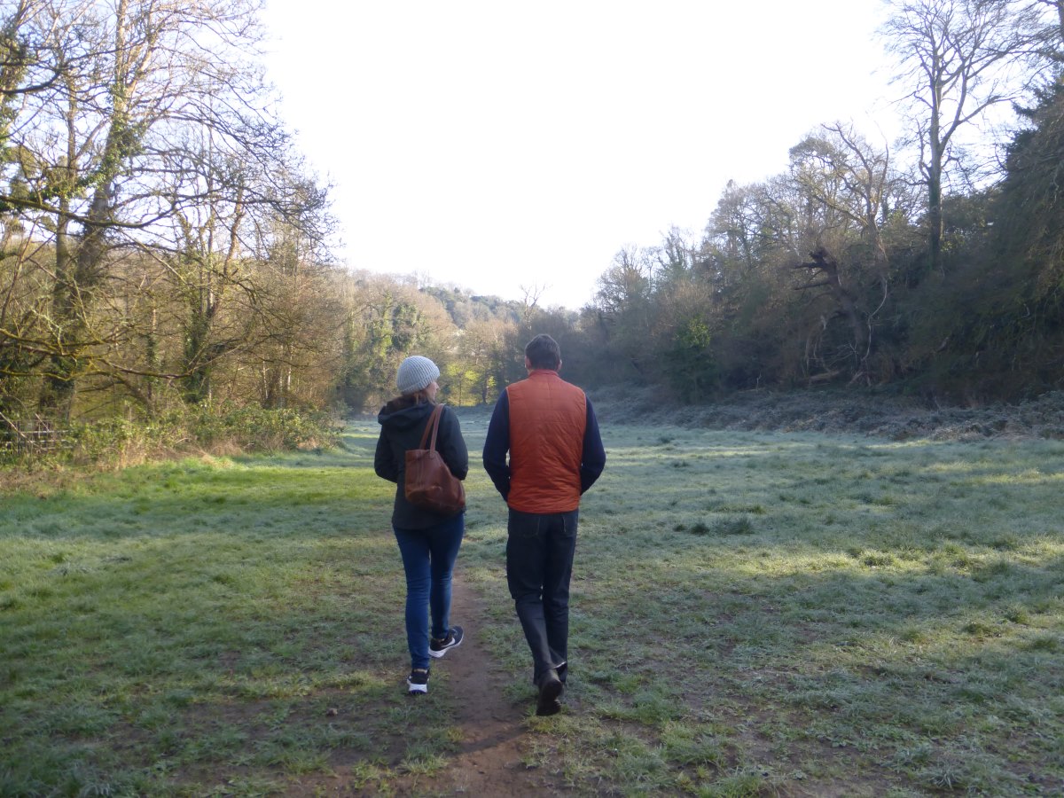
Leaving Bristol with Lizzie and Robbie
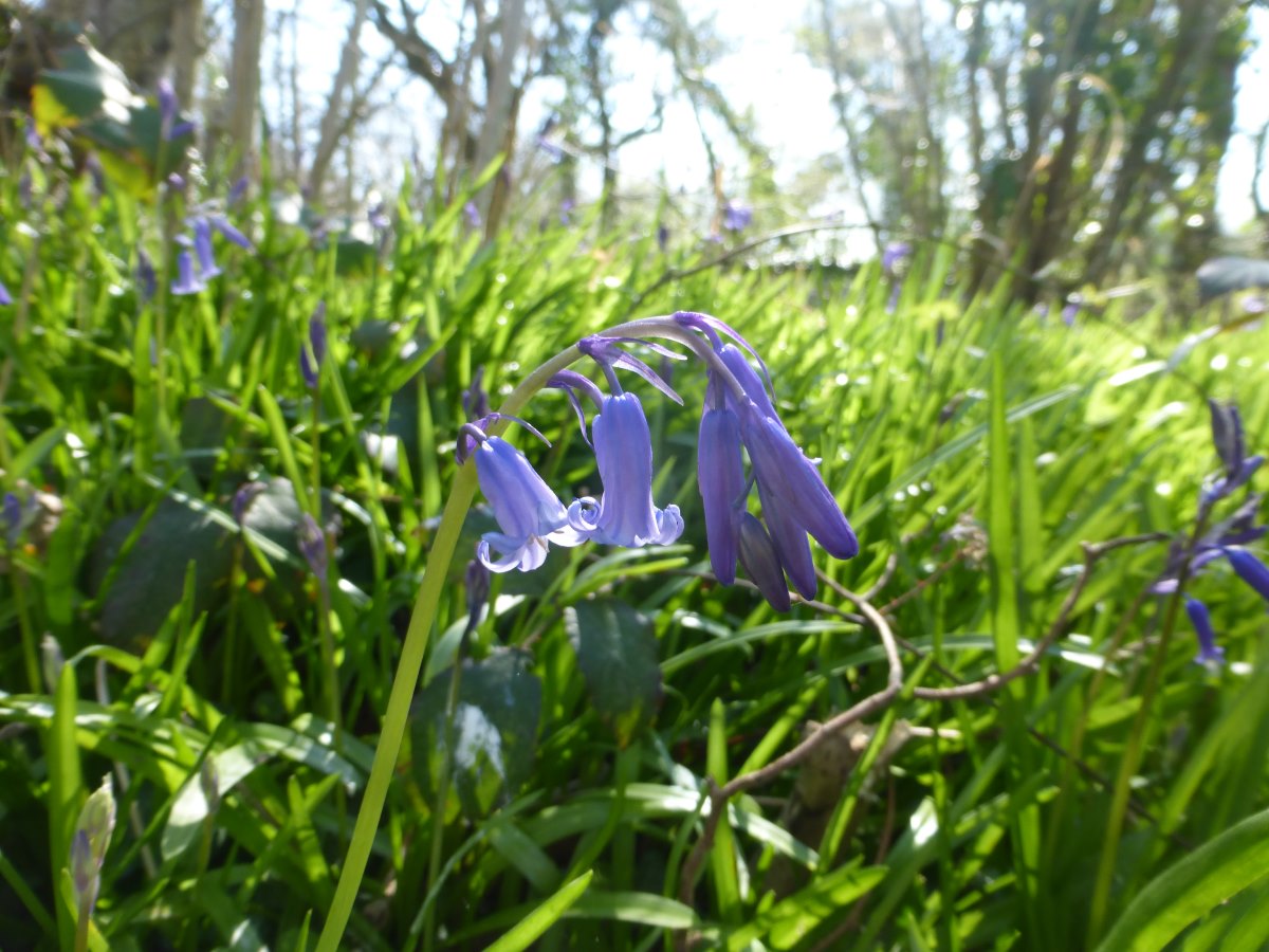
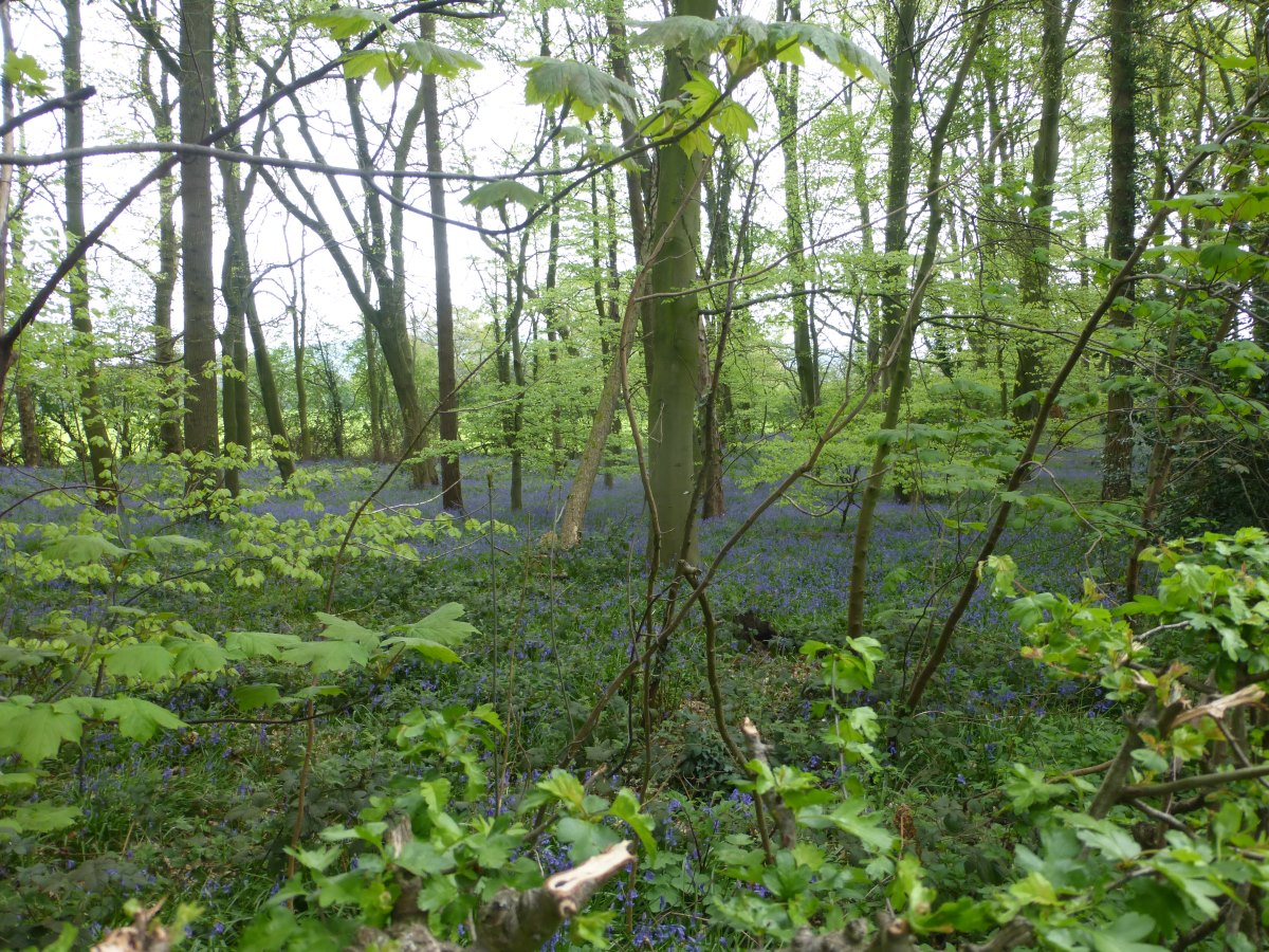
Bluebells
Navagating the roads
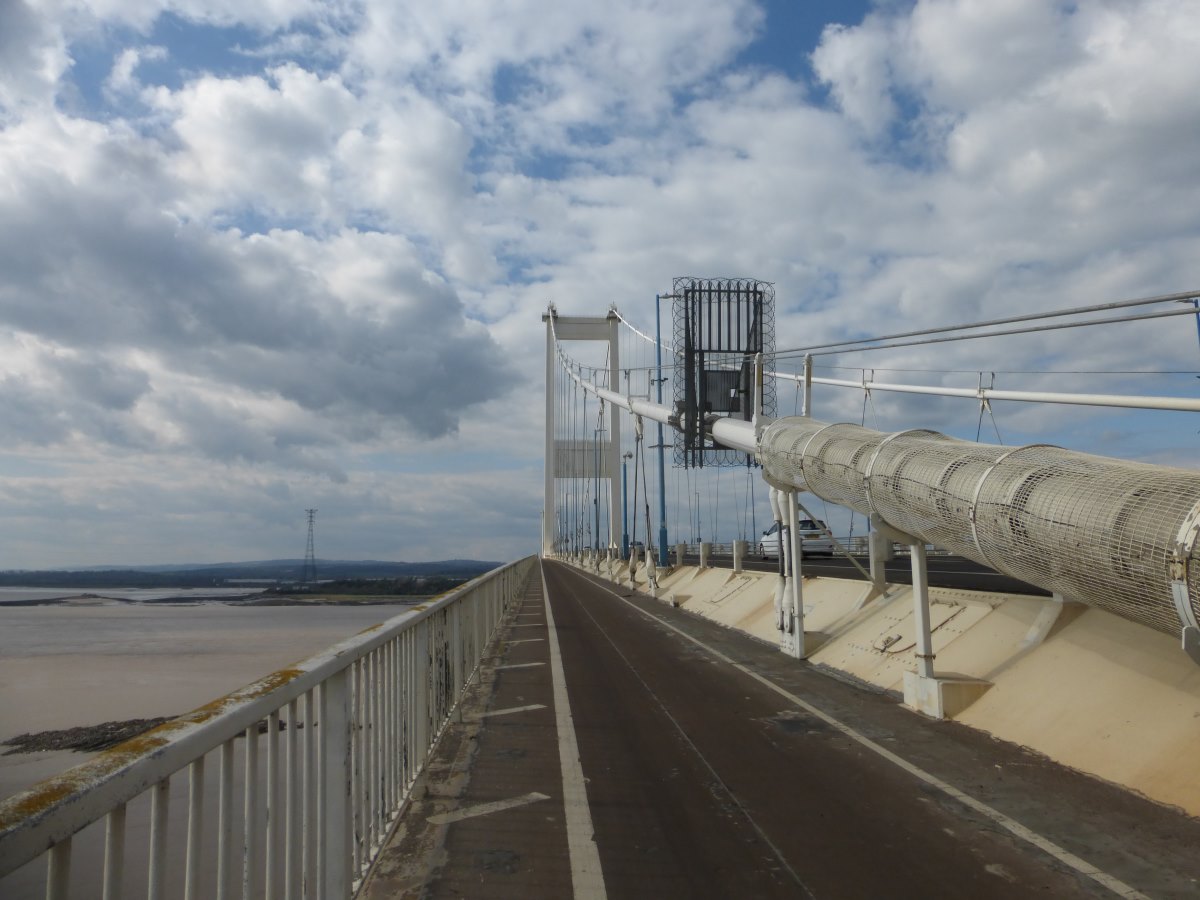
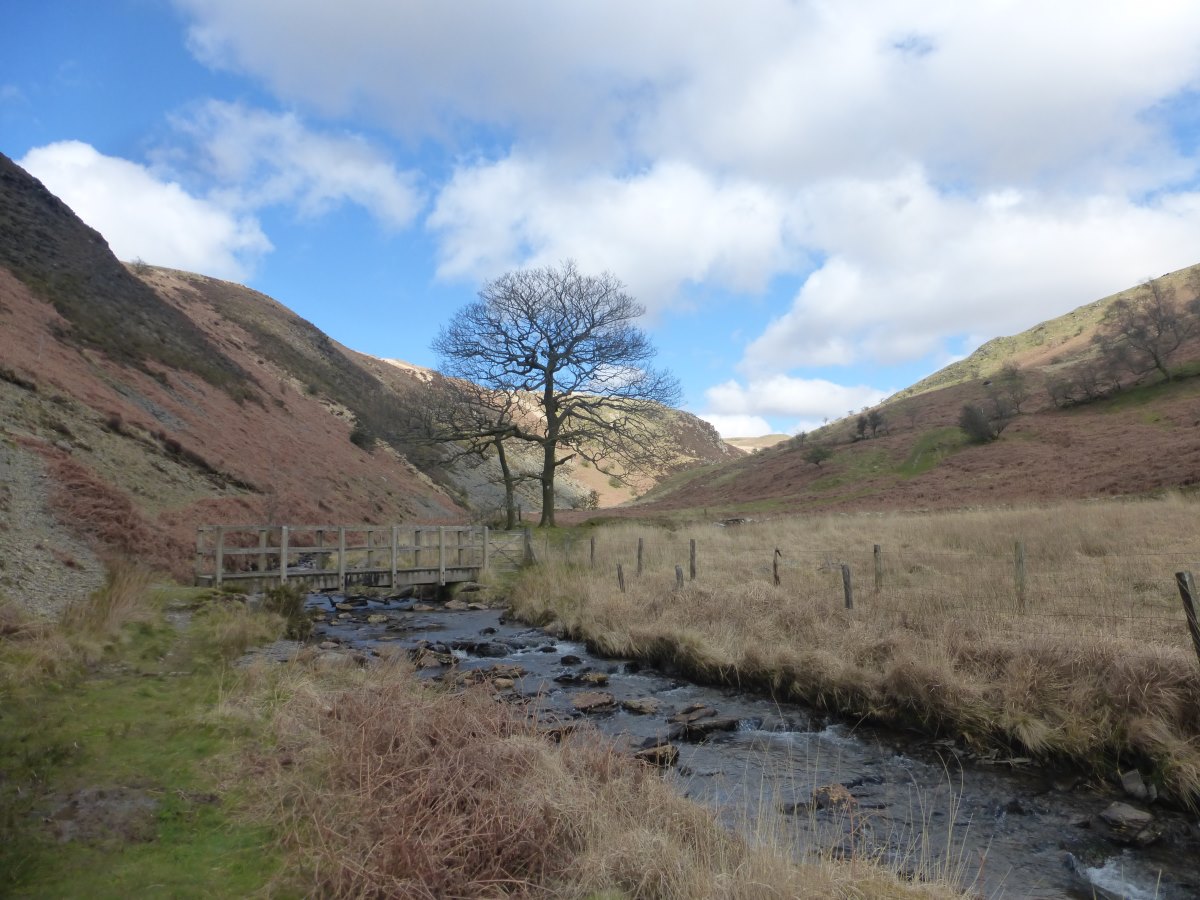
Severn Bridge
Severn Bridge
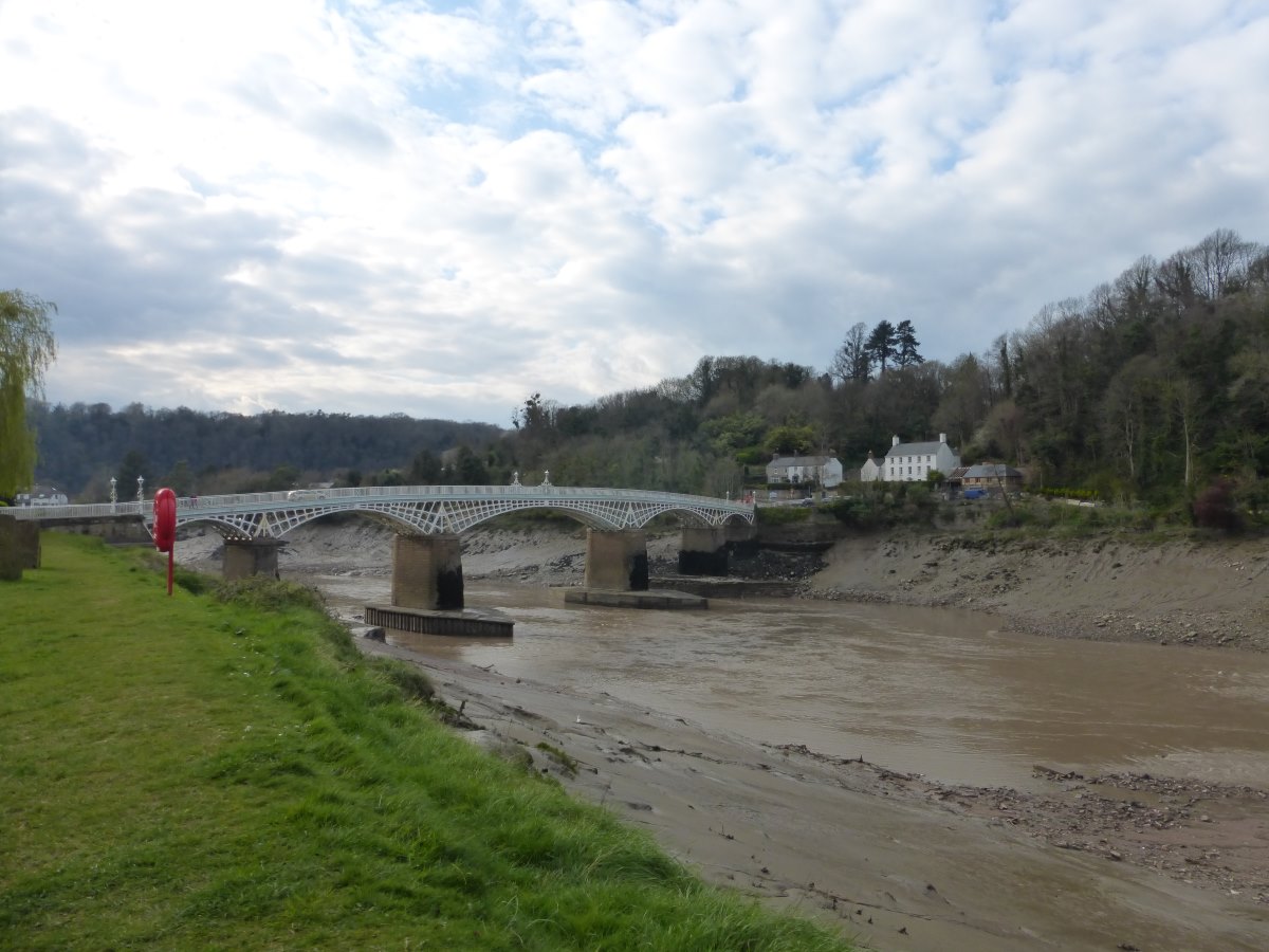
Crossing the Wye
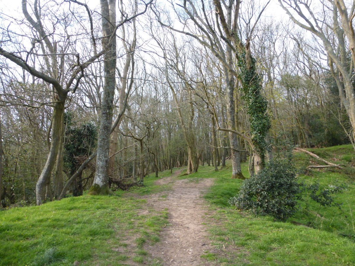
Into the woods
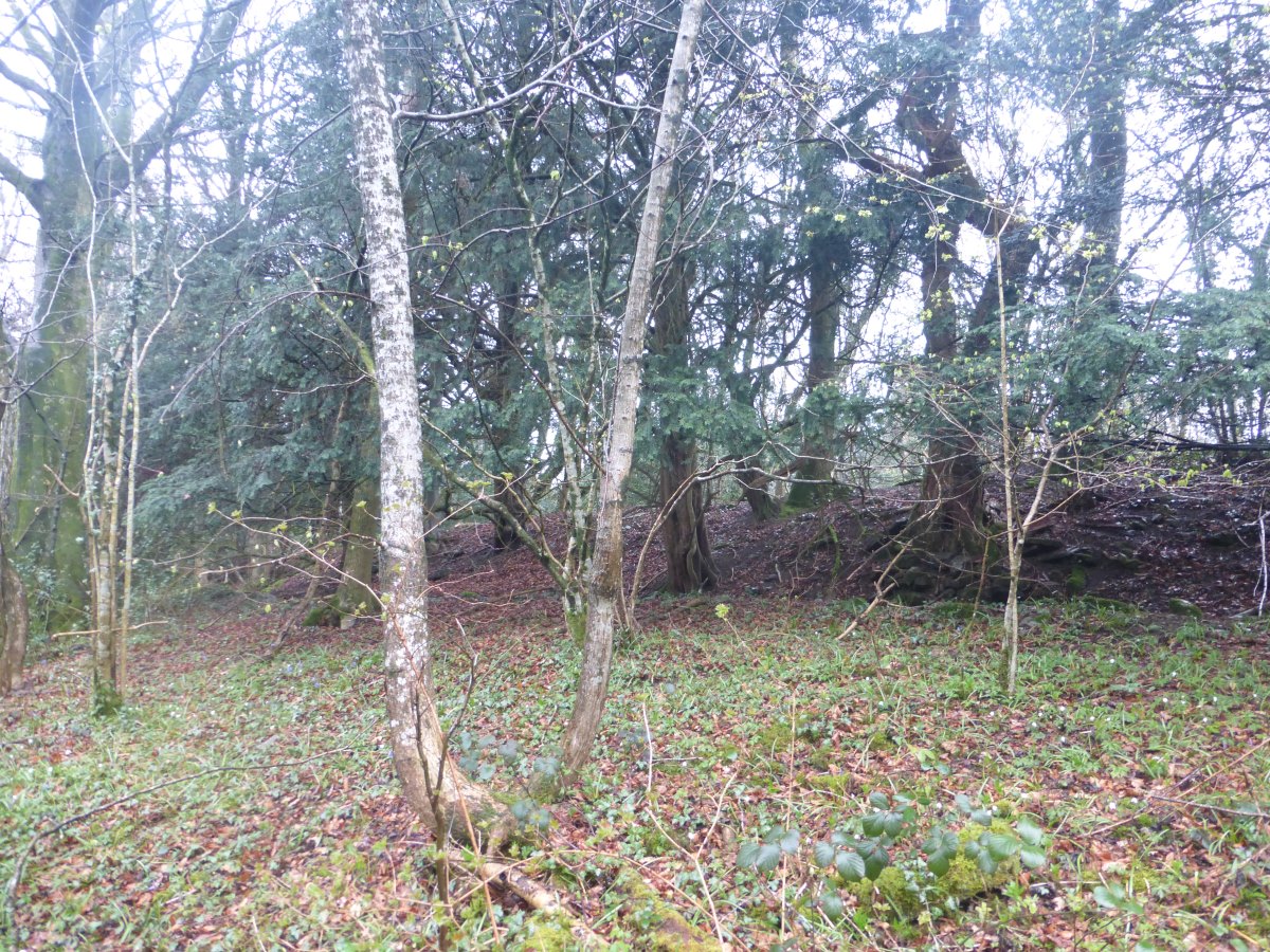
Dyke hidden in the trees
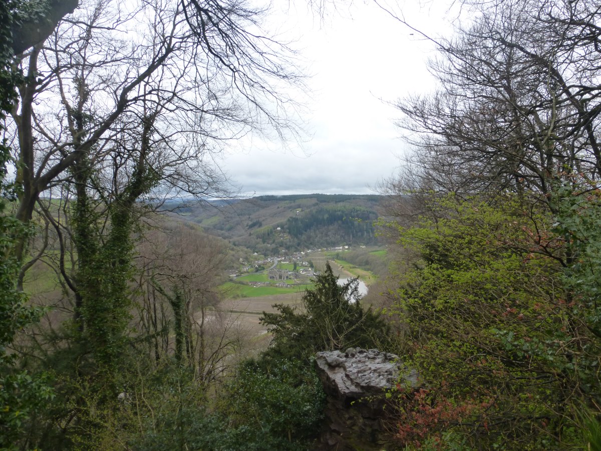
The Devil's Pulpit (Tiniturn Abbey below)
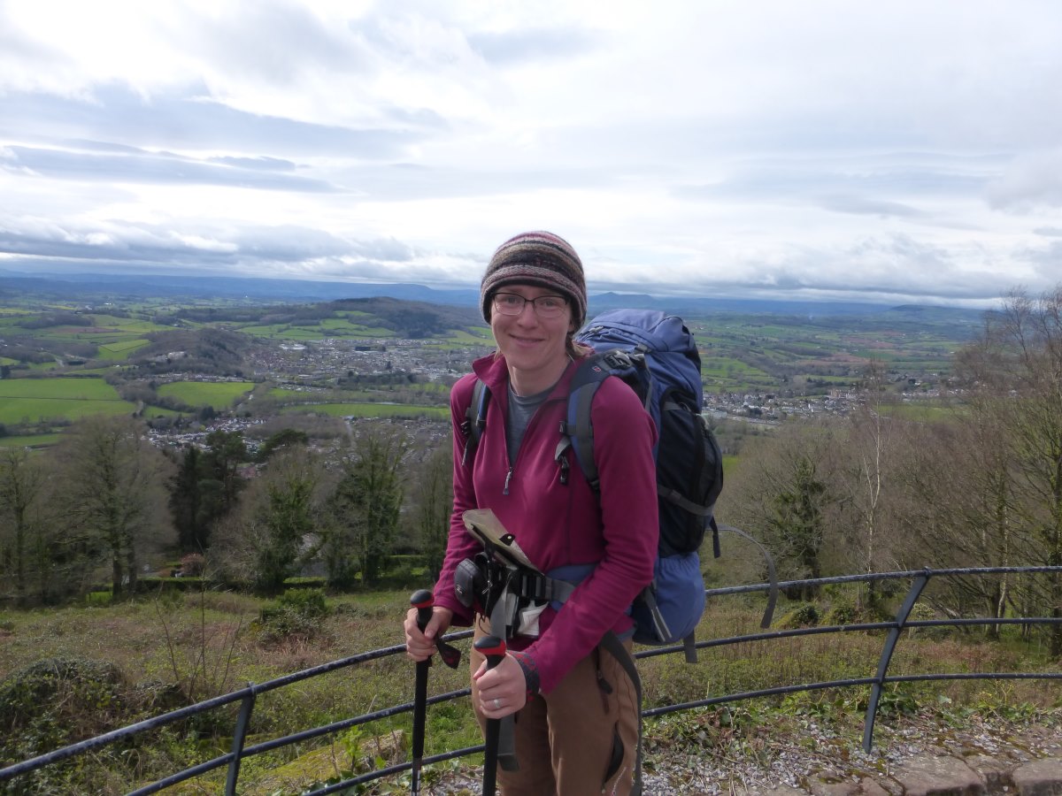
View from the Naval Temple above Monmouth
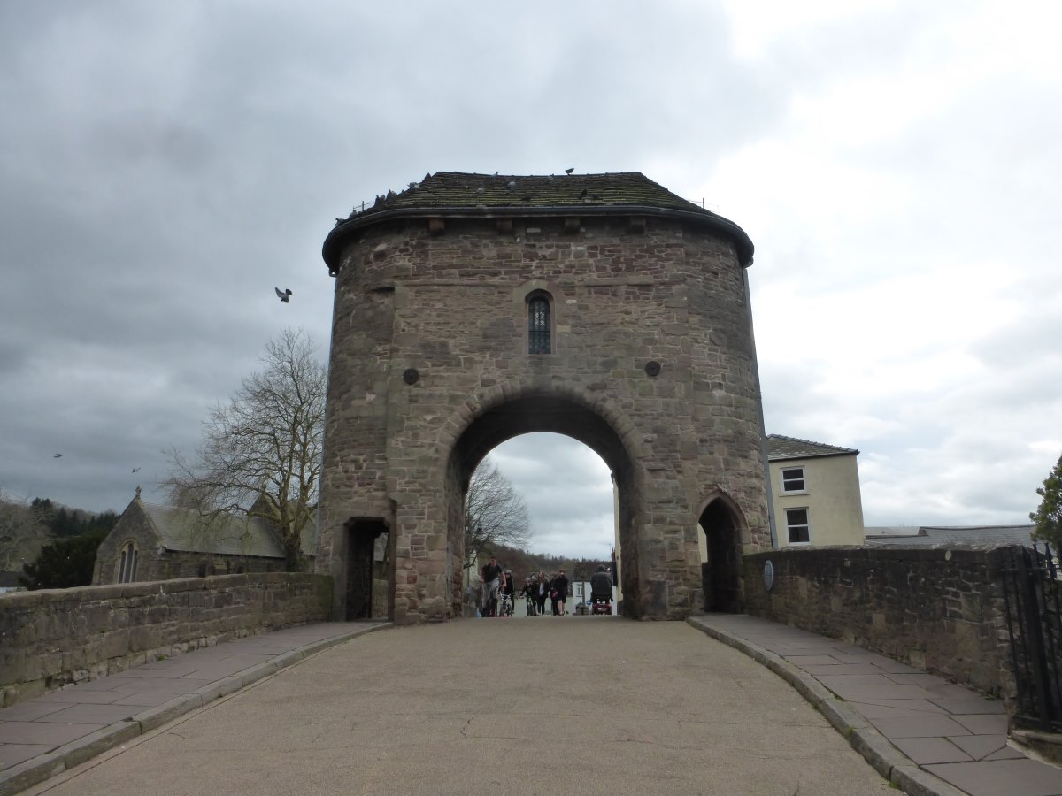
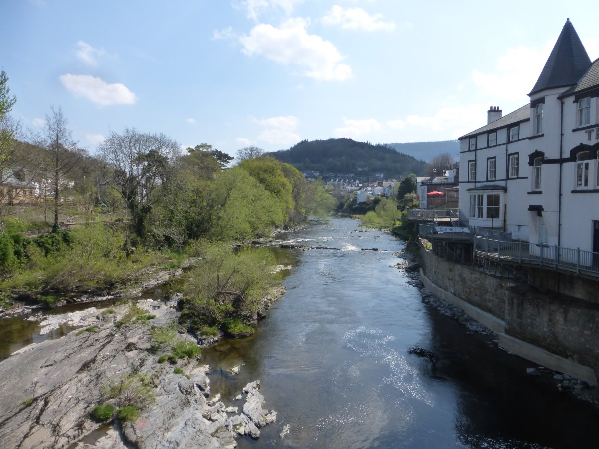
Monmouth
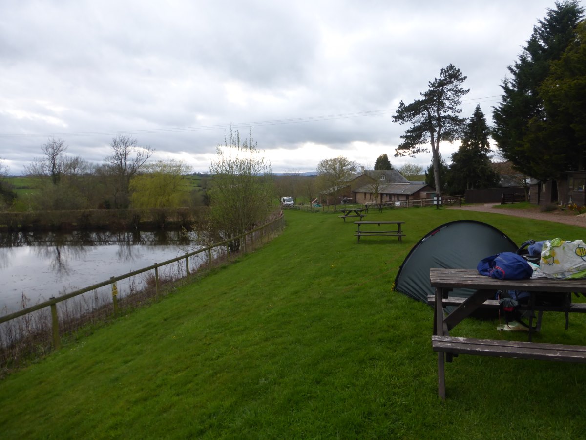
Hendre Farm campsite all to myself
Definitely back in Wales
Over the fields
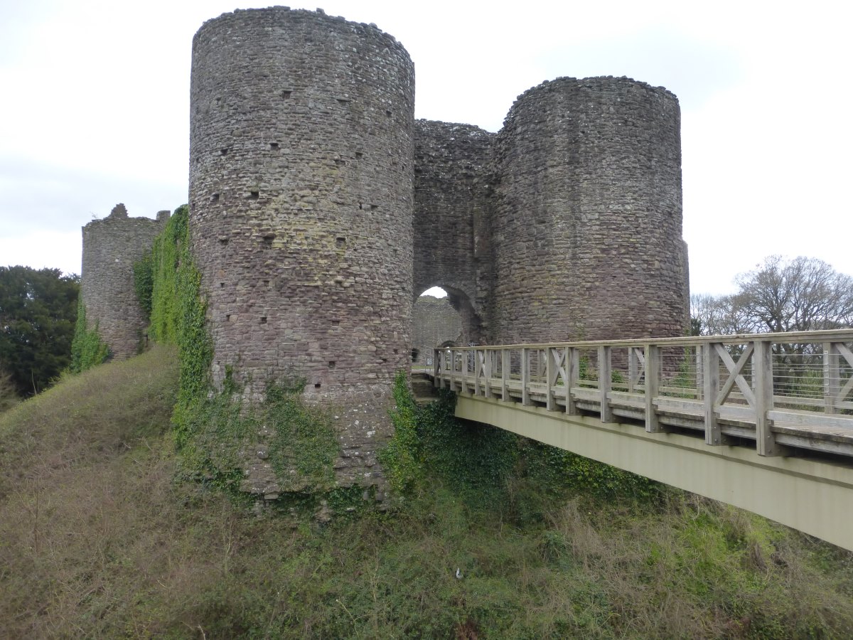
White Castle
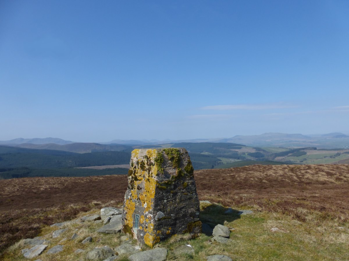
Abergavenny to Crickhowel
Cambrian Way (ish), 30 miles, 2 days
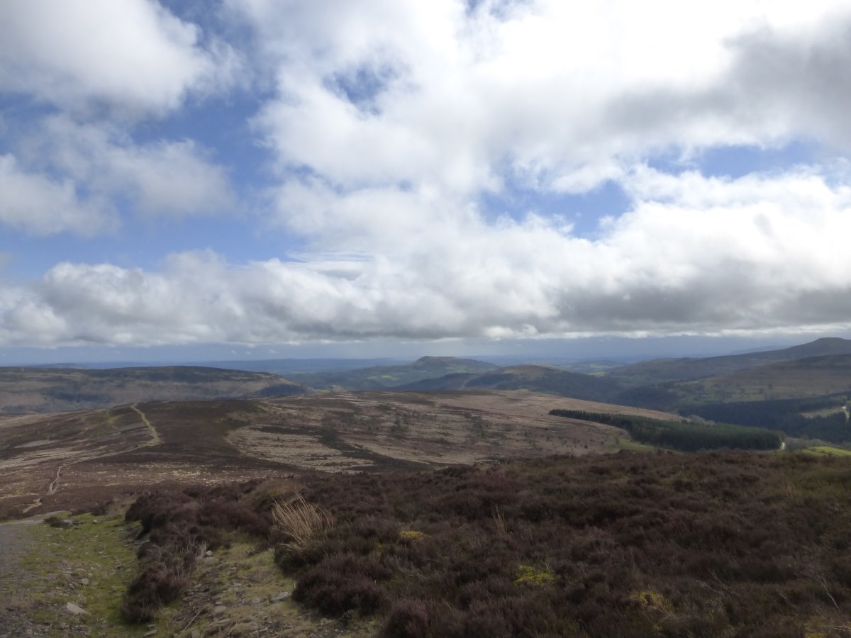
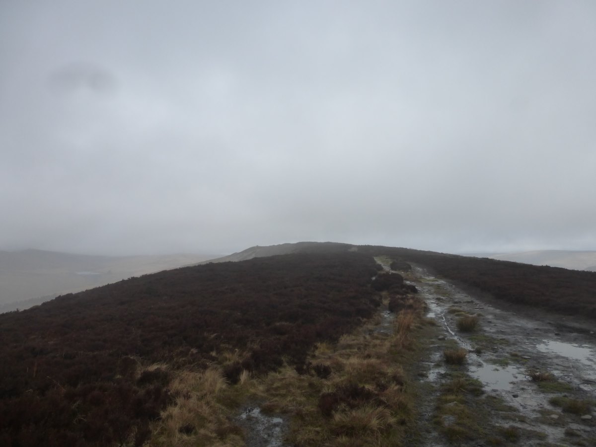
Day 33: I enjoy a late start for a cooked breakfast while the rain pours down outside. By the time I do head out into it there is just a gentle drizzle and before long this stops all together. I follow the roads around the Sugar Loaf (which is covered in thick cloud) but then, when the rain shows no signs of returning and the cloud layer lifts a little, I decide to give it a go over the hills. There are a few showers but they pass by quickly in the 50-60mph winds and there are moments in between when the sun comes out giving great views. One moment I’m wandering along a beautiful ridge in full sunshine, the next I’m crouching in a ditch being lashed by horizontal rain. It’s exhilarating, and I’m glad to have gone for it. I drop down into the valley at the far end and find the campsite full of 25 DofE teenagers, bit of a change from being by myself! Having not stopped for much food during the day I snuggle up in my sleeping bag and treat myself to a decadent dinner of curried chickpeas, rice and onion bajis. Perfect. Day 34: today is supposed to be the start of the good weather window, but it’s raining when I get up and the wind is strong and gusty even in the valley. Sensing it’s not going to be a good day for the tops I take a tiny road up the valley and then do a quick out-and-back dash to what should have been the first summit. I’m glad I made this choice as the wind pushes me vertically up this hill, and then makes it very difficult to walk back down again. There’s phone signal so I grab an updated forecast where suddenly MWIS are predicting 70mph winds that should die down over the day (so much for yesterday’s 40). I pin a fair amount of hope on the dying down part and set off at a serious slog straight into it. It’s genuinely hard just to lift a leg and bring it forwards for each step. I climb steadily up to 800m where I’m atop the highest summit in the Black Mountains. I’m wearing everything I have with me and the wind is bitingly cold. Down a bit I’m now faced with a narrowing of the ridge and another three summits ahead. It’s already 1pm and if anything the wind is only getting stronger. I give it up. Find a side track which will lead me down to a road. It’s significantly further but I just haven’t the strength to battle with the wind anymore and feel there is a genuine risk of being blown off the ridge. The sun comes out and I thaw my freezing fingers. This was supposed to be one of my three good weather hill days and I’m exhausted and feeling pretty low. I wonder if I should just give up on the Cambrian Way entirely and go back up Offa’s Dyke as low level walking seems pretty appealing just now. But I make it (finally) to my campsite and spread out all the maps as best I can in the tent and realise I can chop a big corner of pathless moor off tomorrow by following a canal instead. Then I find a pub with a roaring fire to sit right in front of and have a huge dinner and everything feels much more manageable again.
Crickhowel to Llandovery
Cambrian Way and a canal, 48 miles, 3 days
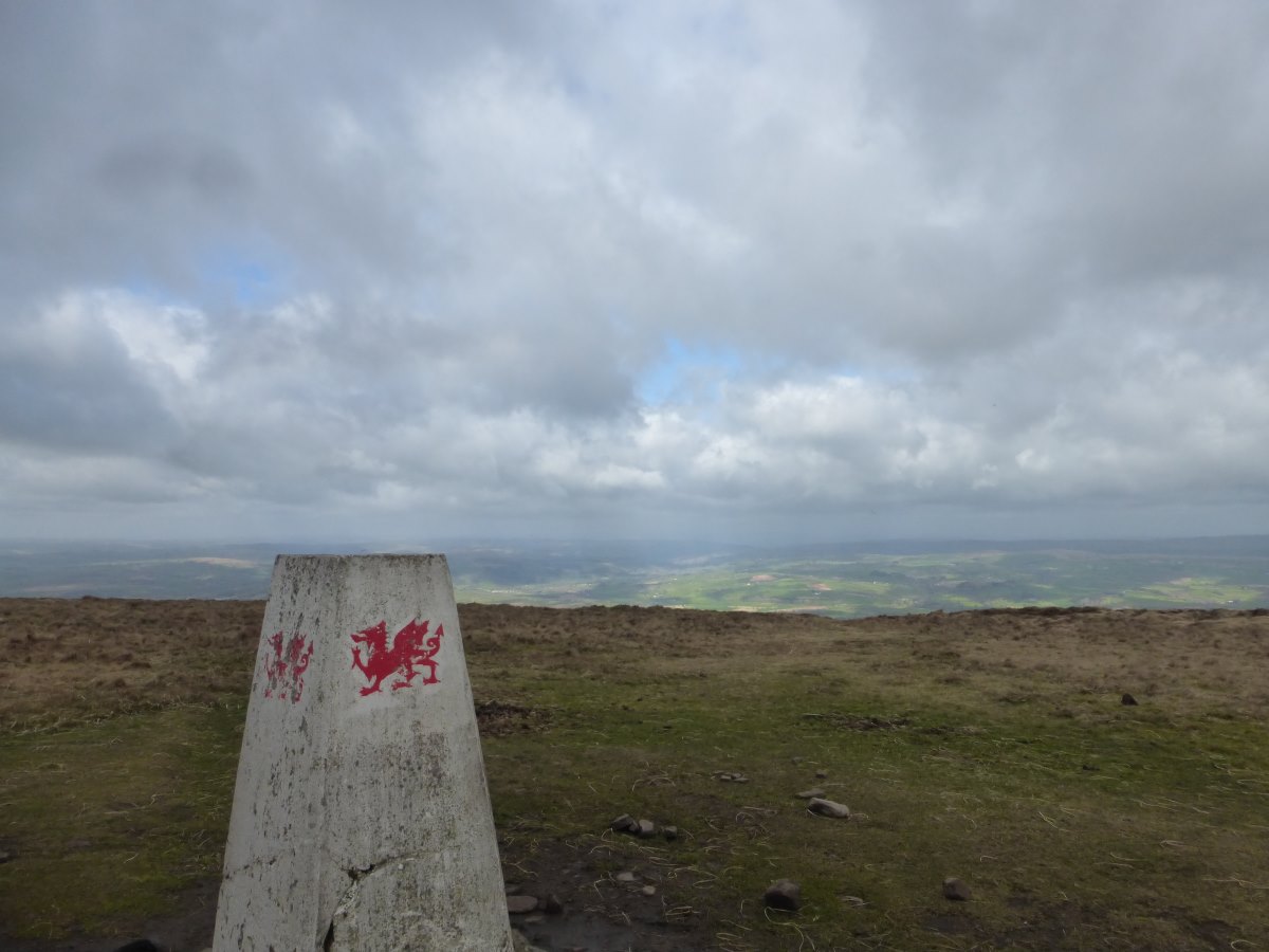
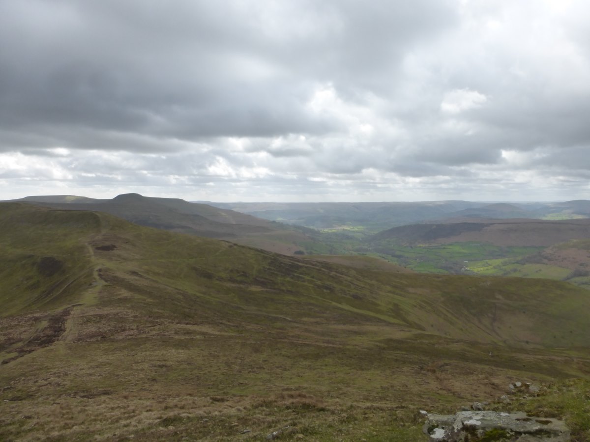
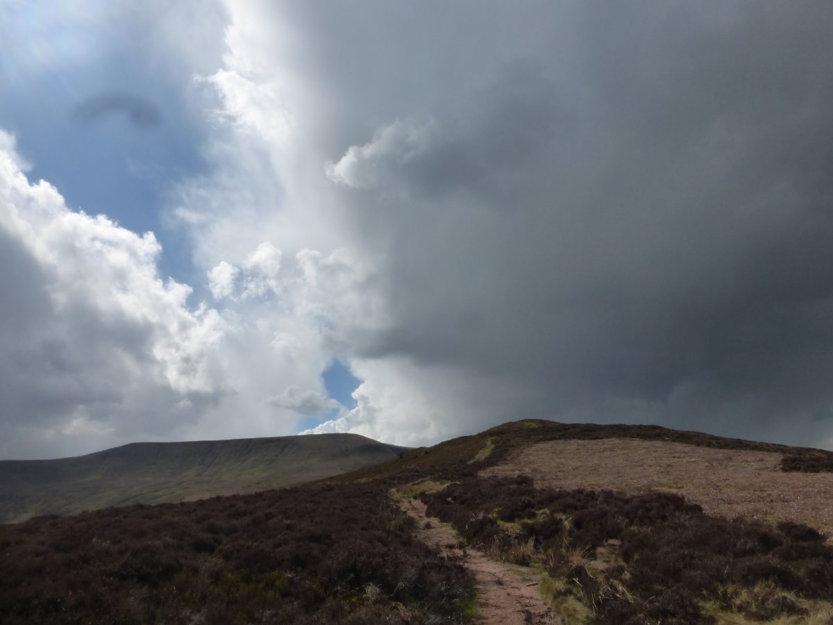
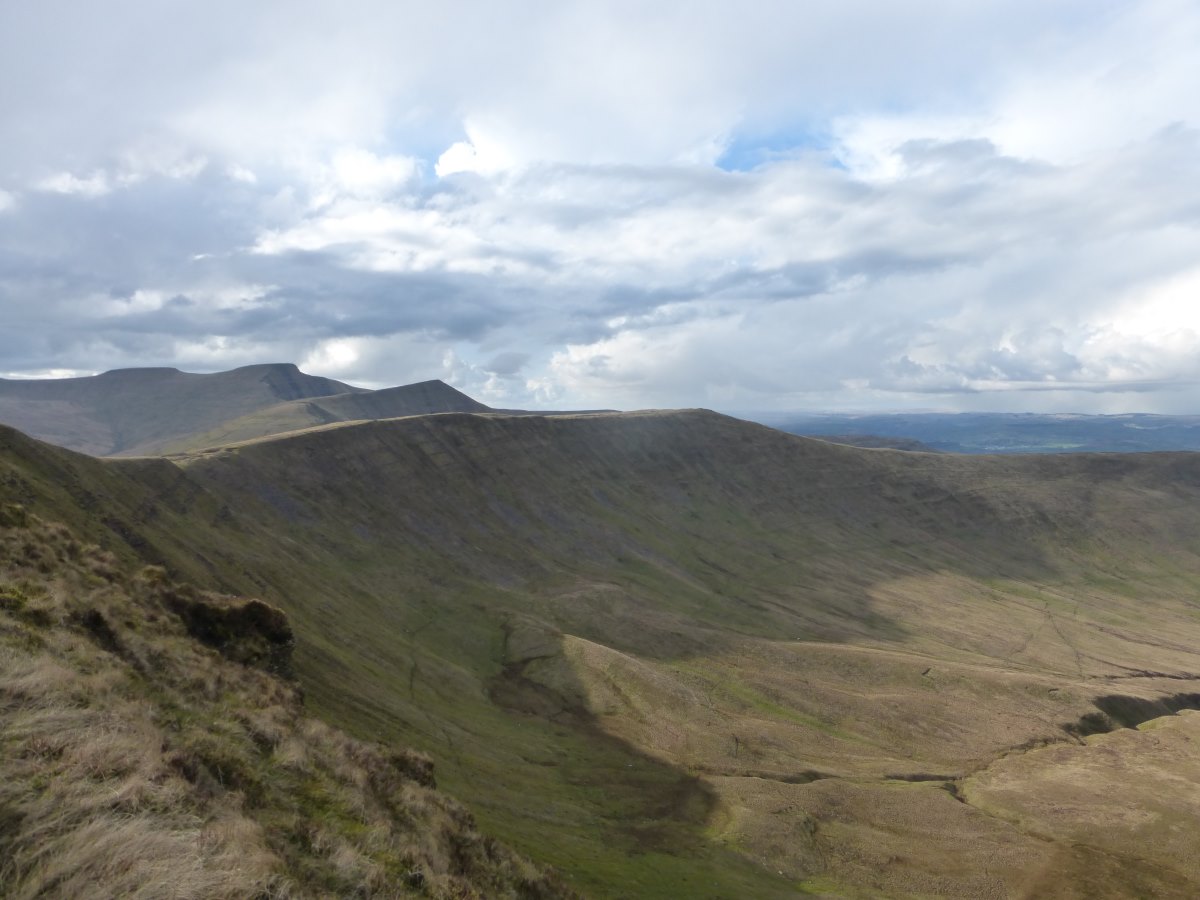
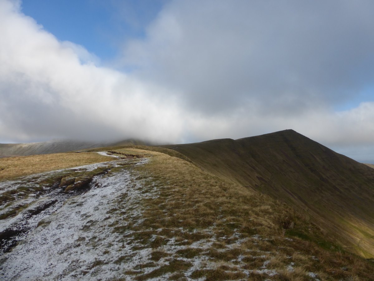
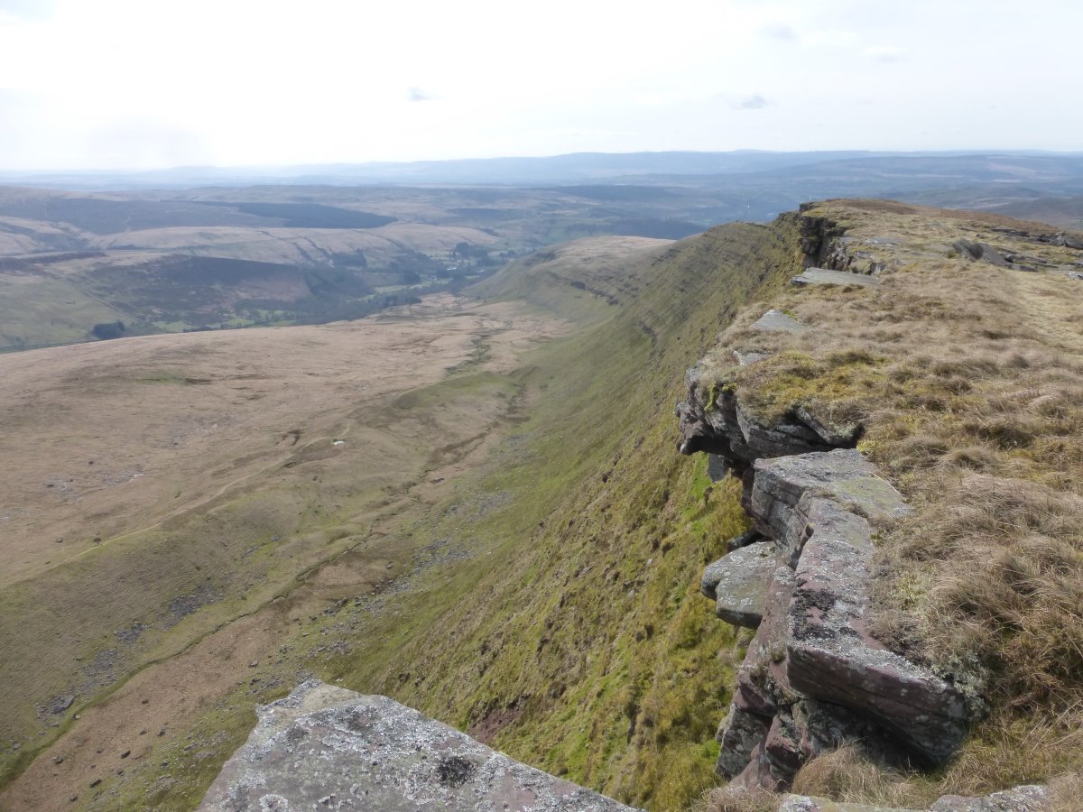
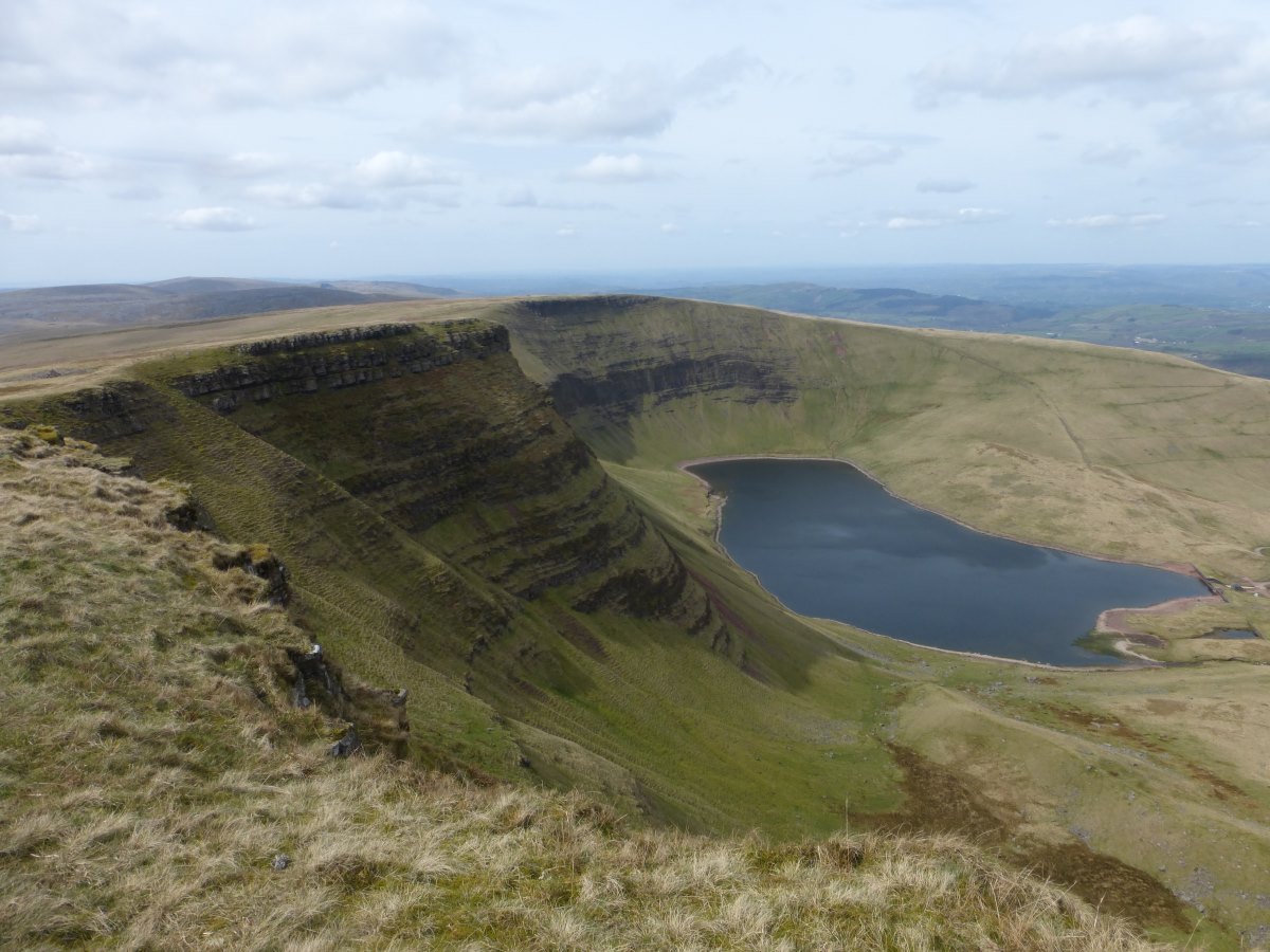
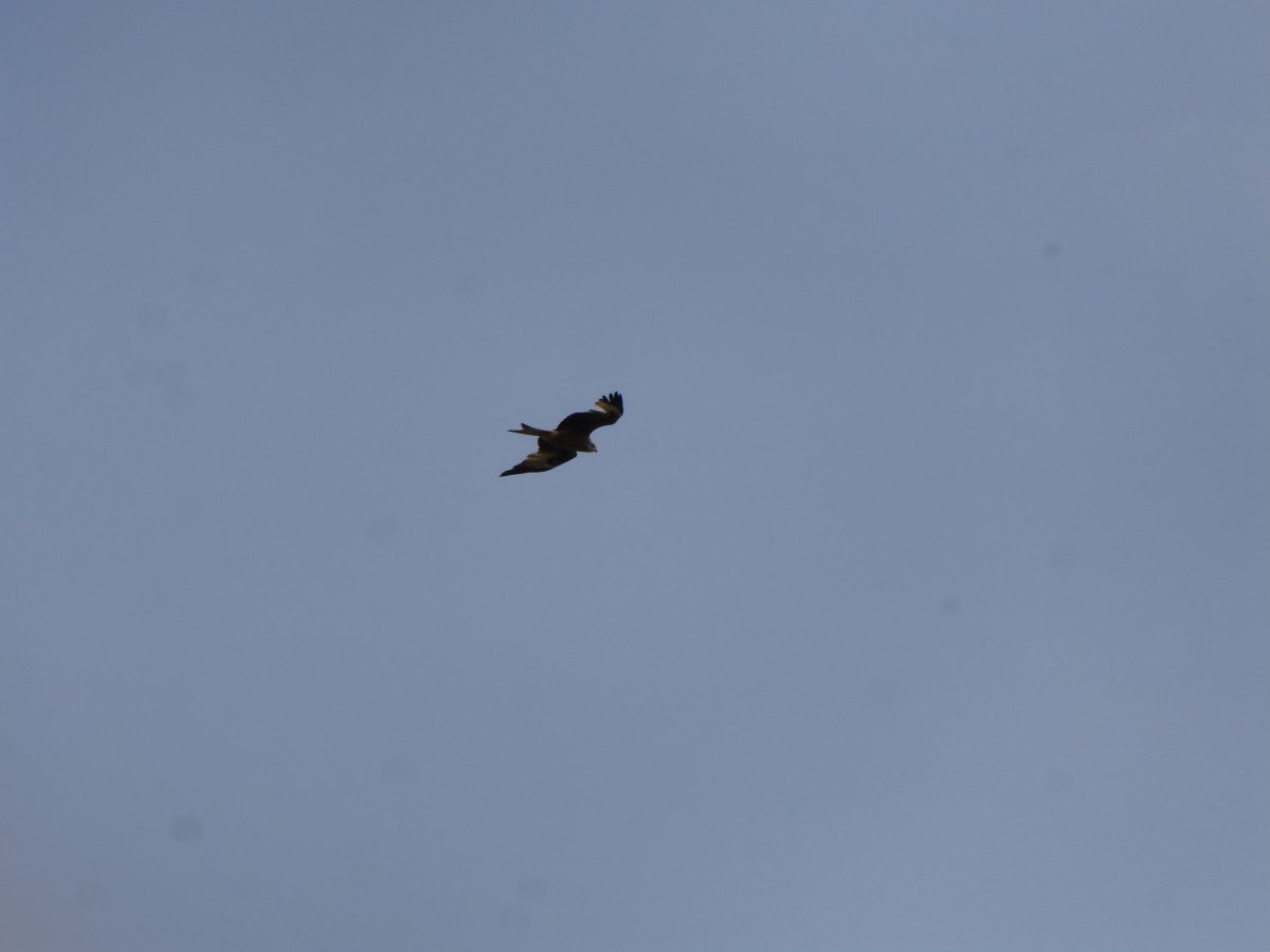
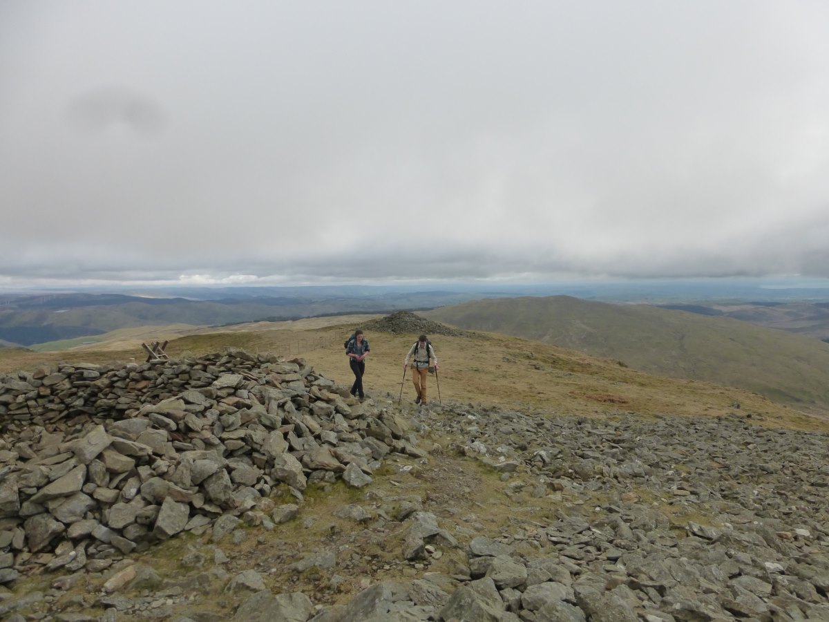
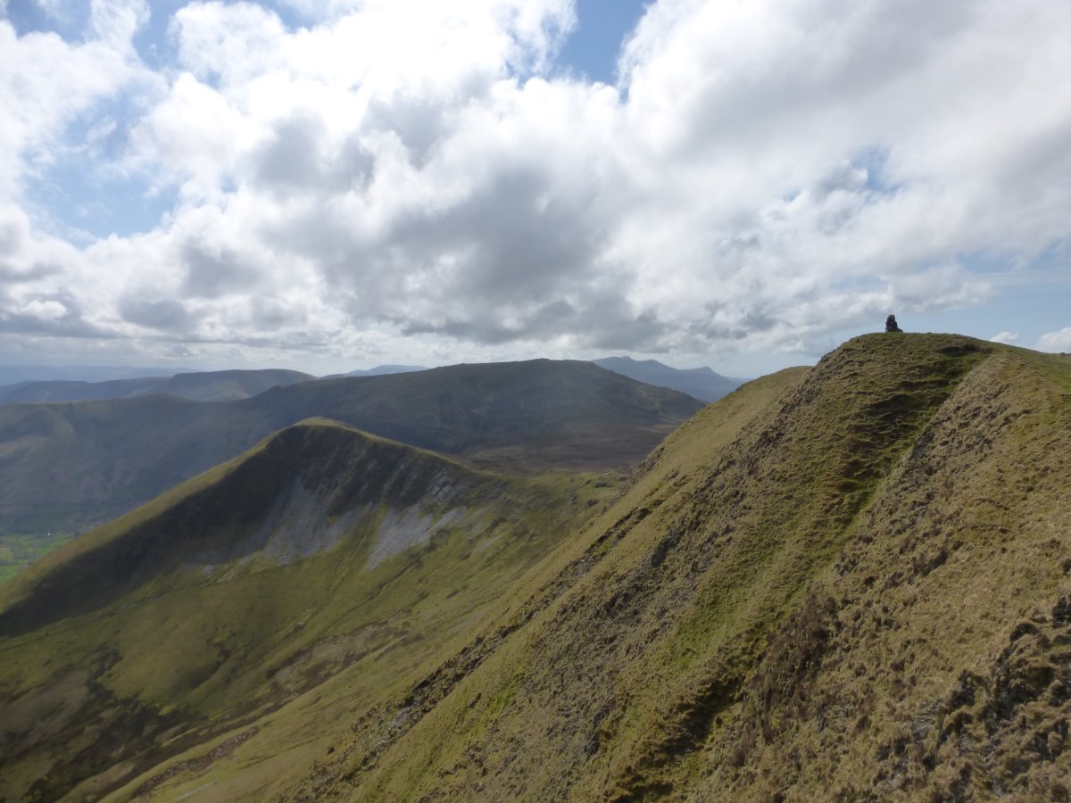
Day 35: it’s a chilly start with the morning’s condensation frozen hard onto the tent. I leave it to thaw while I do a food shop, including an enormous chocolate muffin topped with half a mars bar which I eat for breakfast. Yum. Onwards I keep to yesterday’s plan of ignoring the Cambrian Way entirely and picking my own route along a lovely flat canal path. It’s beautifully sunny though the air is still cold, and I make great progress on the easy ground. There are lots of canal boats and several locks to watch them navigate which is always fun. Passing a reservoir I then pick up one of the alternative routes in the guidebook and head back up into the hills. There are great views and lots of big rain showers which seem to mostly pass to the sides, though I do catch a few spots of hail. The wind remains cold but it’s nowhere near as strong as yesterday which is a huge relief. Over the first top I drop into the valley and find myself a wild camp by a small stream. I’m high up and expecting a cold night but I don’t really fancy dropping further down just to have to climb up again in the morning. Day 36: it is indeed a very cold night. I wear everything I have, including both synthetics, thermal leggings, trousers and a hat and am just warm enough but only just. Lifting the door of the tent in the morning there is a tiny snow drift piled against it. I have breakfast in the sleeping bag and have to brace myself to get out though it’s not long before the sun comes out and I boil myself out of my waterproofs slogging up a steep hill. I reach the top of Pen Y Fan on which, although it’s still early morning, I have to queue up to get a picture with the top. Down the other side I cross a road and immediately find myself in much quieter country with no-one else around for the rest of the day. The air is clear and I can see South all the way across the Bristol Chanel to Devon and what I assume must be the hills of Exmoor - the view I couldn’t see from the other side! Then there’s one last summit and time for the descent. I’m joined by a heard of small black cows who decide the walk is interesting and they want to come too. It’s a tense moment but luckily they get bored after 100m and fall behind. I check into another campsite where I get the tent up in the sunshine (just) and attempt dinner in the pub but, despite advertising “food all day” on several large signs outside, at 6:30 on a Saturday they’ve already stopped serving. Couscous it is then. Day 37: following another cold night the tent is frozen again this morning, but it’s my last night high up for a while so hopefully soon it will get warmer? Onwards and upwards I find myself climbing a long cliff-like ridge with another great view, zigzagging across the summits around a corrie lake far below. I decide this is my favourite section of the Brecons and the one I’d return to if I was to pick out a day walk. All too soon it’s time to drop down, back to civilisation and green fields and then a stretch across moorland with the Brecons already looking very small behind me. Red kites fly overhead. I’m tired, after a lot of consecutive long days, and I’m out of food. Getting to Llandovery at 6:30 on a Sunday all the shops are shut and I’m expecting it to be an emergency couscous night (something I’ve carried since my last food disaster also on a Sunday in Somerset), but on a whim I wander into town anyway for a look and find an Indian doing buffet style all-you-can-eat. Hallejulah. 3 full plates of curry and rice + naan bread + bahjis later I am officially well fed.
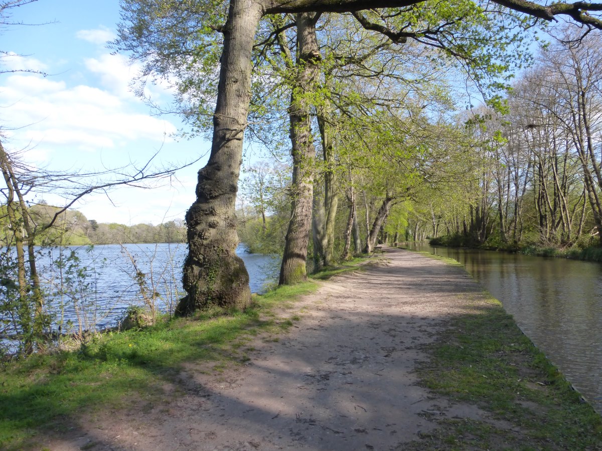
Monmouthshire and Brecon Canal
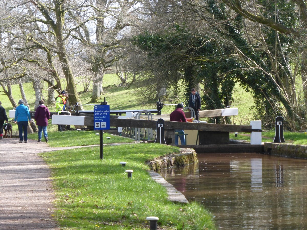
Descending the locks
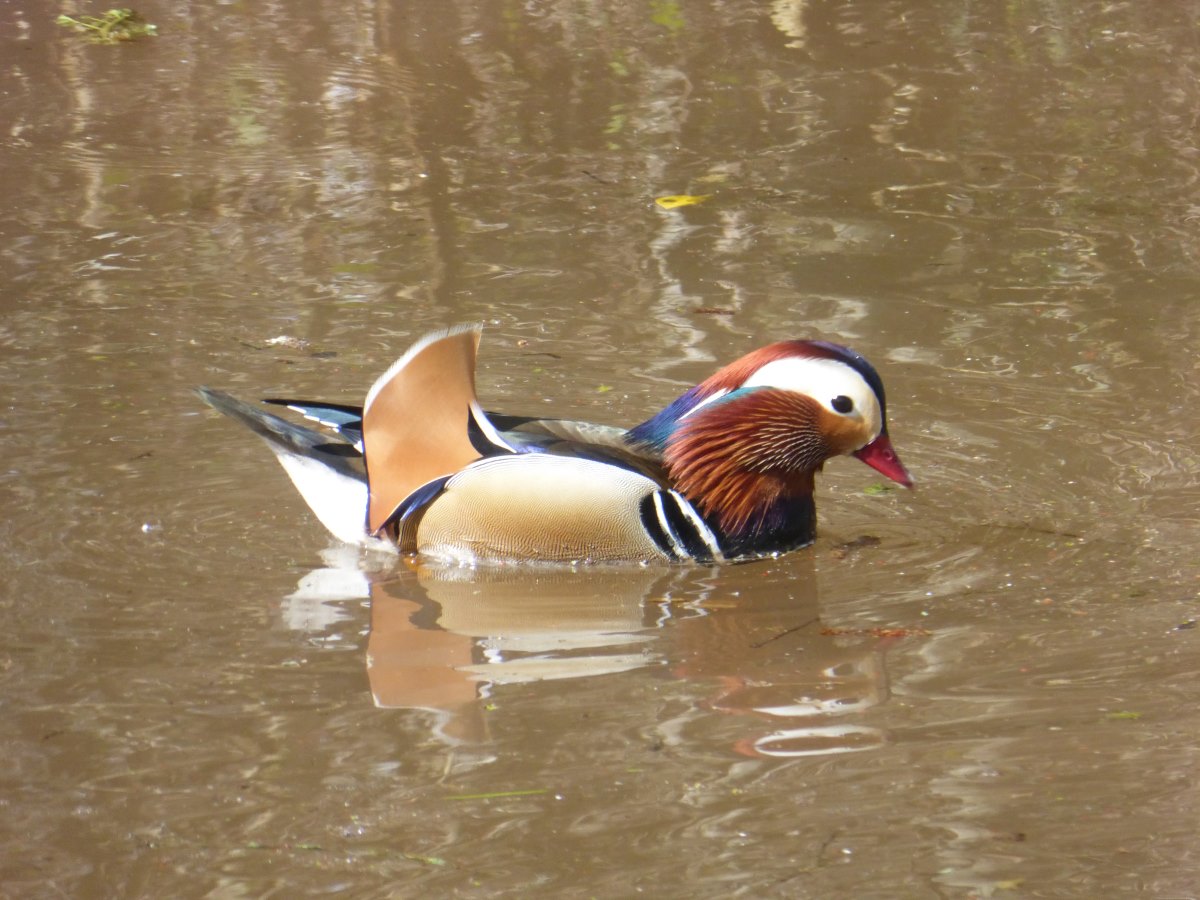
A mandarin duck
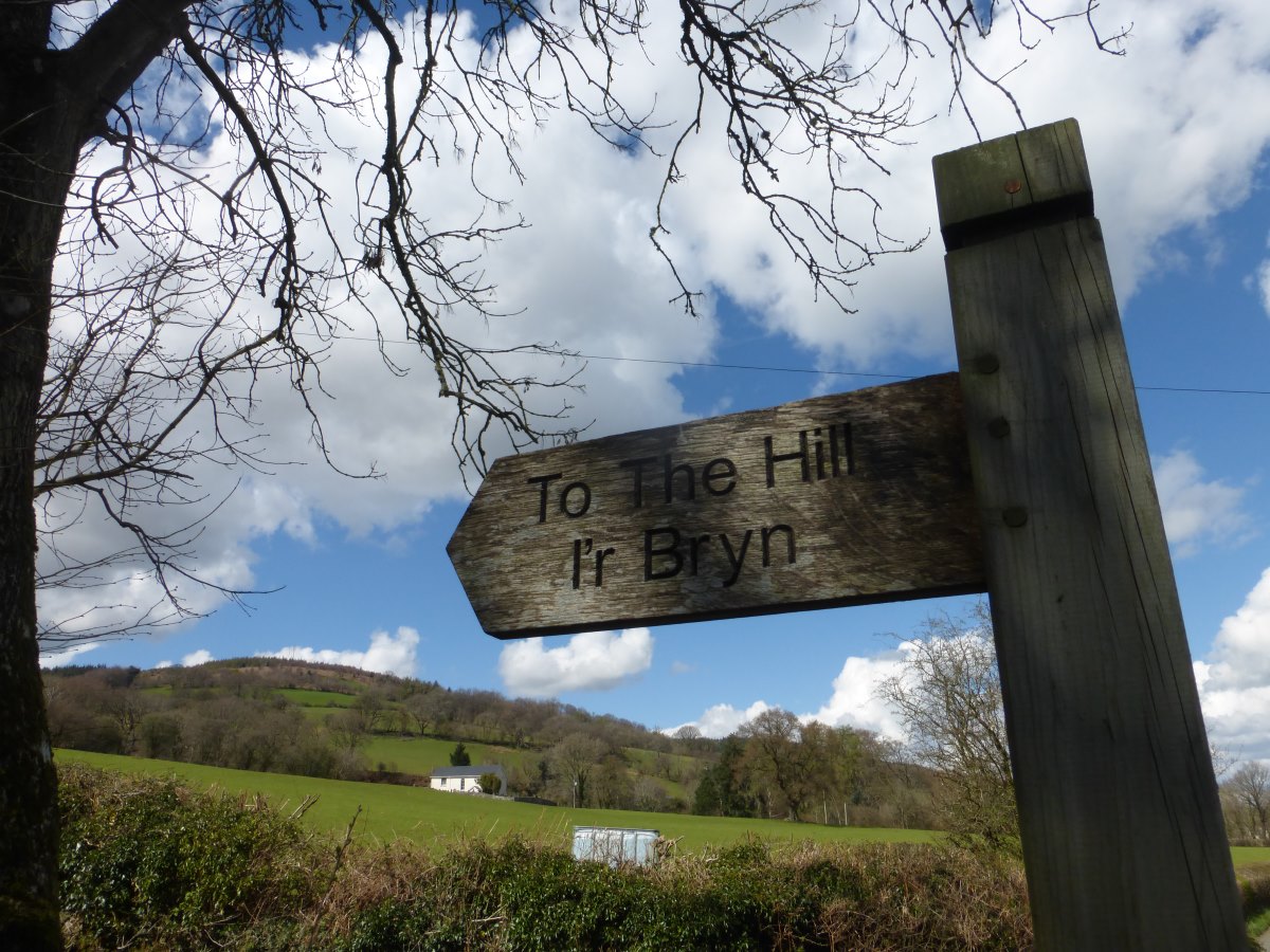
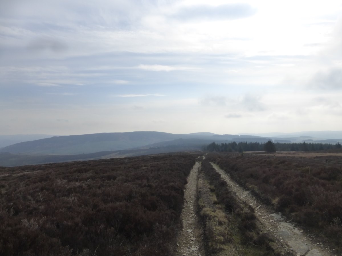
To the hill!
Up up up
Dodging the rain showers
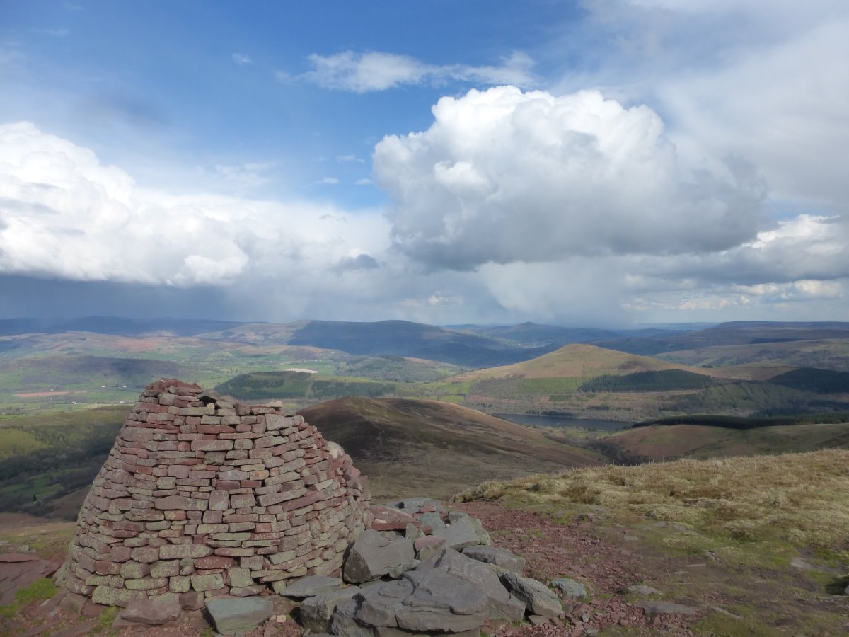
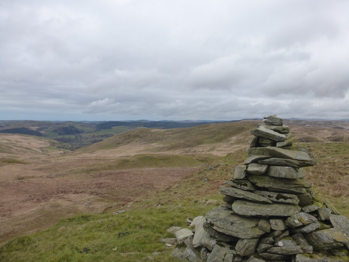
Brecon Beacons
Good Morning!
More up
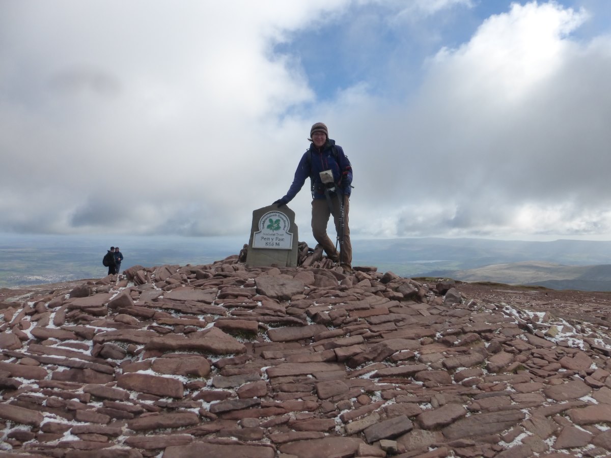
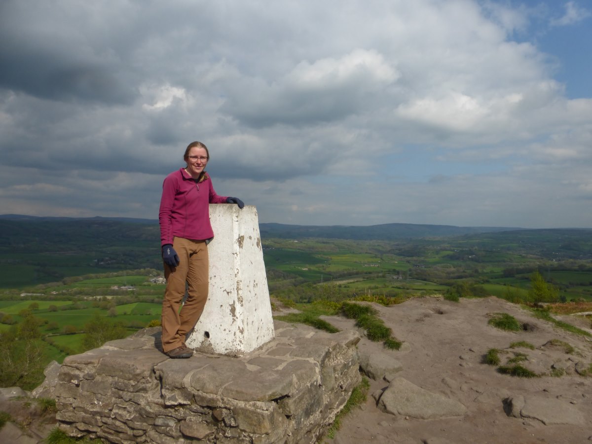
Pen Y Fan
Off into quieter parts
With inaccessible summits
Descent down an old mine railway
Breakfast in bed
Peaking out over the edge
Llyn y Fan Fach
Red Kite
A return to fields
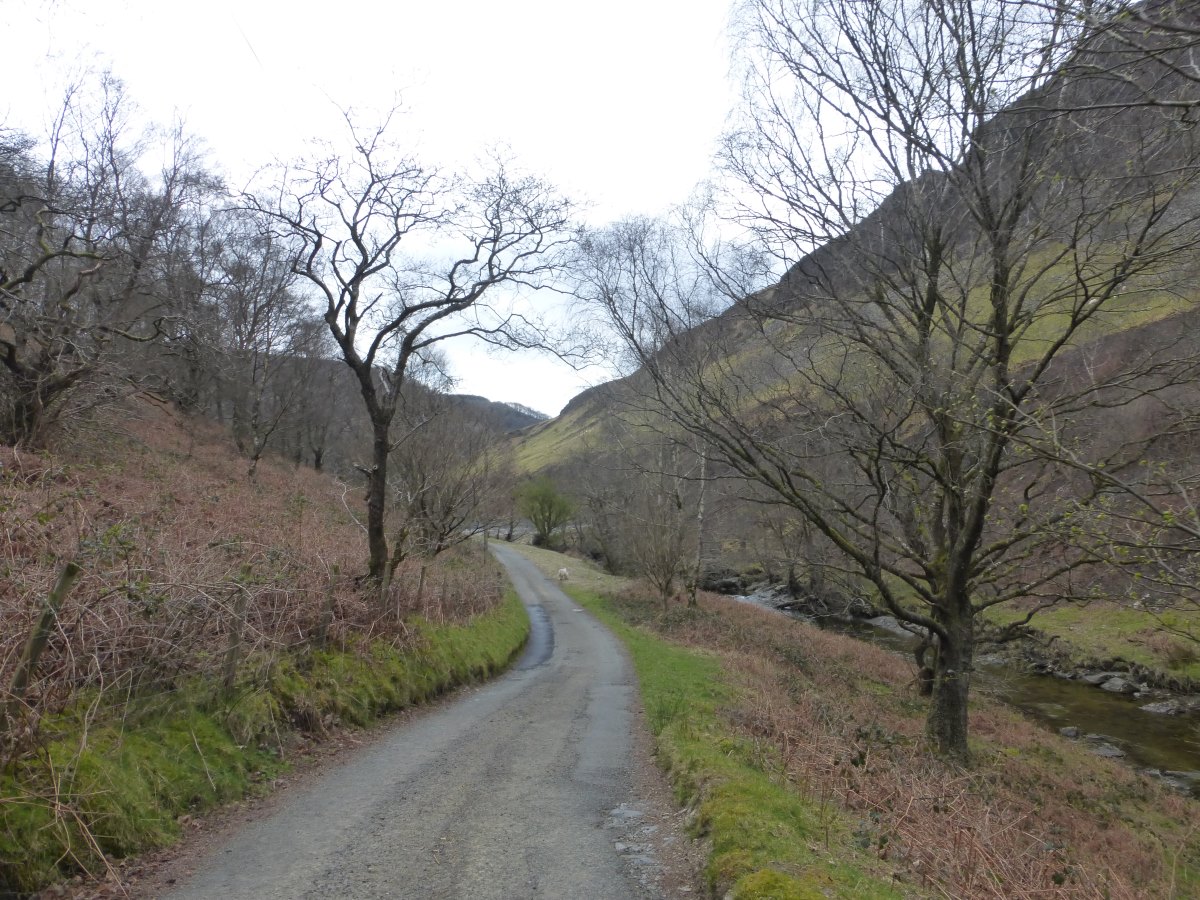
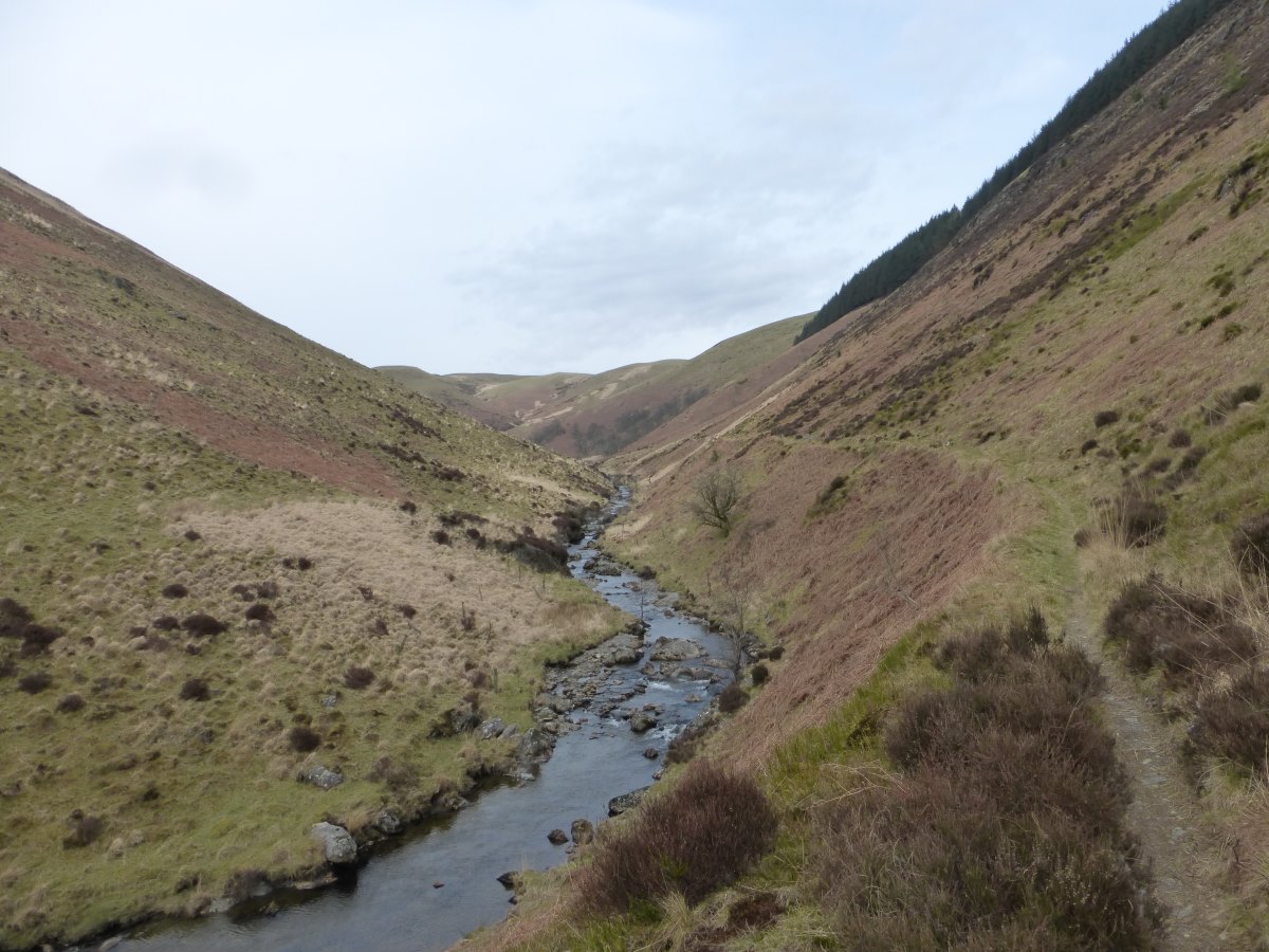
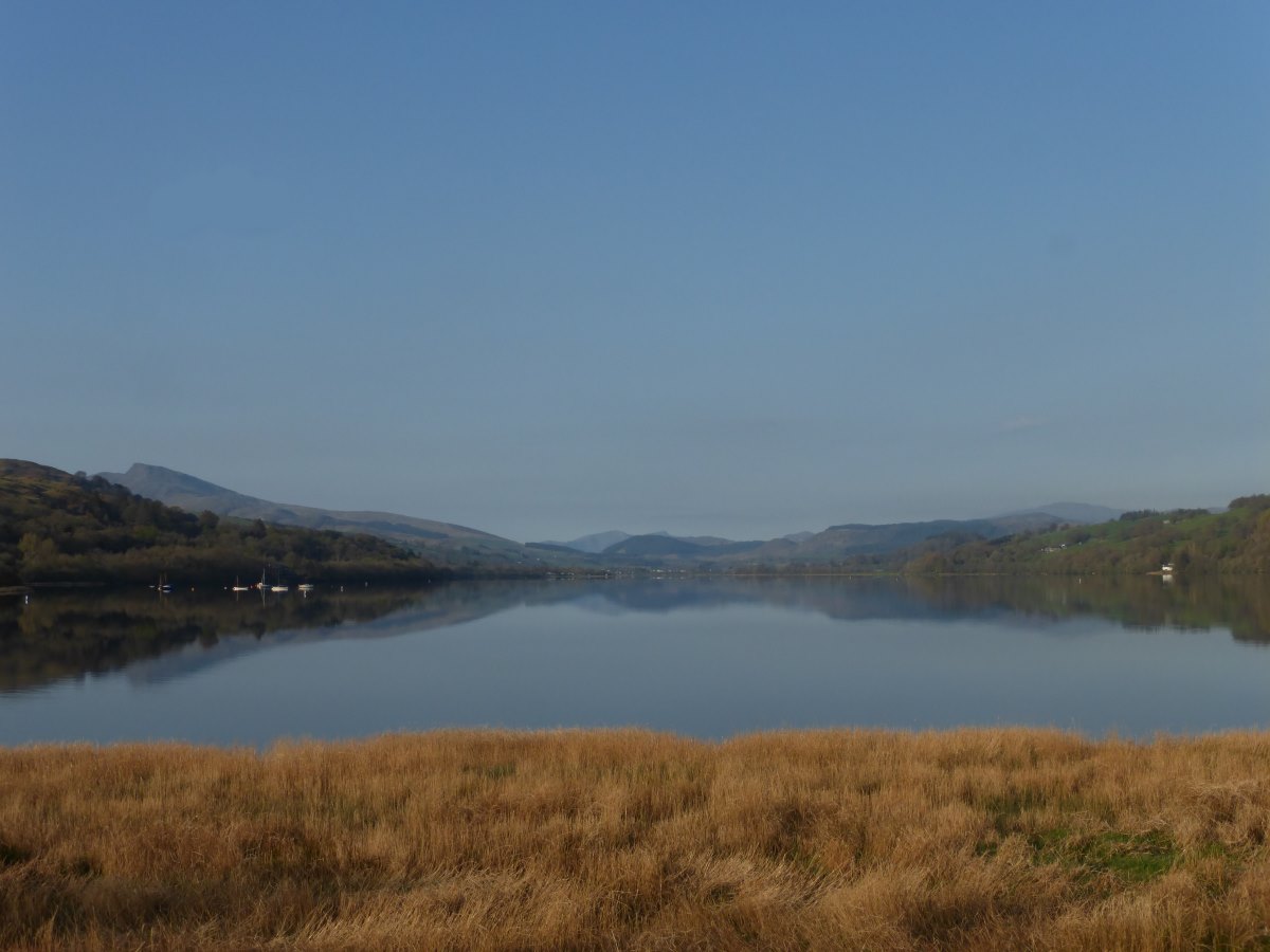
Llandovery to Nant Syddion
Cambrian Way, 40 miles, 3 days
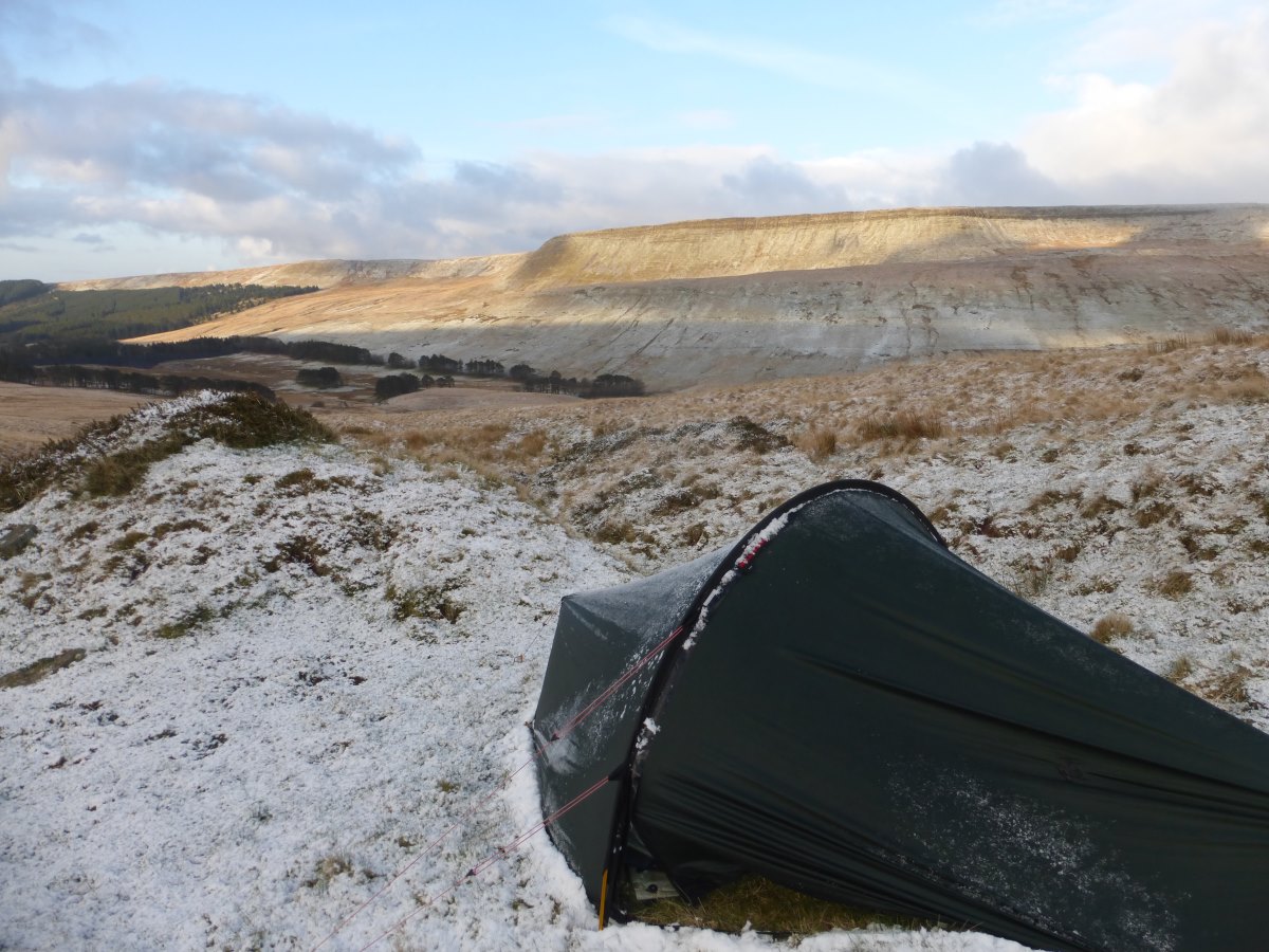
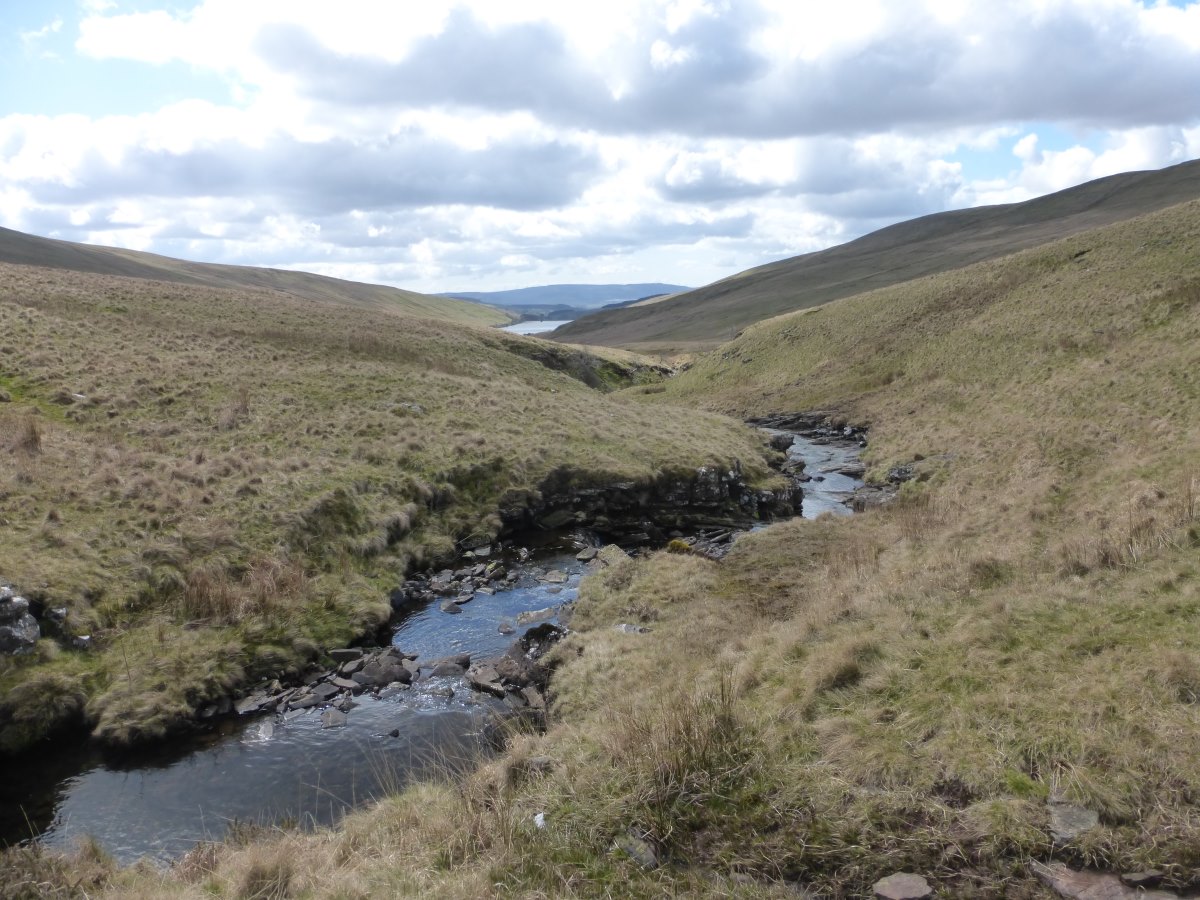
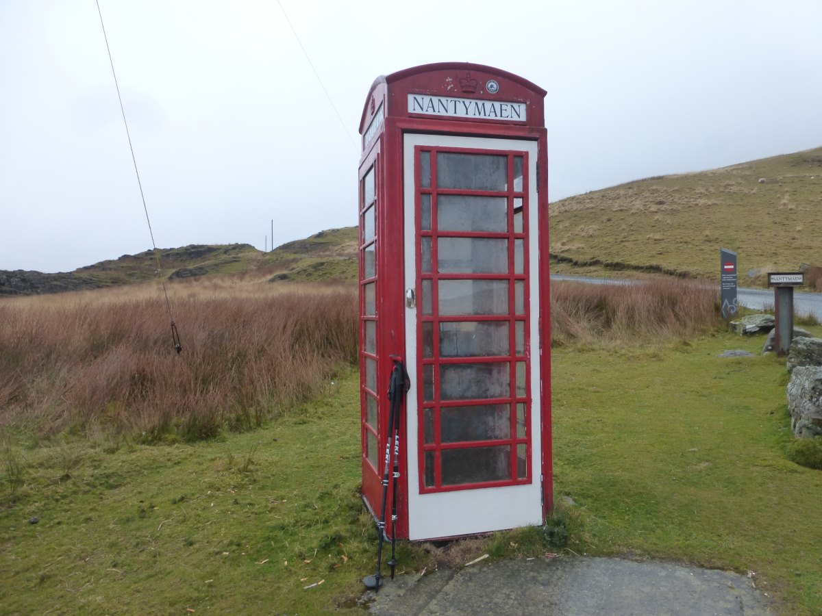
Day 38: I wake to a dry tent, following a night so warm that, for possibly the first time on the walk, I don’t have to sleep with the bag scrunched up around my face. Walking wise it’s a low level day which is just as well because my bag is heavy with four days of plentiful food. I find the amount of food I buy yo-yos. I go periods with not quite enough, then overcompensate, buy too much and end up cursing the weight of my bag. I was hungry and cold in the Brecons and therefore my bag is now very heavy. It is sunny, though not particularly warm and I follow a series of little lanes with good views back to the mountains behind. In the afternoon the walking changes and I escape the roads back into wild country. The path meanders along the side of a stream through a series of gates which all seem to have seized and stuck, either permanently open or (more commonly) permanently closed. There is a lot of climbing over to do, which gives plenty of opportunity to bemoan the unwieldy weight of the rucksack. Late in the afternoon I arrive at Ty’n y Cornel, billed as the “most remote hostel in Wales”. I’m planning a rest day to avoid some incoming rain, and had booked two nights in a dormitory for the grand sum of £30. Turns out I actually have the whole place to myself, and a volunteer warden David, who jumps straight into stoking up the fire and making me hot chocolate. I have a wonderfully cosy evening and an enormous dinner of pasta, cream cheese sauce and fresh greens. Suddenly all that rucksack weight is worth it after all. Day 39: I enjoy a very well timed rest day reading David Attenborough’s Life on Air while the hostel is enveloped in thick cloud and the rain patters down outside. Day 40: today is supposed to be dry and cloudy, but it is raining suspiciously heavily when I wake up. I have a leisurely start and finish the book I was reading yesterday. About half 9 I set off in a brighter spell but it doesn’t last long and I soon find myself getting rained on again. This is a tricky section of pathless moor with a lot of tussocky grass making it especially difficult to walk over. I find myself balancing from tussock to tussock to avoid the knee deep watery mud that they stand in. The poles are amazingly helpful but I still slide in several times. I wonder if I should just give up washing my clothes as the trousers and socks that I hand-washed so carefully yesterday are once again dripping with mud. Finally I reach a track where I take shelter in a phone box and have a standing-up lunch. Emerging I find it has stopped raining but the clouds have descended and the thought of the way ahead over more pathless moorland to a 500m lump is distinctly unappealing. So I once again abandon the Cambrian Way and take to a series of forest tracks which are wonderfully solid underfoot and actually reasonably direct. The sky brightens slowly and by the time I emerge out the other side there are even patches of warm sun. Red kites circle overhead and I surprise a small lizard basking in the sunshine. The last part of my day over to Claerddu bothy is very pleasant with a nice firm path and a clear blue sky. It’s hard to believe it’s the same day. I have the bothy all to myself, which is an experience that I’ve never had before and does make the place seen very lonely. Day 41: it’s still dry this morning and I set off into more pathless moorland though, without the rain, it is much drier underfoot and I manage to take a better line, keeping to more of the high ground. I make much quicker progress than expected and am clear of the moor by mid morning. Then it’s a gradual descent on farm tracks, along a series roads and back into forestry again. Here I turn off the Cambrian Way yet again for a detour to another bothy for the night. In the photos I saw before visiting Nant Syddion looked like a good creepy house to get murdered in, but actually it is very peaceful with a lovely view down to the stream and the inside is clean and bright with a recent fresh coat of paint. It has been a short day for me and I’m the first to arrive, but I’m joined shortly after by a couple on bicycles and then, as it gets towards evening, by a family of four. We share a fire beside which my boots actually dry out for the first time in two days, though they do feel a bit hot and crispy and I worry that I’ve slightly overcooked the leather.
Setting off into central Wales
Into the wilds
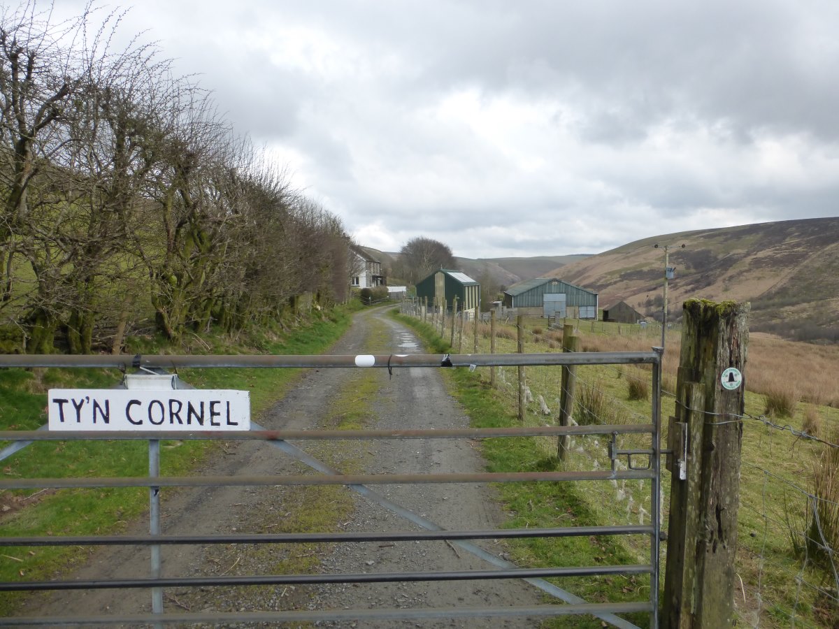
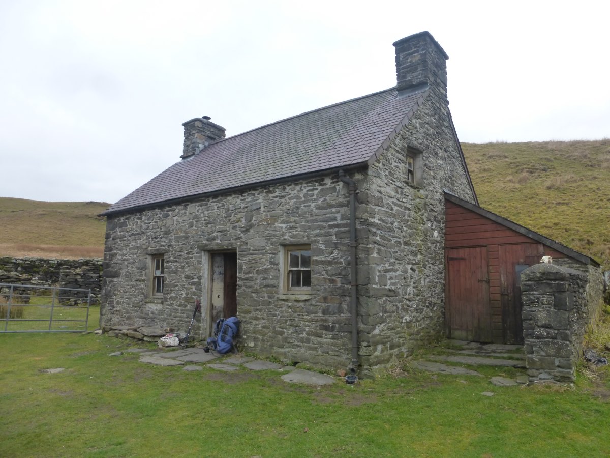
Ty'n y Cornel
A wet pathless moor
My phonebox refuge
Diverting towards the forest tracks
Can you believe it's the same day? Sun at Strata Florida Abbey
Onwards to Claerddu
Claerddu Bothy
Keeping to the high ground
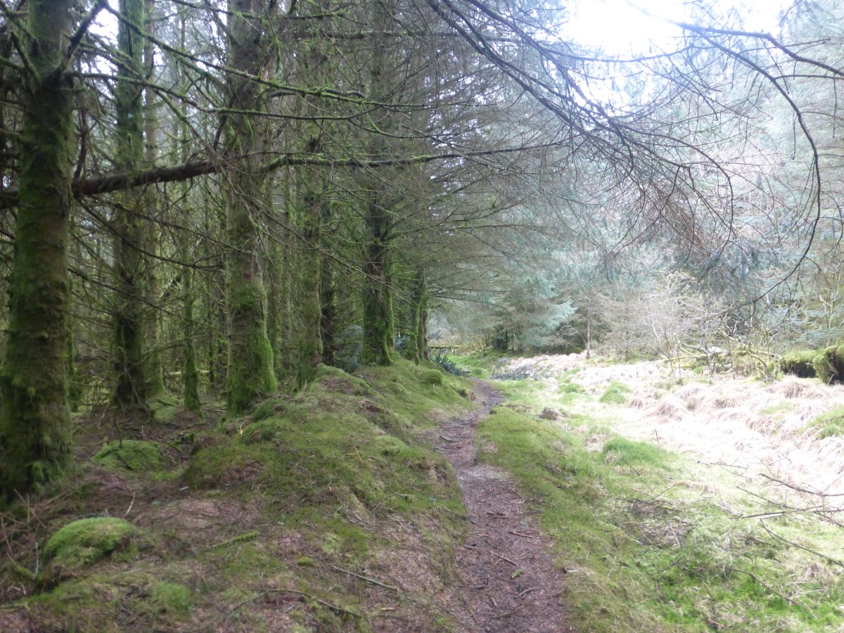
Paths through forestry
Nant Syddion Bothy
Nant Syddion to Dinas Mawddwy
Cambrian Way, 37 miles, 3 days
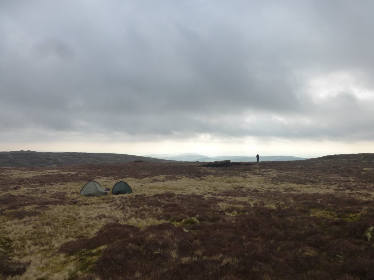
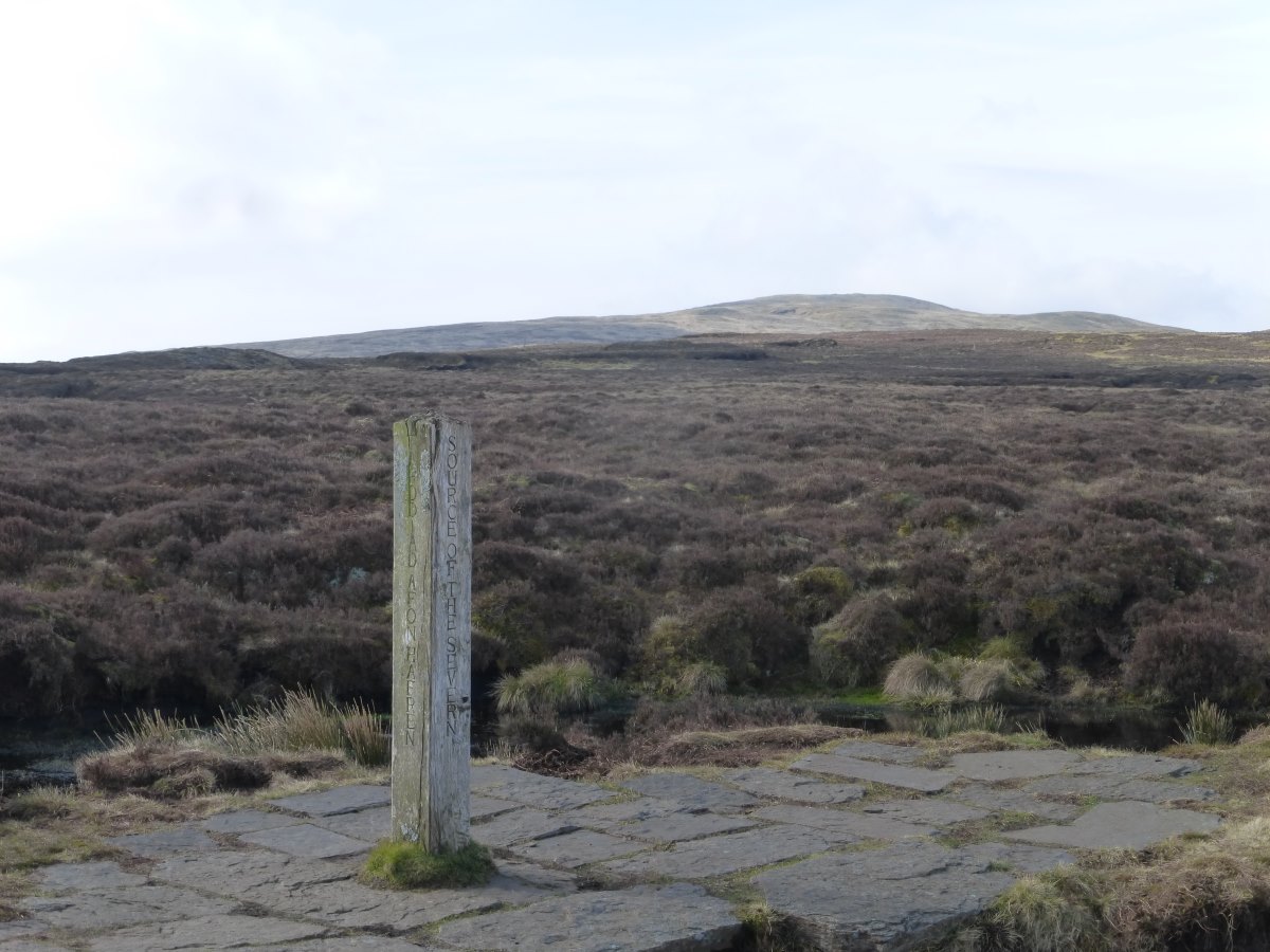
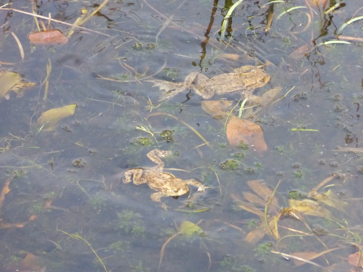
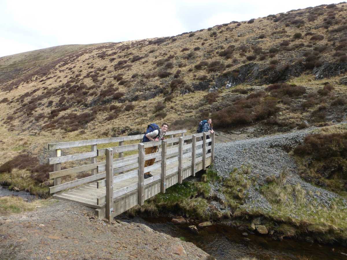
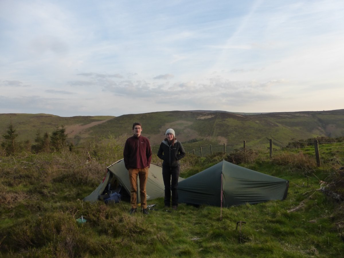
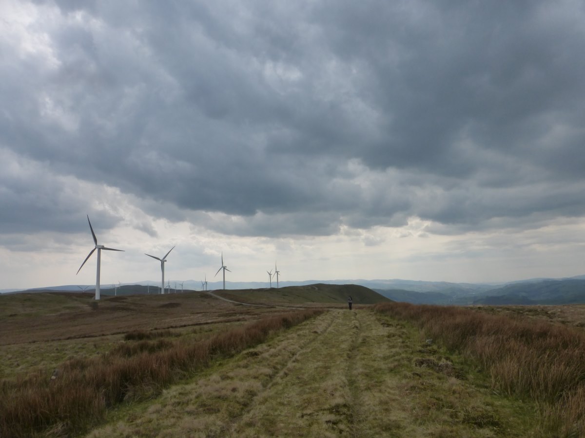
Day 42: it’s Good Friday today, which means I’m about to gain the company of Robbie and Lizzie for a four day weekend. They have some complex car dropping arrangements and bank holiday traffic to deal with, while I have a very short walk to our meeting point so it’s a leisurely morning spent tidying out the bothy and gathering fresh wood to replace what we burnt. I make it into Porterwyd for midday and get a couple of hours sitting on a bridge waiting for them to arrive. Luckily there is a small shop at the petrol station next to me so I can spend the time productively eating free food (free by this stage means that although you do have to pay for it, you don’t have to carry it). Finally a familiar car comes into view. There is a compulsory bit of faff sorting bags and provisions and then we are off for lots and lots of up, right to the top of Pumlumon. The weather is overcast but clear with a good view all round. We spend a while debating camp spots but it’s already late in the day and ultimately we stick the tents up right on the summits, close to the source of the river Severn. Day 43: it’s an overcast morning but quickly clears into a sunny and actually warm day. We pack everything up and drop down from the ridge into a pathless bog which we run through as quickly as possible to try and keep it out of our boots. We are mostly successful. We stop on a small bridge and count a very large number of frogs in the stream below. Then there’s another moorland section which takes us through to Dylife where the map marks a pub. We speculate about lunch but do our very best not to get out hopes up which is just as well because it is very shut. We eat wraps and cheese in the next field instead, watched closely by the sheep. Then there’s more moorland and lots of red kites. Our target for the weekend is to complete a loop over Cadair Idris (kind of a reverse of the Cambrian Way which here turns West) and get Robbie and Lizzie down to the waiting car at Dinas Mawddwy by Monday morning. It’s a loop I had vaguely sketched out for a different friend before I started the walk, but hadn’t been able to look at since. At some point in the afternoon, still a very long way short of our target for the day, it occurs that that had been based on four full days of walking, and what we really have here is 2.5. Hmmm. We plonk ourselves down and get all the maps out. Cadair Idris is a very long way away. So we give it a cheery wave and come up with a much straighter line for plan B. This is great, because rather than a death march into the dusk we can stick the tents up, have a leisurely dinner and sit about and chat our way through a very enjoyable evening. Day 44: even with the much straighter plan B this still feels like a long day. It’s hot and sunny but with a forecast for rain in the evening which gets us moving at a decent trudge. The heat and the addition of two extra people sees a lot of time very laboriously filtering stream water and the hole in the bag is growing rapidly. There’s a particular way of pinching it shut that works really well, but can only be sustained for about a minute before the hand goes into cramp. We wander through forestry and fields, and along a long ridge under a wind farm. At one point the guidebook recommends a 1km detour around the edge of a terrible bog but we chance the direct line and it’s so hot and sunny that we all make it across with dry feet. At the end of the day the trail drops onto a long contouring track and the clouds start to gather ominously overhead. We’re all feeling tired and flat footed but push on to make it to the campsite just as the rain starts. We hide in the porch of the big(er) tent and cook vast quantities of pasta in a very small pan.
Dinas Mawddwy to Llangollen
An Over-the-Hill Improv, 43 miles, 4 days
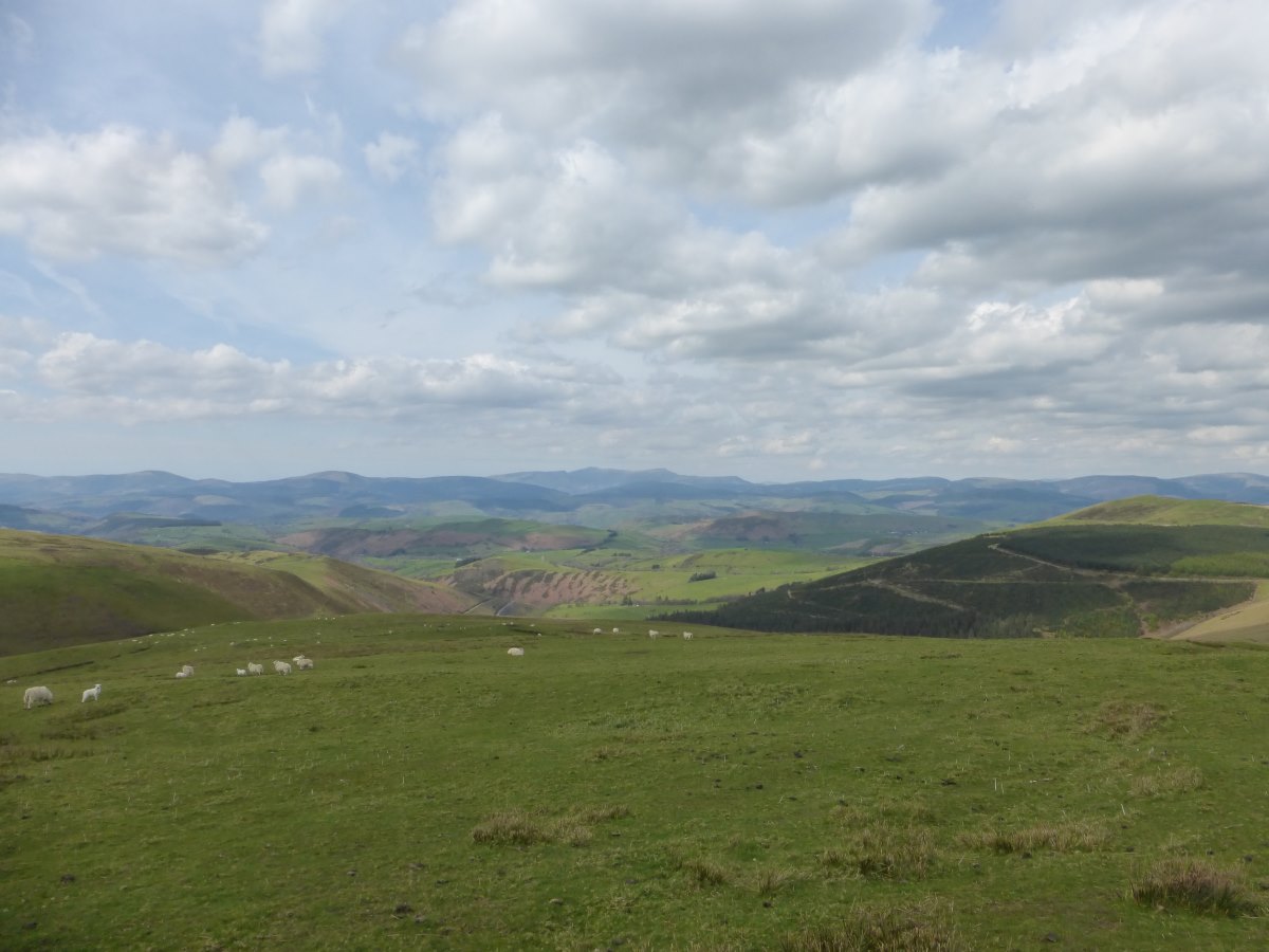
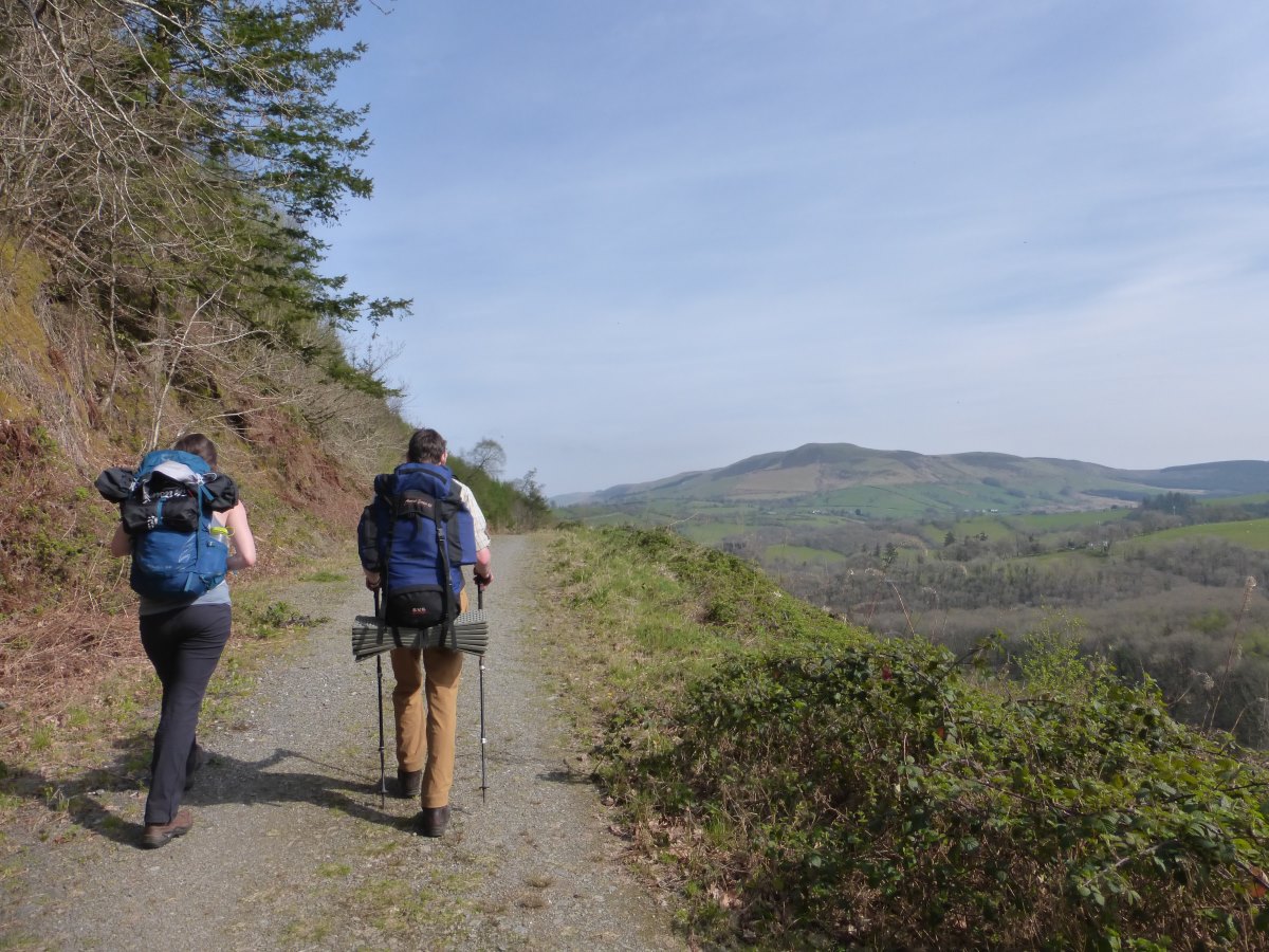
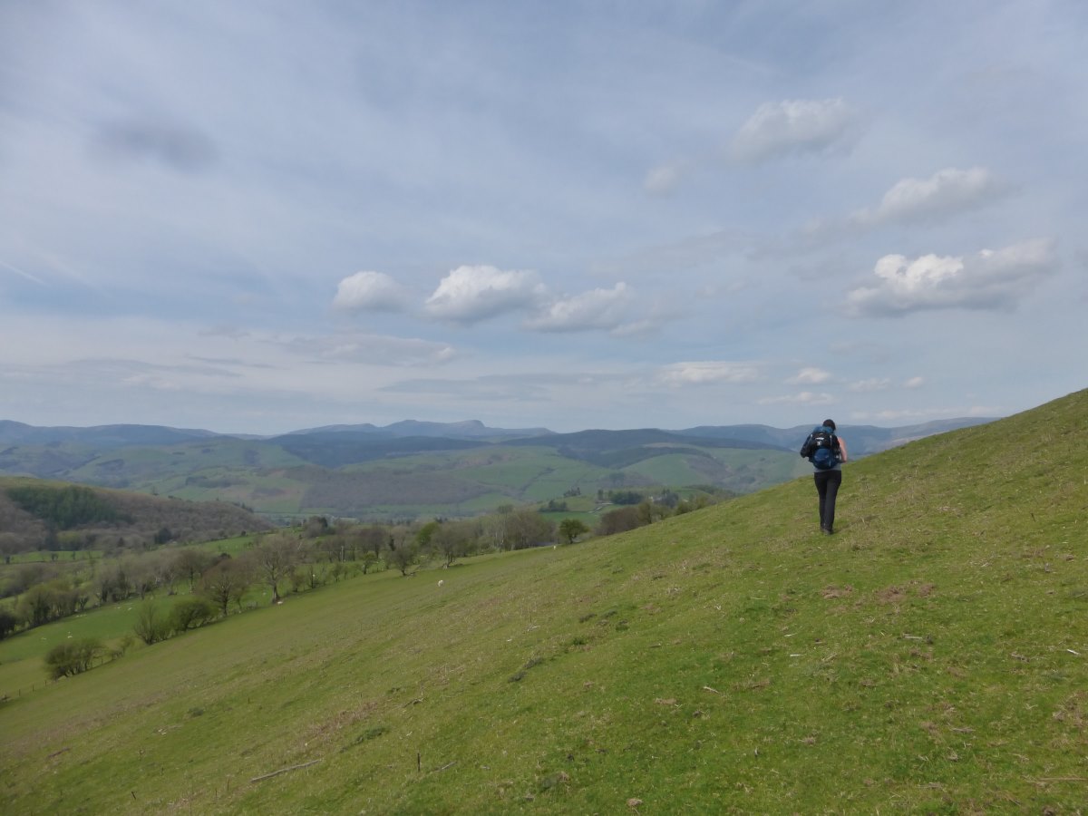
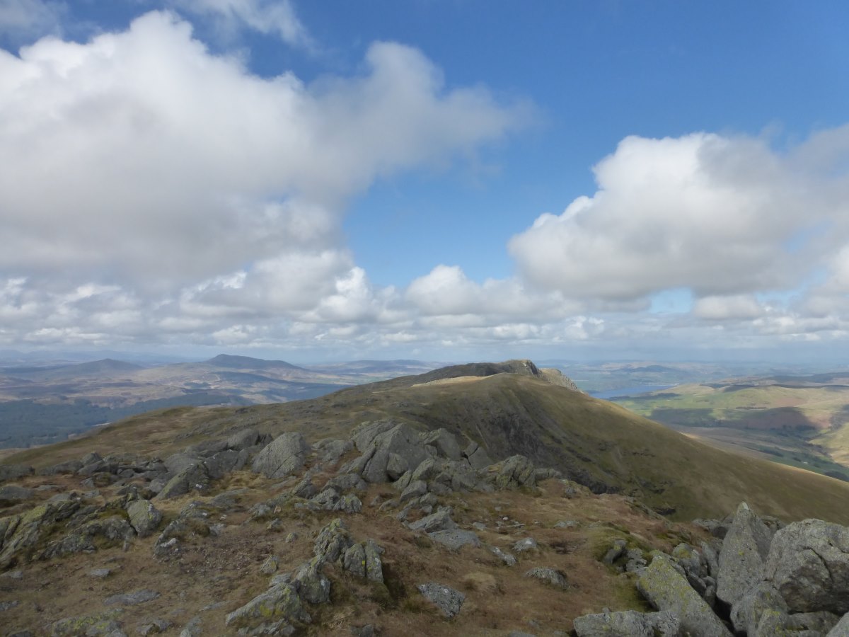
Day 45: we are re-united with the car this morning which means fresh clean clothes and new maps for me, and a ride home for Robbie and Lizzie. We have a leisurely start and a big café brunch and then I’m back to being on my own again. The weather has cleared and, feeling somewhat cheated of the chance to climb Cadair Idris, I re-jig my route slightly to head up and over Aran Fawddwy. At 905m it’s the highest point on my walk so far and may remain unbeaten unless I add any excursions up Scottish munros. From the top I can see clearly the summits of Snowdonia and almost wave to my house. Passing within a few days walk of home it does feel odd to turn away East but my next target is Edale and it’s time to turn the corner and start making my way out of Wales. I enjoy a pleasant meander down the ridge in the sunshine, and put the tent up just before I drop back into the fields. I expected this to be a tough day mentally, settling back into being alone but the weather and the views have been a fantastic help and I’m now passing into areas that, while still new to me, are close to friends and family. Suddenly I seem to have a social calendar to sort out! Day 46: I wake to sunshine warming the tent and, when I eventually poke my head out, found the valley below shrouded in mist. I don’t have far to walk so enjoy a lovely leisurely morning watching the tent dry and listening to more audiobooks - nearly finished Return of the King. It’s all very peaceful, though somewhat at odds with Frodo and Sam crossing Mordor. Finally I get moving and drop down the last bit of the ridge then follow a quiet road along the lake all the way to Bala. The steam train passes twice, but both times in places where it’s behind a thick hedge. Into Bala I find a café for lunch while an unexpected downpour occurs outside. Then it’s a shop re-stock and into the hostel for mid afternoon. I spend a few hours staring at lots of maps for the upcoming crossing of the midlands and trying to come up with a way of seeing family, while not also having to walk 20 miles with them. Plan thrashed out and campsites booked I join Hannah, an ex-colleague, for dinner. It’s only been 7 weeks since I quit my job but already it feels like a lifetime ago. Day 47: an early start (mornings are so much easier when you don’t have a wet tent to deal with) and a perfect clear blue sky with a beautiful still reflection of the mountains in Bala Lake. I set off along minor roads then forestry tracks which take me almost to the top of my first hill of the day. The last bit is a pathless deep heather slog with a rather tiring diversion to touch the top of a little lump of a hill. It’s officially a Hewitt or I probably wouldn’t have bothered, which leads to some interesting speculation about why I climb hills but that could fill a whole blog post in itself. So, heathery slog ticked I rejoin a narrow path onwards to the main Berwynion ridge. Here some wonderful people have laid a series of old railway sleepers in a solid and easy path that avoids all the bogs, prevents erosion and gives a beautiful low effort walk pretty much all the way along the main ridge. I meet a man at one summit who remembers the path being thigh deep bog before them, which makes me even more grateful. The sun stays out for the whole day though the haze is building and starting to reduce the view. I can still just about make out Snowdon. The later part of the ridge where I’m hoping to camp ends up being deep heather and in search of an appropriate spot I end up walking a much longer day than I had planned. Eventually I find a lovely flat bit of grass next to a bog which is flowing just enough for me to extract a trickle of water to make dinner. It’s a lovely warm evening to celebrate my last hill camp for a while, though it is a relief to have the major summits behind me and not have to worry so much about what the weather has in store for me in the coming weeks. I can also now safely look back and reflect that the last couple of weeks have been amazingly dry for the time of year, and that I never did get that two weeks of solid rain that I was initially promised when I entered Wales. Here’s to it continuing! Day 48: another short day. After walking such a huge distance yesterday in search of camp spots there really is not very much mountain left before the descent into Llangollen. Dropping down into fields I spot several very agile birds swooping around making very odd almost electronic noises. Several terrible photographs later I manage to catch a good enough one to zoom right in and identify them as lapwings. This is really cool. I remember having a bird book as a child with a lapwing on the front and I always wanted to see one so I have a big grin on my face for the rest of the day. I reach Llangollen by midday and enjoy a leisurely café lunch and find some postcards to write. About 20minutes after putting them in the box I get a text from a friend saying my postcard just arrived. In Aberdeen. I’m really confused as I didn’t think the postal service had developed teleportation yet, then we realise she is referring to a card I sent nearly a month ago that had gone astray! I also wander into an outdoor shop and on the advice of Robbie, who was appalled by the efforts required to make my leaking water filter work, acquire a fancy Platypus “wine carrier” (aka plastic pouch with a compatible screw thread) so that for the extortionate fee of £15 I can begin turning wine into water…

Llangollan to Malkin’s Bank Golf Course
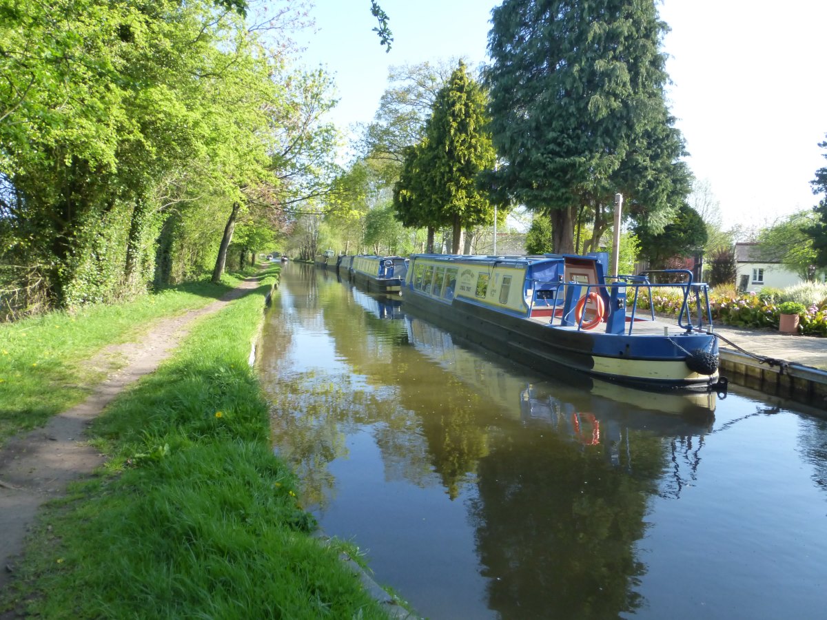
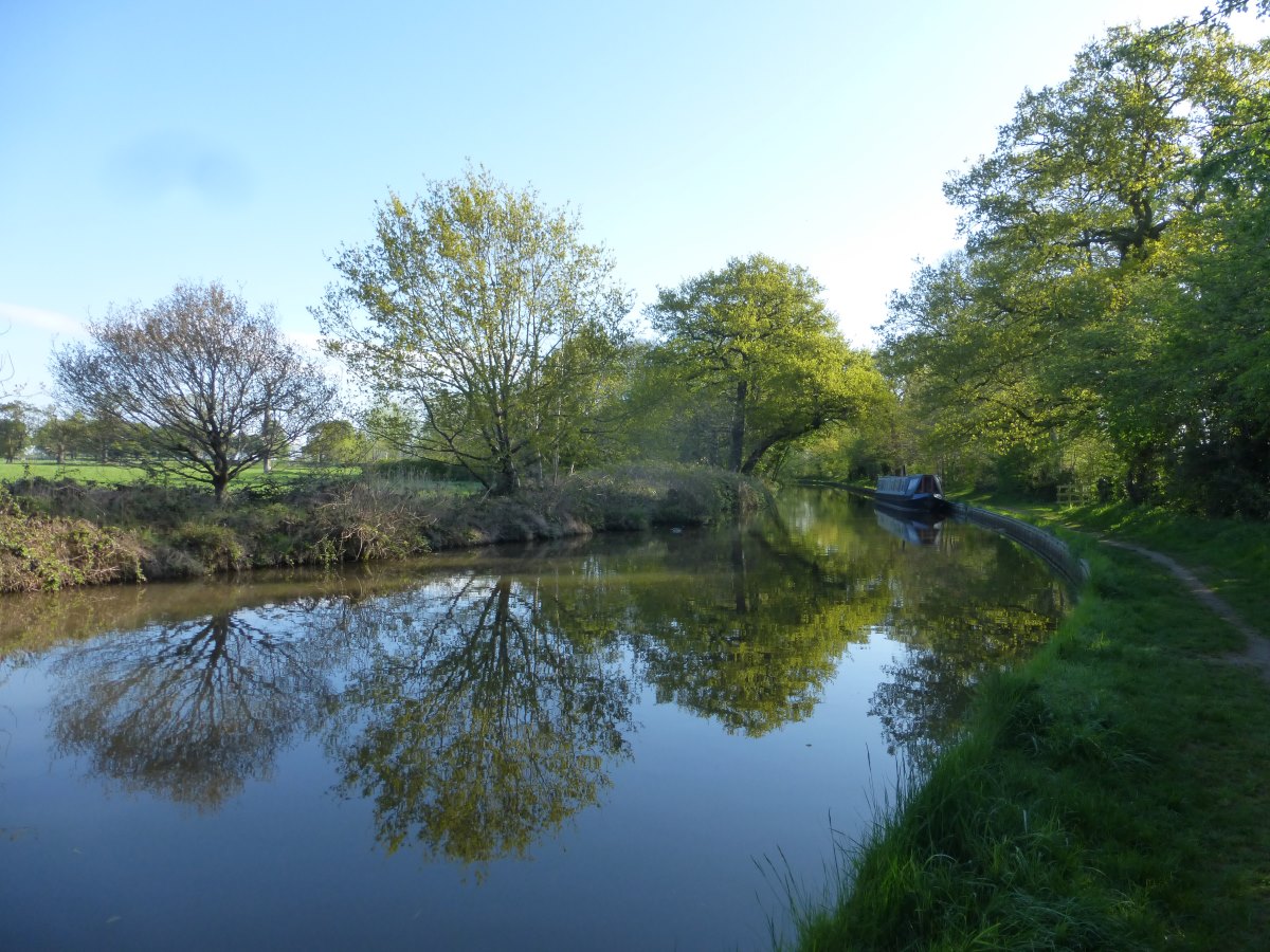
Llangollen Canal, 56 miles, 3 days
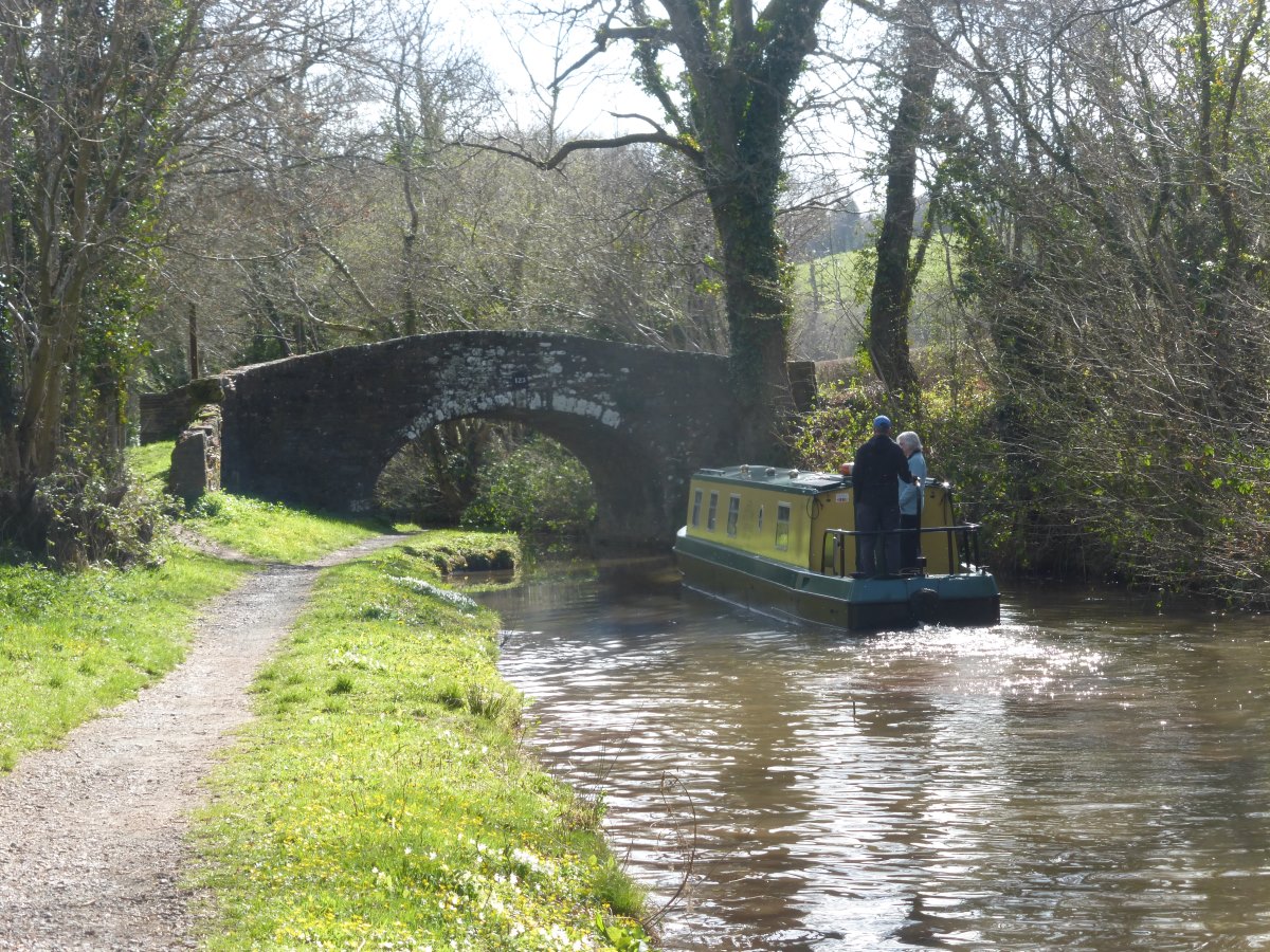
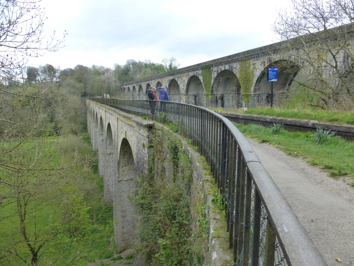
Day 49: on to the canals! I was a bit worried about trying to stealth/wild camp on this section so I’ve booked myself a series of campsites etc. Today’s target is about 15 miles away so it’s up and off early for a long plod. It’s flat and very green, with spring much more advanced down here than up in the hills. I’m just wondering if it’s still a bit early for ducklings when around the corner comes a large tribe of them and there are regular sightings throughout the day. After a few miles I cross the pontcysyllte aqueduct which is very impressive with a great view and plenty of drop below you. I rejoin Offa’s Dyke (but heading South), and have a hard time explaining to a fellow walker how I’m actually heading to the top of Scotland. Before long though the Llangollen canal peels off away from the trails and tourists and the afternoon is very quiet. There’s another aqueduct + viaduct combination to mark the return into England, and then the tow path becomes grassy and much less walked. The sun comes out though it’s windy and not especially warm. The navigation is easy (just follow the canal!) and overall it’s a very enjoyable and relaxing day. I stock up on heavy luxury food in Ellesmere including a glass jar of pasta sauce (so decadent!) then it’s only a brief detour through some lovely woodland to my campsite. I have the whole non-electric field to myself and there’s an indoor area with a comfy sofa to relax on and a shelf of books to browse. Day 50: a rest day. I’m joined by Sarah and Graham and we have a pleasant stroll around the Ellesmere sculpture trail and a decadent pub lunch. We apparently clock up 8 miles but it’s bag-free and flat and I hardly notice them. Day 51: onwards on the Llangollen canal. It’s peaceful and sunny with more ducklings, easy navigation, brimstone butterflies and more lapwings (now I recognise their calls I’m seeing them everywhere!). It’s very relaxing, and a great easy way to cover 15 miles without really noticing them. Before this section I was quite nervous about whether the canal paths would be open (not all are rights of way) and thought I’d likely get bored really quickly, but actually it’s proving to be such a delightful contrast to the mountains that I’m having a great time. I realise that I made a mistake in Somerset of trying to get what I thought I wanted from an area, rather than appreciating it for what it’s best for. Hence I took the “shortcut” to Cheddar gorge, and missed out places like Wells cathedral which would have been a really unique memory in the course of my mountain/wilderness orientated walk. I have another campsite tonight at the top of a very small bump of a hill, but because the land around me is so flat I can see for miles in all directions, to the faint bumps of the Welsh hills behind, and those even smaller of the Pennines ahead. Day 52: another loooooong day. I wake at 6 with the sunrise and, seeing as I have foolishly let myself run out of porridge, grab a cold breakfast (apple and half a malt loaf, yum) and am off just after 7 for what might be my earliest start so far. The sun is shining brightly but it’s cold and I keep the hat and gloves on for most of the day. Back on the canal I pass a man on a boat who recognises me from the previous day and is very interested to hear where I’m off to. Although I haven’t seen any other long distance walkers on this section it makes me realise that I am still part of a travelling family of people moving on each day and leaving no trace behind them. Only they’re doing it sitting down… Herons and swans, and lots of orange tip butterflies. Because I’m up so early the pub I’m planning to lunch in is closed (to be fair it’s only 10am). I carry on, and find a café which is also shut, and then a marina which apparently has everything but is on the wrong side. I eat my last crust of bread and keep walking. In the afternoon I venture onto the Crewe and Nantwich Circular Walk to cut a large corner and find myself in the cow fields of deepest Cheshire. There is however a very nice pub in the first village I pass where a large cheese and onion pie with chips sates my hunger and removes the need to divert several miles to a shop. One set of cows charge at me, but early enough that I can do a controlled jog back to the gate (as opposed to a desperation sprint) and find another way. But there are lots of fields to cross between each road and, as a person who (especially when alone) is moderately terrified of cows it’s a stressful afternoon. A feeling I encounter a few times on this walk is that I’m envious of my future self. That the idea of being someone who is sitting about at the end of an epic journey looking back at the memories, is much more appealing than being someone who is actively doing such a challenge. Well, in classic “grass is greener” style I can now tell you (as I sit here writing this up) that I’m very envious of my past self who was still walking! But that comes with knowing I made it, that (spoiler alert) I never did get a month of rain or a significant injury or trampled by a cow. Stress is a part of life, and there is always an awareness while I’m walking that I only have so much food, or that I don’t know where I’m going to put the tent tonight, or how long good weather will last. They’re very different stresses to my normal life, but they’re there. They’re amplified in the mountains where the stakes are higher; and soothed by canal tow paths and signposts and fellow travellers. Oh, and luxury accommodation. There are no campsites around this evening so I’m forced to up myself to the luxury of a golf club “pod” which has an actual bed, a microwave and an en-suite with a lovely hot shower.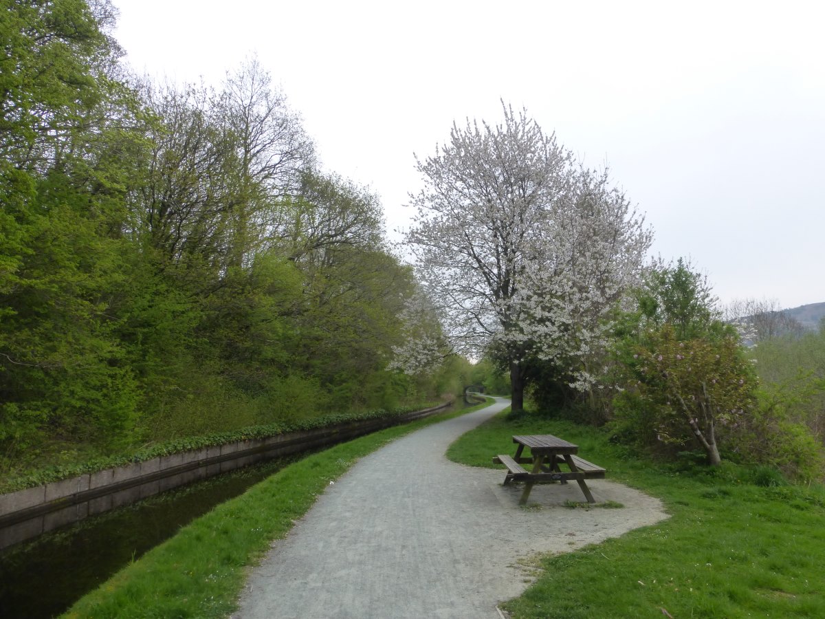
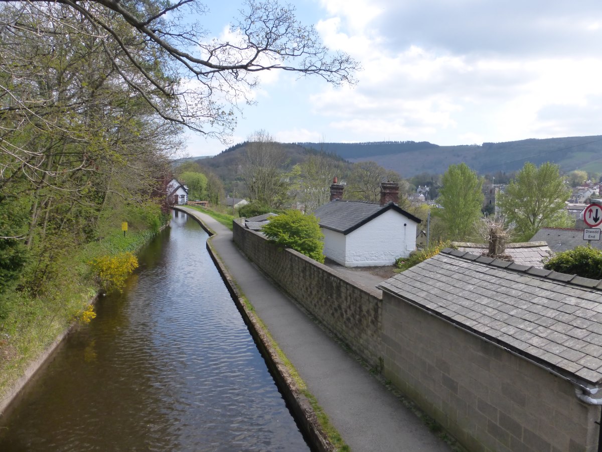
Llangollen Canal
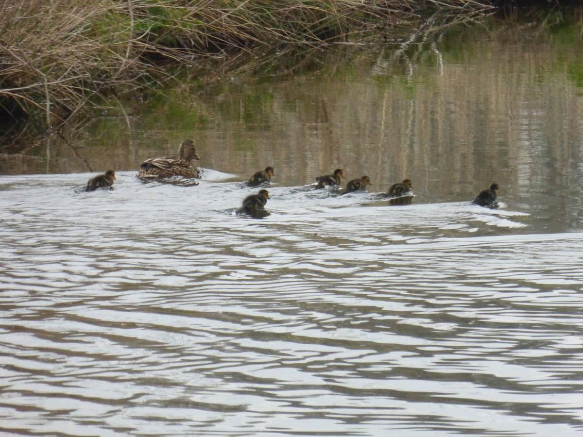
Ducklings
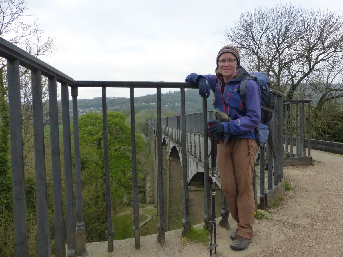
Pontcysllte Aqueduct
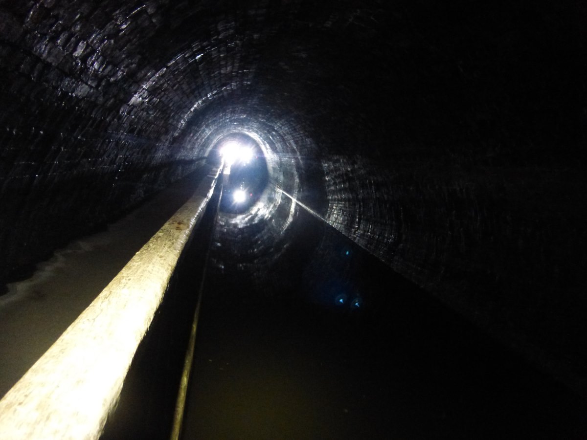
Under the railway near Chirk
Crossing back into England
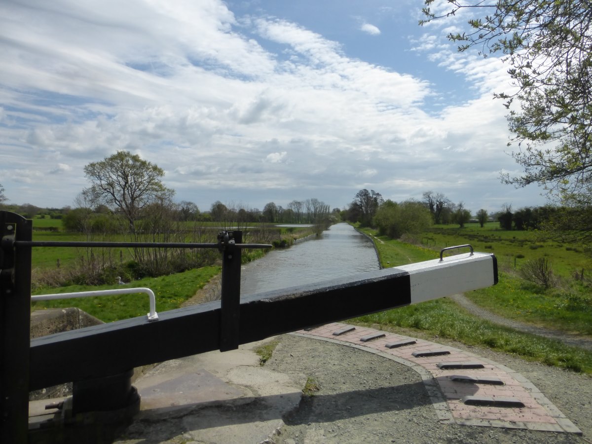
Locks
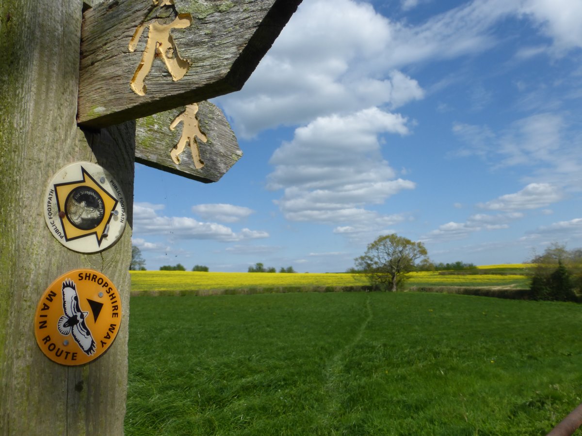
A brief corner cut on the Shropshire Way
There's a path in here somewhere
Blake Mere (left), canal (right)
Llangollen Canal
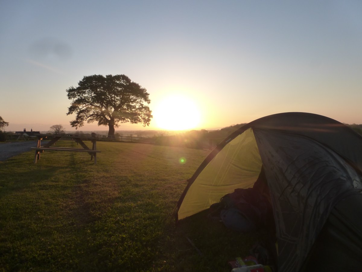
Sunrise at Marbury Campsite
Llangollen Canal
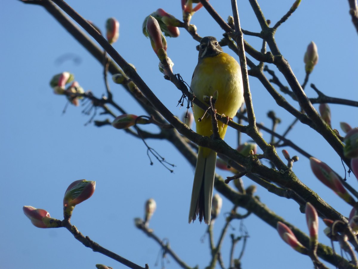
A very yellow Grey Wagtail
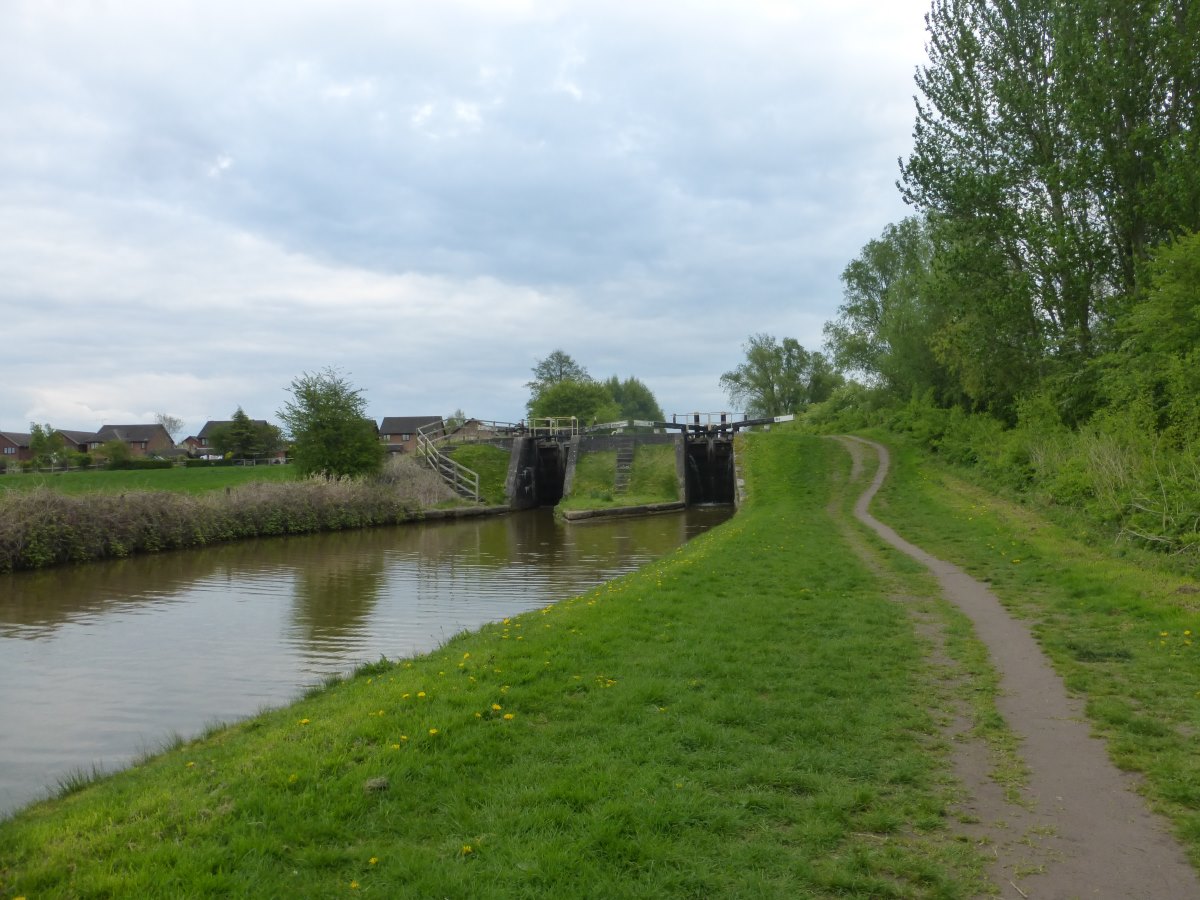
Double locks
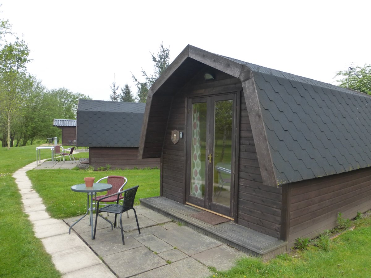
My luxury pod
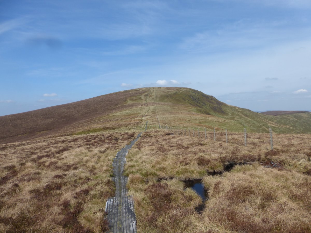
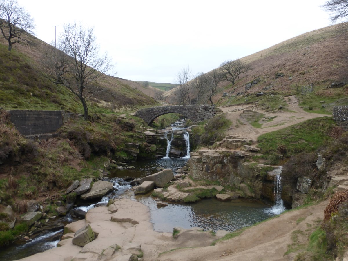
Malkin’s Bank to Edale
Llangollen Canal, Dane Valley Way and other fragments, 44 miles, 3 days
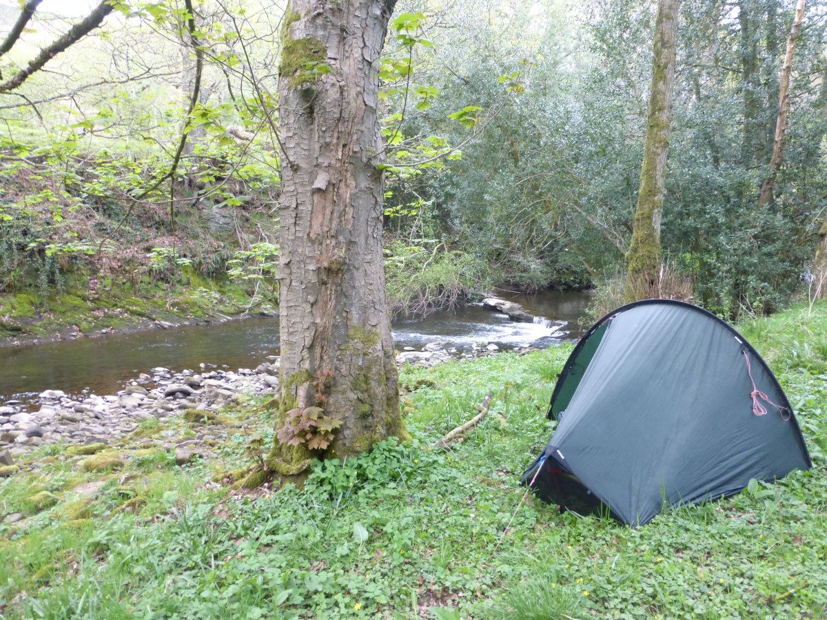
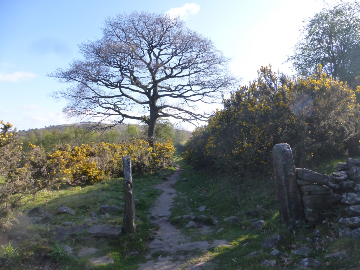
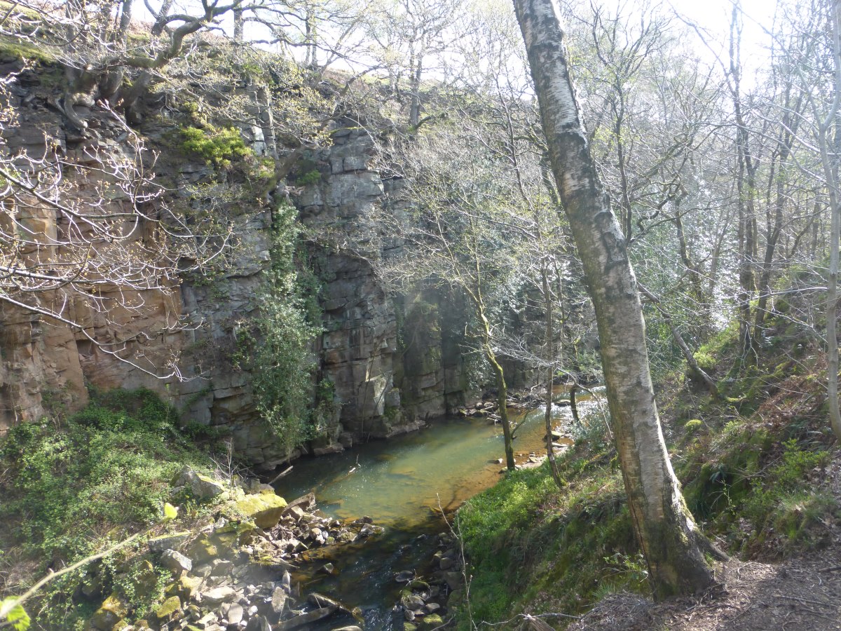
Day 53: I have an excellent night’s sleep in my pod and, with no tent to pack away, get another early start. Breakfast is my last remaining porridge sachet exploded in a teacup in the microwave (oups) leaving the emergency couscous as the only food in my bag. My planned route for the day diverts off the canal on the Staffordshire Way, but I decide after yesterday that canals are much less stressful than cow fields and that my appetite for canal tow paths is still far from exhausted. So it’s onwards for a final morning on the tow paths. I’m rewarded by a village shop that Google didn’t know about which fixes my food problem, and then another excellent pub lunch of spinach and sweet potato pie. Then it’s goodbye to the flat and straight up The Cloud (what a wonderful name for a hill) on the Gritstone Trail. There’s a brilliant view from the top, out over an eternity of flat with lots and lots of buildings to a distant strip of hills which is Wales looking oh so far away. A slightly depressing distance circle informs me, among others, that it’s only 280 miles to Land’s End. I think I have walked at least twice this, though I am now on course for a much straighter line for the rest. I sit about for a while and ponder camping on the top but decide in the end that it is a bit too popular and lacking in flat space. So on down the other side to pick up the Dane Valley Way into a lovely wooded valley. My feet are feeling pretty flat by this point but eventually I find a great spot by a bend in a river where I’m completely hidden from the path. To confirm how great it is a kingfisher (the first I’ve ever seen) flies past not once but three times while I’m making dinner and a pair of dippers spend the whole evening playing in the water just downstream. Day 54: I poke my head out stealthily and silently (ish) at sunrise just on the off chance that there is a family of otters playing next to the tent but I guess you can’t have everything. The dippers are back and it’s another cold but sunny morning. My route continues onwards and gently upwards following the lines of the rivers and it’s beautiful to walk through woodlands in the morning sun. After so long on the flat I feel like the landscape has gained a third dimension and it makes me excited for the Pennines ahead. I have lunch by an old bridge with another dipper, lapwings swooping overhead, and the first Swaledales (Pennine sheep); then it’s off onto the moors. The sky clouds over and it’s a cold day requiring the synthetic, hat and gloves despite walking up hill. It’s a short day though and I’m into Buxton in the early afternoon. Solomon’s temple on a little hill gives an excellent view and a volunteer litter picker gives me a fantastic impromptu talk about the area, from gritstone/limestone geology and the formation of caves, to extensive underground tunnels once used to store guns which are now full of maturing whiskey and cheese. I check into a campsite for the night and enjoy a decadent dinner of pasta parcels, posh tomato sauce and fresh rocket leaves, then curl myself away in my sleeping bag for a lazy evening hiding in the tent in the warm. Day 55: another cold night with the fleece, synthetic and socks on, when is summer coming? I get a leisurely start past a gigantic Morrison’s (it’s quite exciting by now to pass anything other than a small village shop) where I grab a large banoffee pie for second breakfast and eat it in the car park (free food!). Heading out of Buxton I’ve drawn a fairly random line along a few public footpaths on an old map and find myself, completely by surprise, traversing a huge limestone quarry which is really cool. I have a great bird’s eye view from the path and can watch enormous trucks scuttling around like ants sorting piles of different sized stones. Up the other side I pick up the Pennine Bridleway, though thoughts of coming back on a mountain bike sometime are dashed when I have to climb two gates and a barbed wire fence to escape a field of cows that decide to take an interest. Wouldn’t be managing that with a fully loaded bicycle! On to the Limestone Way there’s a lovely section through a series of small but steep valleys with exposed rock sides which remind me of Cheddar gorge, but also of the GR221 - if only the Hawthorns were Olive trees and it was a tad warmer! On the subject of warm, it is not. My fleece, synthetic, hat and gloves stay on all day and, with that being everything I have, there’s not much scope for sitting about. I’m tired, and I’m not stopping to eat as much as I should. The ground is stony tracks and hard baked mud which is bruising the soles of my feet. I want a week off in a house with a hot bath and a warm bed, which makes me feel a bit like a stroppy child rather than a grown adult on the adventure of a lifetime. A lot of it is weather related. Exposed to the outside world all day every day the weather is having a huge impact on my mood and today is grey, cold and darkly overcast. But I’ve also walked over 600 miles and probably not had the greatest nutrition for the last two months. I resolve to eat more vegetables. And in more mood-improving news I make it to Edale, the vague sort-of half way point of my journey and the venue for two whole rest days while I wait for Dad to join me for the next steps. I celebrate with dinner in the Nag’s Head (the official start of the Pennine Way), then go and hide in the tent with the door shut because it’s too cold to enjoy the view. Days 56-57: wall to wall sunshine, rest and relaxation, hand washing of all the clothes and lots of food.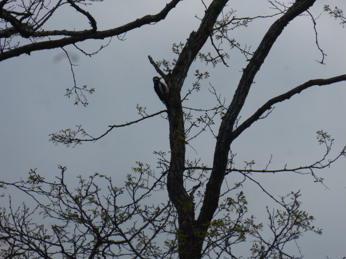
Woodpecker
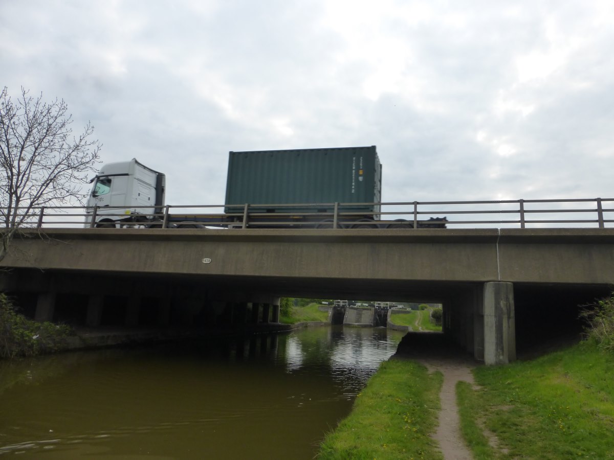
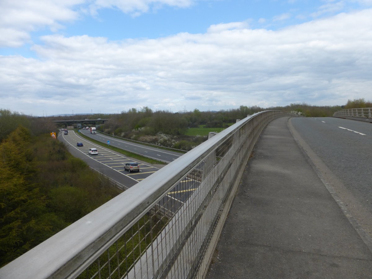
An old express delivery route under a new one (the M6)
Bluebells
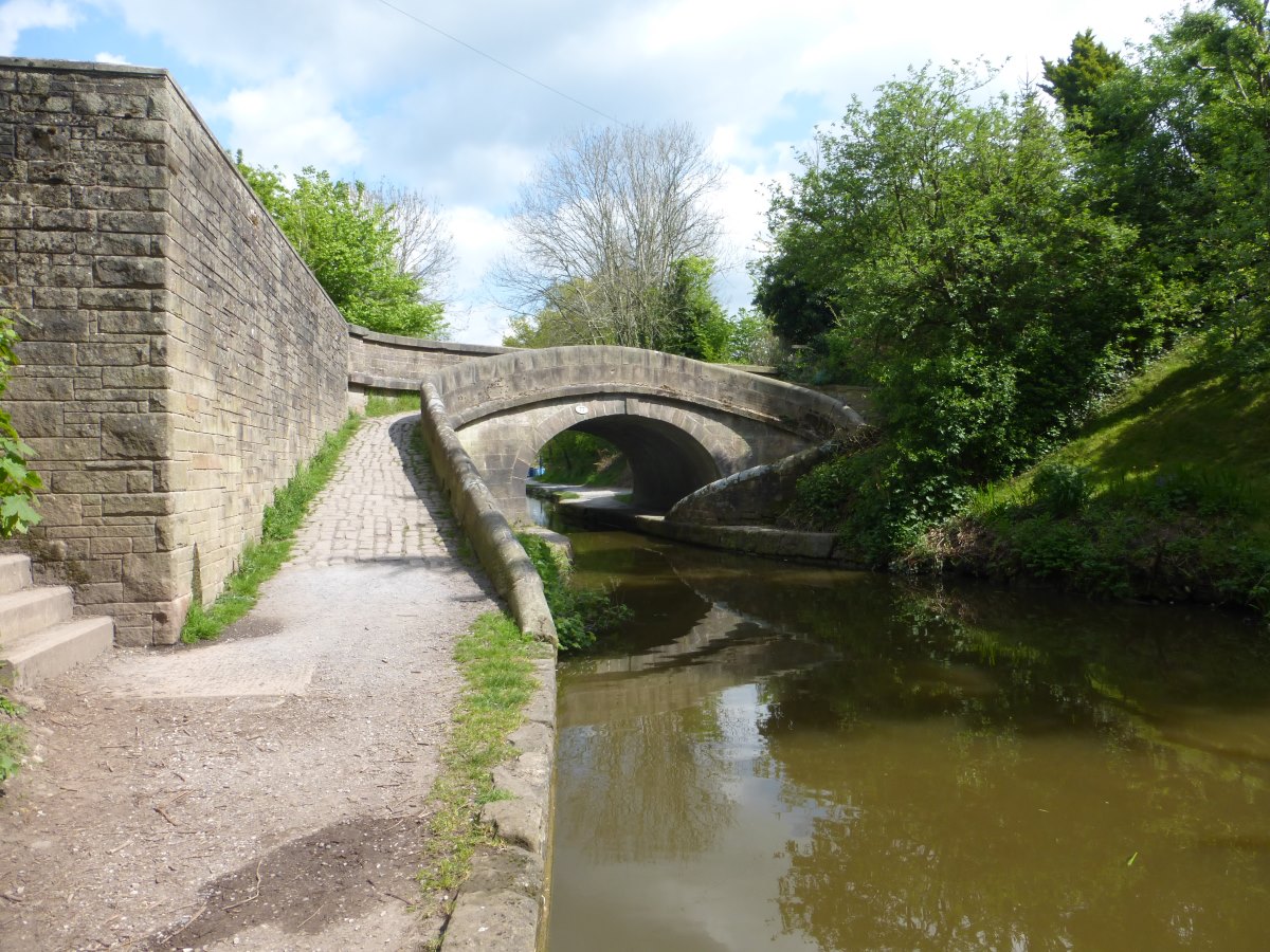
A turnover bridge - no need to unhitch the horse
On The Cloud
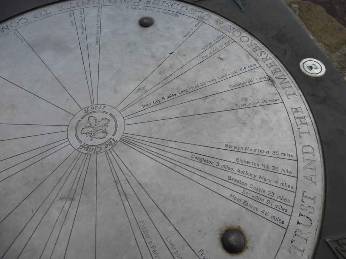
Only 264 miles to Land' End
Kingfisher Camp
A change of scenary
Onto limestone
Lunch spot with a view
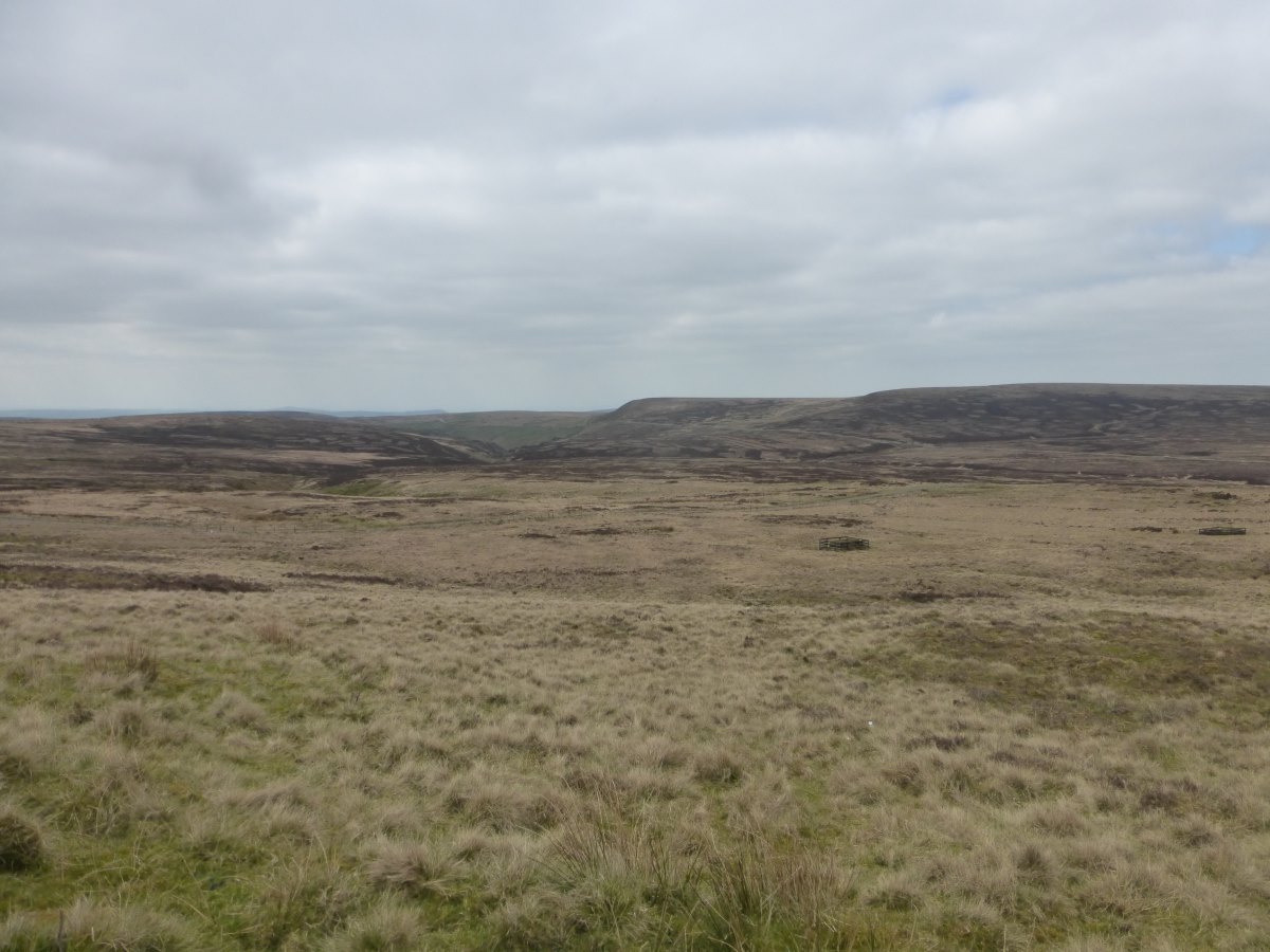
Onto the moors
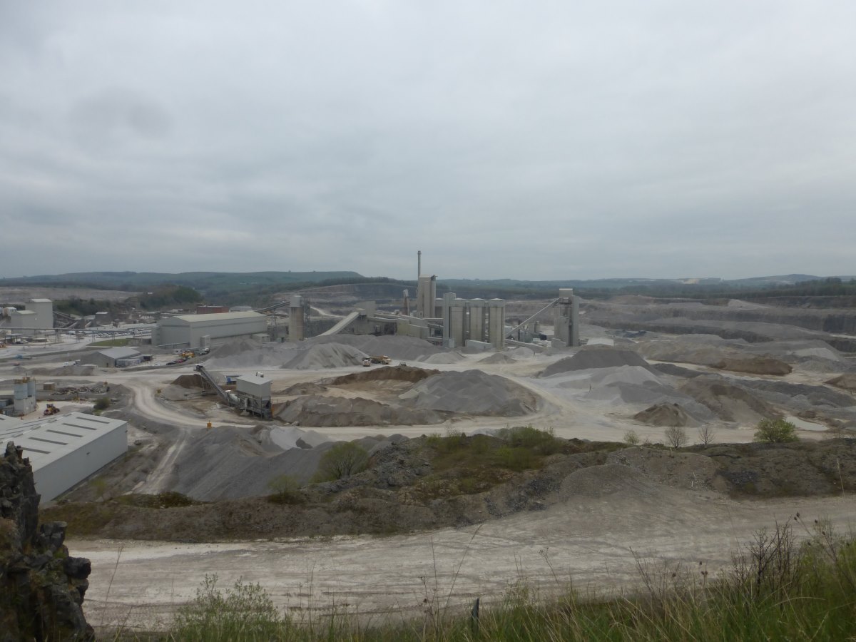
Limestone quarry
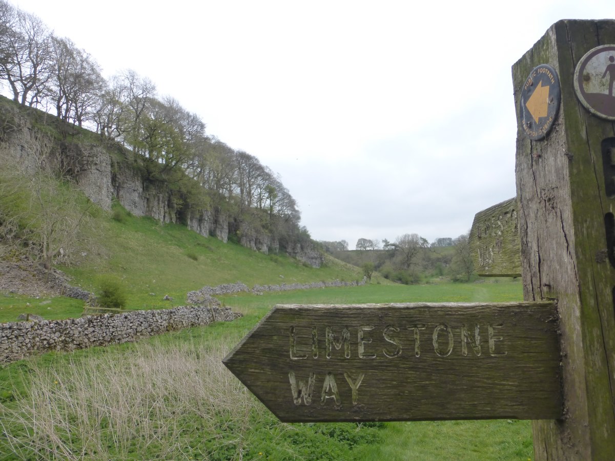
Limestone Way
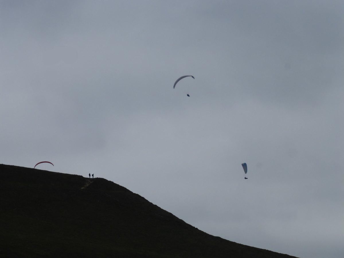
Paragliders over Mam Tor