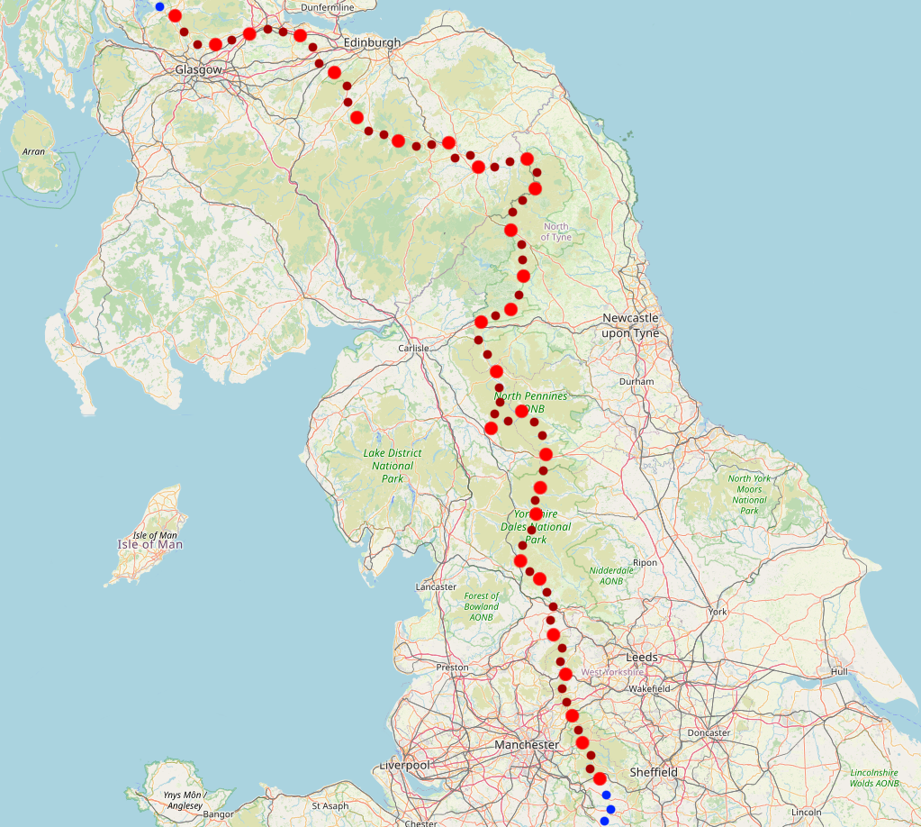
Land's End to Cape Wrath
Part 3: Edale to Loch Lomond
May 2022
This is the third part of my End to End journey in which I walk the entire Pennine Way (my first complete trail), then follow the St Cuthbert's Way, Cross Borders Drove Road and John Muir Way to the edge of the Highlands. << Back to Part 2 | End to End Home Page | Onwards to Part 4 >>
Edale to Ickornshaw
Pennine Way, 58 miles, 4 days
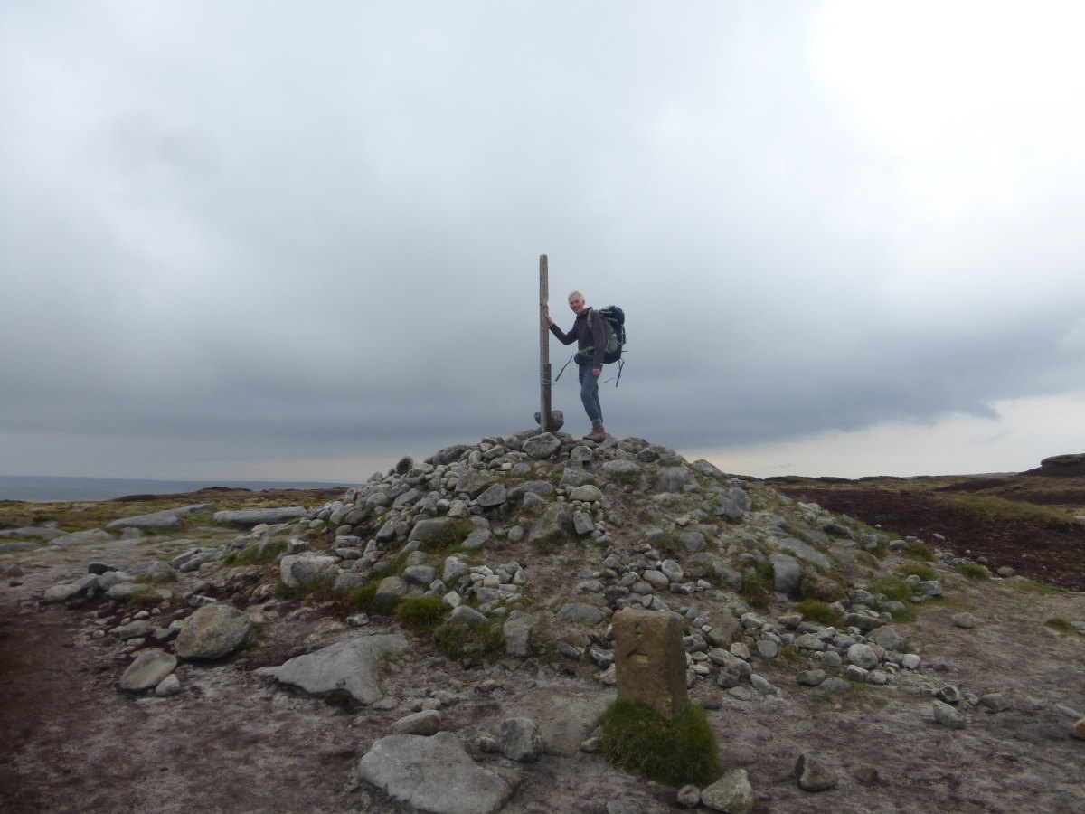
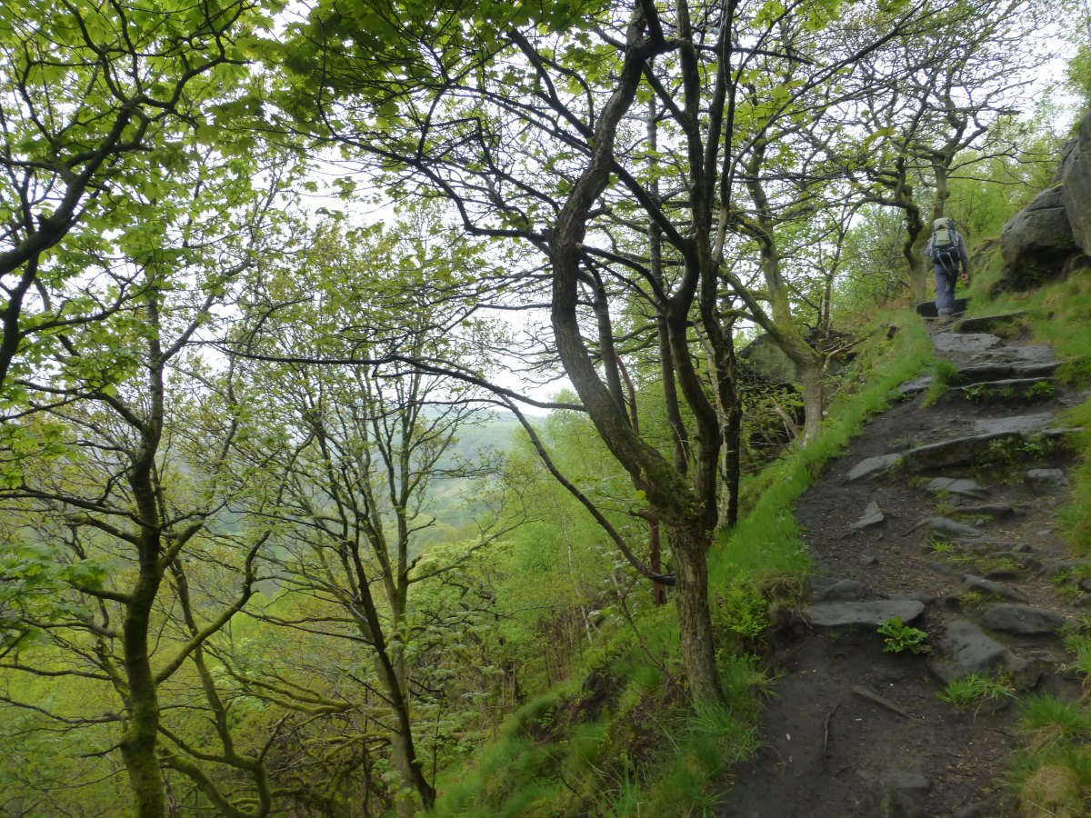
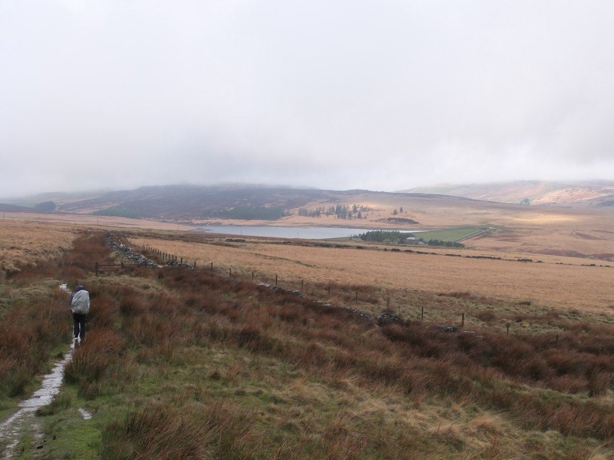
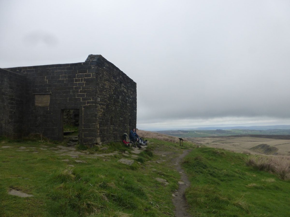
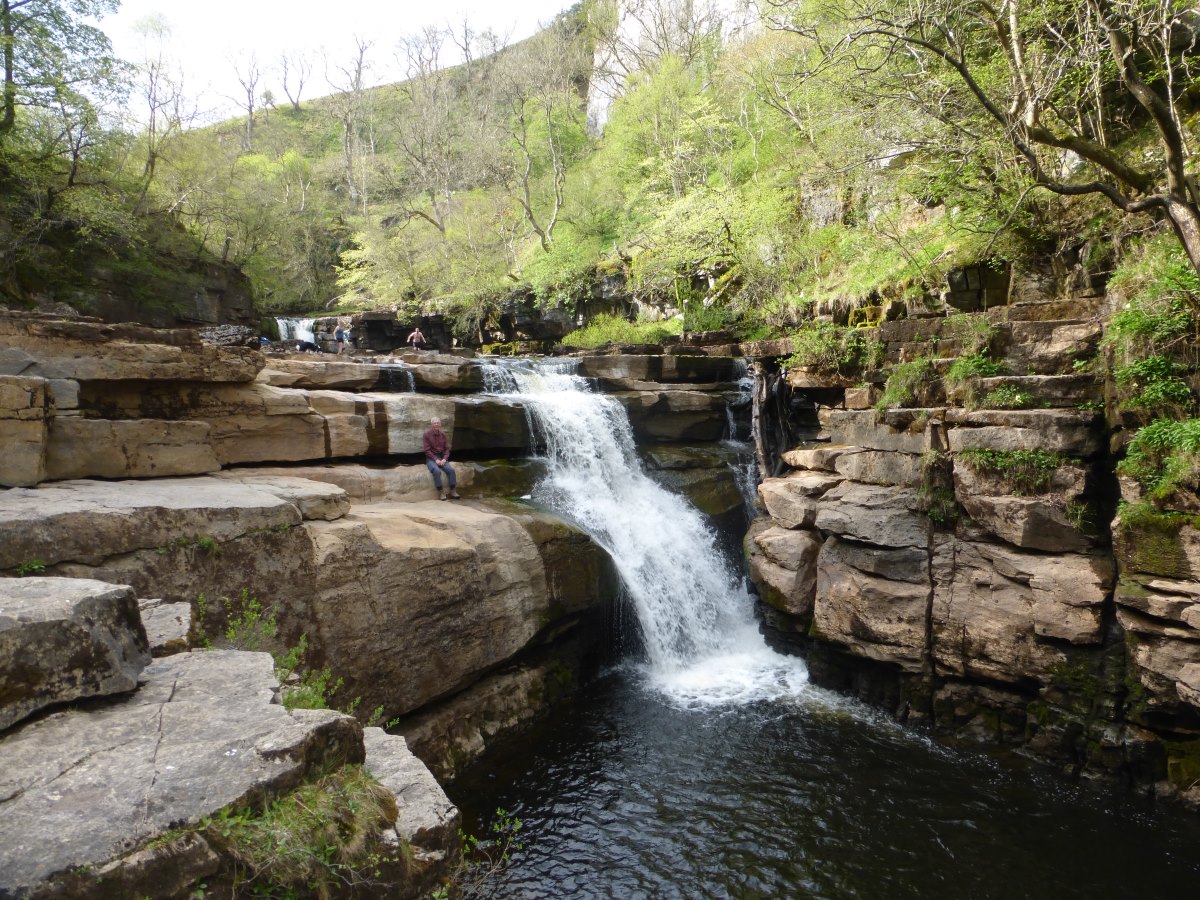
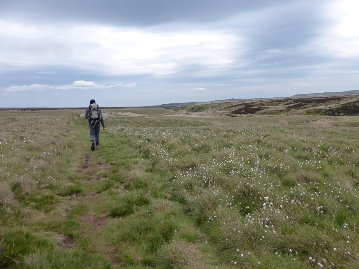
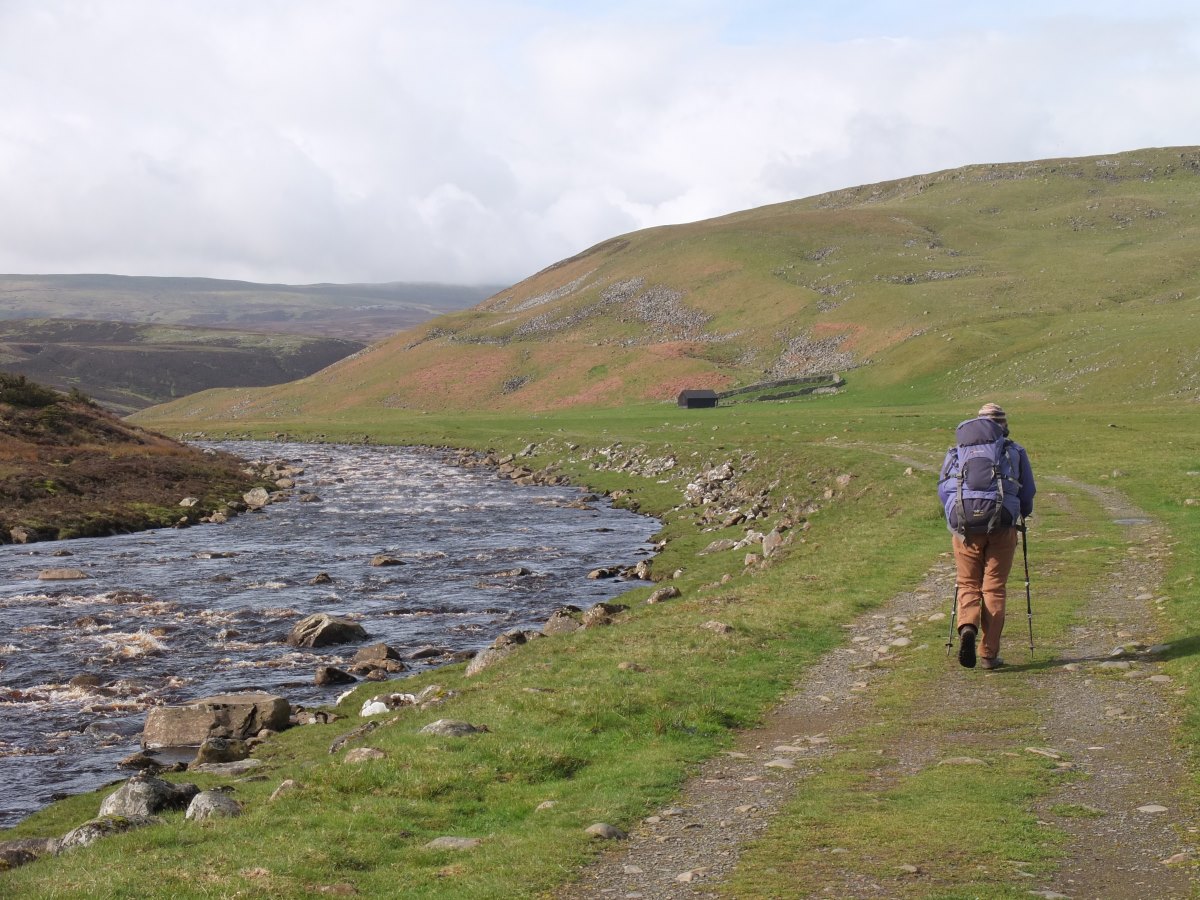
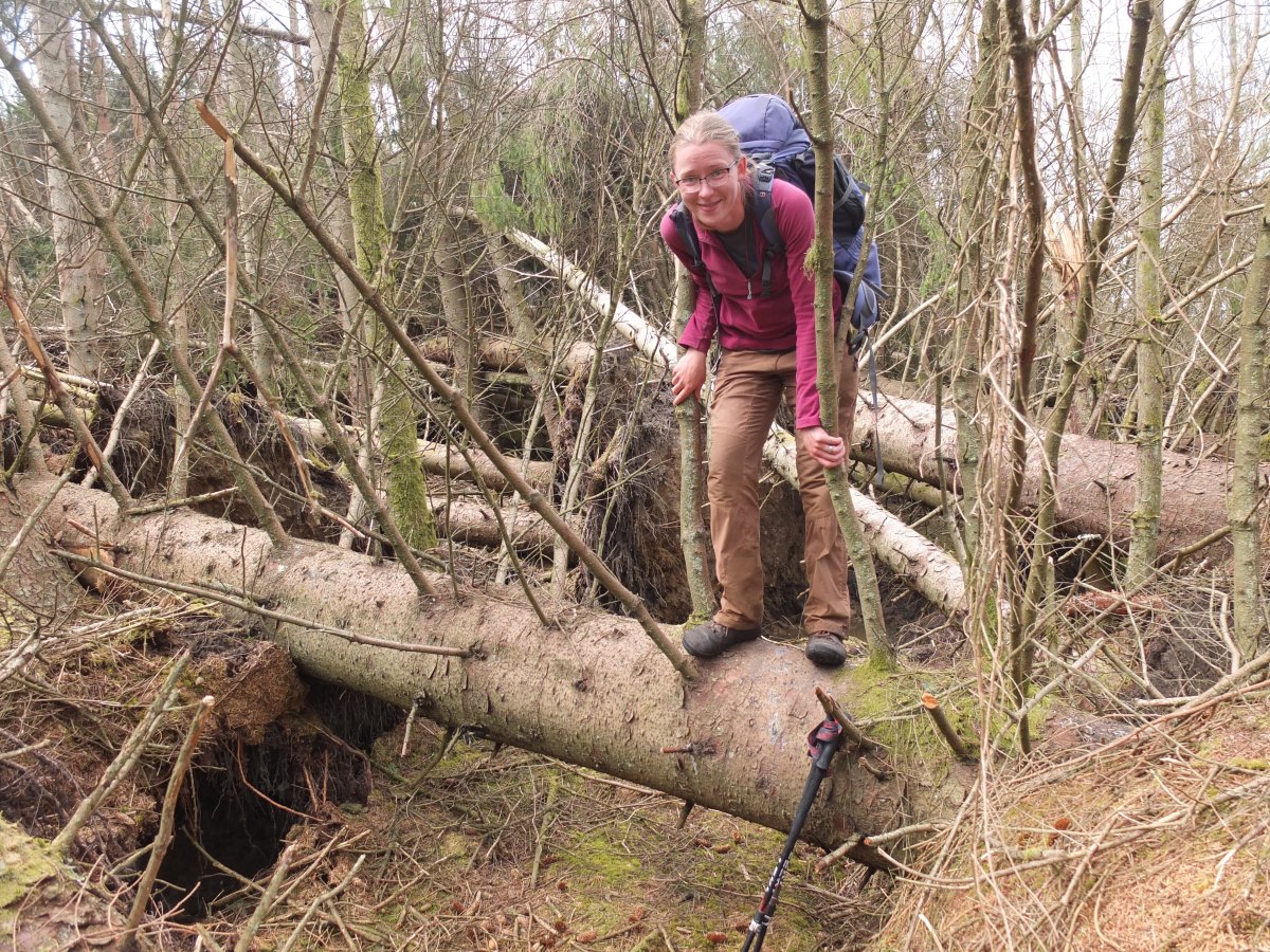
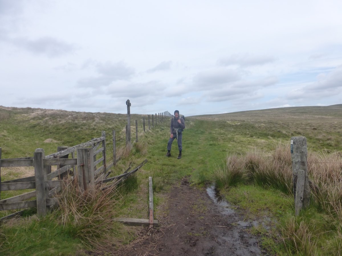
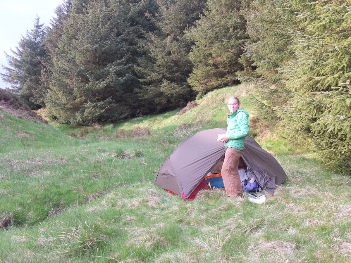
Day 58: after two days of glorious sunshine there is an ominous amount of low cloud shrouding the valley as I pack away my little one-woman tent for the last time in England. It is, of course, soaking wet but I have a very kind mum who will hand it back to me clean, dry and neatly folded in Kirk Yetholm in 18 days time. She is also lending me Dad, as my first properly long distance walking companion. He comes with a two-person tent, a large bag of posh dehydrated food, an overly optimistic pair of shorts (which get vetoed) and a strict schedule of hostels and campsites that we need to reach each day in order to have him back at work two weeks on Thursday with his Pennine Way completer’s certificate. It’s all a bit different to my usual thinking-no-further-than-two-days-ahead approach. We snap some photos by the Nag’s Head and are off. Mum joins in as far as Jacob’s Ladder and then waves us off up into the clouds. Luckily they rise with us so we never quite lose the view. At the top we get mobile signal and a message from Mark and Judith who were thinking about coming along to see us off, to say they are in Edale, but an hour behind us. So we have a very very leisurely lunch break by Kinder Downfall followed by a lovely but brief catch up, and then we really do have to get a move on over a lot of moorland to make it to Crowden campsite shop before it closes and we miss out on dinner. Dad has brought along the old Wainwright guidebook which describes these peat bog tops as a genuine risk to life where if you put a foot wrong you may simply sink out of sight never to be seen again. Luckily the modern day reality is a beautifully laid set of flagstones which make for dry and efficient walking (and easy navigation) while allowing the bogs to re-vegetate and recover. Even with these it’s still a long slog and I have the upmost respect for anyone who walked the route in its old state as we stumble wearily into Crowden with 20 minutes to spare. We celebrate with lots of heavy tinned things for dinner, and peaches and custard for pudding. Day 59: up and over more moorland, it’s a warm and muggy start though the clouds remain thick and gloomy all day. We traverse a scenic gritstone edge, and then more flagstones to save us from the bogs (though really it all looks pretty dry just now). We cross Black Hill with its teetering/subsiding trig post. The wind has picked up making it too chilly for lunch on top so we tuck ourselves into a peat hag for cheese sandwiches and tomatoes. Of course 10 minutes further on there is then a perfect sheltered spot by a stream. Onwards over more moorland. We pass a couple of reservoirs and have a fairly long debate over whether to camp or go on - it’s flat but the water is very peaty. We walk around the reservoir while debating and spot lots of curlews, their calls have become a daily constant but I think this is the first time I’ve actually seen them up close. Ultimately we decide to carry on. The wind and the drizzle come out and the next ridge is exposed and lumpy and it all looks like a rather bad idea, but we do eventually find a spot to squeeze the tent between the tussocks. Day 60: it’s a poor night’s sleep with a rock in my back and rain drumming on the tent. Luckily the morning dawns dry and there’s a decent view out from our camp. We get going over yet more moorland; dark heather and peat under more overcast skies. My impression of the Pennine Way so far is all rather bleak. There’s a long section along a perfectly flat reservoir track with a disused waterway running alongside, it’s easy on the knees but less so on the soles of the feet with lots of jagged stones. The last bit of moorland ends with a huge monument (so big that for a long time it looks much closer than it is!) that we climb up for an even higher viewpoint. It’s carved with a huge amount of very old graffiti, the earliest readable dates going back to the early 1800s. From here we drop down into Hebden Bridge where we stock up on food before a very steep slog up to our first hostel. It’s a nice place and actually busy with a group of dancers and several other Pennine Way walkers. We meet Jeff - on a fast and light 14 day plan with pre-booked baggage transfers, and at the other end of the spectrum a woman with a sore knee and no particular schedule who is thinking about giving up. Dinner is fish pie with extra potatoes, stealthily cooked in the “vegetarian kitchen” - oups! Day 61: a wet morning. We delay heading out with a large free fruit filled breakfast, then it’s off back down the hill into the village and straight up the other side through damp green woods and fields. Back onto the moor the drizzle turns to rain and the waterproof trousers come out but thankfully it remains light. Progress is slow. Maybe it’s just the weather but by the time we stop for lunch I feel we’ve hardly covered any distance at all. We find a lovely spot by a stream, then wind our way past a couple of reservoirs and up onto more moorland. We pass Top Withins, the ruined farm house associated with Wuthering Heights. It’s all very bleak and I certainly don’t envy anyone living up here. Down into green again we pass another reservoir and then moor number three, with the clouds parting and the sun peaking out as we head up hill. There’s a great view ahead over green fields to distant hills. Down into Ickornshaw it takes a false start before we find our tiny campsite (essentially a back garden). Jeff is already installed as the only other guest and has been here since 2 or something ridiculous like that. It’s after 7 and too late for the fish and chip shop but there’s couscous and tuna for dinner which is just as good right?
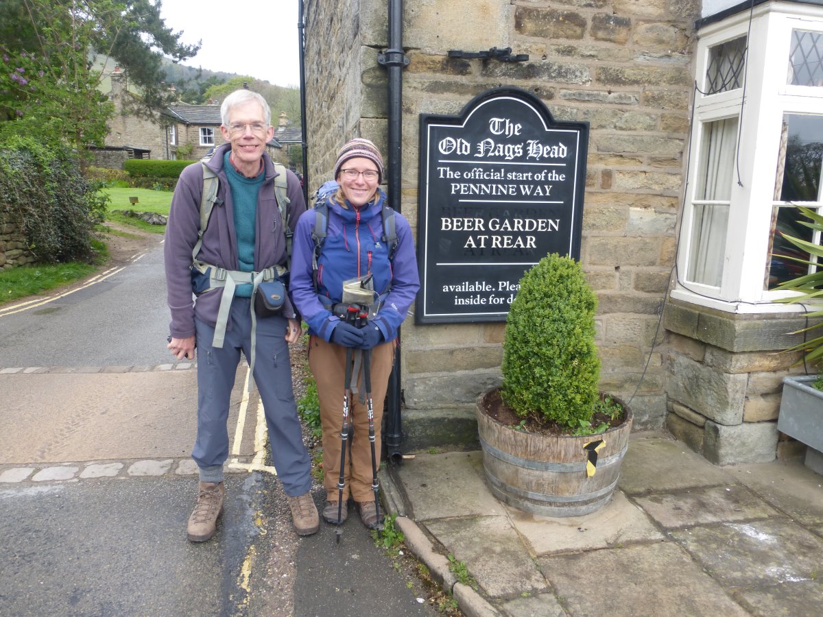
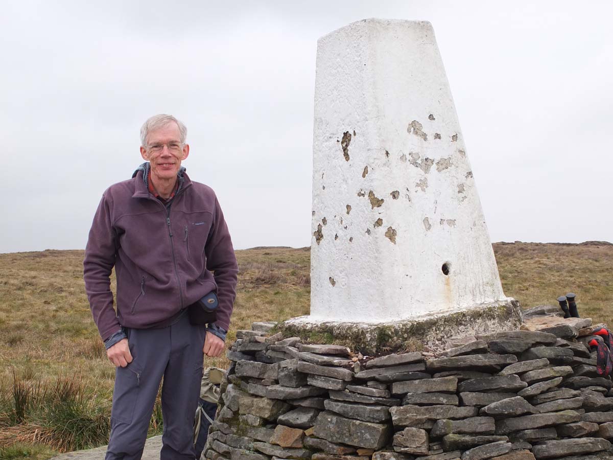
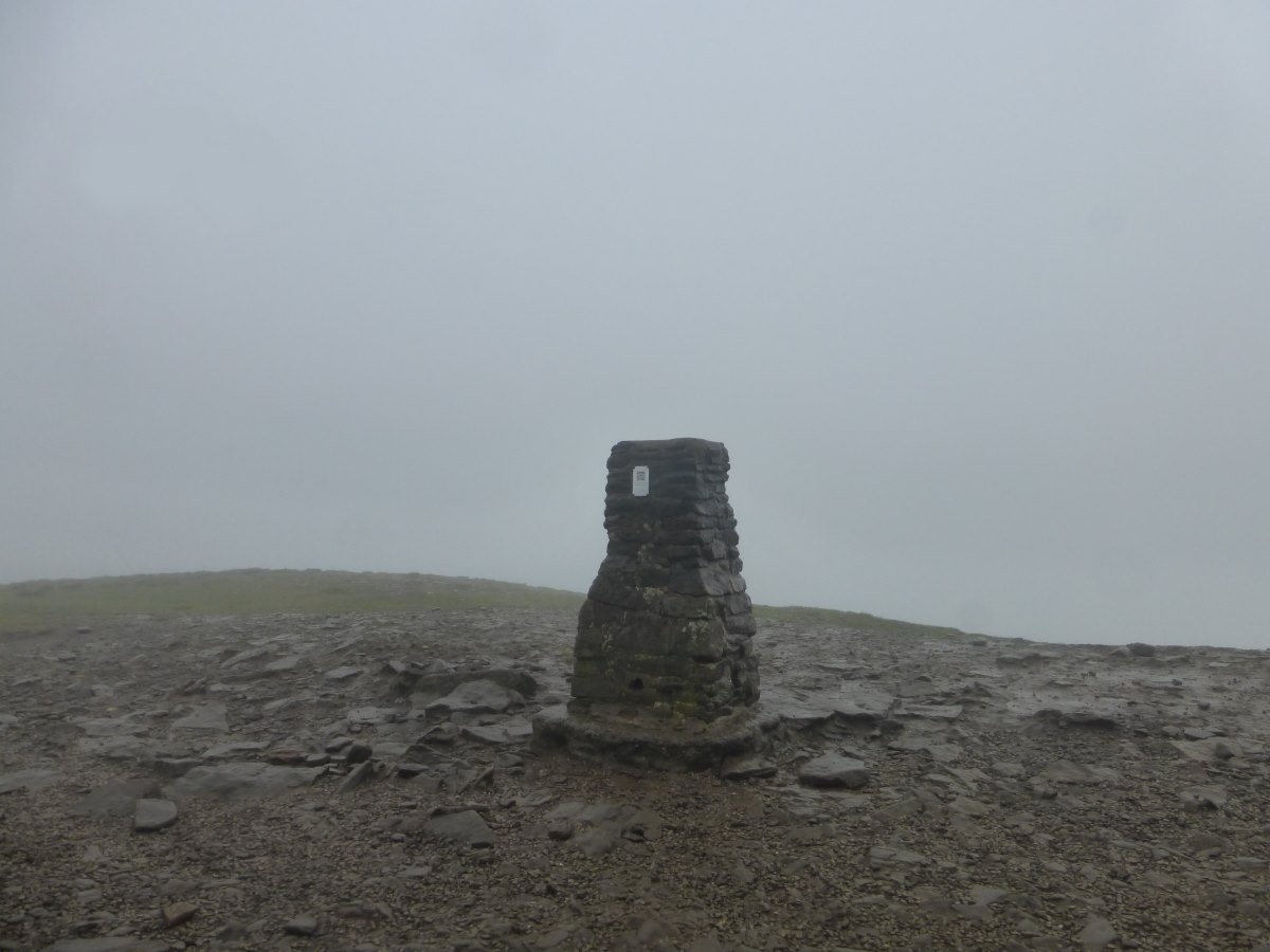
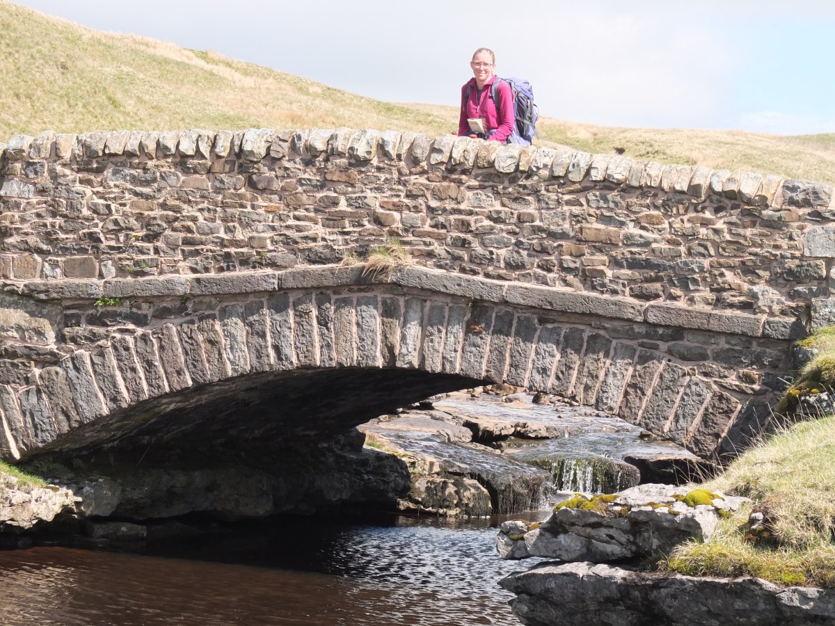
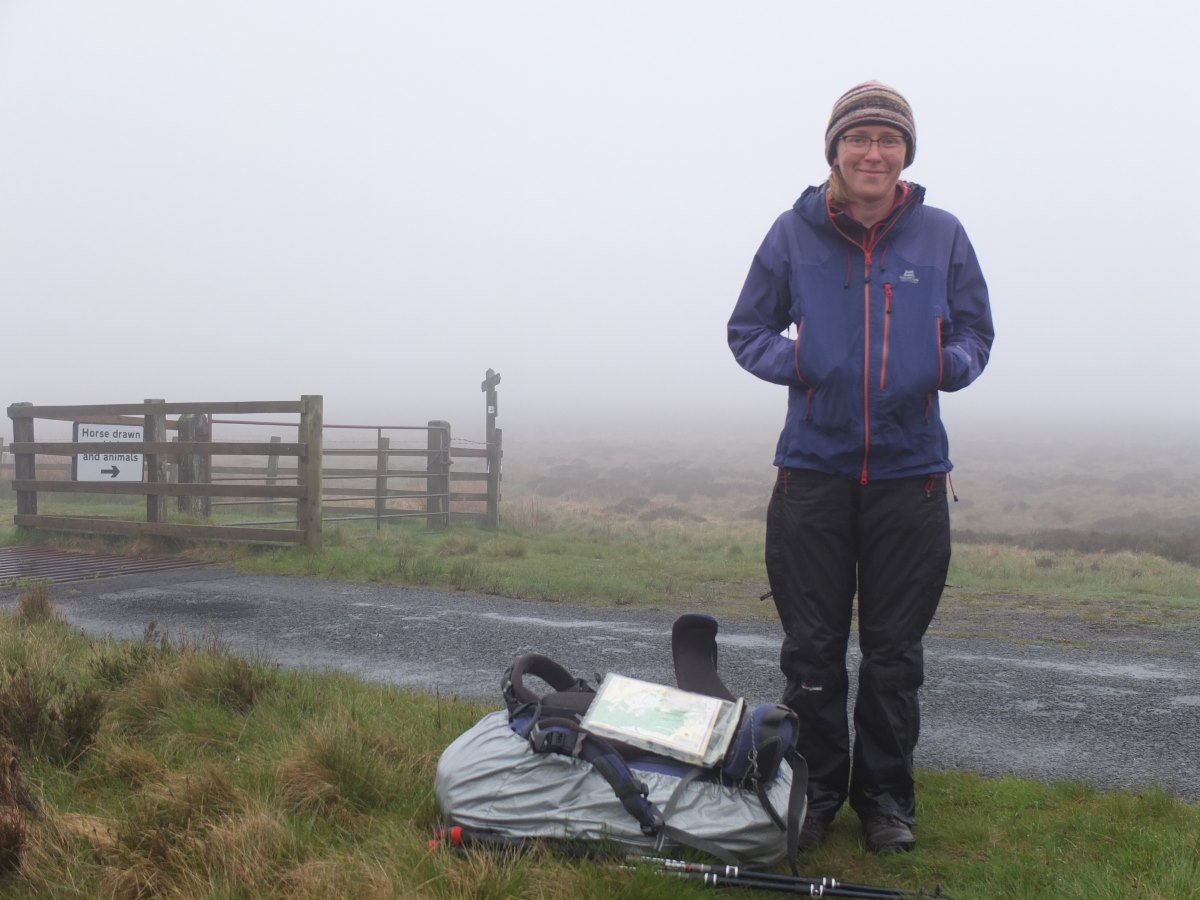
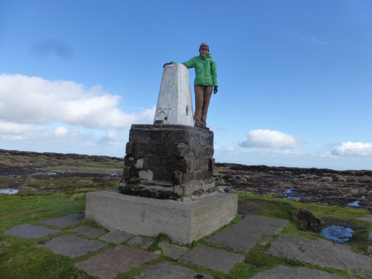
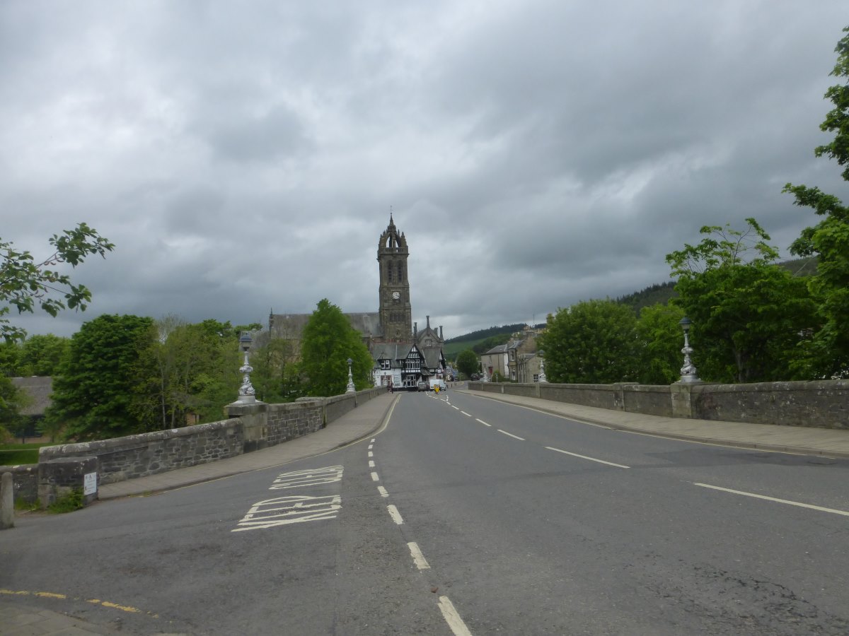
Official start of the Pennine Way
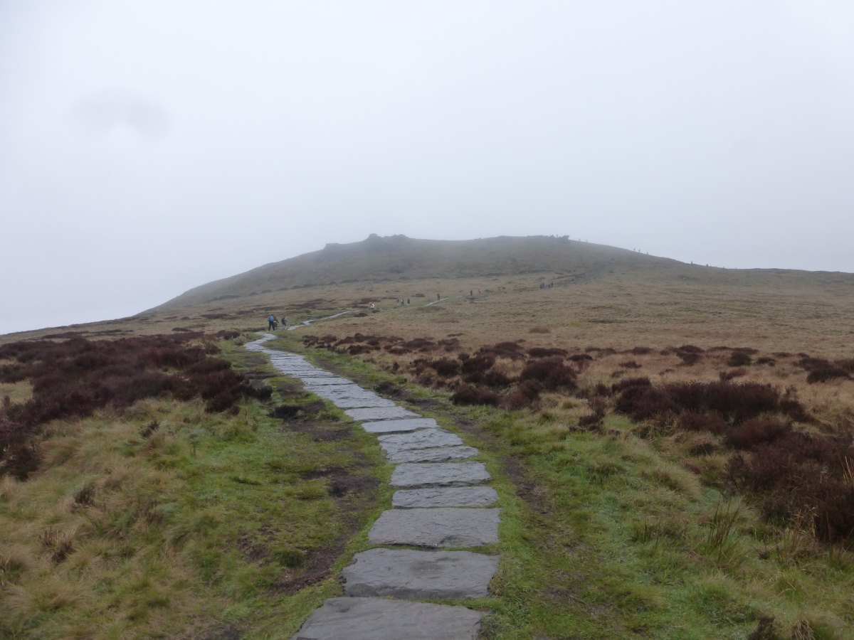
Up onto Kinder Scout
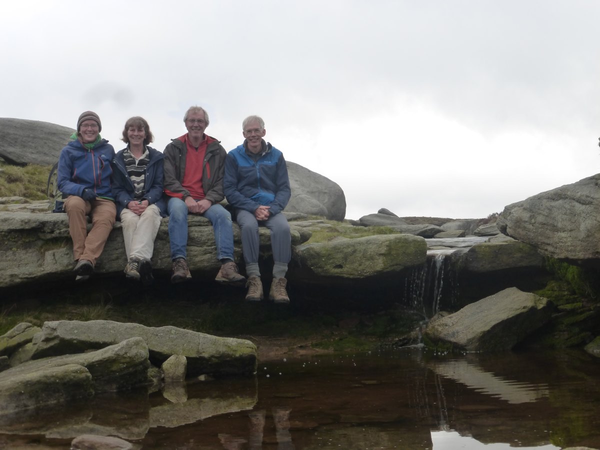
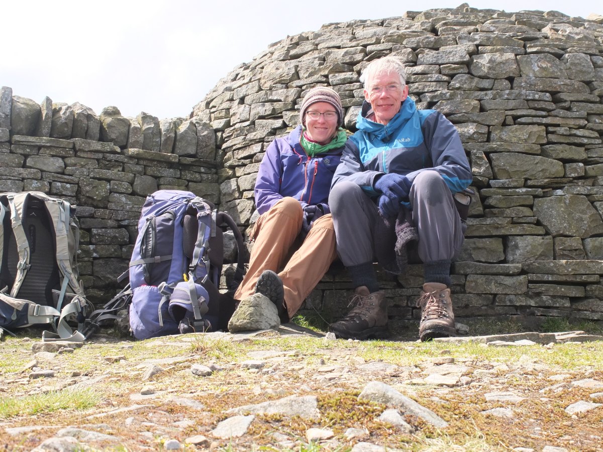
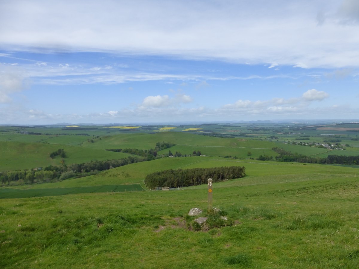
A brief family gathering at Kinder Downfall
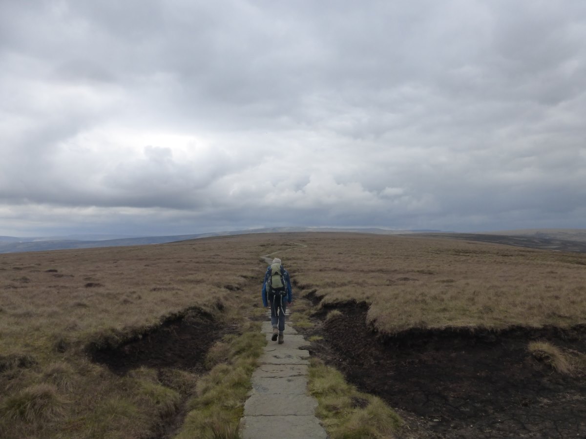
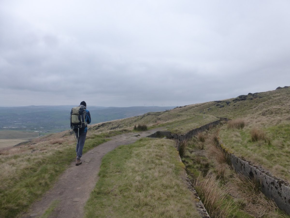
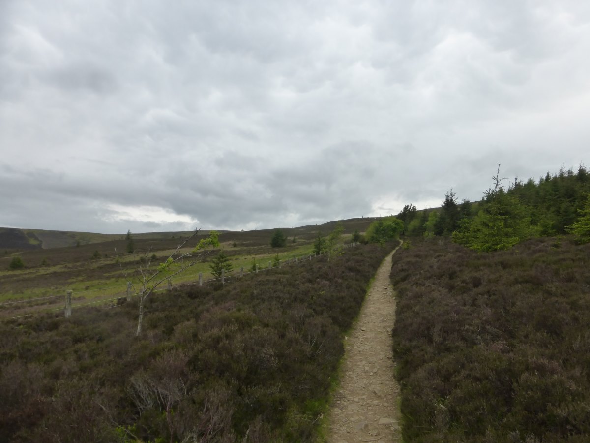
Flagstones over the moors
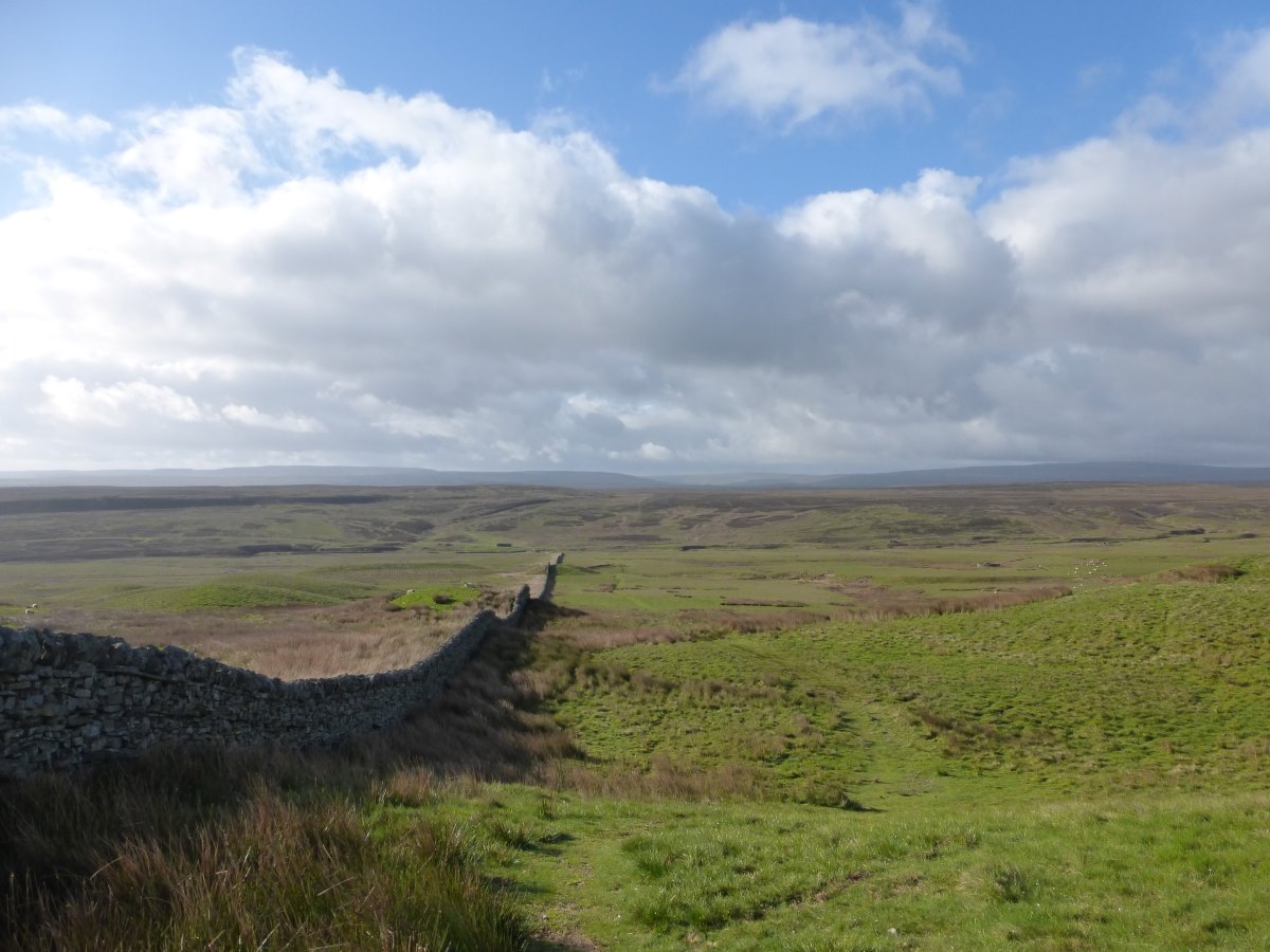
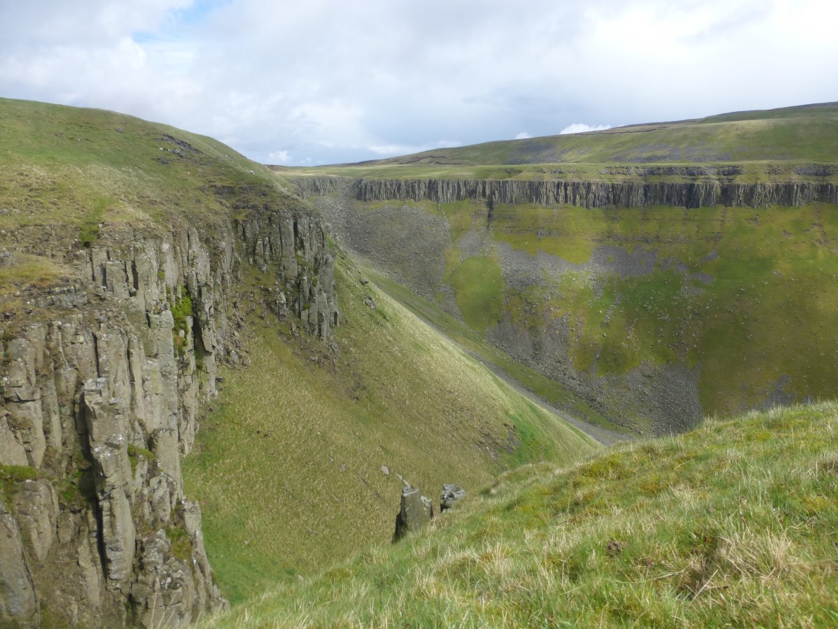
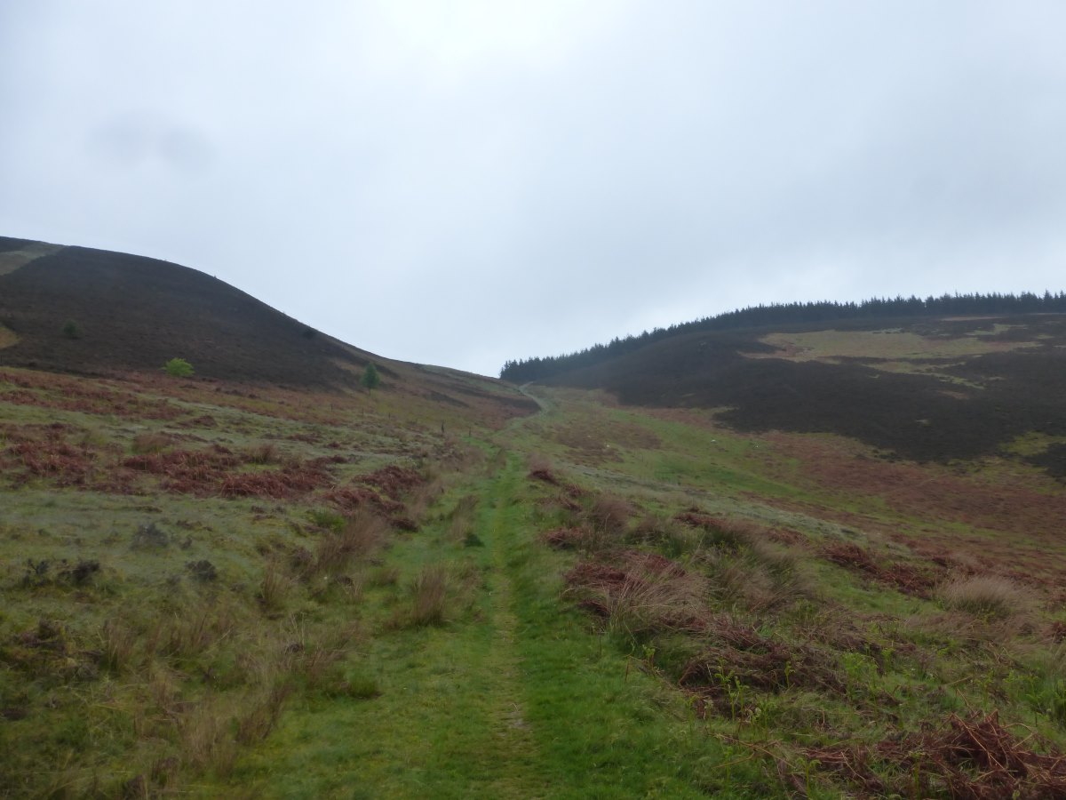
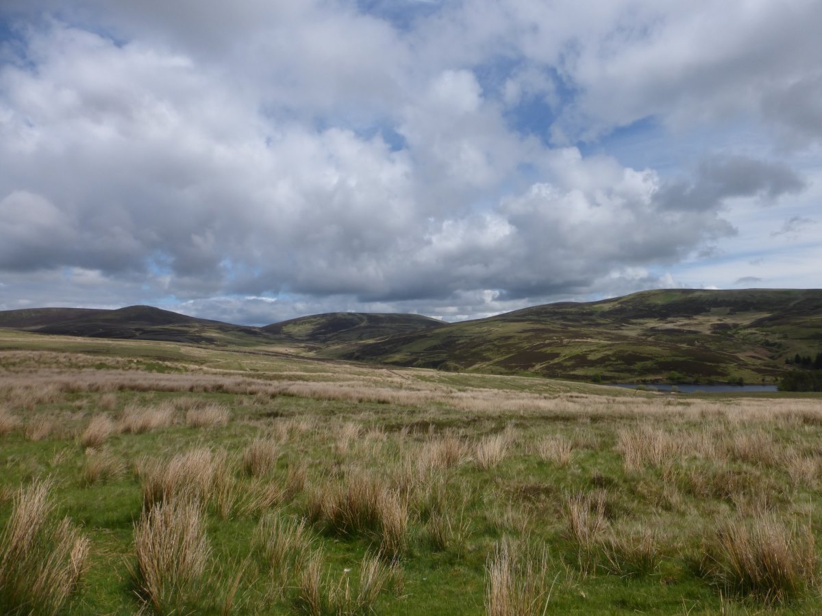
Bleaklow Hill
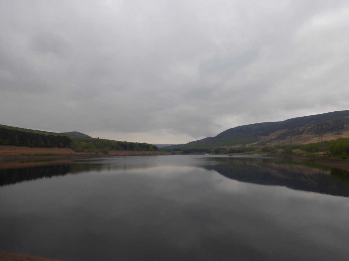
Woodhead Reservoir
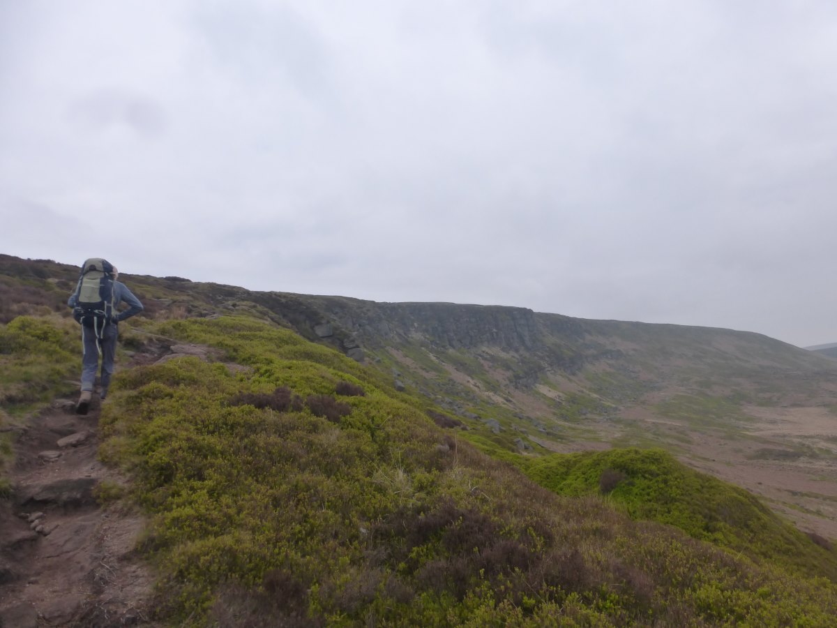
Gritstone edges
The subsiding trig of Black Hill
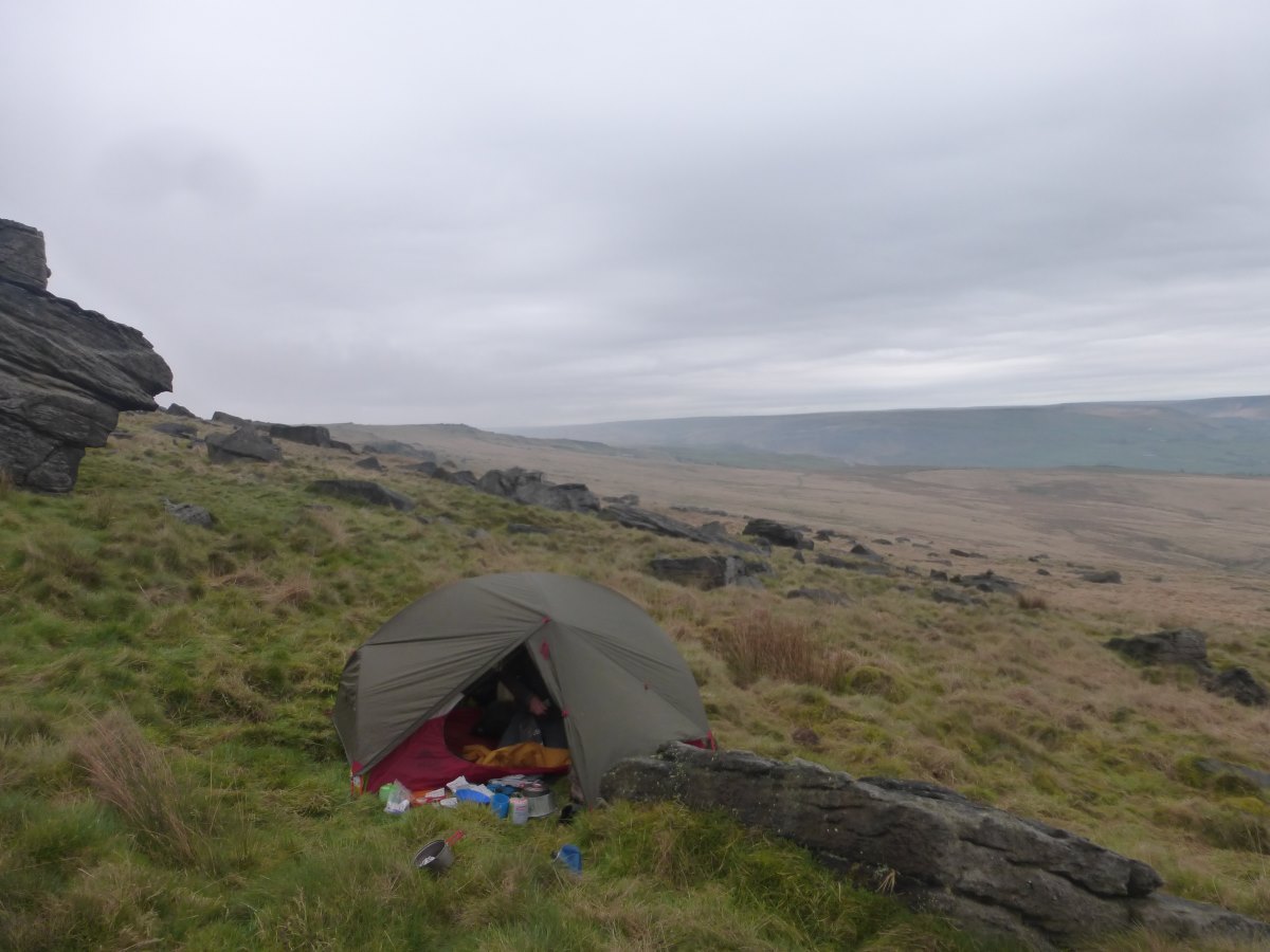
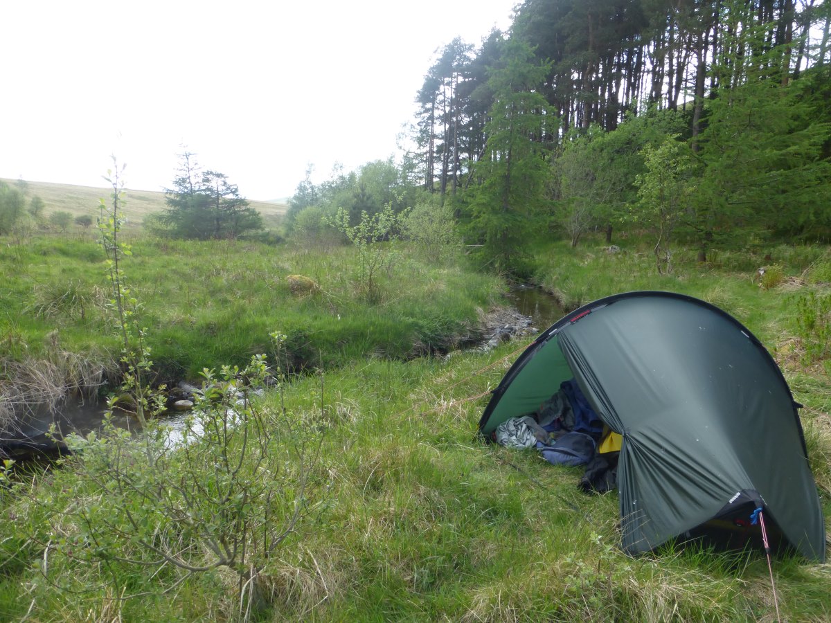
Wildcamp between the tussocks on Standedge
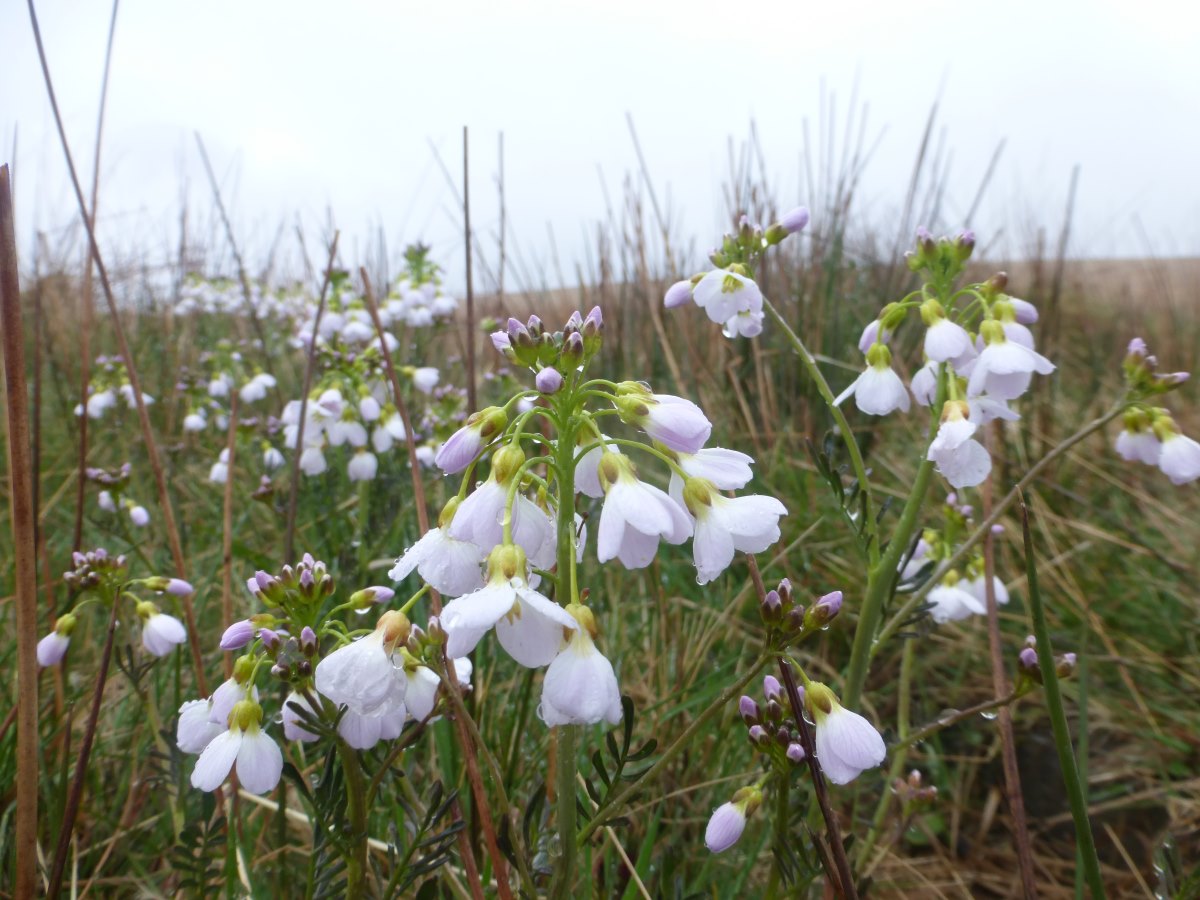
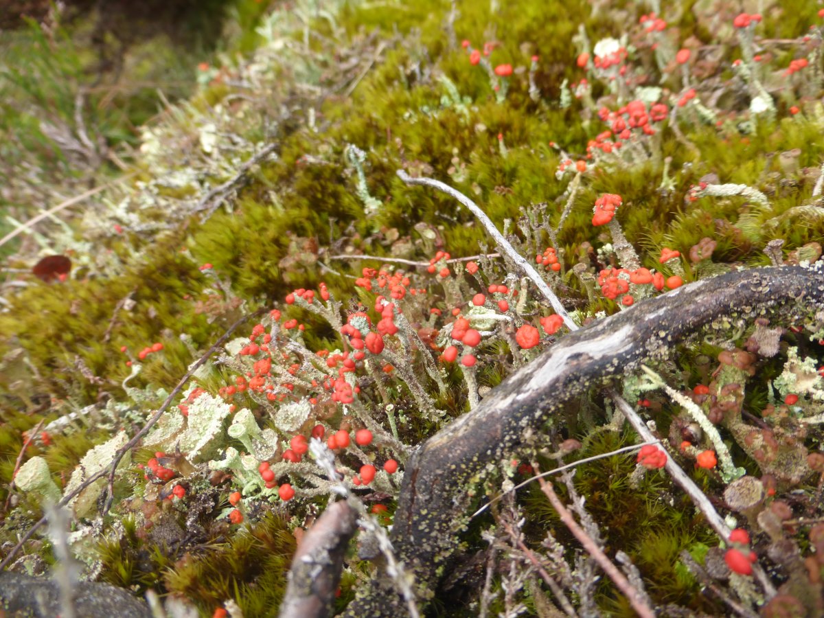
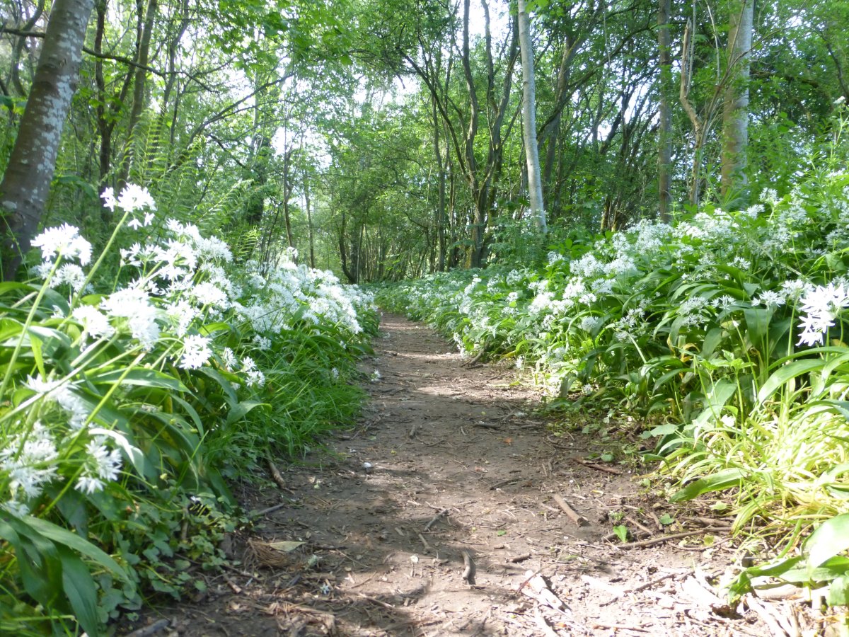
Wildflowers
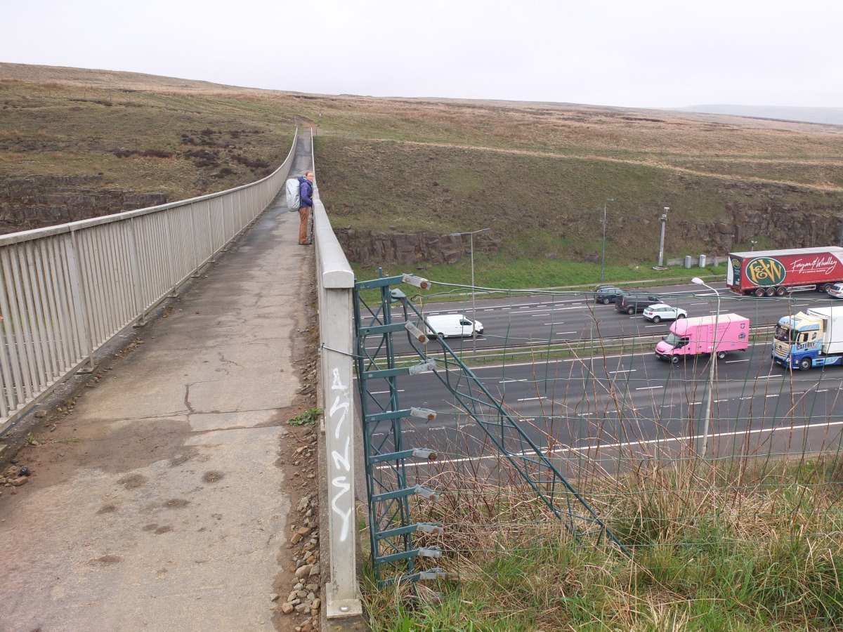
Crossing the M62
Reservoir tracks
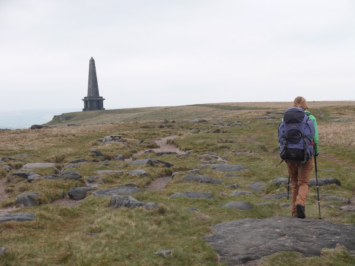
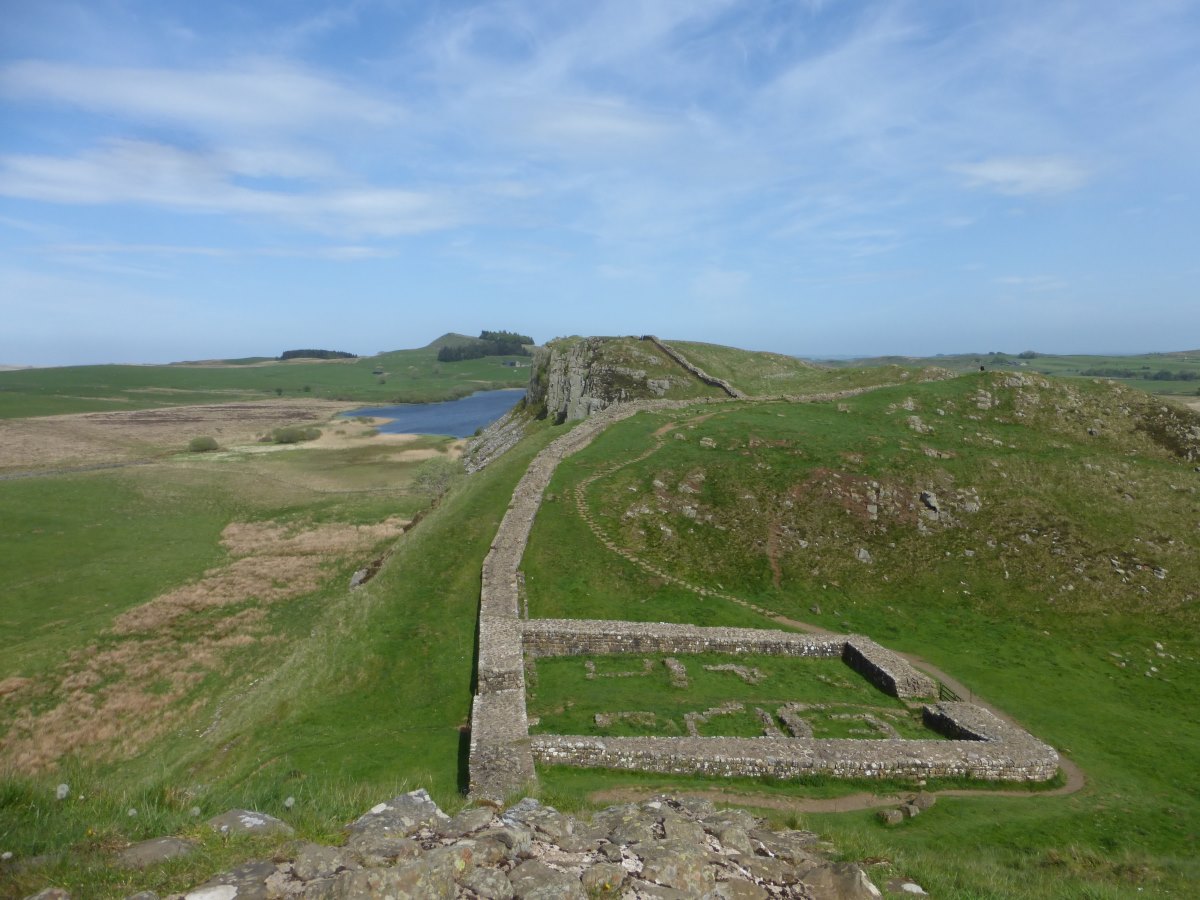
Stoodley Pike Monument
A steep climb of Hebden Bridge
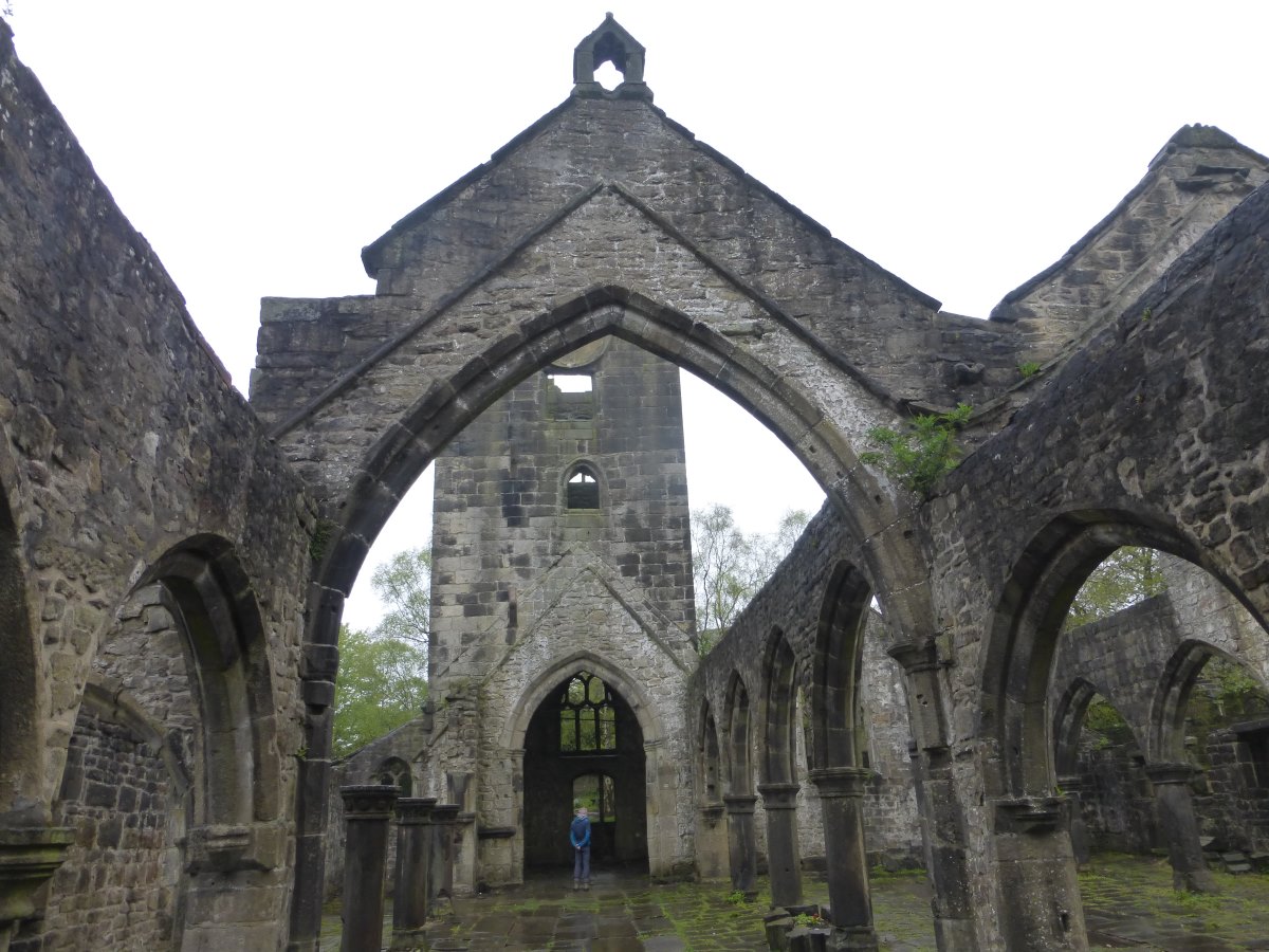
Ruined church at Heptonstall
Onwards over the moors
Top Withins looking very bleak
Back down into greenary
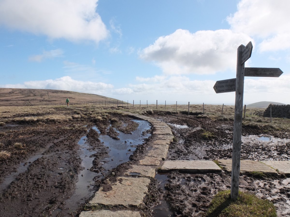
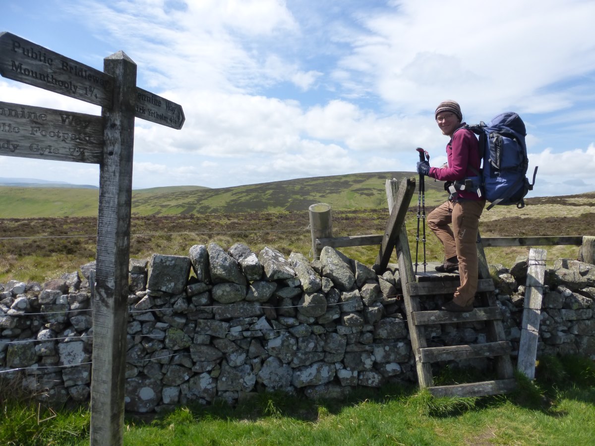
Ickornshaw to Keld
Pennine Way, 56 miles, 4 days
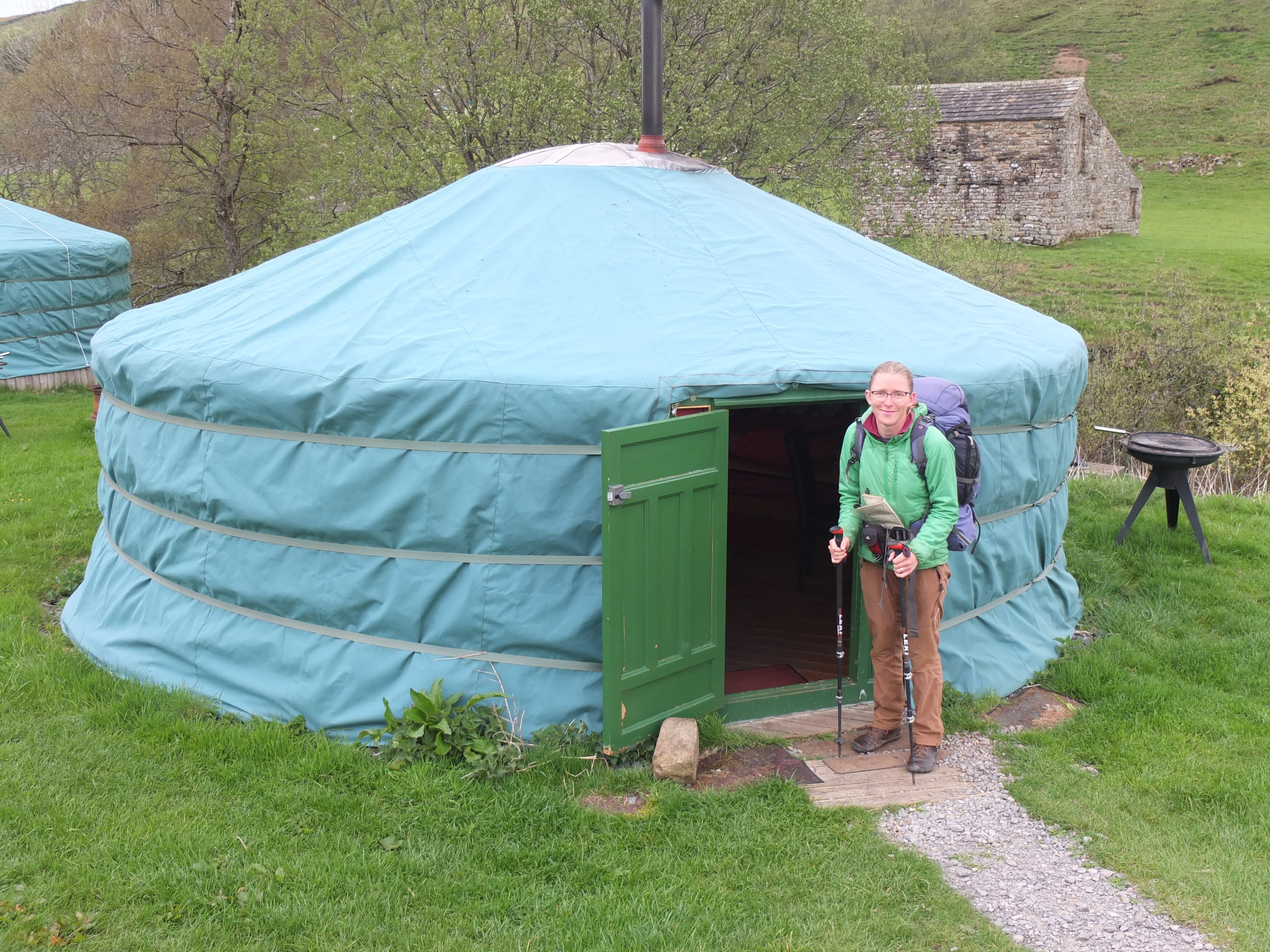
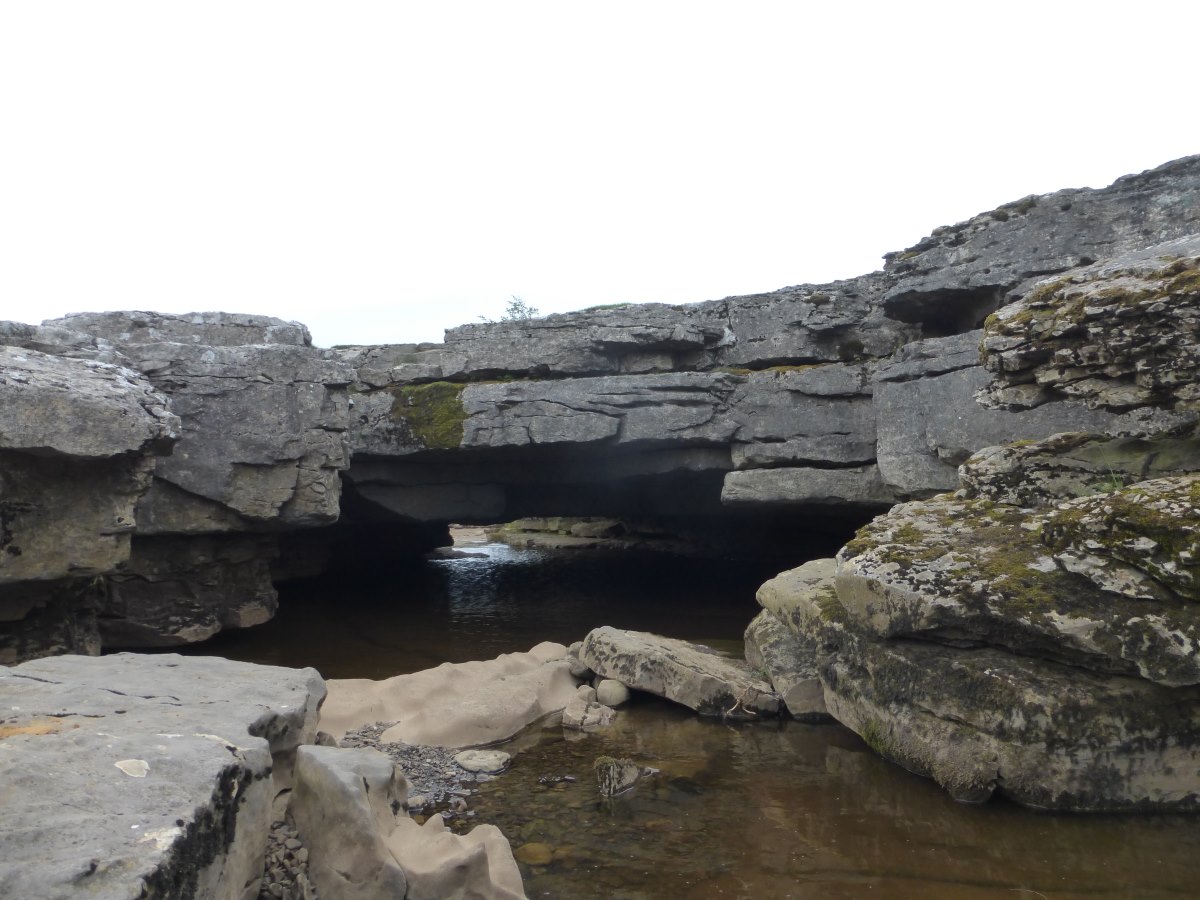
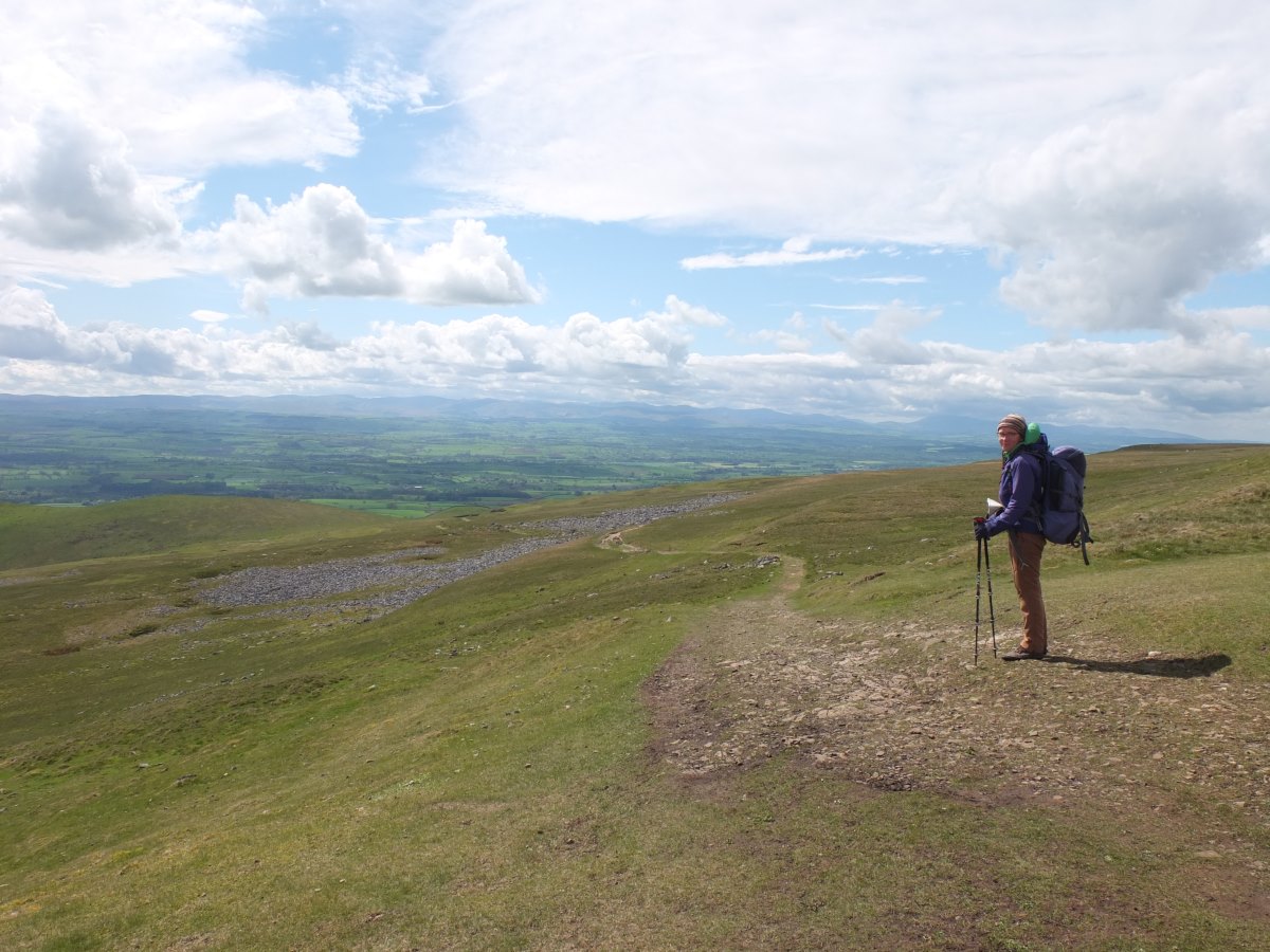
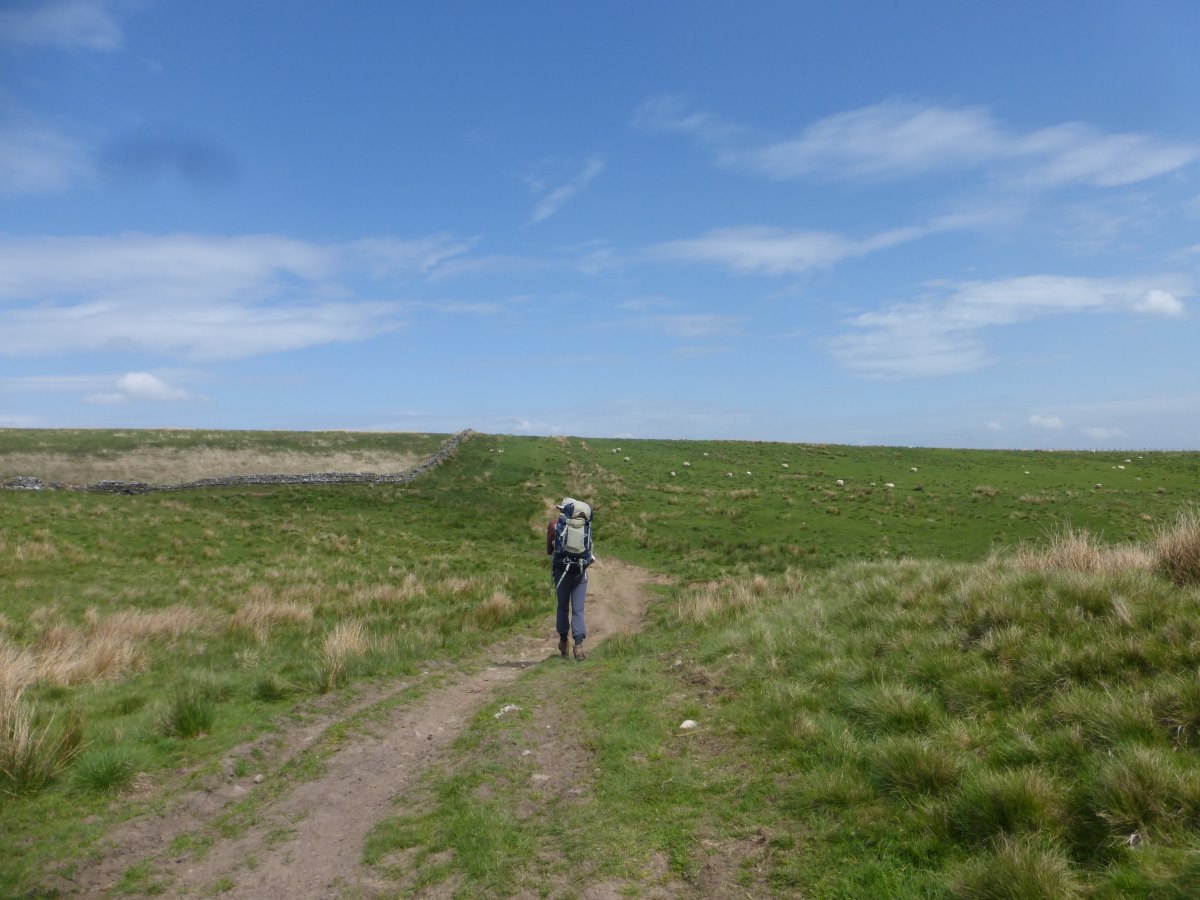
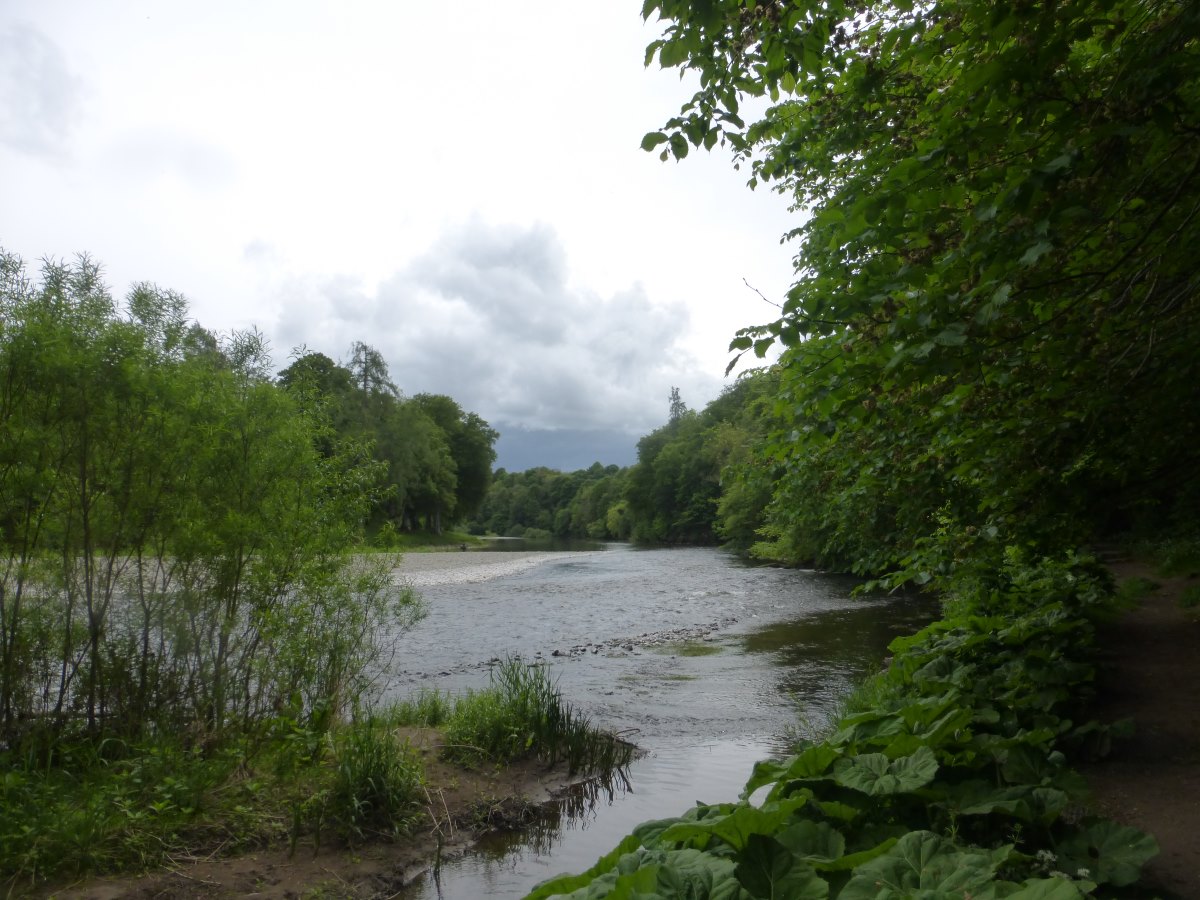
Day 62: we’re supposed to get an early start and do get away for 8:30 but ideally it would have sooner. We’ve left the moors behind and it’s a day full of fields and brighter weather with gentle ups and downs but nothing too taxing. There's even a bit of canal tow path. There are a few herds of cows which all appear very bored by people. We pass a stand selling cake which turns out to be freshly baked and very tasty, then in the afternoon it actually gets sunny! Wandering through yet more fields we get chatting to another couple of walkers and hence meet Chris and Pete who decided that Land’s End to John O’Groats wasn’t far enough and are instead walking Scilly to Shetland. They’re the first other End-to-Enders I’ve met and we walk together for a way comparing our routes, which turn out to be very different. We part company in Gargrave where the café is shut but the fish and chip shop open so that makes up for last night. We then stock up on lots of heavy dinner food though there’s still a few miles left to walk. My bag feels like it weighs a ton and I’m getting distinctly flat footed as we trudge at last into Malham. A lovely final mile along a stream with a view of the limestone escarpments up ahead lifts the spirits, as does our accommodation for the night with a whole bunkbarn to ourselves. Day 63: an excellent night’s sleep in my bunk followed by left over apple pie for breakfast. Dad has found his first blister so that gets taped up and then we’re off again. It’s a great walk up Malham Cove; huge cliffs, wonderfully crinkled limestone pavement and a fantastic gorge above. All very different to anything we’ve walked through so far. From the tarn onwards it gets cloudy, covering the hills ahead. We have a snack break in a bird hide but the birds are also hiding. Lots of cave spiders though with their hanging nests. Onwards and upwards we enter the clouds over Fountains Fell. The Pennine Way cuts just to the side of the actual summit and after a bit of debate we decide to make the detour. It rains. There’s a major faff to dig Dad’s waterproof trousers out of the very bottom of his rucksack. As soon as they are retrieved it stops again. No view from the summit, just a quick square of chocolate and back the way we’ve come. Then it’s down and back up again for Pen Y Ghent where the rain really sets in. The ascent is steep but over pretty quickly. There’s a great sheltered seat on the top but it’s rather lacking in view. On down the other side to a rather soggy campsite where we lie in the tent for a few hours listening to the rain drumming off the roof. Emerging later we rectify things with an excellent pub dinner. Day 64: the tent is soaked outside and in this morning but the skies are bright blue and sunny! It’s a first in a long while and stays around as scattered sunshine all day. We get a leisurely start drying all our stuff out over a picnic bench and I meet another End-to-Ender Tom who is walking LEJOG and has been out for about a month following a significantly straighter line than me. Before I started the walk I’d been curious as to whether I’d meet anyone else doing something similar and now that’s three people in as many days. I guess it’s because I’m now on a mainstream trail with the Pennine Way being the backbone around which a lot of people build their routes - much more likely to meet people here than in the middle of Wales! Getting going we’re still on Limestone and can actually see the views that were somewhat obscured yesterday. It’s a beautiful Saturday morning and absolutely packed with people doing the Yorkshire Three Peaks. Thankfully we soon turn off and have the paths to ourselves again. The Wainwright guide proves it really is worth its weight by pointing out a rather impressive pothole just over the wall which we would otherwise have walked straight past, and then taking us on a few hundred metre detour through fields to Browgill cave where the water which plummeted down underground resurfaces through a long horizontal passage. With the right kit you can apparently link the two but even as complete cave novices we are able to clamber deep inside, surrounded by beautifully water-sculpted limestone, dripping stalactites and the soft rushing of the stream. Emerging dazzled, back into the daylight we carry on up onto moorland, over grit and limestone on hard gravel tracks which are unforgiving on the feet. The sun stays with us and we drop at last into Hawes where we visit the Wensleydale Creamery to stock up on cheese and find our way to the youth hostel where there is just space to squeeze our tent. Day 65: another bright and sunny morning! We enjoy a full cooked breakfast, I think the first I’ve had since Abergavenny, and get chatting to Steve who turns out to be the man with the big black rucksack who usually overtakes us a few hours into each day. He is carrying all his own stuff (the only Pennine Way walker we’ve yet met doing so - everyone else is on the baggage transfers) but B&Bing to avoid carrying a tent. He has ripped his guidebook to pieces so that each day he can throw away the bit he’s used and carry a few grams less, but despite this and the complete lack of camping/sleeping/cooking gear/three days of food that our bags are filled with his rucksack is the same size as mine. I wonder what on earth he has put in it. We get underway by 9:30, with a quick stop at the shop for more chocolate (apparently yesterday we failed to buy enough), followed by a brief (and expensive) detour to Hardraw Force. Then we’re off through fields and up onto the gradual ascent of Great Shunner Fell which goes on seemingly forever but is a good track and not particularly steep. It stays warm and sunny though the wind still has a bite and there’s a bit of jostling at the top for the (few) sheltered lunch spots. Then there’s an equally long descent down the other side into Thwaite. We stop just above the village to eat our muffins while we still have the view; then arrive to find there’s a tea shop with cake. We consider it anyway but can’t quite muster sufficient enthusiasm. Carrying on round a high valley edge we reach Keld where Dad has booked a surprise night of accommodation which turns out to be a very posh yurt. It’s rather luxurious with a wood fire and actual beds. The river runs just past the site with a small waterfall plunge pool where we take a surprisingly non-freezing wild swim then straight into a hot shower and the fire on to warm us through. We find a chess set and play until it gets too dark to see the board. Dad wins, of course.
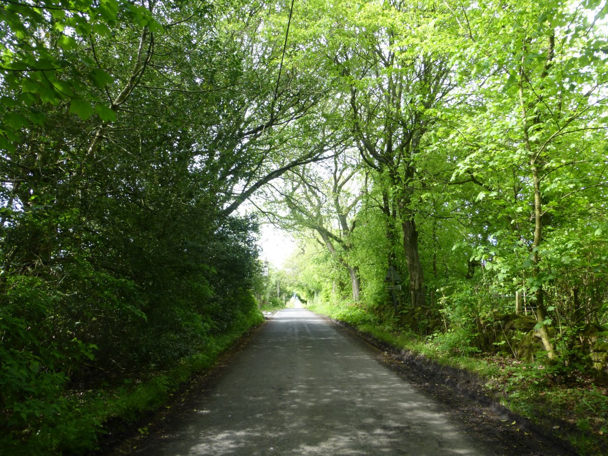
A brief canal walk with a very confusing bridge
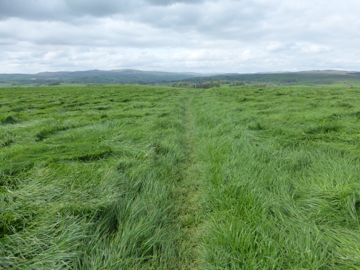
Lots and lots of grass
First sign for Yorkshire
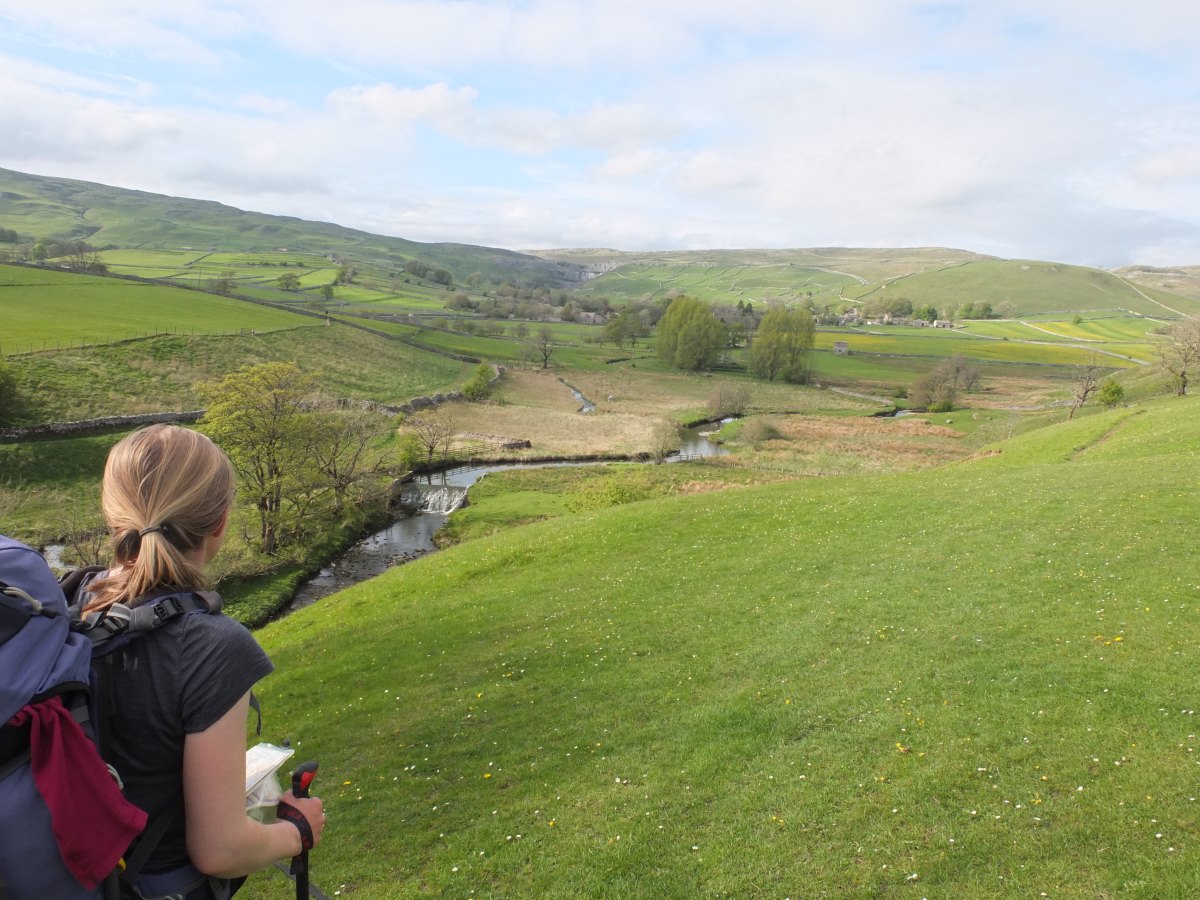
The aproach to Malham
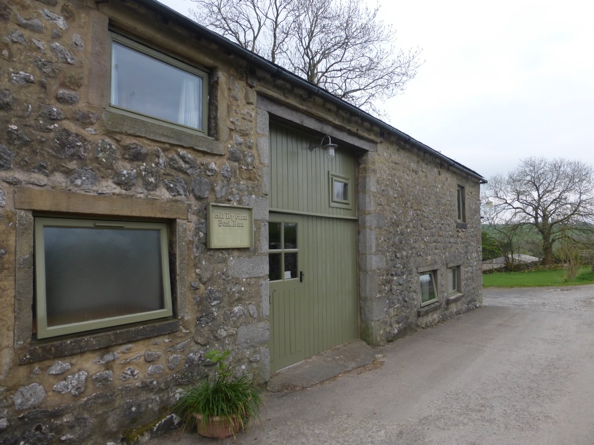
Hill Top Bunkhouse
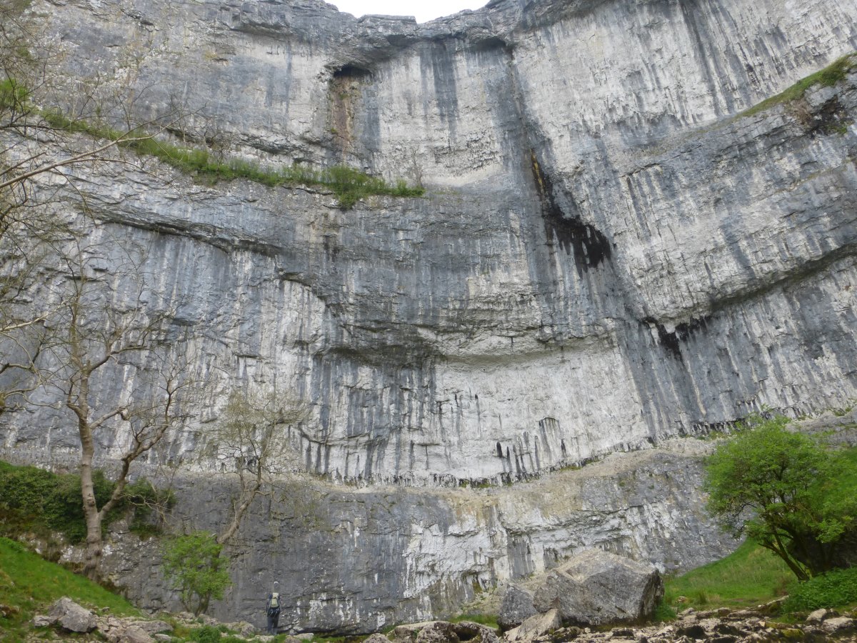
Malham Cove (Dad for scale)
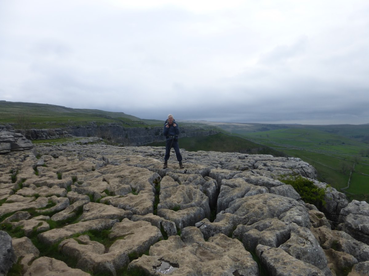
Limestone pavement
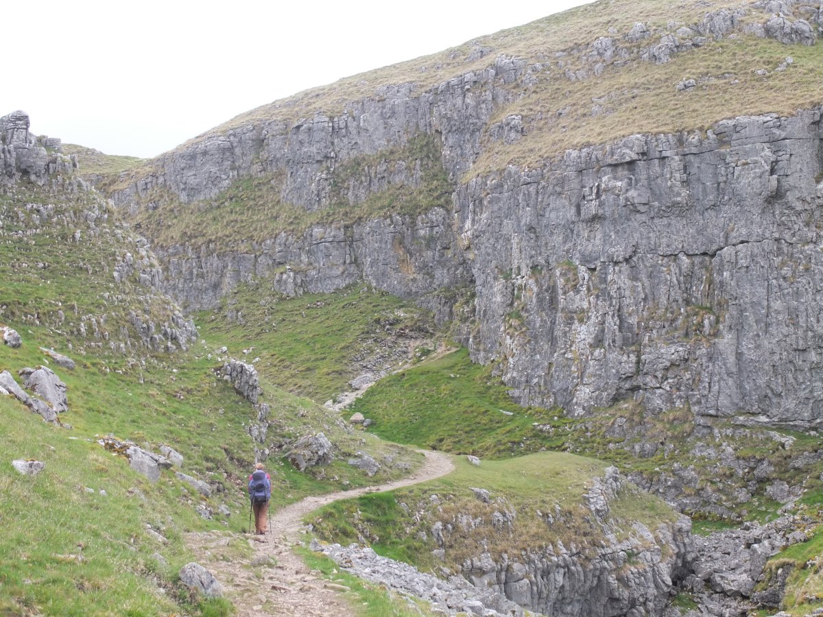
Through the gorges
Ascent of Fountains Fell
Summit of Pen y Ghent
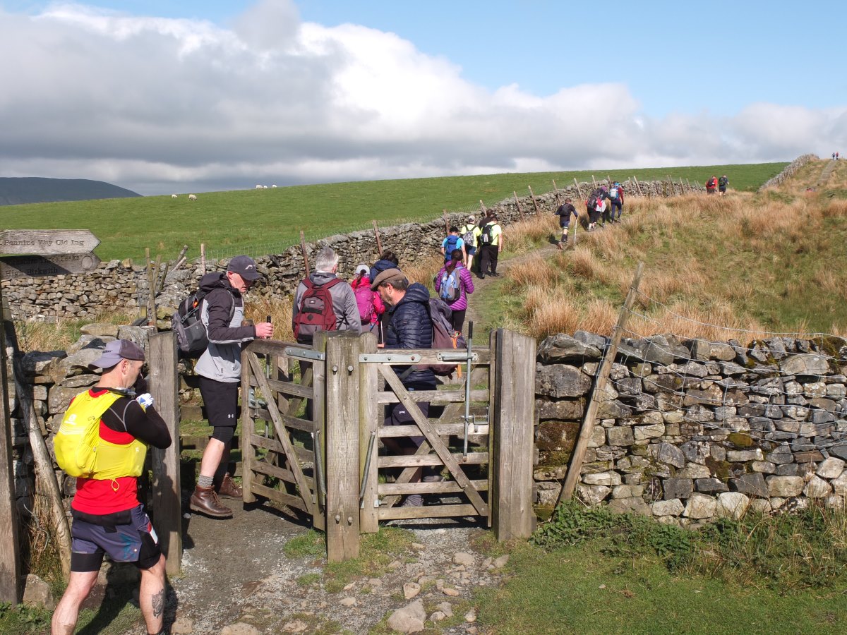
A busy overlap with the Three Peaks route...
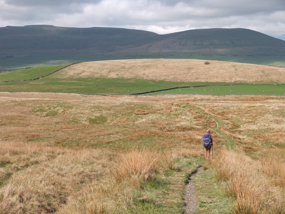
...then back to ourselves on the Pennine Way
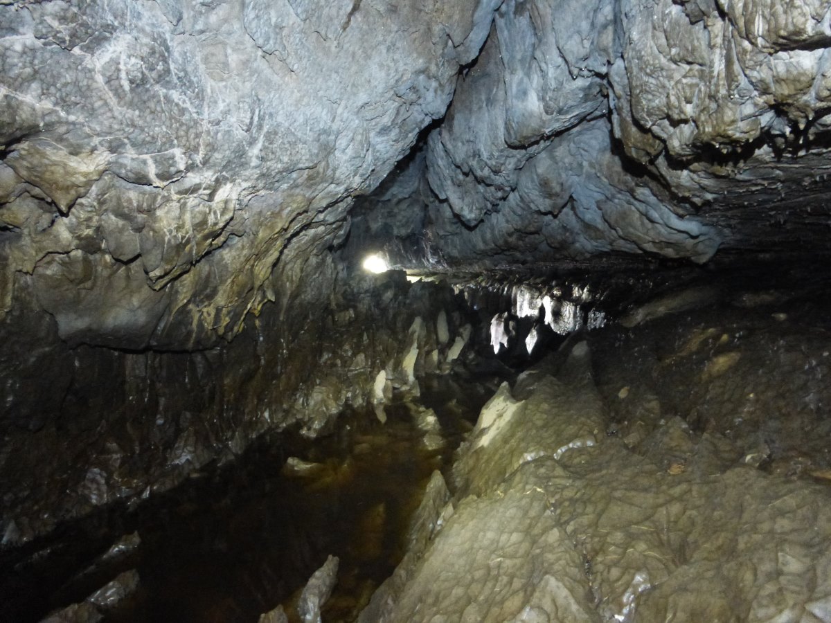
Exploring underground
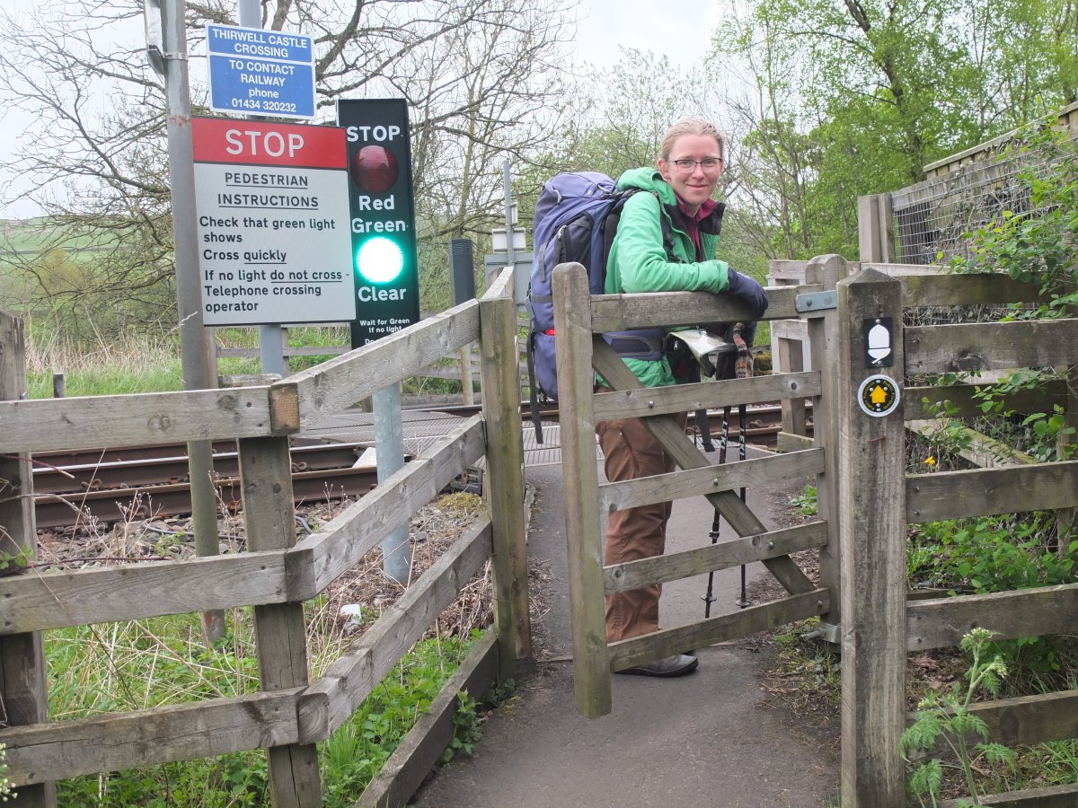
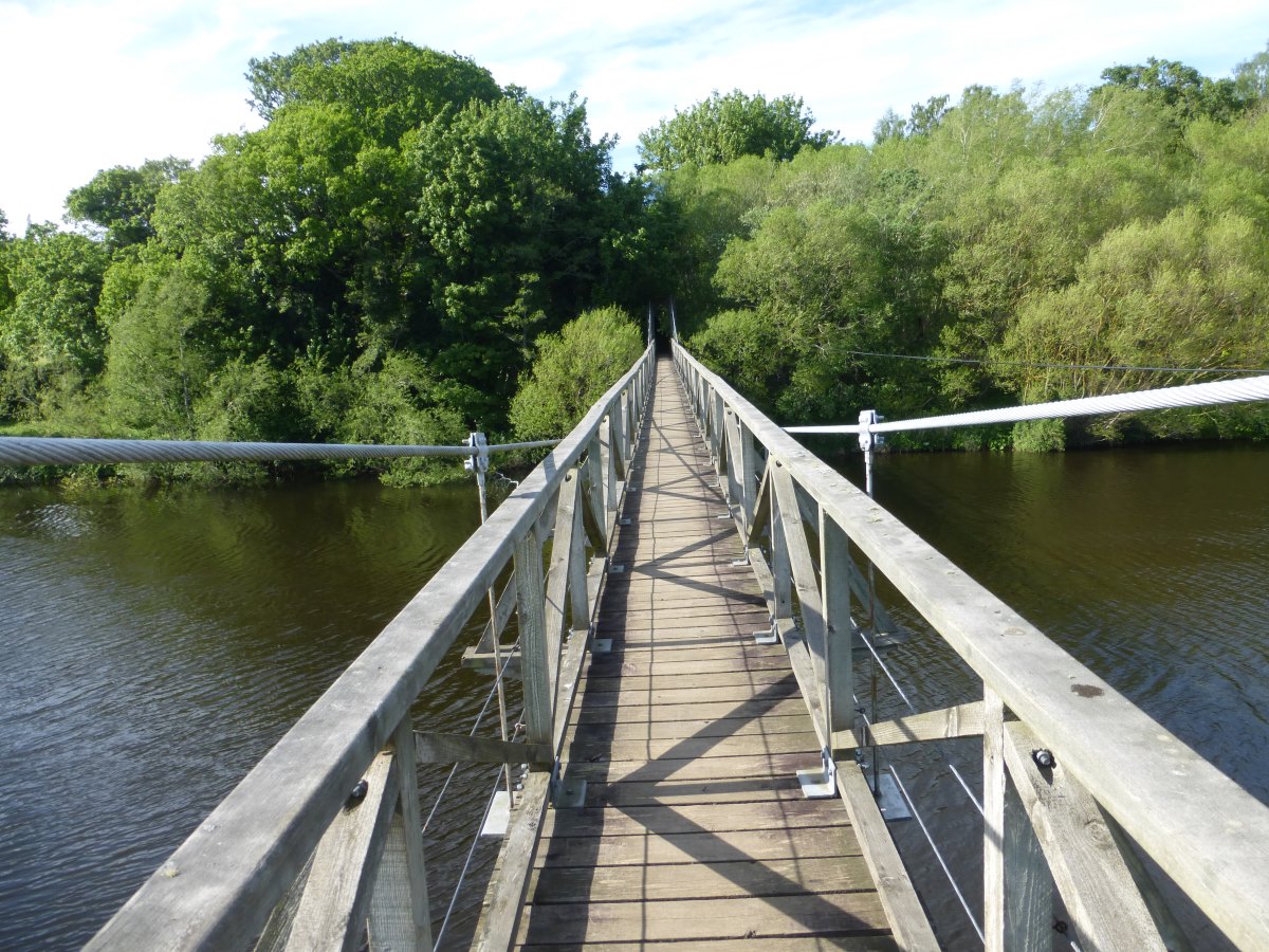
Bridge crossing
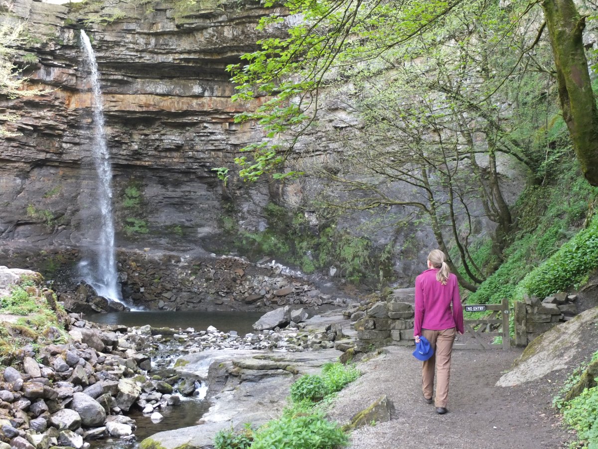
Quick detour to Hardraw Force
Ascent of Great Shunner Fell
Round the corner towards Keld
More beautiful waterfalls
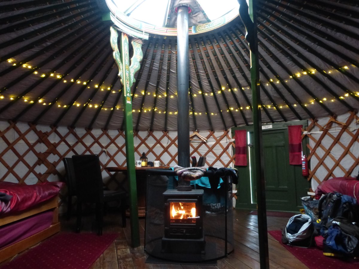
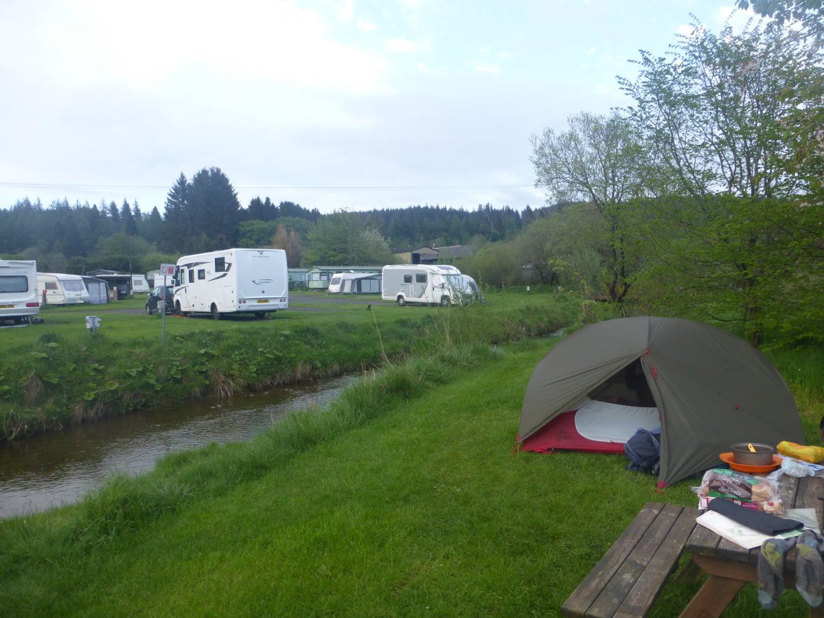
Fire on in the yurt
Keld to Alston
Pennine Way, 61 miles, 4 days
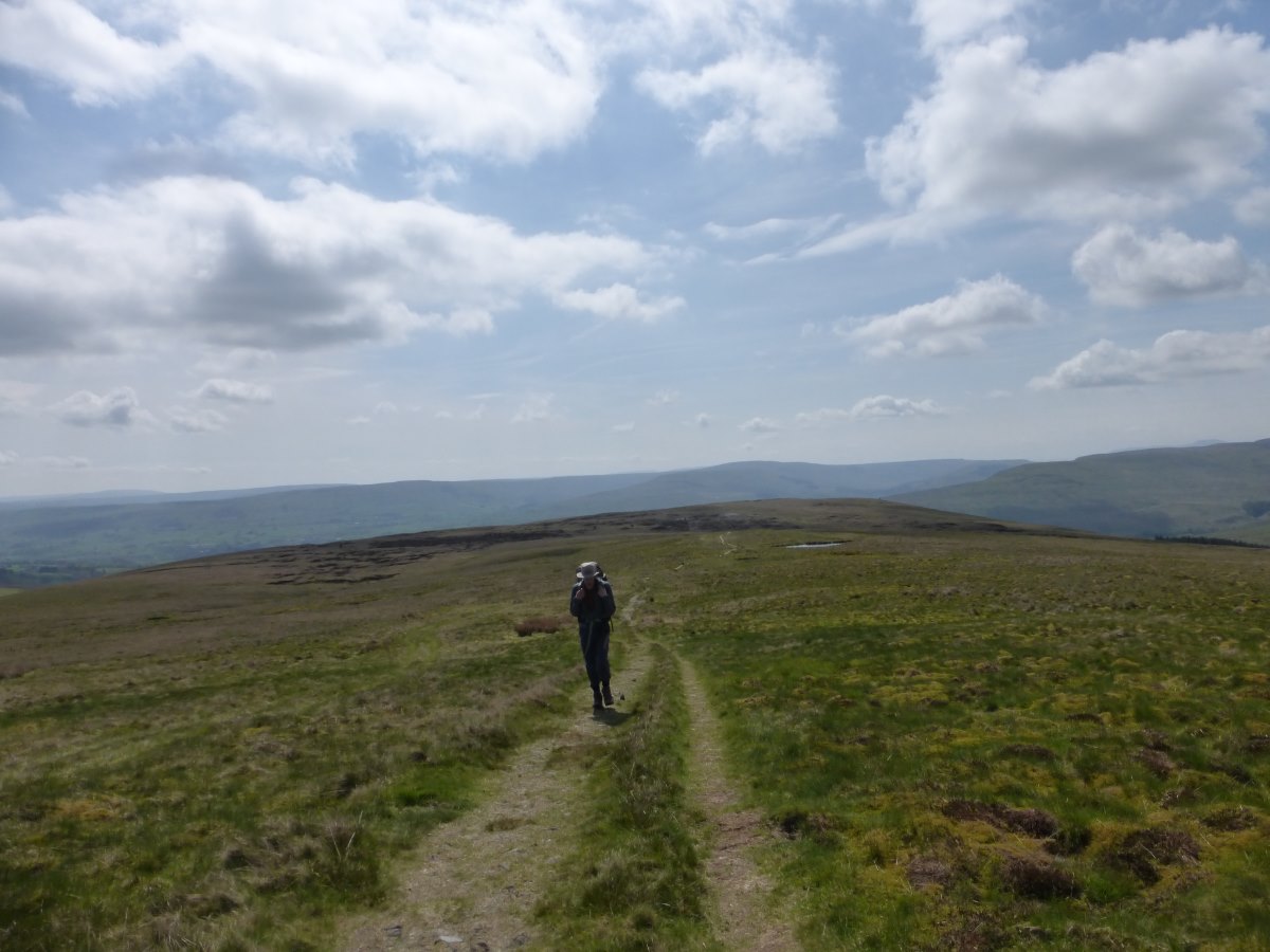
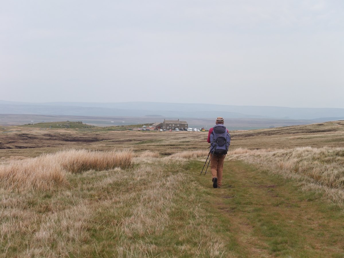
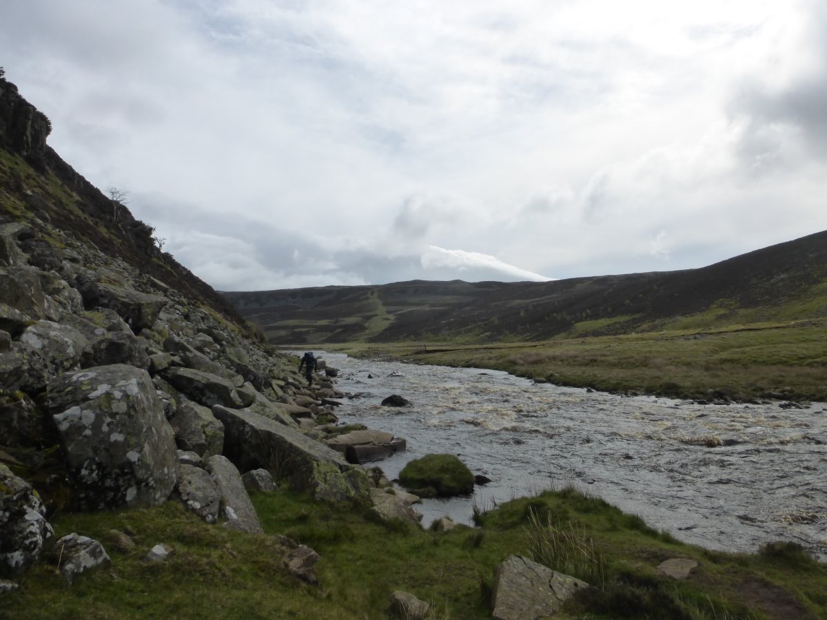
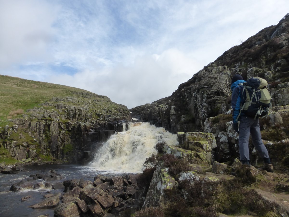
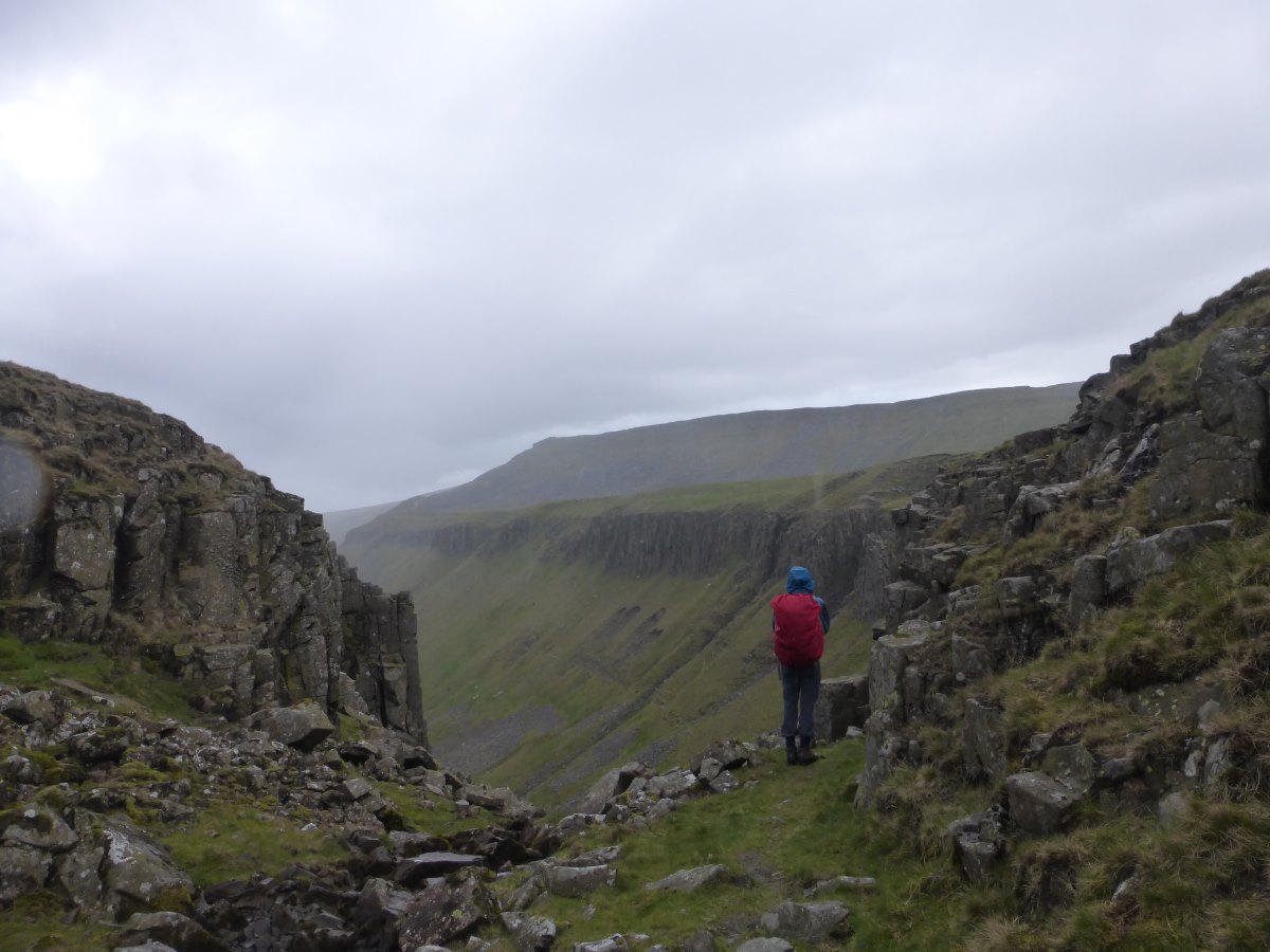
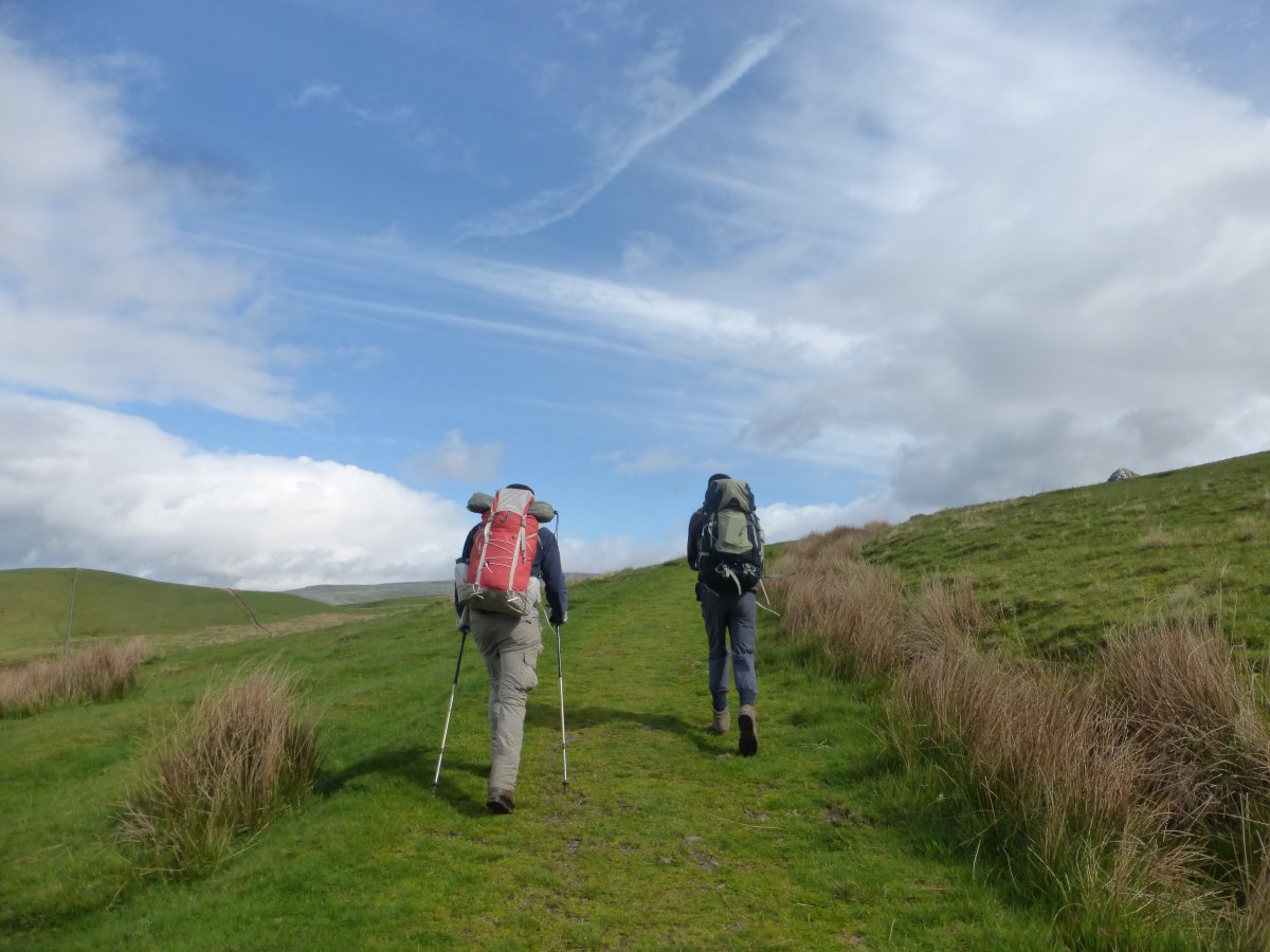
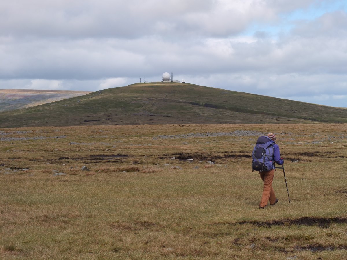
Day 66: an excellent night’s sleep followed by a breakfast of hot croissants and jam, if only all days could start this way. Back on the trail we’re waving goodbye to the limestone gorges and returning to moorland. We wind our way up to Tan Hill Inn, the highest pub in Britain which serves an excellent hot chocolate and carrot cake and we browse through some interesting books about the history of the building. Back outside the wind is picking up and there’s a fair amount of bog - the first we’ve met since Edale actually as the rest of the wet sections have been flagged. We lunch by a stream where little silver fish are jumping to catch insects and the air is full of lapwing calls. I had a theory when I saw my first one that maybe they were a southern/farmland bird and that’s why I’d never seen them before. Having heard them on an almost daily basis since, I’m starting to wonder if I just never had my ears open. We cross God’s Bridge, a really cool natural limestone bridge with the stream flowing below, and then the A66 by a fairly dreary underpass. The wind keeps getting stronger and we reach Deepdale where we’re intending to wild camp. There’s a shelter of some sort mentioned in the guidebook which turns out to be a delightful (well, I think it it’s delightful) little space at the end of a barn with windows, a few plastic chairs and a clean(ish) floor where we elect to spend the night, listening to the wind howl outside. Dad thinks it’s all a bit desolate and is distinctly uninspired. I make him a hot chocolate. Day 67: it continues blowing a gale all night with on and off lashings of rain and we both agree in hindsight that we’re very glad to have the shelter. The sun pops out as we get going and though there are intermittent clouds all day they fly by pretty quickly in a strong wind. There’s a little more moorland to cross to make it to Middleton in Teesdale where we re-stock on food and enjoy a well timed café lunch while a rain shower passes outside. From here it’s a delightful walk up the Tees passing the very impressive waterfalls of Low Force and High Force. Then there’s a climb up at the top of the valley straight into the wind and we’re both getting tired and cold. Langdon Beck youth hostel eventually appears as a welcome sight after a nearly 20 mile day. I collapse onto a sofa and pick the shortest book off the shelf in the hopes that I may finish it in an evening. It’s PG Wodehouse’s Code of the Woosters, which turns out to be very old fashioned and rather odd. I only make it half way through so I never will find out if he pinches the cow creamer or not. I decide I can live without this knowledge. Dinner is an enormous amounts of pasta and we meet some new Pennine Way walkers Paul and Tracey who, on a 20 day schedule, are the first people we’ve met walking slower than us and are due to finish on the same day. Day 68: with excellent timing it rains heavily overnight and dries up this morning. The wind is still getting stronger though and is straight into the face and cold. It sneaks in around the ears and blows the tear film from the eyes to make focusing on the ground ahead difficult. We’re still following the Tees as it winds up and up, the valley sides becoming rocky and awkward. Cauldron Spout waterfall is a good frothing mass of white water. We lunch just above it hidden behind a wall for a brief respite from the wind then it’s onwards yet again with all the layers on as we climb higher. There’s a brief but drenching rain shower just as we reach High Cup Nick with the Eden Valley spread out in front of us. As we traverse the sill we watch a whole weather front blow its way south across the valley, a great line of cloud and rain stretching away as far as we can see. And then the sunshine. The wind slackens (a little) and we break out the cake with a spectacular view of the Winn Sill and then outwards over to the Lake District, South to the Yorkshire Dales and North. North I can see the glimmer of the Solway Firth, and a distant line of land beyond that is Scotland. Down down down into Dufton all the walls and buildings are sandstone and suddenly it feels very much like home. We’re too early for the youth hostel so find our way into a café for more cake and hot chocolate, then spend the evening with Mum (home being just round the corner) and dinner out at the very posh pub. Day 69: there’s another cooked breakfast to see us on our way this morning making it a leisurely start. Having done the down down down yesterday we now have to climb back up up up but it’s not as strenuous as I’d thought it would be and we gain height quickly. We fall into step with another Pennine Way walker Pat, who is doing his walk in single week sections. Up on the tops there’s an easy broad ridge over lots of summits to the top of Cross Fell. Sitting on the summit I discover a piece of grass sticking out of the side of my boot and, on closer investigation, realise that the crack in the leather which resulted from the bothy fire baking in Wales has become a small hole. This may explain why my feet have been rather soggy of late. It’s a sad day. Despite the struggles of the first few weeks I’ve really come to love these boots and would love to do the whole walk in a single pair. But nothing to do about it now except wait and watch. Down the other side we stop for lunch at Greg’s Hut where we meet our first JOGLE walker (John O’Groats to Land’s End) who is working as he walks and somehow managing to carry a laptop around in his 35L rucksack. Carrying on down we’re back on hard stony tracks then a warmer more sheltered section along a river to reach Alston. We’re both feeling tired and flat footed and find ourselves standing in the supermarket staring at the shelves completely overwhelmed at the prospect of planning another three days of food that is somehow tasty, nutritious, varied and has a sufficient amount of pudding, yet weighs almost nothing. So much easier catering for one. In the end we just get dinner. We’ll come back tomorrow.
Departing our yurt
Approach to Tan Hill Inn
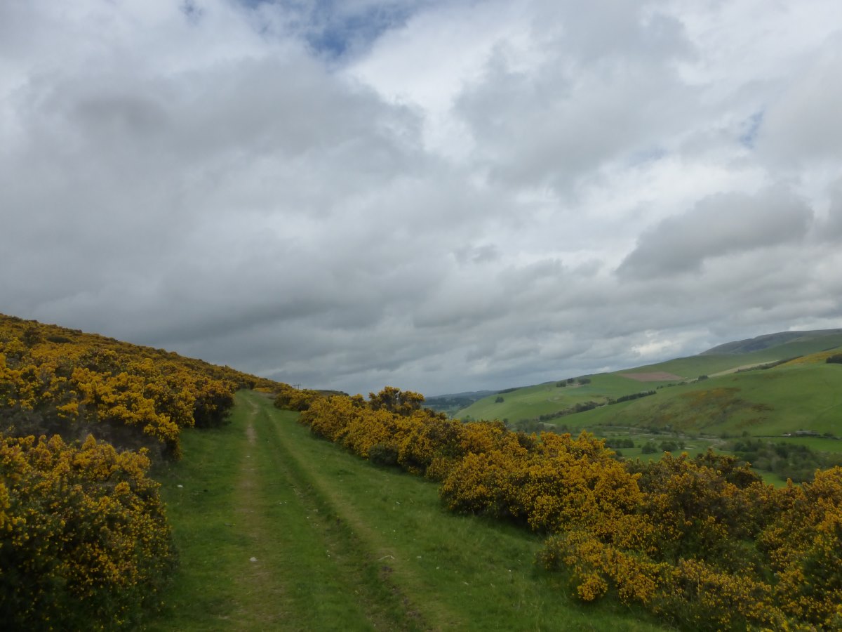
Through the bog cotton
God's Bridge
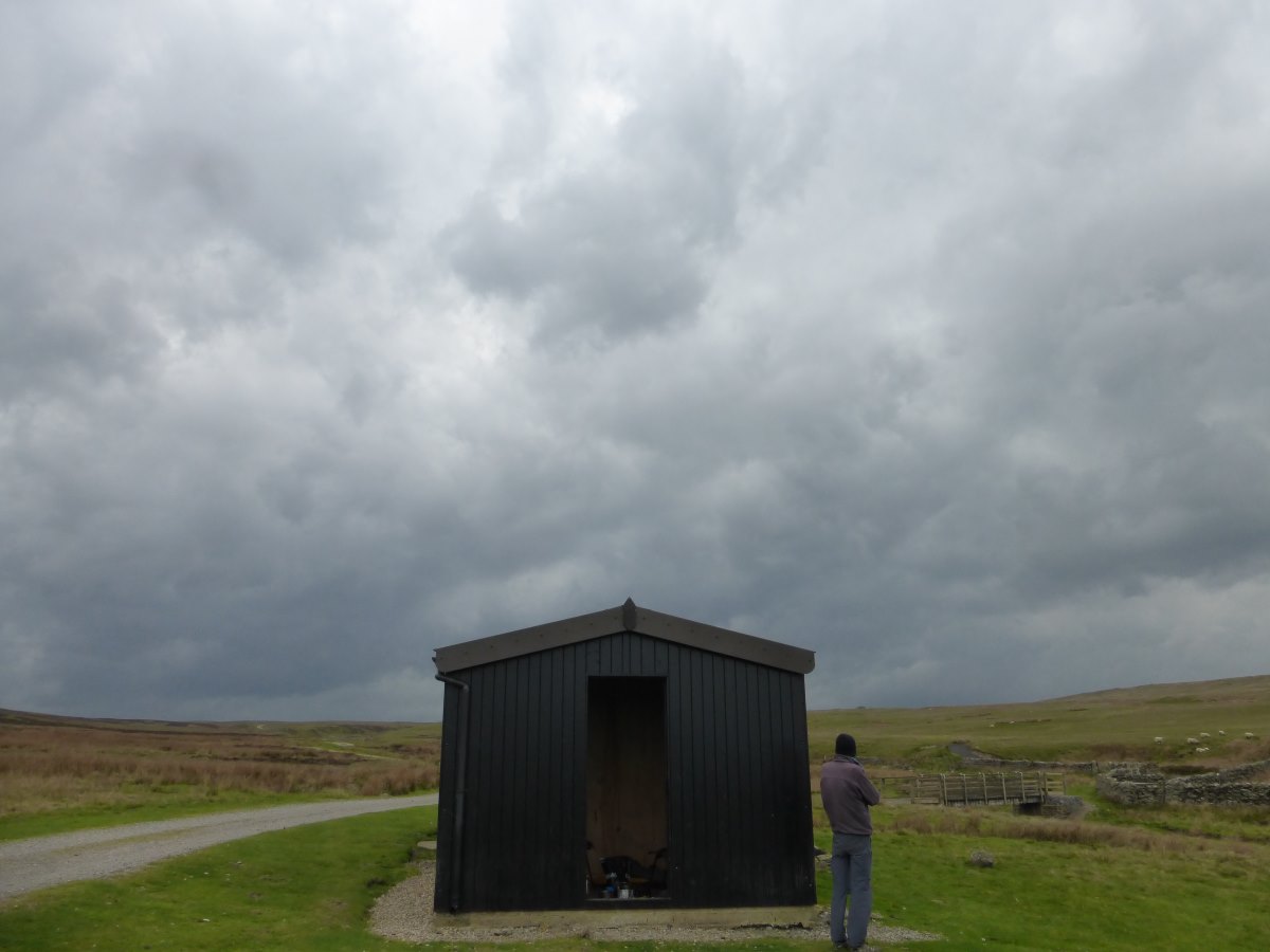
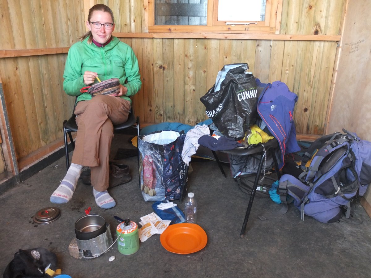
Deepdale shelter
A cosy spot for breakfast
Brightening up
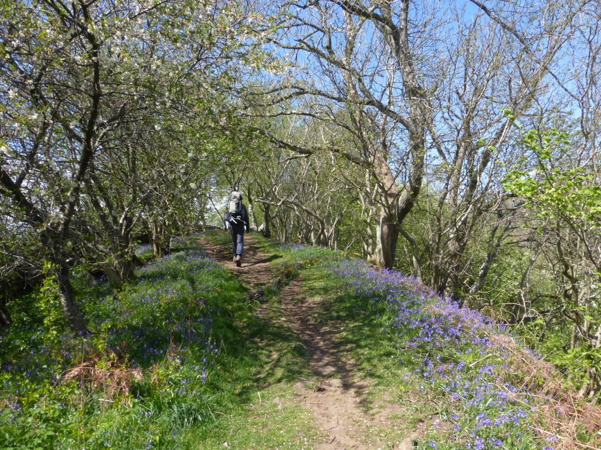
Through the bluebells
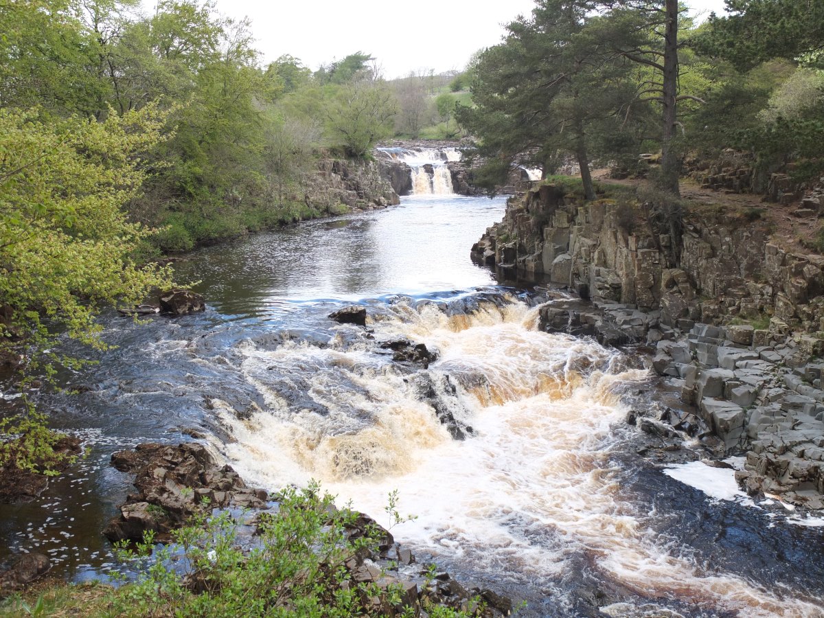
Low Force
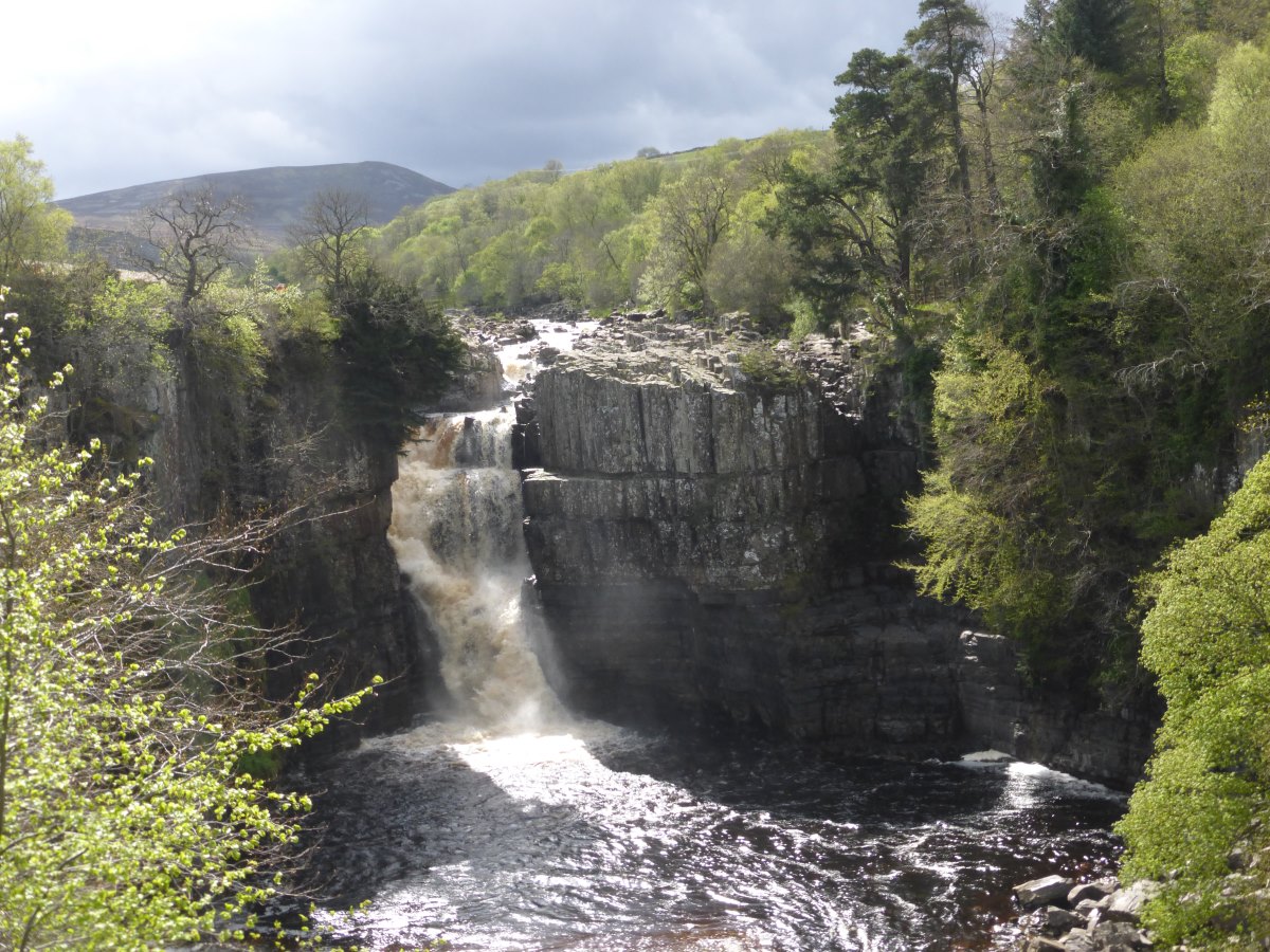
High Force
Continuing up river
Continuing up river
Cauldron Snout
High Cup Nick in the rain...
...and 5 minutes later in the sunshine
View down over the Eden Valley
Up up up, Pat and Dad
Many summits
Cross Fell
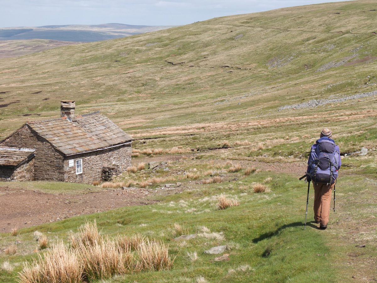
Down to Greg's Hut
Alston to Bellingham
Pennine Way, 38 miles, 3 days
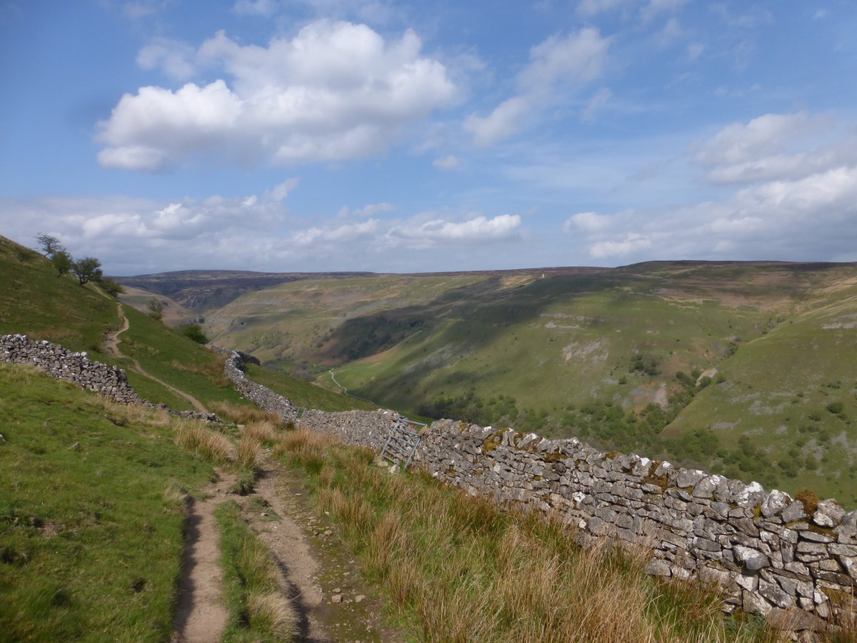
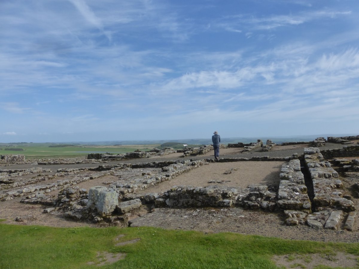
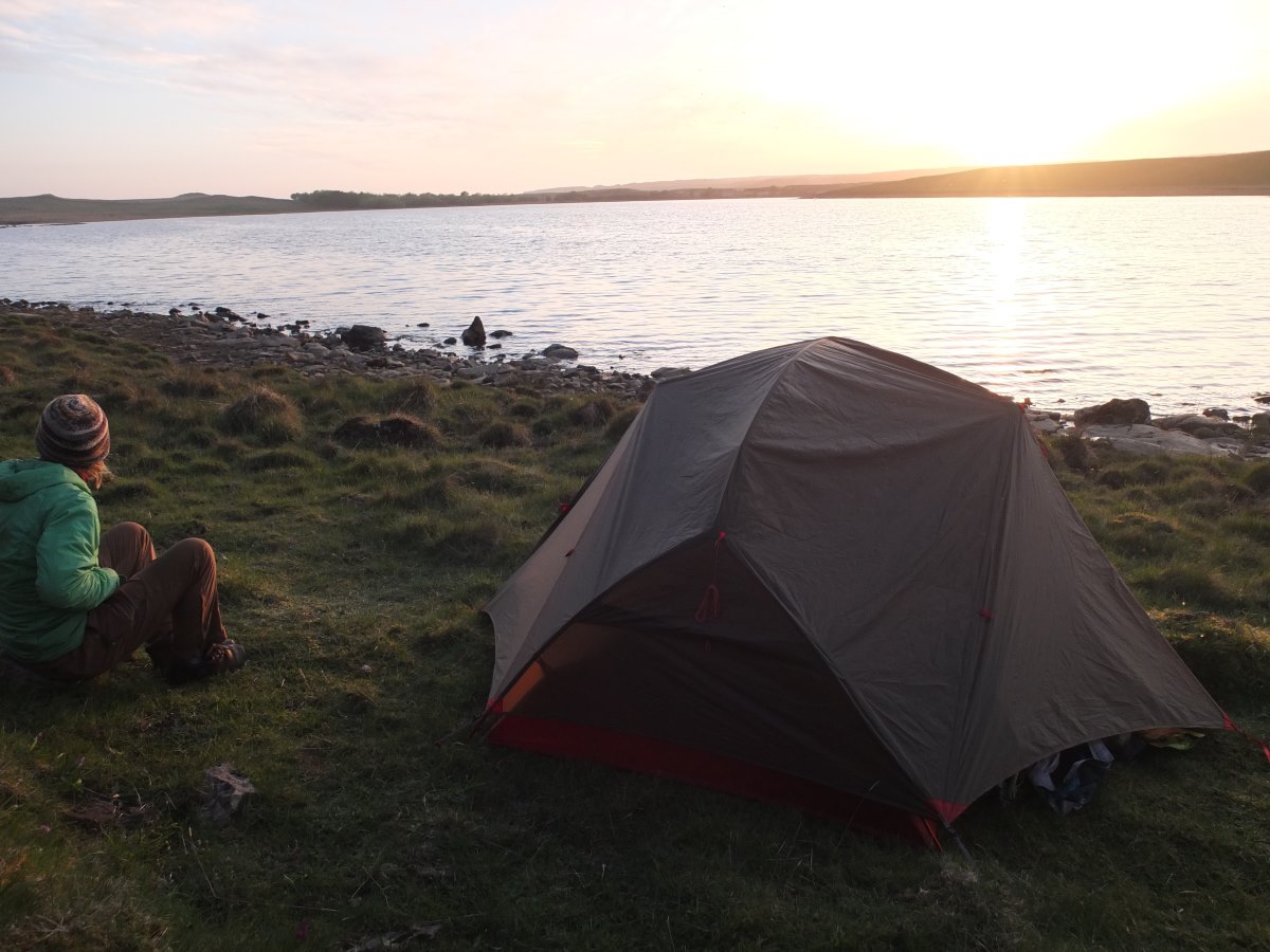
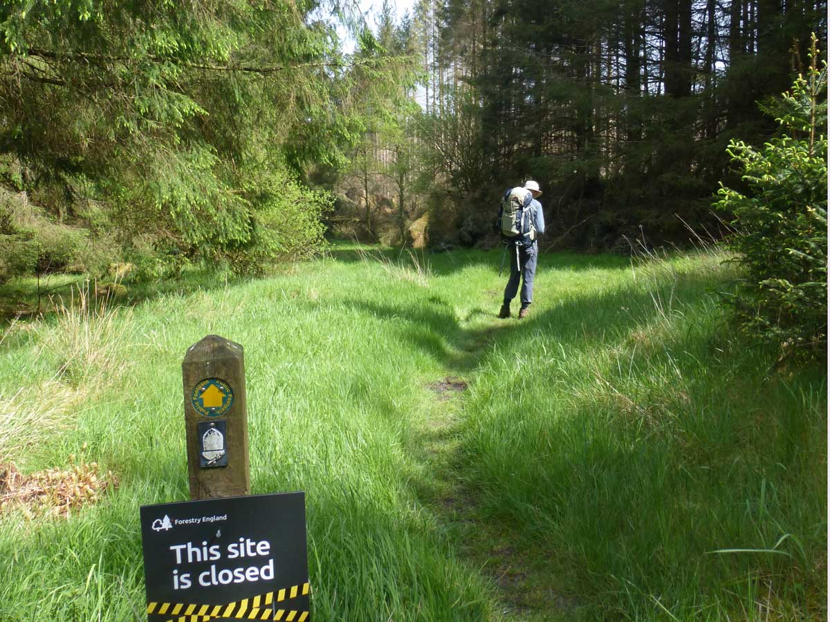
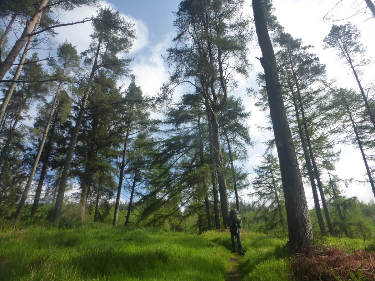
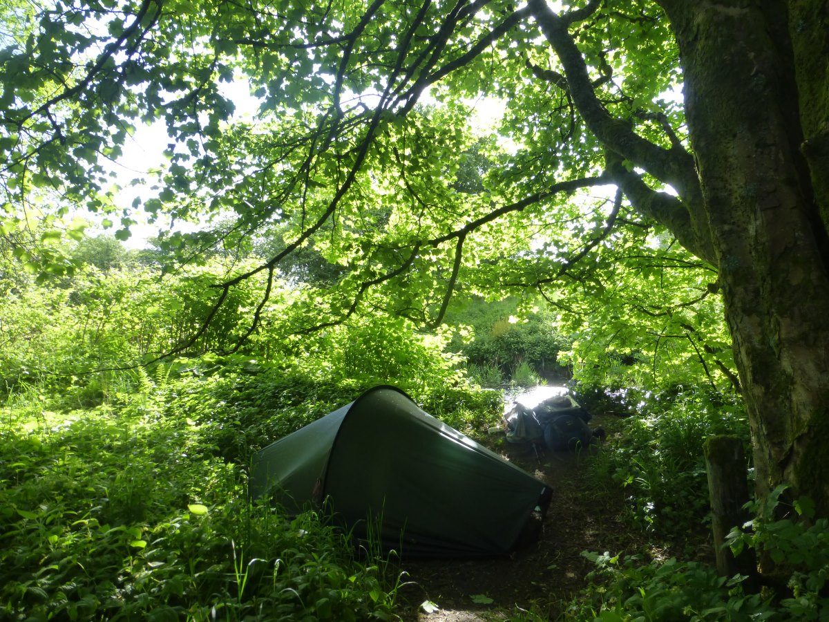
Day 70: 10 weeks in! It’s another cooked breakfast to see us on our way for another long day. We head back to the shop and manage to achieve tasty, nutritious and pudding, though not so sure about varied, and definitely lacking in light-weight. It’s a struggle of a morning mentally with my feet still aching from yesterday, a heavy rucksack and a darkly overcast sky. Lots of fields and moors are trudged. We meet Tom (LEJOG) again who has changed his route and decided to do the whole of the Pennine Way. There’s a nice lunch spot by a stream where the sun comes out and it briefly feels warm. Then there are more fields and moors. At one point I nearly step on a clutch of perfectly camouflaged grouse chicks which go sprawling in panic in all directions while their parents watch despairingly from a distance. The hole in my boot has progressed to medium-large though surprisingly small amounts of bog leak in, the other one is actually worse and leaks by the toe where the rand has come away slightly from the shoe. And still all of Scotland to go. At least I won’t need to bother with a change of shoes for river crossings - these will already be soaked. We make it at last to Greenhead hostel which has a plumbing problem with the shower coming through the kitchen ceiling. In a silver lining we get upgraded to a private room instead. Dinner is 500g of pasta which will now not be in my bag tomorrow. Small wins. Day 71: our warm sunny day that the forecast has been promising for weeks has finally come. It starts grey and chilly but brightens quickly and by lunch time is properly warm. It’s a short day along Hadrian’s wall with some great views as we pass many mile castles and turrets and climb up and down the Winn Sill. We pop in to the Sill Café for lunch then take a bit of a detour to Housteads which is shut but we climb in over the back wall for a brief look around. The hole in my boot is becoming a triangle as the leather rips along the line of the sole. Fortunately the lining is still attached so they are not yet filling with debris and the going underfoot today is dry, but the decision is made that I’ll need a new pair before the tackling the Highlands. In the afternoon we take another diversion to a wild camp round the back of Broomlee Lough where we put up the tent by the water, surrounded by wild orchids. It’s a beautiful evening for dinner outside in the sunshine, watching the light turn golden as it sets. Day 72: we wake to condensation and low cloud shrouding the view but it soon brightens up for a warm and sunny morning. We’re off into a large section of forestry and this part of the route is officially closed with an 8 mile diversion around a section of wind-blow. There’s nothing on the ground to tell you this though, and I wouldn’t have known if Dad hadn’t stumbled across it online while doing his bookings. We’ve met a few South-bound walkers by now though who all seem to have got through it fine (with accounts varying from “didn’t even notice there was a problem” to “horrible”) so we decide to go for it. After several miles through forest and clear-fell we start to wonder if the difficult section has been felled but do eventually reach it. A roughly 100m section has blown over in a huge tangle of trunks, root plates and spiky branches. On a warm sunny day it’s a fun scramble and squeeze, with a compass bearing thrown in in the middle to keep us on course, but there’s also a pretty short (1 mile?) alternative round a couple of forest tracks that avoids it completely. We lunch by a stream in a sheltered spot with strong sunshine where I’m boiling and even Dad removes his jumper for the first time since Edale and declares it may be verging on warm. Just up the next hill there’s a “pit-stop” with an honesty box for cold cans and biscuits, and even a shower and sofa bed if you needed a stop for the night. We meet Paul and Tracey again and then a new couple Andy and Anne who are doing 21 days and also due to reach Kirk Yetholm the same day as us. In the afternoon it clouds over and there’s a not especially inspiring final wander into Bellingham where we find our campsite. Dad heads off again for a three mile excursion to a waterfall but I elect to sit about and have a nice hot shower instead. My feet are sore and a bit swollen from a combination of lots of hard gravel tracks and a heavier bag (my efforts to save Dad’s feet!) and the soles are starting to look a bit macerated from being constantly wet.

Bellingham to Kirk Yetholm
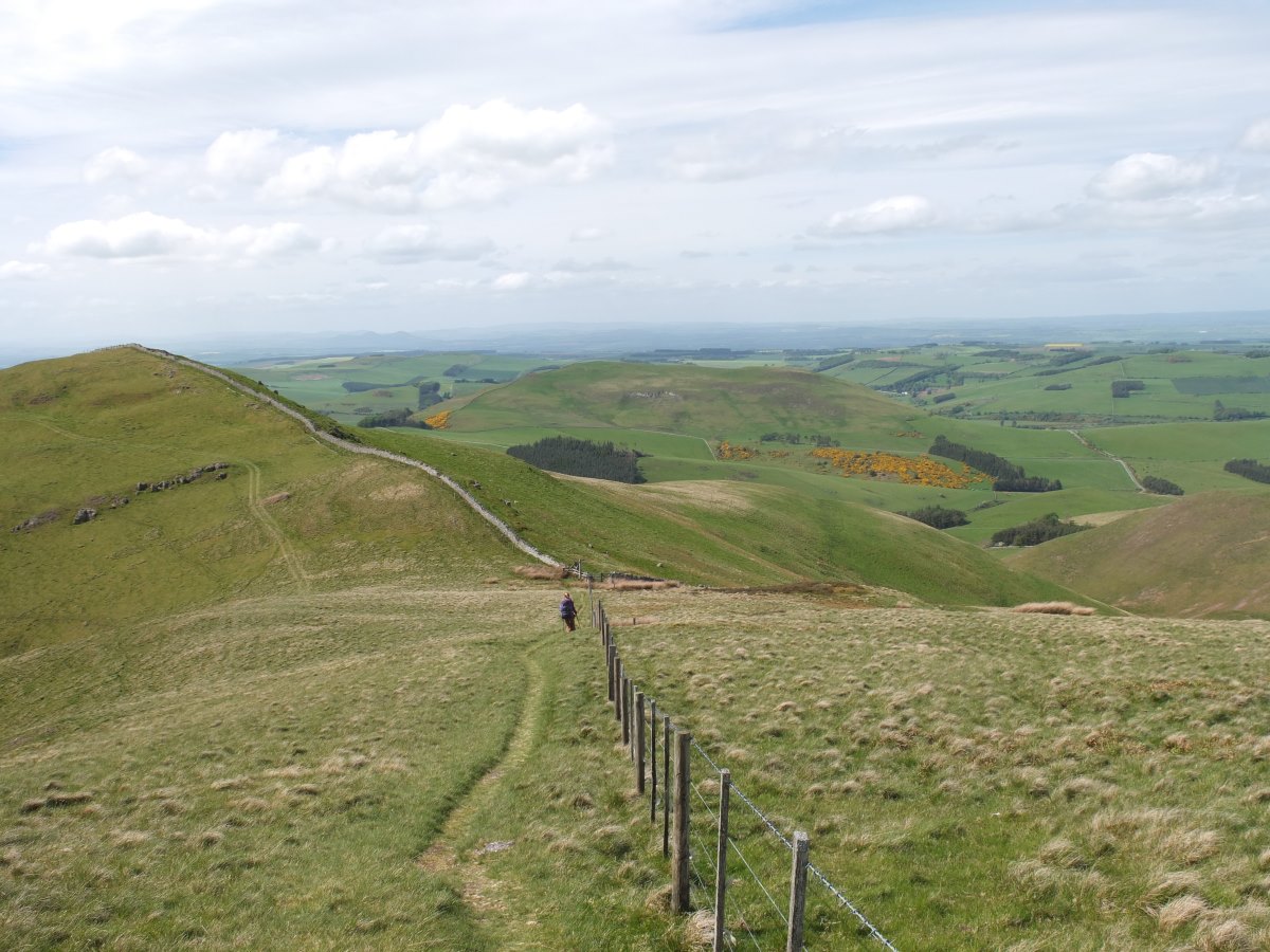
Pennine Way, 42 miles, 3 days
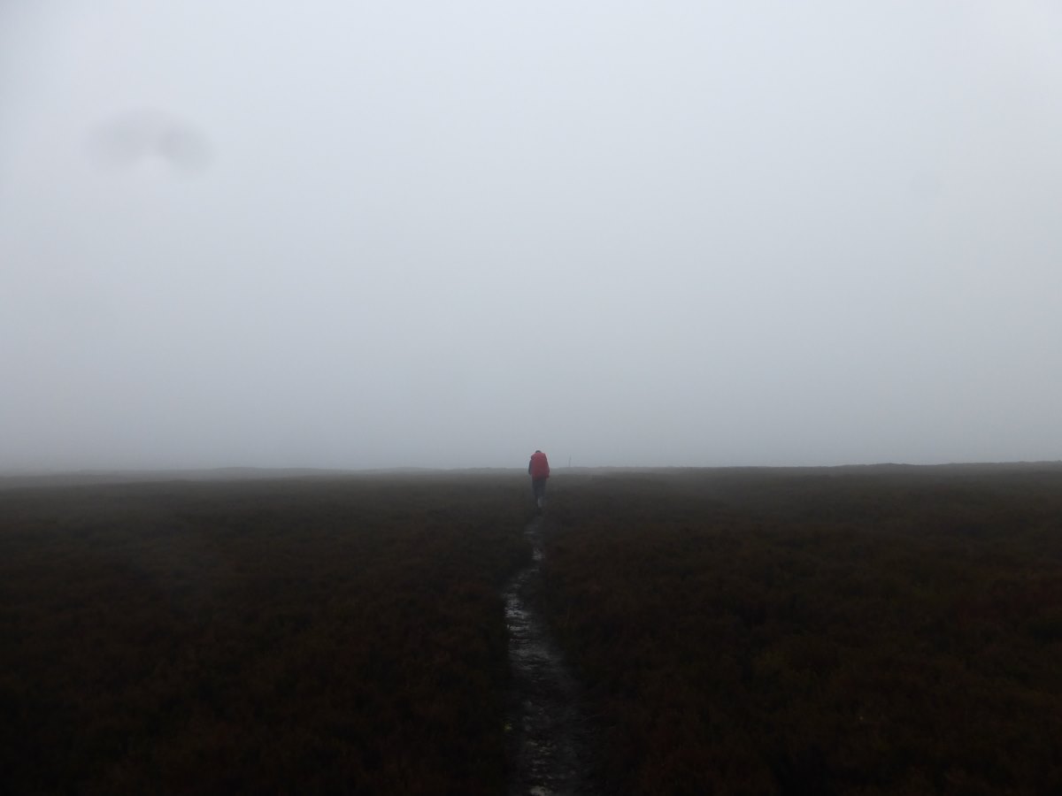
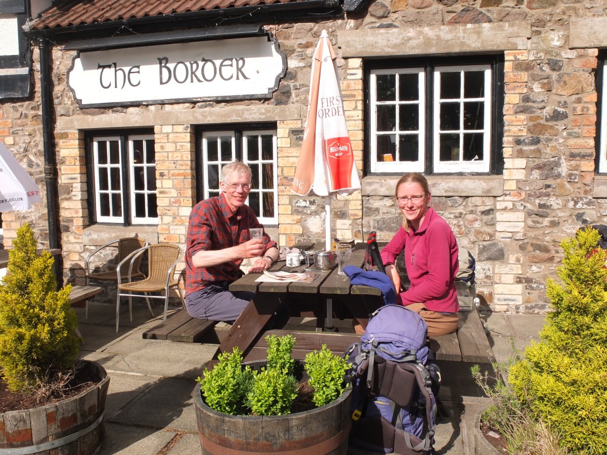
Day 73: a wet day. The sort of day that if we didn’t have bookings and Dad’s end date to keep to, would have become a tactical rest day. We have breakfast in the tent, then sit about for a while hoping for a miracle, then give up and set off into the rain at about 10. It does dry up a little but the cloud stays low and the ground is soaked making it a fairly featureless trudge through lots of heather. My feet are so soaked that I can feel water squelching around not just between my toes but all the way up to my ankles. We meet another (unnamed) LEJOG walker who is heading for a bothy a little off the main trail up Spithope Burn. It’s been a bit of a surprise in this area how many bothies and shelters there are that I had no idea existed. We end the day through more forestry into a campsite just short of Byrness which has a microwave for easy dinner cooking. We get a pitch just across a little stream from the main site and there are lots of wagtails out catching insects, and a female siskin that watches us from the forest edge. I also see the first midges of the walk. Though this is not exactly something to celebrate it is a marker of Northward progress and of the coming summer. I make plans for a friend who is joining me for the West Highland Way to bring me new boots, and on a whim send an email to Freet who supply them explaining that I’m probably the first person to walk the length of the UK in their shoes and asking for a discount. Day 74: it rains overnight but the day dawns bright and sunny and we have a leisurely morning letting the tent dry out. Heading off we pop our heads into a little church which has a stained glass window dedicated to a very large number of people who died in the construction of a nearby reservoir. Then it’s steeply uphill through forest. The air is still and stiflingly hot and the ground slippery and muddy underfoot. We make it out the top to a very welcome breeze and then a long and gentle grassy ascent onto the Cheviots. The England-Scotland border runs along the ridge with the Pennine Way crossing repeatedly back and forth between the two and it is with a certain thrill of anticipation that I approach the first crossing. They’re strange things borders. A big bold important line on a map filled with human significance; and a rickety fence on a hill surrounded only by sheep. This one is particularly underwhelming with a broken down gate and a muddy puddle laid out in welcome. Onwards. There’s a tiny mountain refuge hut where we find an entry in the book from Jeff three days ago having breakfast on an epic final day (there is no accommodation on this last leg so you either wild camp like us, do an epic two in one like Jeff or get bussed out and back like Paul and Tracey). There are sections of flagstones through heather and a few potential death traps where the stones have been eaten by the bog leaving black pools that I am unable to feel the bottom of with a pole. We’re intending to wild camp by a waterfall/stream in a forest a little off the ridge but half the trees have blown down making the way there completely impassable. Back up to the ridge again. Our second option is a small stream at the top edge of the forest which requires a lot of heather bashing but we do eventually make it to a decent spot. It’s Dad’s last night of the walk and my last night in England. We celebrate with rehydrated expedition pasta and chocolate mousse. Day 75: the last day of the Pennine Way. Starting high there’s an initial heather slog back to the ridge path but then only a very short way remaining to the top of the Cheviot. The route here would be an absolutely apocalyptic bog expect that someone very kindly added a flagstone path in 2013. Nine years and plenty of conservation input later you can see how slowly bog recovers. We mark the summit with a cherry bakewell then begin to wind our way downwards where we pass a second mountain refuge hut identical to yesterday’s, small boxes with a single bench too narrow to comfortably sleep on. We cross over the Schill with an excellent rocky top where I get mobile signal and a reply from Freet to say I can have 50% off my new boots. Yay! Now I have to think of things for a really detailed review. There’s a great view out to the sea which is my first glimpse of the East coast, then it’s more down over rolling grassy tops and a final border crossing with a good sturdy stile from which to wave England goodbye. Then Kirk Yetholm and the Border Hotel and the end of the Pennine Way. There’s a free half pint, a certificate and a chance to sign the book. We sit around in warm sunshine for a bit, Dad lamenting that it’s the first time he’s felt warm since leaving Edale, then Mum arrives and Dad is swapped for a clean and dry one-woman tent and some apple and raisin porridge sachets (a poor deal) and I wave them goodbye. Luckily there’s no time for loneliness with a quick turnaround to get into the hostel, wash clothes, wash me and get back to the pub for dinner. There’s a sign outside for the Scottish National Trail (not quite my route but similar); 470 miles to Cape Wrath.
Off into the rain
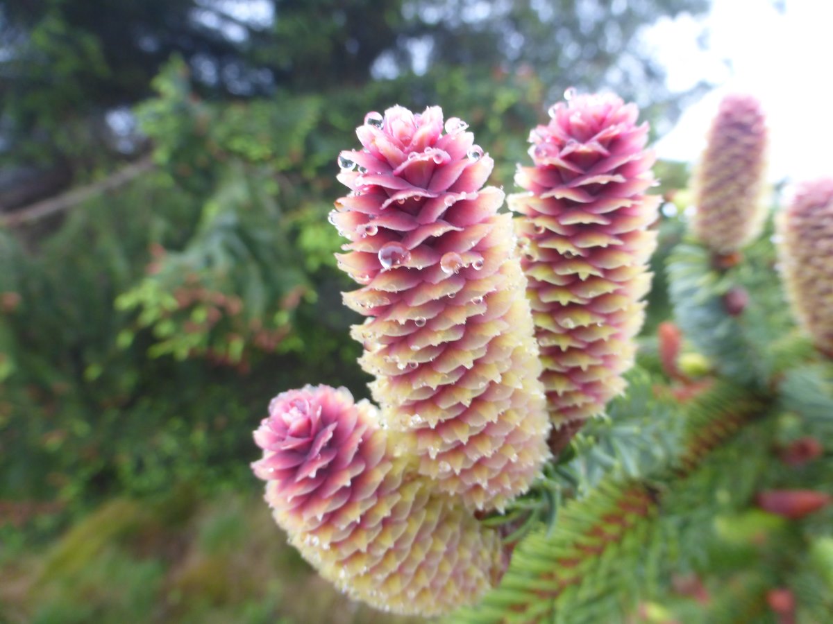
Beautifully soggy young pine cones
Still smiling
Byrness campsite
A steep ascent
Onto the Cheviots
An unspiring first crossing into Scotland
A good collection of devil's matchsticks
Our last night in England
Cheviot
Cheviot
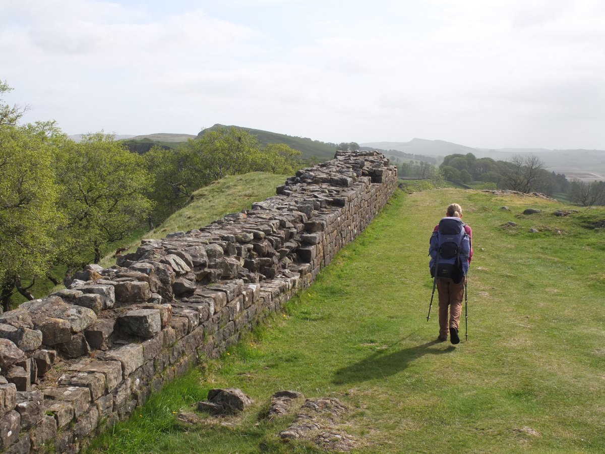
The final border crossing
Down into Scotland
The End of the Pennine Way
Kirk Yetholm to Melrose
St Cuthbert's Way, 30 miles, 2 days
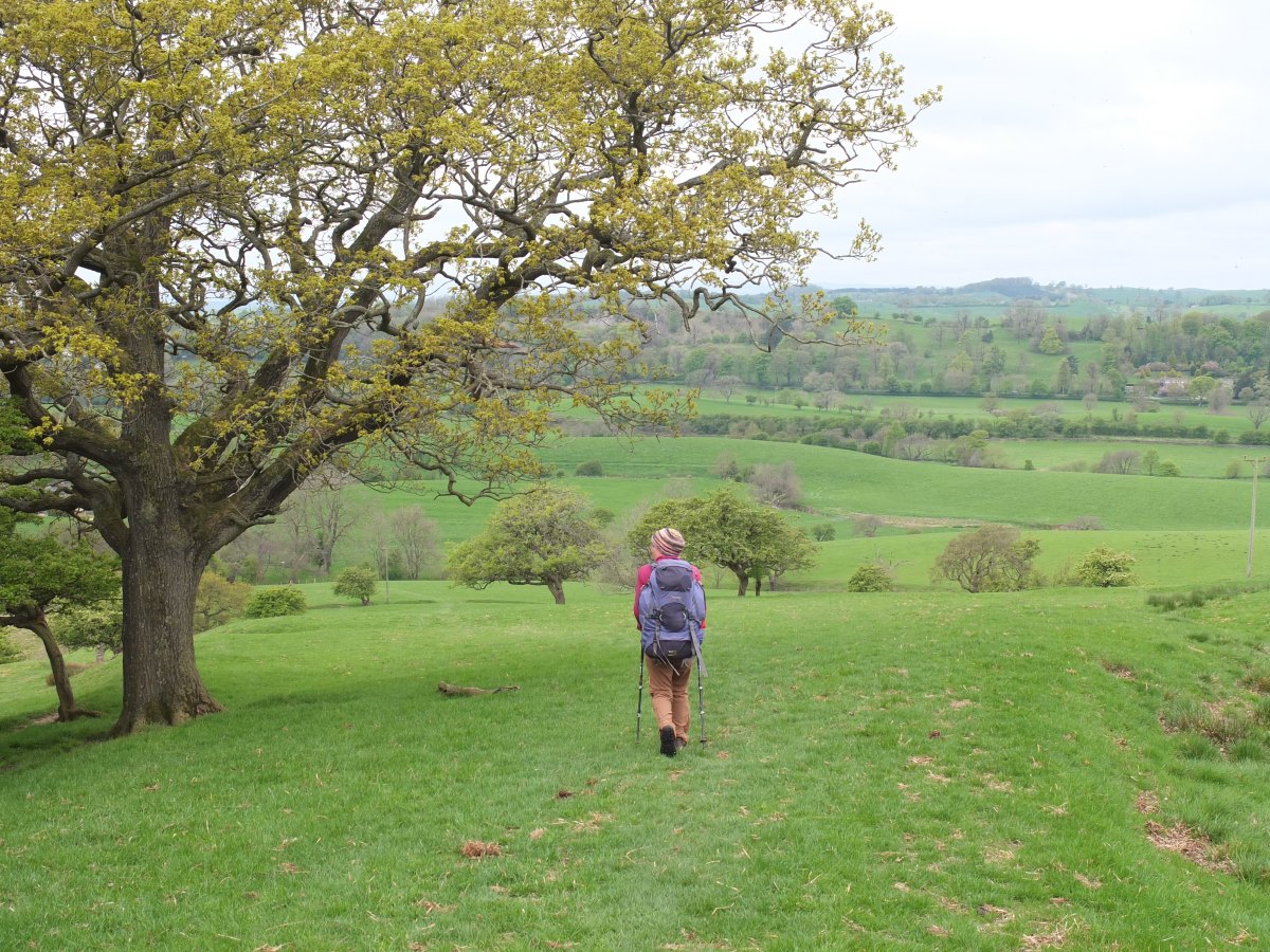
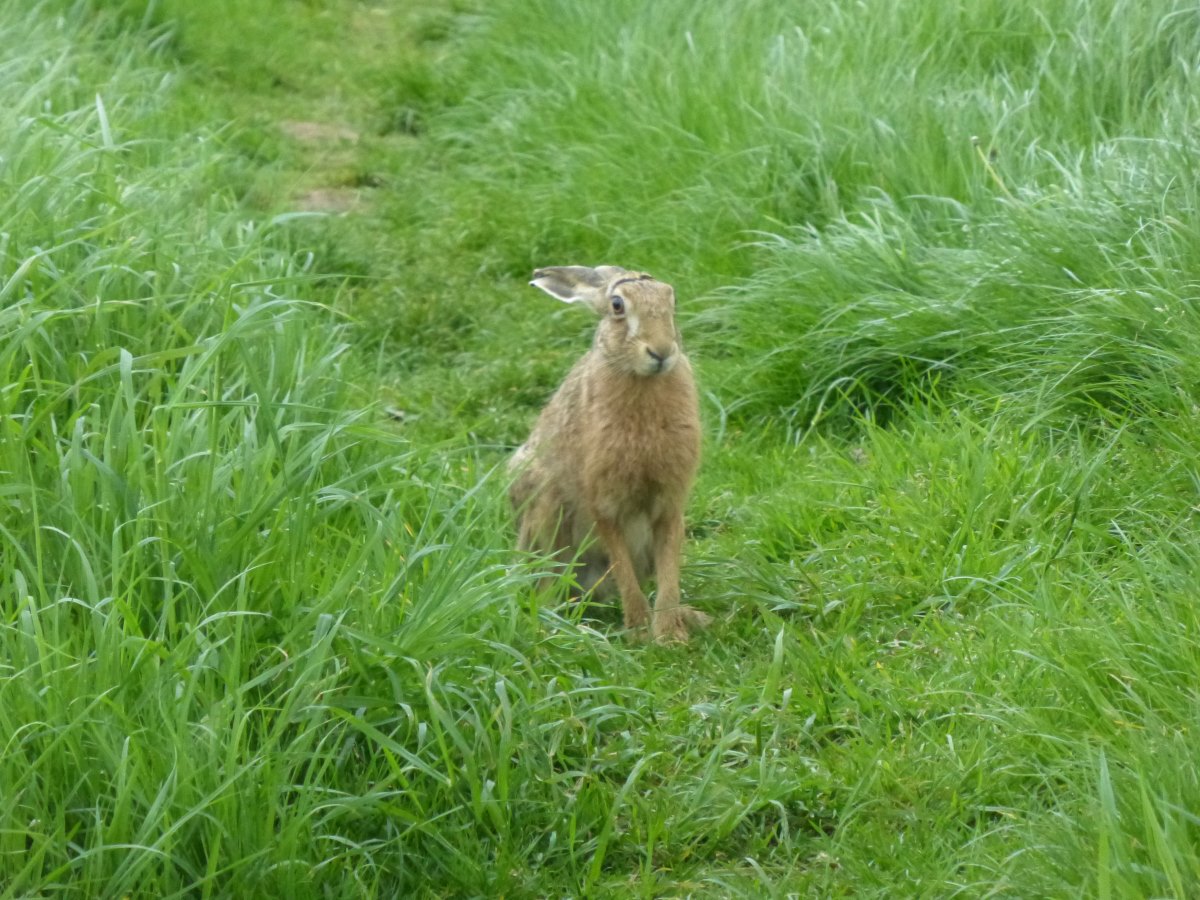
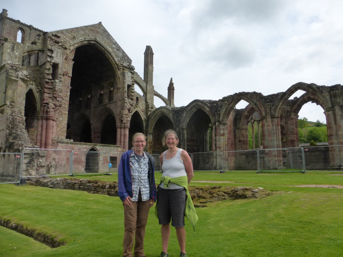
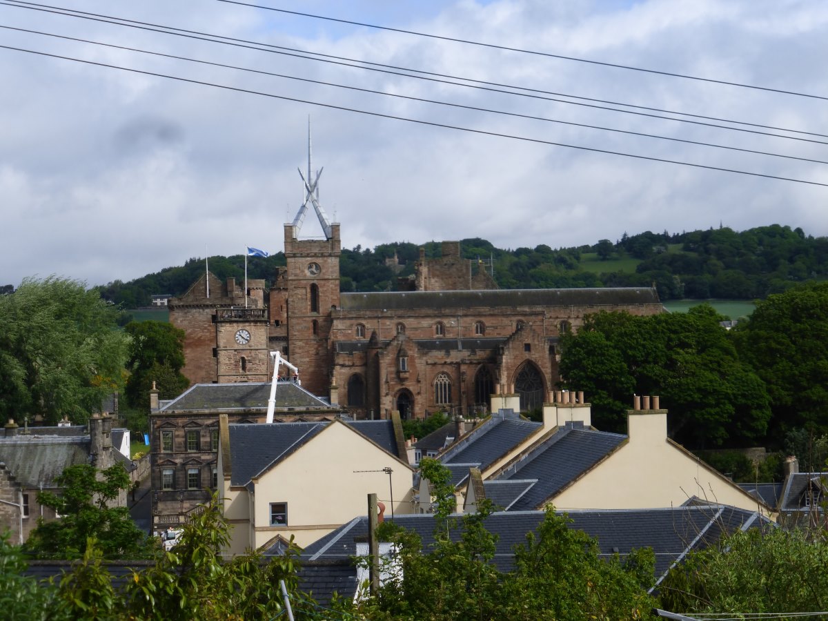
Day 76: back to being on my own. I have a good chat with the hostel warden this morning, including a very kind offer of accommodation as I pass Edinburgh which is sadly a bit far from my route. He is intrigued by my boots and, when I comment that they’re getting a bit worn out, remarks that nothing is really waterproof for long and they look very comfy, like old slippers. It’s true. I’ve been focussing on the waterproofing because of my feet being soaked for several days but they’re so light and comfy and well fitting that I hardly feel like I’m wearing shoes at all. I will be sad to replace them. Out on the path it’s a perfect blue sky day though with a chilly wind. I’m onto St Cuthbert’s Way which turns out to be so well signed I barely need the map. There’s a shop in Town Yetholm giving out free over-ripe bananas then it’s off up a hill with a strong wind to the face. A sign at the top marks the highest point of St Cuthbert’s Way then I escape back down into the warmth of the fields and woodlands and it’s a perfect day for non-strenuous lowland walking. Meandering along a small lane I startle a stoat who darts up over the wall but then has to come back for her second cub. Two siskins. A dipper at my stream-side snack stop. Lots of other birds. Some warm snoozing cows. I keep walking into the early evening then enjoy my first night of actual legal wild camping since Dartmoor, tucked under an ancient yew. Day 77: I’m due to meet Julie at 10 and have an early start and a bit of a route march to get to our agreed rendezvous on time. The way follows a perfectly straight line along Dere Street roman road. Part way along I meet a hare coming the other way. I stop, it continues; coming to within a couple of metres. We stand still and watch each other for a good few minutes before the spell is broken. Hurrying on we both reach the meeting point at exactly the same time (i.e. 15 minutes late and out of breath). We enjoy a lovely meander along the river Tweed, though after the roman road it feels distinctly convoluted and inefficient! Oystercatchers and a heron. Warm and bright. Leaving the river we climb over a small hill with a great back to the Cheviot which now feels very far away. Dropping own into Melrose I’m able to leave the rucksack in Julie’s car and enjoy a light almost floating feeling as we take a tour around the very beautiful Abbey. Waving goodbye to Julie I’m expecting to have to walk all the way through Galashiels to find a camp spot but, carrying on back to the river, there’s actually a little flat grassy area with a picnic table. It’s very public but it’s Scotland and not anyone’s garden or field and therefore legal? After years of wild camping in the hills I find I have no idea how access rights apply to urban areas. I decide to go for it, but have a pub dinner first and pitch late. There’s time to kill first and I sit about watching a few birds, tiredness starting to creep up on me. I’ve covered a lot of miles since my last rest day and there was a moment by the car when I thought it would all be so easy to get in and stop. These two days have been surprisingly pleasant but there are a lot of borders hills ahead and then a busy bit through the central belt which is not especially inspiring right now. I’m longing for a countryside canal to whisk me straight to the highlands. I’m lonely too. I knew the bit after leaving Dad would be tough, but it’s still tough. There is still a very long walk ahead. I know now that I will get to the end, and that there are plenty of highlights, both expected and unexpected to come but part of me feels I’m reaching a saturation point. That I’ve walked far enough. It’s the evenings that are toughest. The mornings are full of promise and new adventures; the evenings are a time for being at home. I go and get my pub dinner then grab a reduced four person apple pie for second pudding/breakfast. Returning to my picnic table I decide it’s far too public even for Scotland and make my way across the river where I find a delightful woodland. The evening sunshine is slanting golden through the trees and the air full of the smell of wild garlic after rain. I snuggle up in my sleeping bag and feel much better. The tent is becoming home.
Melrose to Belstane
Southern Upland Way and Cross Borders Drove Road, 49 miles, 3 days
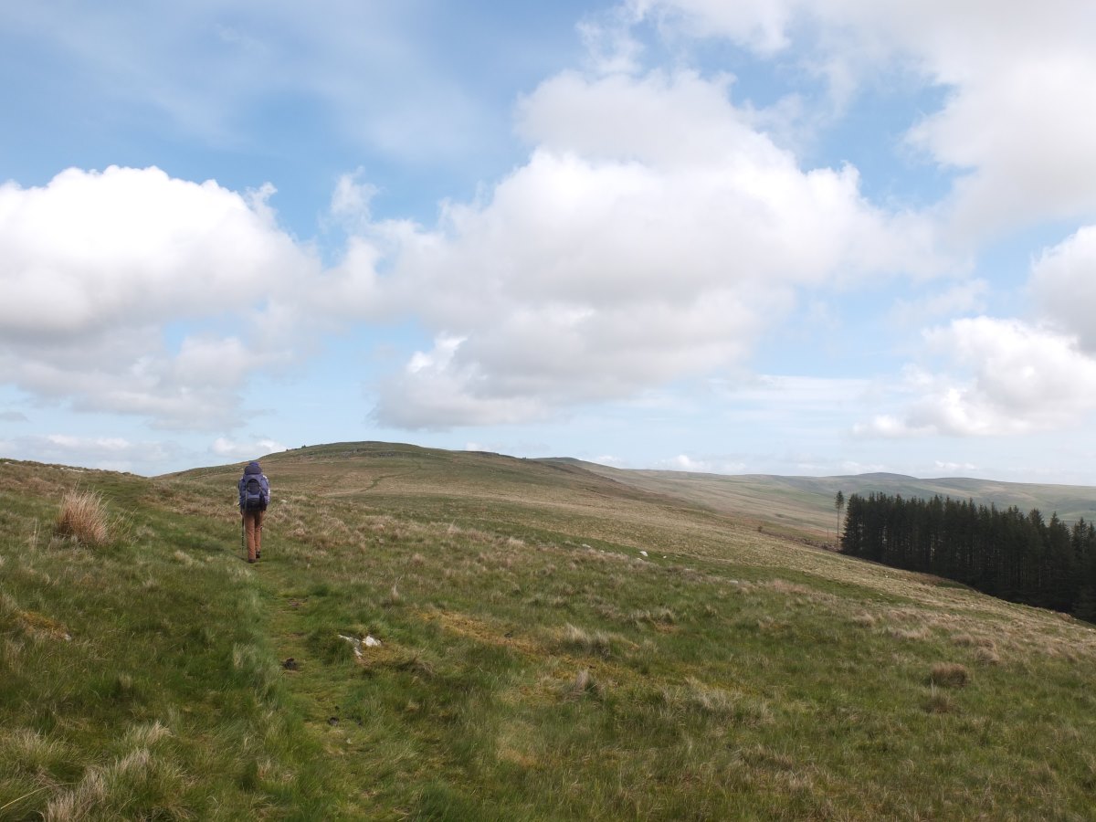
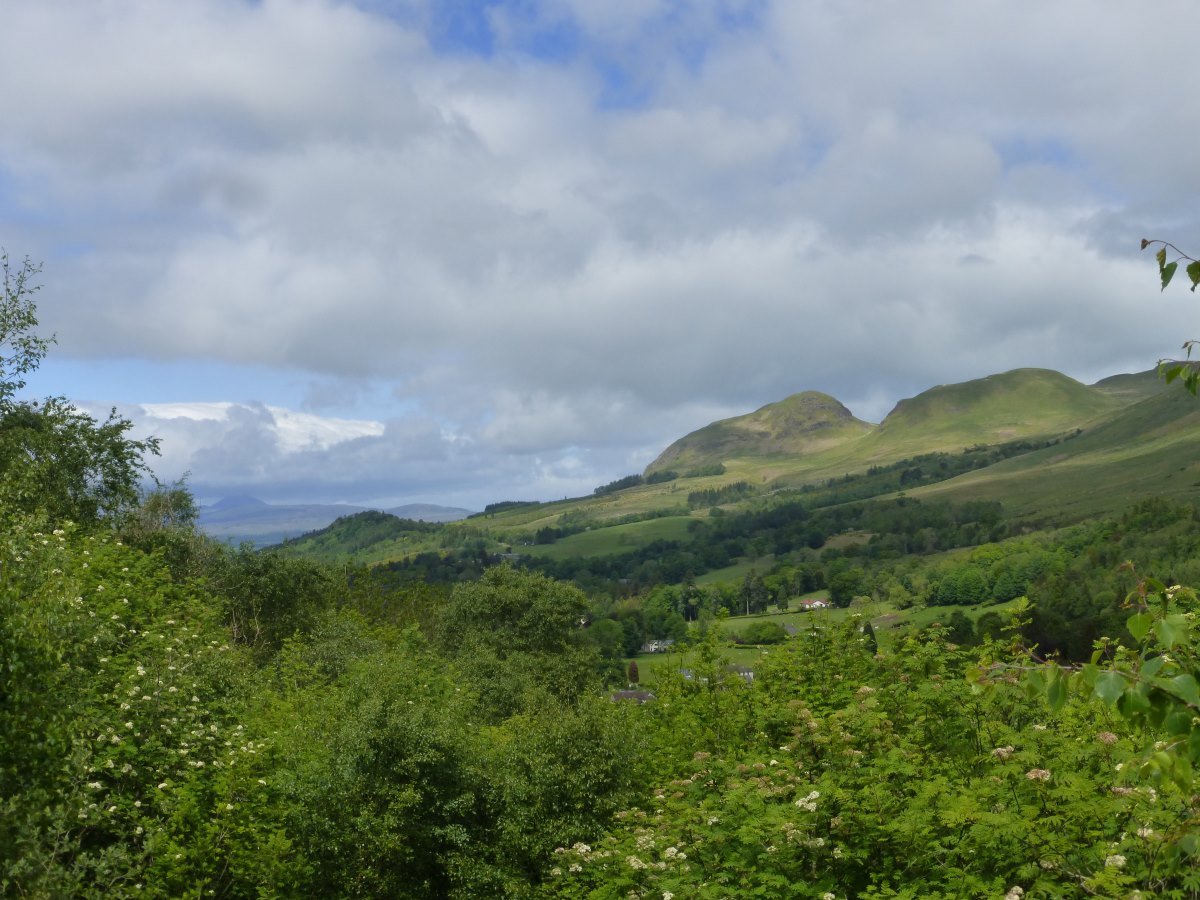
Day 78: there’s a generous helping of apple pie and berries and yoghurt washed down with fruit juice for breakfast, then it’s off into a grey day with the promise of rain to come. I follow the river then railway into Galashiels where I’m after a food shop and also a public loo (camp spot being a bit too public). There’s a sign next to the ASDA pointing to toilets, which then leads to another sign, and another, and another, until I have essentially walked a massive loop and eventually found some less than 100m from where I started. Then it turns out ASDA has them too. I stock up on not very much food (the advantage of there being lots of shops ahead) then take quite a long time to pick up the correct part of the Southern Upland Way which does so much zigzagging that I initially set off in the wrong direction. So much faff. It’s nearly 10:30 and I’ve barely left town and feel like I’ve wasted the best bit of the day. I set off at a slog up a rather small hill and am feeling really tired and miserable. Thinking back to my rather decadent breakfast the penny drops that I’m actually just coming down off a massive sugar high and a quick stop for some more sensible snacks soon has my energy levels restored! Over the first hill, up another, I set my sights on getting over the tops before the rain arrives and manage it. There are decent views but it’s darkly overcast and I don’t know the area at all to be able to pick out any landmarks, except that of the Cheviot disappearing into the distance behind me. I’m still not feeling great and lunch gives me a case of indigestion that just will not go away. I’ve also managed to tweak a very small muscle in my foot that makes lifting my toes at one specific angle extremely painful. Normal plodding is fine; clambering through heather and tree roots is less so. But the sun makes an unexpected appearance and I find a lovely spring to fill up a water bottle at the Cheese Well. A little further down the hill I find just enough flat ground to get the tent set up and spend the afternoon sitting in the sunshine which brings my mood back up to OK. Day 79: it starts drizzling on me a few minutes after setting off this morning but despite this I’m feeling better than yesterday (maybe it’s all just down to a more sensible breakfast). The drizzle persists but crossing more hills I manage to keep just under the cloud layer and there are decent views, if all a bit grey. The Box is shrinking. Progress feels good. The Box? It’s an idea that has been in my head for a long time now, that if you look at my whole route flat on a map it has maximum East/South/West/North points around which you could draw a box. When I started that box pretty much included the entire country, and while I’ve chipped away steadily at the South edge, zigzagging back and forth East/West/East again wasn’t making it much narrower. But now I’m heading West for the last time. I’ve collected that far East edge that was marked by the Pennines. Every step I take now makes the box smaller, as if I am the little crop corner symbol on a picture pressing slowly inwards. The unknown ahead is shrinking. I drop down into Peebles and treat myself to a fruit smoothie. Heading out of town I meet a Dutch JOGLE walker who appears keen for a chat but then mentions that he’s only just passed another couple who are walking all the way to Shetland. Chris and Pete! (See day 62). He reckons they are only about half an hour ahead of me so I make my apologies and set off at a speed walk/intermittent jog and do eventually manage to catch them up which gives them quite a surprise! We have a good catch up about my route through the Pennines and theirs through Cumbria, and reflect on just how unlikely is it that we’ve met again on such very different routes (they are now heading over the Forth and through the Cairngorms while I’m off to the West Highland Way). We walk together until I spot a good camp spot and they carry on to their B&B, but on parting they add me to their Whatsapp group so I can get their progress updates as we head onwards up our parallel lines. Day 80: another tent has appeared near mine this morning and on waving a good morning to its occupant he exclaims “you must be Catherine!” I’m completely bewildered and wonder if I’ve managed to turn into some sort of local celebrity, but then he explains he met Chris and Pete yesterday evening who had recommended this as a potential camp. We chat about our walks and he explains how he is on a still evolving course having started up the West Highland Way and Cape Wrath Trail, then come South through the Cairngorms and is currently doing the reverse of my route to get to the Pennine Way (but he would never walk the length of the country because that is far too far?!). Carrying on there’s a bit more hill/moorland into West Linton with occasional drizzle occurring very predictably every time I take my coat off. Eventually I give up and leave it on and then magic happens and the sun comes out and it stays bright for the rest of the day. I cross into the Pentlands with first lunch by a lovely river meander which would have been a perfect camp spot if only it were later in the day (once again proving the rule that all the best camps spots are encountered before 11am). Onwards, upwards and over. The air is crisp and clear and cresting the final broad ridge I’m treated to an amazing view. The whole of the central belt is laid out flat before me and off in the far distance, on the very edge of the horizon I can see the Highland mountains bathed in sunshine. I had planned to camp just at the end of the moorland but the ground is not particularly inspiring and the view is so I collect some water and carry on. There’s a bit of main road but not too busy and with a decent verge to jump into as needed, and then I’m off onto little lanes over minor lumps and bumps, the view peeping in and out as I go. At the top of one bump I watch a dog walker seemingly disappear into a hedge and, on investigating, find a lovely open beech woodland full of golden evening sunshine. Perfect!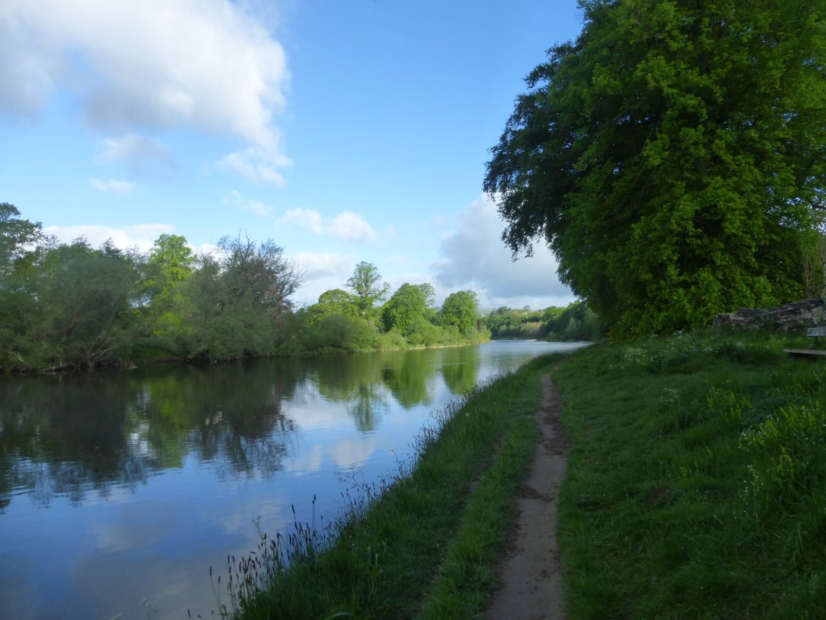
Following the Tweed to Galashiels
Up the Three Bretheren
Sun coming out over the tops
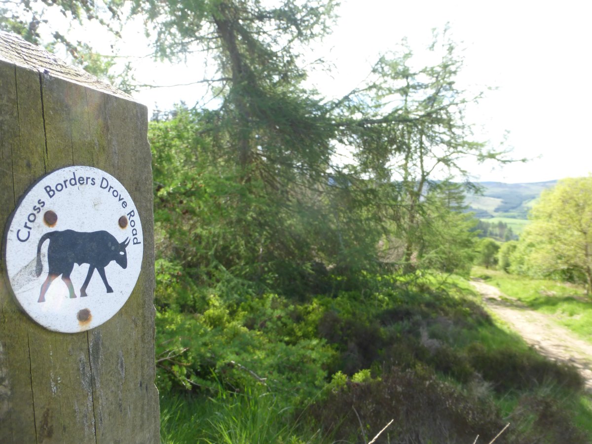
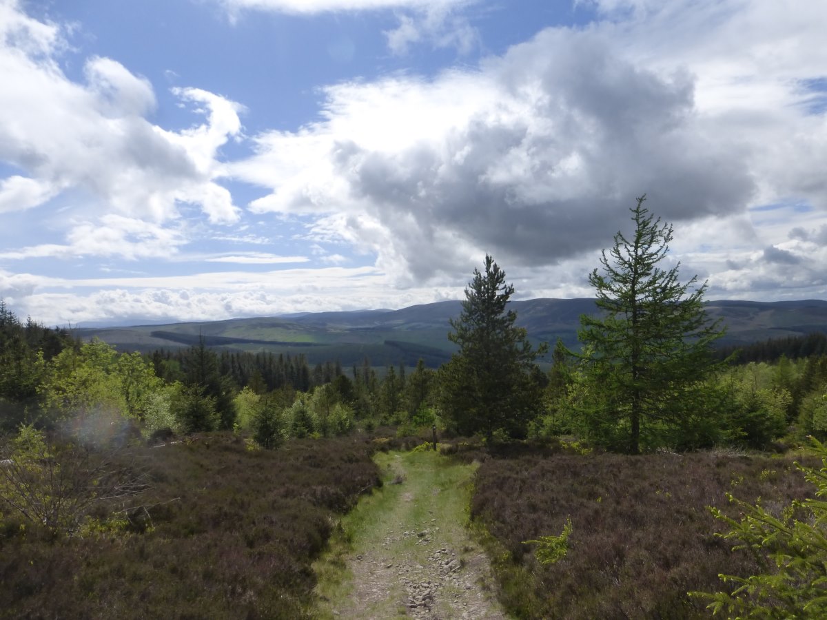
Joining the Cross Borders Drove Road
More up
Peebles
Speed walking to catch Chris and Pete
A fine camp spot
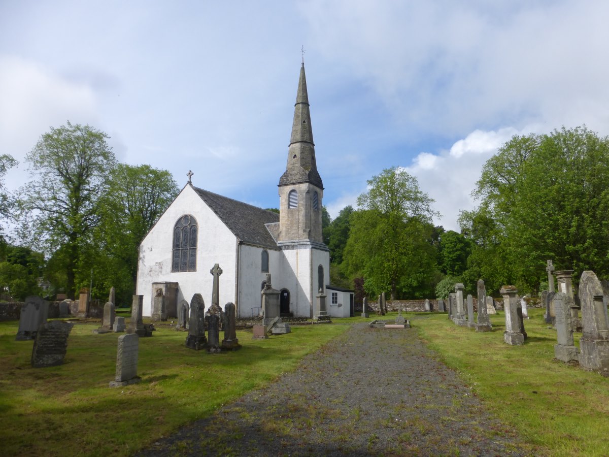
West Linton church
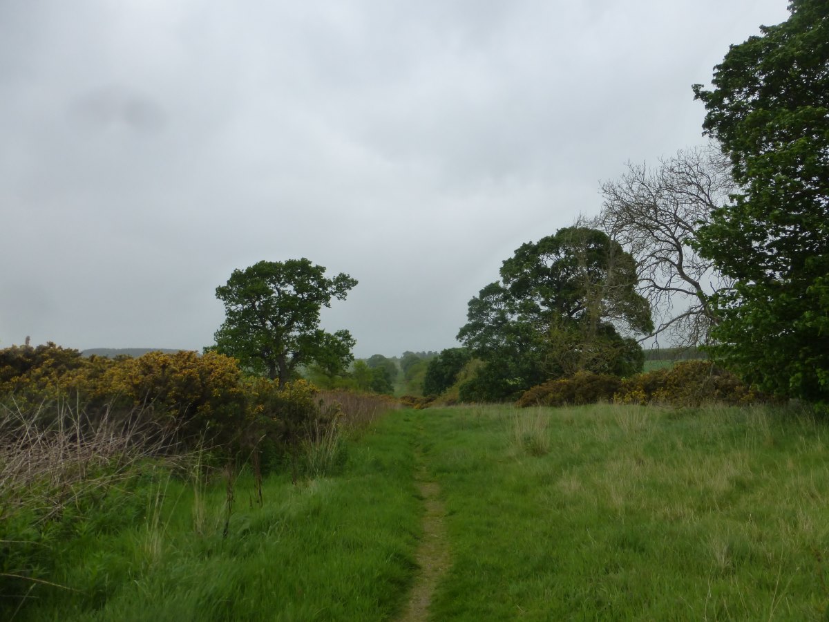
Pentland Hills
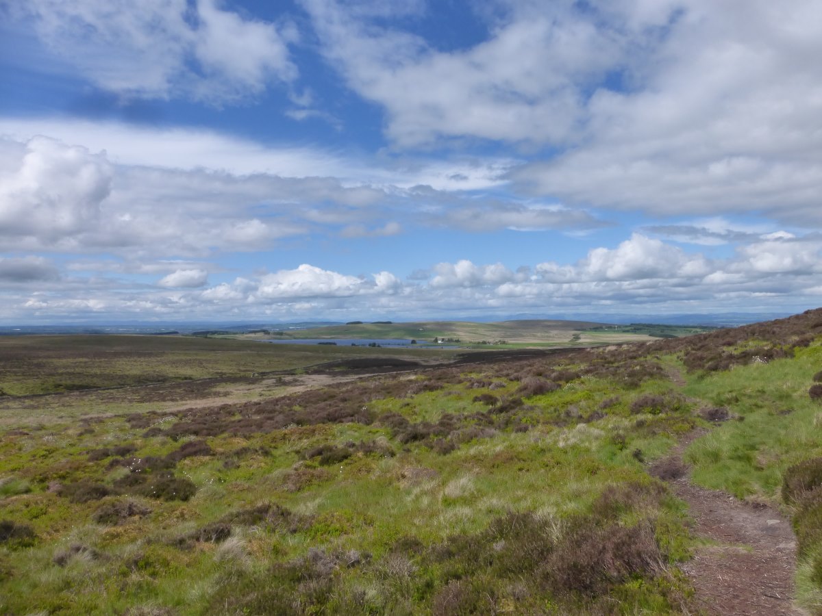
I see mountains ahead (difficult to adequately photograph)
Joining minor roads
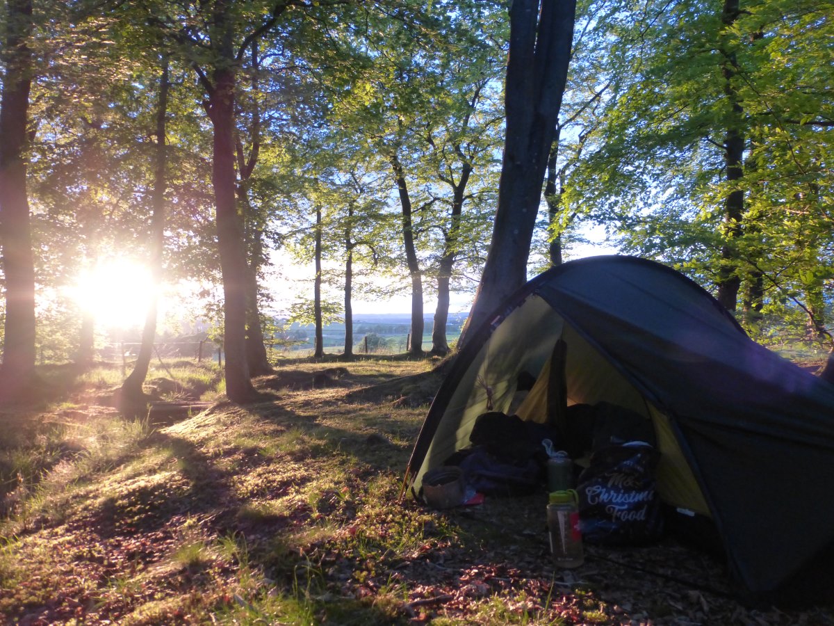
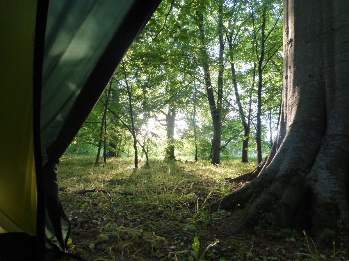
My surprise beech wood camp
Belstane to Kilearn
Union Canal and John Muir Way, 55 miles, 4 days
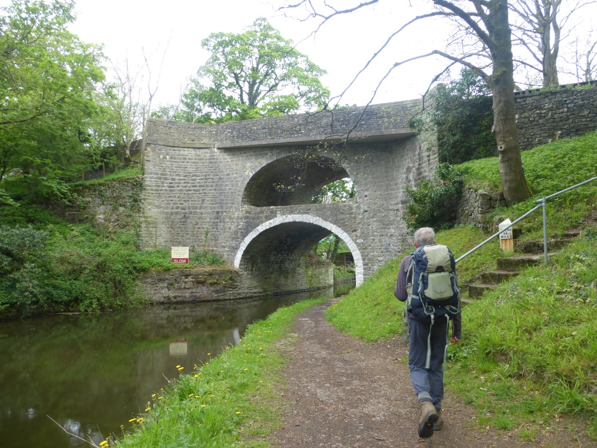
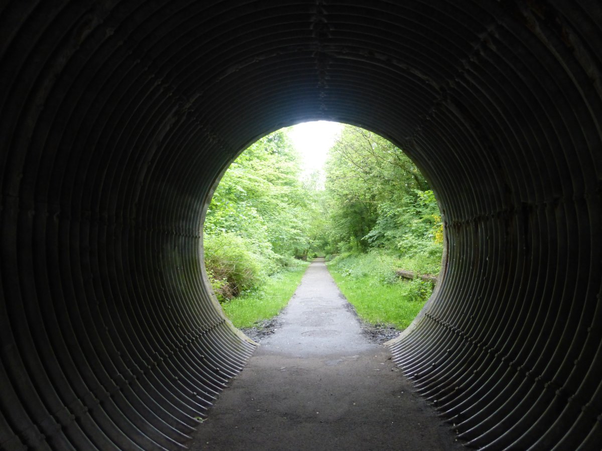
Day 81: a dry and bright morning following a chilly night. The air is perfectly clear and the sky a deep blue with crisp clouds. The world in HD. I set off down the hill, saying goodbye to the big view then pass through Calder woods which are lovely and would have made another great/easy camp. There are even public toilets for fresh water. Then there’s a fair size detour around a big residential development building site which isn’t on the maps yet, and onto the Union Canal. A sign declares 20 miles to the Falkirk Wheel, though thankfully I’m doing less than that today. It’s flat, fairly sunny and very green, though not many boats compared to the canals of the South. I meet Ben, another LEJOG walker who has raised £7000 for Breast Cancer Research and got here in 30-something days. That’s more than twice as fast as me. In fact, I’ve not yet met anyone taking as long as I have to do their end-to-ends. Even though my route is wiggly it’s not that wiggly. I reflect that I’ve had some rest days, that I started slow, but I still can’t help thinking that I could have got here much sooner. Or maybe given myself tendonitis again and not got here at all. I’m spending the night in a posh hotel in Linlithgow where I have a long and luxurious bath then fish and chips by the loch. Wrapped up in my big fluffy hotel towels I go back through the diary and calculate that although this is day 81 since I set off, it’s only day 74 of actual walking. I tell myself I’m being silly but I can’t help it. When we were on the Pennine Way every fellow walker wanted to know how many days you were doing. It was almost like a competition to do it as fast as possible. With end-to-enders the alternative is what day are you on, and how many miles is your route. It’s a double edged competition, to be the person who’s been out for longest, but also to be the person who’s got there fastest. In winning the first, I am by default losing the second. Day 82: it’s raining so I have a long lie in and a full cooked breakfast to see me on my way. I take a quick detour to see Linlithgow castle and the pointy topped church then get back onto the canal and essentially just follow it all day. Lots of green. The sun is shining but it’s cooler and very windy (straight into the face) and I never make it out of the waterproof. Wandering along I pass a sign advertising a town just off the path which warns that if I carry on West it will be a whole hour and a half before I next find anywhere with supplies. Having spent last night delving into my Cape Wrath Trail guide and trying to figure out how to carry 8 days of food without killing myself this makes me laugh. I pass through the Falkirk Tunnel which is excellent, 650m long; cool, dark and drippy. After this it’s a surprisingly long way to the Wheel (which is explainable because the paper map I’m following is so old it’s not actually on it) where I sit for a while and watch the boats go round. A good excuse to have a rest. In contrast to the southern canals this whole tow path is tarmac and it’s wearing on my feet. My bag is also slipping down and causing sore shoulders though having walked about 1000 miles I’m bewildered as to what has changed to suddenly cause this. Back on the canal I realise that, with the wheel being further West than I thought, I’ve missed my turn off to the Antonine Wall (where I was thinking to camp). I don’t fancy the retreat so keep going, thinking I’ll find something somewhere. I pass one flat area under a tree beside the path but it is littered with beer cans and burnt rubbish. I carry on. Then keep carrying on. There is nothing particularly promising on the map. I take every side path, nose into every bush. I find in situations like these my standards basically just get lower and lower until I meet something that becomes acceptable; a 2pm camp spot must be utter perfection; by 7pm I’ll be quite happy in a ditch. Eventually I strike gold in the form of a tiny tunnel running beneath the canal and main road and straight into a beautiful flat woodland on the opposite side. There are some lumps which are remains of the Antonine Wall, bluebells, two roe deer and a stream. Spot on. Day 83: according to the very rough plan I have on an excel sheet I’m due to be reaching Cape Wrath in exactly one month’s time. Three quarters done, just the hard part left to go! I get a late start. Everything had been laid out ready for breakfast in bed but an enormous leopard slug has crawled into the pan overnight and there is slime everywhere. Humph. Back on the tow path there are scattered rain showers, sunny spells, cygnets, greenery, lots of teenage ducklings. I meet yet another JOGLE walker (if you ever want to meet an end-to-ender in action I’ve decided the Union canal is the best place for it because everyone walking along it with backpacking gear is linking routes) and we stop on a bench and swap snacks and chat. Comparing routes I show him the map on this website and he comments he’s seen it before in his pre-walk research. Err, come again? OK so I know this site is on the internet and officially viewable to anyone, and that part of my reason for making it was to help other people plan their routes, but it never ever occurred to me that I would actually meet a complete stranger who has read it. My mind is blown. Onwards, I take a brief diversion off the canal to follow the John Muir way up to the Antonine Wall. There’s a section of fairly obvious ditch but that’s about it which explains why I’ve never heard of it before researching this route. Still, it’s nice to be up a bit with a view, even if it does include a rather large rain cloud which is about to blot out everything. Full waterproofs on I think about going and hiding in a pub for dinner but I do a shop trip first and find nice things for dinner including the same packet of curried chickpeas that I had on my very first wild camp night back in Cornwall (though this time I add a full helping of rice too). Food sourced I wave goodbye to the canal, though the next section is an ex-railway cycle path that runs along a river so not much actual change. It does have a signpost though declaring 10 miles to the West Highland Way! I camp right next to the path in a little dip behind a tree. People don’t see things they don’t expect to see and no heads turn in my direction all evening. Days 84: a dry and bright day but cold and windy enough that I never make it out of the synthetic jacket. More railway path with small hills appearing to the right. Woodlands. Up a hill to a bench with a view of mountains just around the corner. I have a quick lunch then drop down the other side and onto the West Highland Way. It’s a track exactly like the one I just stepped off but it has a new signpost and suddenly I’m in a different world surrounded by other backpackers. I meet Louise who is just starting solo as her first long distance walk and we walk together for a few miles. It catches me out a little but I think she is the first other woman I’ve met walking solo. Plenty of women in pairs or couples and plenty of solo men, but I genuinely can’t think of any other women I’ve seen walking alone. Eventually I turn away off the path and head up to Kilearn where I have a dinner date with Rose. We enjoy a good catch up and possibly the best fish and chips of the walk so far. Then it’s back down the hill and into a wood where I find a good flat spot almost straight away which is lucky because I’m so full I can hardly walk. Time for bed on my last night in the lowlands. Tomorrow the mountains await.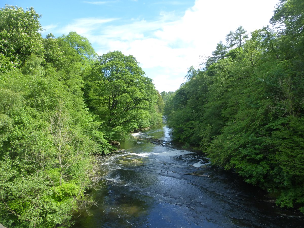
View from the Almondell Bridge
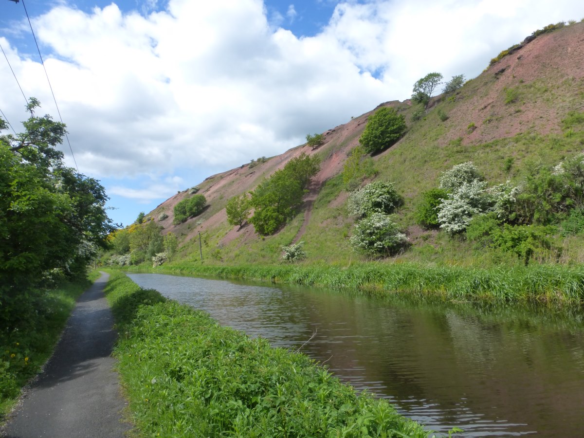
Union Canal
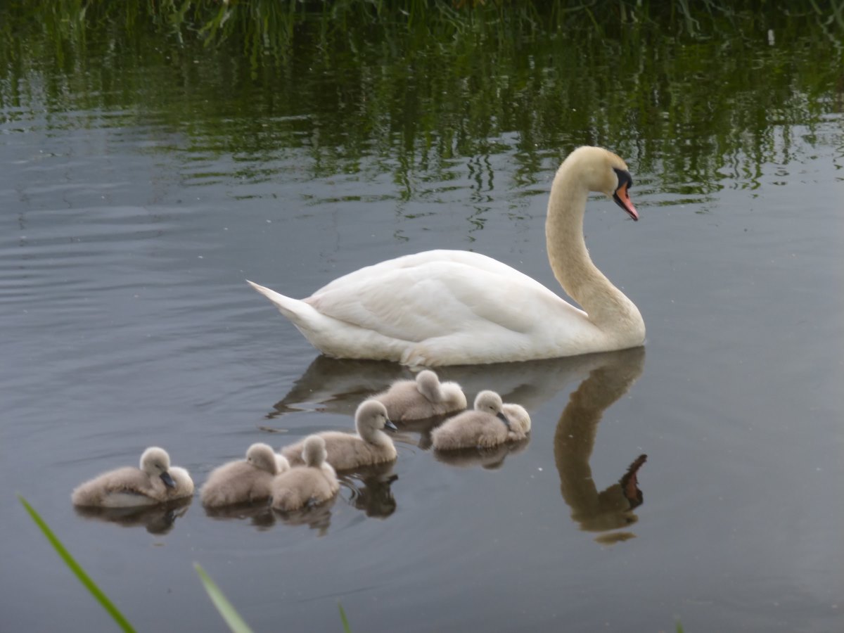
Cygnets
Linlithgow's Pointy Church (aka St Michael's)
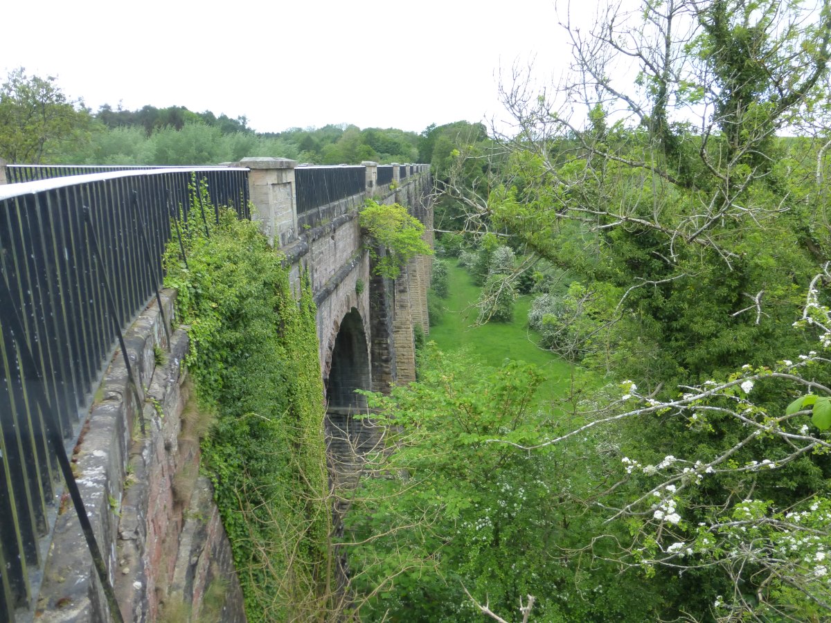
Avon Aqueduct
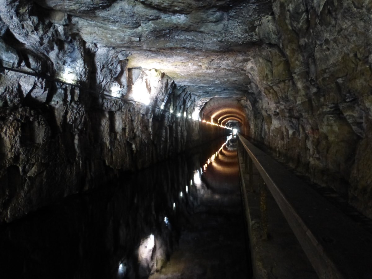
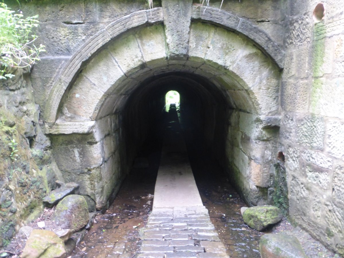
Falkirk Tunnel
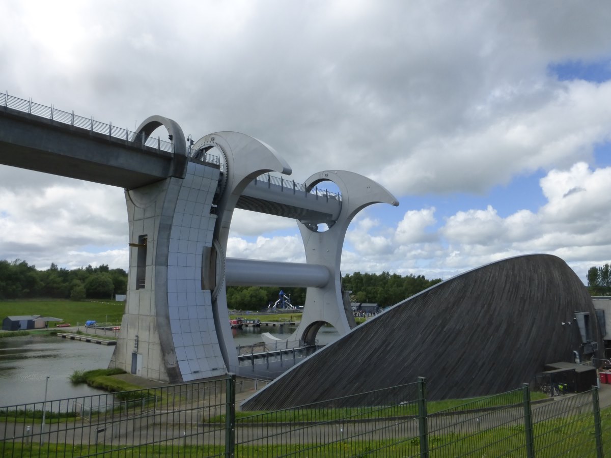
Falkirk Wheel
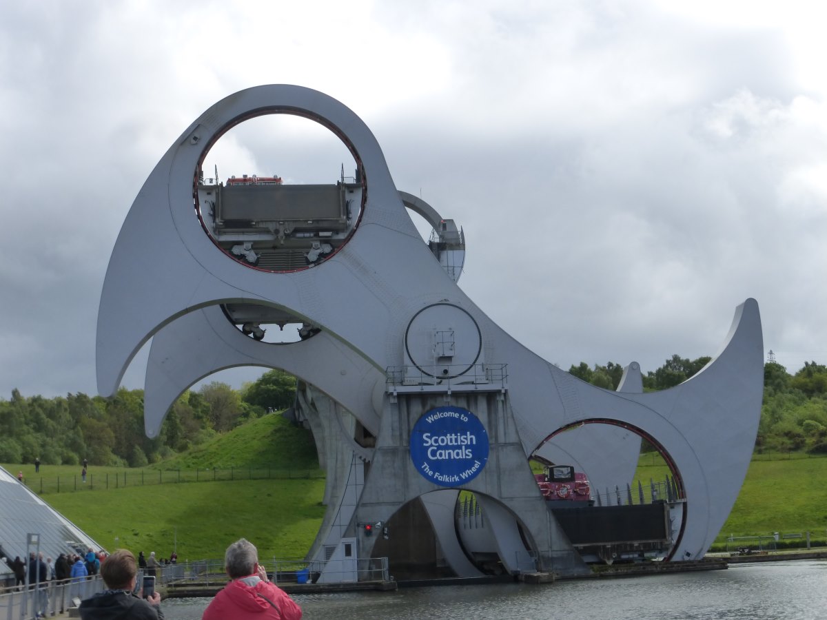
Watching the boats go round
My secret tunnel to a perfect camp spot
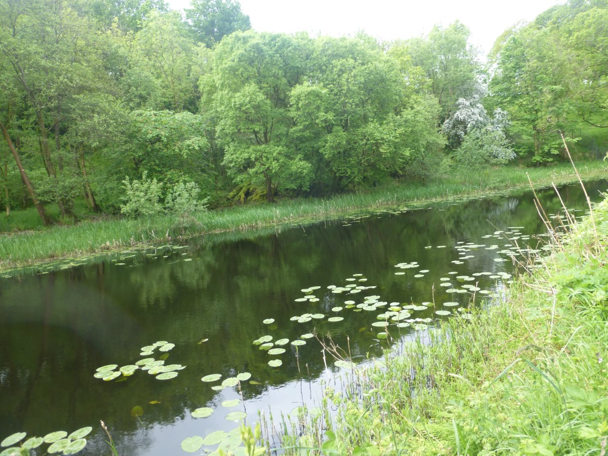
Union Canal
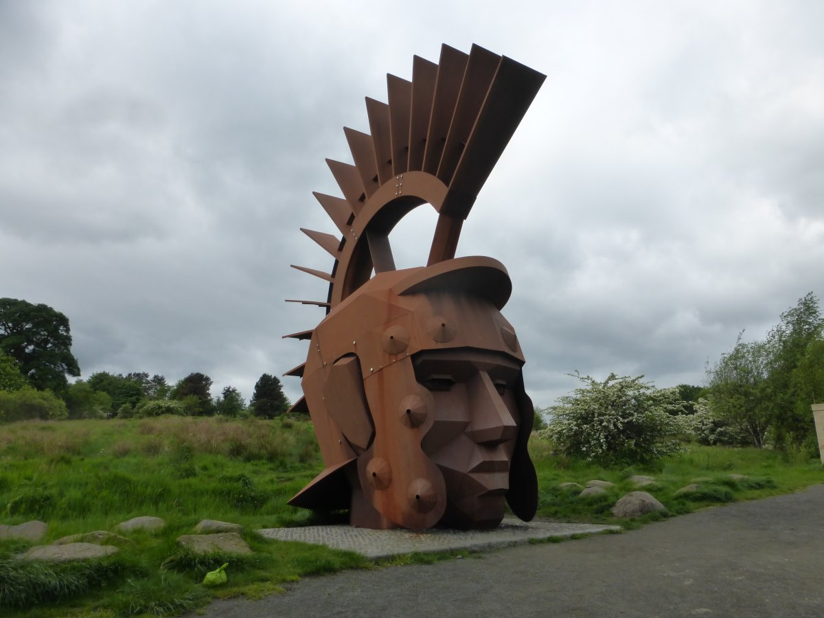
A Roman soldier standing(?) guard
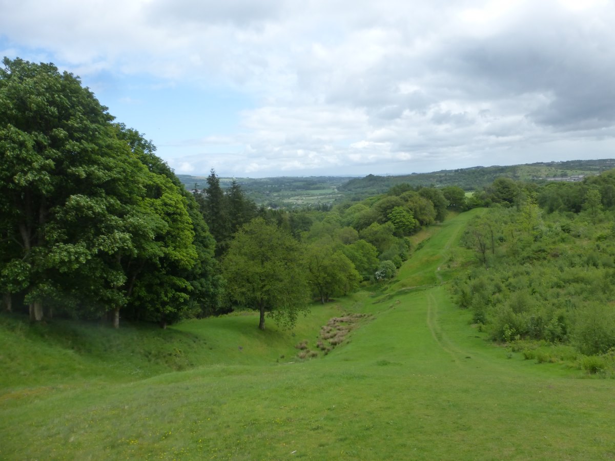
The Antonine Wall
A perfectly invisible camp site
Railway tunnel
Mountains appearing
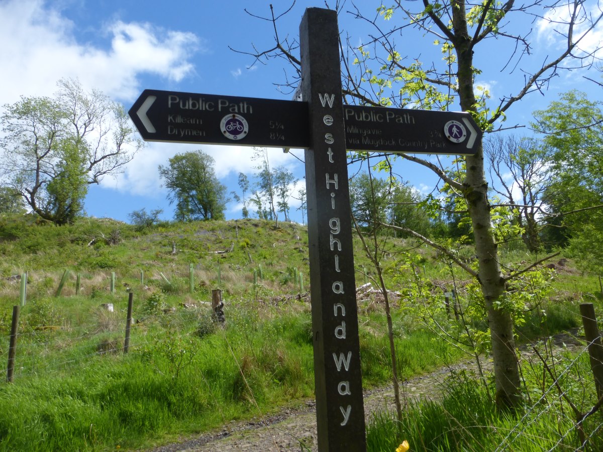
Joining the West Highland Way