Land's End to Cape Wrath
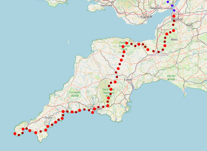
Part 1: Land's End to Bristol
March 2022
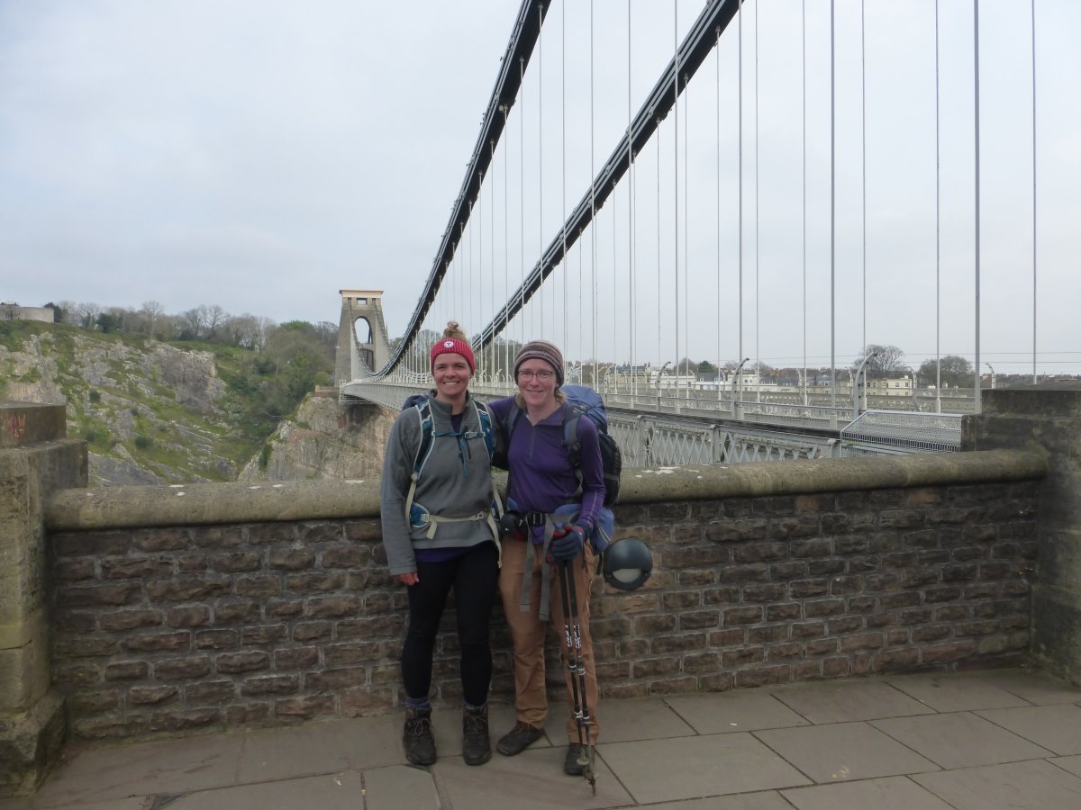
This is the first part of my End to End journey, telling of the early days when daylight hours were short and I was still breaking in my first pair of boots (oh so long ago!). I set off South from Land’s End and followed a stunning section of the South West Coast Path as far as Plymouth and then turned North across the hills on the Two Moors Way. After this it got a bit more improvised and I crossed the Quantock Hills on the Macmillan Way West before cutting through Somerset to Cheddar Gorge and the Mendips, finally arriving into Bristol on the Monarch’s Way. End to End Home Page | Onwards to Part 2 >>
Land’s End to Falmouth
SW Coast Path, 49.5 miles, 5 days
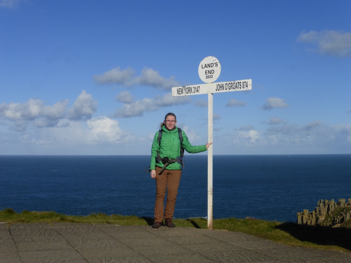
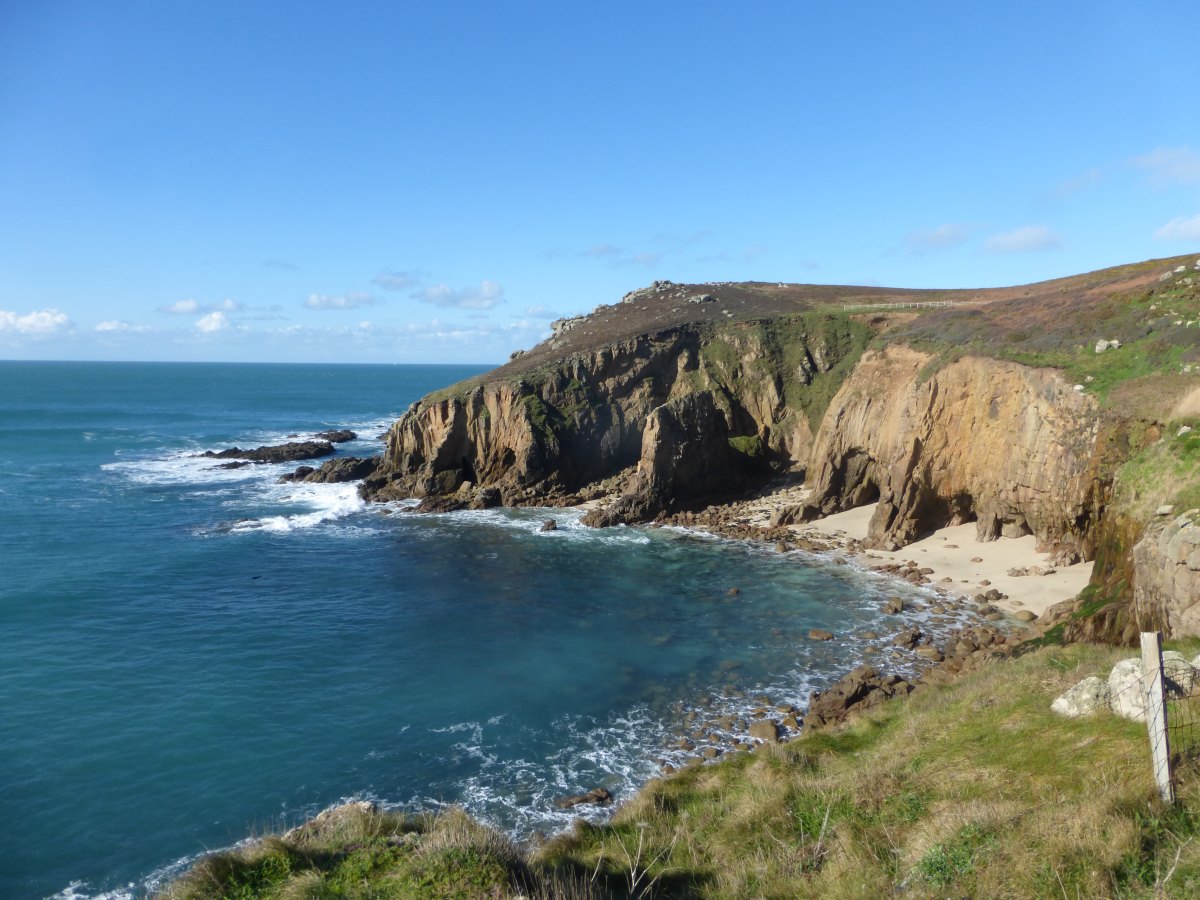
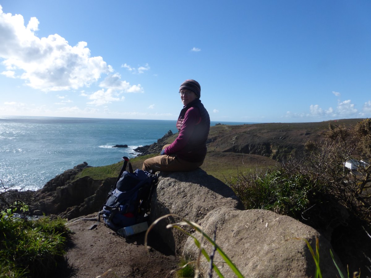
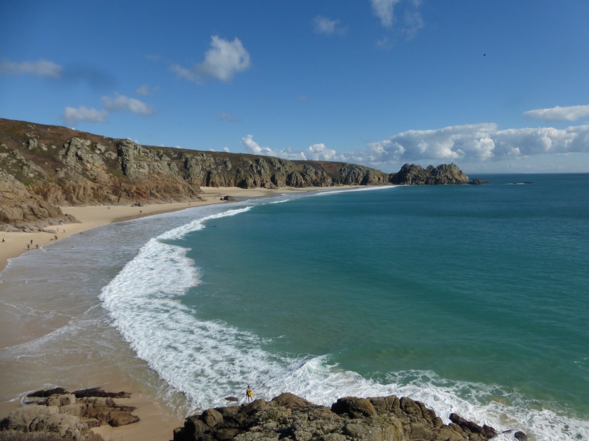
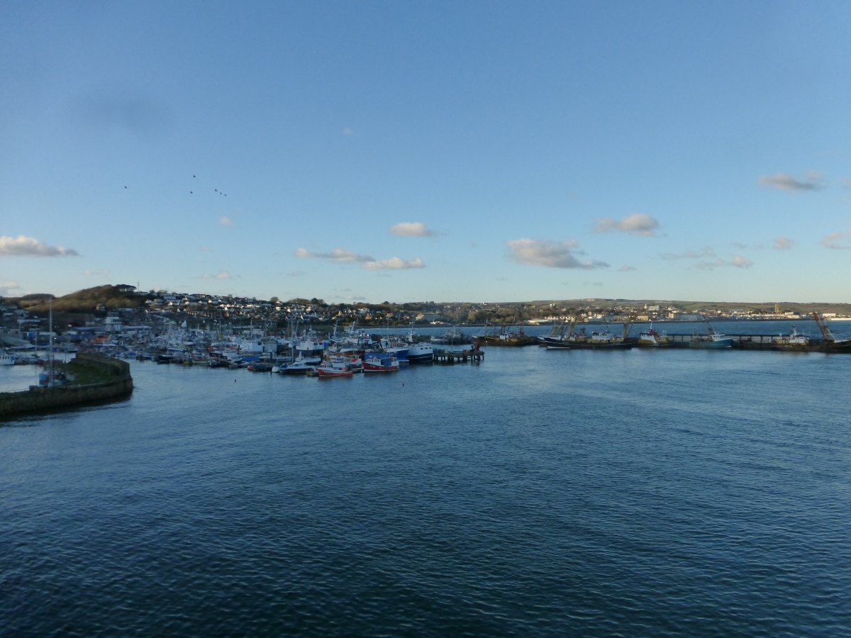
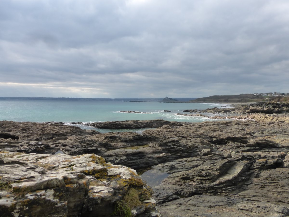
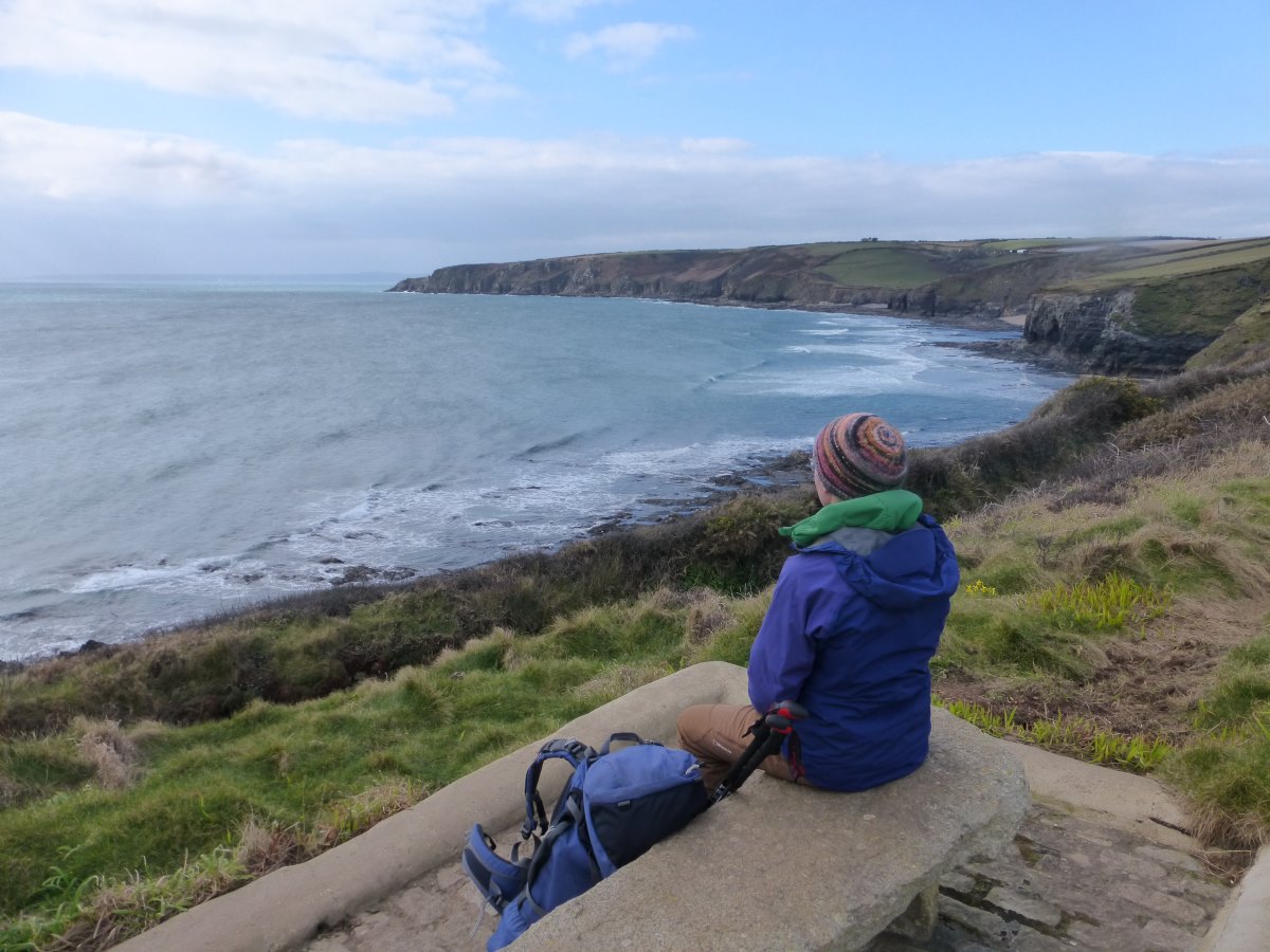
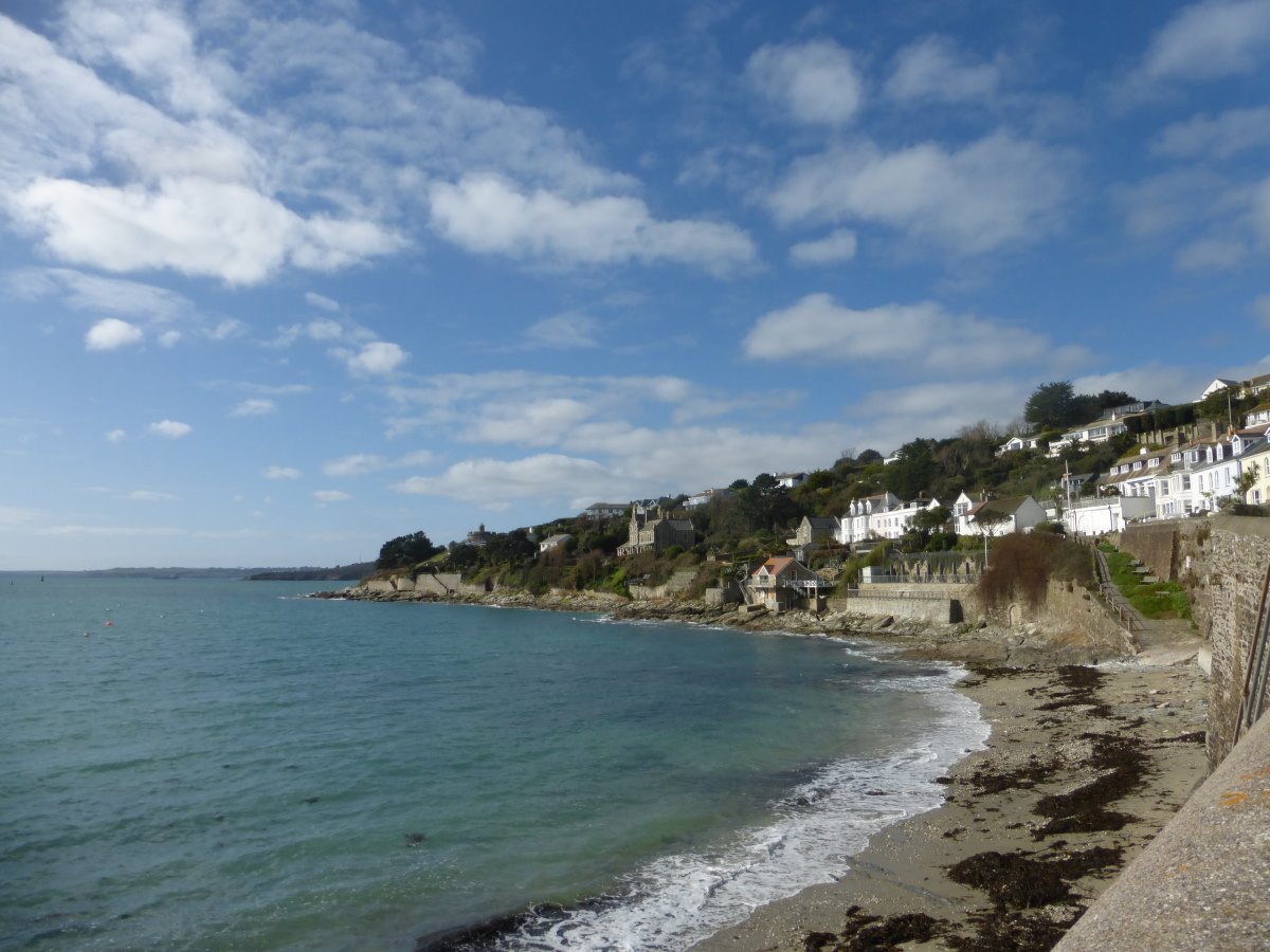
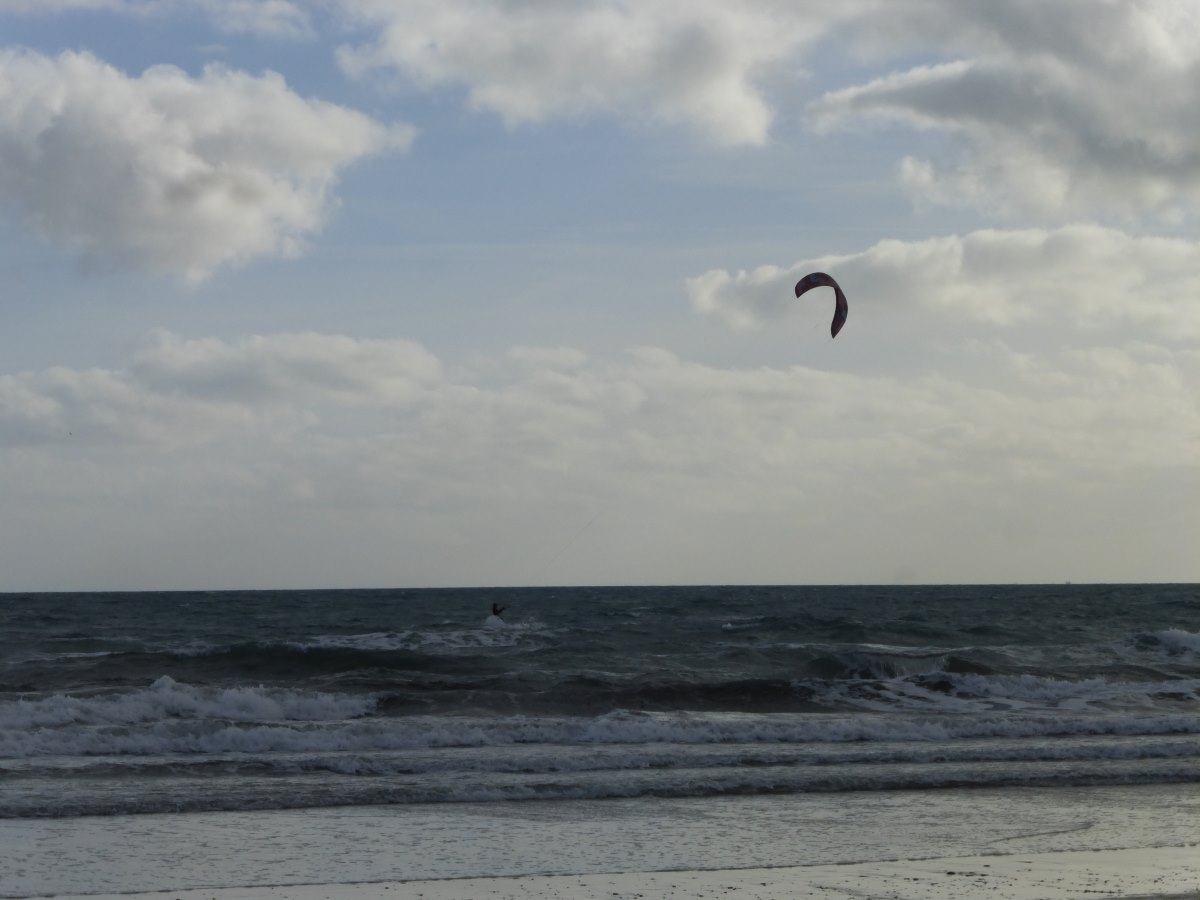
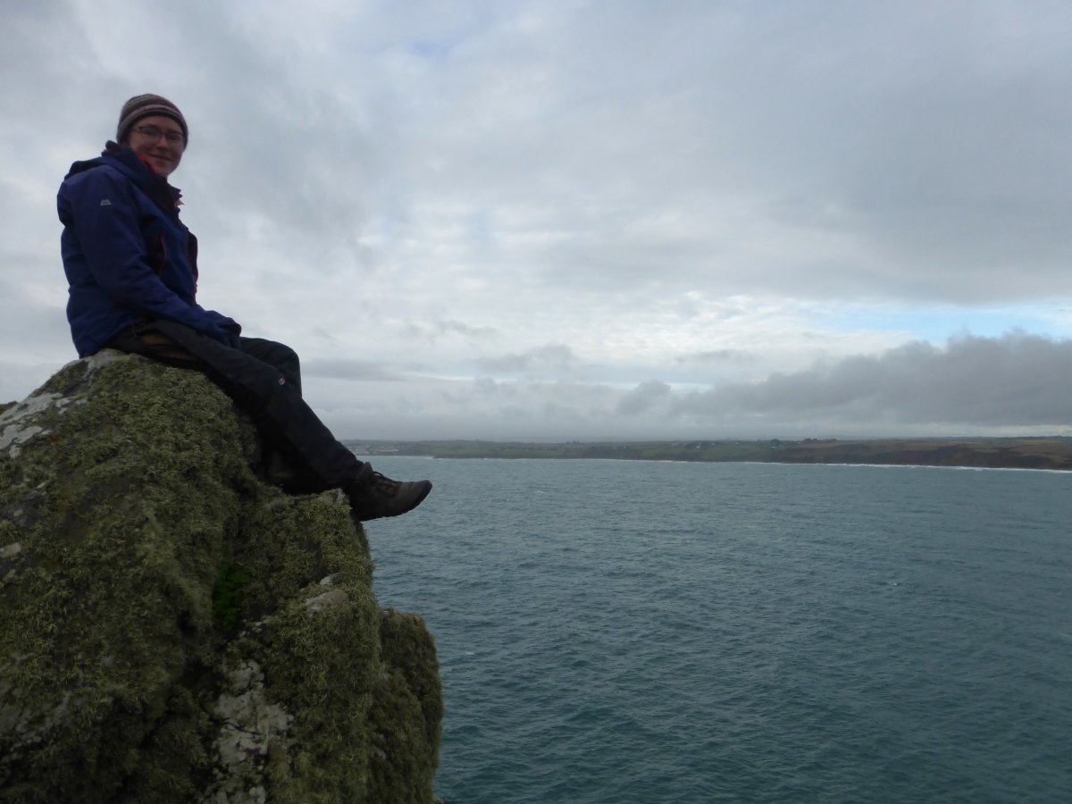
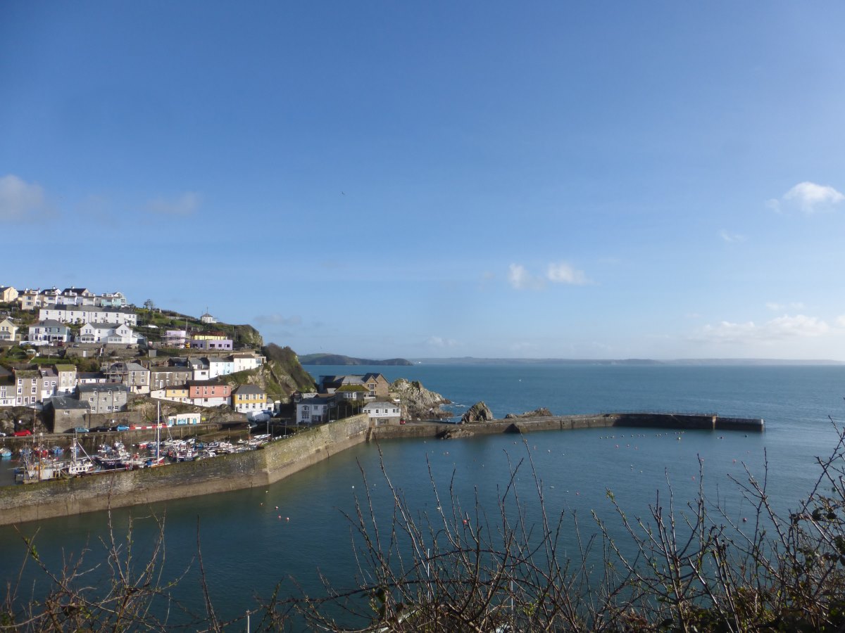
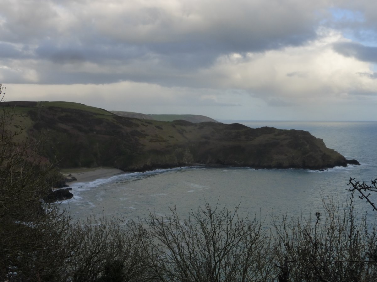
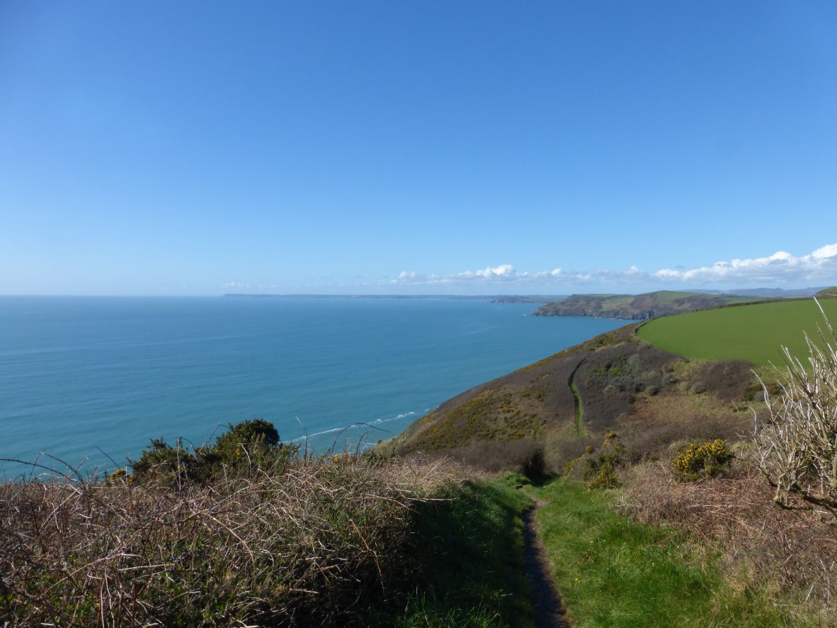
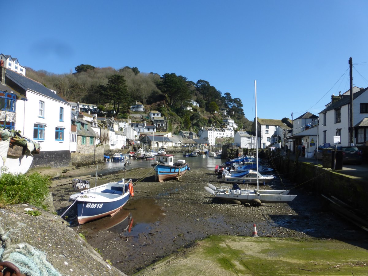
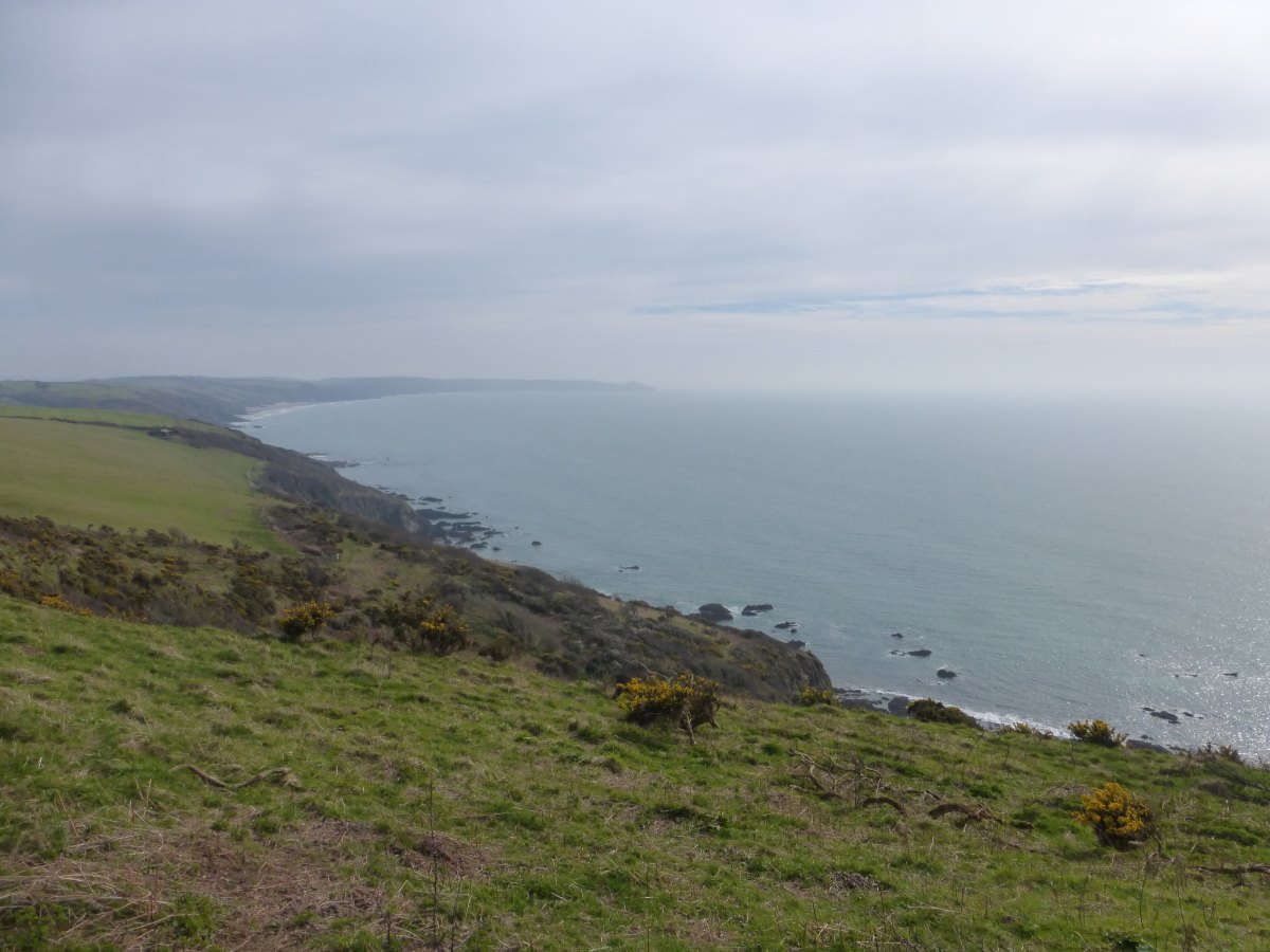
Day 1: It’s an earlyish start from Penzance youth hostel to catch the 08:30 bus to Land’s End. I leave the tent up (and all the heavy stuff in it), committing myself to a 16.5 mile first day on a fairly rough path, but with a beautifully light rucksack. It’s gloriously sunny, even a bit warm. Photo with the sign post then off! No great fanfares. No-one else around that realises the significance of this moment (and with my suspiciously light bag who can blame them). Just me, a few steps, minutes, hours, miles. It begins. And what a beautiful day for it. It’s sunny. Actually slightly warm. The coast is stunning, the daffodils coming out, seals bobbing in every bay, coughs on the headlands, the smell of coconut rising from the gorse, the horizon so crisp and clear I can see all the way to the Scilly Isles. I break out the suncream and the sunhat and kick off the boots to walk the length of Porthcurno beach at low tide (luckily you can get up the other end but it is a bit of a scramble). It’s all rather enjoyable, and very different to this time two years ago! In the end I decide that 12 miles was probably about right for day 1. The last few are tough and by the time I join the roads through Mousehole and Newlyn my feet are feeling distinctly like someone has spent the day repeatedly bashing them with a small mallet. Thankfully there is a hostel sofa to collapse onto at the end. Day 2: Feeling more serious today with a rucksack full of stuff and the forecast changing for the worse. The first challenge of the day is to eat an entire tray of pineapple (I was supposed to have half yesterday but forgot) and, on failing in that, to devise some way of carrying it without filling my bag with juice. Walking wise it’s basically a grand tour of St Michael’s Mount. In endeavouring to avoid injuries I’ve set myself a maximum average of 11 miles per day for the first couple of weeks and having gone well over that yesterday the theme of today is sitting about enjoying the view, trying not to get too cold and eating yet more pineapple. There’s lots of walking on the beach though yesterday’s beautiful white sand has been replaced by a lot of pebbles. Soles of the feet doing ok but towards the end of the day a bruise starts to develop along the top of the boot. I loosen the laces and hope for a miracle overnight recovery. My first wild camp spot is found; just off the path, and with its own private beach. It’s still very early though so I put on all my warm layers and an audio book and watch the waves and a very early sunset. Day 3: When you are faced with 12 hours a day of absolute darkness (i.e. not including dawn and dusk) you soon realise there is only so much sleeping you can actually do. At 5am I reach that maximum and it’s a couple of hours of audio books before it becomes light enough to get up. The wind has picked up overnight and is now blowing due easterly (i.e. straight into the face). Today’s don’t-walk-too-far strategy is to keep on all my warm layers and stop for a rest whenever I get too hot. Sadly it’s not very often. There are some very dramatic old mine workings as I pass Trewavas Head and some beautifully remote sections away from fields and houses. My feet are suffering though, and today I work out why. On walking along a coastal path you always have the sea on the same side (in this case the right) and therefore the land generally will slope slightly downhill in that direction. Hence the very painful swellings that are developing on my right inner ankle and left outer ankle. Walking backwards relieves this but is impractical. Thankfully on reaching Porth Leven I find a food-all-day pub that does me a 3pm fish and chips (is that lunch or dinner?) and gives me an opportunity to hide away in the warm. I emerge a few hours later intending to pop just round the corner and camp in the woods around the Loe but am thwarted as it is closed for felling (controlling phytophra) and it’s a fairly long walk all the way around the other side before I finally find an excellent and sheltered spot hidden away in the trees. Day 4: a mini coast to coast. The coast path at this point turns South around the Lizard. It is one of the most stunning and remote sections of the whole way and, having walked most of it previously, I would absolutely recommend the extra miles. Unfortunately the passenger ferry at the end to cross the Helford river doesn’t run in the winter and the detour around this basically takes you most of the way back to the Loe. So I wave a temporary goodbye to the coast and carry on inland through the woods to Helston. It’s a bit of a jarring return to civilisation with lots of traffic and two fighter jets taking off right over my head. I escape onto small lanes and a footpath through to Gweek where there’s a lovely café in the boatyard with a wood fire and a cooked breakfast and the rain starting to fall outside. I find a temporary fix to my ankle problems by stuffing dishcloths into the tops of the boots to keep the edges away. Back outside it’s more little lanes and not much traffic through to Porth Navern. The rain cumulates in one torrential downpour where I hide under a tree in full waterproofs and still get slightly soggy but that seems to be all of it over in one go and on rejoining the coast path the sun comes out for a lovely clear section towards Rosemullion Head. I find a nice flat wooded camp spot and spend the last few hours of daylight having dinner up on the headland and watching the sun set. Day 5: a short one into Falmouth for a pre-booked night in a B&B (part of forcing myself to go slowly). Luckily having booked this before I set off it turns out I’ve picked a day with a fairly serious storm and, making it to Falmouth for 11am in a howling gale and the beginnings of a lot of rain, I’m able to hide away from the rest of it by spending the day wandering around the Maritime Museum and the night in a warm bed.
Land's End
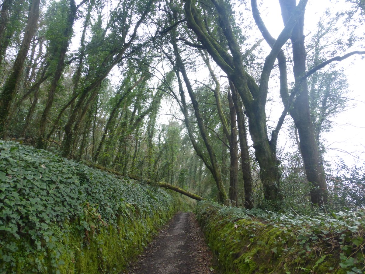
Coast Path
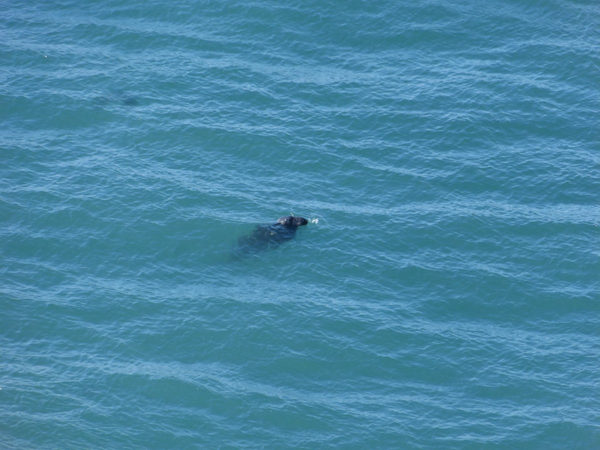
Seals in every bay
Coast path
Porthcurno beach
Penzance
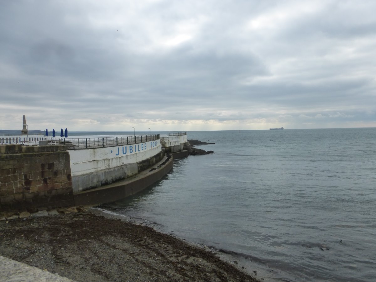
Outdoor swimming pool
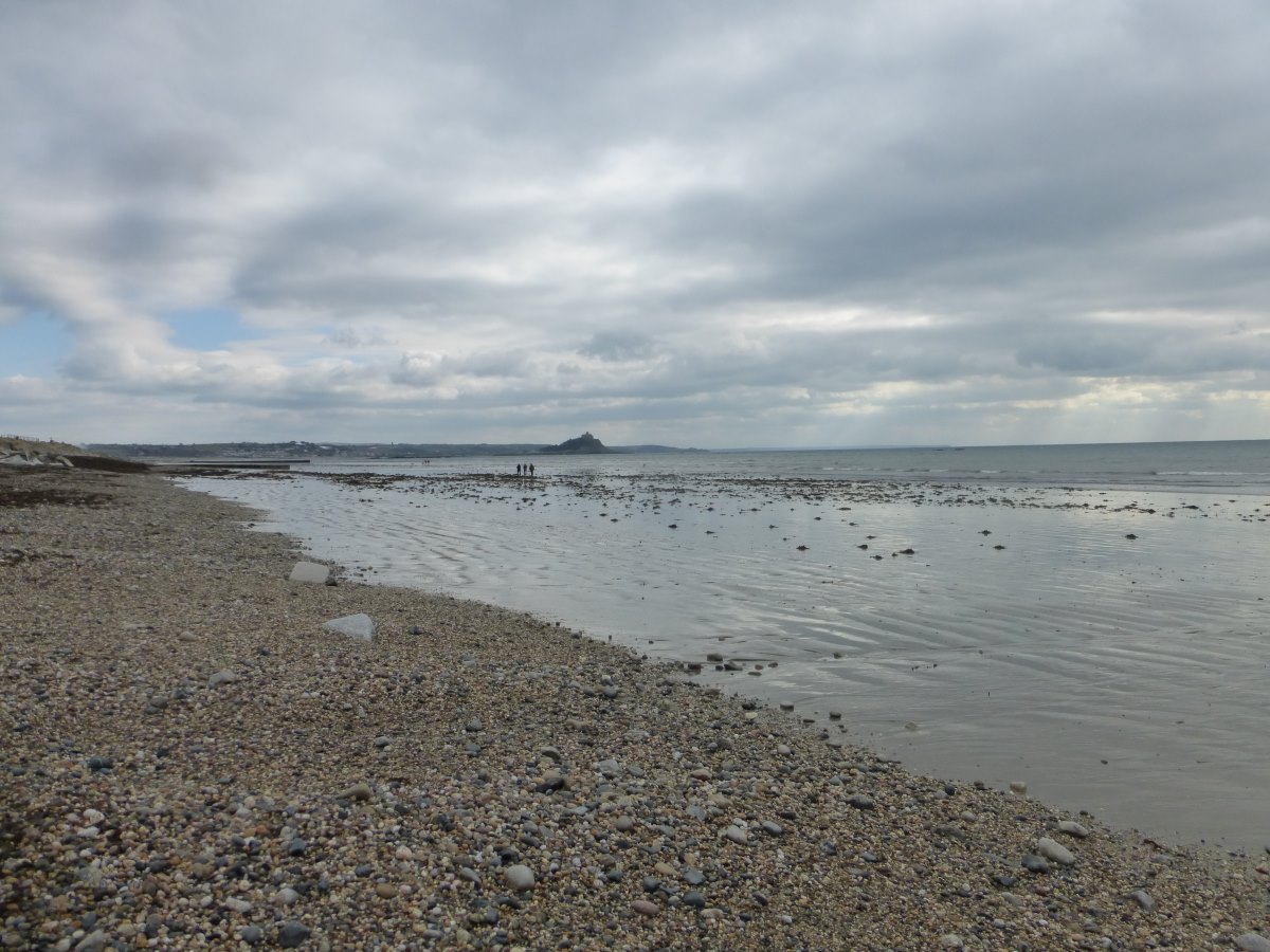
Towards St Micheal's Mount
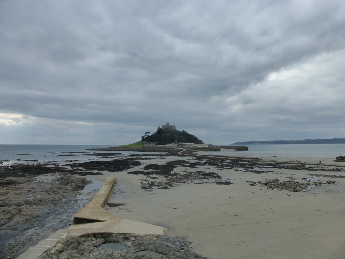
St Micheal's Mount
Time for dinner and audiobooks
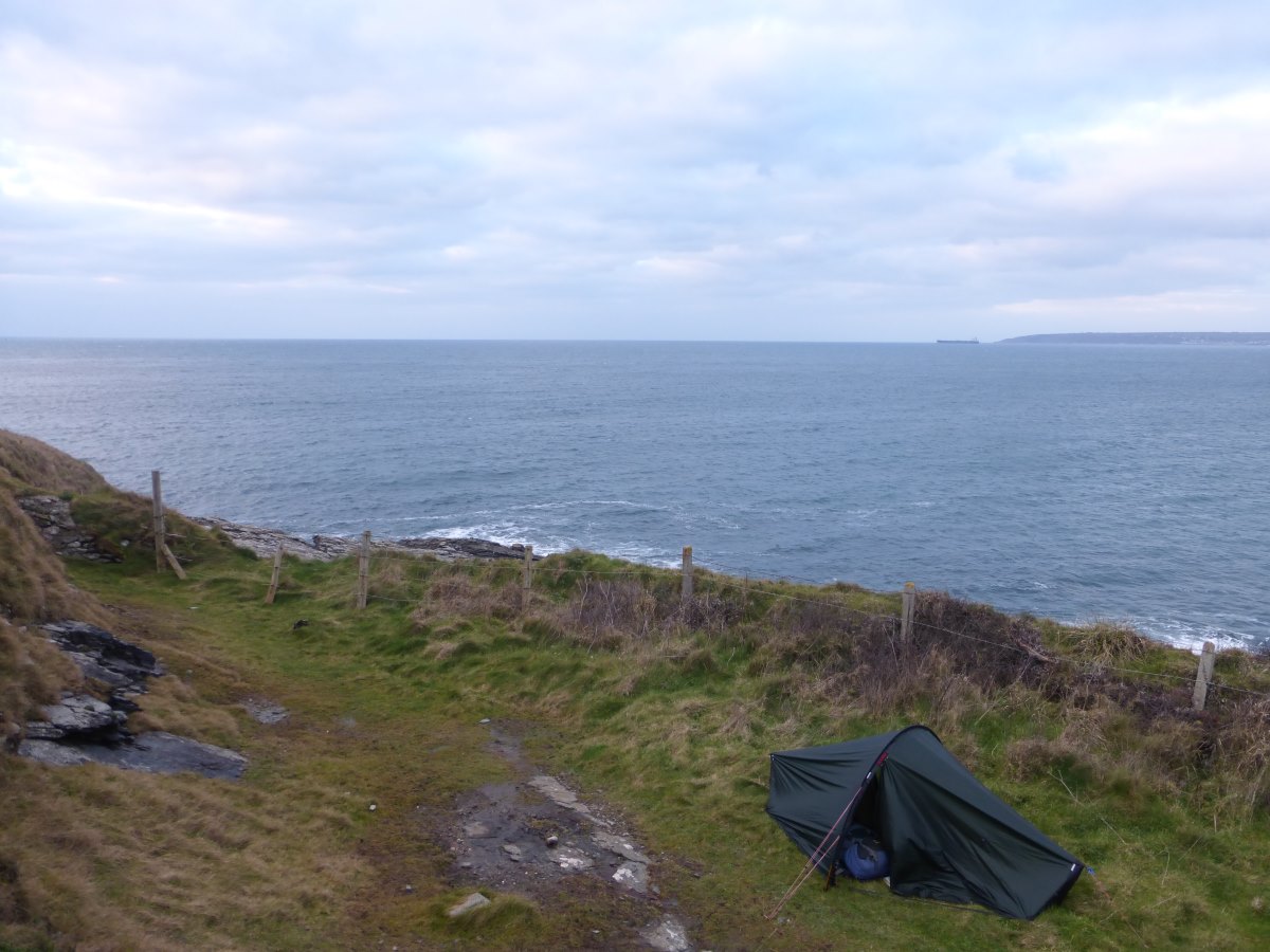
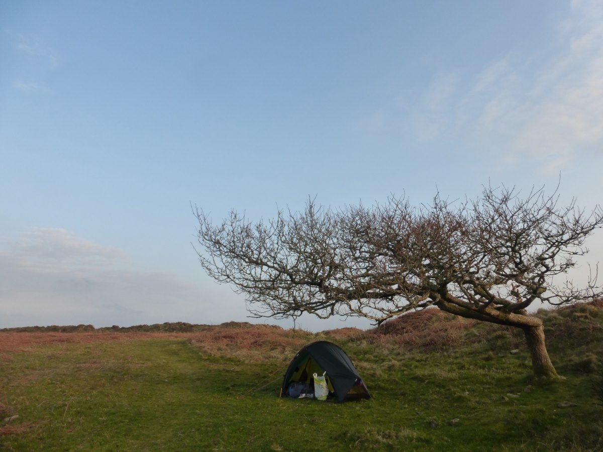
My first wild camp
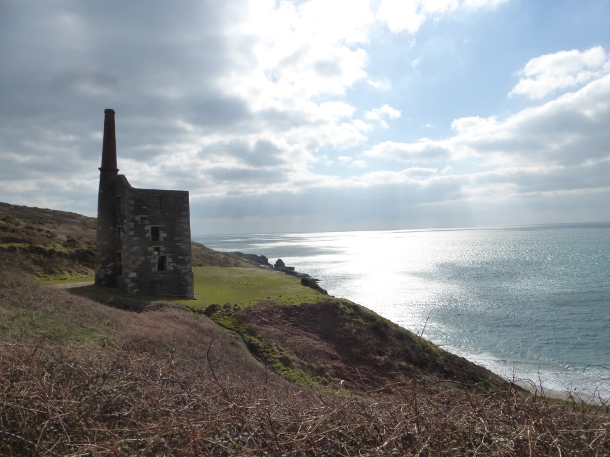
Trewavas Head mines
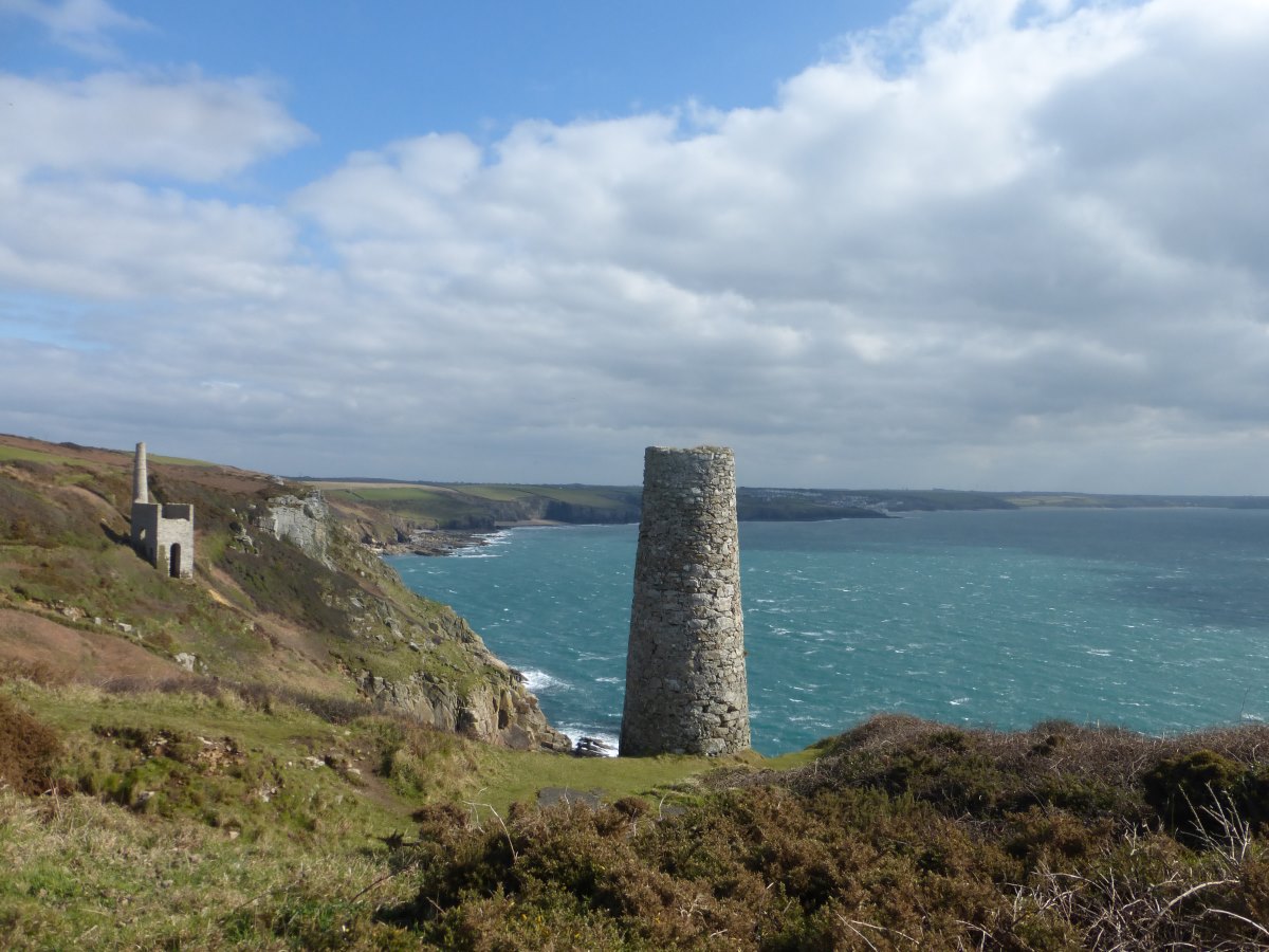
Trewavas Head mines
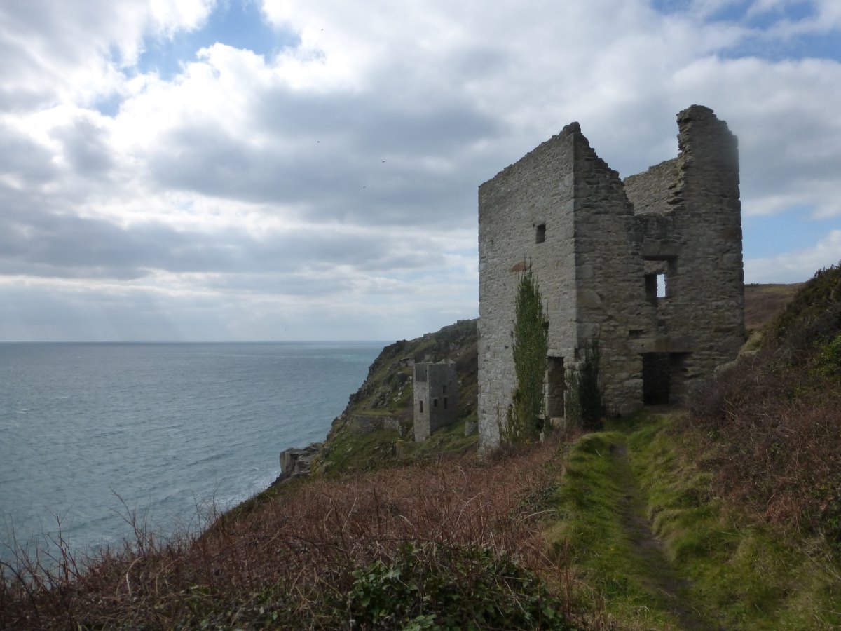
Trewavas Head mines
A welcome rest
Porth Leven
Camping in the Looe
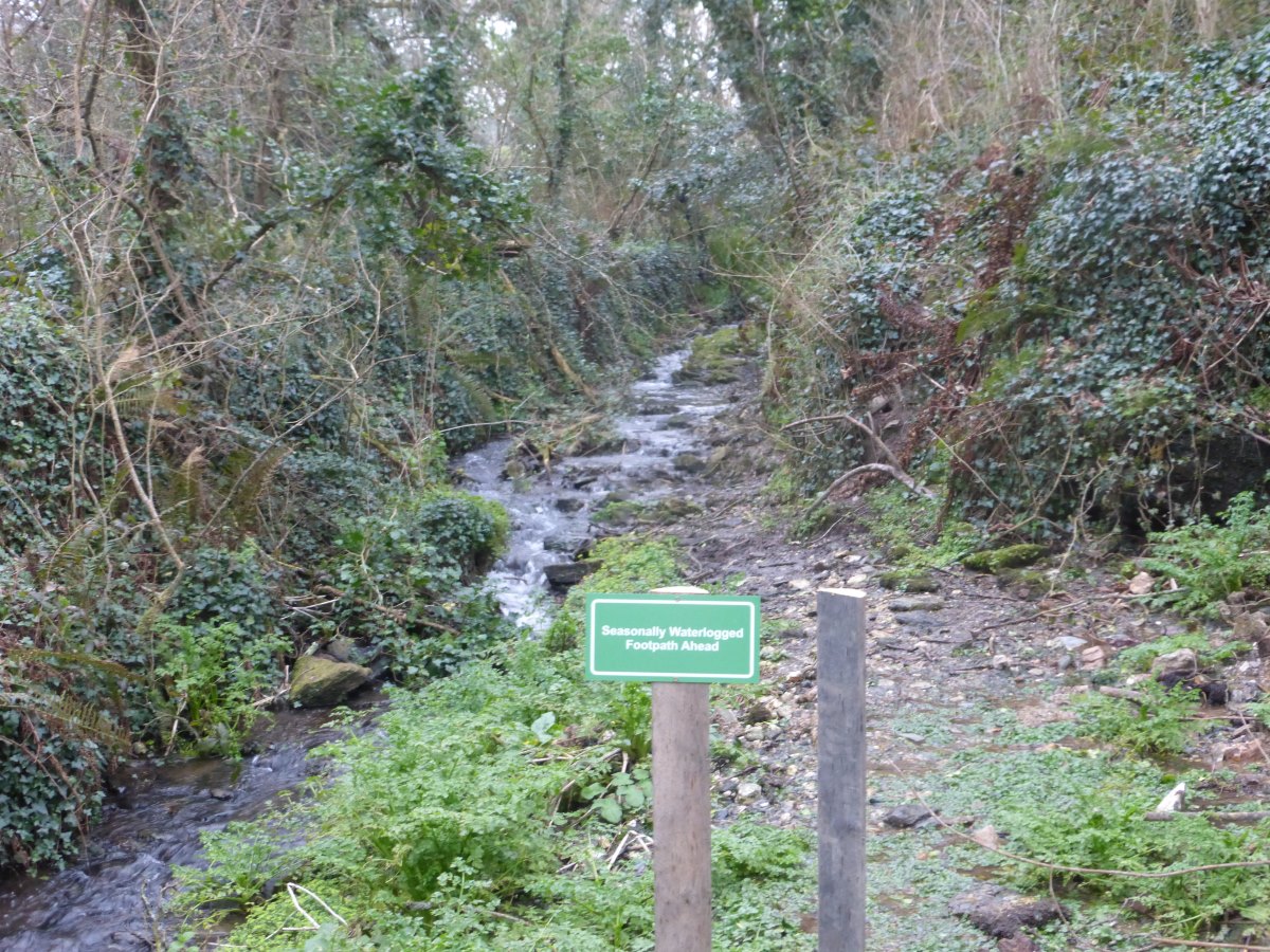
Seasonally waterlogged footpath
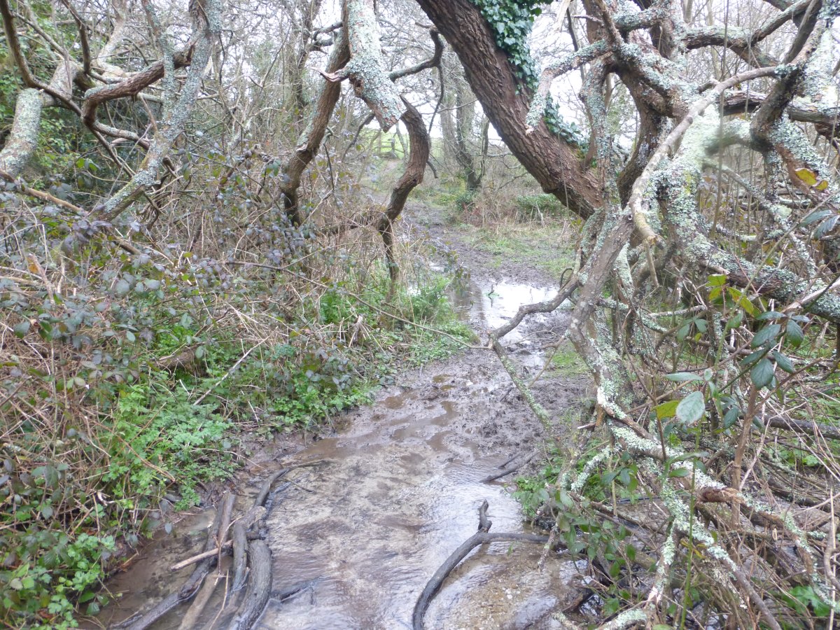
Mud
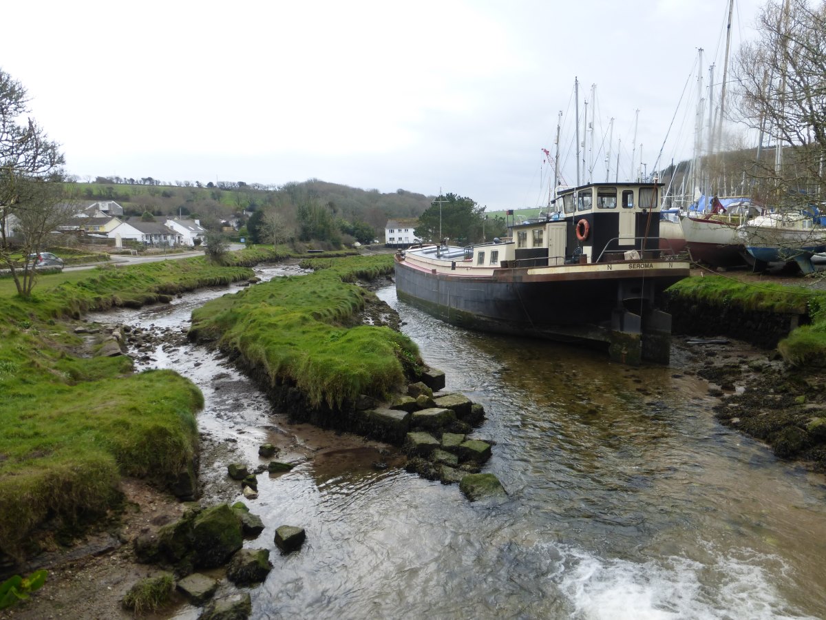
Gweek
Back to the coast
Sunset from Rosemullion Head
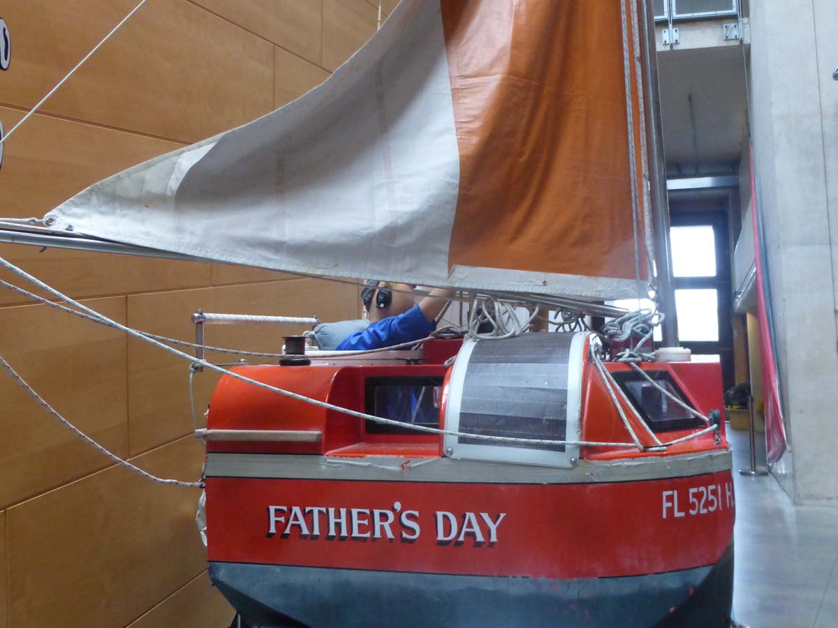
The smallest boat to sail the Atlantic
Falmouth to St Austell
SW Coast Path, 30 miles, 3 days
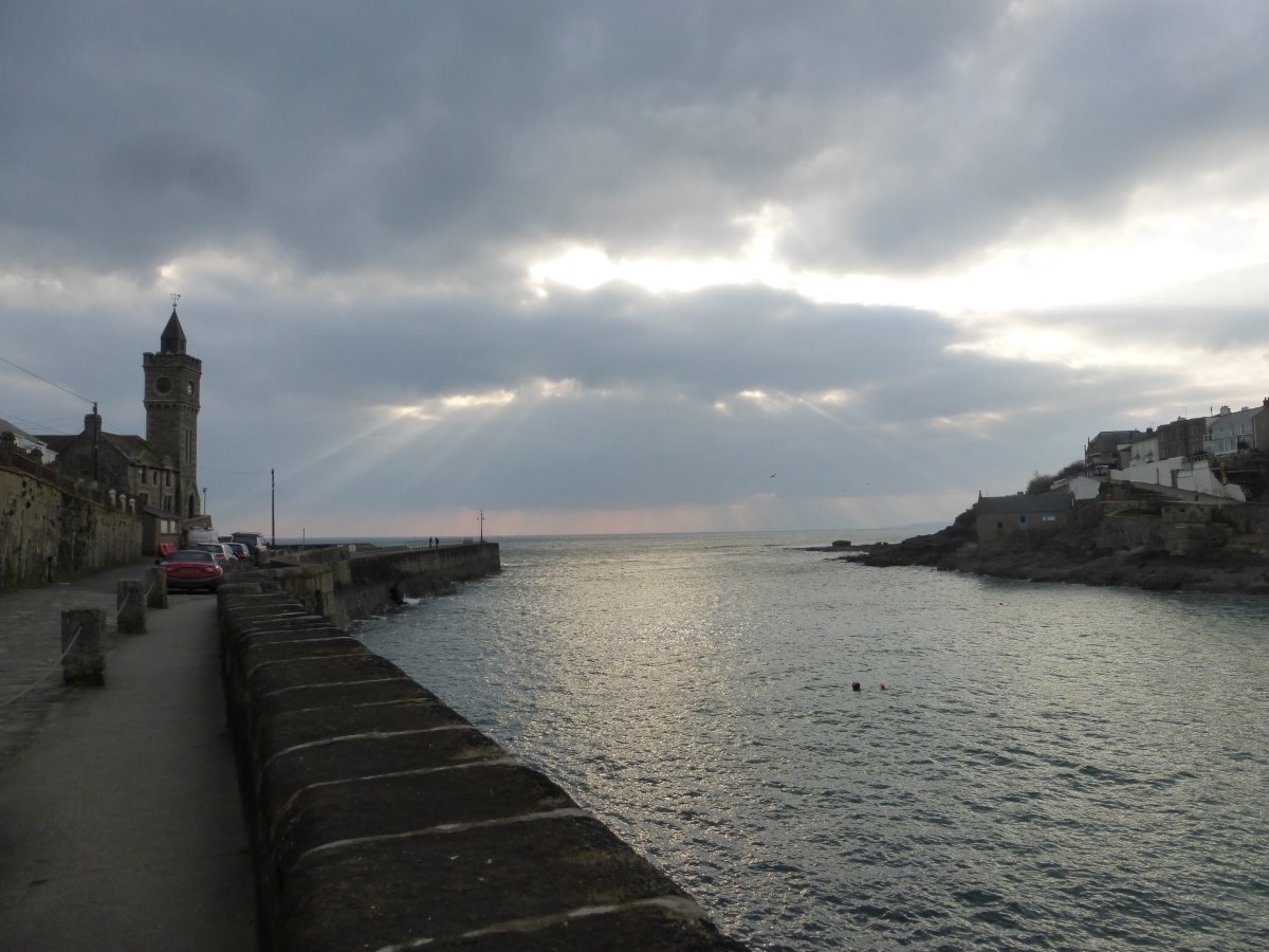
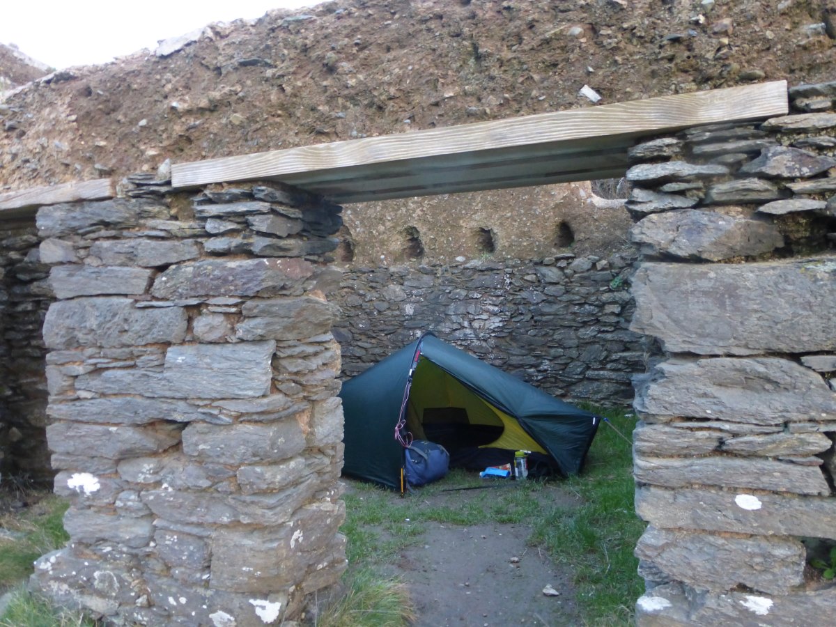
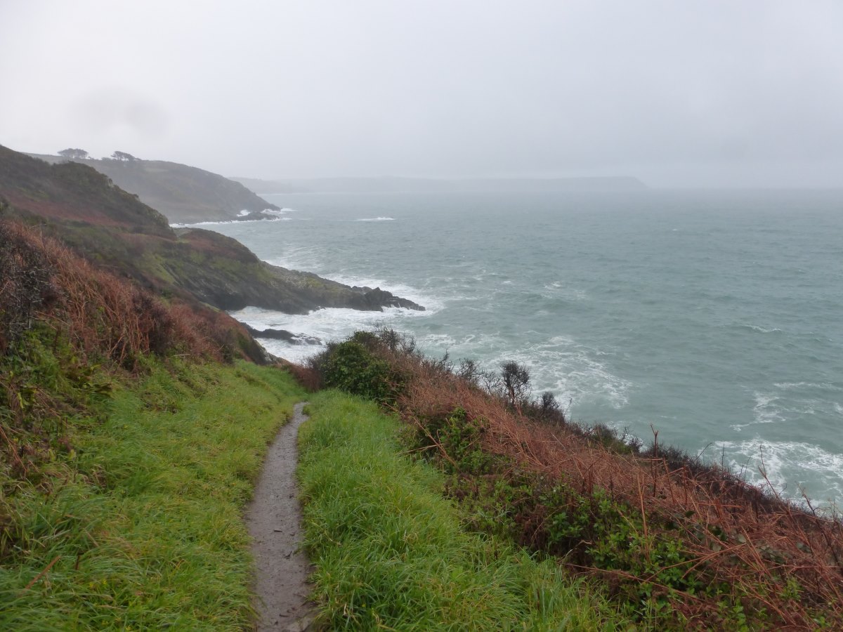
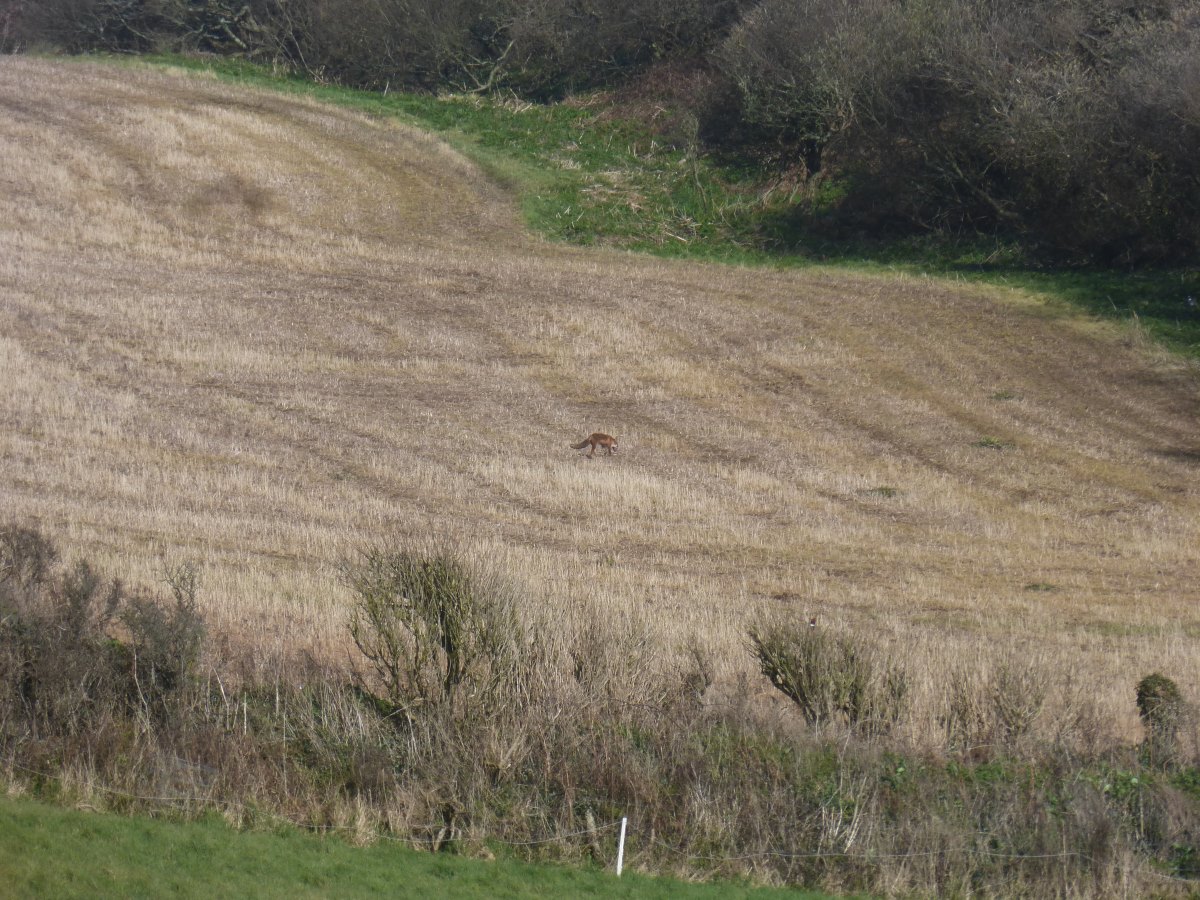
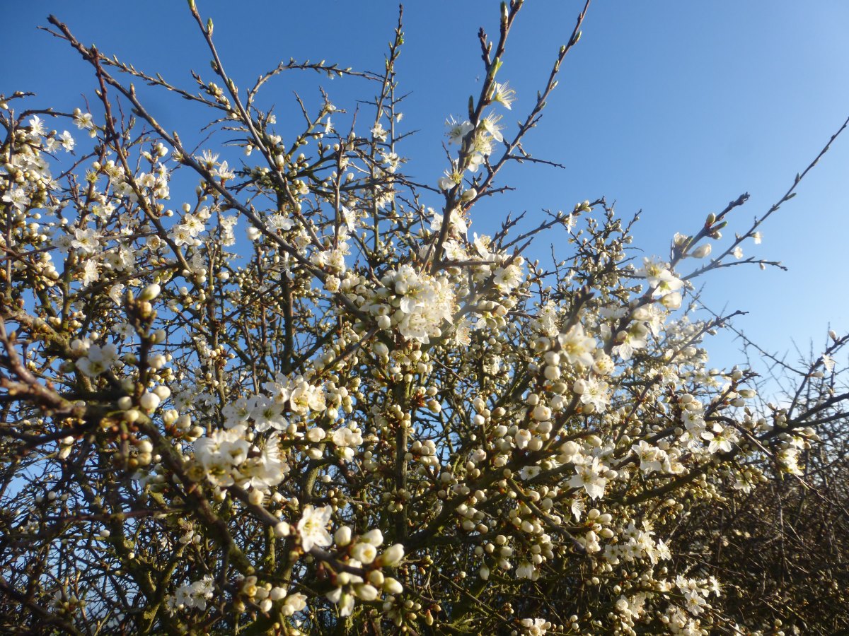
Day 6: I’m due to catch a ferry across the Fal this morning. Tickets are cheaper online so I bought one last night. This morning the storm has passed (sailings were cancelled yesterday) but I quickly check online to see if everything is up and running again. No. All services today are actually cancelled because of filming on the pier. Why did you not have this information available yesterday when I bought my ticket? Will services be running again tomorrow if I wait? I am unable to find the answers to these questions and, having already booked a B&B for St Austell in 3 days, I end up spending three hours on buses into Truro and back to get around to St Mawes. I make a slightly sad point of walking onto the piers at both sides (no evidence of any filming) but it feels jarring and like I’ve broken the continuity of the walk. I regret it, although I still haven’t come up with a better solution. The little Place ferry is also off for the winter (though this one I knew about in advance) so when I do finally start walking it’s off inland up the Fal and along a few roads to finally re-join the coast path by Portscatho. Storm having passed it’s actually a lovely sunny day and the wind feels much warmer. There are signs of spring with the start of the hawthorn blossom and a red admiral. It’s short lived though with more strong winds due overnight and I find a fantastic sheltered camp spot in the ruins of an old building near Nare Head. Day 7: My little house keeps me wonderfully sheltered overnight and despite a forecast for a 90% chance of rain I manage to catch a dry spell to pack up and have breakfast. I enjoy a somewhat soggy walk around Nare Head, reminiscing about a sunnier visit a few years before. Then it’s down to the waterfront at Portloe where the sun comes out and with incredible good fortune there is no more rain until just after I get into my tent for the evening! It’s a lovely section of path, relatively wild and under National Trust care with plenty of grazing ponies. I spot a pheasant wandering down the hill beside me and then, eyes now attuned for movement, a fox in the field behind. Inspired by the good weather I push on a little, passing up some great looking camp spots on Dodman Point and carrying on through Gorran Haven. Up the other side the wilder land is replaced by sheep fields and I wonder about going back but luckily find a little fenced off patch of scrub on the cliff top where my tent is sheltered from woolly friends (and farmers!). As already mentioned, the return of the rain was very well timed too. Day 8: There’s a lot of rain overnight and this morning everything feels very cold in a damp sort of way. It’s beautifully sunny and still, though with a late sunrise and a complete absence of breeze there’s no chance of getting the tent dry and it’s another soggy take down. I cross over more stunning headlands and into Mevagissey where I grab a pasty for second breakfast. Then it’s a reasonably quick paced day to get to St Austell before 60mph winds and rain hit later. There’s a lot of mud about which makes for some interesting slipping and sliding in sudden gusts but I make it in the dry, dark storm clouds gathering ominously overhead. With yet more fantastic timing I’m booked into my second B&B tonight so I get to watch the rain lash the windows from the luxurious heat of a very large bath. Pure bliss.
St Austell to Plymouth
SW Coast Path, 45.5 miles, 4 days
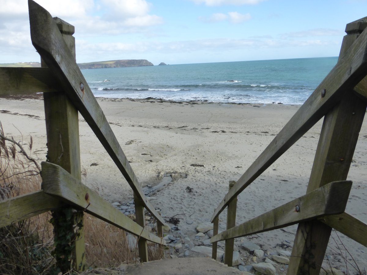
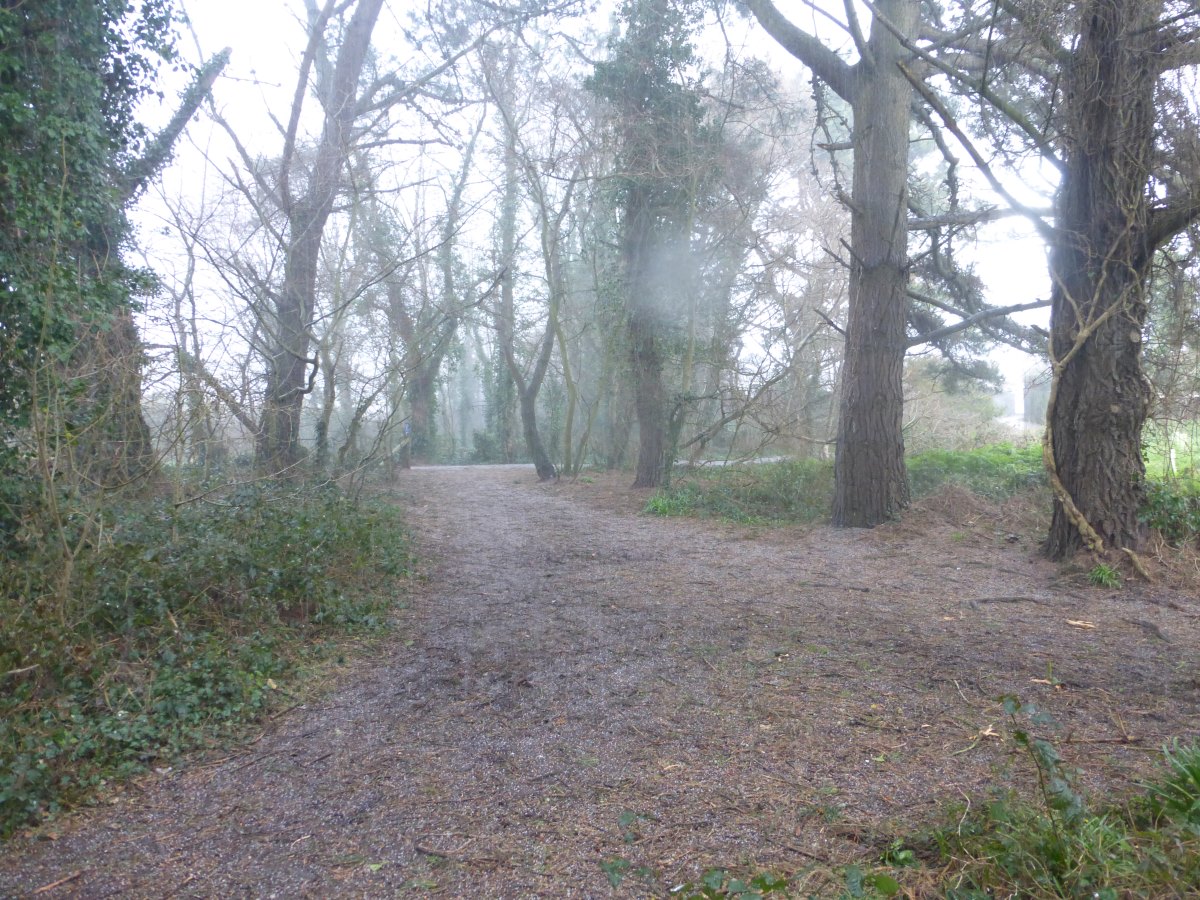
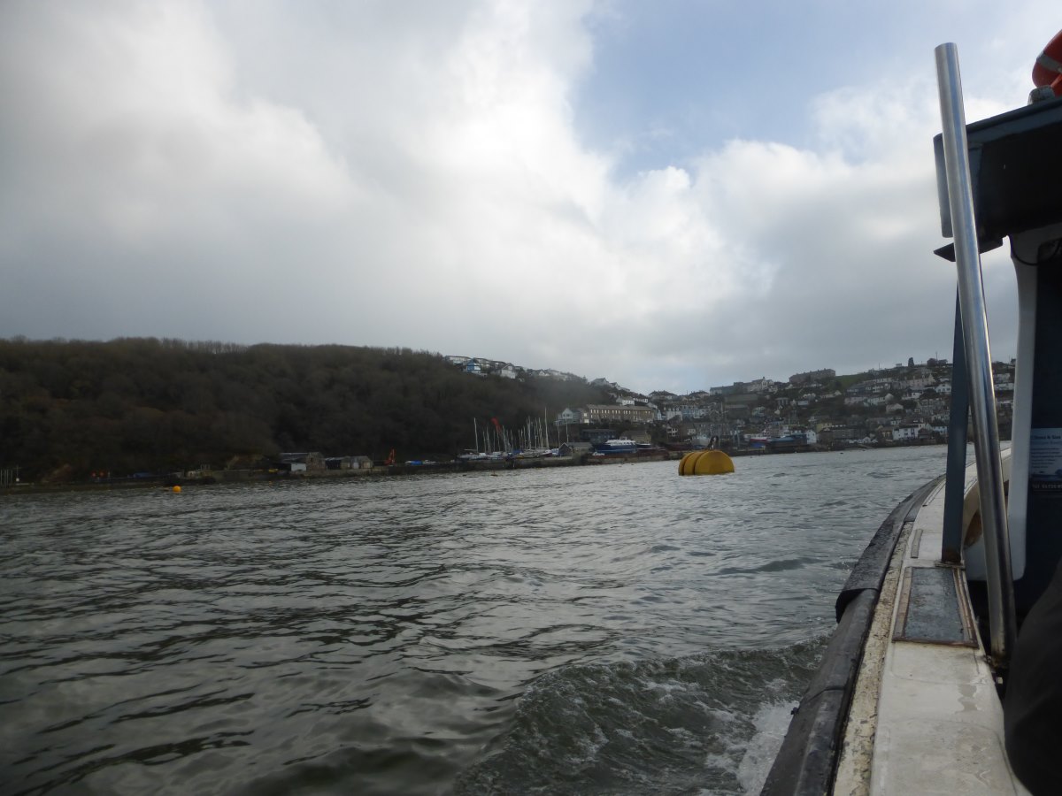
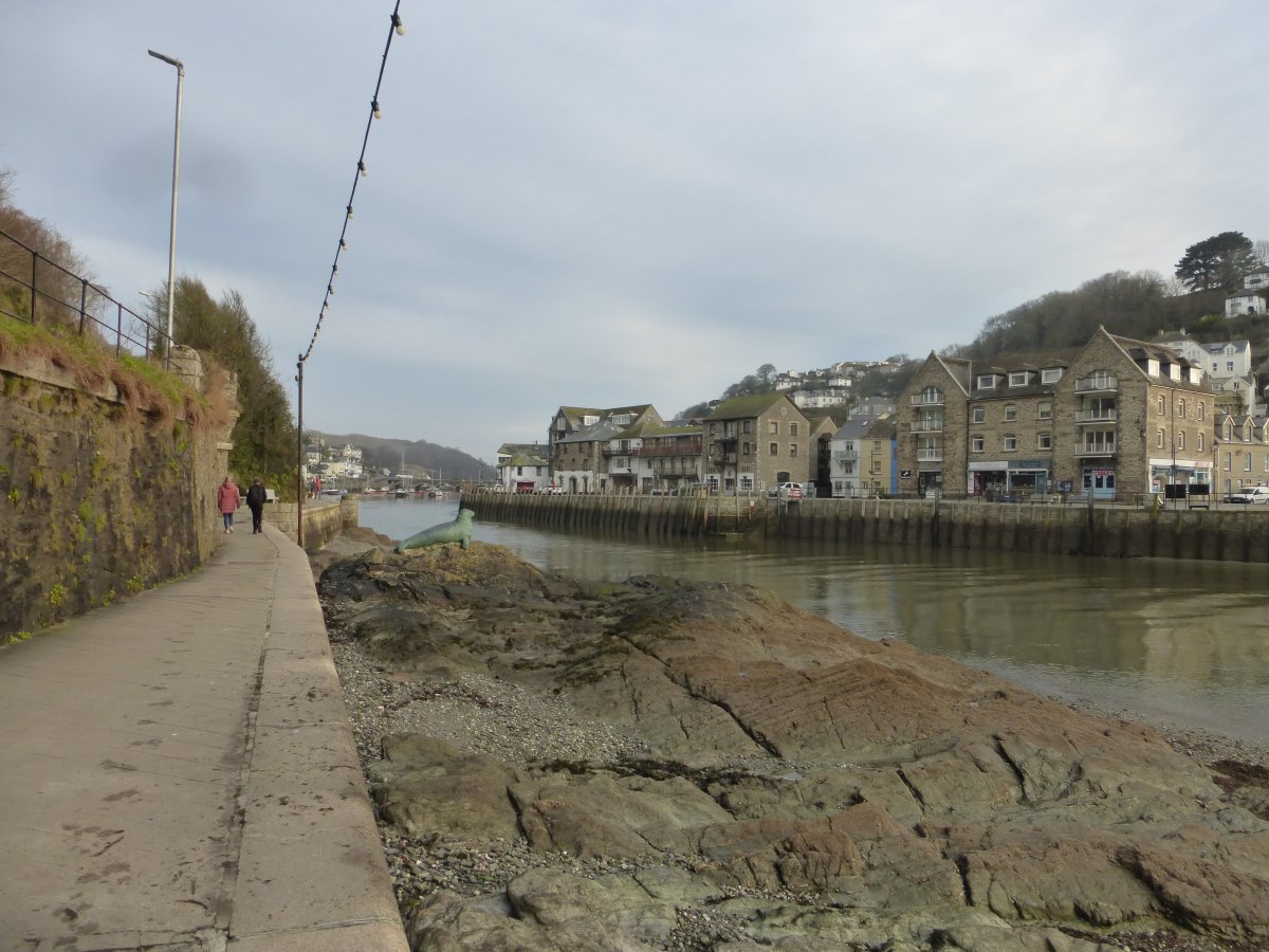
Day 9: It’s a late start this morning because my allocated slot for a full cooked breakfast isn’t until 9am. Then I’m out into a showery day with occasional hail storms and lots and lots of mud. There’s an especially dreary bit past Parr where a big diversion cuts away from the coast to get round Imerys with lots of industrial somewhat rundown buildings and a railway line. On rejoining the beach I find a dead seal and spend ages trying to locate the path up onto the headland at the other end (turns out to be behind/through a pub). Thankfully after this the weather brightens somewhat and lifts my mood with it, though I leave far too many layers on and boil. The path becomes much pleasanter but it’s a bit of a power walk to make it round the headland to Fowey before the last ferry which finishes early on Sundays. I make it with a few minutes to spare and am whisked straight across the water with no real chance for a rest, though it feels good to finally make my first successful ferry crossing of the trip! On the other side I meet a local man who recommends camping at Lantic Bay and I follow his advice, finding a lovely flat grassy area at the back of the beach with the evidence of many past beach fires. I’m tired after all the power walking but pleased to report that the ankle/boot bruises are almost completely gone. The dishcloths have done their work. Day 10: a gloriously sunny day. I watch the sun rise over the edge of the bay and get the tent dry for the first time in a long time. Climbing back up to rejoin the path the thermal leggings I’ve so far worn every day are instantly discarded and for good measure I also ditch the dish cloths and lace up the tops of my boots for the first time since day 2. The path is as beautiful as the weather, very wild with hardly any fields or people though there are a lot of steep stepped ascents and descents as the price for this. But the butterflies are out and it’s warm in the sun and I take plenty of time to sit about and watch the view. There’s a pretty little fishing village at Polperro which is reasonably full of tourists but apart from this I have the path pretty much to myself. I carry on until Looe and, on the advice of the same local man as yesterday (who I happen to pass out for a morning walk), camp just before the houses start at the top of a field. It has a public park kind of feel with lots of dog walkers at the bottom but only me, the gorse bushes and the sunset up the top. Day 11: condensation +++ this morning but no time to do anything about it because for the first time on the walk today I actually have to cover a fairly big distance. I have breakfast while watching the sun rise then am off for 7am through Looe and onwards. It’s warm again but not quite so clear with a light cloud layer and a haze that gradually envelops the horizon. I’m walking around a very large bay and all day I’m treated to a view of Rame Head (my target destination) which never seems to come any closer. It’s also quite a bit more built up than the previous sections of coast path, with lots and lots of little houses (both lived in and holiday-home-esque) scattered all down the cliffs. At one point the path does a fairly steep up-and-down-again and as I’m toiling up my side I notice a man coming towards me up the other. He is very red in the face and carrying an ancient looking fully laden rucksack with a big metal frame and no waist belt at all. I am horrified by how soul crushingly heavy such a set up must feel and, as we pass at the top, I attempt to initiate conversation with a casual “your bag looks heavier than mine”. He looks slightly like he might cry and without breaking stride replies “it gets heavier with every step” and then he is gone. My questions, so many of which begin “why??” must remain unanswered. Making progress around the bay I cross a series of cow/bull filled firing ranges (uneventful on both counts though I do find myself walking very quickly!) and eventually make it onto the headland for late afternoon. There are some lovely flat grassy looking camp spots right by the sea but they are a long way below me and there is a lot of dense spiky foliage and loose scree in between. Carrying on a way I do after a few false starts find a way down some deer tracks (and find the deer that made them) to a perfect spot for my last night by the coast. The tent dries out in the last of the evening sunshine and I’m treated to a gorgeous red sunset then, as the light fades away, sit out and watch the waves by the light of a full moon. I suspect it will not get very dark tonight. Day 12: into Plymouth today and goodbye to the sea. I’ve run out of fresh water to make breakfast so am off early and manage to get the tent down dry just before it starts drizzling. There are public toilets on the top of the headland but no water - frustratingly a lot of places on the path have combined soap/water/dryer units that presumably help them reduce their water consumption but are of little use to the backpacker with an empty bottle. On my way onwards I pass three groups of quite young looking military trainees with full backpacking gear - maybe this explains why there are so many spots that look like they get camped in. Otherwise I have it all to myself. There’s plenty of woodland, ongoing misty drizzle, and a delightful little shop/bakery in Cawsand that sells me a very tasty wild garlic and goats cheese bun to make up for the lack of breakfast. I carry on through Mt Edgcumbe Country Park where there are some nice gardens and several more eating opportunities and then all of a sudden I’m at the end of Cornwall and another passenger ferry is whisking me over the Tamar into Devon. On the far bank all that remains is a short walk to a guest house and an outing for a very tasty fish and chips.
Plymouth to Cranbrook Castle
Two Moors Way, 48.7 miles, 4 days
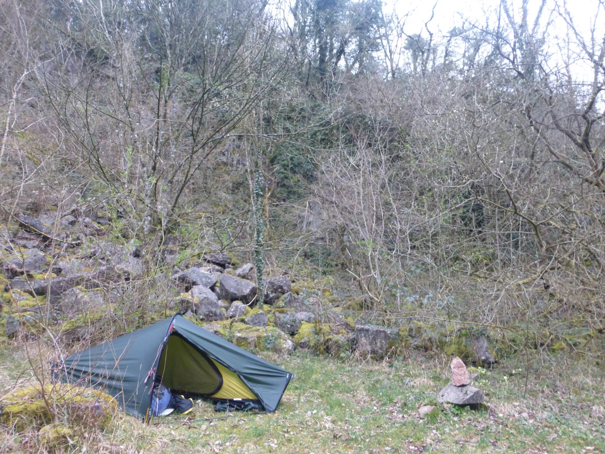
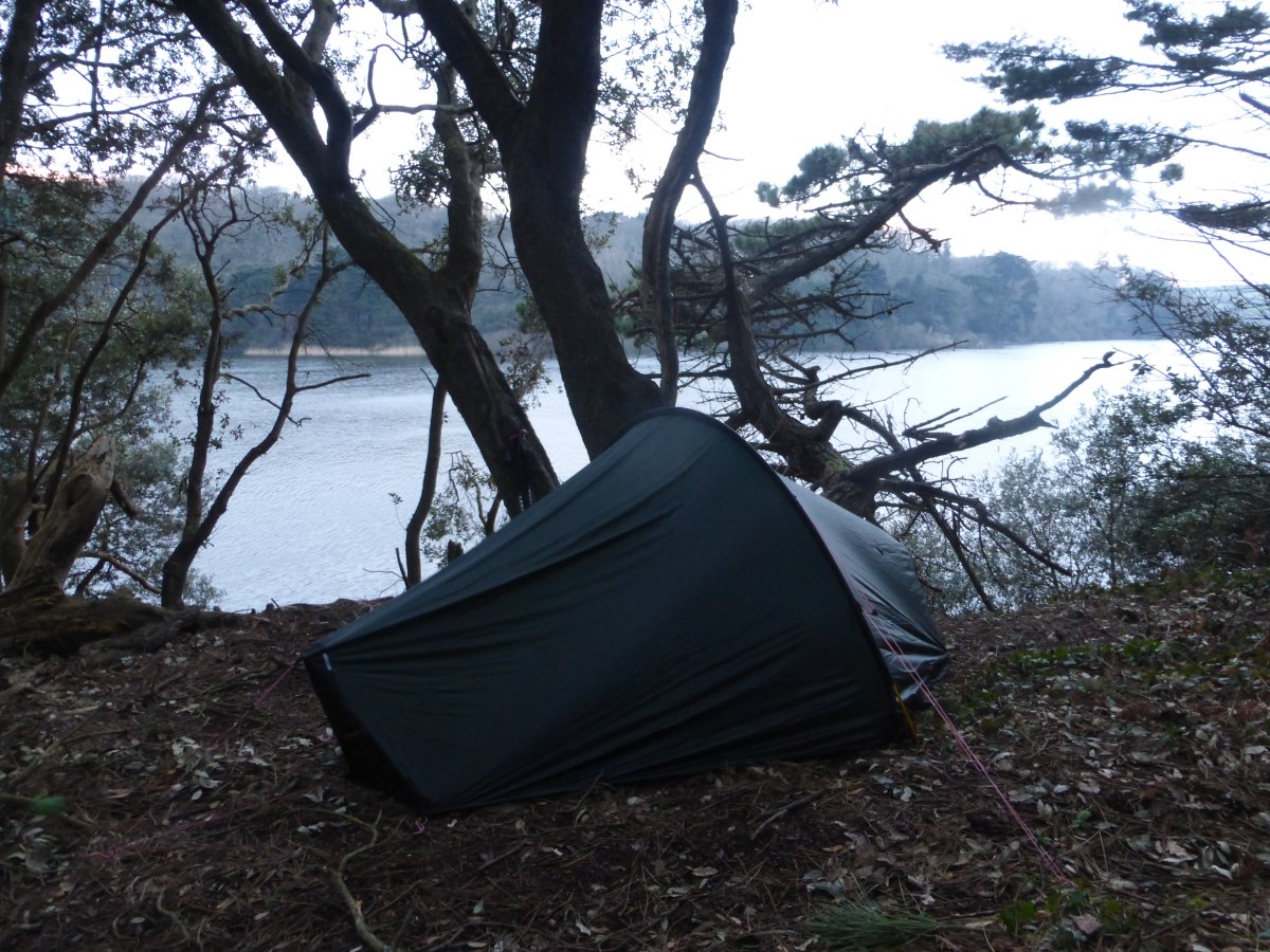
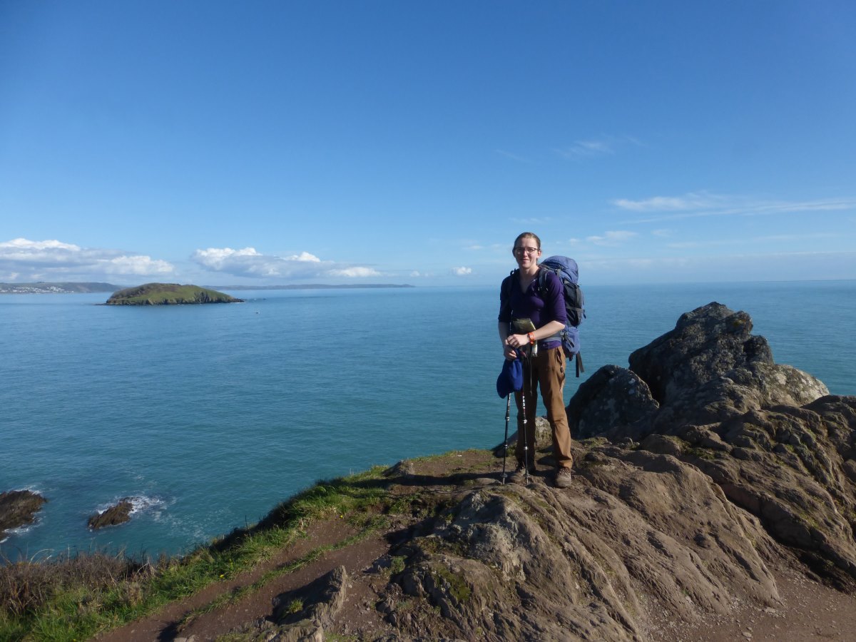
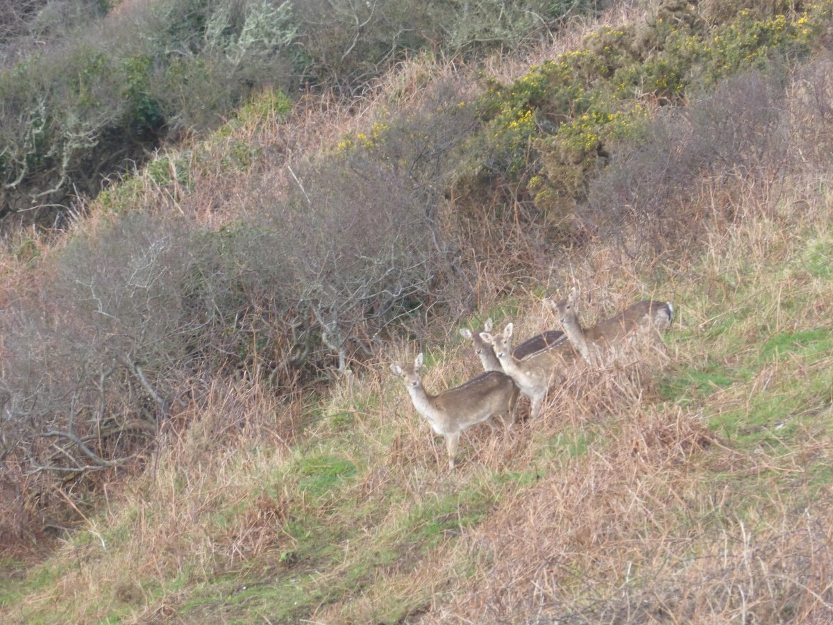
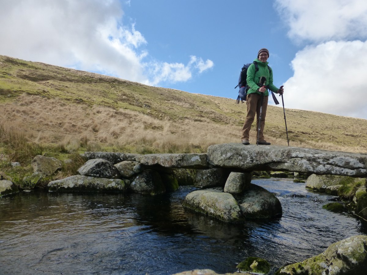
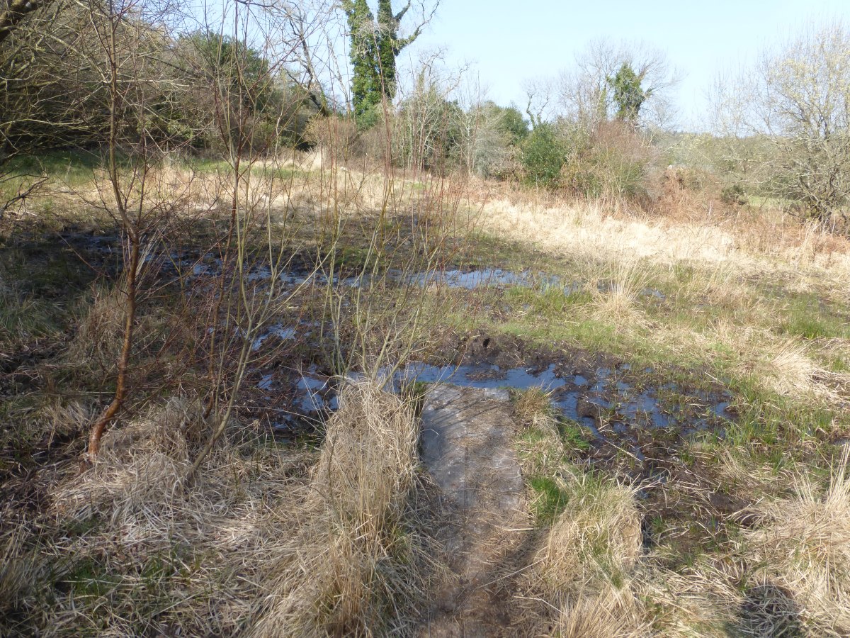
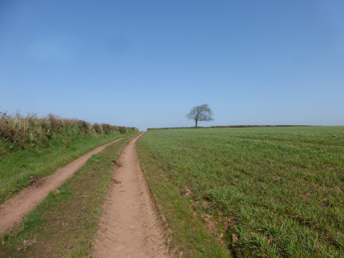
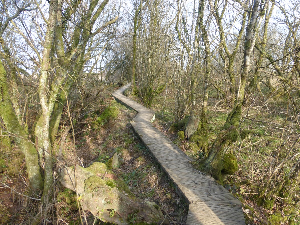
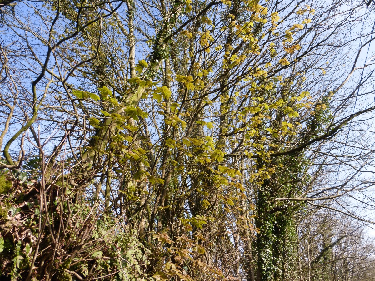
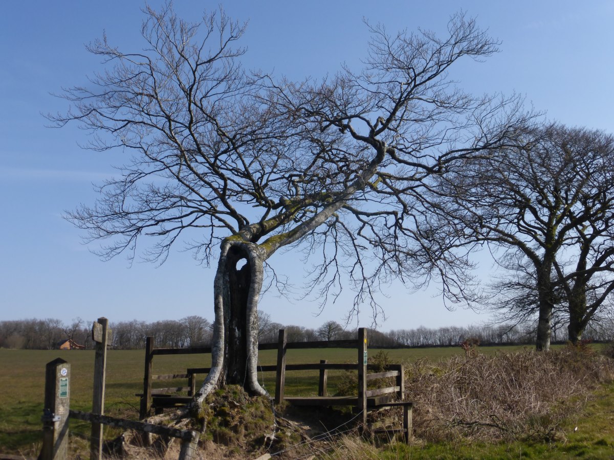
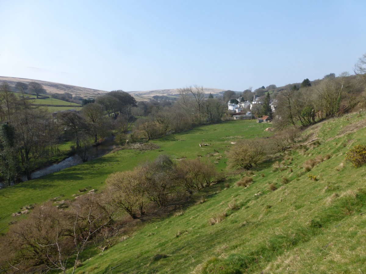
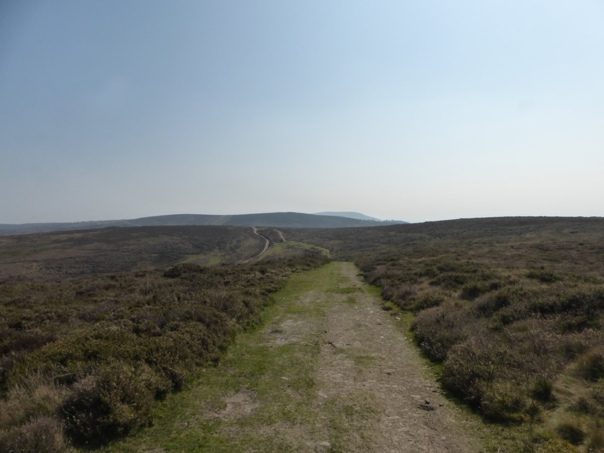
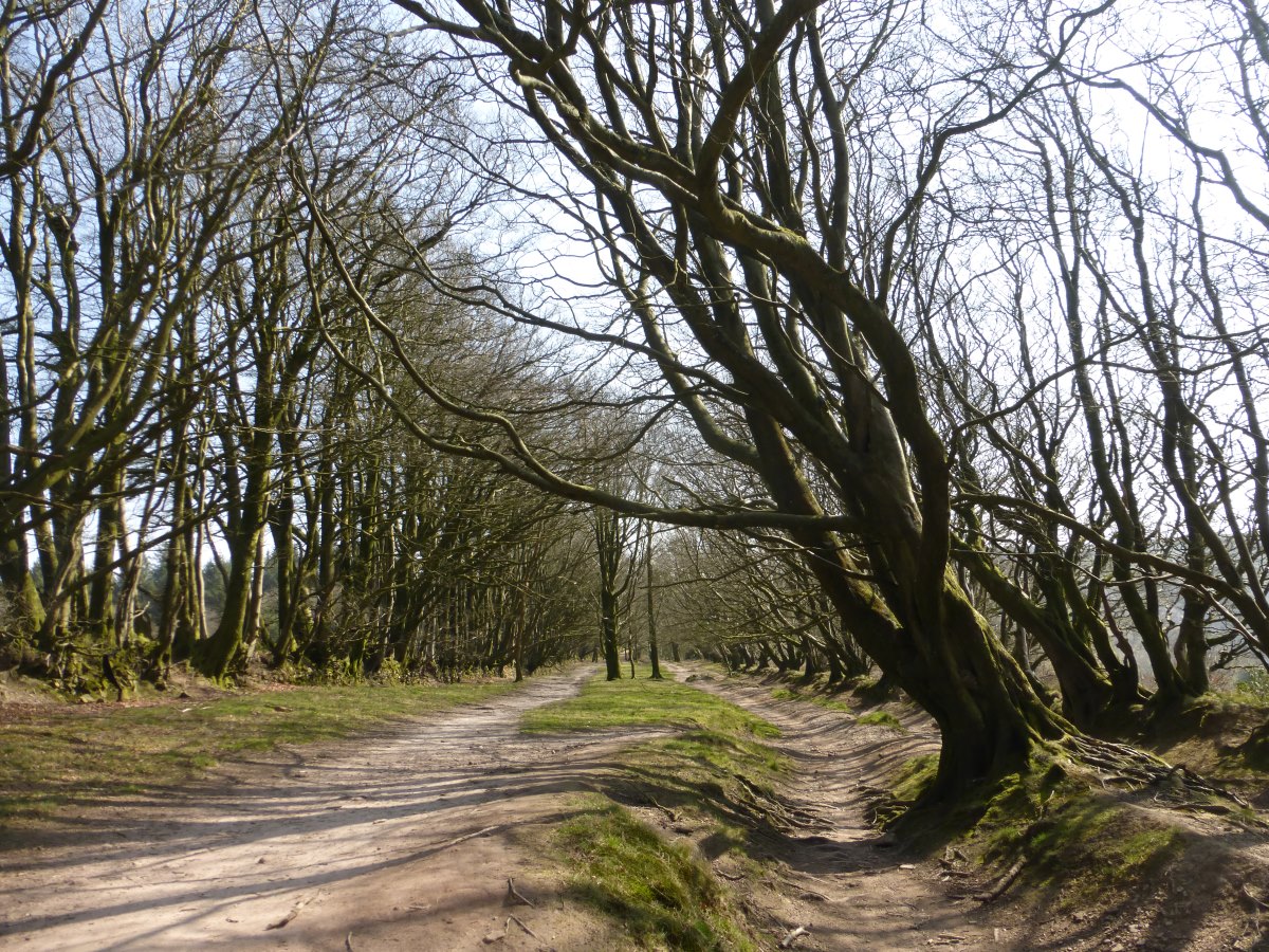
Day 13: a gloriously sunny day. In my head the walk has split itself into sections. After the surprises of 2020 this year is not about walking to Cape Wrath, in fact Cape Wrath doesn’t even enter my thoughts until about 1 week before the end when I suddenly realise it’s almost over. Right now it’s about getting to Bristol so that if I then have to go home and do it all again I’ll have gone far enough that next time I can just start from Bristol. But Bristol is a long way from Land’s End so it subdivides further - until yesterday it was about getting to Plymouth so I could get to Bristol, and before that it was getting to St Austell, so I could get to Plymouth so I could get to Bristol. Today my sections have a new set of markers. Plymouth is gone. Exford awaits. I set off in full sunshine along a series of signposted cycle trails which will lead me to Ivybridge (though this does commit me to a full day on tarmac). There’s an interesting start past a harbour and up on a raised path that lifts me over a large industrial area. Then there’s a National Trust saltmarsh with plenty of wading birds. Sadly that’s the end of the interesting bit. Cycle paths are easy to follow but this is one better sped along on two wheels than plodded on two feet. There are a lot of roads and a several miles along the side of the A38. Separated, yes, but only by a foot of grass verge. The ball of my left foot is unhappy on the tarmac. I down a couple of ibuprofen to safeguard against trouble and keep up a rapid plod to get it over as quickly as possible. Reaching Ivybridge I fill the bag up with food and escape up up up onto the moors. The sun is still blazing and the going feels so easy now that I’ve left the tarmac behind but I want to do this part slowly and make the most of Dartmoor’s wonderful wild camping rights so at 4pm the bag goes down and the tent goes up. Time to laze about in the evening sun and greet everyone who walks past. Day 14: there is an urge again this morning to go far and fast. Something about sunshine and moorland, the skylarks singing; I want to get out there and drink in the views, see what’s round the corners. I suppress the urge. Listen to more audio book. Make breakfast out in the sunshine. Actually dry the tent. When I do set off it’s at a leisurely stroll. My foot is much happier on the soft ground and, after leaving the immediate vicinity of Ivybridge behind, I only see one other person all day. It’s a day of sunshine and clouds - moving quickly overhead in a swift wind which necessitates the return of my thermal under layers. The moors roll away into the distance, giving a thin strip of big open view atop last year’s dead dry grasses. Depth is added by the occasional hidden bog but by and large it’s good walking on tracks and paths. Early in the afternoon I stumble upon a perfect camp spot and get the tent up at a record-breaking 2:30pm. Despite that I see no-one in all the time I am there. Couscous and haloumi for dinner followed by Jamaica ginger cake to celebrate 2 weeks on the move though already it feels much longer than that. I have made a lot more memories in these last two weeks than I do in the average. Day 15: the sun breaks over the tree tops at 8:30 but I’ve already (having been sound asleep since 7:30 last night) eaten breakfast, packed all my stuff and washed my clothes in the stream and there’s only so long I can sit and stare at the condensation-soaked tent fabric not getting any drier. So it’s another soggy pack-away. It’s a day of two halves, the first dropping into the valleys to cross fields and lanes; the second back up onto the moors. All very quiet with hardly anyone about even though it’s a Saturday. The wind gradually builds in strength and by the time I’m climbing Hamel Down it is strong enough that a gust catches me climbing over a broken wall and knocks me off my feet. It feels almost comically slow motion as with the weight of the rucksack I poise at tipping point, realise I can’t save myself, and then somehow end up with my head at the bottom of the wall and my feet still on the top. Thankfully I manage to get the offending rucksack underneath me so there’s only a bruised elbow and a slightly bent pan to show for it. Battling my way over the rest of the hill I find a large ancient stone settlement on the other side with a circular outer wall sheltering many individual dwellings. There’s a complete lack of any tourist information boards and no phone signal to be able to look it up though I later discover it to be one of the best preserved bronze-age settlements on Dartmoor. One of the times a guide book would surely have been useful! I camp just next to it in a hollow by a little stream where I am hidden from the wind. Day 16: it’s a cold night over which I progressively add socks, a fleece and two synthetic jackets to my usual thermals but do finally manage to get myself toasty. Possibly as a result I find myself raiding the food back at 2am and am still hungry just after finishing breakfast this morning. I start off over more moor land and, on joining a minor road, take a diversion to find some public toilets. I am rewarded with no only open toilets (always a big gamble at this time of year) but a hot food van from which I get a second breakfast of bean curry. From here it’s goodbye to the moorland and over fields and tracks to Chagford. There are a few large expanses of mud and some very uninterested cows but no other hazards. I stock up on new food and break away from the trails slightly to follow a beautiful deep wooded gorge and then a steep climb up to Cranbrook Castle to camp. The name somewhat over-sells it as all that is left of this hill fort is a lump of a wall running in a large circle around the flat summit of the hill but it is a last tiny remnant of the Dartmoor permitted wild camping area and I feel that, while such luxuries exist, I should stick to them. I’m hoping to be rewarded with a beautiful sunset but it’s too hazy to see far.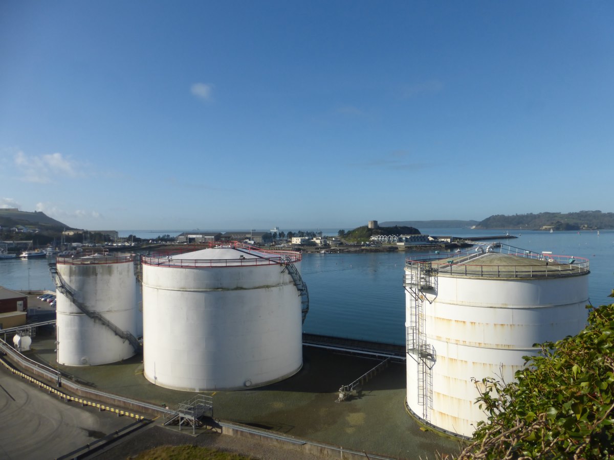
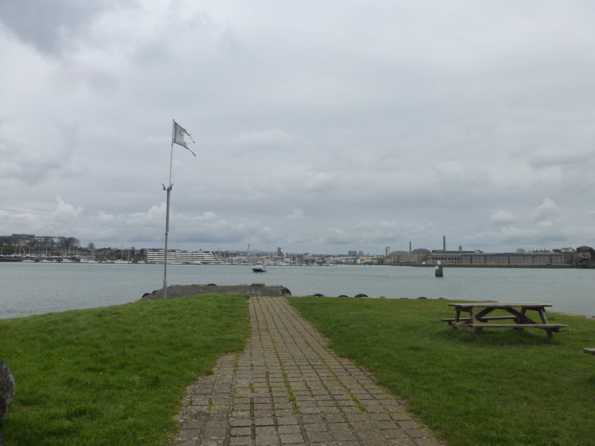
Plymouth
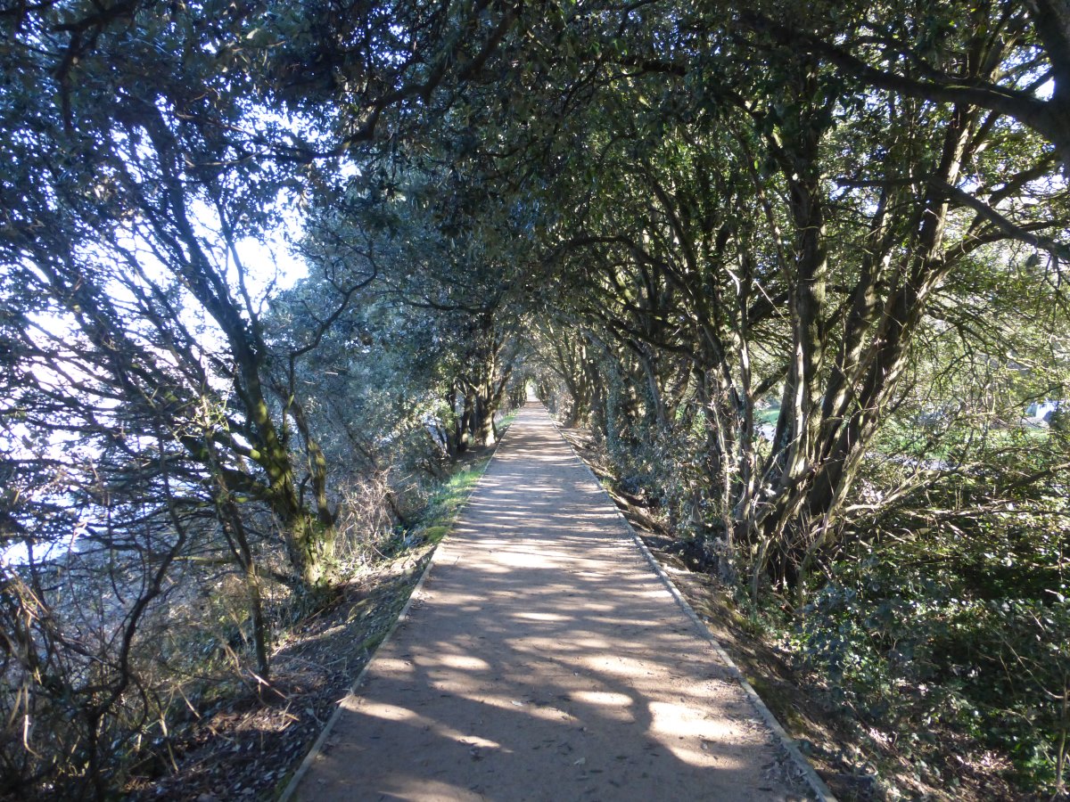
Cycle routes
Under the A38
Dartmoor
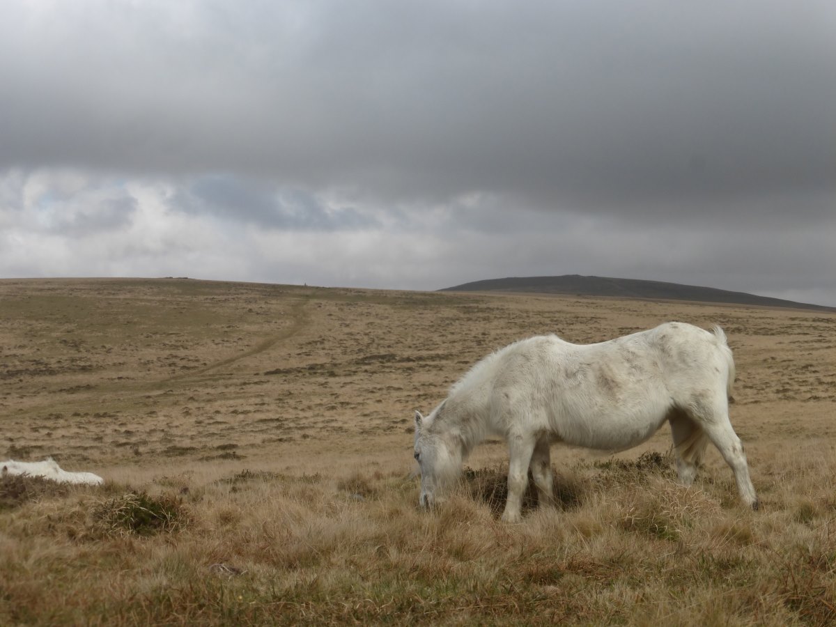
More ponies than people
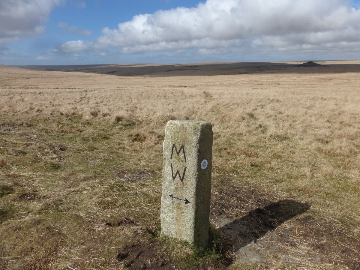
Signposts on the 2 Moors Way
Old bridge
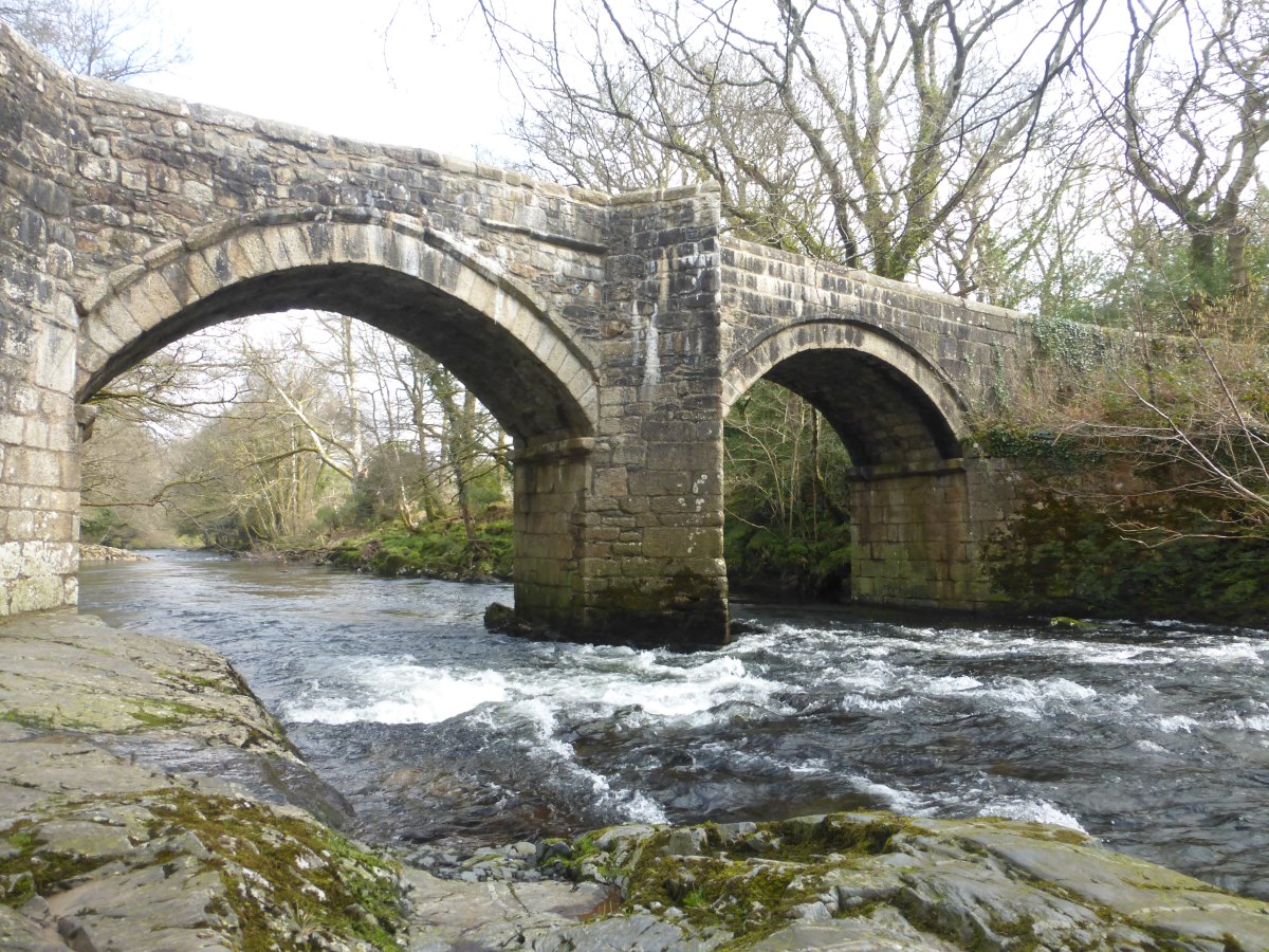
And a more modern equivalent
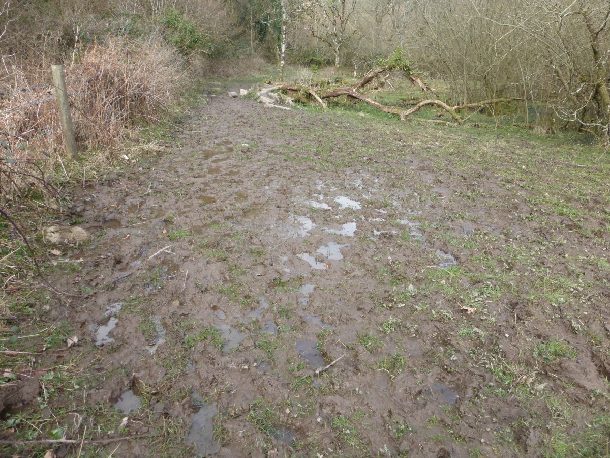
Mud, mud, glorious mud
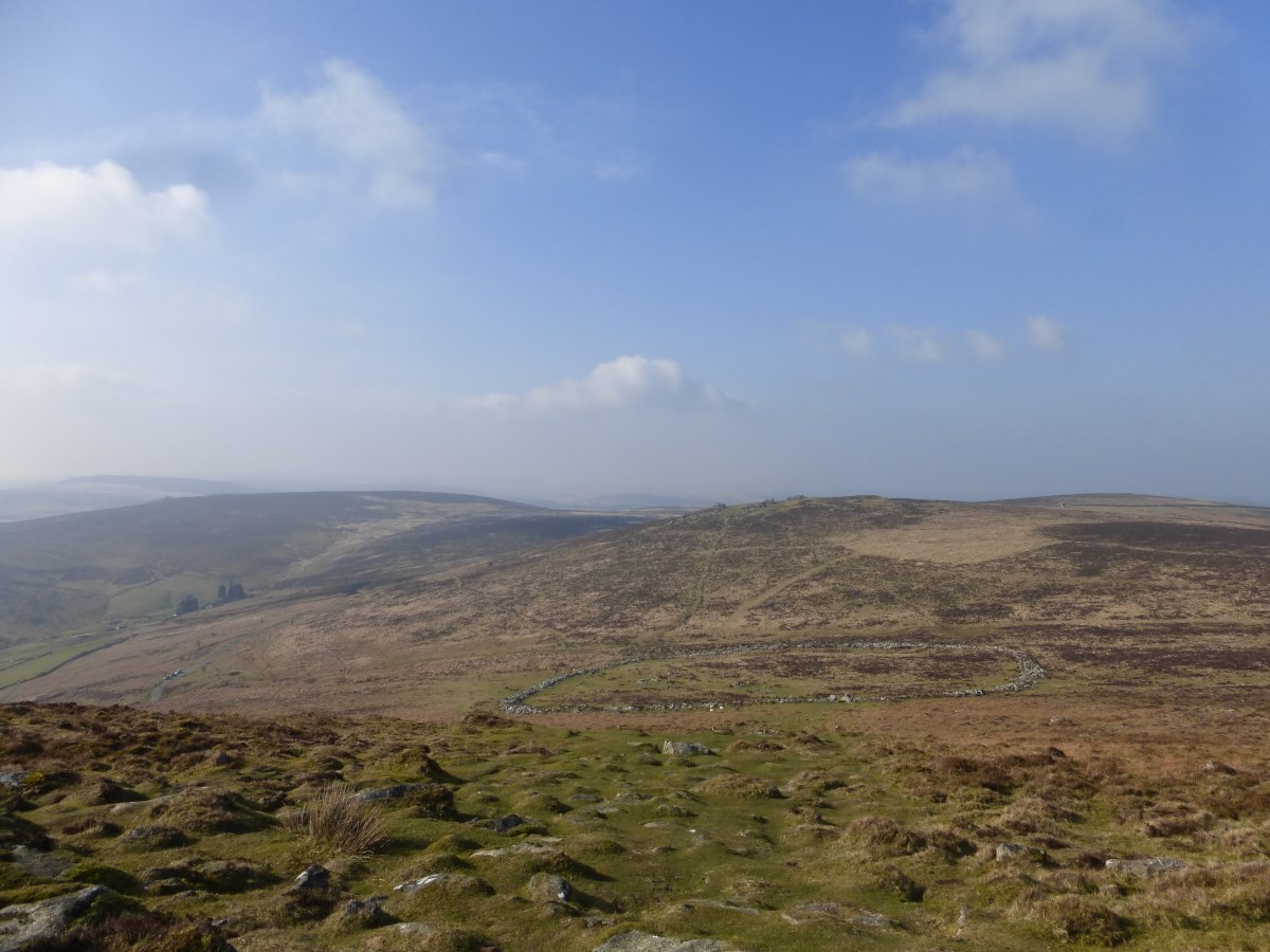
Grimspound
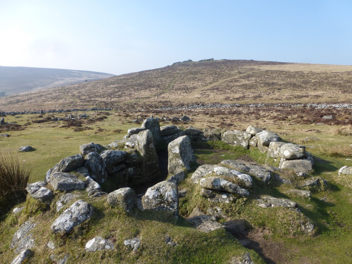
Grimspound
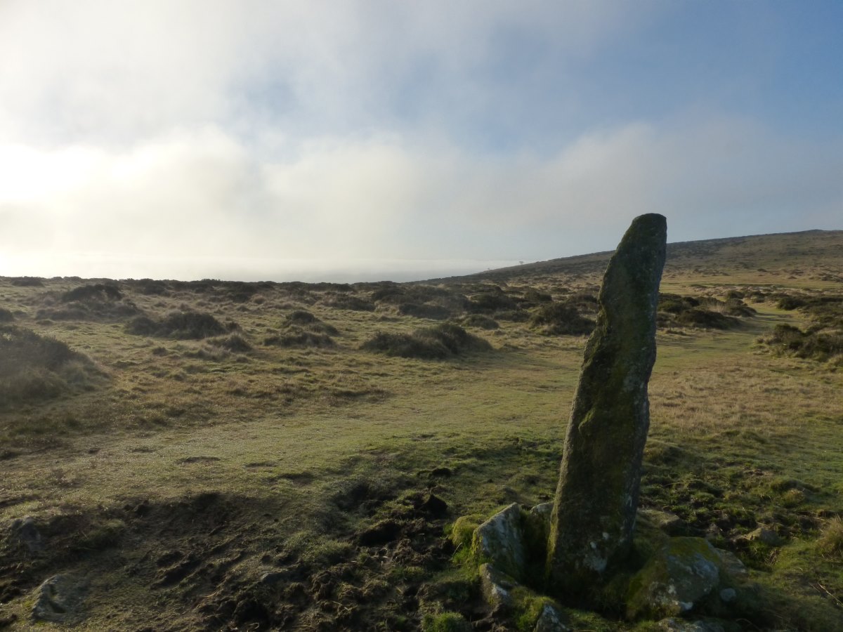
A very wind blasted cross
Great boardwalk over the mud...
...which runs out just when you need it most!
Cranbrook Castle
Cranbrook Castle to Dunkery Beacon
Two Moors Way, 50 miles, 4 days
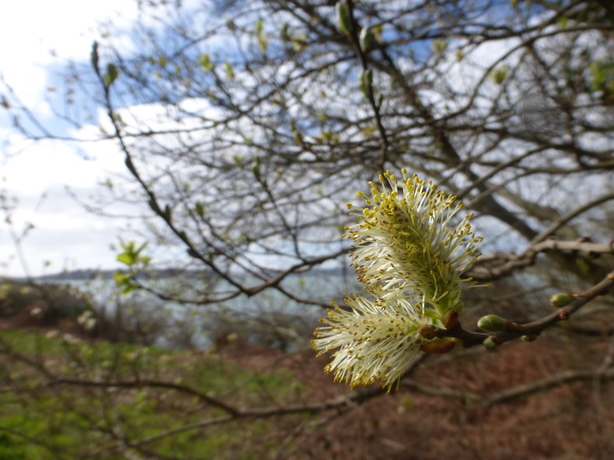
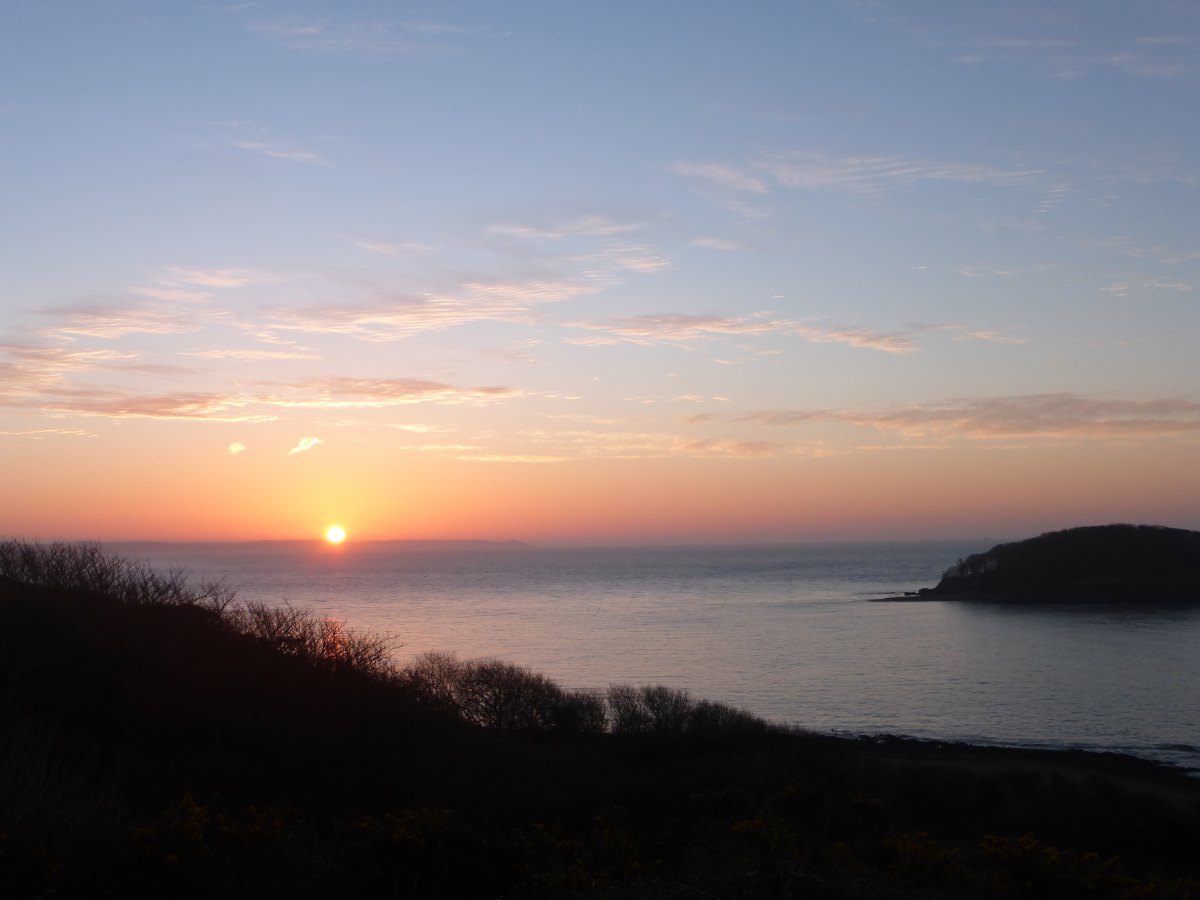
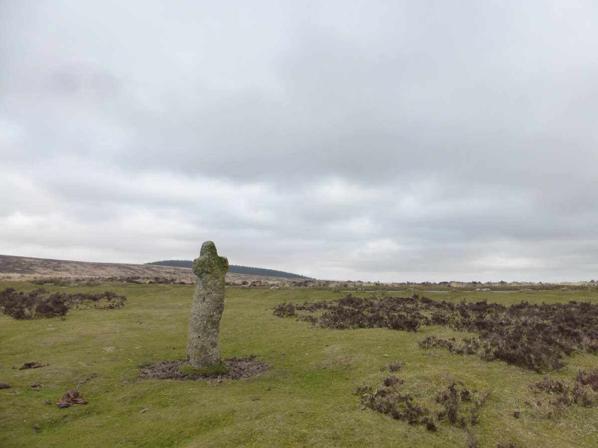
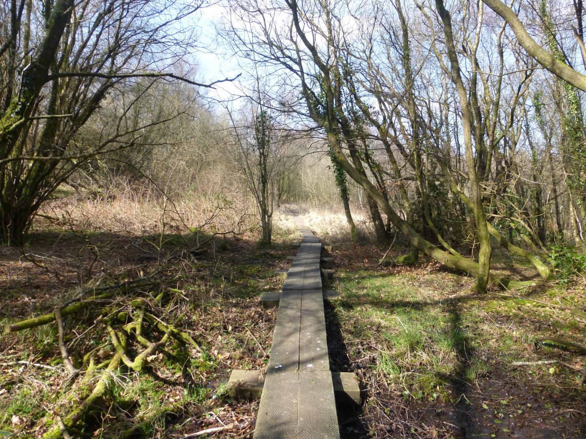
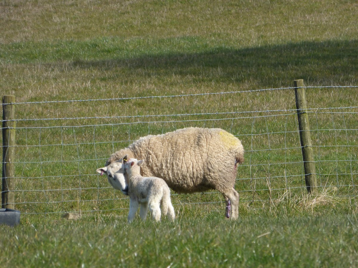
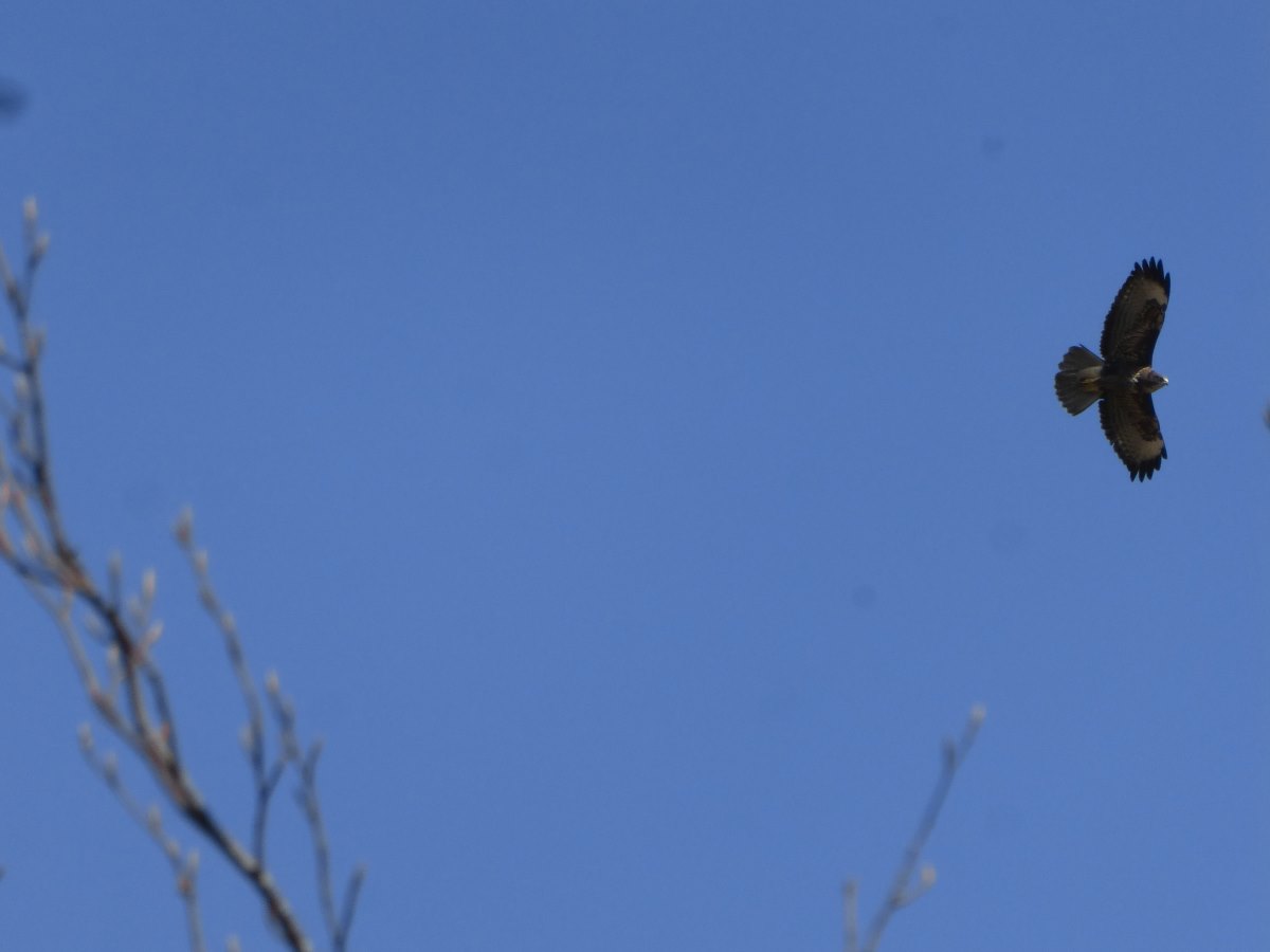
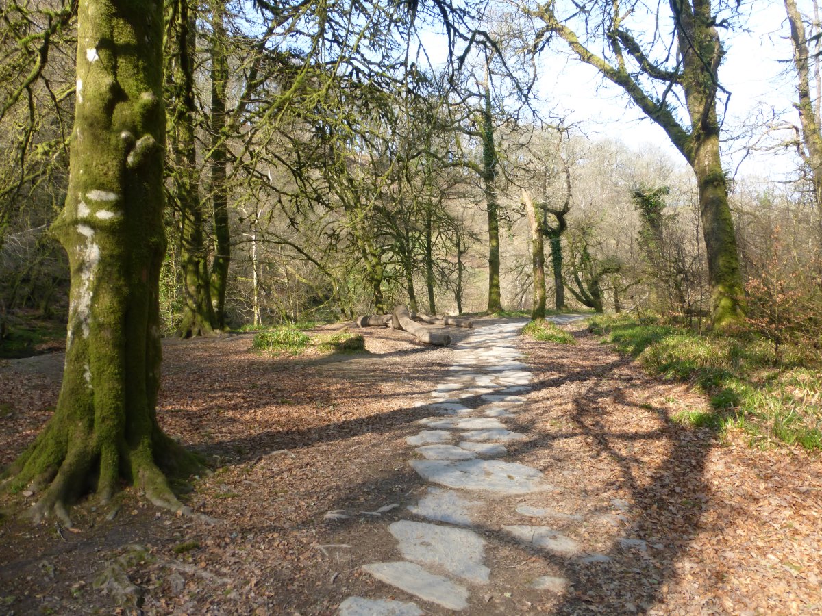
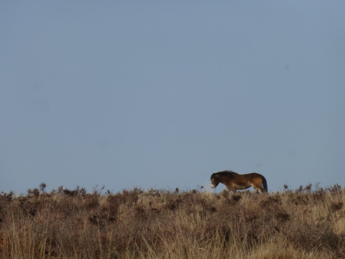
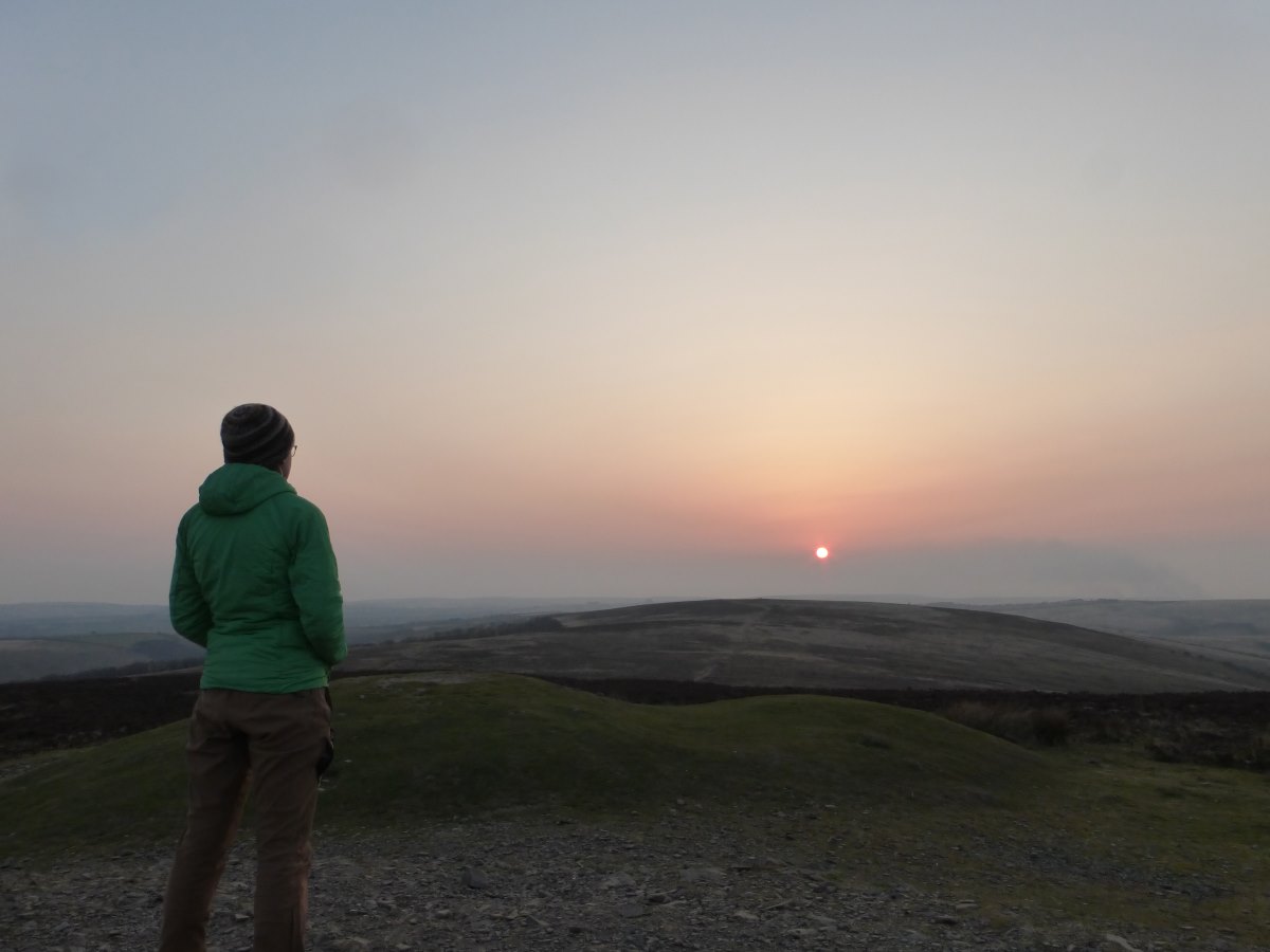
Day 17: it’s a very underwhelming sunrise and so hazy it’s only possible to see a few fields away. My sleep mat has also done an internal pop overnight and the top three bars have opened together to make a bubble/”pillow”. I am unimpressed and will just have to nervously await further developments. I’m up and away early with no water left for breakfast and none to be had at the (shut) public toilets or pub at the bottom of the hill though I do eventually find a small stream. After this it is a long day over lots and lots and lots of fields - after all my loitering and “making the most of Dartmoor” it’s time to see how far I can go. I pass only two dog walkers all day. Despite it not having rained for over a week there plenty of mud and one unpleasant huge industrial farm with many miles of electric fenced fields containing far more prints and poo than grass but thankfully (and slightly bewilderingly) not a cow to be seen. Shortly after this I descend a steep muddy track through a woodland to find at the bottom that the path over the railway line is closed and barred off (and has been for nearly two years) but there is no official diversion or suggested alternative. I slog all the way back up the hill again before meeting a local man who tells me how to climb through the barriers and saves me a few miles on the road. So all in all it’s not the most fantastically enjoyable of days but it is at least productive in mileage. On finally finding a spot to pitch the tent (the only tiny scrap of non-bramble-covered ground in a small wood surrounded for many miles by fields) I am half way to the relative wilds of the fringes of Exmoor. Day 18: that’s a lot of days of consecutive walking! This morning I look up Exford YHA intending, two years later, to finally have the rest day I had booked in 2020 but find it shut for refurbishment until 2023. I guess they really don’t want me to stay! A couple and their dog pass the tent while I’m doing this and remark that I should probably move because this is a very popular dog walking path and the dogs might react badly to my tent. When I tell them I’ve been here since 4pm yesterday and they are the first people I’ve seen they look just as confused as their dog, mumble something about too much mud and walk off. It’s an odd conversation but, looking back 3 months later I can say happily that that this is the closest I ever got to anyone having an issue with me wild camping. On the move again it is another very long day of lots and lots and lots of fields and lots and lots and lots of mud. My boots get damp (on the inside) for the first time which shows just how impressive the mud is and that’s despite it not having rained now for over a week. Finding some fresh non-muddy water to filter (a rarity round here) the bag for my water filter then bursts. I’m thirsty and experiencing a strong craving for freshly pressed apple juice when I find a village shop that sells… Nope, no apples or juice of any kind. Except for the sunshine (which is glorious) it’s a generally poor day all round until in mid afternoon I spot a couple of walkers with rucksacks coming towards me and meet Claire and Clarissa, walking South on the Two Moors Way. They are the first fellow long distance walkers I’ve met and it’s great to stop for a proper chat and swap news on the routes ahead. Carrying on alone and feeling a bit lonely I reach a tiny patch of moorland. The haze has cleared enough that I can see all the way back south to Dartmoor and feel slightly awed by how far I have walked in just two days. Day 19: the tent is dry this morning!! Off over the moors which feels great after two days of just fields. There are fields too of course, and plenty of sheep, but I’ve left the cows behind which seems to mean that I’ve also escaped from the mud. Hallelujah. Cresting a small bump in one field I come across a sheep with a very tottery and damp looking lamb that can hardly be a few minutes old. It has mastered standing on the back legs but not yet the front ones. Unfortunately the quiet corner chosen by this new mother for this small miracle of life is right in front of the stile I need to cross. I sit a safe distance off and watch. Standing is achieved but it appears that walking will wait for another time. The lamb is tired. Mum is tired too. I go and find another place to cross. Onwards over more moorland with lots of buzzards overhead then down into a delightful woodland and the Tarr Steps - a very interesting and beautiful old pack horse bridge and the inn that shares its name. I’m melting in the sunshine (and my long sleeved merino top) and very glad to call this place home for the night with a delightful cool bath followed by large amounts of excellent food. Day 20: I enjoy a full cooked breakfast followed by a beautiful morning walk on a winding path along the river surrounded by mature woodland. There are catkins out on the trees, golden in the morning sun, and the air is full of birdsong. It’s quiet, peaceful and all mine to enjoy with no-one else about all morning. Reaching Withypool I enjoy my first ice cream of the year and am slightly alarmed to find the metal tips of my poles making little dents in the hot tarmac of the road. From here it’s goodbye to the Two Moors Way (which now turns West) and I carry on North back up over the moors to Exford. I visit the (still shut!) red brick youth hostel where my journey came to an abrupt end in 2020. It’s an odd feeling. Like I’m picking up some remnant of the last walk, closing a loop, joining together two stories to now head on together to pastures new. I send off a few postcards then carry on onwards and upwards to the summit of Dunkery Beacon - the highest point on Exmoor where I pick up the Macmillan Way. It is sunny and still with hardly a breath of wind. The perfect night for a summit camp. Through the haze I can just make out the coast of South Wales, and lots of sea, and the Quantock Hills (I think) up ahead, and many miles of green fields. I sit on the summit cairn and watch the sun set and the light fade.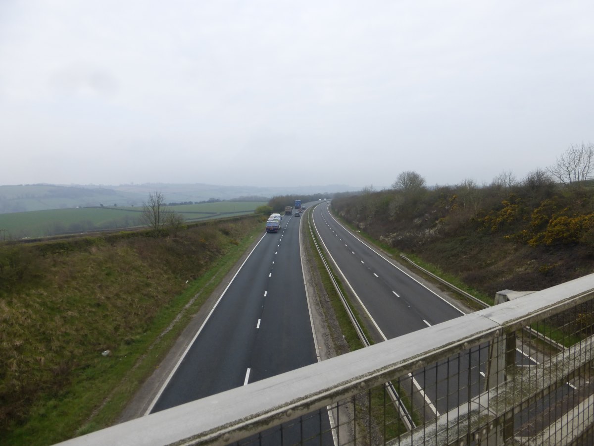
Over the A30
Lots and lots of fields
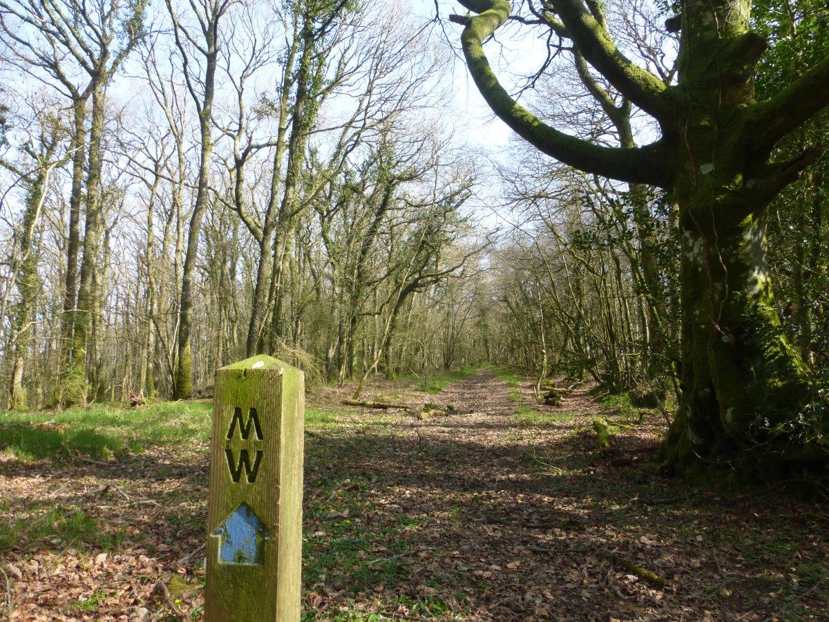
Two Moors Way signs
And more fields
Avoiding the mud
Spring is coming
Missing a bit
A brand new lamb
Buzzard
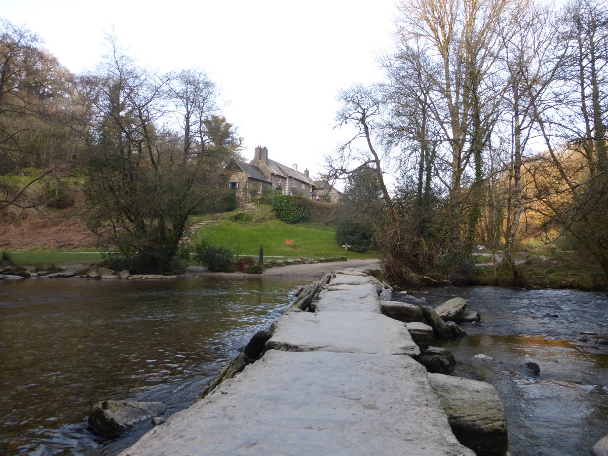
Tarr Steps (bridge and inn)
Onwards through woodland
Approaching Withypool
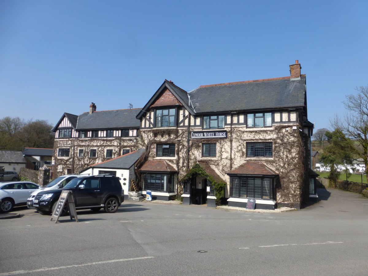
Exford White Horse - where 2020 ended
Exmoor
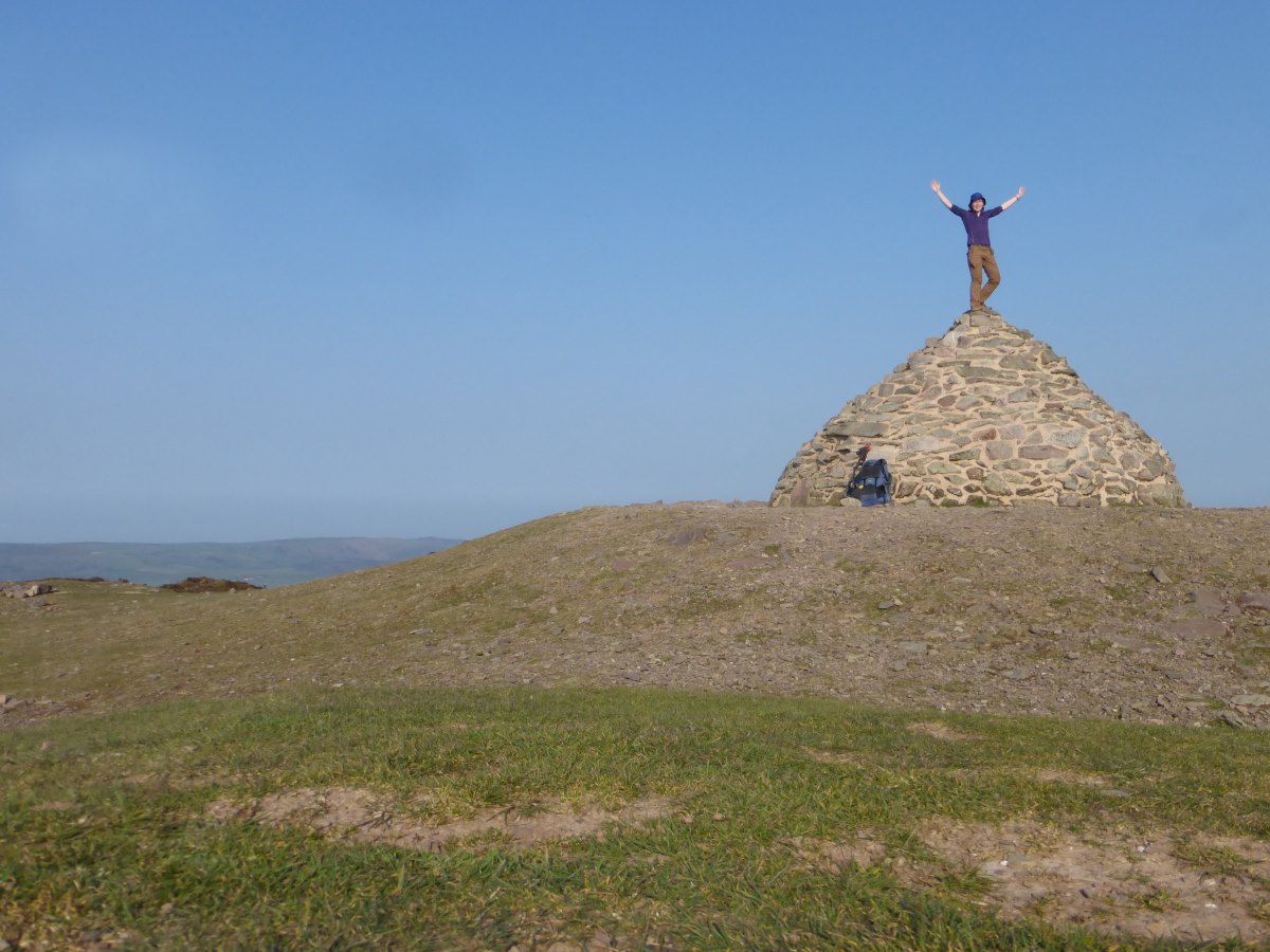
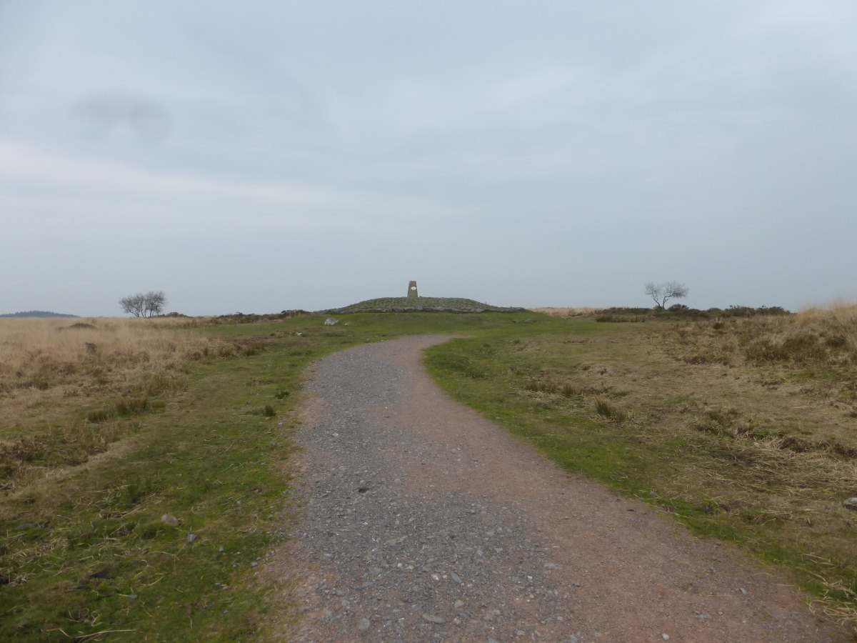
Dunkery Beacon
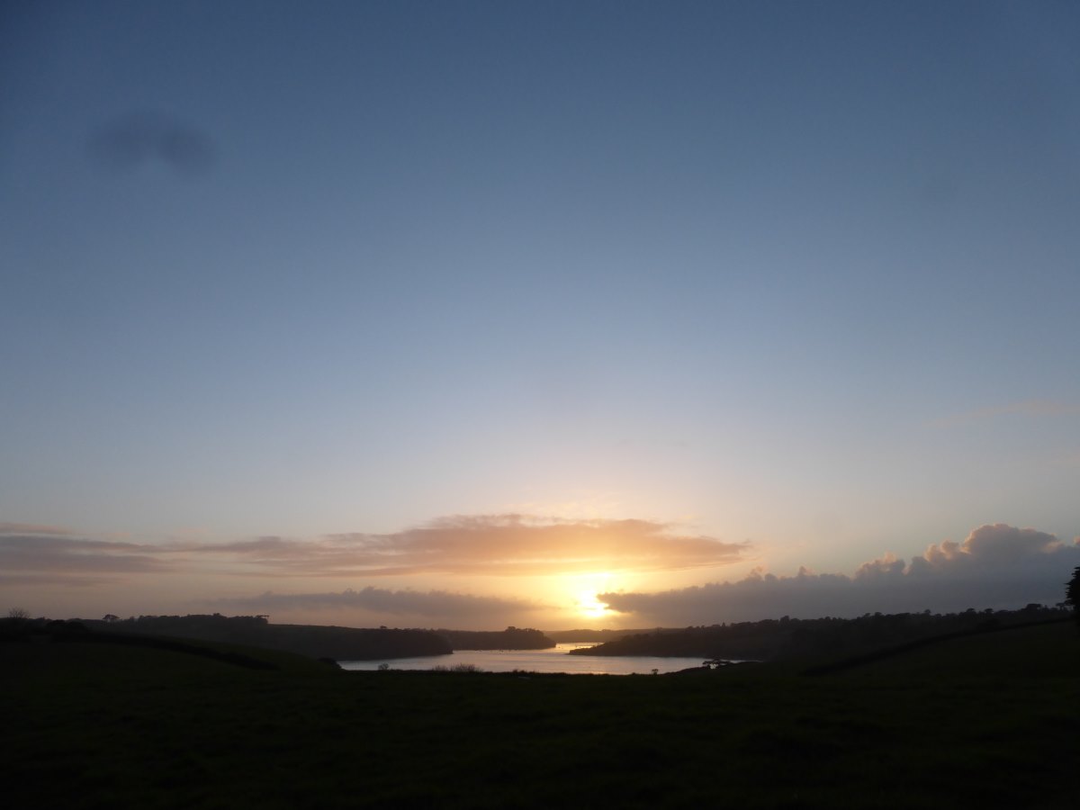
Sun setting into the haze
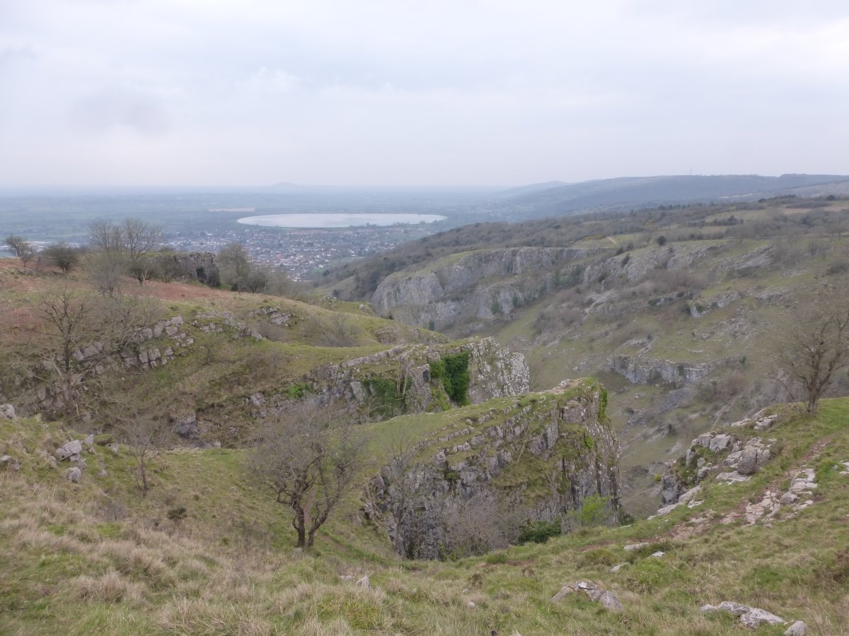
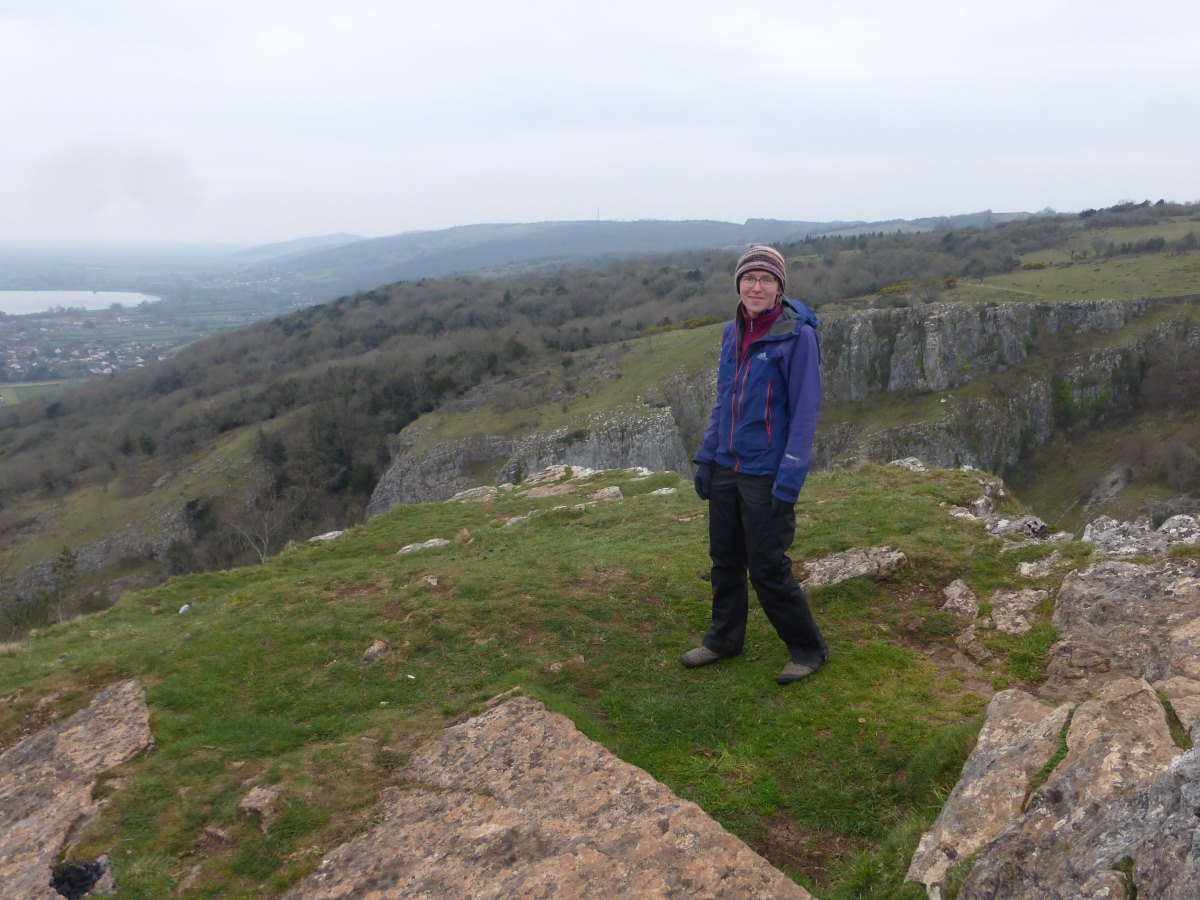
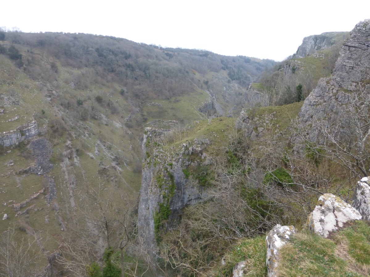
Dunkery Beacon to Cheddar
Macmillan Way West and an Improvised Bit, 64.9 miles, 4 days
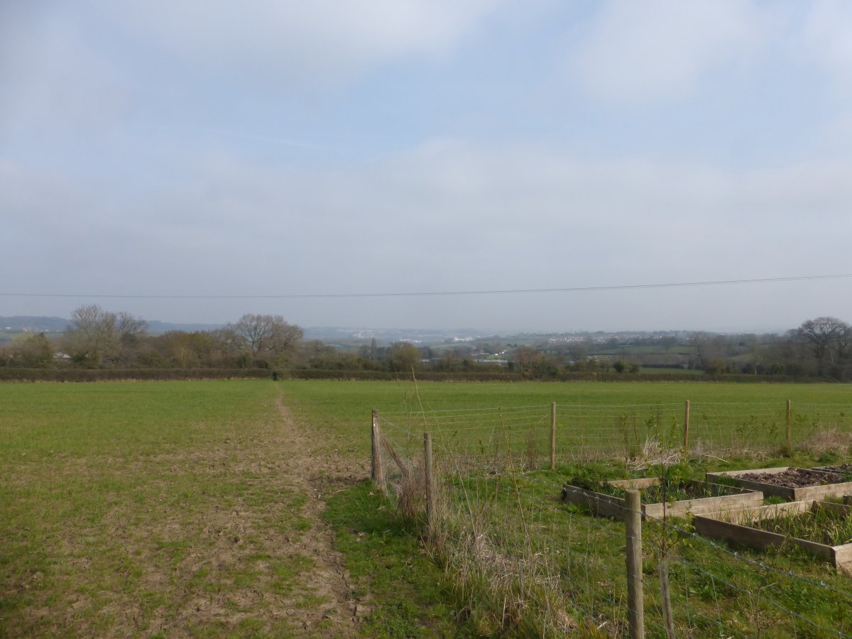
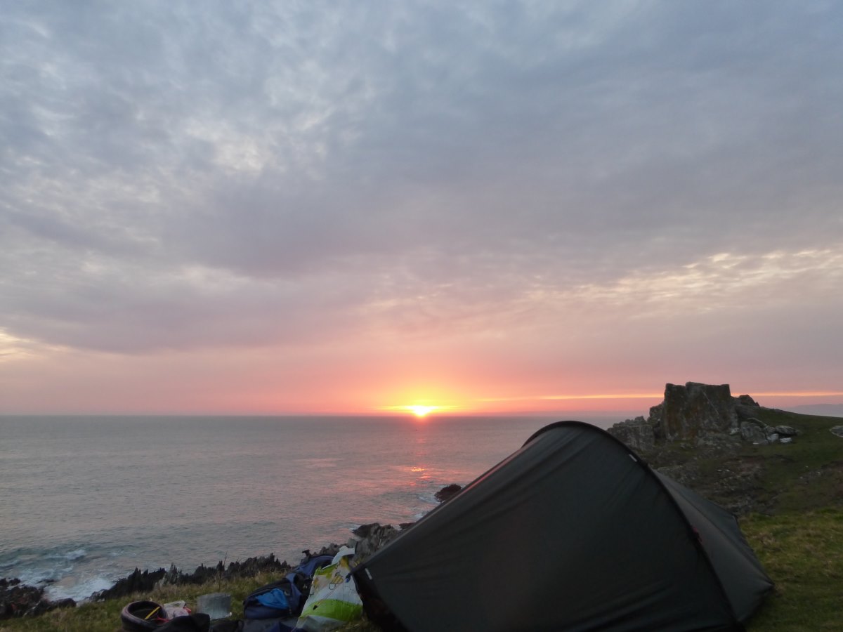
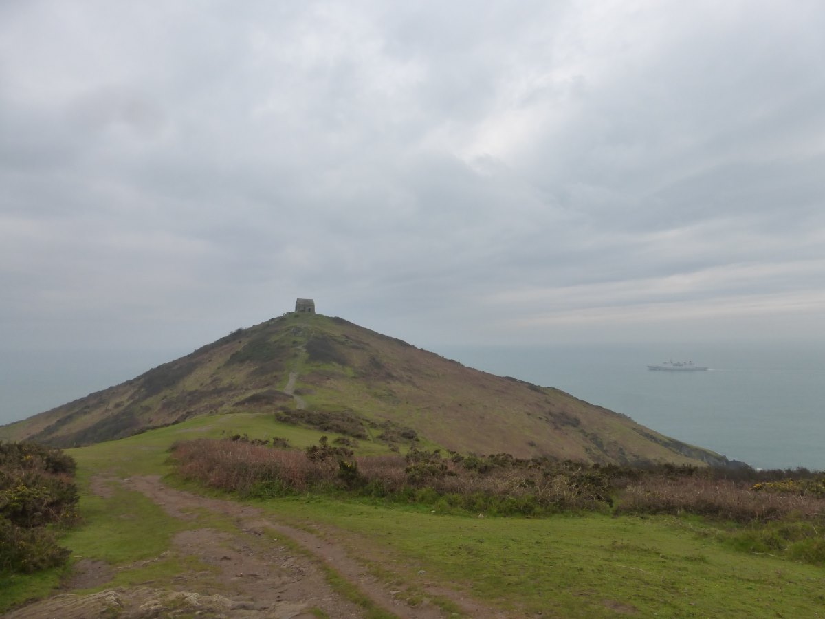
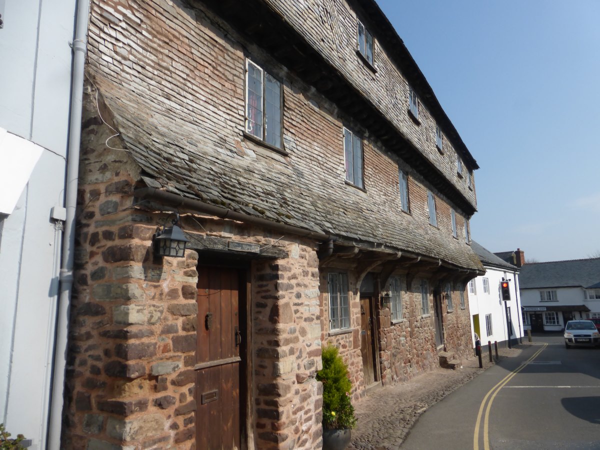
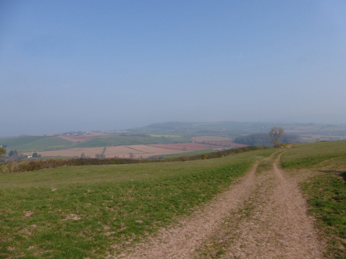
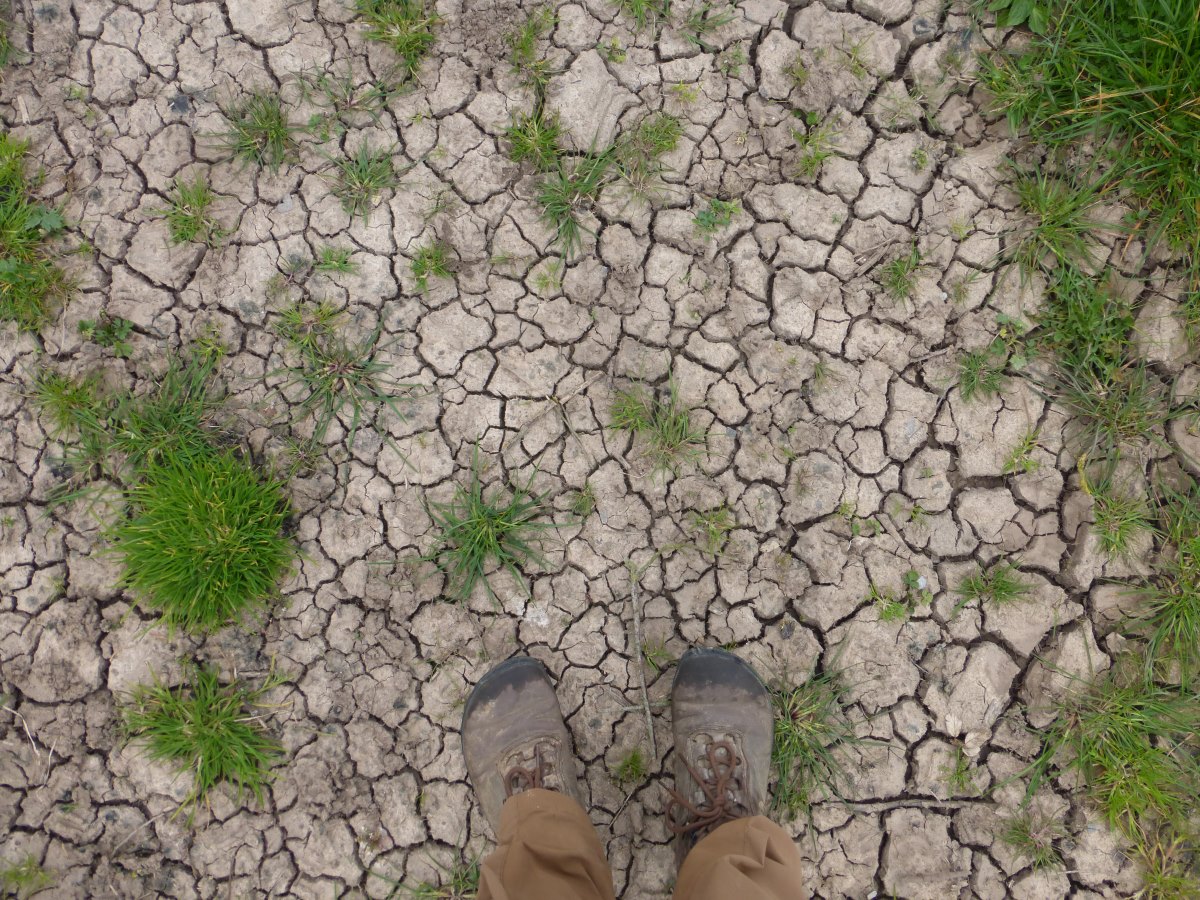
Day 21: at 1am some people come up the Beacon to photograph the stars. After about an hour of comparing exposures and setting up some complex sounding shots with someone standing on the cairn in the dark and flashing a torch for a second at exactly the right moment one of them finally points a very bright light at me and exclaims “oh, there’s a tent! Sorry!” After they finally depart I decide I may as well admire all these stars I’ve heard so much about so I put a new phone app to good use and identify lots of new constellations before finally getting back to some much needed sleep. I’m up again for the sunrise (if you count sticking my head out while having breakfast in bed - it’s getting earlier!) and am packed up and off for 7:30 for a fairly long day - the pay back for my summit camp. Down off the moors then along a series of plantation covered hills with views out to Minehead and what should be the sea. I say should be because, although it’s just a few miles away it is so hazy that it’s totally invisible. Down a very steep slope into Dunster which is a beautiful medieval village with a castle and lots of lovely looking local shops (where I bitterly regret that my rucksack is already full of standard supermarket food). Onwards past many thatched cottages and upwards to Bat Castle which turns out to be a practically invisible bronze age hill fort (i.e. a ditch). I meet another couple who are also walking the length of the UK but in stages by linking together all the walks they have previously done. Down again I drop back into fields and the first signs that say Somerset. Anticipating difficulty in finding camp spots I’m booked into another B&B for the night. It’s a posh looking place where I can just about afford the cheapest single bed but on arrival they upgrade me for free to a luxury double! They have an in-house restaurant where I enjoy the best food of the walk so far and, as I’m booked into another place in 2 days time, I spend the rest of the evening sitting about and relaxing (rather than hand washing socks and phoning home). It’s practically like being on holiday! Day 22: I get the very welcome news this morning that the friend I am hoping to be staying with in Bristol in a few days time will, after many months of house-buying struggles, actually be moving in just before I arrive and I do have somewhere to stay and have a rest day after all. Whoop! Walking wise it’s a shorter day, heading up onto the Quantock Hills and following them to their end. On the up part I’m stocking up on as much water as I can drink (no more streams on the top) when a heard of deer start to pass over the slopes above me. The word start is important here because 10 minutes later they’re still coming. A seemingly never ending continuous line of what must be many hundreds of running deer. Carrying on it’s still super sunny and hazy and the view from the ridge is somewhat limited. I camp on the last hill, just down into the woods to get away from a heard of young and inquisitive Exmoor ponies. I listen to two chapters of the audiobooks, then the evening birdsong. Day 23: worst night’s sleep of the entire walk so far. The reason? Owls. Three of them. Right above the tent. All night. There’s enough phone signal to listen to some examples and identify the culprits as three Tawnys; one female, two male. Yelling at them achieves nothing. They finally stop with the sunrise but then I have to get up. I’m tired and not feeling great and make matters worse by setting off on the wrong path because I didn’t want to keep yesterday’s map out for only 200m and thought I could remember two junctions. It’s yet another hot and sunny day through fields and woodlands and overall a rather nice path. After spending the best part of three days on the Macmillan Way West I look over my shoulder at a junction and finally find my first sign post! It turns out that the whole way is perfectly going West, but with nothing for the backwards adventurer heading East. About midday I notice that the little pencil line I’m following on the map (which is too old to have the Macmillan Way marked on it) attempts to cross a river where there is no bridge. Thinking there must be a new footbridge or something I carry on until I reach a large volume of water with, indeed, no bridge across it. A bit of frantic research reveals that this is where I was intending to turn off the Macmillan Way and the past-Me sitting at home three years ago drawing lines on maps clearly didn’t spot the large blue line in the way. Oups. It’s a very sad four miles on tarmac to the nearest bridge where having almost run out of food I have to make a decision between carrying on to my B&B or spending a few hours waiting for a table to free up in a pub because it’s Mother’s day and everything is full. I choose the B&B and spend multiple hours trudging along the edge of a main road to make it only three hours later than estimated. I lie on the bed while my feet throb and work out the distance at 22 miles. What is even more sad is that everywhere that could have sold me food is long since shut. I eat my last two wraps, plain, for dinner. Then I have to crawl into the shower because my feet have swollen up and hurt too much to stand. It is a new level of low and one I pray I won’t be beating later on. Day 24: I’m still awake at midnight because my feet are throbbing too much to sleep so I give up on any notion of getting to Bristol in two days and book myself into a campsite for the coming evening to enforce slowness. Thankfully I do then sleep and on tentatively lowering my feet onto the floor in the morning find that I am able to stand without pain. I’m also able to appreciate my very lovely surroundings in a private converted potting shed in a beautiful cottage garden where breakfast includes homemade bread and eggs and spinach from the garden. Walking starts off well too with the first tracks I set off down containing lots of unexpected bird hides and tiny nature reserves. There’s a woodpecker at the first and then as I move into wetlands a lot of swans, coots, moorhens, a grebe and an egret. Sadly that’s the nice part of the day over with. The second consists of my increasingly frustrated attempts to reach Cheddar, thwarted at various turns by overgrown bramble thickets on bridges, aggressive farm dogs, locked 6ft high gates, inquisitive cows and electric fences with no openers. Oh and yes all of these are on public rights of way. I’m sitting dejectedly on a bench staring at the map when a local man offers some help and comes up with a route which finally actually works. He mentions that, long ago, he also walked John O’Groats to Land’s End but only took a road map and every time he tried to take a short cut it ended up being a big hill. He got tired of it very quickly and it was a very long way. Thanks to his help I do finally make it to my first campsite of the trip, though the first task on getting there is to add an additional 3 miles into Cheddar and back to finally reach an open food shop. I decide that no-one in Somerset walks anywhere. They must just do absolutely everything by car. My mileage for the day including detours and retraced steps adds up to 19.5 (not the 14 it should have been). This does not include the shop.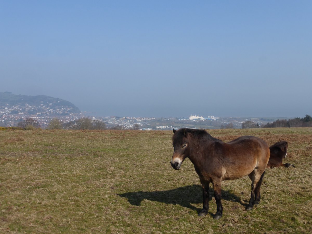
Looking down on Minehead and the sea
Dunster
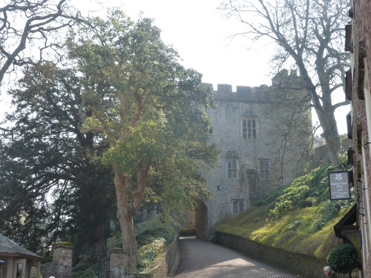
Dunster castle
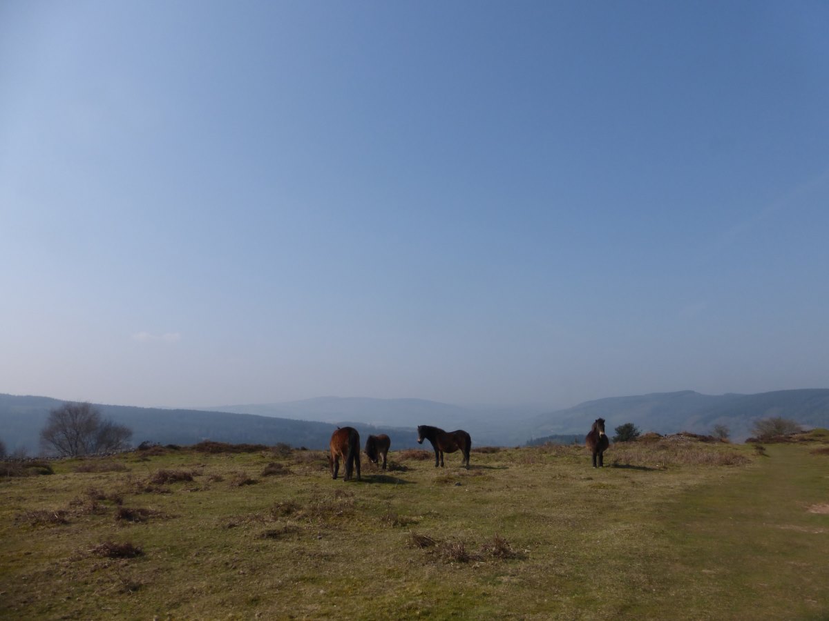
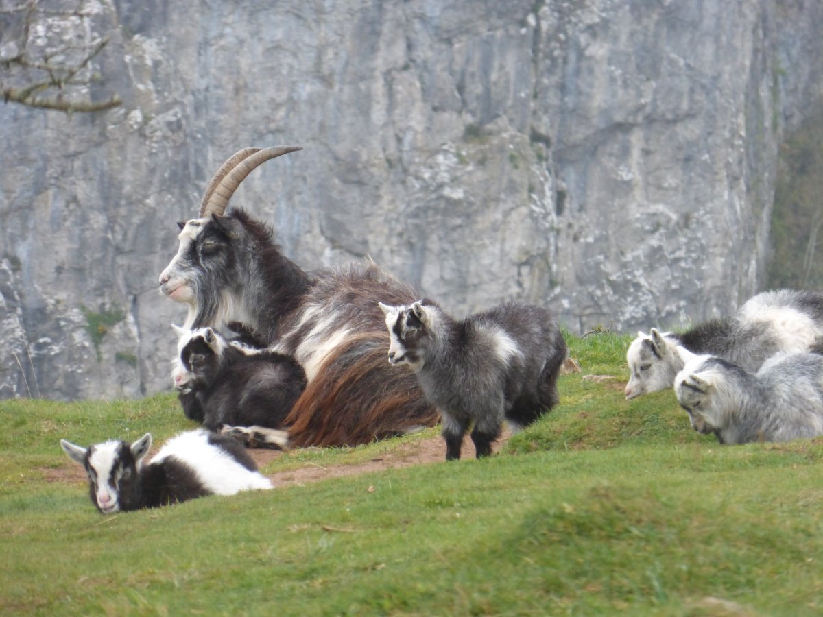
Exmoor ponies
Into Somerset
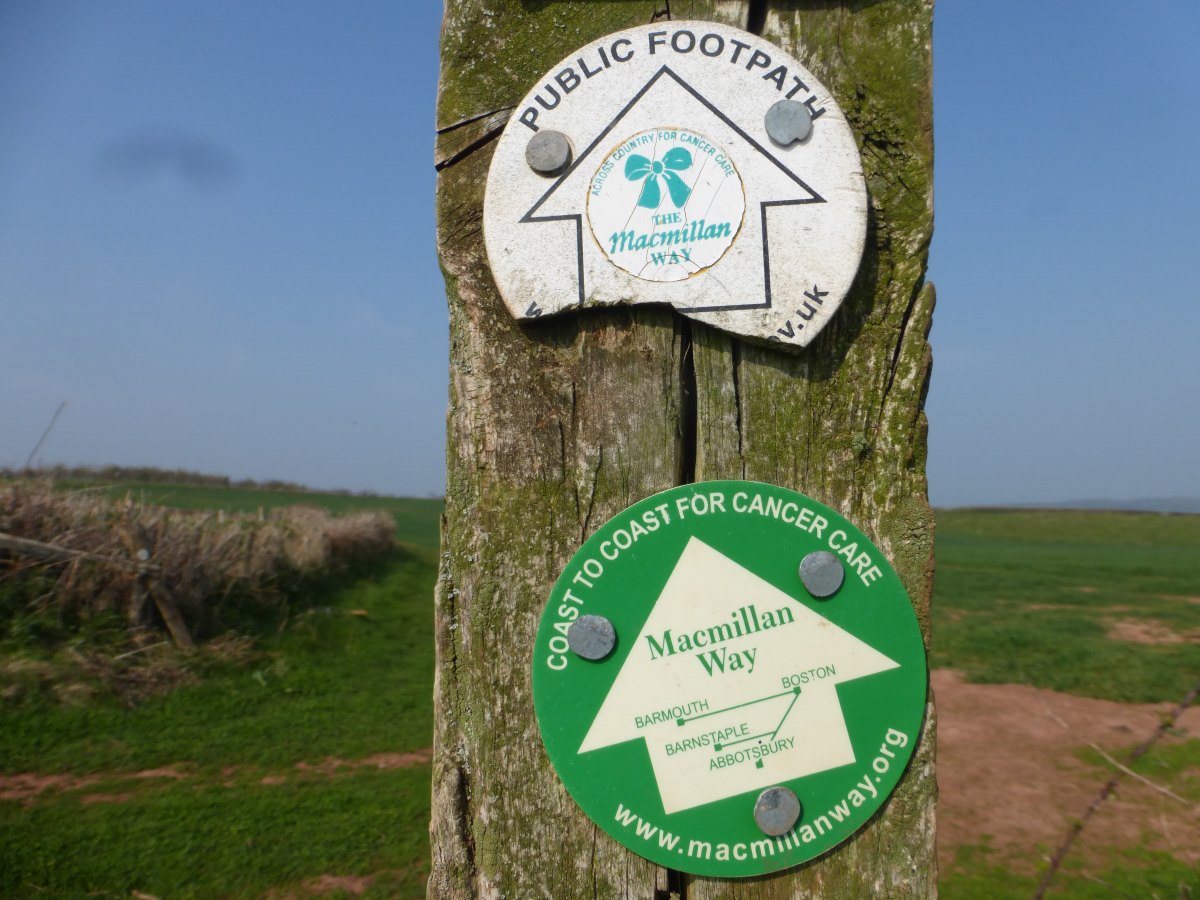
Signposts only back West
So which way is East?
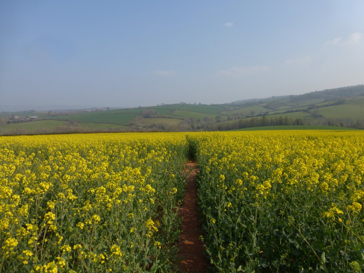
Rapeseed
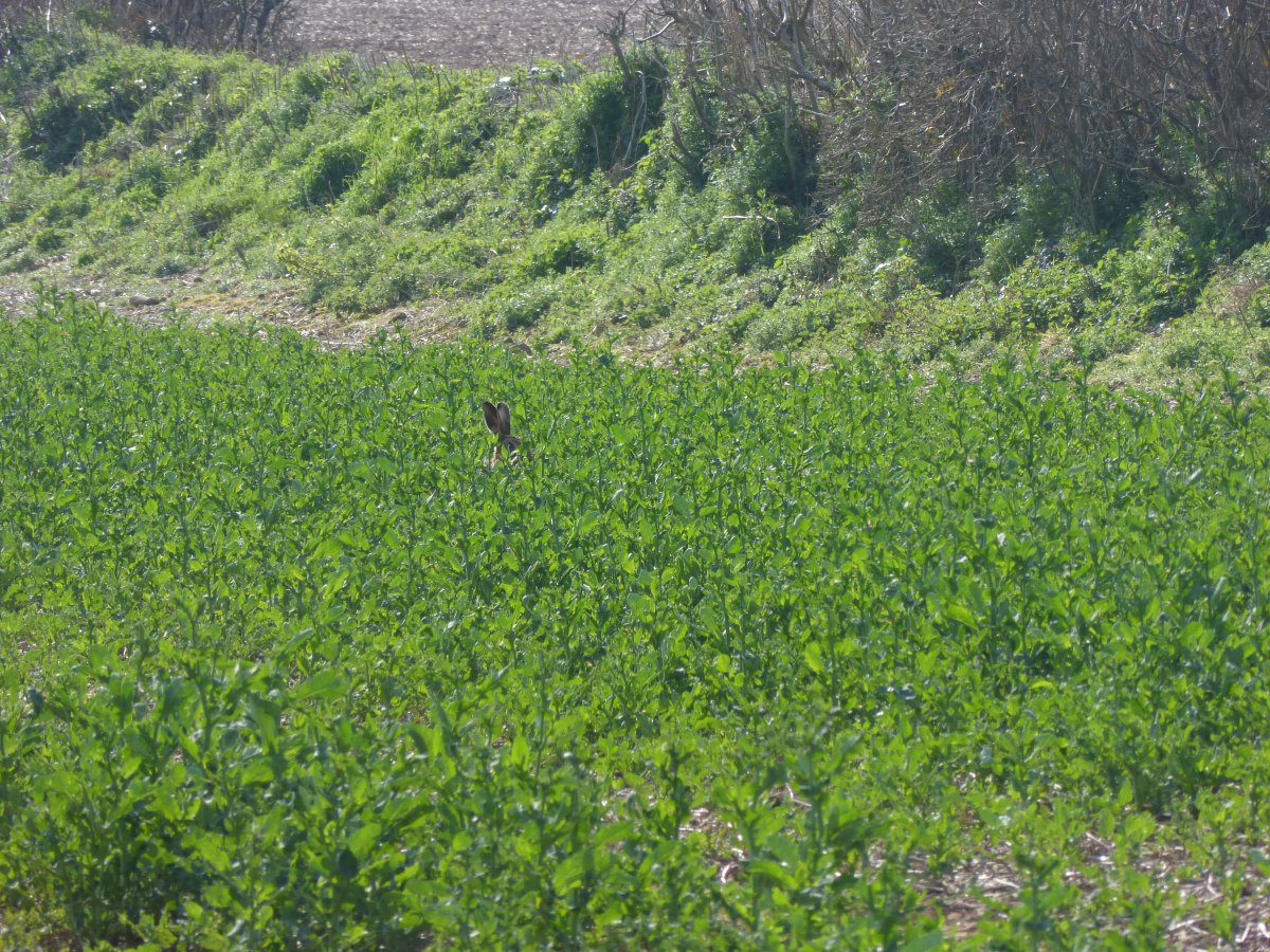
Spot the hare
Climbing the Quantocks
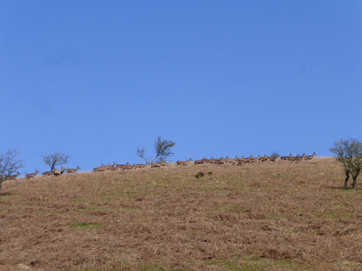
A never ending stream of deer
Quantock Hills
Quantock Hills
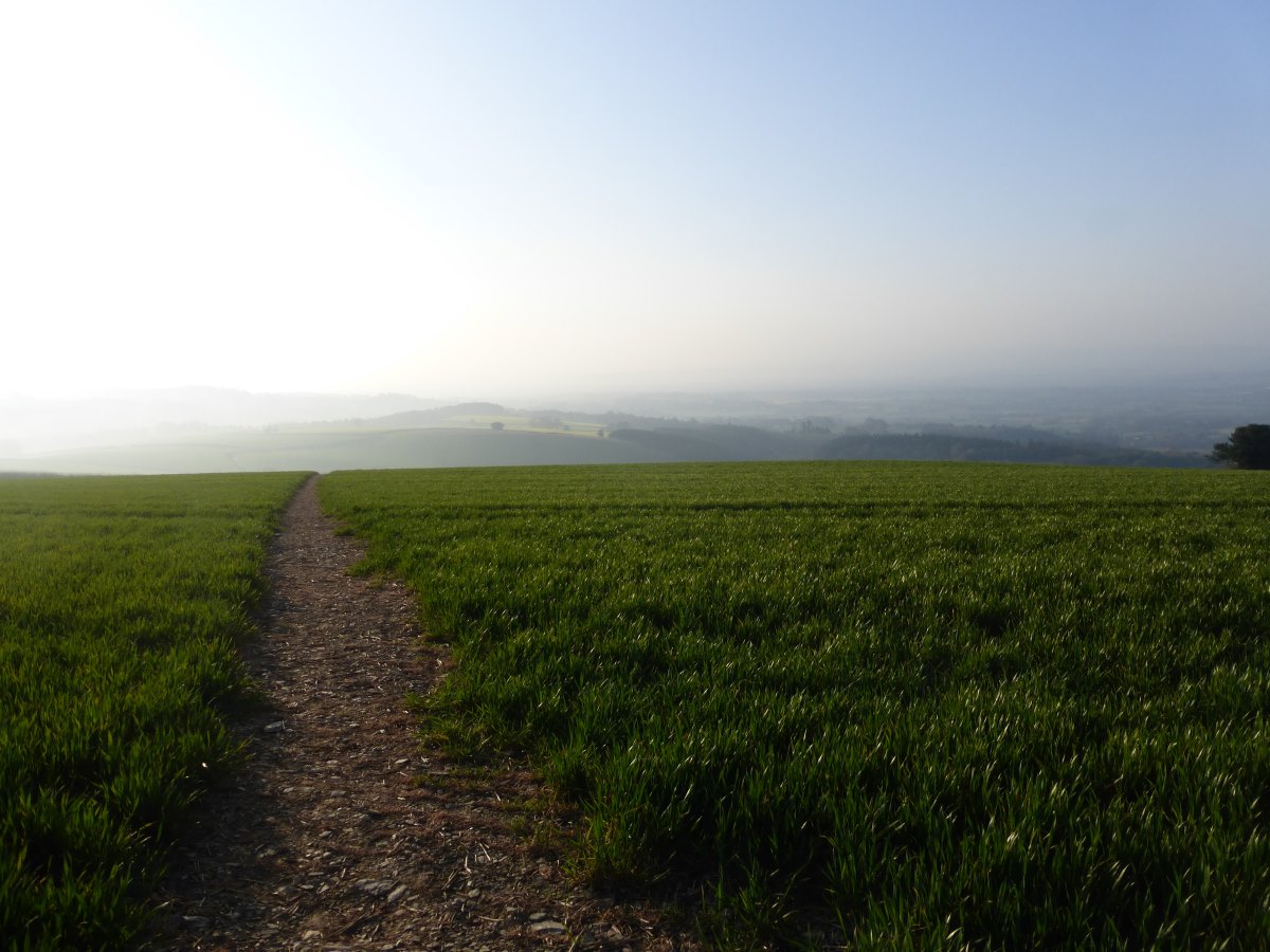
Sunrise over the fields
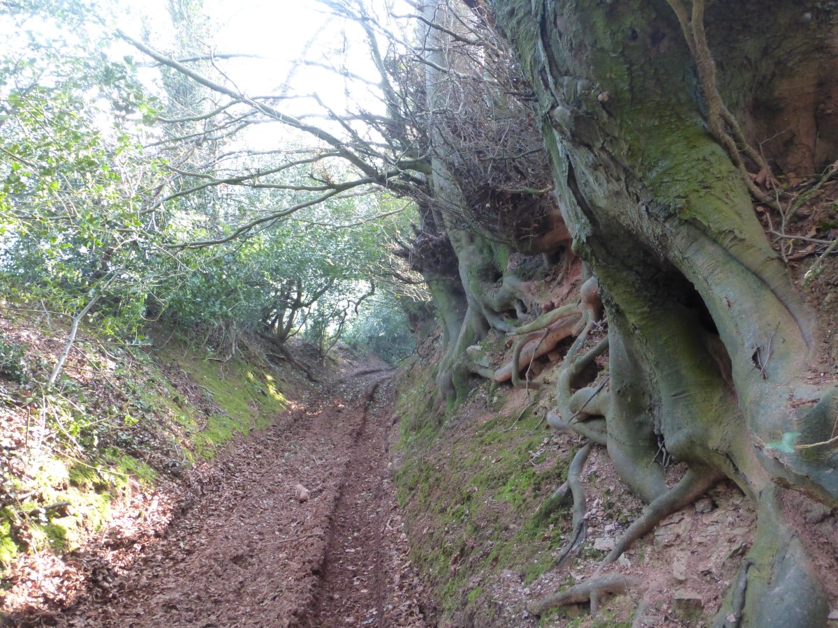
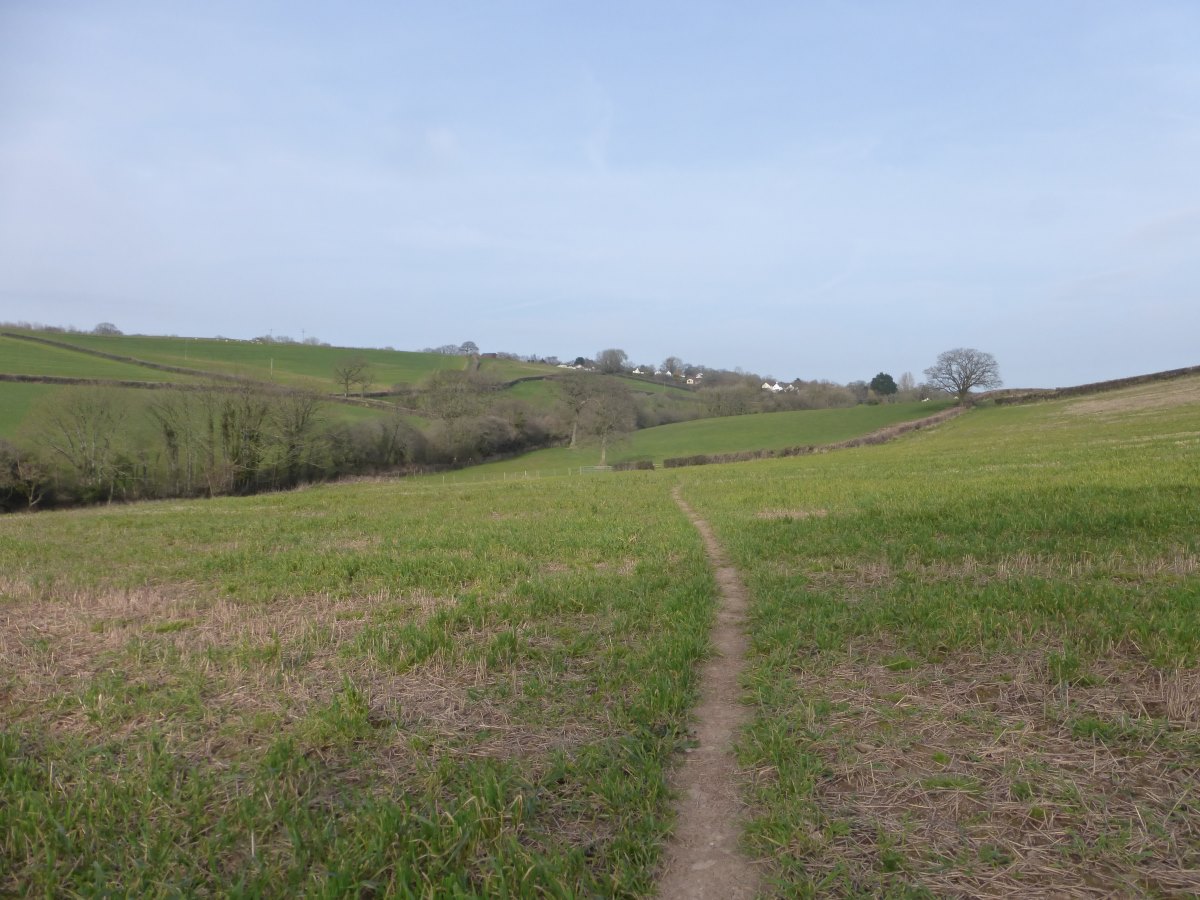
A sunken lane
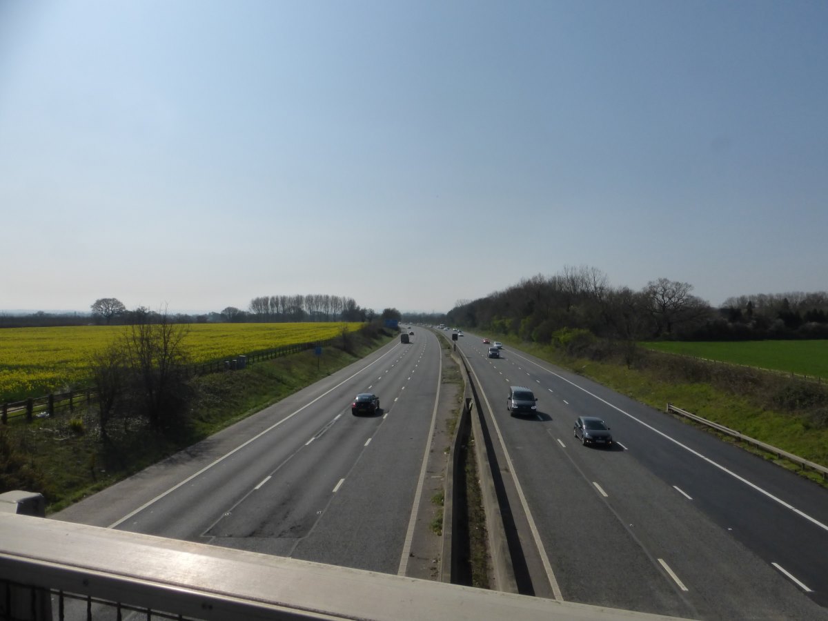
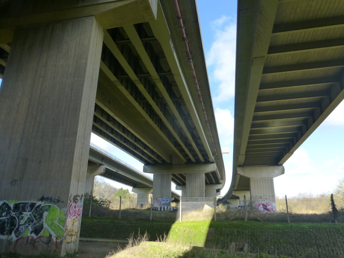
Crossing the M5
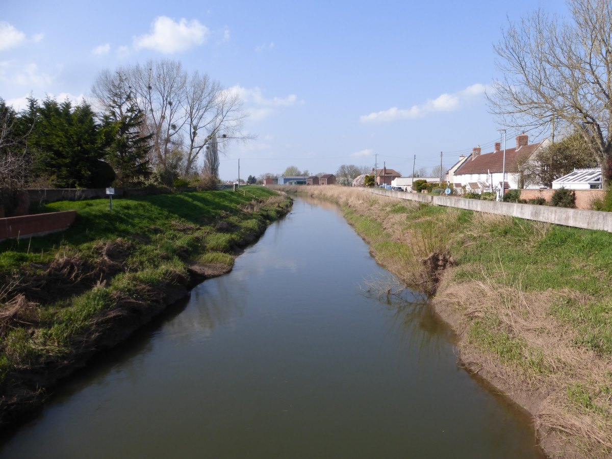
The river I didn't notice...
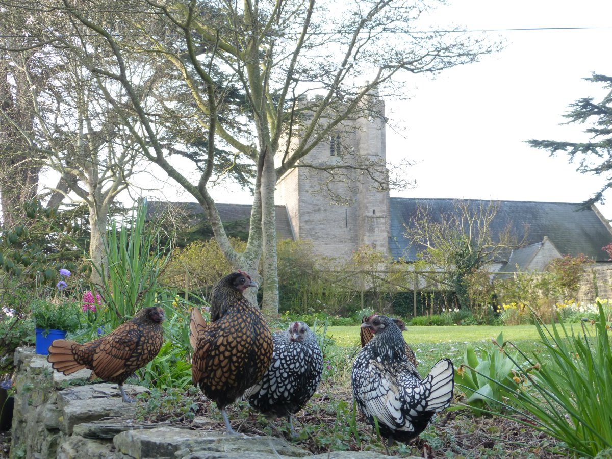
Chickens posing at my B&B
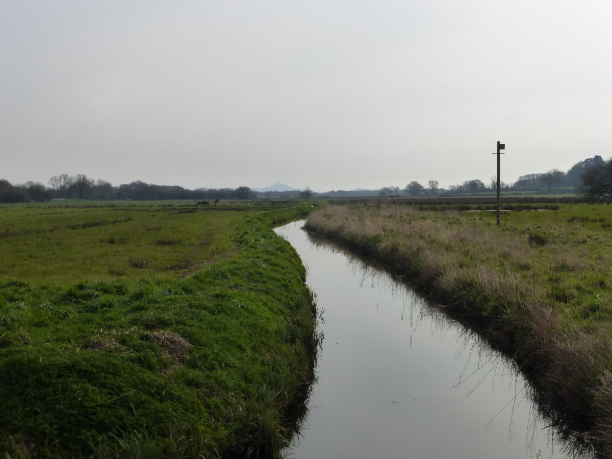
Glastonbury Tor in the distance
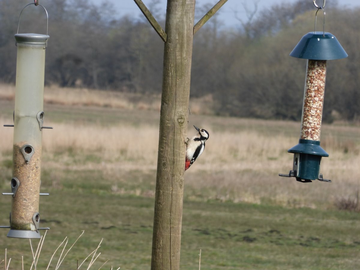
Woodpecker
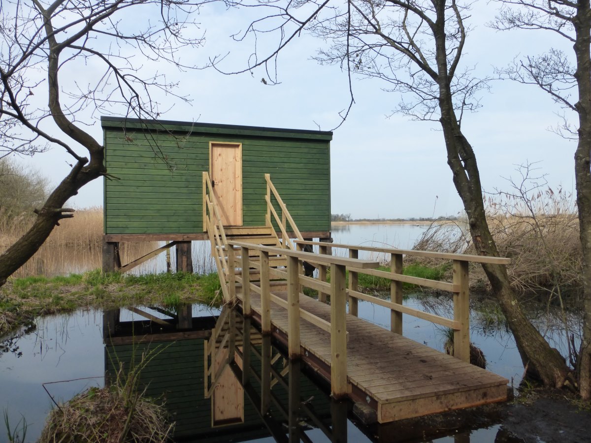
Unexpected bird hide
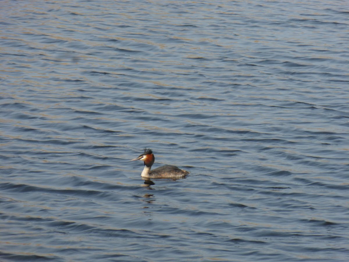
Great crested grebe
It wobbles
Getting very dry
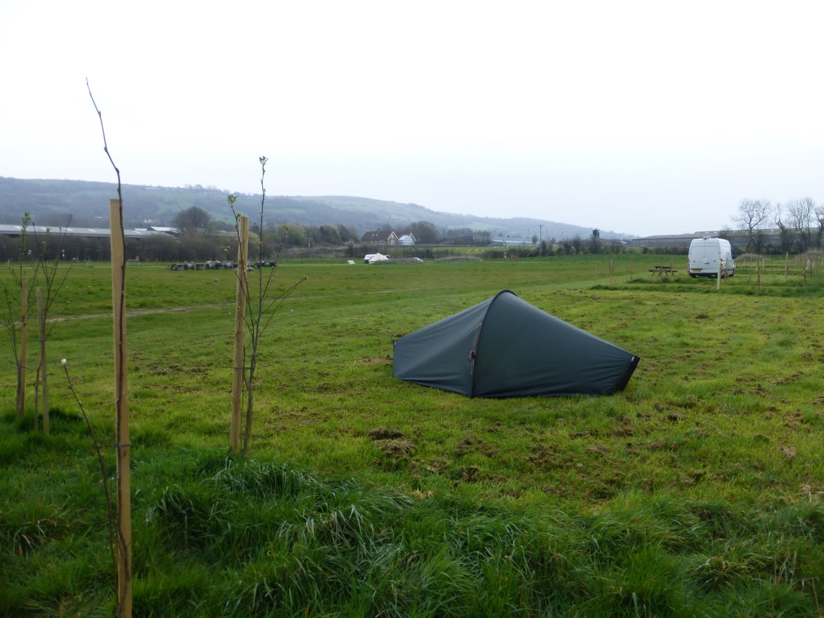
First campsite!