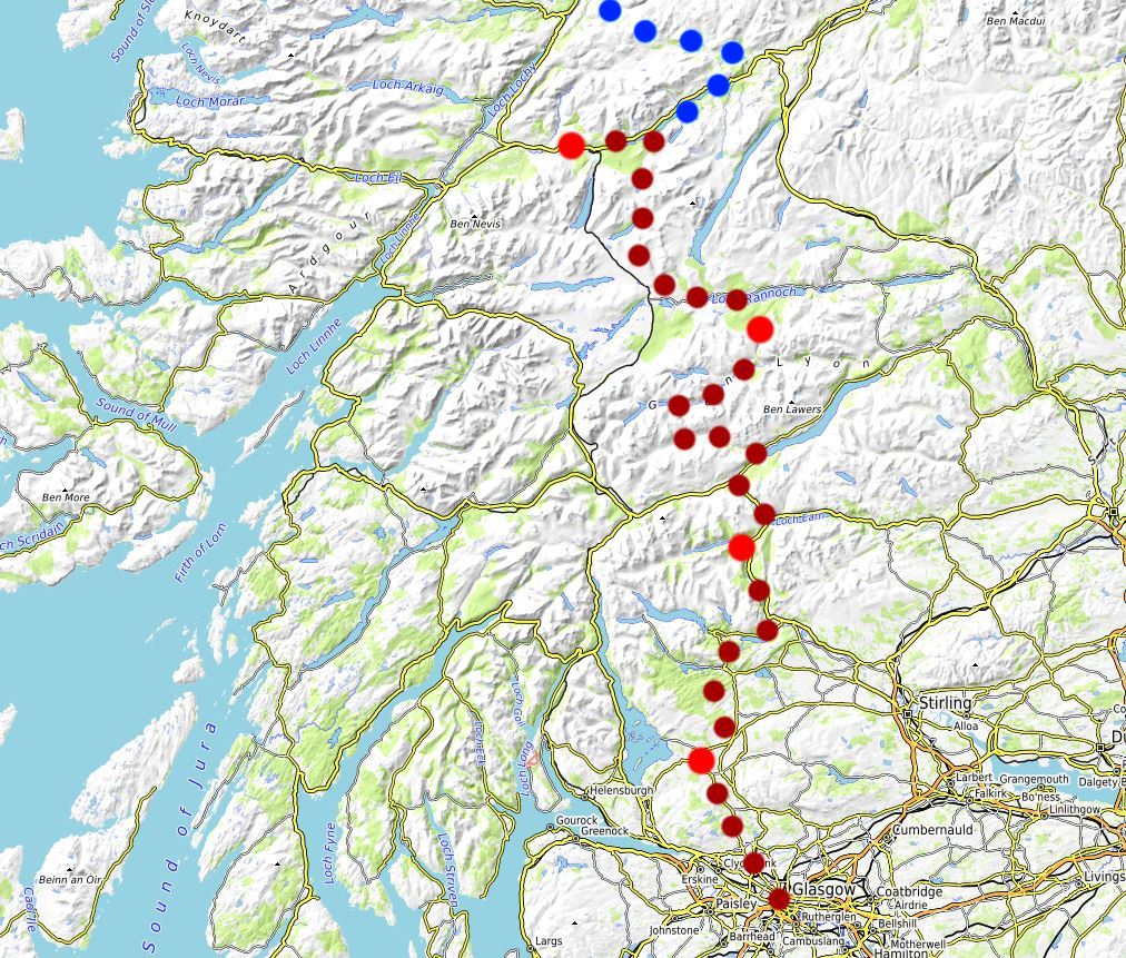
Day 1: Glasgow to Drymen 33km/20miles
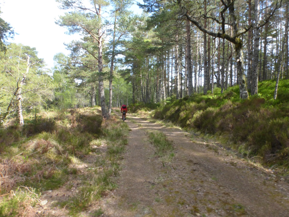
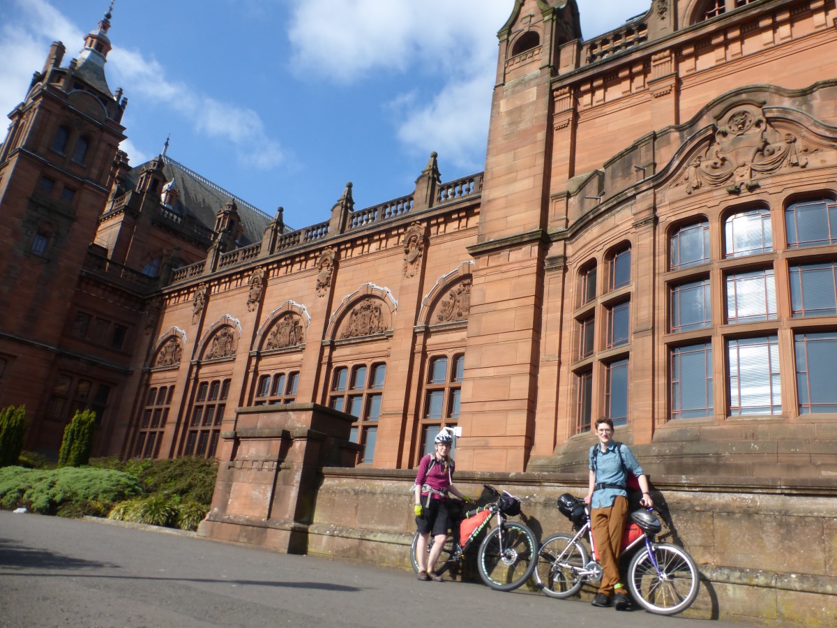
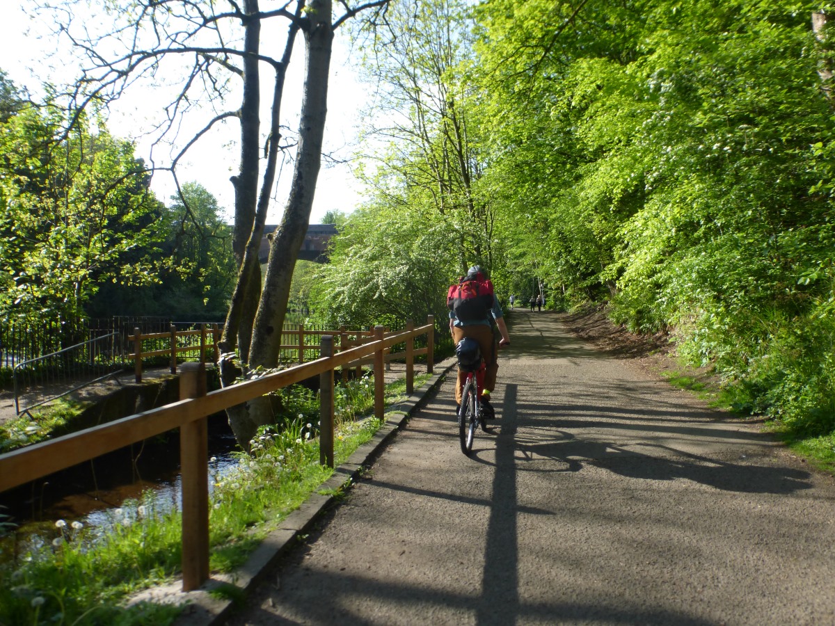
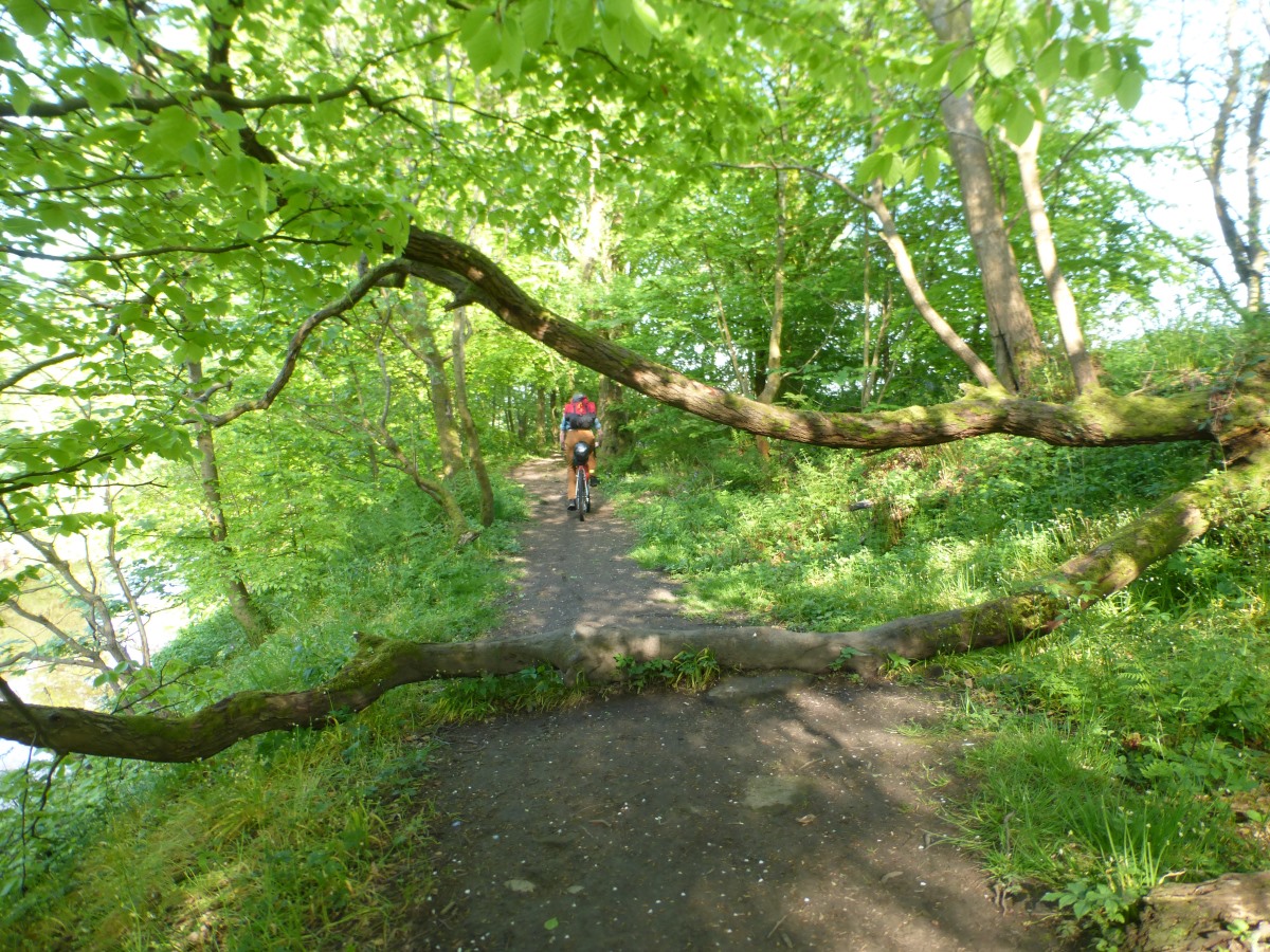
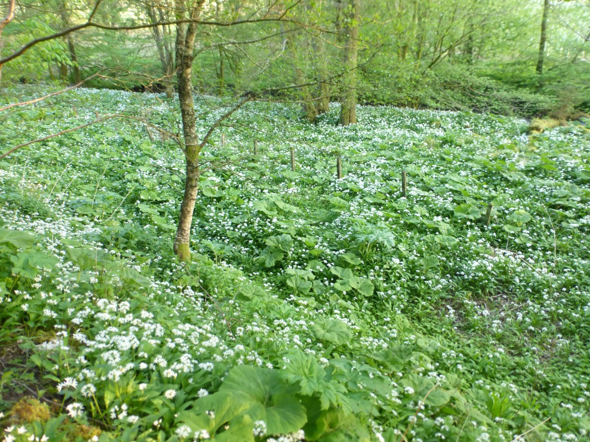
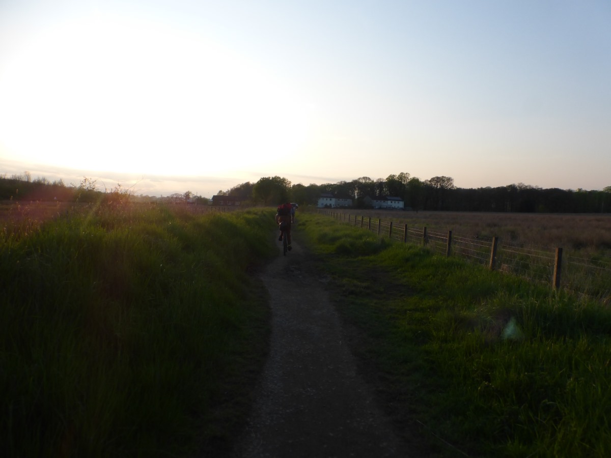
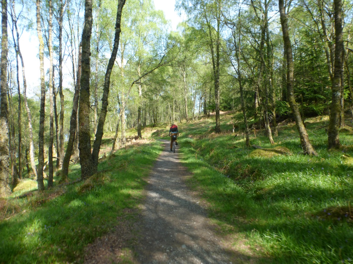
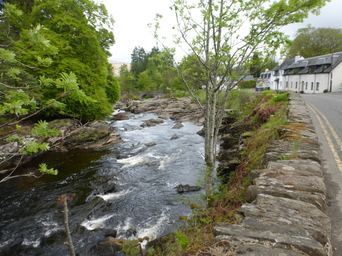
Our train gets into Glasgow at 15:30 and we decide not to brave city traffic but instead to push the bikes the couple of miles to Kelvingrove Gallery where the trail starts. On route we find an excellent katsu curry with crispy battered king prawns and a delicious sauce which I manage, by virtue of my bike falling over, to splatter all over me and said bike. Goodbye clean clothes. Getting going at about 5pm we’re straight onto the Kelvin walkway which is a lovely route, if initially very busy with people. It feels like we’re pretty much straight out of the city, and it’s not long before we leave the people behind too. Off the walkway but still following the river the trail becomes rougher and slower with a few tree roots to negotiate. This is the first time I’ve ridden my mountain bike fully loaded and it feels heavy and cumbersome, so there’s a few bits that I get off and push. But mostly it’s ride-able and enjoyable, if a bit on the slow side. Reaching Milngavie we pick up the official start of the West Highland Way, though by now it’s gone 7pm and the trail is thankfully almost empty of walkers. There’s one fairly brutal hill to get us out of town followed by a few bumpy rocky sections but again it’s mostly ride-able and there are some great views as the light turns golden around us. It doesn’t take us long to reach the point where I joined the trail last year on my Land’s End to Cape Wrath walk, so now I can say I’ve done the whole thing. A smattering of tents appear by the path and we set ourselves the goal of getting to Drymen so that we won’t be people-dodging in the morning. The sun sets overhead, and it’s just starting to get dark and the legs somewhat leaden when, with a certain sense of relief, we find a lovely camp spot on the edge of a wood. Dinner is noodles and black bean sauce with freshly gathered wild garlic, then straight to bed.
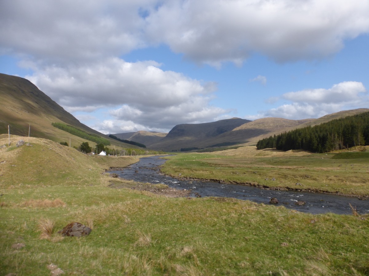
Day 2: Drymen to Lochearnhead 56km/35miles
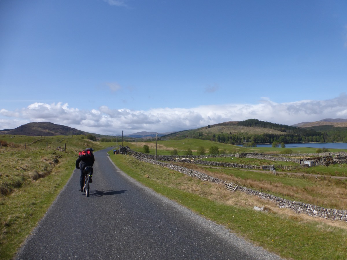
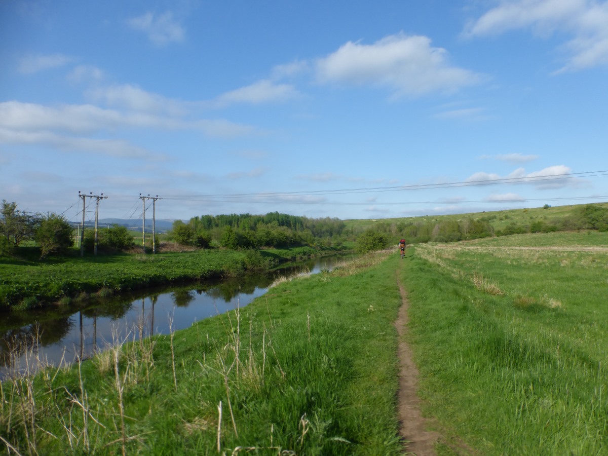
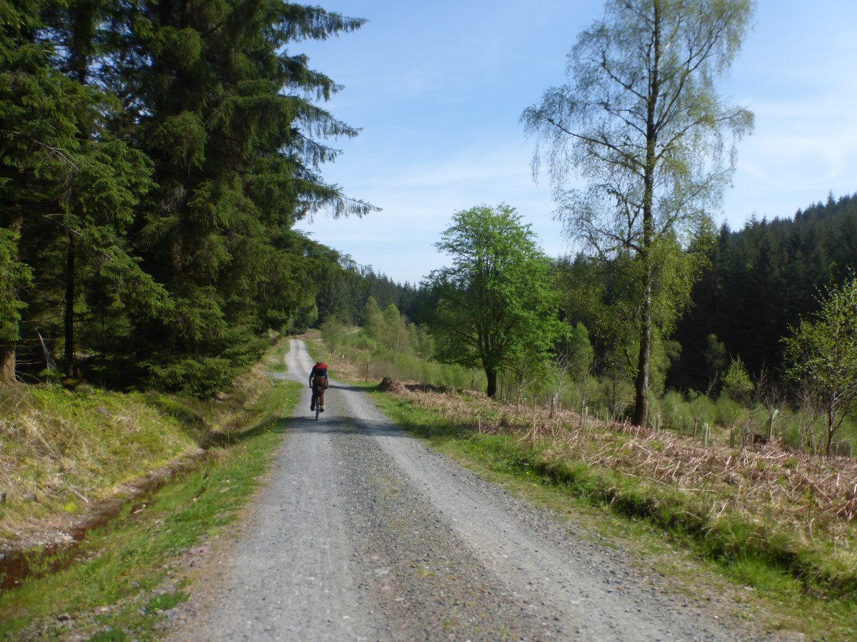
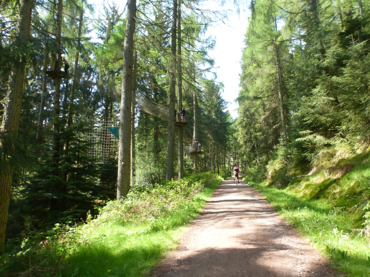
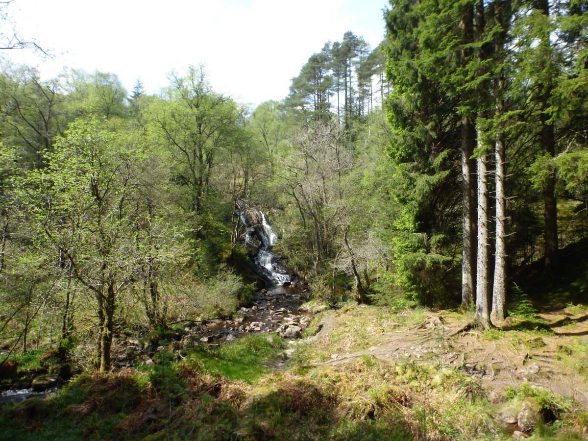
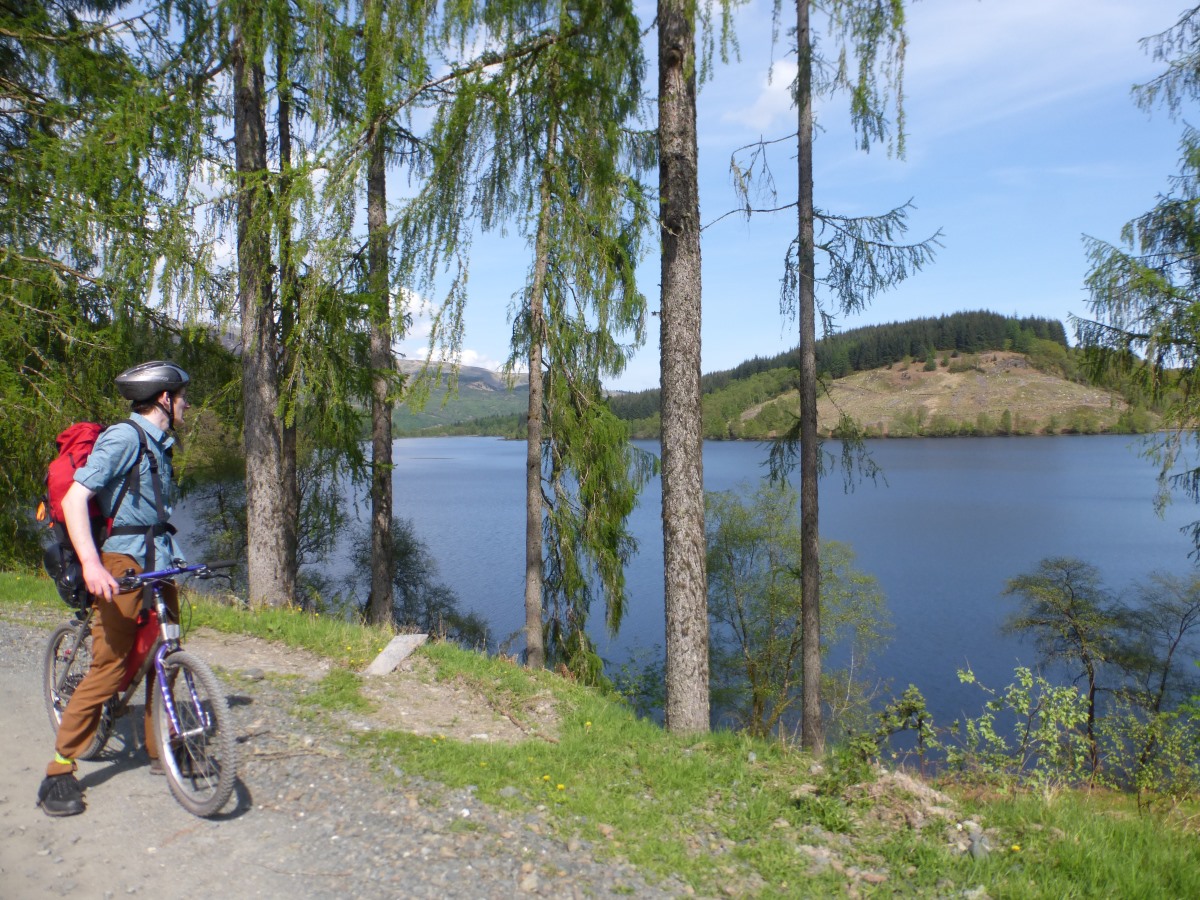
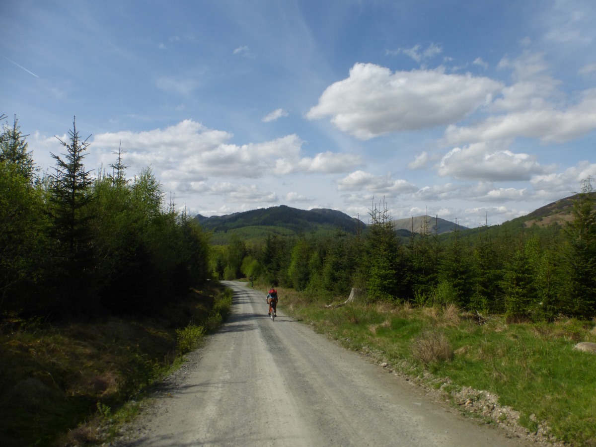
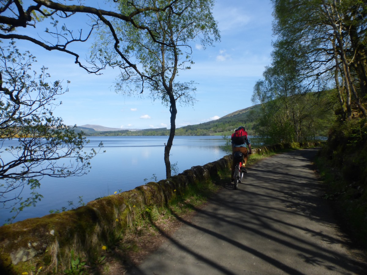
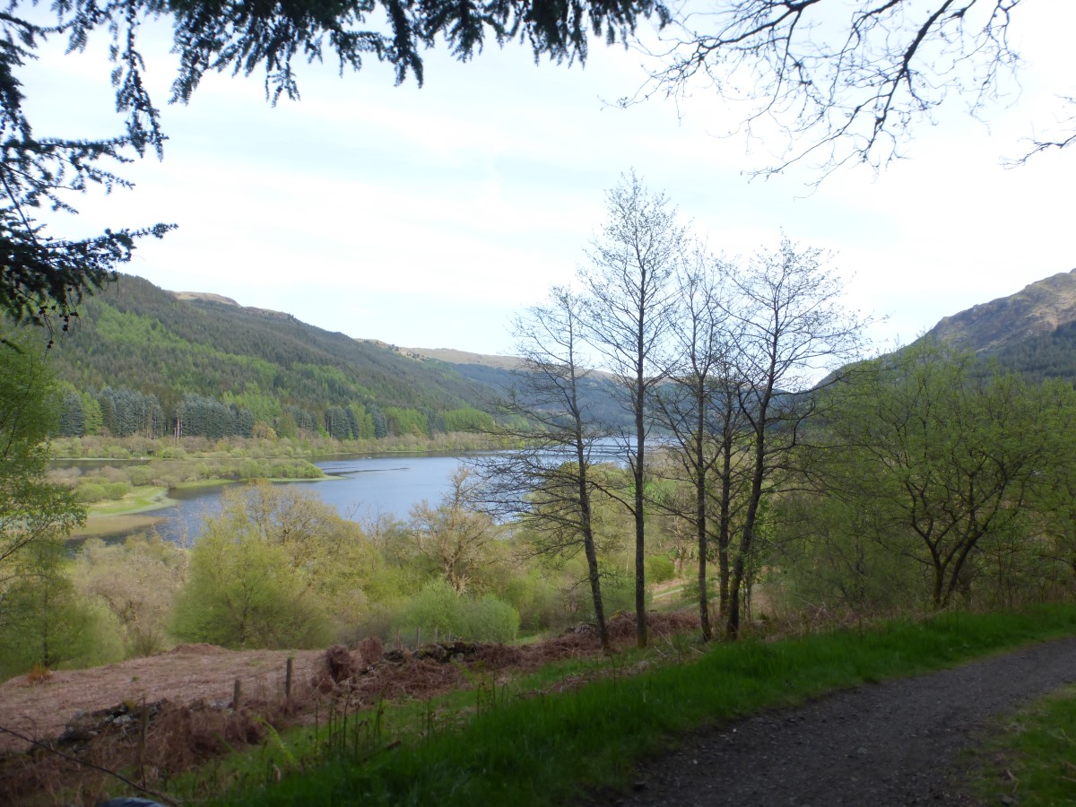
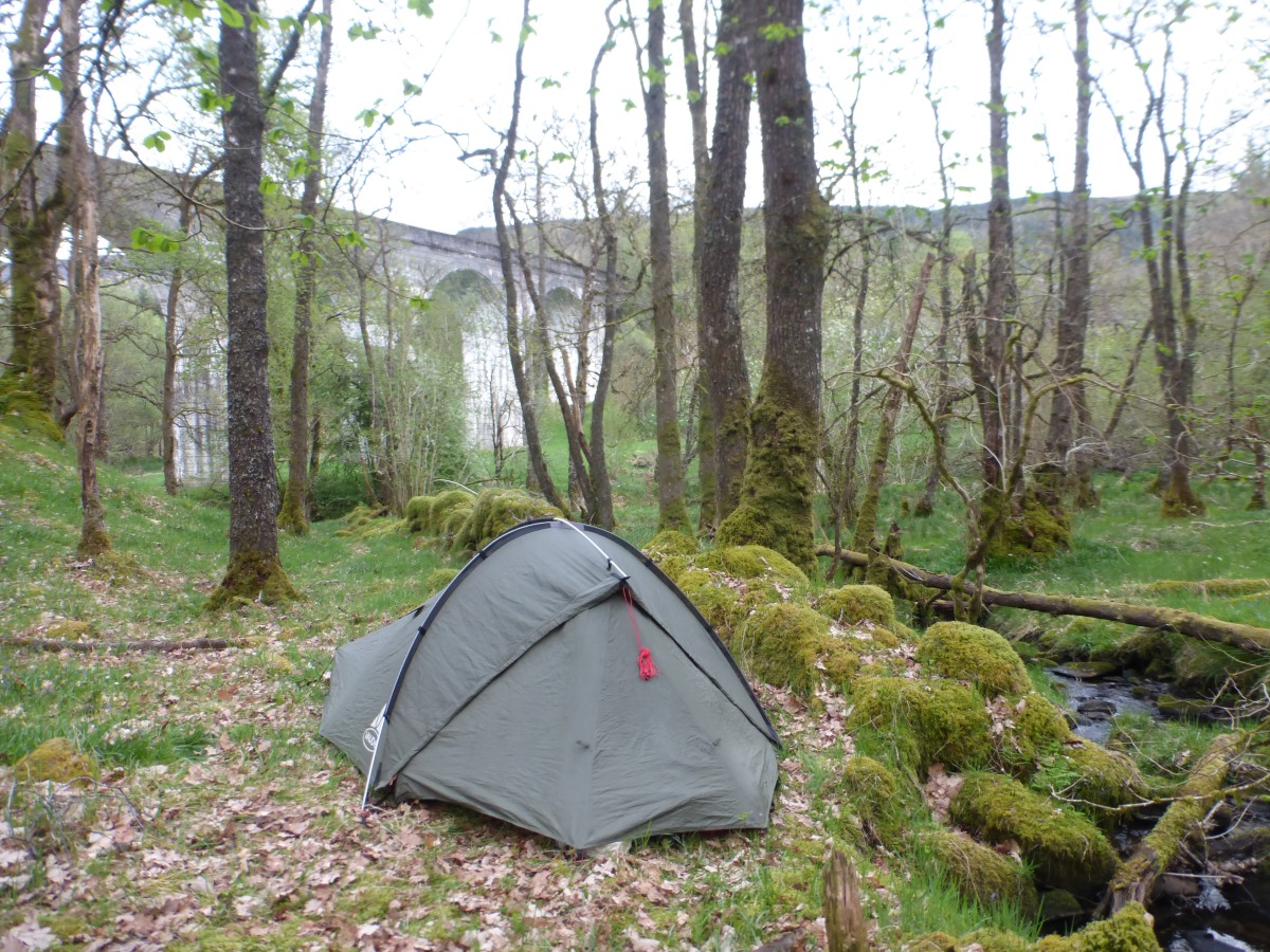
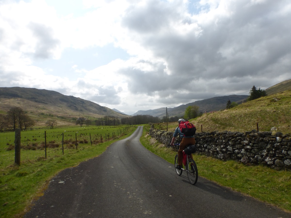
We make up for our late finish with a leisurely start, the morning mist clearing to bright sunshine as we pack up camp. Robbie wanders bleary eyed down to the stream to wash his face and nearly trips over a pine marten (the same stream that I’d just spent a long time quietly sitting next to filtering all our water). We then overcome our first mechanical issue by patching a hole that has worn through his highly technical seat pack (aka dry bag tied to the back of the seat) with cardboard. All ready we get going a bit after 11 into an already hot day. There’s an initial slog up a hill that we both agree we would not have had the legs for last night, then a very satisfying descent to forest tracks where Robbie overshoots, fails to hear my shouting, and has to come all the way back up again. Through the tracks, all lovely and smooth, we emerge into Aberfoyle and take up the guidebook’s recommendation for Liz MacGregor’s café. We fill ourselves up with excellent fish and chips while watching lots of road cyclists zoom past looking much faster than us. Thoroughly full we then cycle straight up a massive hill. OK maybe it’s not actually that big, but it feels it. We get a rest by spending ages finding our turning (which looks like someone’s driveway), but soon find ourselves on the beautiful NCR7 which we follow for most of the rest of the day. It’s a mix of tarmac and a nice solid hardcore which makes a great surface for cycling and the progress feels much faster than yesterday. Up up up we make it to the top of Duke’s Pass, followed by a great swooping gravel descent down to Loch Drunkie. Despite being gravel this part is actually a road and feels somewhat crowded with tents all along the shore and lots of parked up cars. It’s beautiful though, and nice to have somewhere relatively wild that is so accessable for people who are not able to stray far from their cars. We’re soon back to being on our own again as we pick up the cycle trail along the side of loch Vernacher, with more great views. The trail here is pretty much flat, taking advantage of an old railway line as it snakes its way up to Loch Lubnaig. We make quick progress, which we celebrate with a stop for fresh fruit juice and an excellent milkshake. Onwards we pass Balquidder - the guidebook’s official end of day 1, and very shortly after spot a beautiful looking camp spot under a viaduct, making a perfect place to end our day 2. The descent down the bank is slightly hairy but it’s lovely, quiet and flat and probably a perfect spot to be devoured by midges except that we’re still (just) early enough in the year. Dinner is tikka masala and rice, and we wile away a final hour of daylight watching little fish jumping in the stream to catch insects.
Day 3: Lochearnhead to Rannoch 56km/35miles
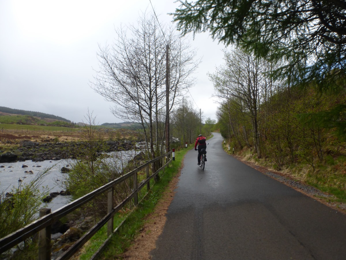
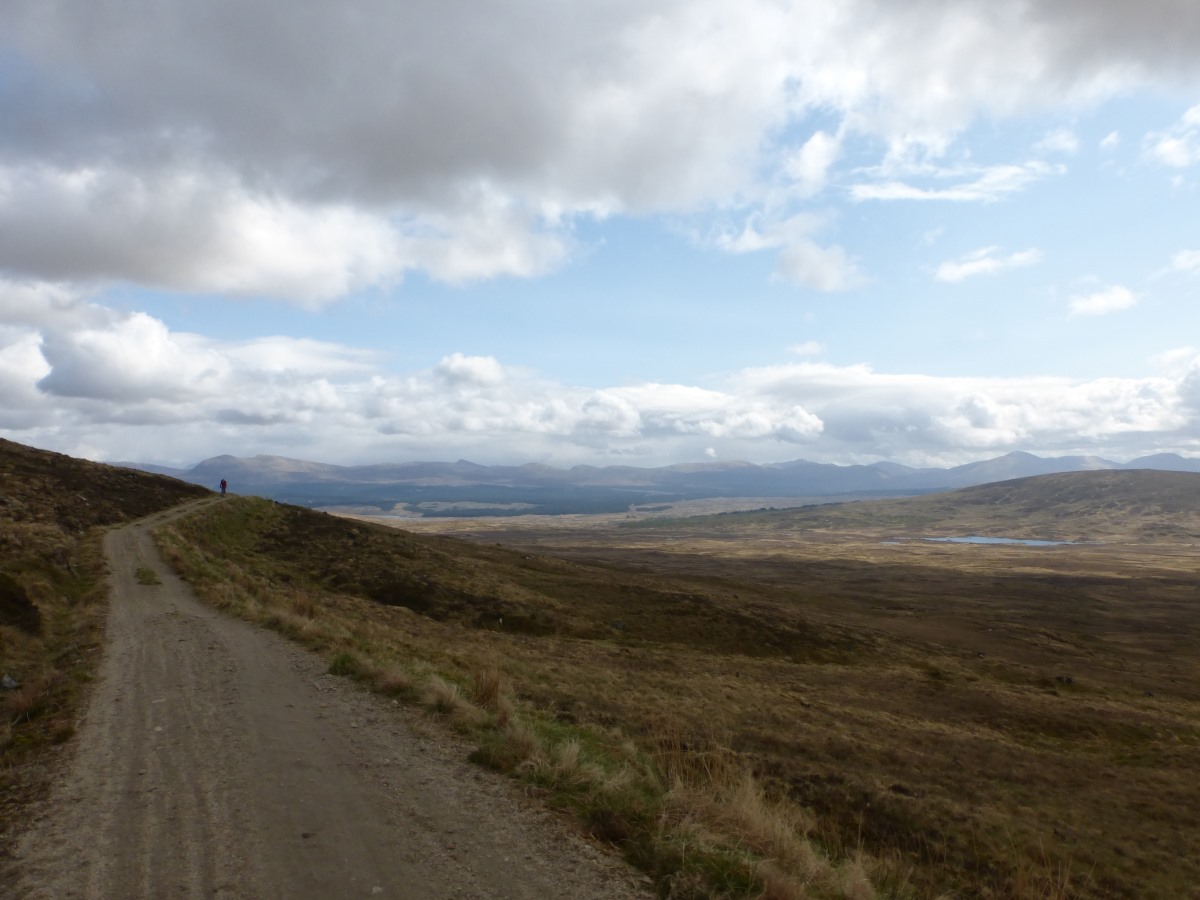
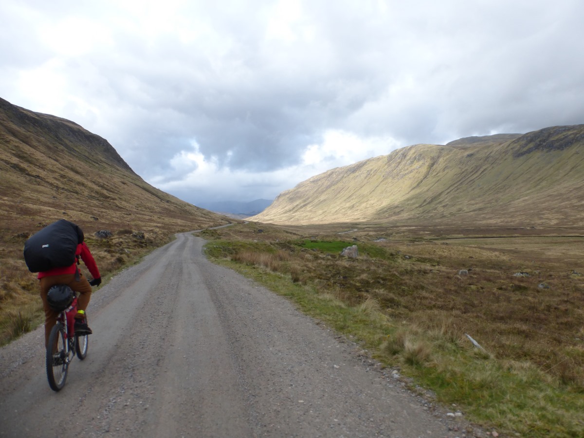
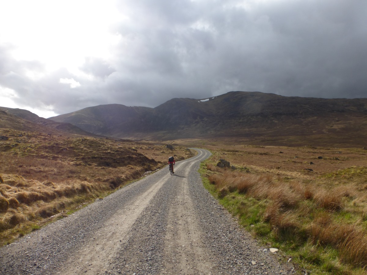
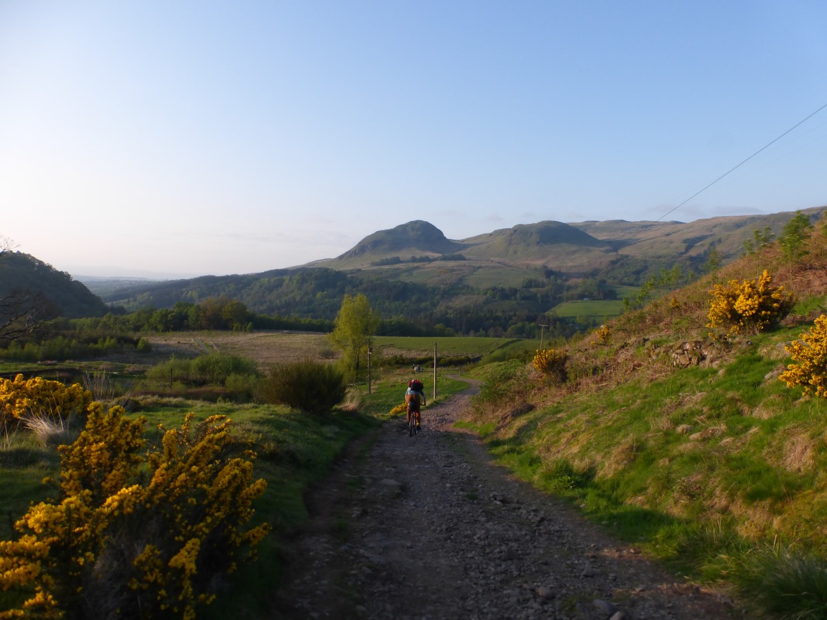
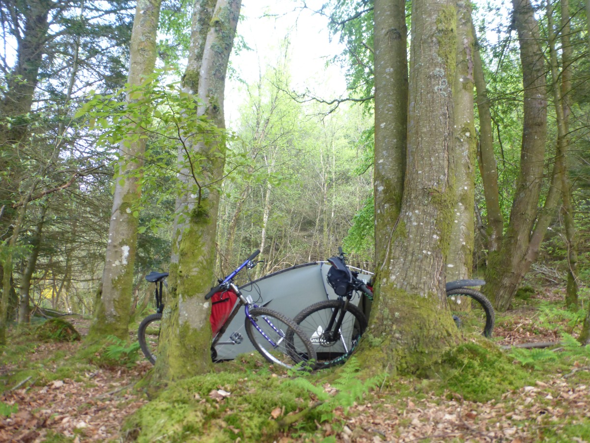
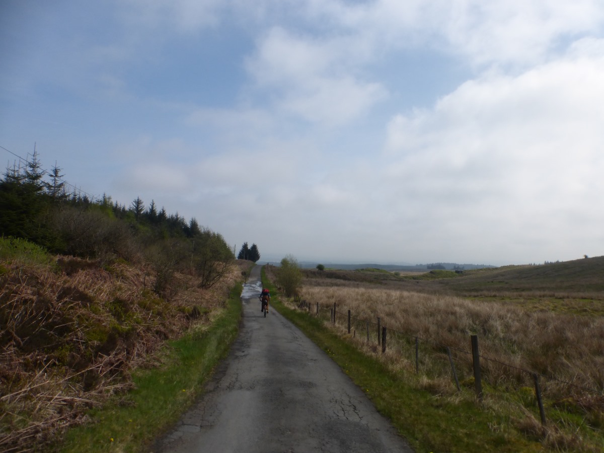
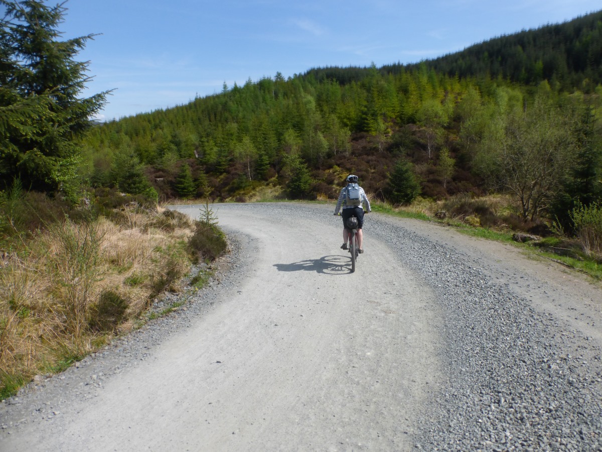
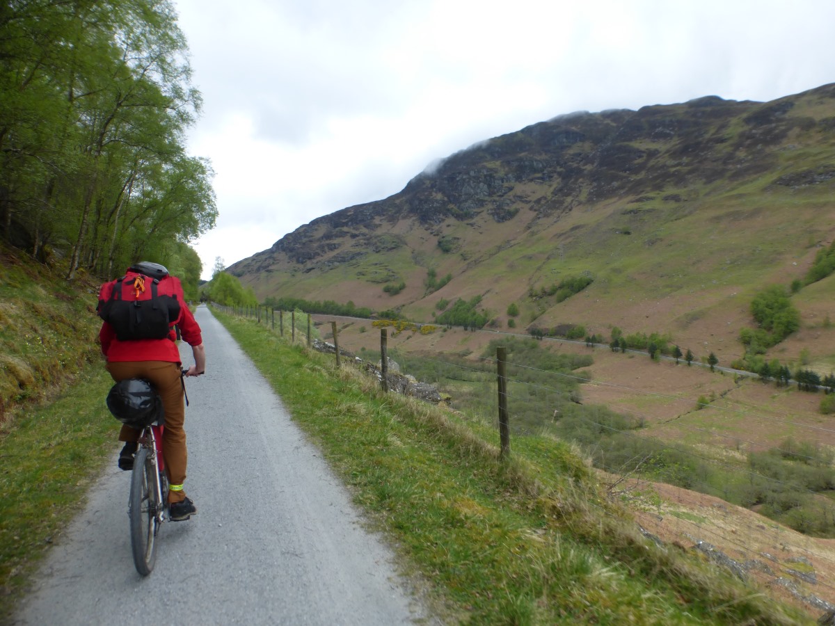
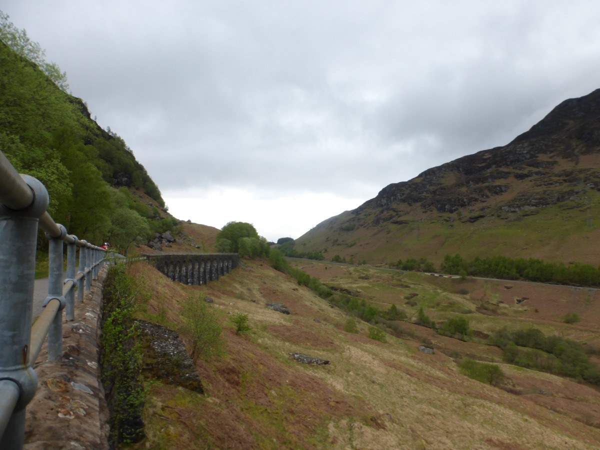
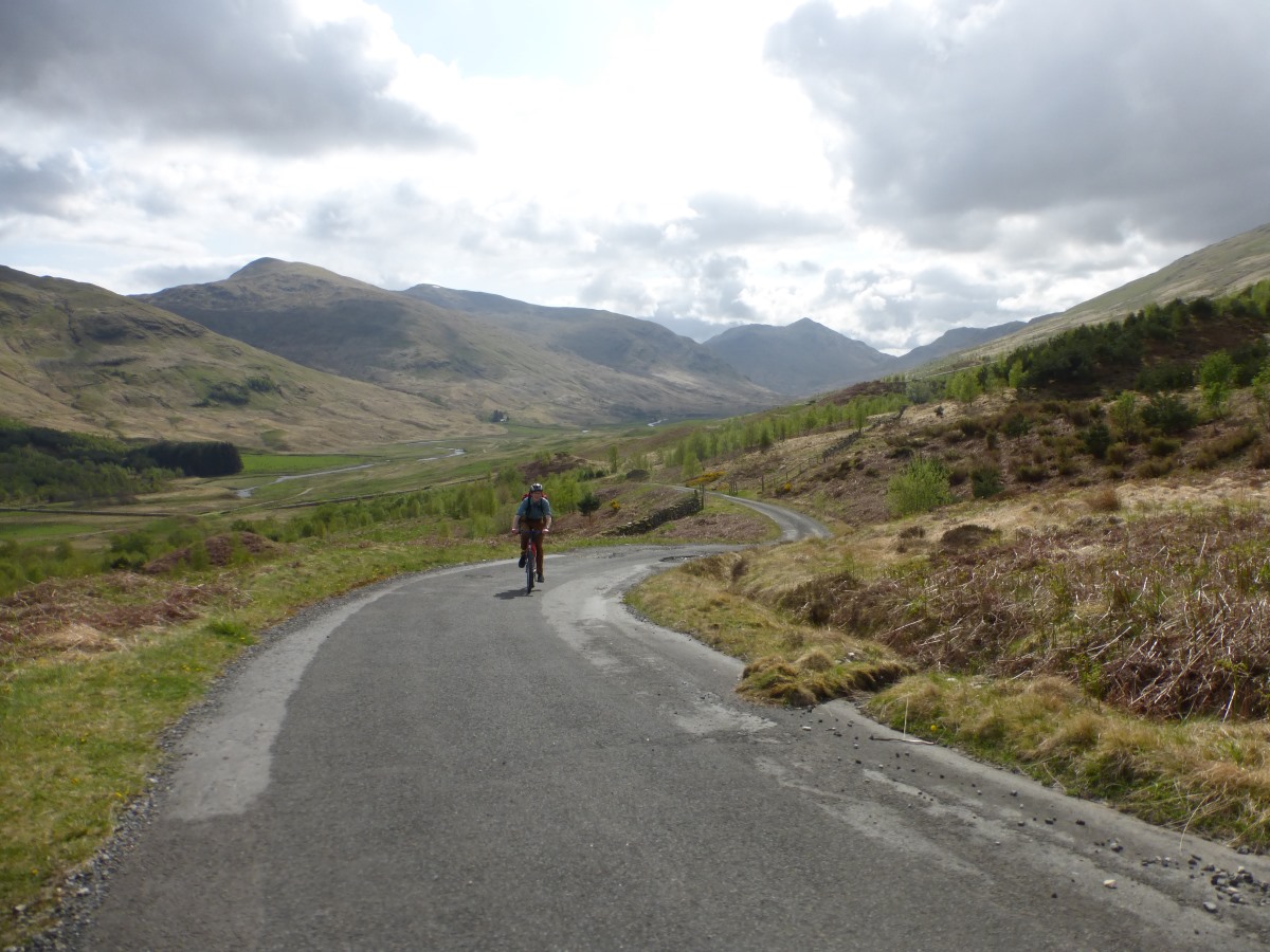
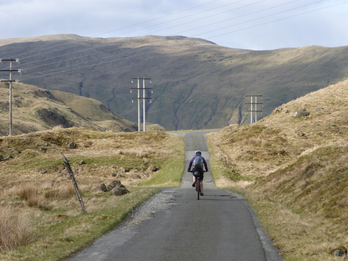
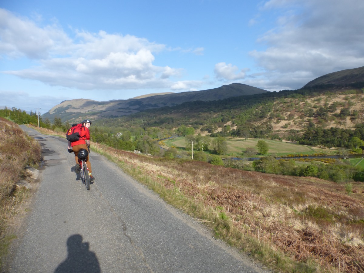
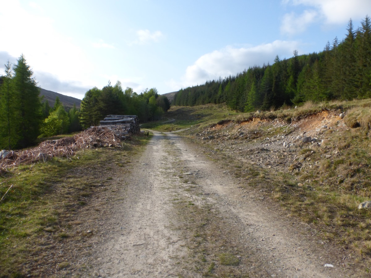
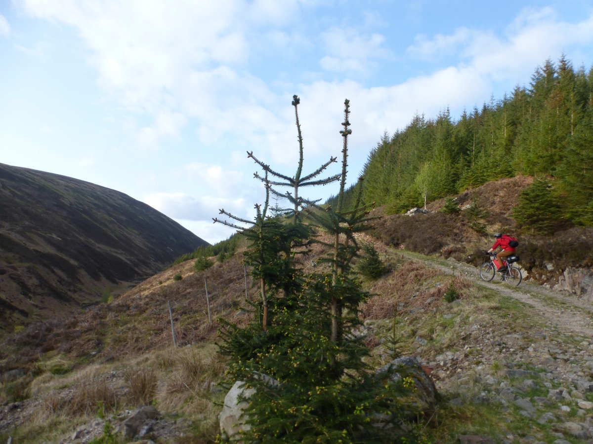
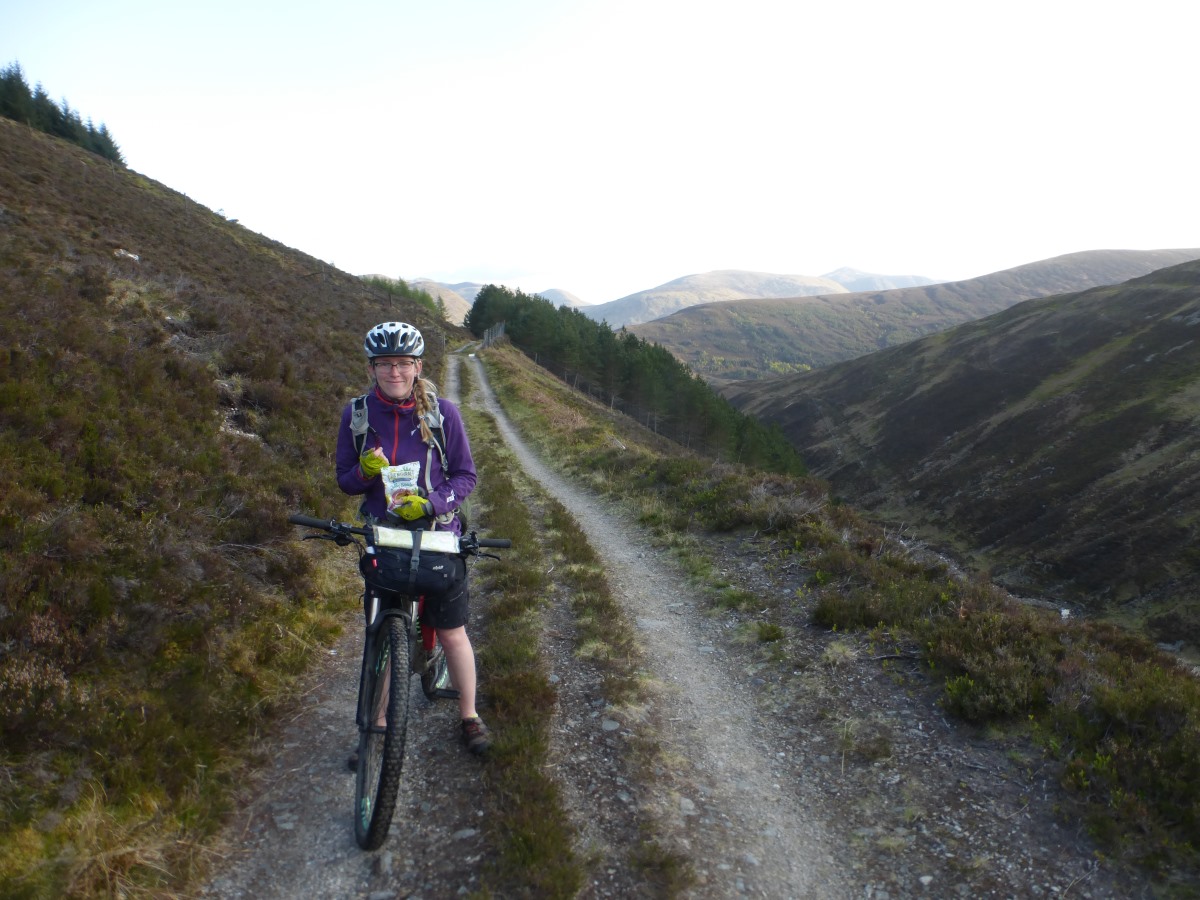
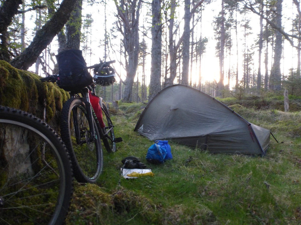
The forecast is for a wet morning which should improve so we sleep in late. While cooking breakfast I spot a red squirrel which runs through the trees over our camp. Onwards, it’s an easy cycle along to Killin still following the rail line with a great view over the valley and some impressive engineering. A fun twisting track then takes us down to the Falls of Dochart. Despite having not really done very much cycling yet we follow the guidebook’s advice and stop in at Shutters Café for excellent toasties and soup, then visit the co-op for a food restock (though with all these cafes we’ve barely touched our lunch supplies). Fully loaded once more we head off on what in my head forms a huge zig zag - valley road west, mountain pass, valley road east, mountain pass, valley road west. Heading off up the first glen progress is swift on nice smooth tarmac and for the first time since setting out it’s starting to feel quiet and like we are leaving the tourist areas behind. The first pass (marked as a track on the map) turns out to be a tarmac road, albeit a very weathered and eroded one where you are jumping from one strip to the next. It’s steep but doable with a few rest stops. At the top we’re slightly alarmed to meet a small campervan whose driver stops to ask is this the way to Killin? Er, technically maybe, but not a recommended one! The drop down into Glen Lyon is fast and smooth with a great view and we zoom along the gentle downhill gradient of the glen. Our minimum target for the day is Bridge of Balgie, but getting there at 6 we both still have a reasonable amount of energy in our legs and several hours of daylight remaining so decide to do the second pass. The Kirk road, despite its name, is all gravel and it feels like our first proper bit of mountain biking since the West Highland Way. It’s steep, slightly technical and wiggly enough that you are focused just on the next few metres. Looking back I’m surprised to see how quickly we’re climbing, and how steep the track behind us appears! Up and up and that reverses, things that look easy feeling hard, definitely nearing the end of the legs. All the gummy sweets are in Robbie’s bag though and he’s ahead so there’s nothing for it but to keep going and ultimately we both make it to the top without walking. The rocky bumpy path that follows over the tops is almost as hard as the uphill (or maybe I’m just tired), and on descending into the forest we make camp at the first opportunity, grabbing a lovely spot by a small lochan. Reading back through the guidebook it describes the pass we’ve just crossed as a “challenging climb” that “only the strongest of riders” will manage, which makes me pretty chuffed though I’m glad I didn’t read that before hand! Lots of pasta with tomato and chilli sauce and extra cheese for dinner. We reflect that if we were trying to make the guide’s punishing stages that we could have made it down this hill to Rannoch without too much bother, but that crossing the next hill over to Corrour would probably have finished us off.
Day 4: Rannoch to Home 55km/34miles (+15km)
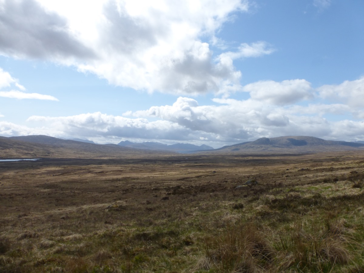
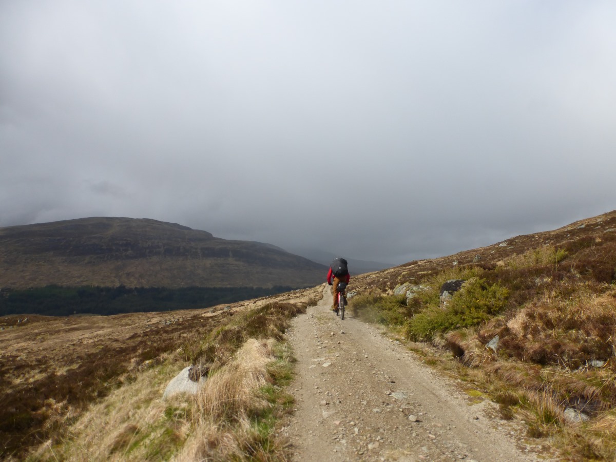
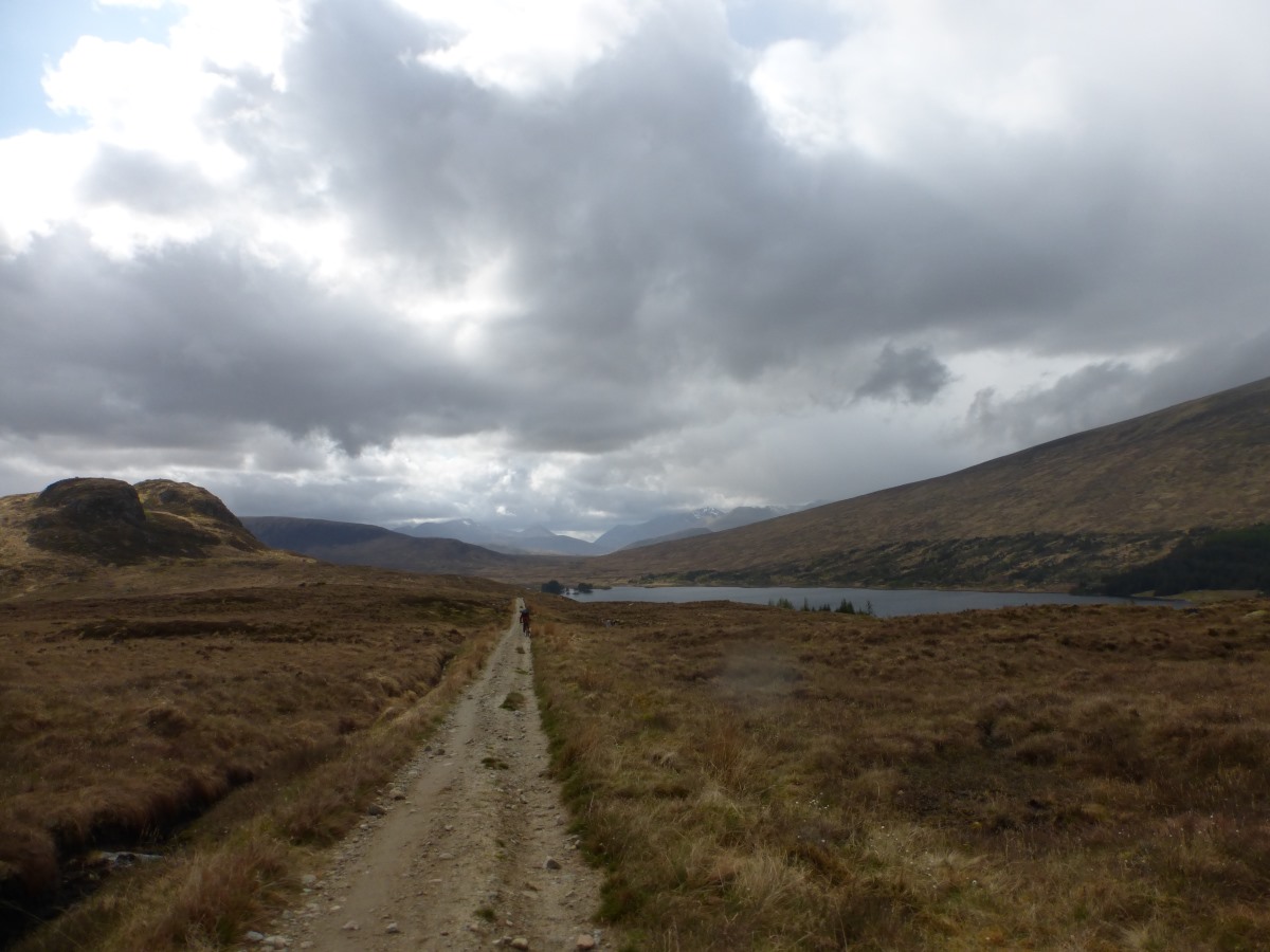
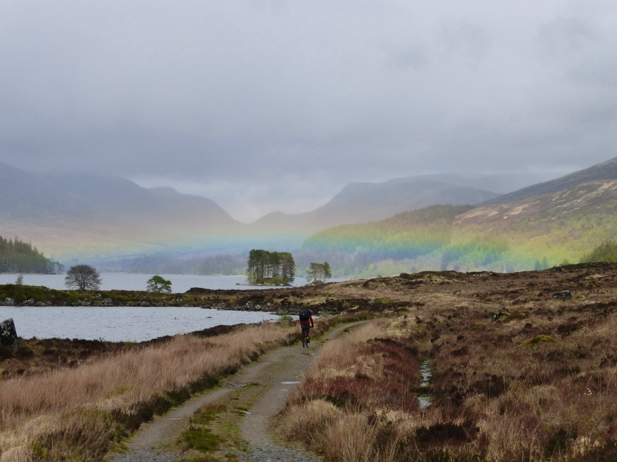
Our luck with the weather seems to be running out, but today we’re crossing back into familiar territory and are anticipating being back in our own bed tonight which makes a few fairly torrential cloudbursts much less problematic. We get going with a lovely swooping descent down the forest track (now all nice and smooth) to loch Rannoch, then pick up a head wind for a rather punishing cycle along the road towards Rannoch Station. Cloud bursts come and go fast enough that we never seem to be wearing the right clothing - either sweating along in full waterproofs in bright sunshine, or instantly soaked in a t-shirt while scrabbling for more layers. After a few attempts I get better though, and feel quite smug when I suggest lunch under a large sheltered tree and consequently perfectly miss a ten minute downpour that the other cyclists on the road go straight on into. Rounding the loch we are back onto tracks for a long ascent around the side Carn Dearg to Corrour. There’s a huge open view all around across Rannoch Moor, ringed by distant mountains, though given the extent of flat ground it feels somewhat mean that the track decides to climb all the way to 570m rather than following the railway through at 400m. It’s also very very bumpy with lots of big jagged stones to bounce our way between meaning that, at an average speed that feels like 2mph there is plenty of time to enjoy our surroundings. Bounce, bump, bounce. Eventually we make it to Loch Ossian where we decide to follow the South bank rather than detouring round to the youth hostel. The track here is less smooth than the North side (which is basically a road), but still much more solid than what we’ve just covered. We cycled this section as a day ride as part of our rigorous pre-trip training schedule (aka two day trips) and knowing that everything ahead is beautifully smooth gravel is now a real help in keeping tired legs moving on what is becoming our longest day. Also the views through Strath Ossian are stunning. Onwards we enter the forestry above Loch Laggan and then take a left, following the trails through to Fersit and the minor road across the rivers for a final swoop down the A86 to home. Collapse into bed.