West Coast Cycling
An Alternative to the Hebridean Way
July 2021
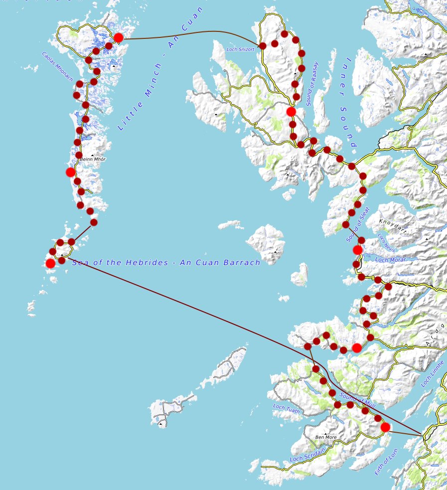
Our first venture into cycle touring! I was drawn to the Hebridean Cycle Way after seeing a friend's photos but, while the concept of cycling up a chain of islands from one end to the other is very simple, the logistics of getting back to your start point are anything but. We eventually settled on a round trip from Mallaig which would cover Barra to Harris before coming back down Skye. Unfortunately family illness prevented any advanced booking of ferries and the night before we were due to depart we had the unfortunate realisation that everything was fully booked and we couldn't get to the islands at all... Queue this rather impromptu circuit from Oban instead, which has a bit less Hebrides and a bit more mainland but is possibly just as beautiful (I'll get to Harris someday and let you know) Logistics wise we wild camped every night so the only thing that required booking was ferries, all of which are run by CalMac. Possibly is was just a post-covid thing but they ALL needed to be booked in advance, even the tiny ones, so don’t let that catch you out. We booked the main on/off the Hebrides ones before starting and the others typically about a day in advance to leave us with some flexibility. As a cyclist you travel as a foot passenger and the bikes are free. There are no cycle reservations. For navigation we took the Cicerone Guide Cycling in the Hebrides which included our entire route (some of it in reverse) and many others; an overview OS road map (West Scotland sheet) which was great for overal route planning; and detailed OS maps on a phone to help us pick camp spots.
Day 1 Oban to Vatersay
(5 miles, 1 ferry)
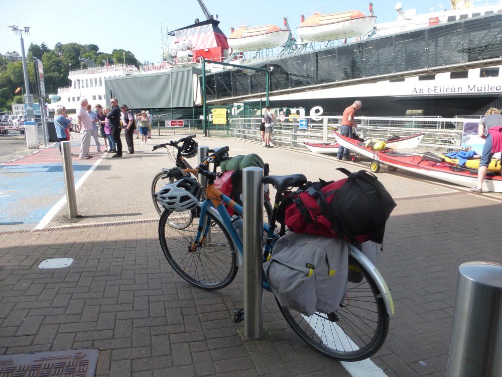
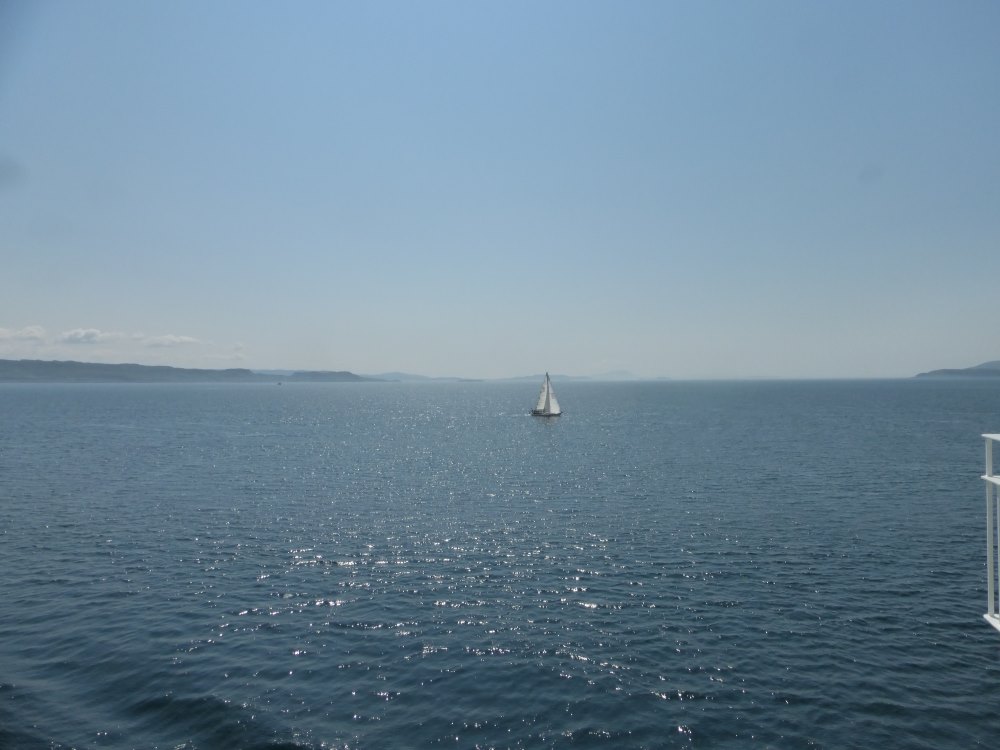
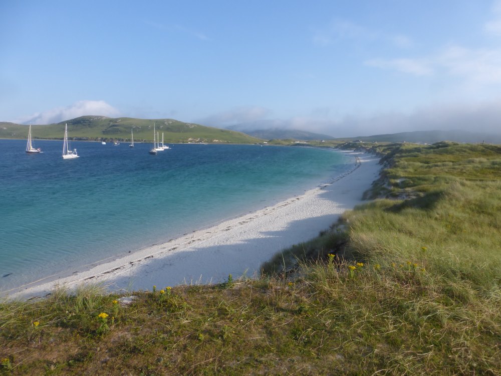
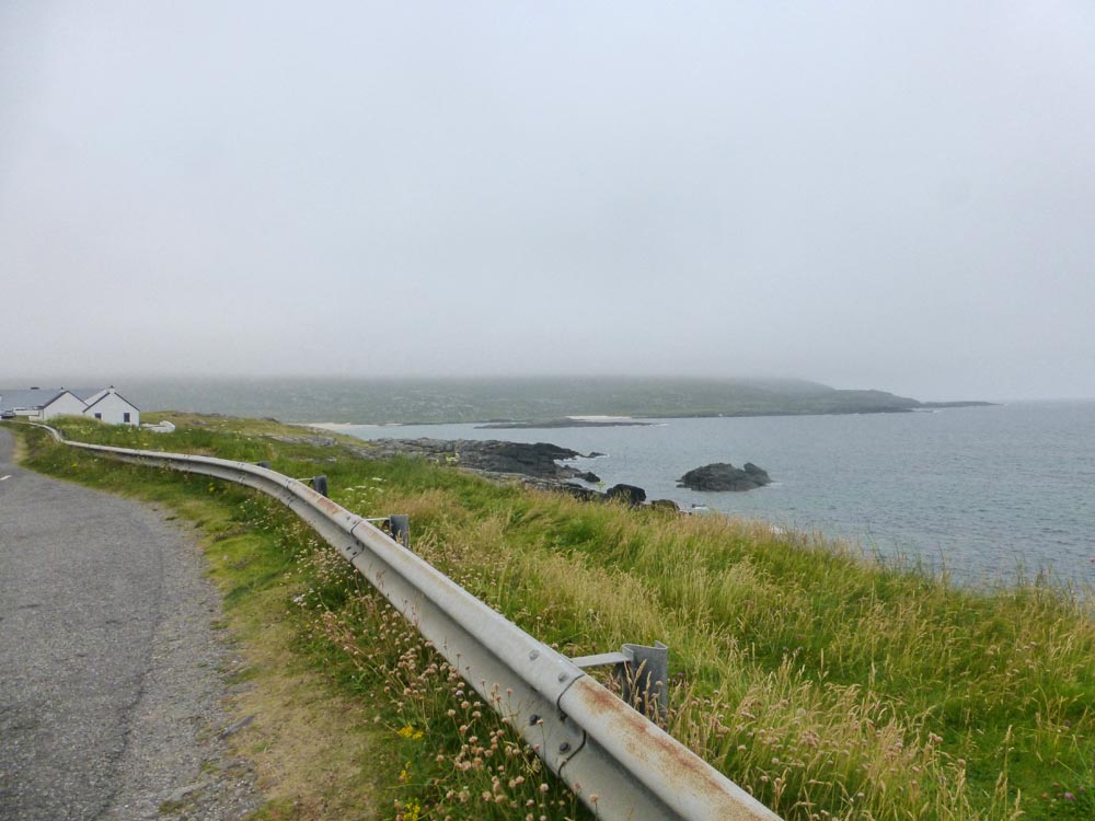
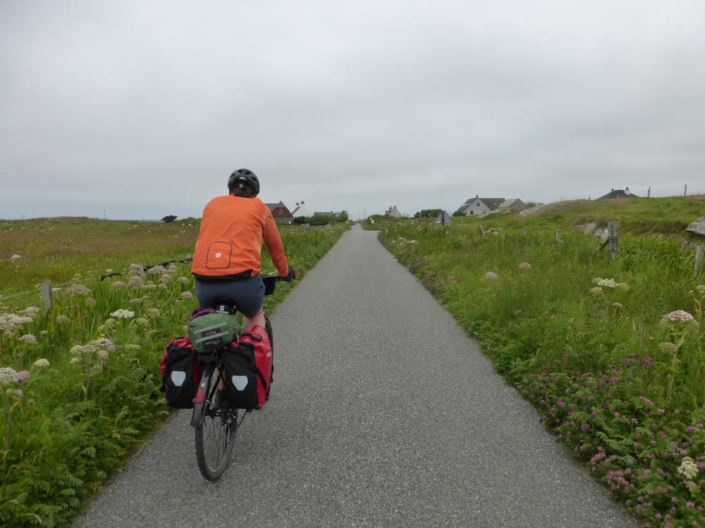
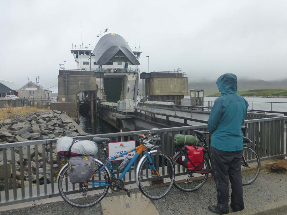
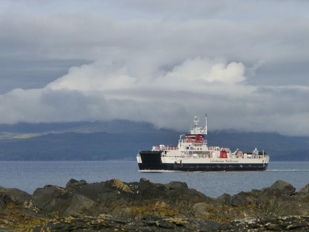
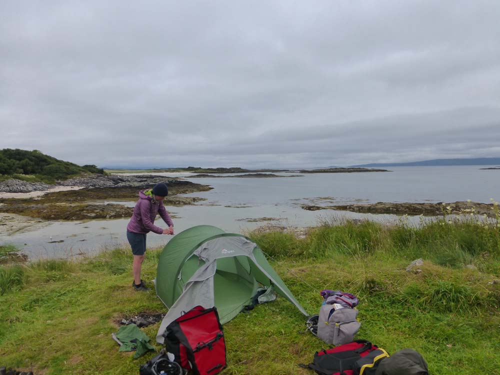
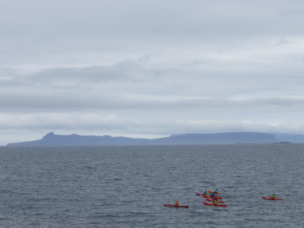
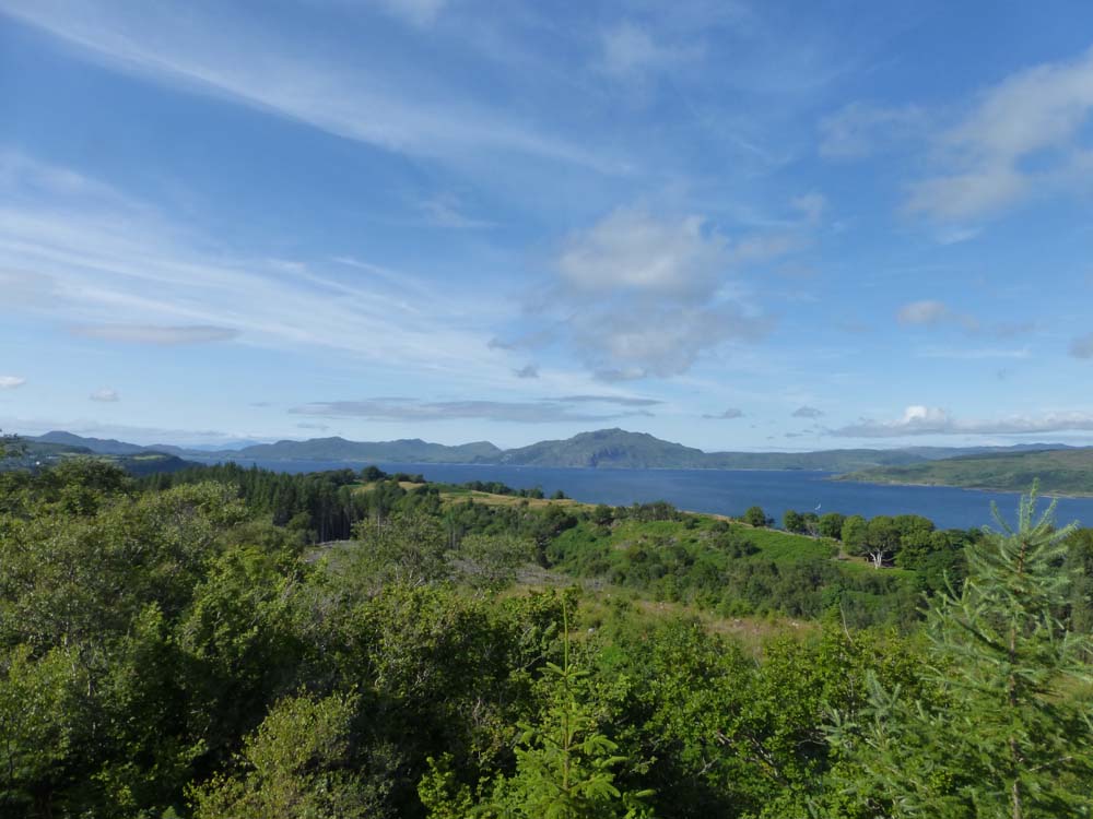
It’s a 5am start and a long drive to make it to Oban for the once-a-day 1pm sailing across to Bara (no pressure!). Long stay car parking is not free (Mallaig is…) but you can buy a one week pass online that’s done by registration plate so no paper tickets needed. All unpacked, we wave goodbye to the car and get checked in for the ferry. There’s a handy sign saying “cyclists wait here” and you get the honour of being first aboard ahead of all the cars. We’re left to our own devices to tie our bikes to a side rail which takes a few attempts but we’re still the first up on deck and get the pick of the seats. The weather is beautiful, hot and sunny, and remains so for the entire crossing with great views out over Skye where we can spot our return route and get a sense of the scale of the journey we’re embarking on. It’s a long crossing and it’s evening when we arrive into Castlebay on Barra which is just about to be eaten up by a low lying cloud. The tourist info kindly fill up our water bottles (which we forgot to take on deck with us on the ferry) and we’re off on our first rather short cycle round to Vatersay bay, a stunning spot that I last camped at as a child about 20 years ago. A lot has changed since then and what I remember as a quiet wild camp with a toilet has now gained a community centre/café, showers, and a man to great you and make sure you camp somewhere appropriate and put your £2s in the box. We get the tent up and finish a long day by cooking dinner on the beach and getting everything appropriately filled with sand.
Day 2 Vatersay to South Uist
(35 miles, 1 ferry)
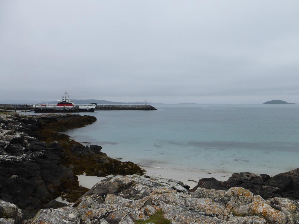
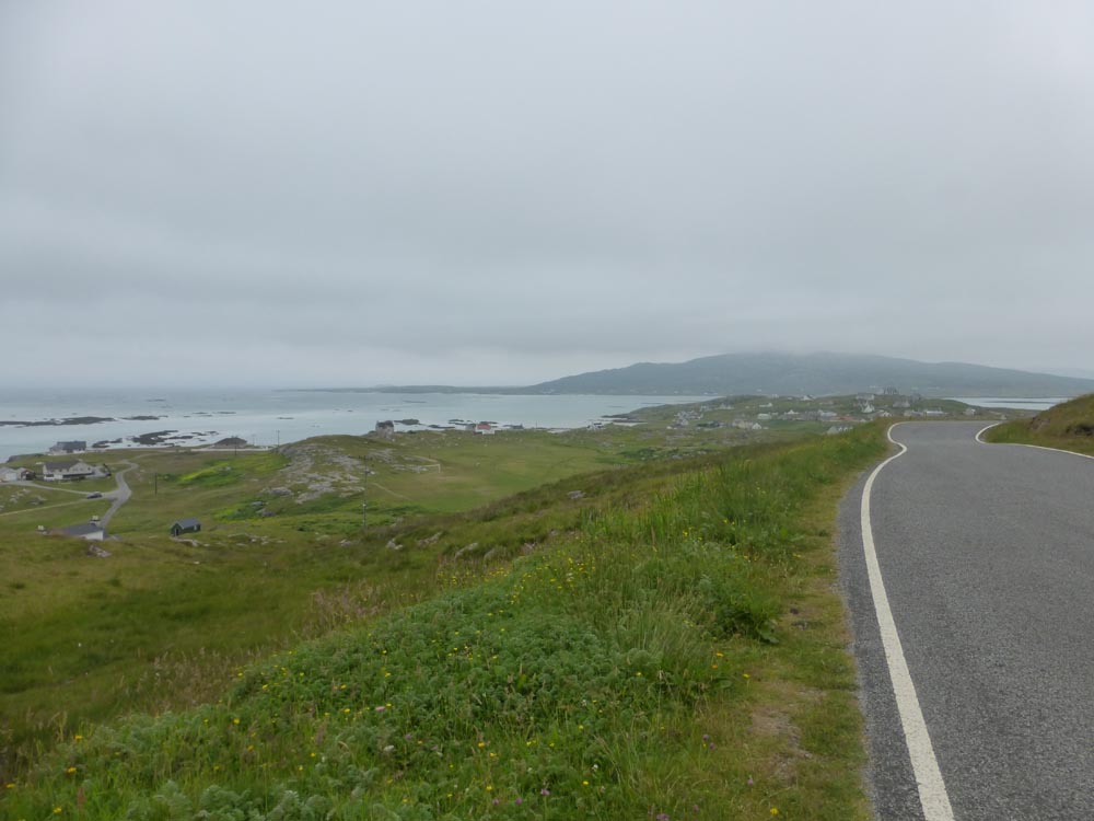
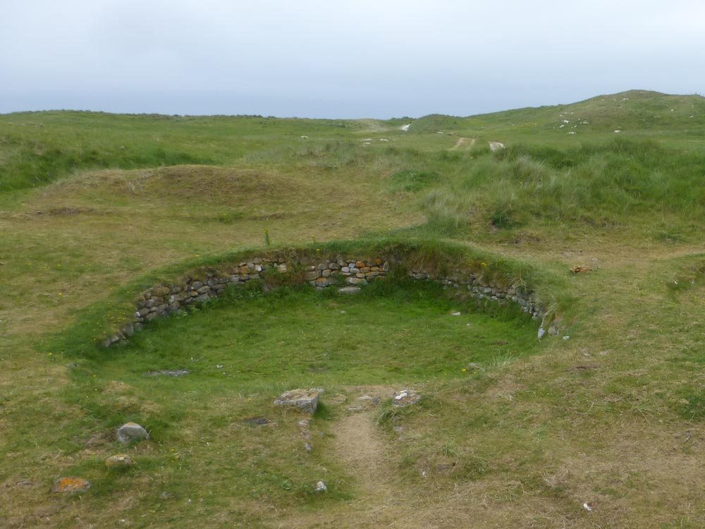
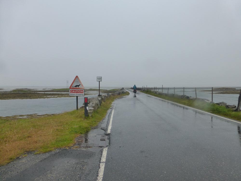
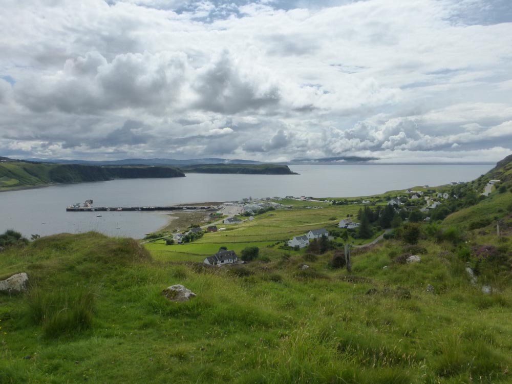
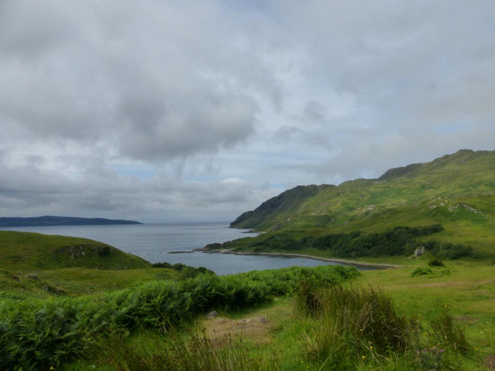
Fears that we may have had the best of the weather are well founded, and we emerge in the morning to thick low clouds a light drizzle and a persistent northerly wind. Sadly it’s exactly what the forecast predicted and is due to be with us for the next few days. The café doesn’t open till midday so we borrow its front porch to cook breakfast and faff our way through the as yet unpractised routine of stowing everything away in panniers. A quick photo with the official Hebridean Way signpost and then were off into a rather underwhelming sea mist which persists all the way back onto and around Barra until we suddenly find ourselves at the Eriskay ferry when we thought we still had half the island to go. Oh well. It turns out a ferry is just about to depart and we get accidentally included in another group of late-arriving un-booked cycling women who it seems have had to do quite a bit of arguing and persuading to be allowed on without a reservation. We follow them happily onto the boat and make it all the way to the other side before we realise that we never actually bought tickets… Oups. On to Eriskay! Island number 3 of the journey is a small one with more beautiful white-sand beaches and a moderate sized hill in the middle from you get a view over most of the island. It’s over very quickly and we’re soon on South Uist, island number 4. Our target for the day is to get about half way up the island and with the early Barra ferry we’re making good time so we add in a few optional diversions through little hamlets and machair meadows. Following some signs for “hut circles” takes us on an off-road adventure to some iron-age dwellings in the dunes and some fellow tourists have a rather fun app that they let us borrow which lets you watch a reconstructed version as you walk round them. Very fancy. We carry on a bit further and finally stop for the night on a somewhat rocky beach where the seaward side of a large protective wall actually gives the best shelter.
Day 3 South Uist to North Uist
(37 miles)
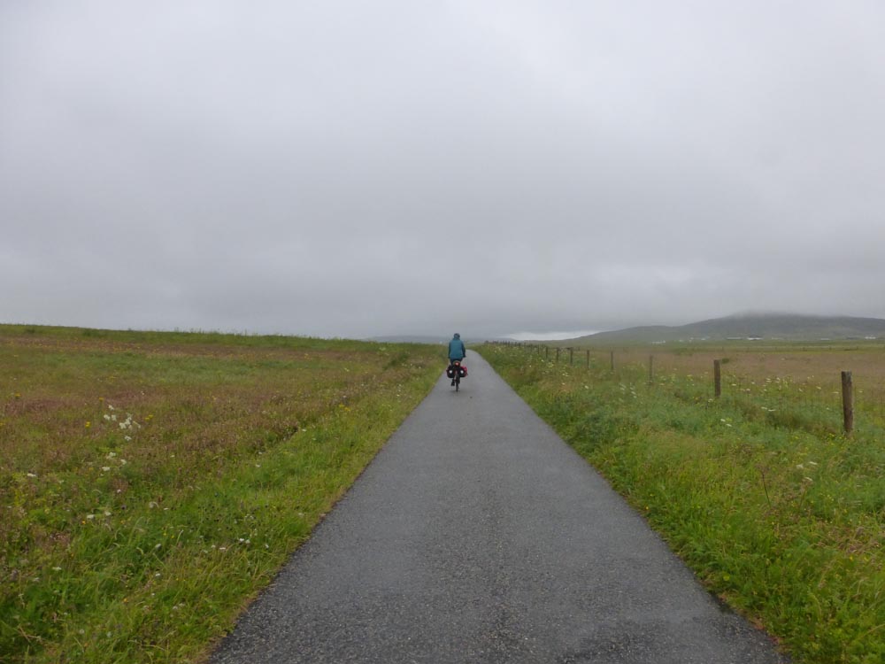
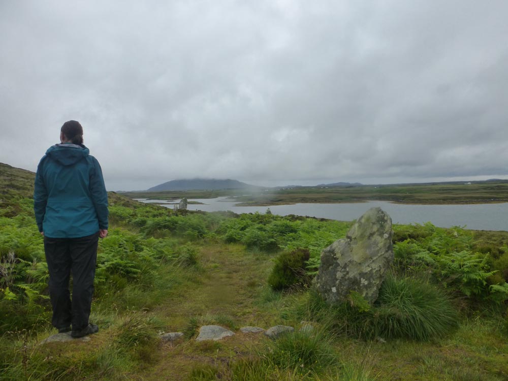
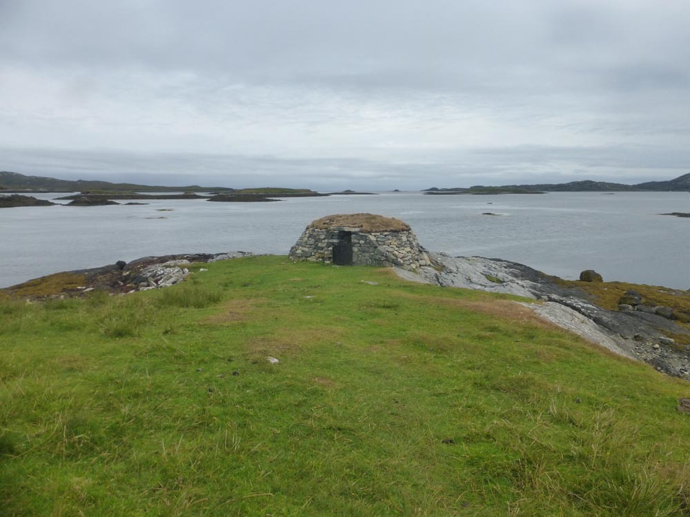
Today the low cloud has progressed to moderate rain. The northerly wind has increased in strength. We decide to skip cooking breakfast, in place of snack bars and the aim of finding a café to hide in. Thinking that we won’t be out for long and that cycling in waterproof trousers is unpleasant we set off in shorts. There are no open cafes on the rest of South Uist. That’s OK though, there’s a loop round Benbecula where several places are mentioned in the guidebook. There are no open cafes on Benbecula. No worries, North Uist won’t fail us, there are at least two places that the guidebook mentions food… Luckily we sense that this plan may be doomed to failure and squelch our way into supermarket that provides us with a large tear-and-share brioche and hot chocolate, then a public toilet where we re-dress ourselves in dry clothes and full waterproofs and feel much better. Just as well because North Uist turns out not to have any open food-serving places either. Plans to buy dinner supplies are dashed when even its supermarkets are closed. It does however have a few interesting archeological sites and the rain is drying up so we fit in a wander to a stone circle and a chambered cairn, and cycle the rest of the way to Lochmaddy with our wet clothes strung out over our panniers to dry. We find a camp spot by the sea near a little “camera obscura” which is a small and very dark stone hut where the outside view is cleverly projected onto the inside wall. Having set up the tent we wander into the town to find dinner. The shop is closed. The pub is fully reserved and no longer does take-aways. The restaurant is full. They take pitty and sell us some crisps. Dinner is crisps and tomorrow mornings porridge. At least the view is good.
Day 4 North Uist to Skye
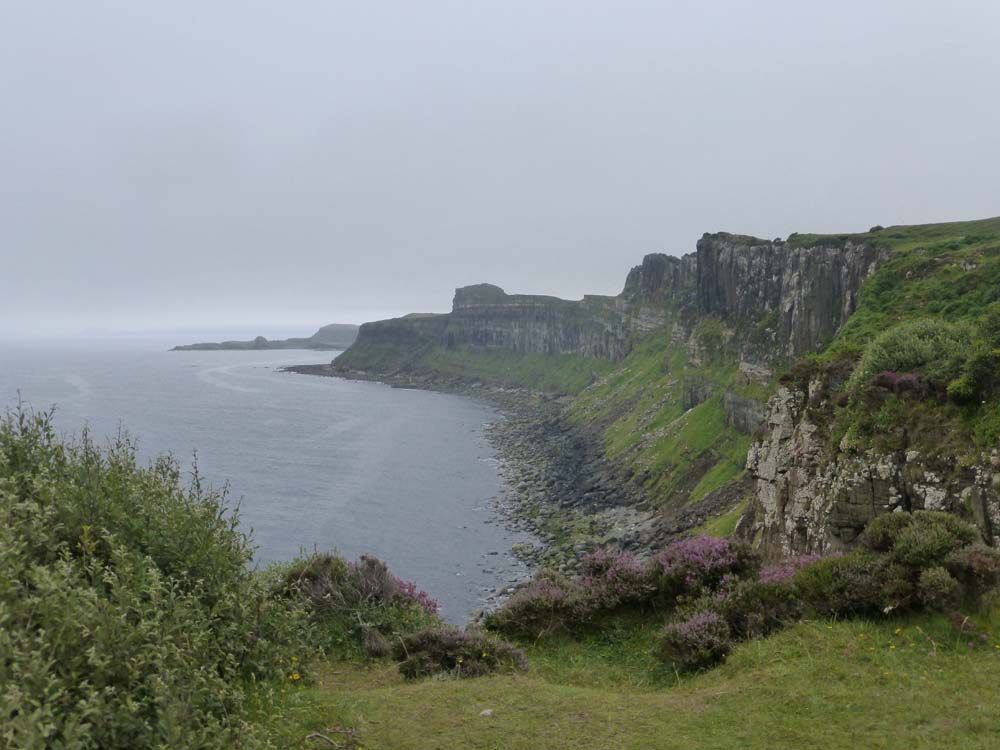
(28 miles, 1 ferry)
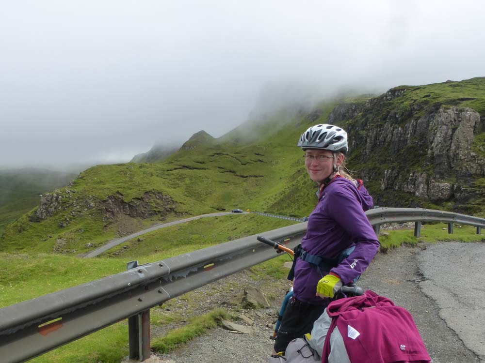
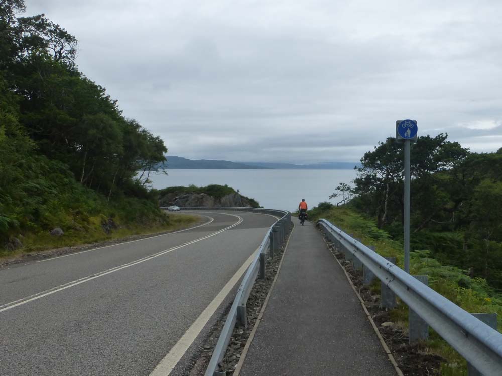
It’s raining again. The porridge is gone. The tent is full of slugs. We turn up 2 hours early for the ferry and hide in the waiting room. Good timing as it turns out because the rain now turns torrential. Finally salvation arrives in the form of a ferry and huge plates of fish and chips. To reflect the lift in mood the sun even comes out and we emerge into a beautiful summer’s day on Skye. It doesn’t last long but it inspires us to extend our route away from the main road and head up and over the Quiraing pass, which turns out to be a beautiful ride. The climb from Uig is gradual and not too taxing and the hairpin descent back down into the cloud is exhilarating. The extra bonus is now we’re on the coast road which is distinctly less busy than the main one and there are some great view points over the Staffin cliffs and the old man of Storr (we omit this one because it’s raining again and we’ve already seen it in the rain several years ago, but its car park does have some good public toilets and a chance to re-fill water bottles). There are also some much bigger hills than we’ve encountered on the islands which seem to go on and on forever. I slog my way to the top of one shortly ahead of Tas who then reveals that she walked up half of it and managed to keep pace with me… After this there’s a glorious free wheel into Portree where the rain begins again in earnest. We stock up on dinner food (yay, open shops!) then find a camp spot by a bridge just south of the town. There’s just enough of a breeze to keep the midgies at bay and hiding under the bridge lets us stretch out and cook dinner in the dry. Perfect.
Day 5 Skye to Arisaig
(48 miles, 1 ferry)
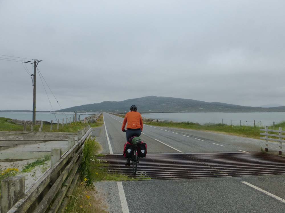
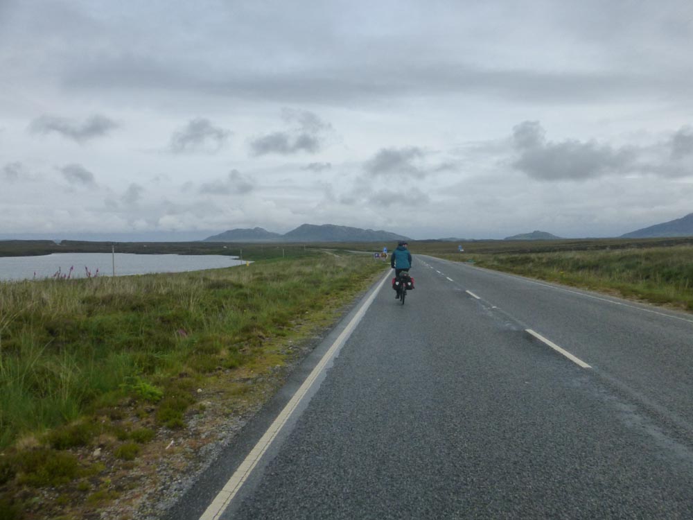
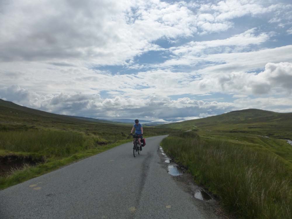
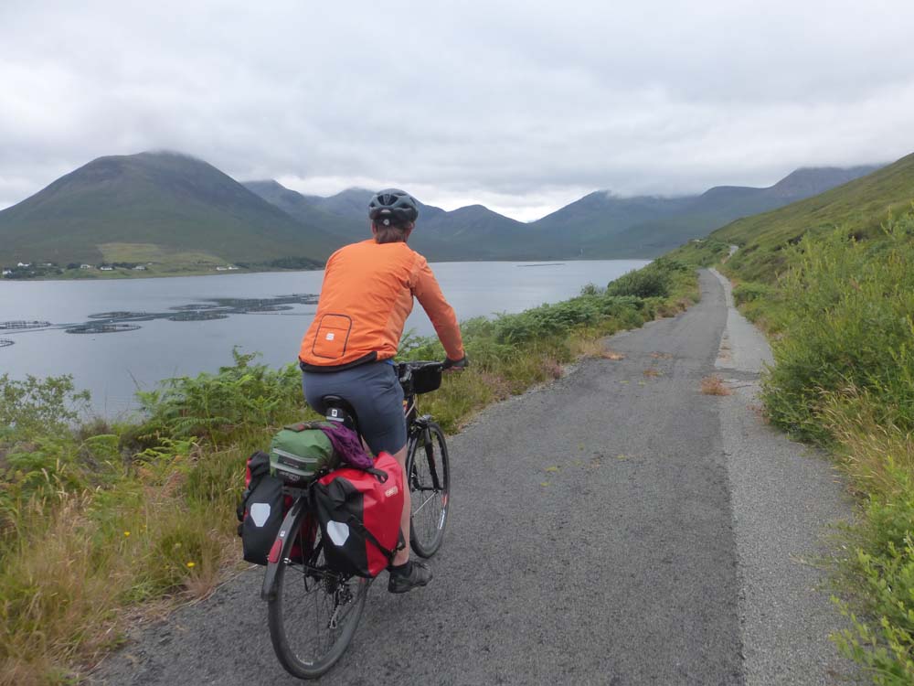
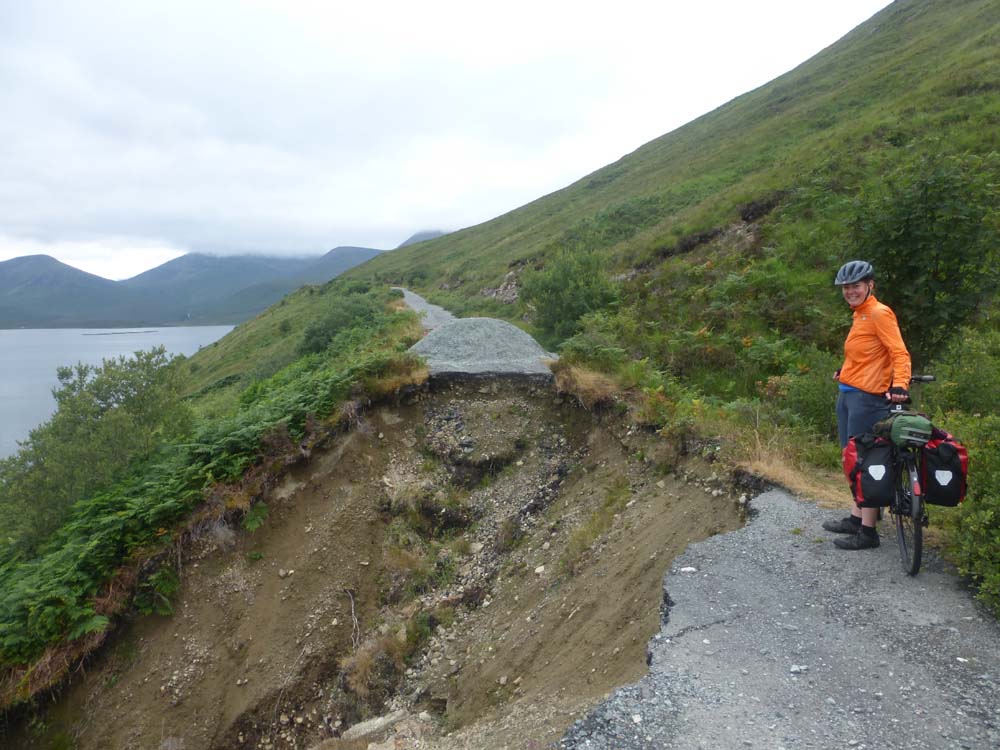
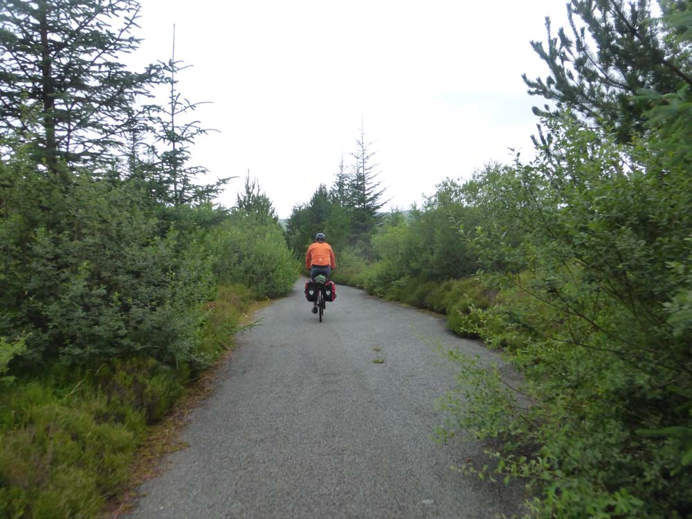
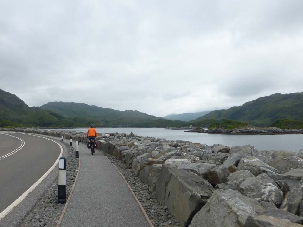
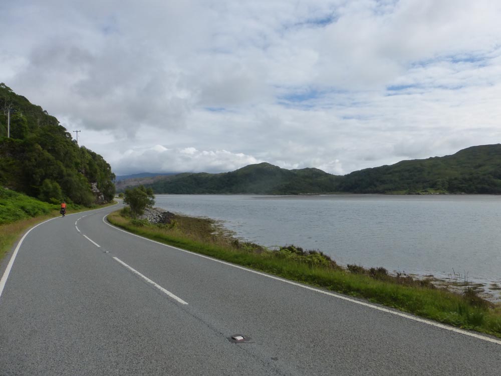
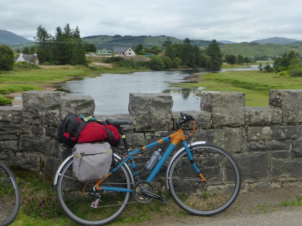
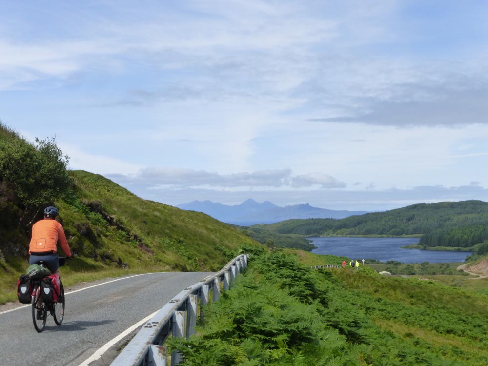
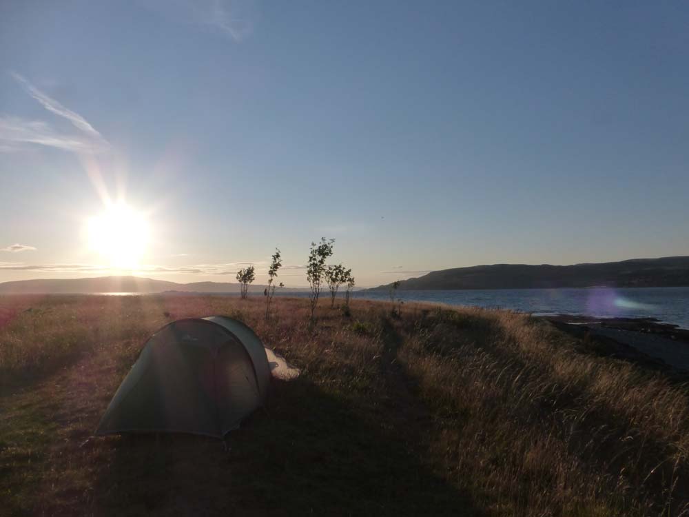
The forecast has promised that from here it gets better. The rain has stopped and we wile away a few hours waiting for the sun to appear washing ourselves and all our stuff in the river and airing out a lot of damp kit. Eventually we give up on the sunshine and get back on the bikes Today’s route is the biggest roads we’ve yet been on and it’s heads down and keep moving pretty much all the way to Sconser, though we do pause for a leg stretch and a photo at the old Sligachan bridge. Just after Sconser we escape onto a little single track coast road which goes round to Loch Ainort and avoids the rather congested bit of road over the hill. There’s a sign saying road closed which we debate for a while and eventually ignore hoping that whatever the problem is we can just push the bikes round it. The road is deserted which is great because for once we can actually cycle side by side and chat but it does get ominously less and less maintained. Eventually the problem is reached about half way down Loch Ainort where the entire road has fallen into the sea. Fortunately we can just about squeeze round the side, but only just. After that it’s back on the main road to Broadford where we acquire food for the next couple of days. We emerge to find that someone has left a bar of chocolate on the wall next to our bikes. A gift? An accident that they are coming back for later? A trap? We opt for the first, but cycle a few miles before we eat it just in case. Out the other side of Broadford we leave the main road behind and head south down towards Armadale. We actually then leave even the minor road behind because the old one still runs alongside it in sections marked on the map as tracks but that are smooth, cycleable tarmac slowly being enveloped by trees. We reach Lochainort in plenty of time for the last ferry back to Mallaig and the mainland. On arrival it’s late enough that the roads are quiet and some considerate planners have actually built a separated cycle path that takes us all the way to the quiet coastal loop to Arisaig where we collect another white sandy beach campsite, though this time we have it all to ourselves.
Day 6 Arisaig to Ardnamurchan
(36 miles)
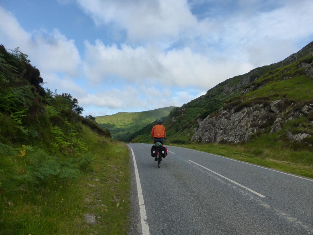
The promised sunshine still hasn’t arrived but it’s stayed dry which will have to do. We’re planning our route and ferries about two days at a time and for our next two day chunk we have a choice of following the guidebook suggestion round Loch Sunnart to the Lochaline ferry, or heading out down the Ardnamurchan peninsula and coming back along Mull. We opt for the second and attempt to book an evening ferry from Craignure back to Oban only to find the last available sailings over the weekend are at 9am each day. Oh. Unfortunately we’ve now been out for a week and if we extend an extra night on Mull the car parking will expire. Fortunately it turns out you can buy a day ticket remotely online. Unfortunately this requires a code which is written on the machine in the carpark. Fortunately a webchat with the council gets us the code. Unfortunately you can only buy tickets for now, so we need to set an alarm for midnight tomorrow to buy parking. Fortunately (?) when we finally do that we discover that parking on Sundays is actually free and we didn’t need to bother. The above takes us most of the morning sat on a rock in Arisaig which has mobile data. From here it’s back to main roads but the handy separated cycle path persists for a good two thirds of it until we turn South at Inverailort onto something much quieter. The sunshine still hasn’t appeared and we’re even treated to some drizzle as we head down Loch Ainort and reminisce about when we were last here on the Loch Shiel kayak circuit which had distinctly better weather. At least the atypical Northerly wind which we were cursing on the Outers has stuck with us and is now blowing at our backs. It’s a beautiful coast road and once the drizzle clears up the view opens over Rum and Eigg. We turn inland along Loch Moidart and finally some chinks of blue sky start to appear in the clouds and we are able to spread all our damp stuff over the back of the bikes again. We stop briefly at the seven men of Moidart (we count a slightly underwhelming 2.5 and a stump) then there’s a steep hill climb up and over to Shiel Bridge. On the descent I’m joined for a good few minutes by a buzzard who flies along just in front, almost at eye level, matching our speed along the twisting tree lined road. From here it’s another short climb to Salen where we turn West onto Ardnamurchan and find a camp spot on a lovely flat mowed piece of grass with a sea view and some sheltering trees. It’s completely infested with midges. At about 10pm there’s a lot of shouting and the other family pack up and run away.
Day 7 Ardnamurchan to Mull
(39 miles, 1 ferry)
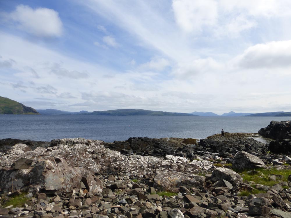
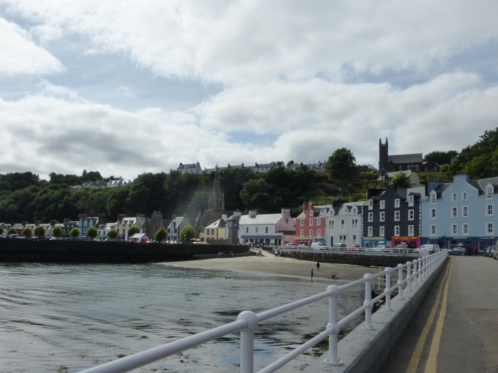
We awake to the sound of a fine drizzle. Oh no, it’s actually the patter of midges against the tent. We lie there for a while, planning exit strategies and eventually make it out into an actual nice day with scattered blue sky and sunshine. Finally! It’s a fantastic cycle along the peninsula on a mostly deserted little road that winds its way around the coast before heading inland and upwards. Part way up we find brownies for sale and, because we don’t have change, end up buying all of them. We take a detour to a chambered cairn in a little bay to eat them. They’re very good. Chocolate fuelled we tackle the rest of the hill where the Northerly wind is back in our faces and Tas does that trick again of walking up just behind me and keeping up just fine. The top of the hill is a fantastic gradual descent past a couple of little lochs with a fine view of Rum and then the descent steepens and there’s no need for the pedals for several glorious miles of swooping single track all the way down to Kilchoan. I decide I like hills after all. The Kilchoan-Tobermory ferry is the only one of the trip that doesn’t need a booking and we lounge around in the sunshine waiting for it to arrive for our crossing over to Mull - island number 9! In Tobermory there’s a long queue for the co-op which has one of those traffic light in/out systems and Tas has time to find public toilets and get us ice creams before I make it inside. It’s a straightforward cycle down the main road along the side of Mull though the climb out of Tobermory is the steepest we’ve had by far and almost (but not quite) defeats me. In the woods at the top there’s a car park with a sign for a viewpoint which turns out to be a lovely little treetop platform with a view over a waterfall which we must have cycled right passed just a minute before with no idea it was there. Very worth the stop. From here there’s a bit more up and down and another glorious free wheeled descent down to reach the sea again at Salen. From here we carry on about half way to Craignure where we find a nice open and breezy camp spot by the sea with its very own picnic table. Perfection.
Day 8 Mull to Oban
(4 miles, 1 ferry)
Not much of a cycling day this one. It’s an early start and a few short miles along to Craignure for our 6th and final ferry crossing back to Oban. The sun stays out for a beautiful finish and we treat ourselves to fresh langoustines and chips in the harbour before embarking on the somewhat gruelling 9 hour drive home.