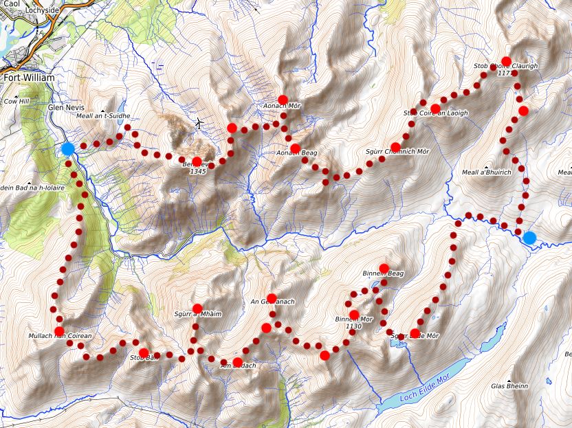
Tranter's Walk
Tranter’s Round is best known as a 24 hour running challenge, but also lends itself well to a 2 (or more!) day backpack with two incredible ridge lines and a bothy perfectly placed in between them. The stats I went out armed with were 59km with 5400m ascent, but actually if you draw a walkers line with zig zags, a tendency to follow a ridge and a stop at the bothy, that turns into 66km and 6100m ascent. So something of an epic which took me a grand total of 29 hours walking. For anyone who is interested I’ve broken down the timings at the end. In giving myself only two days I deliberately made this a huge challenge, but the route would be equally (or possibly more) enjoyable spread over longer, though a lack of resupply options means you would have to set out with a pretty heavy bag of food. I used Harvey’s “Ramsey Round” map for this route as the route is the same. At 1:40,000 it is the same scale as their Lochaber mountain map, however it comes with the route line drawn on which over such a long distance I found incredibly helpful. I also read Cicerone’s “the big rounds” before hand which had some good tips on water fill-ups and a helpful page on how to tackle the “crux” section between Sgurr Choinnich Mor and Aonach Beag.
Day 1
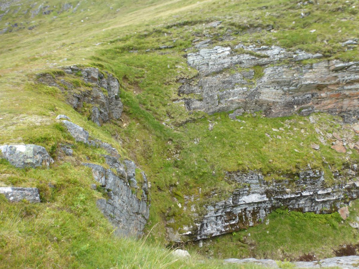
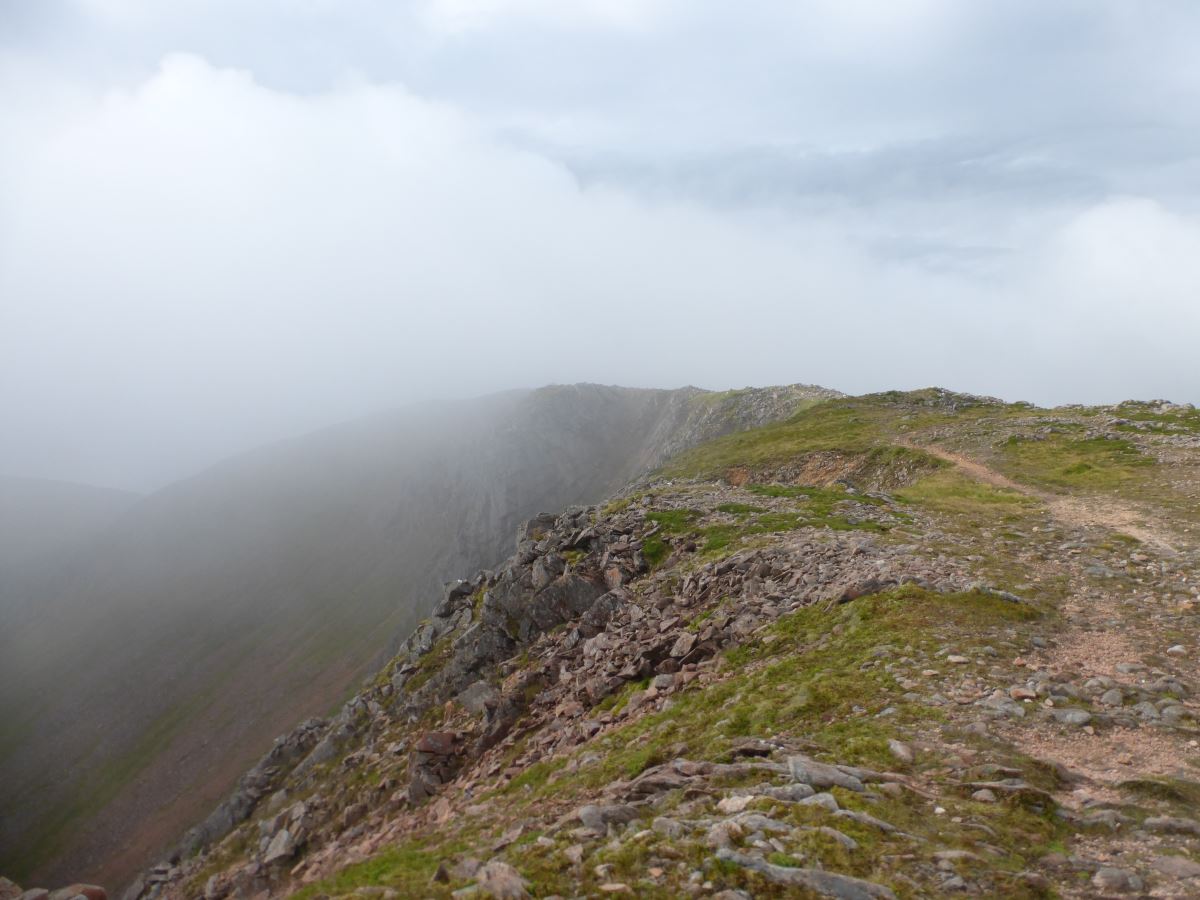
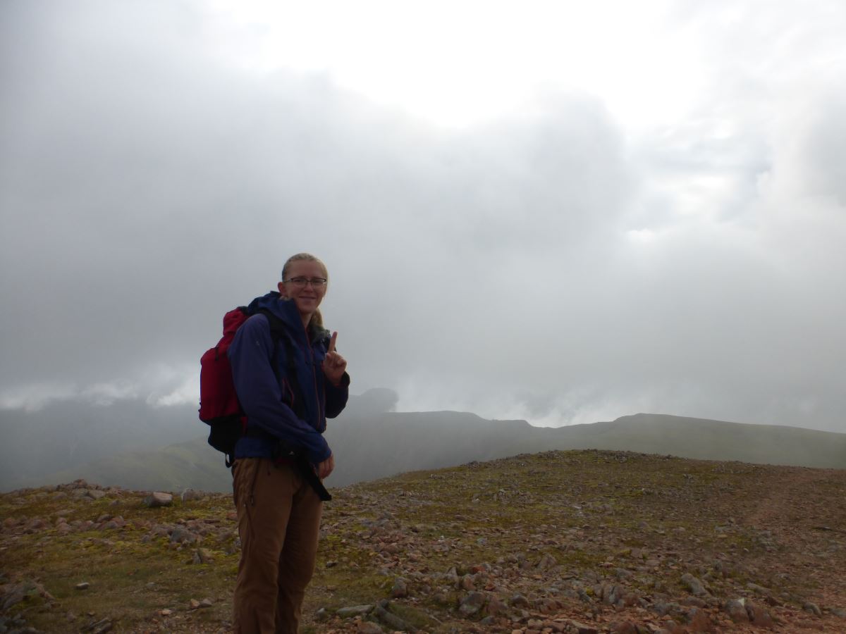
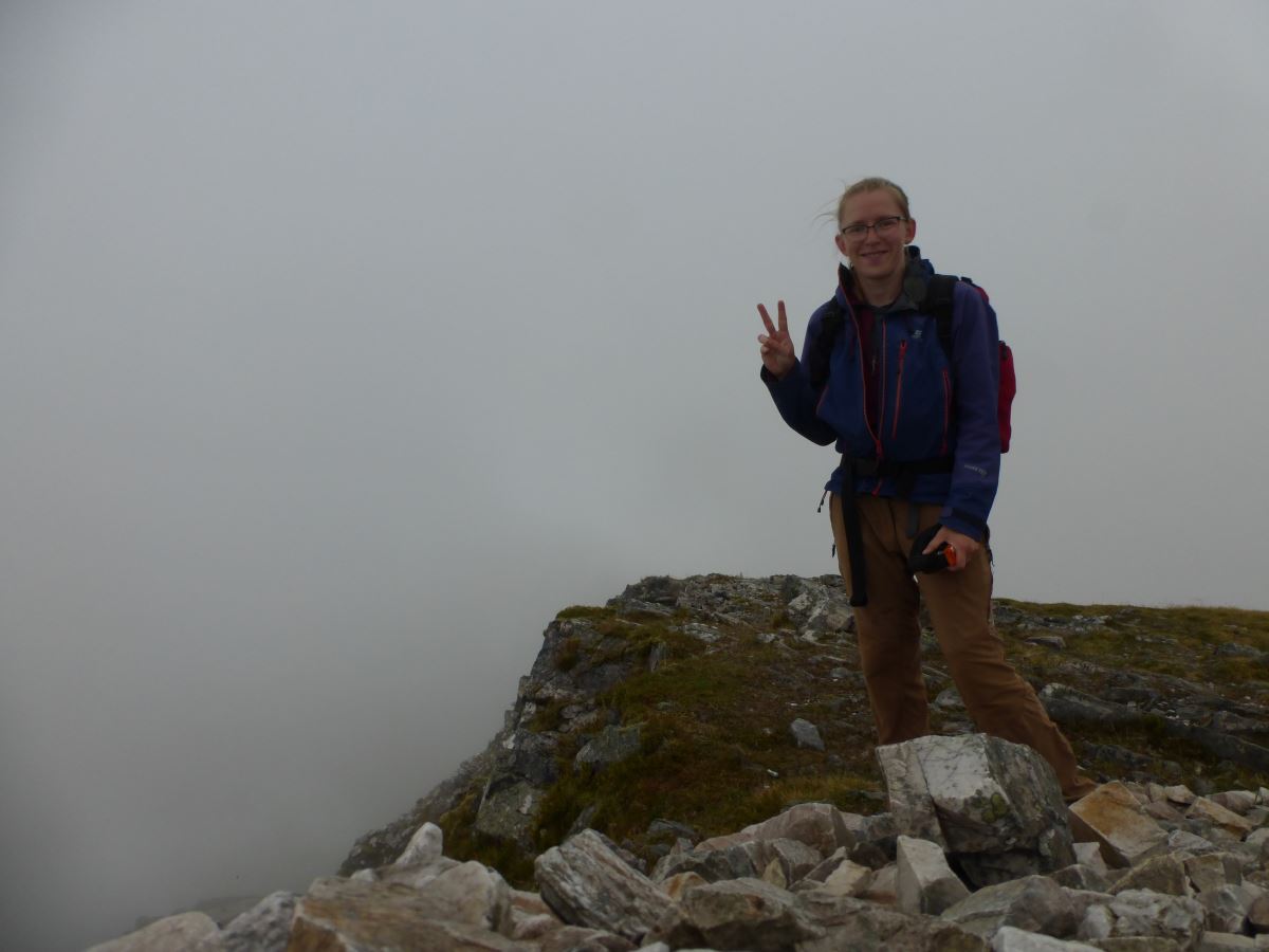
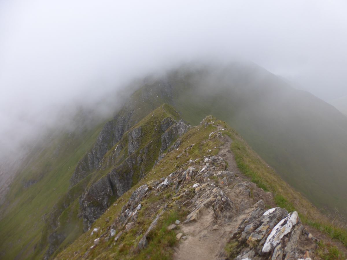
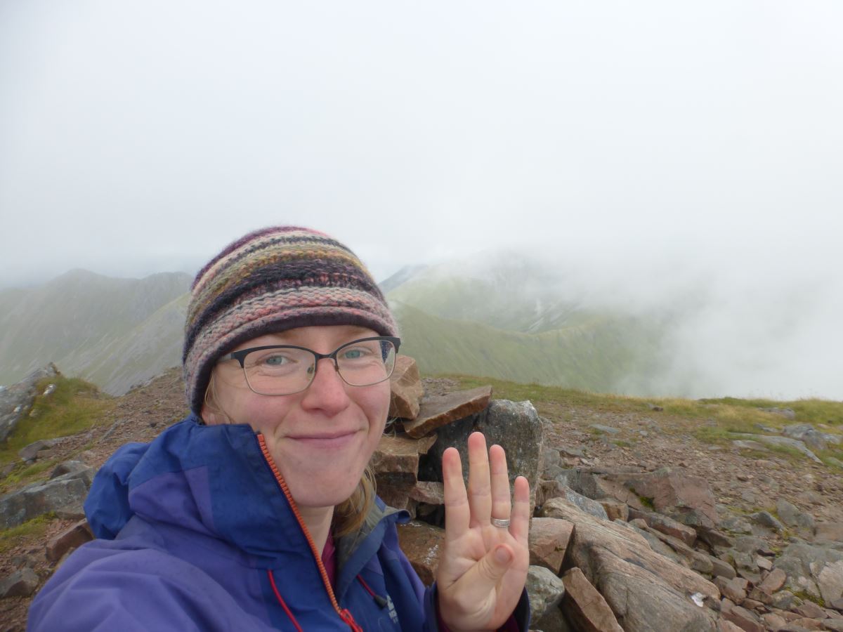
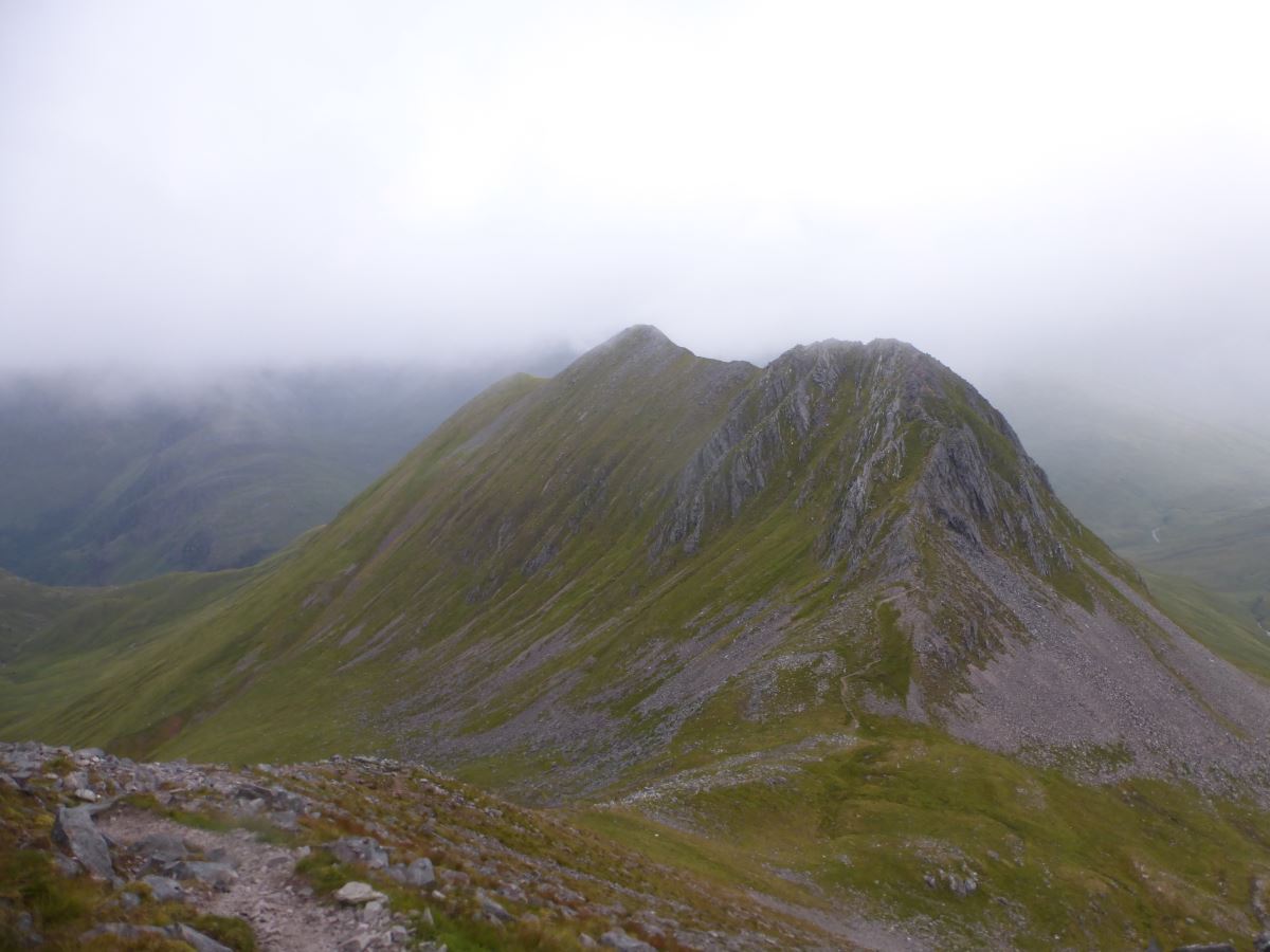
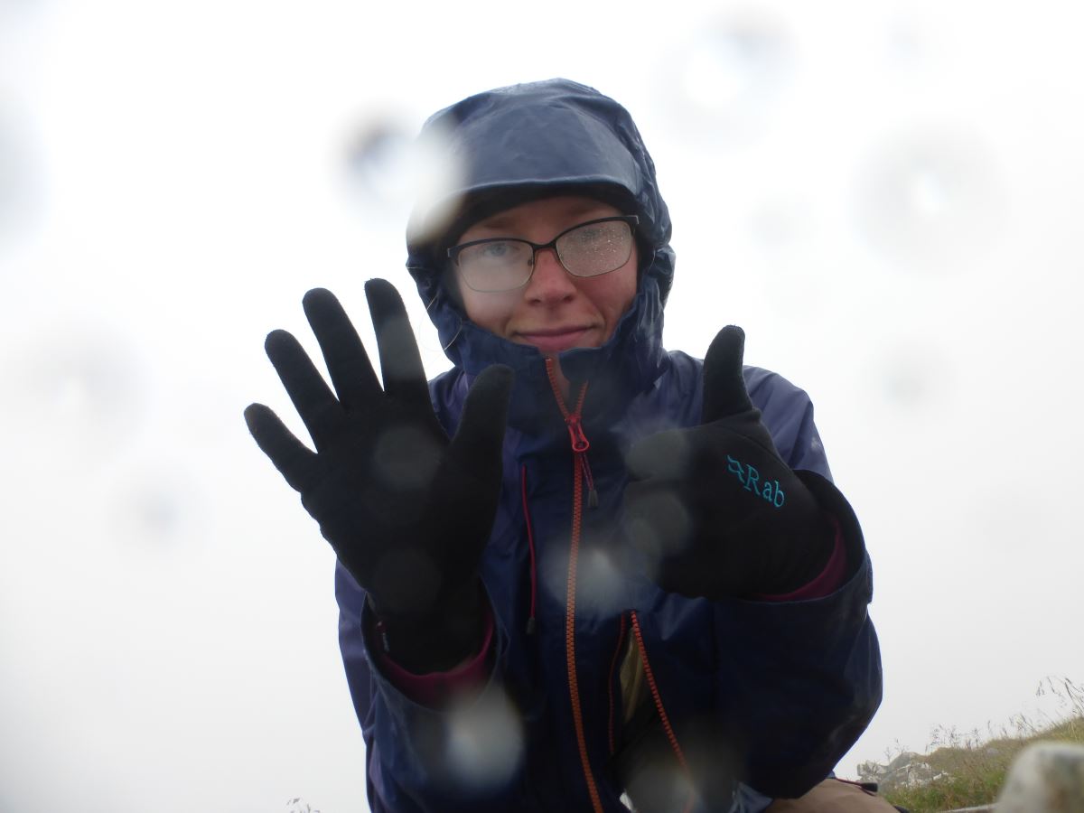
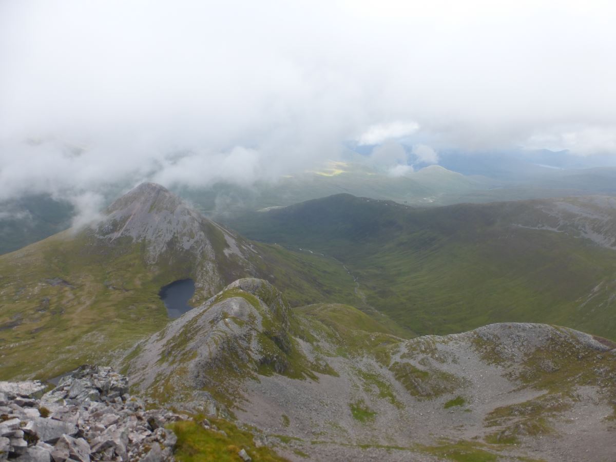
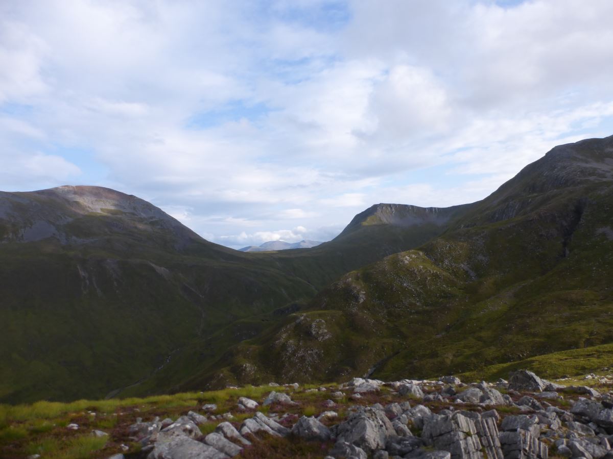
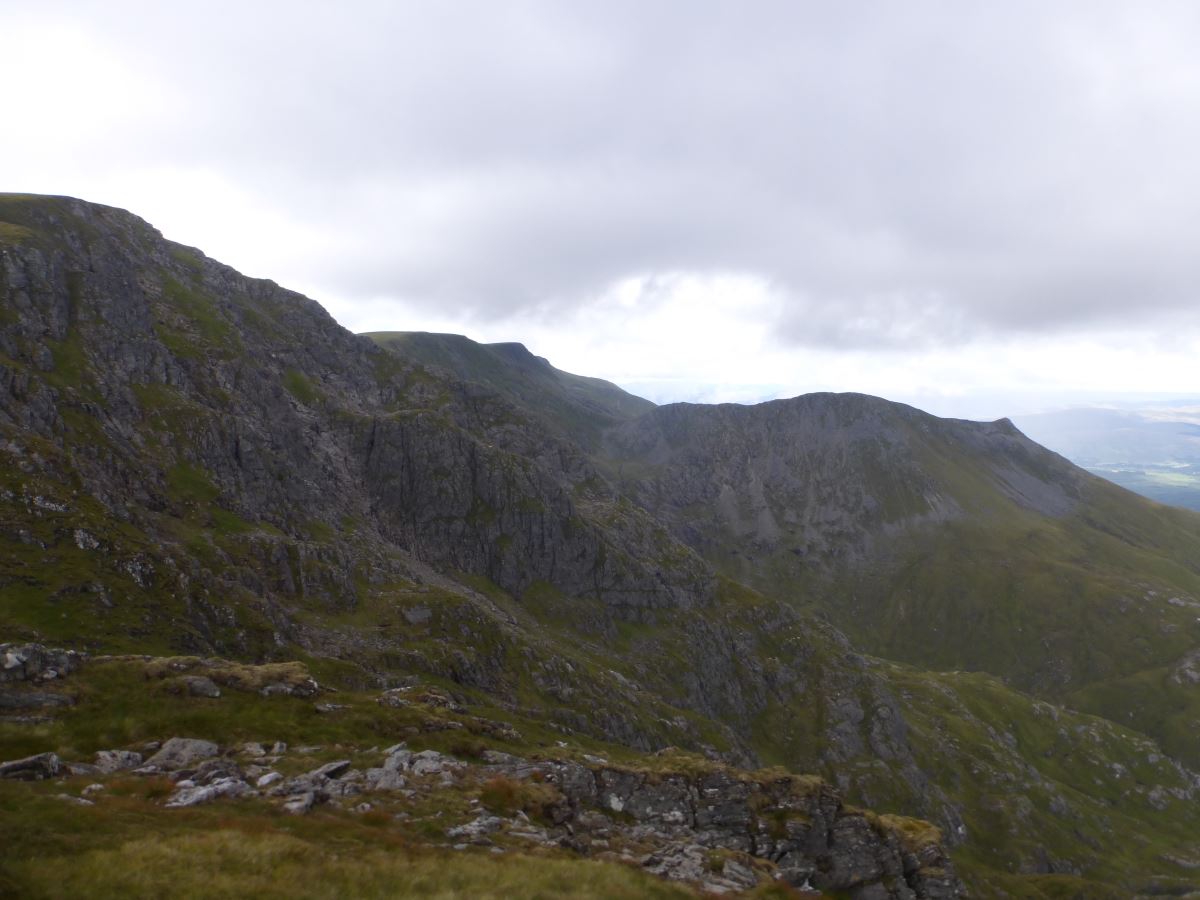
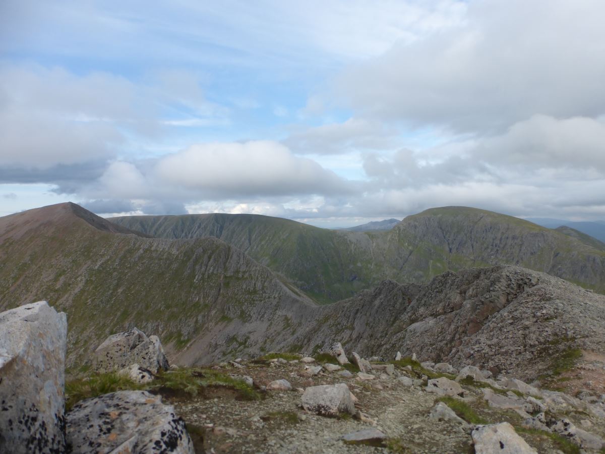
It’s 7am so all the Glen Nevis lay-bys are empty and I leave the car about 1km down from the youth hostel. I’m travelling anti-clockwise so start with a long plod up the Glen along the forest tracks. The sky is grey but contrary to the forecast it’s dry and I make good progress until the switch backs up to Mullach nan Coirean. There’s a little path that leaves the track here which I manage to walk straight past, then take a trod along the stream through the trees. After 50m or so it becomes rather precarious, then smaller and smaller, then I find myself essentially stuck in a very spiky sitka and have to admit that something has gone wrong. I extract myself, return to the track and then do manage to find the small and neat set of stone steps that I should have taken. It’s a frustrating start and I’m brushing sitka spikes out of my hair and the back of my neck for most of the rest of the ascent. Fortunately the ground is fairly dry and the rest of the way up Mullach nan Coirean is quick and straightforward. On the top I grab a photo and remove a sandwich from the bag and get going again. The cloud layer is hovering around summit level but mostly the way ahead is clear and I follow a long curving ridge, followed by a short and steep ascent on white quartzite blocks to Stob Ban. Another summit photo, some water and a cereal bar. The descent from Stob Ban is steep but straightforward and brings me down to a little lochan and some streams from which I refill my water. Then there’s a neat zig zag path up the other side. At the bealach I dump my bag for an out-and-back to Sgurr a Mhaim via the Devil’s Ridge. This is all familiar ground for me which is fortunate because the cloud is down and the rain starts to set in as I gain the ridgeline. The ridge itself is sharp but the scramble easily bypassed on the west side. Then it’s a slog up to the summit of Sgurr a Mhaim for a quick top touch, turn around and back again. I pass a couple of other walkers out on the Ring of Steall which previously I would have considered a long walk in itself and reflect that it’s already gone midday and I’ve only done 3 of my planned 10 munros… But the forecast is set to improve (hence my “late” start) and I’m fairly happy walking in the dark and ultimately it just takes as long as it takes. I try not to think too far ahead instead focussing on climbing the next summit, and then the next. I pass over Am Bodach where the view re-emerges and I allow myself to actually sit down for the first time and have a 10 minute break. Then comes Stob Coire a Chairn where I’m starting to get views of the new summits ahead of me. At the bealach I drop my bag again and slog up the steep side of An Gearanach then out along its long top to the far end and back. I leave my waterproof trousers in my rucksack which is why it now chucks it down, stopping just as I regain the bag some 40 minutes later. Oh well. The ring of Steall is complete.
Ascending Mullach nan Coirean
Mullach nan Coirean
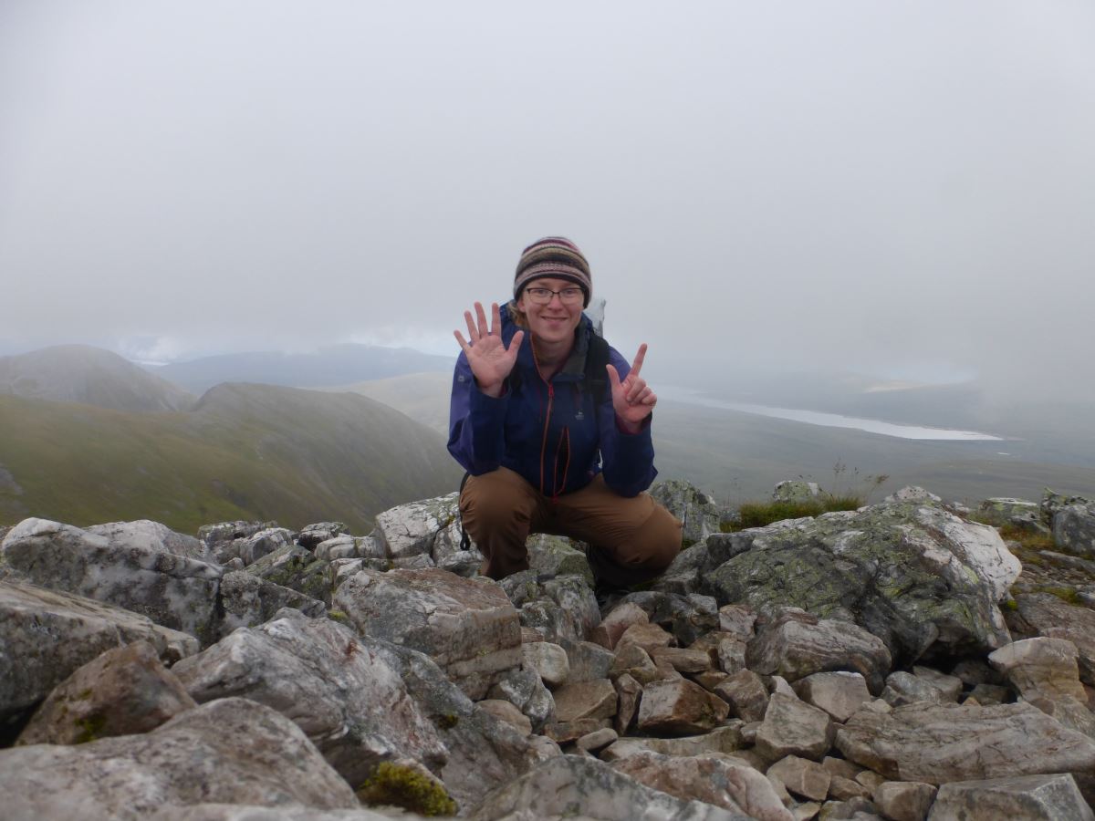
Summit 1: Mullach nan Coirean
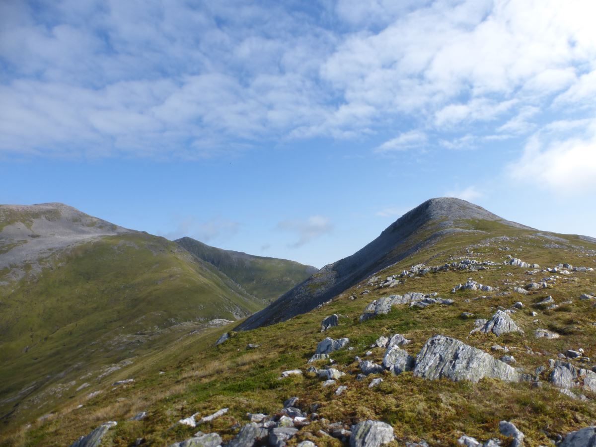
Towards Stob Ban
Ascent of Stob Ban
Stob Ban
The Devils Ridge
In the clouds on Sgurr a Mhaim
The Ring of Steall
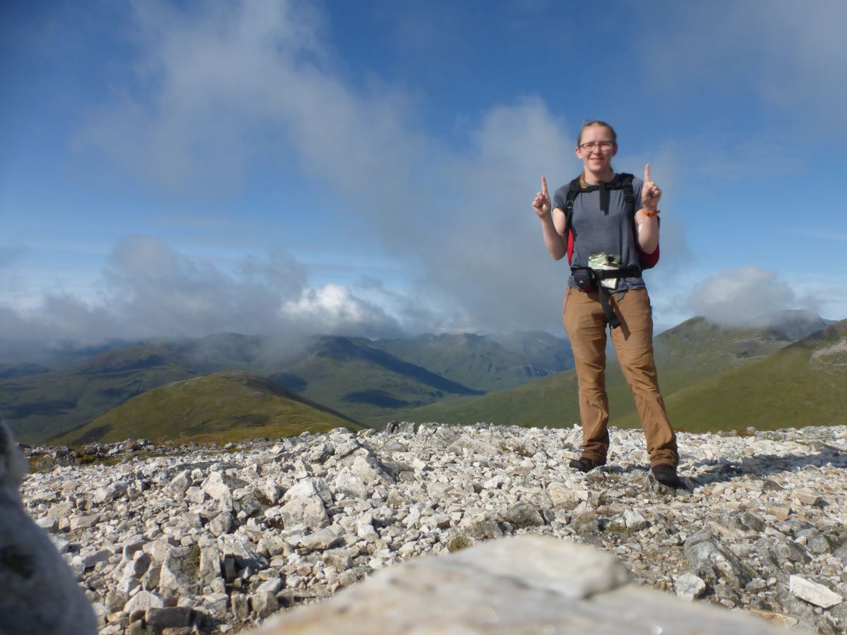
Enjoying a rest on Am Bodach
View ahead - need to climb all of these!
Looking back at Am Bodach
Stob Coire a Chairn
An Gearanach
Enjoying the rain on An Gearanach
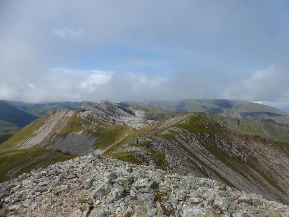
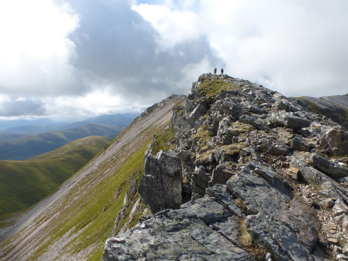
Still Day 1...
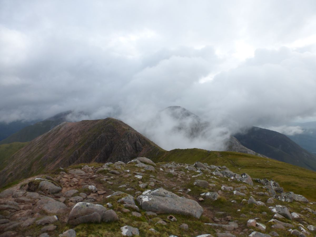
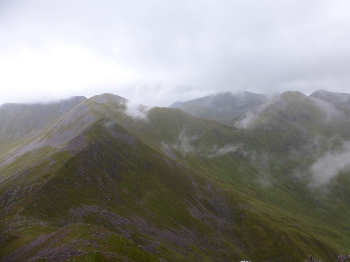
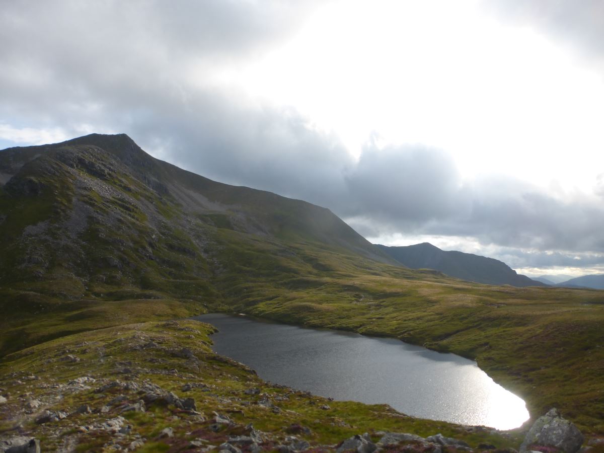
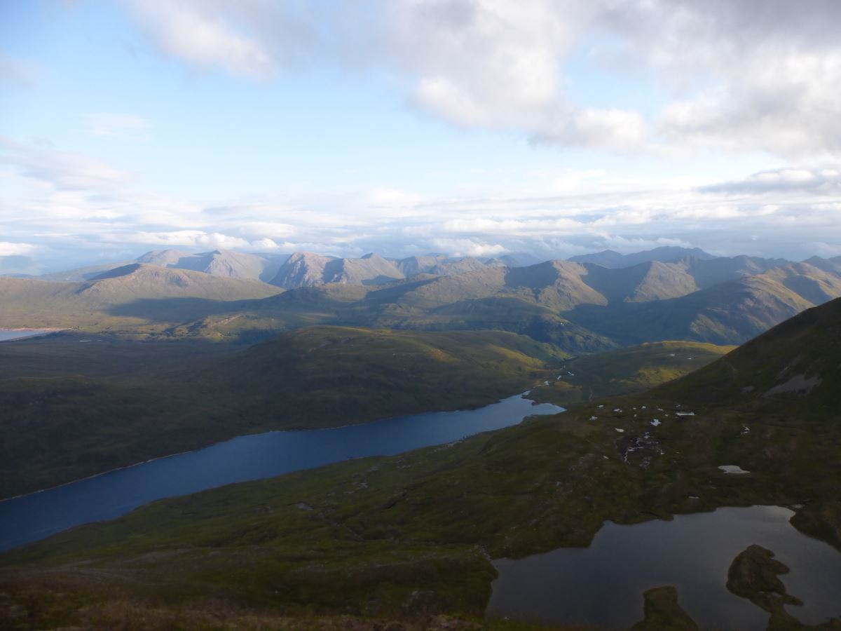
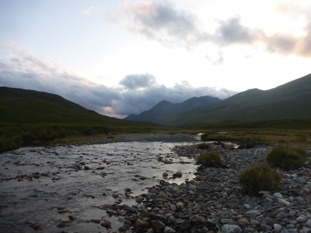
From here I’m onto new ground, starting with a cross country contour round to the next bealach to avoid re-ascending Stob Coire a Chairn. Before the clouds descended I did pick out the line of a trod but I can’t find it again now so just bash my way through the wet grass. There are a couple of side streams to re-fill the water bottle and re-gaining the ridge I have a quick stop to ring water out of my socks. Feet much lighter and less squelchy I head on up the ridge which leads to a slightly cruel false summit with a rough scree descent and re-ascent to the actual top of Na Gruagaichean. 7 down, 3 to go and the weather is looking up, clouds breaking around me to give back the view of the summits ahead. From here it’s an easy walk along the ridge to Binnein Mor, past a couple of tents where people are evidently anticipating a glorious morning sunrise. I did consider bivvying on this trip (and the bivvy bag is in as my emergency back-up plan) but if I stayed on this side of the glen there is no way I’d get all the way round tomorrow, and it’s just too far to contemplate getting up to Stob Ban on the other side tonight. From Binnein Mor I can see the rest of the route, with a big drop and re-ascent out to the last peak of the day. It is certainly the downside of the anti-clockwise route that all the biggest climbs are left till last. I was hoping that by this point I would have eaten enough food that my bag would feel lighter but there is no appreciable difference (or maybe I’m just tired). Setting off down the North-West ridge of Binnein Mor I take a little scree path down into the corrie and then contour across rough grass and heather past the little lochans. The blaeberries are out in force and I allow a few short pauses to gather some particularly large and tasty looking ones. Then I dump my bag for the final time for another out-and-back up Binnein Beag. It’s a rough and blocky ascent but easier than it first looks. At the top I’m treated to a moment of actual sunshine and have a sit for a snack stop. Then it’s back down again to collect the bag and off for another contouring traverse, though this time with an excellent path which makes it pass really quite quickly. I refill the water bottle for a final time then take a couple of zig-zags back up to the ridge where I’m greeted by a glimpse of sun covered peaks away across the lochans. The final climb up Sgurr Eilde Mor is probably the worst of the whole route, with a loose scree path that has me down on all fours genuinely wondering if a wrong step would see me slide to the bottom of the mountain. But then it’s done and I step onto the summit to the most amazing view with the mountains of Glen Coe bathed in golden evening sunshine. I stick some warm layers on and spend a while up there just taking it all in. Ten munros done in a day. Then it’s time to head down. Fortunately the descent is long and gentle with soft moss to cushion weary feet. I follow the line of the ridge all the way down to the river which is low enough to make for an easy crossing at a bank of shale. The final trudge along the bank to the bothy is apparently never ending but eventually the roof pops into view and I arrive just as the sun sets. There are four other occupants who are fortunately still up (though inform me that I’ve just missed the fire), and I make my way through lots of dehydrated food and collapse into bed.
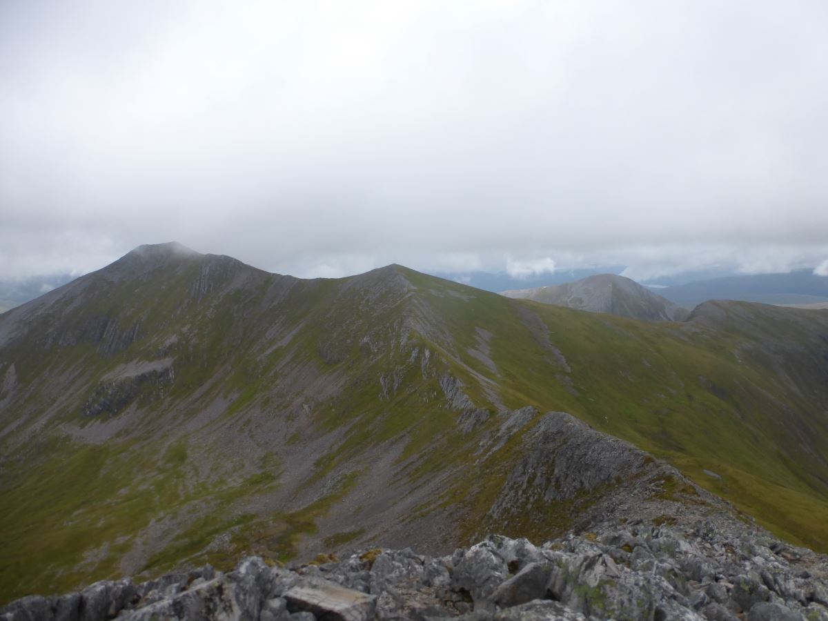
Looking ahead to Na Gruagaichean
A false summit, and a true one
Na Gruagaichean
Binnein Mor
Atmospheric cloud swirls on Binnein Mor
Binnein Mor
Looking down at Binnein Beag
Binnein Beag
Sunshine on the summit of Binnein Beag
Looking back at Binnein Mor
Start of the traverse to Sgurr Eilde Mor
A stunning view towards Glen Coe
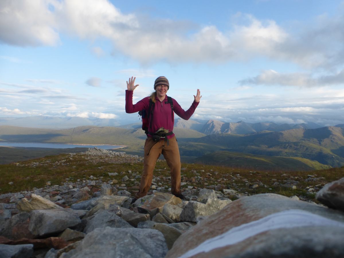
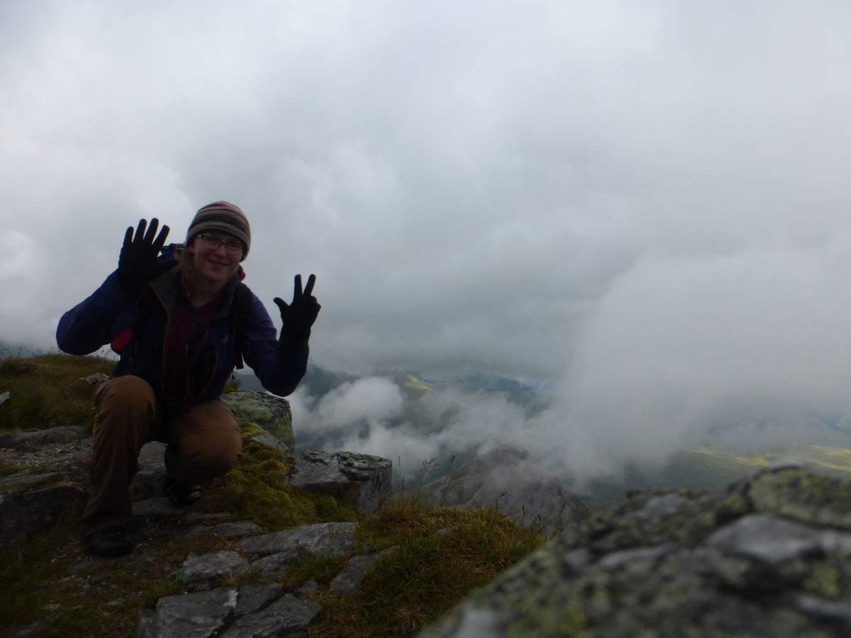
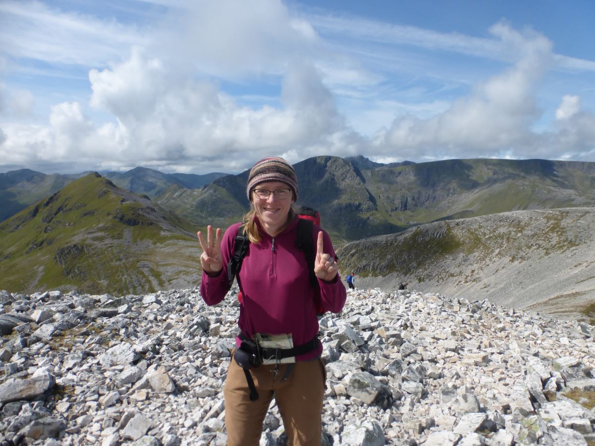
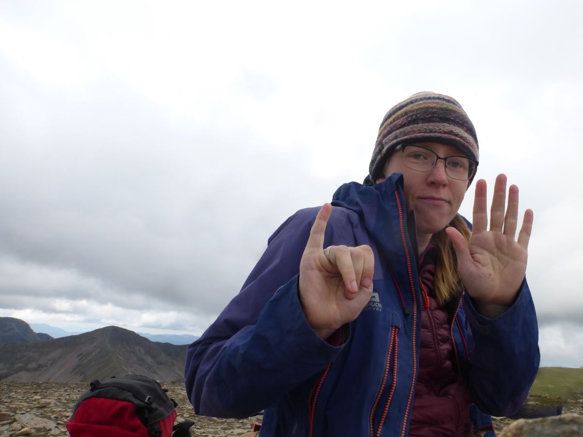
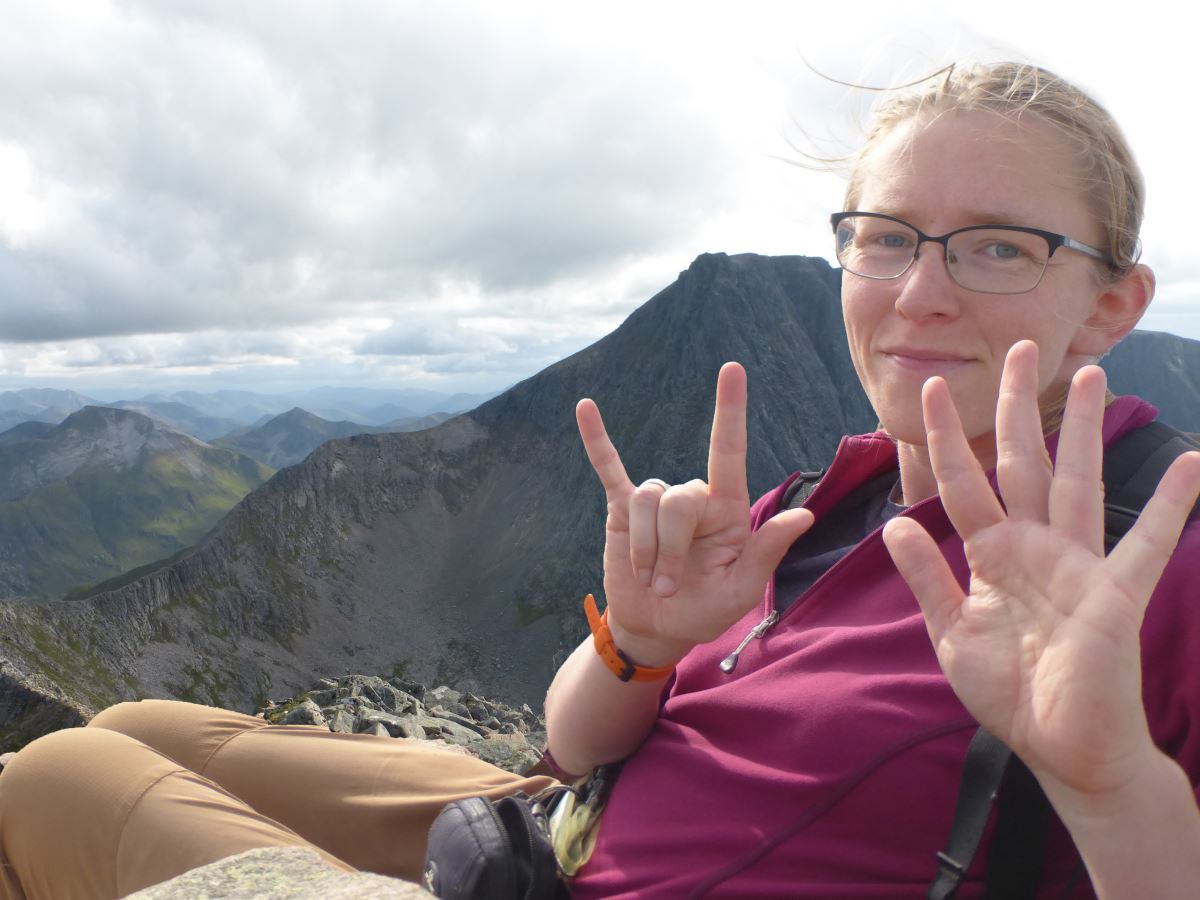
Number 10! Sgurr Eilde Mor
Watching the sun set on Sgurr Eilde Mor
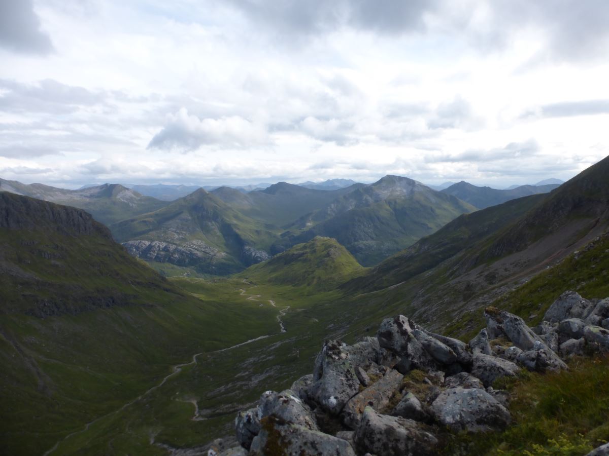
Abhainn Rath
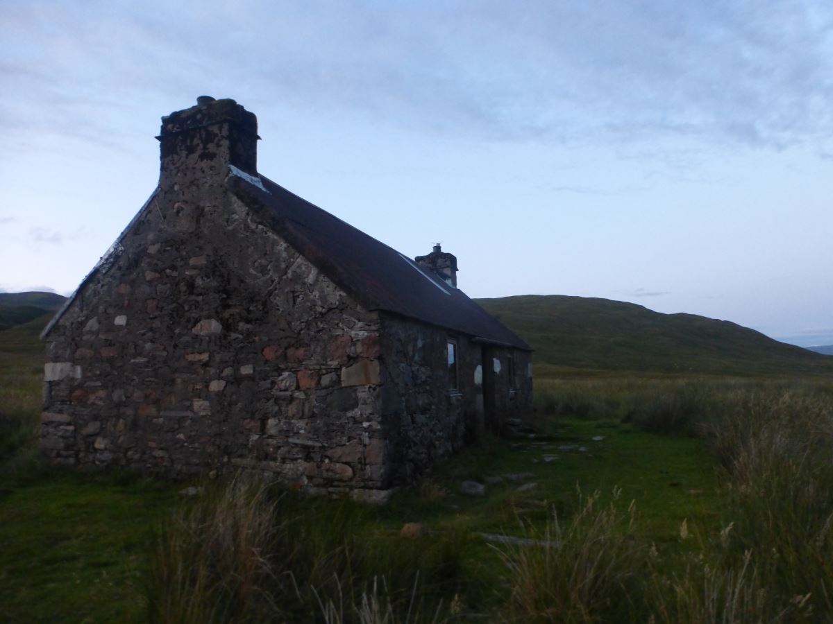
Meanach Bothy
Day 2
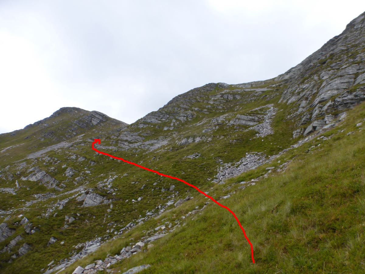
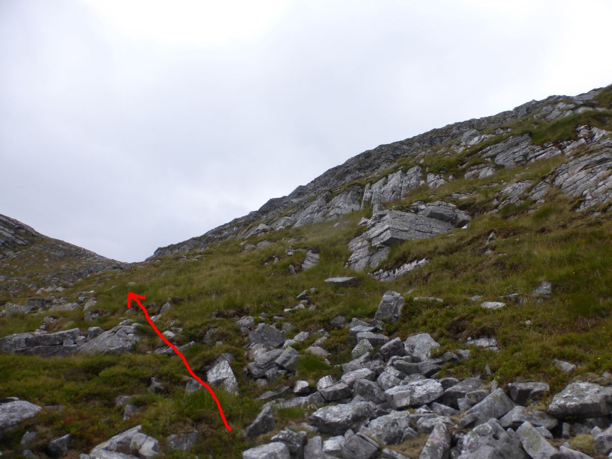
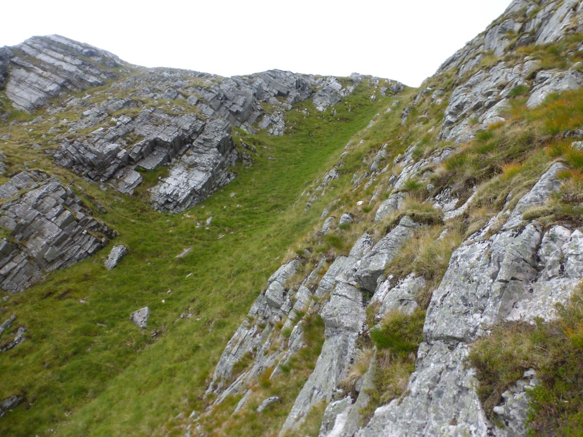
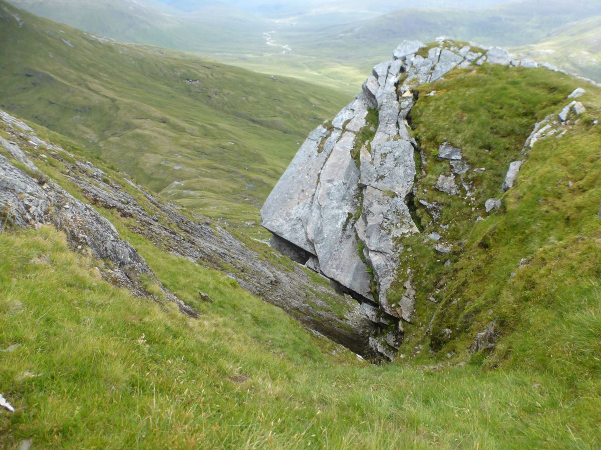
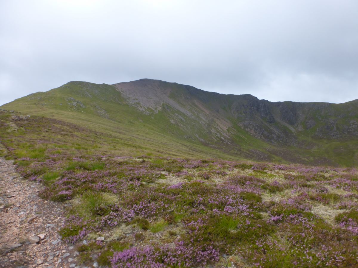
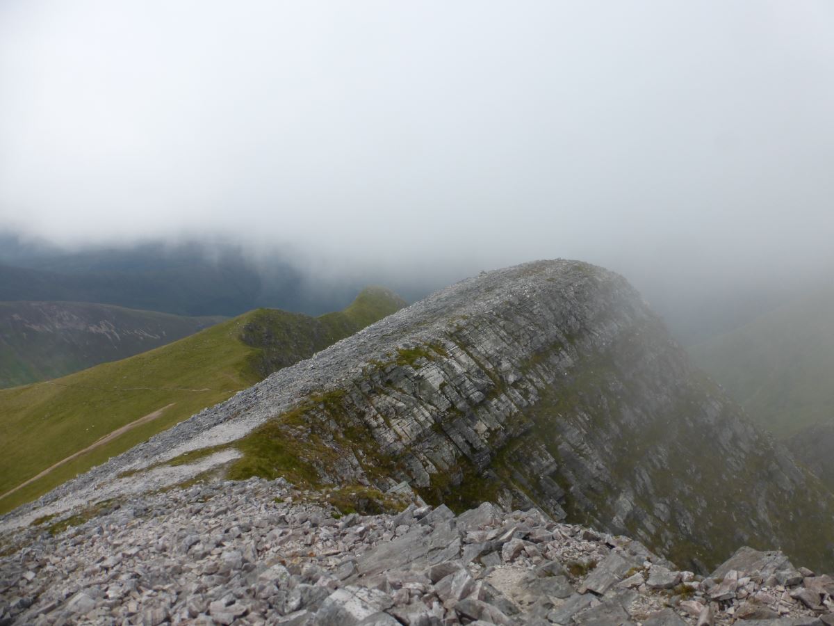
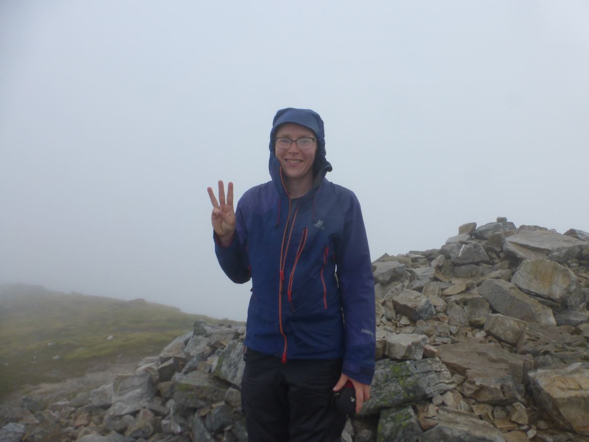
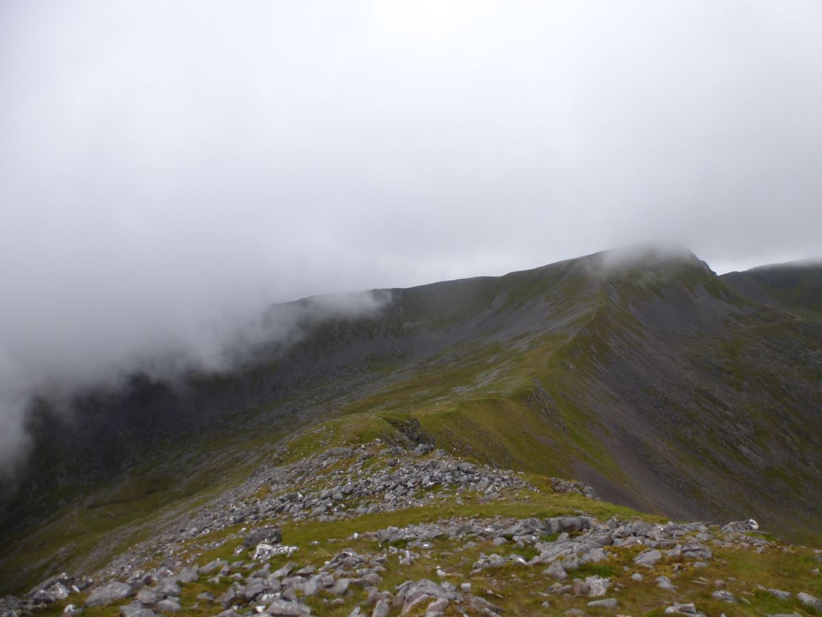
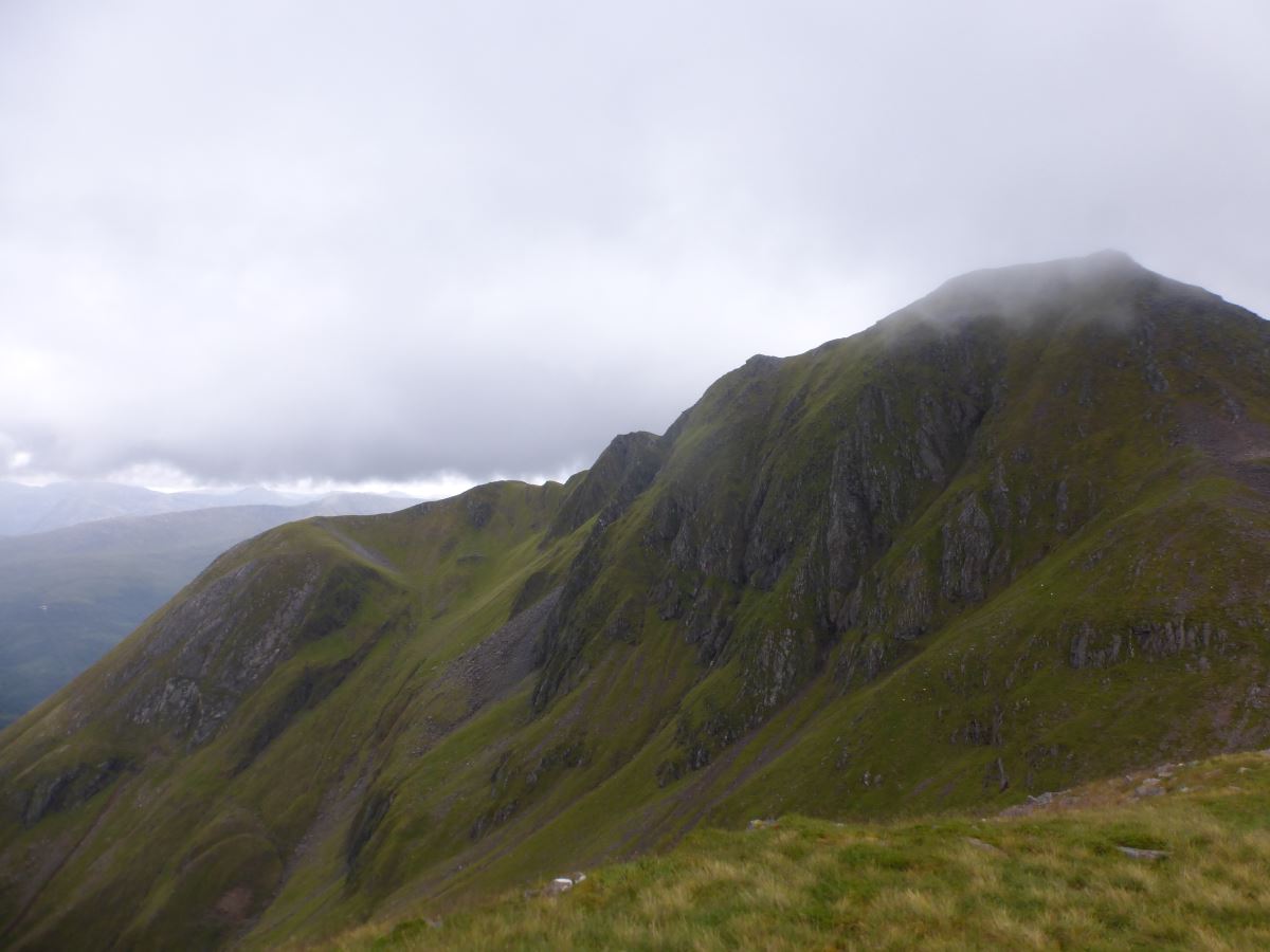
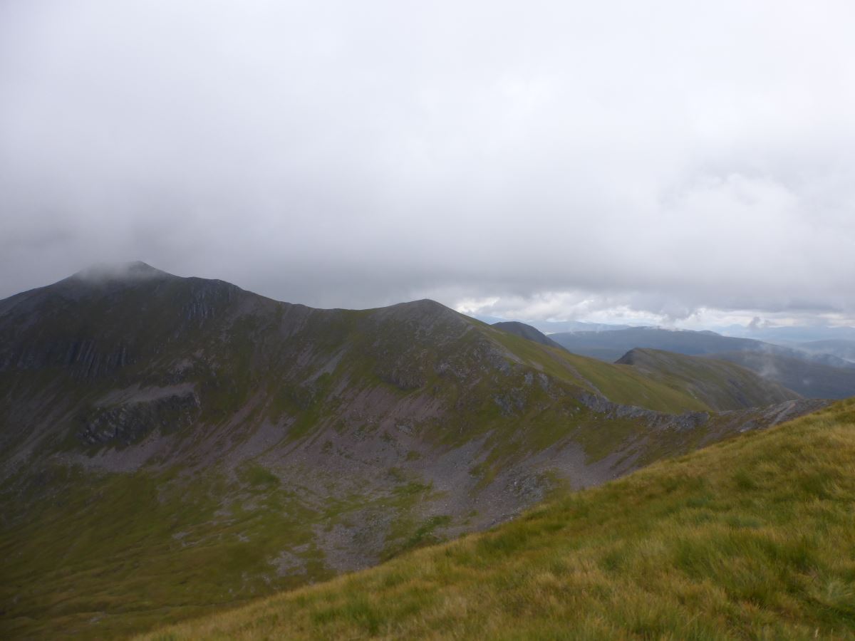
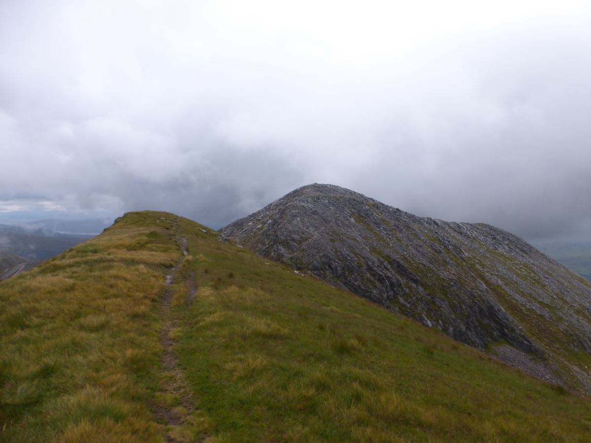
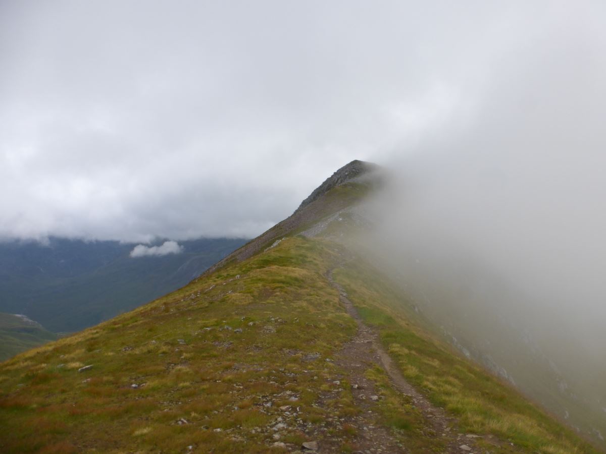
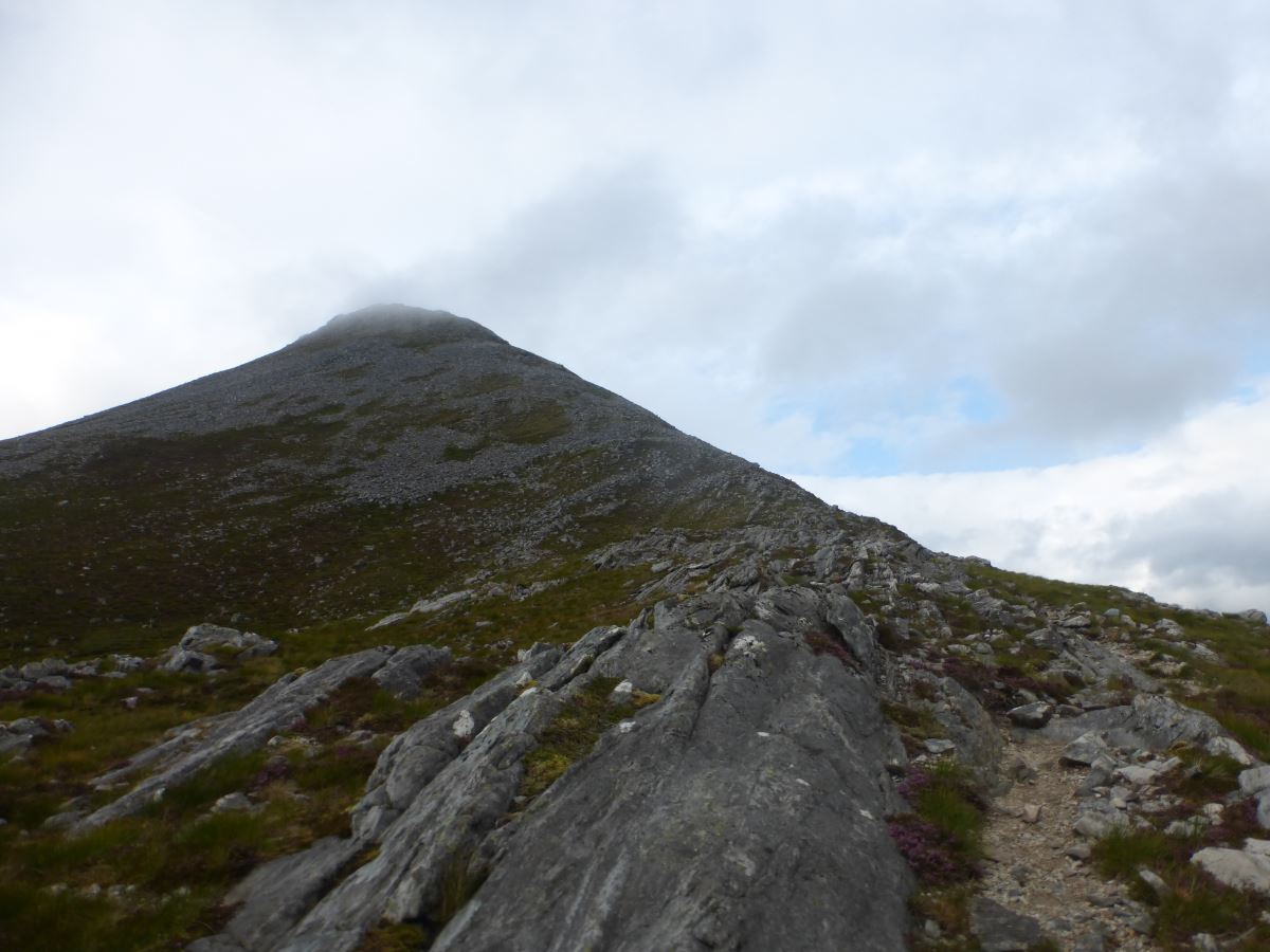
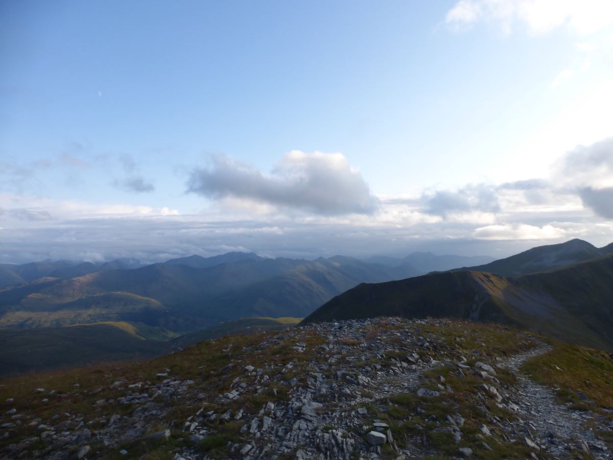
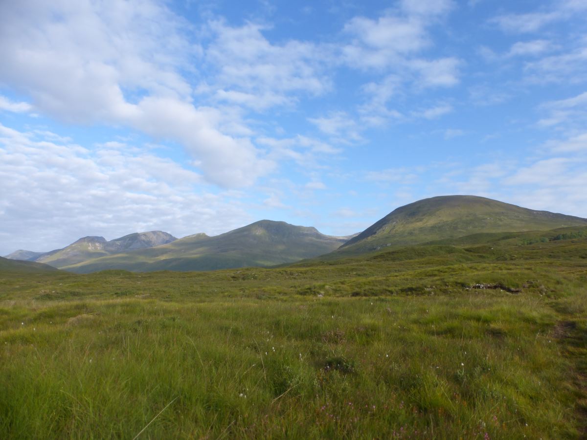
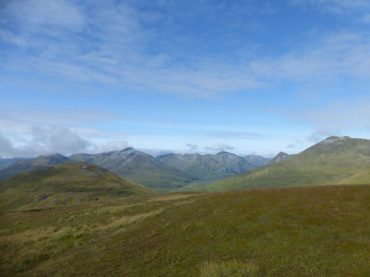
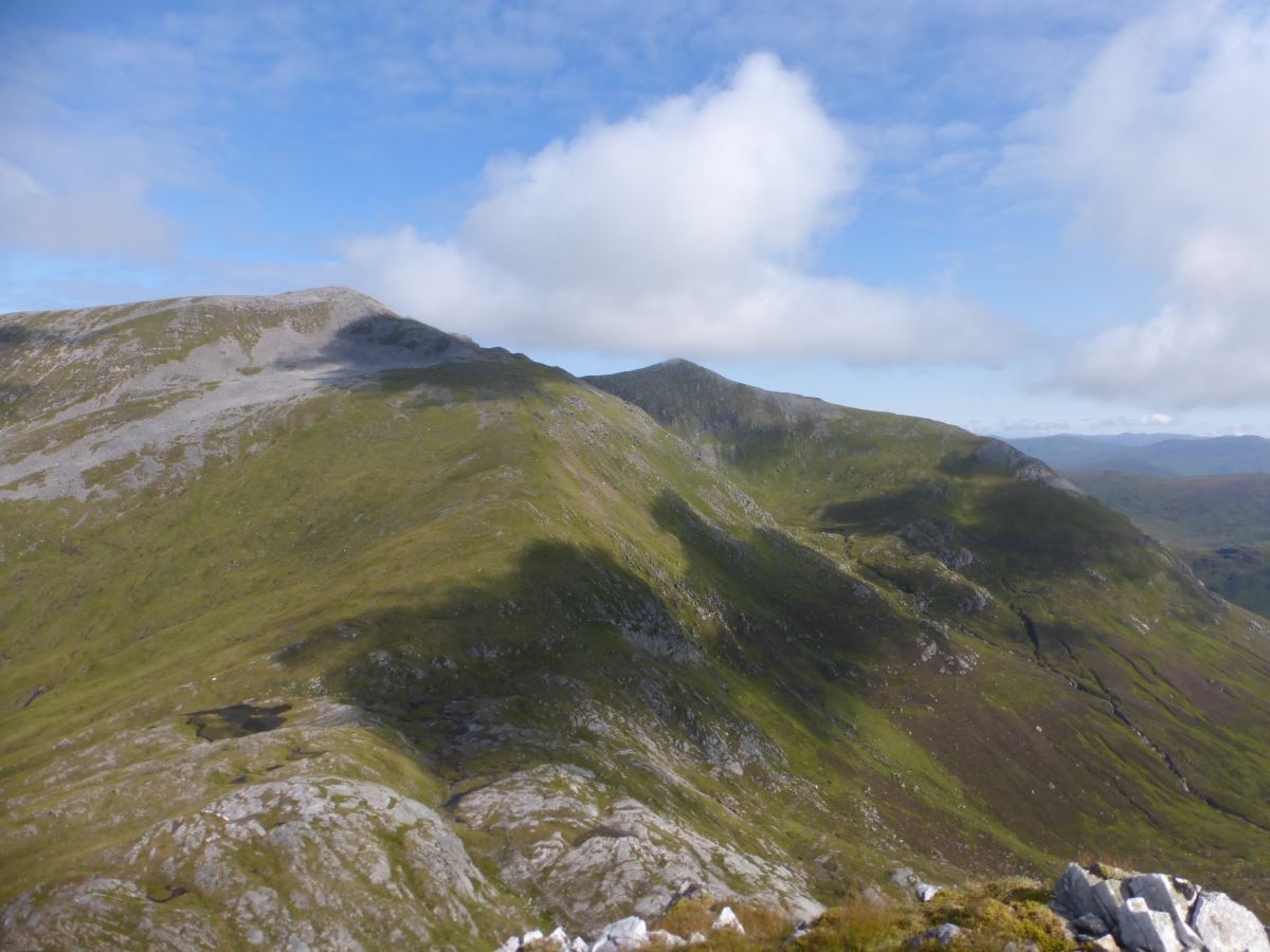
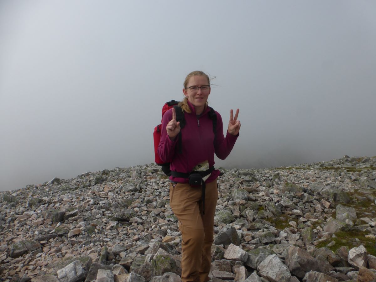
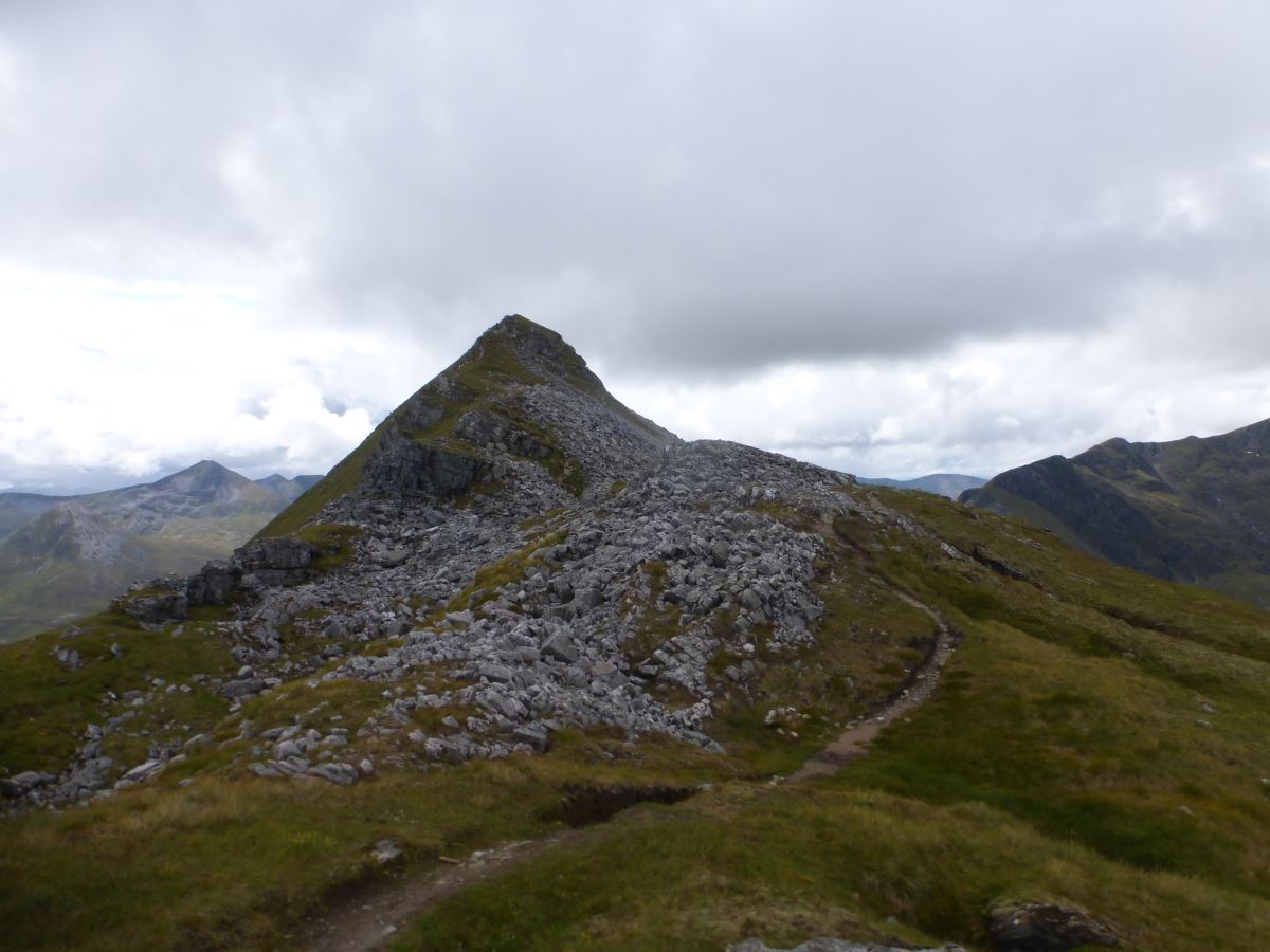
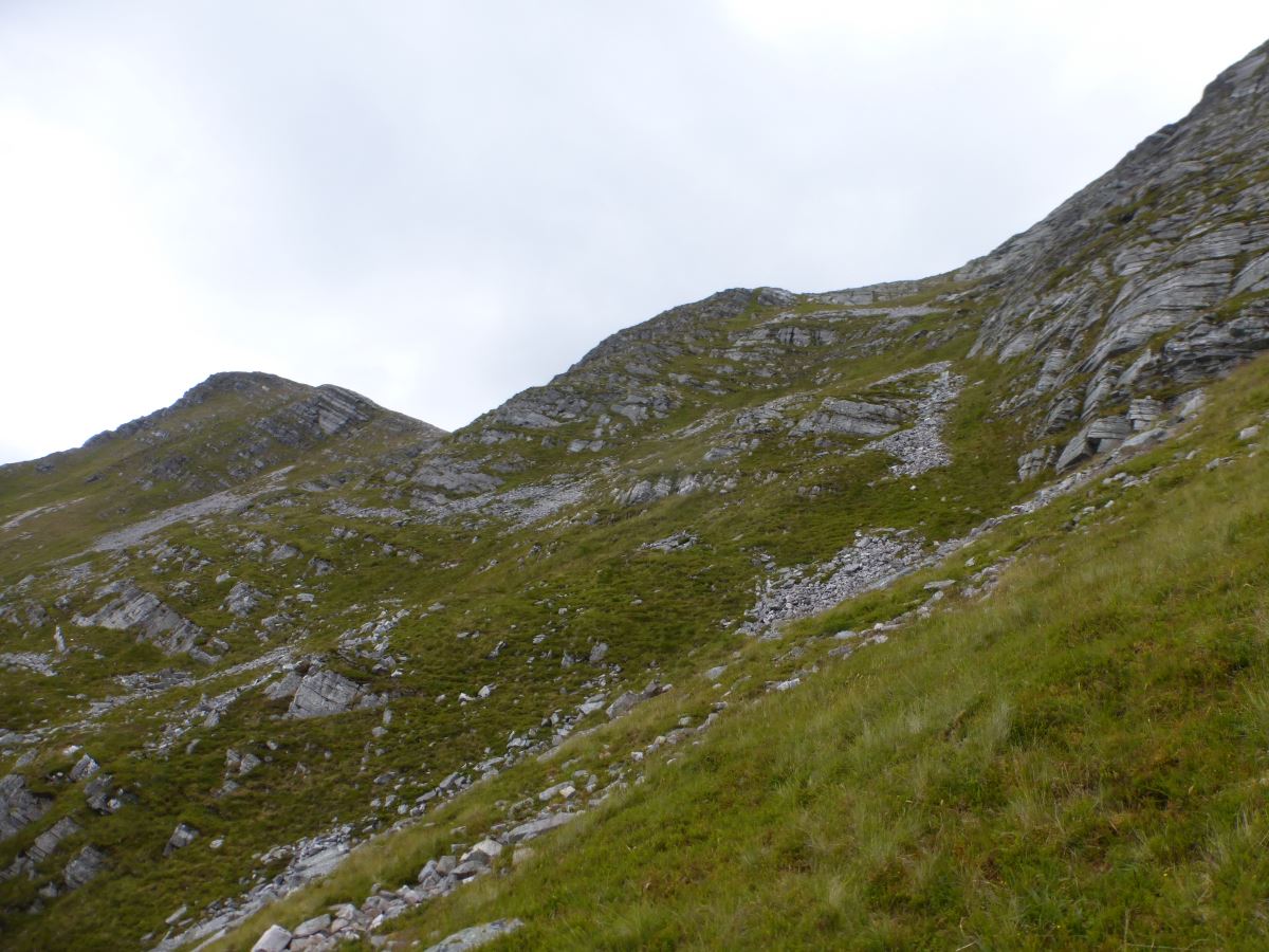
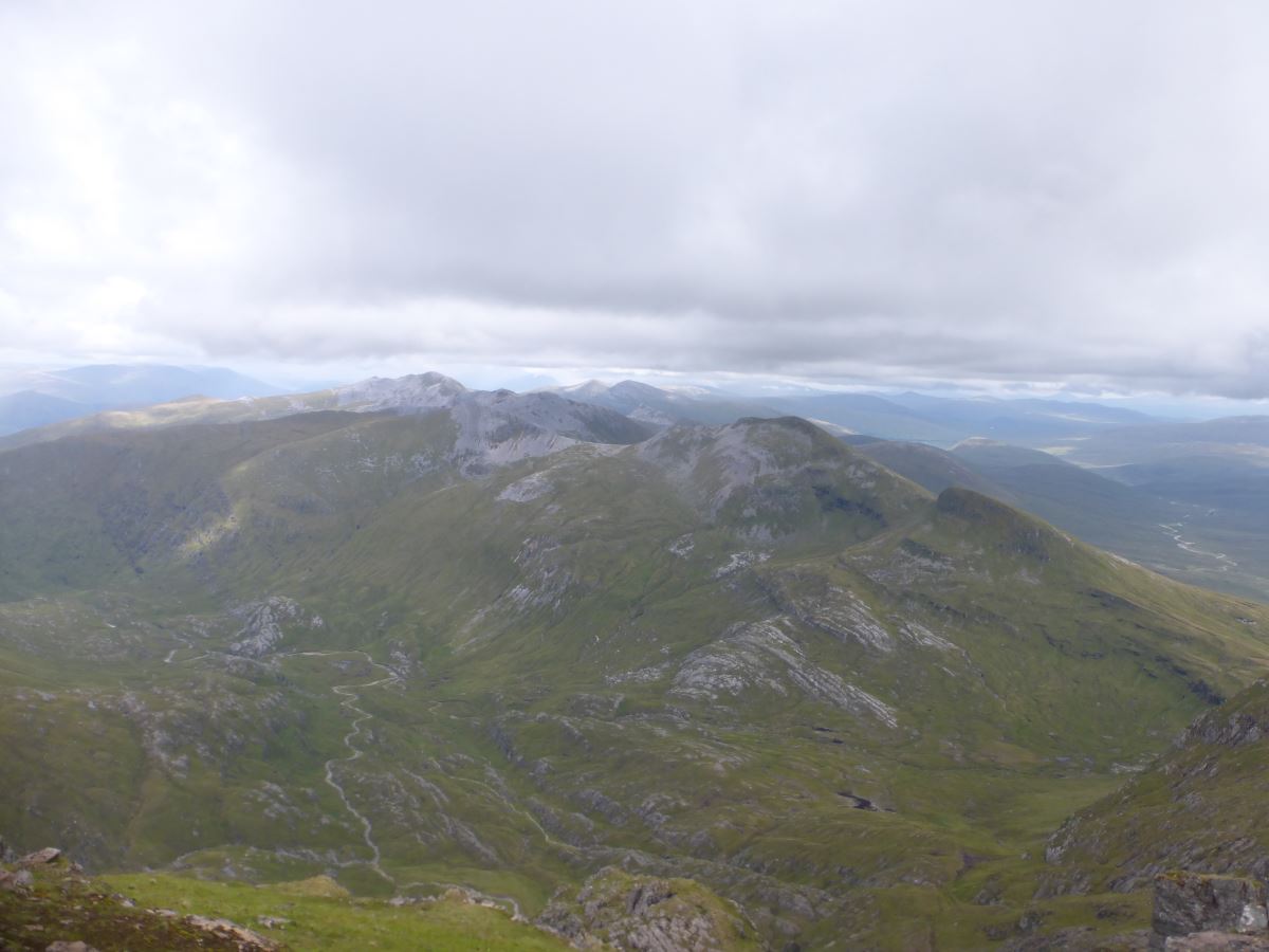
Following a fairly indifferent night’s sleep punctuated by random leg cramps and a small terrier barking at the sunrise, I ease myself gingerly out of the sleeping bag and find that I can still stand so that’s a good start. Breakfast is munched and the bag re-packed (still failing to feel any lighter) and I’m away before 8 for a reasonably long slog up the side of Stob Ban. It’s moderately boggy and mostly off path but the sun is out and the sky is almost completely blue with some fantastic views to lighten the load. I give myself two hours for the ascent and manage to beet that which is a good morale boost, though my legs feel about as tired as they did at the end of yesterday and have failed to magically fully recover overnight. I’ve managed to convince myself that because today is shorter and there are only 8 Munros to do rather than 10, it is going to be easier. I am resolutely ignoring the fact that a few of those Munros are a lot taller, and that I’m already pretty tired. I stop for a breather on Stob Ban to eat the remains of last night’s dehydrated meals which I had been a bit too tired to finish. I’m still not really feeling it today but am going to need all the calories I can get. Then it’s time for a steep descent down some nasty scree and across a short plateau where a brief detour off to the side finds more water. Then more up. Stob Ban is really just a small blip on the side of the much bigger Stob Choire Claurigh and I really feel the effort of this climb. At the top the clouds briefly wrap the summit and I take another rest stop to give them chance to clear. I’m also caught by a couple from the bothy are walking the same line as me today - the Lochaber Traverse. In one of those rather surreal “small world” moments one of them turns out to have been a runner on an incredibly epic Belgian ultra marathon that I was a medic on a couple of years ago. I am very much in awe of everything she achieved that week and it feels distinctly surreal to be up here now, pushing myself to a point where we are walking the same ground. Onwards across the Grey Corries ridge the clouds unwrap leaving us back in hot sunshine. The ridge itself is a stunningly beautiful walk with twisting bands of scree and crag offset against the green of fresh summer grass. I cross a series of minor summits and pass steep crags. It would all be perfect except that my stomach is starting to disagree with me, and a narrow scree ridge with people ahead and behind is not a good place to be looking for a loo stop… So with that motivation I come quite quickly to, and over, Stob Coire an Laoigh and up to the minor top of Stob Coire Easain. My map and the Cicerone guide both recommend bypassing this top to the south and I do spot a small trod emerging at the bottom of the scree slope, but no obvious trod through it. I dislike scree at the best of times so elect to stay on the ridge which remains an excellent walk. I drop off to the North to sort out my stomach, then spot a small contouring trod which I presume will take me back to the ridge. Unfortunately it turns out to actually be a descent route and leads me under a difficult slope of large boulders that I then have to clamber my way back up again to re-gain the crest. The people who had been just ahead of me are now quite small dots in the distance and I feel I’ve wasted a lot of time and energy here. But, did I mention that the views are stunning? Onwards it’s a short and quick ascent to Sgurr Choinnich Mor, and then the minor top of Sgurr Choinnich Beag. The top of Sgurr Choinnich Beag gives an excellent view of the rather tricky looking ascent towards Aonach Beag and I use “route studying” as an excuse to pause and munch half a soreen. The sky has greyed over though the tops remain clear and it all looks a bit daunting. Maybe it’s the daunting-ness, maybe it’s tiredness, or maybe I’ve drunk something I shouldn’t have but the food ominously sets my stomach grumbling again. I press on. There are essentially four options for the climb ahead of me which I’ve detailed at the bottom of the page case they are of help to someone in the future. In advance I’d sort of made my mind up to do the long but easy Grassy Gully, but now I’m here Cicerone’s meandering traverse line looks very doable and I decide in the moment to give it a go. Unfortunately their guide book is a coffee table affair, not one to stick in your pocket, so I’m going off memory (I really should have just taken a photo of the page but never mind). I’ve almost caught up with the other couple who are heading towards Charlie’s Gully and I briefly contemplate following them all the way up but realise that despite being a reassuring presence, they are also quite likely to dislodge scree on me. Instead I traverse grassy ground under a big triangle patch of scree and attempt to pick a diagonal line up to the right. In the moment though, it is consistently easier to walk left rather than right and soon I’m most of the way to Grassy Gully so decide just to finish up that. It’s a lovely easy plod and both a relief and an anticlimax to step out onto the top having not needed my hands at all. Having traversed so far left there is now a bit of a walk to return to the main route. I stop to peer down into the top of Charlie’s gully, which is impressive but steep enough that I feel nervous just standing at the edge of it and I’m very glad I came the way I did.
A beautiful blue sky morning and a long walk ahead
And yesterday's long walk to the side
Stob Ban
Sunny Stob Ban
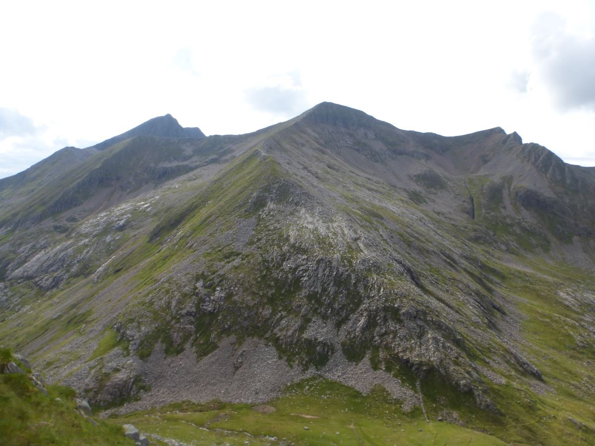
Stob Choire Claurigh
Stob Choire Cloud-righ?
Grey Corries Traverse
Grey Corries Traverse
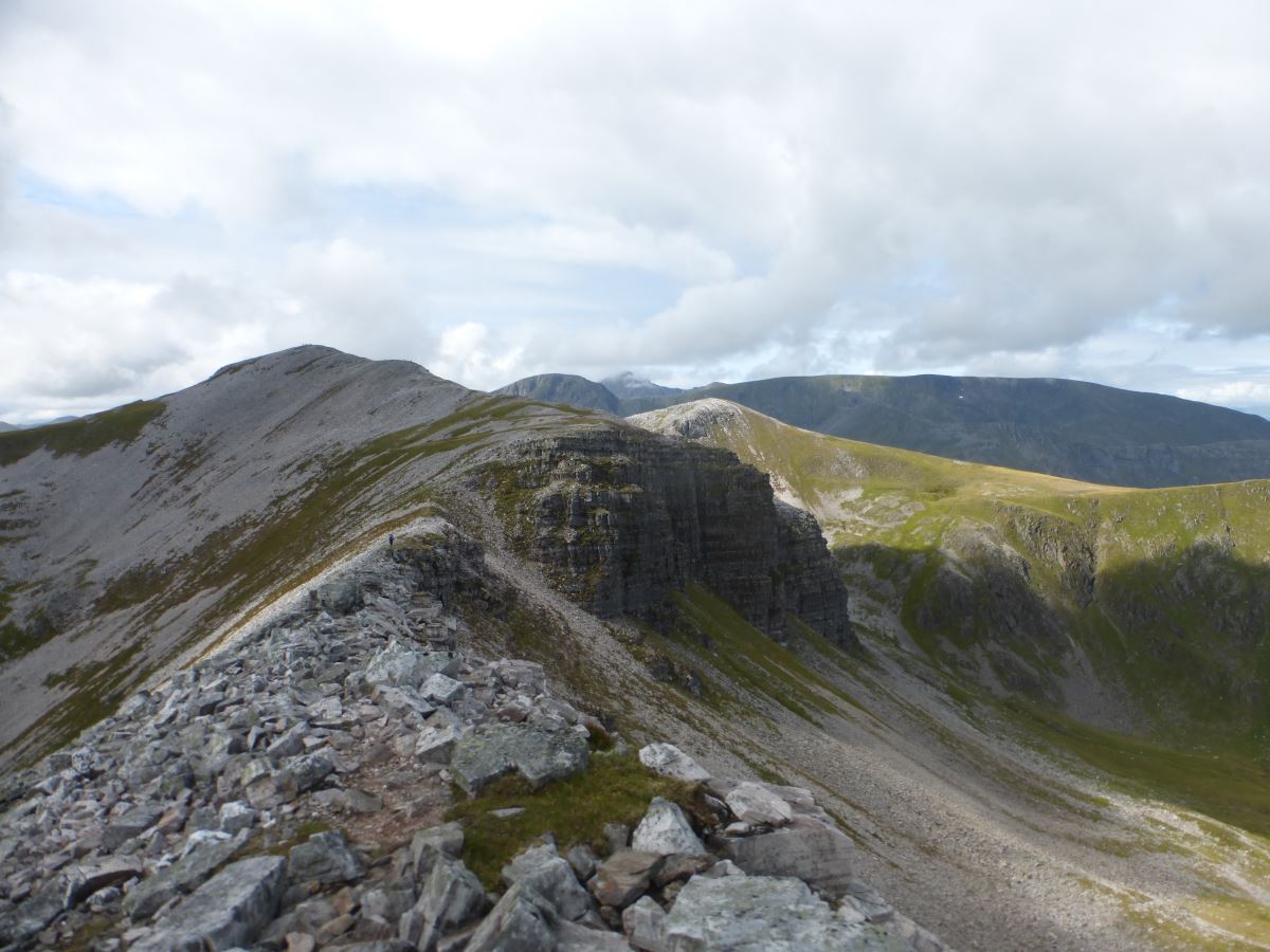
Grey Corries Traverse
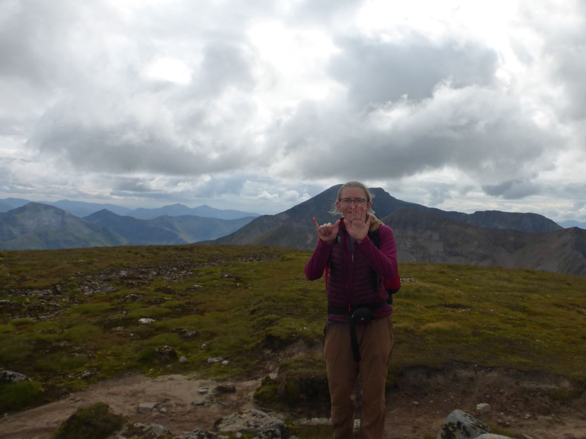
Stob Coire an Laoigh - 13 not 31!
Sgurr Choinnich Mor
Sgurr Choinnich Mor

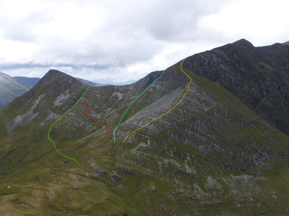
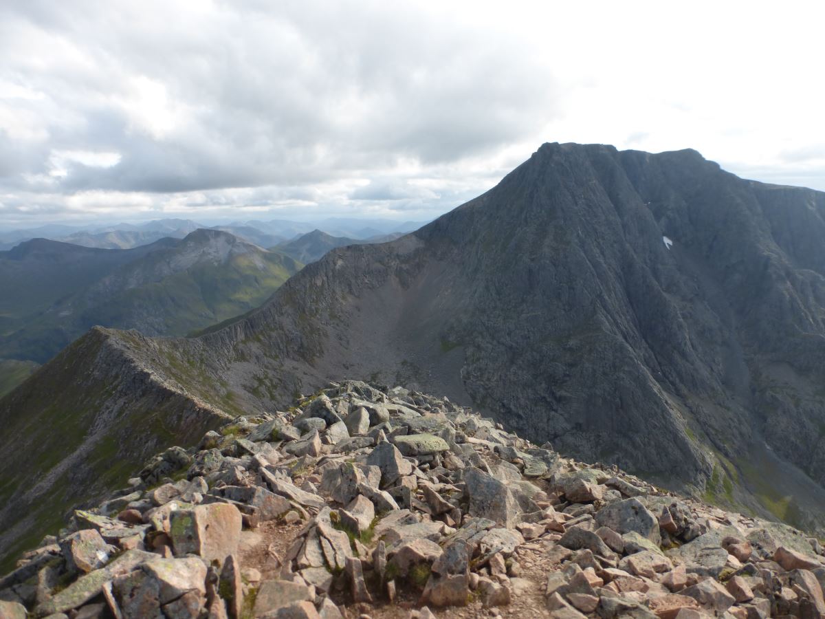
The "crux" link onto Aonach Beag
Picking a diagonal line
Day 2 Continued...
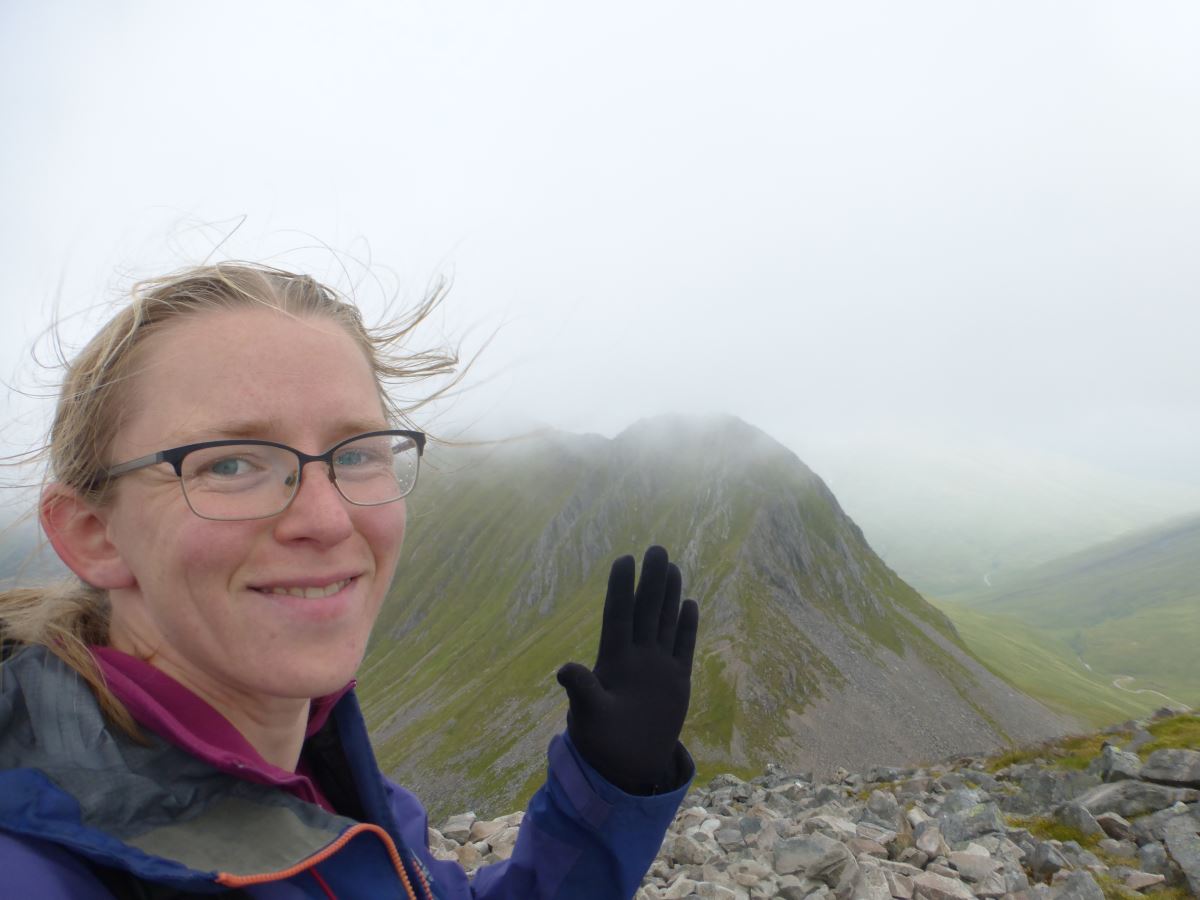
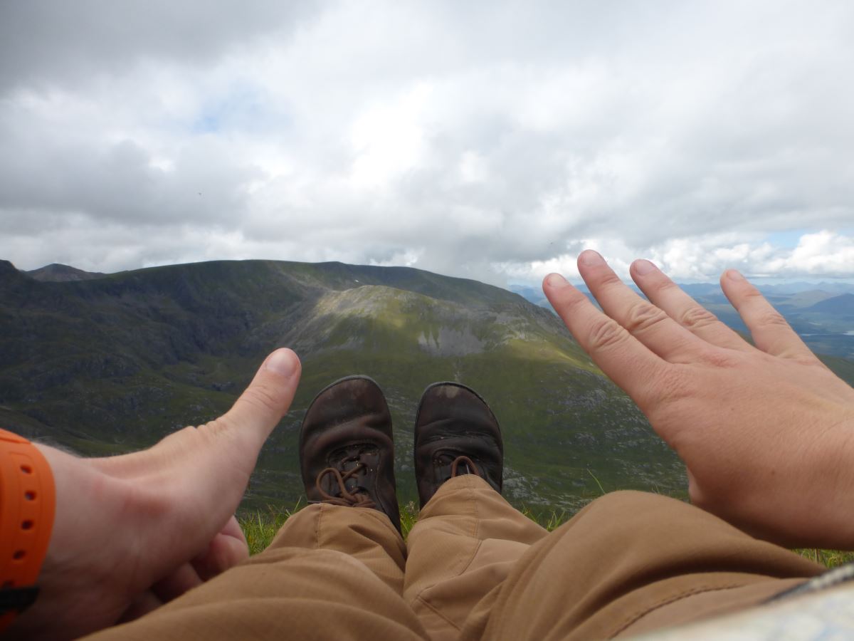
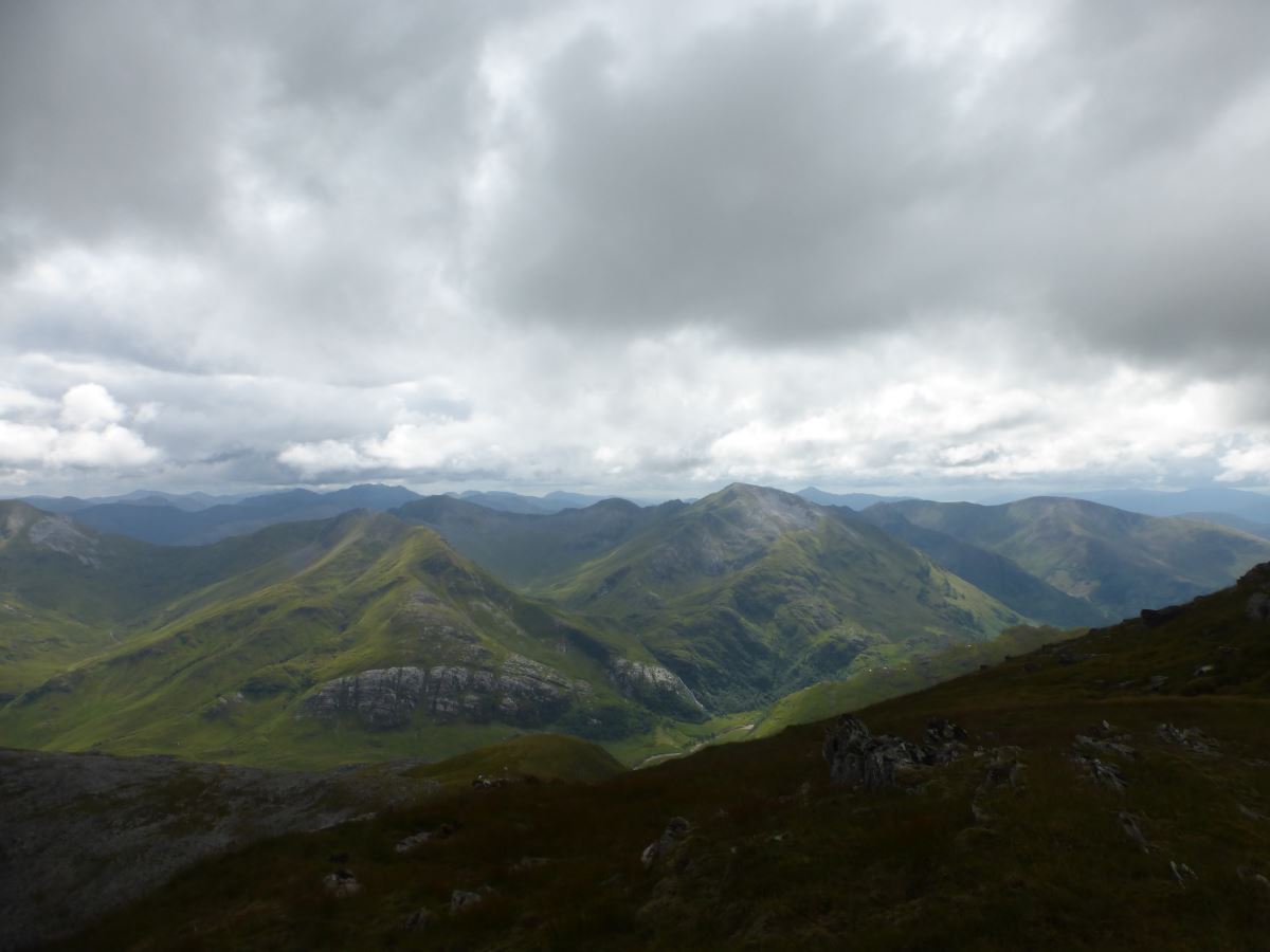
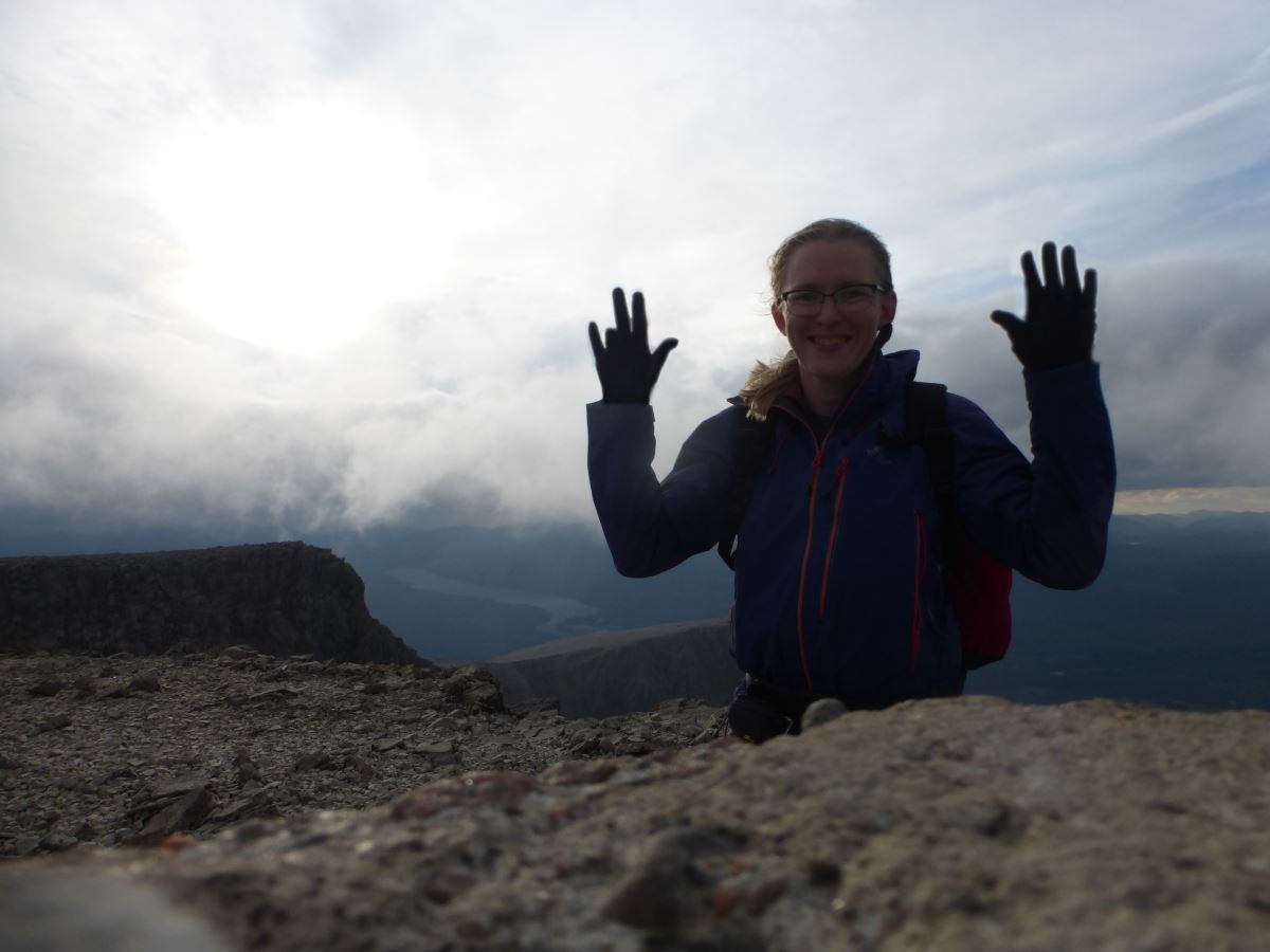
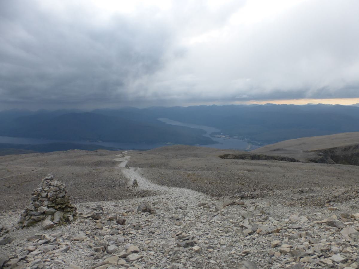
Onwards and upwards it’s a tough and almost never ending slog to gain the summit of Aonach Beag. The clouds are dark and oppressive, the summit eroded and barren and I’m really really tired. My stomach has settled down so I attempt to cheer myself up with half a chocolate brownie and instantly wish I hadn’t. It’s a bit of a low point. Feeling somewhat sorry for myself I trudge on, then watch the couple ahead (the same couple that includes the awe inspiring ultra-runner remember), turn off to the left and skip out Aonach Mor! Now, Aonach Mor is an out-and-back, and it’s a mountain I’ve climbed twice before, and I feel rubbish, and it takes a lot of will power to wave them goodbye and resolutely carry on. Luckily it’s also a pretty short and almost level walk. Top ticked I follow the edge of the plateau to avoid retracing my steps directly. The next section connecting to Carn Mor Dearg is another one that I’m a bit nervous about and I do miss the lack of the other couple just ahead finding the route. But like most situations it ends up being a lot worse in my imagination and in reality there is a little, somewhat eroded but easy to follow path that leads all the way down the spur. I take it slowly. Half way down I spot the other couple emerge from the bottom. They stand for a moment and look up the other side, then turn off South and walk away to the valley. I feel betrayed. I’m exhausted. I’m not hungry but definitely should be. My stomach is protesting, my legs are tired. I probably haven’t drunk enough. Ahead of me is yet another 400m fairly vertical ascent and after that comes Ben Nevis. Oh it would be so easy to follow them. But then, they haven’t down what I’ve done. They are on a day walk. I can look out across Glen Nevis to the Mamores, and see the mountains I crossed yesterday in the rain, now catching the sun. The ominous grey clouds are breaking up, the sky is bright. I haven’t come this far to give up now. (Some small rational part of my brain points out that this is how accidents happen, but another possibly delirious bit reasons that there are always plenty of people around on Ben Nevis to help if I collapse). So I carry on. I reach the bottom of the slope, fill up more water, and then head straight up the other side. Again there is a small path which proves reasonably easy to follow. I go slow and use my hands to take the strain off my legs. Ultimately it passes much quicker than I’m expecting and I make satisfying progress, noting that each time I stop to look back at the view I’m significantly higher. At last, I gain the summit of Carn Mor Dearg. The sun is out and I’m back on familiar ground. It feels good. I sit for a while. I’m possibly a little bit hungry but decide that the CMD arête is definitely not the place to be trying to arrange another desperation loo stop, so I just take on some water and rest. Onwards at a fairly pathetic plod I meander my way along the arête, taking the bypass paths where they present themselves but enjoying a few edge bits in between. It’s getting on for 6pm and I have the whole ridge to myself. The stunning alpine vista of the North Face dominates the view but turn to the East and Glen Nevis stretches away, all it’s many summits arranged out behind me. The ridge ends, the blocky side of the Ben stretches up ahead. Yesterday I climbed five Munros before sitting down for my first break, now it requires five breaks to complete this final epic. But then that’s it. The end of the up. A couple of people are just leaving the summit cairn and by the time I pick my way over to it I have the whole plateau all to myself. I rest a happy but weary hand on the summit of Ben Nevis, and risk a celebratory square of chocolate which my stomach thankfully accepts. Then it’s time for an awful lot of down. I pick up the descent track, wind my way gently from cairn to cairn. The clouds fill in softly behind me, blanketing the top. I start to pass a few stragglers heading down from their own climbs, playing leapfrog with a man who looks just as exhausted as me. We exchange weary smiles and deeply insightful comments such as “long way down isn’t it”. I wonder how many thousands of people have done the same.
Splits and a Crux
Having taken a photo on every summit I’ve ended up with a record of my split times which I’ve included below in case they can be of use to anyone. Make of them whatever you want but do note that the initial ascent of Mullach nan Coirean includes at least 10 minutes getting lost in some spiky trees. Left the car 06:58 Mullach nan Coirean 09:48 (8.98km 948m ascent) Stob Ban 10:49 (12.27km 1205m) Sgurr a Mhaim 12:04 (15.22km 1614m) Am Bodach 13:14 (17.58km 1866m) Stob Coire a Chairn 14:06 (19.27km 2053m) An Gearanach 14:44 (20.30km 2206m) Na Gruagaichean 16:26 (23.12km 2574m) Binnein Mor 17:16 (24.74km 2770m) Binnein Beag 18:27 (27.00km 2983m) Sgurr Eilde Mor 20:06 (30.80km 3382m) Meanach Bothy 21:52 (36.91km 3386m) Left the bothy 07:44 Stob Ban 09:36 (41.56km 3998m) Stob Choire Claurigh 11:03 (43.41km 4391m) Stob Choire an Laoigh 12:13 (46.20km 4516m) Sgurr Choinnich Mor 13:23 (48.09km 4694m) Aonach Beag 15:23 (52.92km 5294m) Aonach Mor 16:08 (54.49km 5430m) Carn Mor Dearg 17:45 (56.83km 5816m) Ben Nevis 19:26 (58.85km 6102m) Back to the car 22:14 (15 mins from YHA) (65.95km 6102m) In total: 29hr 24min (Day One: 14hr 54 mins, Day Two: 14hr 30 mins) A word on nutrition. I haven’t included the full details of my dodgy tummy on day 2 in this write up because that would be unpleasant both for me to recount and you to read. I speculated at the time whether I’d drunk something unwise but on making it home and managing to devour an entire pizza with no ill effects I suspect it was primarily exhaustion, and maybe too much sugar. I tried to stick to a system of eating something on every summit but in the entirety of the second day all I managed to eat was 3 porridge sachets, half a dehydrated expedition meal, one cereal bar, a third of a soreen and half a chocolate brownie, the last being on Aonach Beag - a long way from the end of the walk. I have no current plans to take on any other walks of this level, but if I do this is a note to myself to do some research into what runners eat during such challenges, and to make more sandwiches because they were what I was craving most. Having been somewhat nervous about the link between Sgurr Choinich Mor and Aonach Beag I also thought I'd include some extra detail on that. There are essentially four main options for ascent which are: 1. Spink’s Ridge (yellow) essentially follows the crest. The lower half is apparently fine, but there’s a nasty bit at the top which is very eroded and precarious. Cicerone guide states to avoid it, and a friend also warned me against doing it with a full rucksack so I’d stay clear. 2. Charlie’s Gully (blue) is a very impressive gash through the mountain which is worth taking a moment to appreciate. The couple ahead of me ascended this route. Again the top part is the crux and is essentially a series of steps trodden into almost vertical grass and scree. Peering in from above I was glad I had not come this way. 3. A meandering line through the rock bands (red). Cicerone recommends a line which I set off following but then lost my way (I had not remembered the details correctly and went too far left), so the line drawn shows my route rather than theirs. It was straight forward and I would happily do it again. 4. Grassy Gully (green) is a lovely easy grassy plod but comes with a traverse out and back which adds time/distance. The top bit which I used was very easy and a lot less steep than Charlie’s gully. In poor visibility I would opt for this route rather than the traverse.