Getting Qualified
An Account of my Mountain Leader Assessment
It’s one of my eventual life goals to end up as a mountain rescue doctor somewhere in the highlands and as part of this in October 2021 I completed my Summer Mountain Leader qualification. For those who aren’t familiar with the process this is a two part qualification - a one week training course then a one week assessment course with time in between for personal learning and consolidating skills. Following my assessment week I was asked to write a piece for Chris (my trainer & assessor)’s blog and thought I’d also include it here.
Monday Setting off up the side of Helvelyn, it’s a lovely sunny day. We talk about leading groups and how to assess people’s capabilities and do a bit of balancing over rocks to demonstrate that we’re all able to stay on our feet. After walking quite a way we get asked to locate ourselves on the map. Fortunately this is expected and I have been keeping an eye on it so this is a nice easy first tick. After this we leave the path behind and head off over some rougher ground around the base of a crag. We have a look at movement skills and do a couple of sets of pacing 100m over rocky ground. Then there’s another relocate for which “somewhere along the base of the crag” is not a good enough answer. We find a steep grassy gully through the middle of the crag and work our way up it back to the main ridge, again looking at the way we walk, standing upright, demonstrating foot placements. After this we fall into the routine in which we will spend most of the week - one person is given a point to lead to and on arrival the others have to work out where we are. We pass over Helvelyn and down Swirral Edge then leave the path behind once more, dropping steeply into the valley and back up the other side. As we’re climbing back up a shepherd and three dogs appear and start to gather the sheep in the valley. We’d all been asked in advance to prepare an interesting mountain-based talk and mine happens to be about upland sheep farming so it’s a perfect chance to watch a live demonstration and deliver that. Following this it’s a fairly gentle stroll back to the cars. We finish day one with a general mountain knowledge question paper. The answers are discussed as a group rather than formally marked and it’s a good chance to learn a few interesting facts.
Tuesday Day two is steep ground/rope work and we’re in Langdale, on the bouldery/craggy slopes above the Old Dungeon Ghyll. We probably only walk a couple of miles all day but it’s certainly action packed. We set off looking again at movement skills, and spend a while on a tricky section of path trying to climb it with no hands, or without making any noise etc. We try giving feedback to each other and work on some coaching. After a while things get steeper and we take it in turns to lead particular sections, looking at route finding and spotting. Things get steeper still and the rope comes out and now we’re taking it in turns to pitch short sections and set up anchors. There’s an inevitable bit of sitting around and waiting and we get a talk from another member of the group on the history of the Lakes national park which is pretty much all new to me and really interesting. My particular pitch is an awkward step which requires a tactical knee another person does actually slip on it and tests my belay (fortunately it’s solid!). From here we’ve run out of easily pitchable crag and it’s time to head down again. We do some confidence roping which turns out to be something all three of us are distinctly less confident about so our instructor does some coaching with us. We track backwards and forwards over a loose bit of scree so many times that we make our own paths but by the time we head down again we’ve got it sorted as a skill. Last but not least the gully ends in a short waterfall (luckily with not very much water) which is too steep to safely down climb. There’s a very convenient rock spike just at the top of it which I can throw the rope around and we take it in turns to demonstrate the South African abseil. Then we’re done for the day. We get some feedback from our instructor as we head down and finish off back at the pub with an interactive talk about the science behind a few weather prediction myths/sayings and another question paper - appropriately on mountain weather.
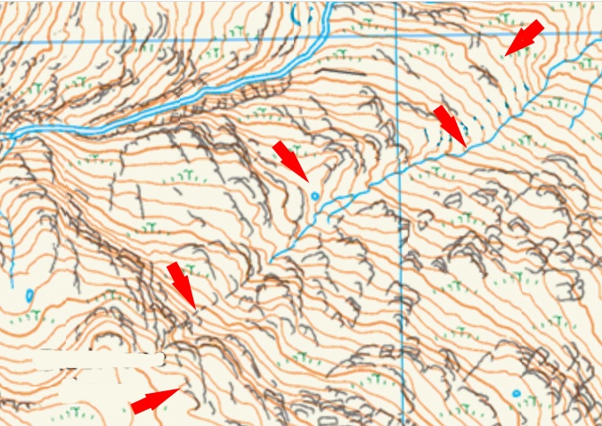
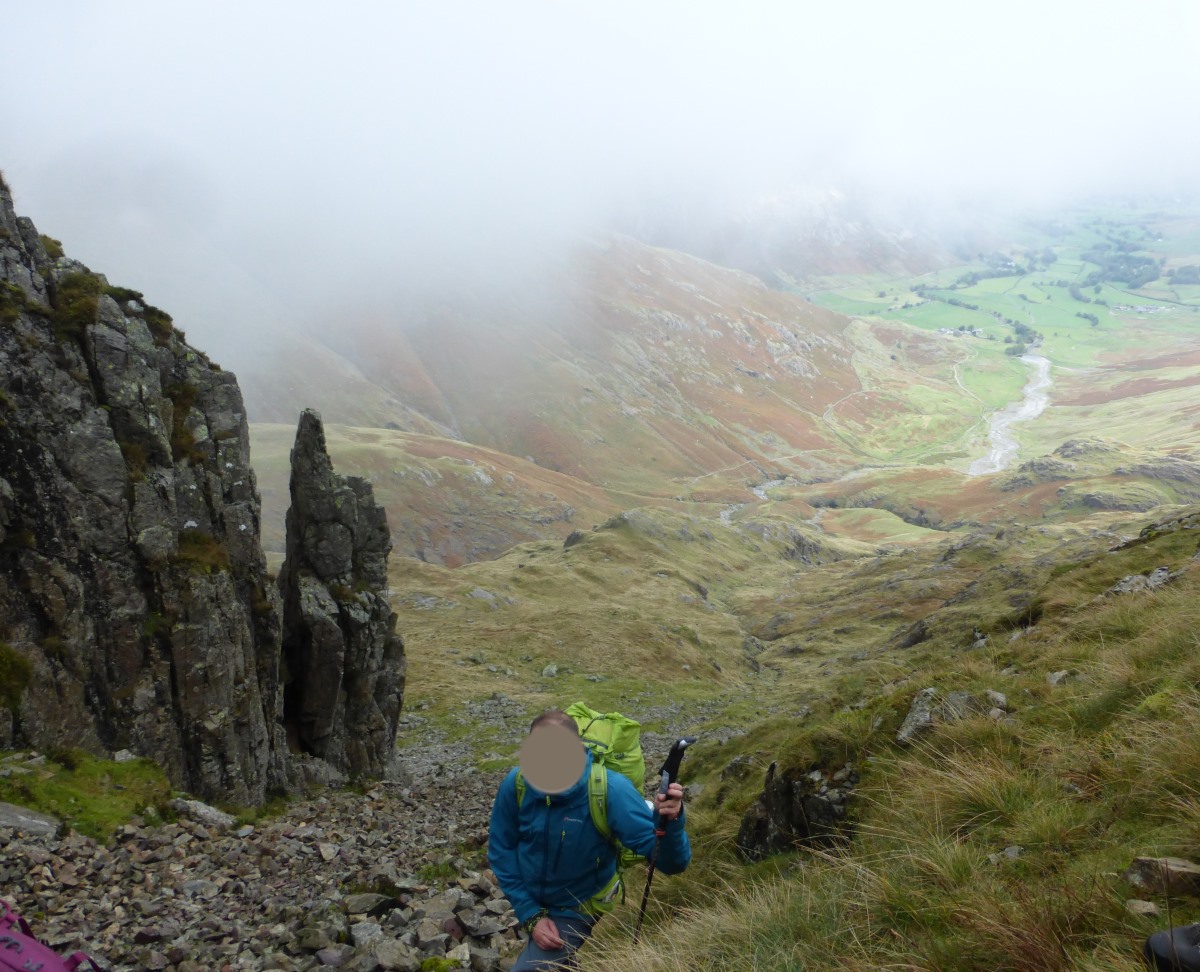
Wednesday Day three is the start of our two-night expedition so it’s time to lug out the big rucksack. There’s a bit of lifting each other’s packs and comparing loads but they’re all pretty similar. We’re in Langdale again, with the broad outline of the day being to head up and over Crinkle Crags to camp at Green Hole. We’re on the main path until we’re pretty much straight under Crinkle Crags and then set off up a gill doing some short navigation steps to find tiny dips in contours etc. I get the last step to lead us up onto the tops where the weather is definitely not what was forecast (high pressure, sunshine, etc.) and there’s a strong wind and clouds. I tell the others to stay sheltered in the gully which earns me brownie points for group management and means I can faff about in the cloud trying to find my feature without everyone else staring at me. In the end I’m about 30m off and get a “not quite, try again” at which point the cloud helpfully lifts up a bit and it’s much easier. The next leg for me is a following one and we join the main path and walk up it and then down it again and it looks like our leader has got slightly disorientated in the cloud. After a while they walk us towards the top of a crag and the instructor steps in and gets us all to relocate. Error spotted we’re able to drop down a grassy slope instead. The next leg is up a gully out the other side and over several small tops which I lose count of and the relocate takes me a while of walking around finding features, checking slope bearings and wishing it was a sunny day but I get it right in the end which is a good confidence boost. From here it’s my turn to lead us down to camp and we pop out the bottom of the cloud again to see the other group heading down the slope next to us. Obviously it’s not a race but just for the record we win. Down at camp we get the tents pitched and have dinner. One advantage of October is we don’t have to wait long for it to get dark and then we head out for some night navigation. Because it’s been cloudy half the day we only have to do one leg each which is a nice bonus. We head up stream to one point, then across through a bog to another at which point there’s some confused looks. A quick heads together between two of us reveals that actually we’d first set off up the wrong stream and point one wasn’t where we’d been meant to be at all. It’s an odd affect of the system that, unless you have these little chats, you actually have very little idea of how your fellows are doing and whether the points you’re finding are anywhere near the points they were supposed to be taking you! The last leg is mine to contour round a little crag to a lump next to the main stream (which fortunately appears almost exactly where I expect it to be), then it’s back to the tents for a well deserved night’s sleep.
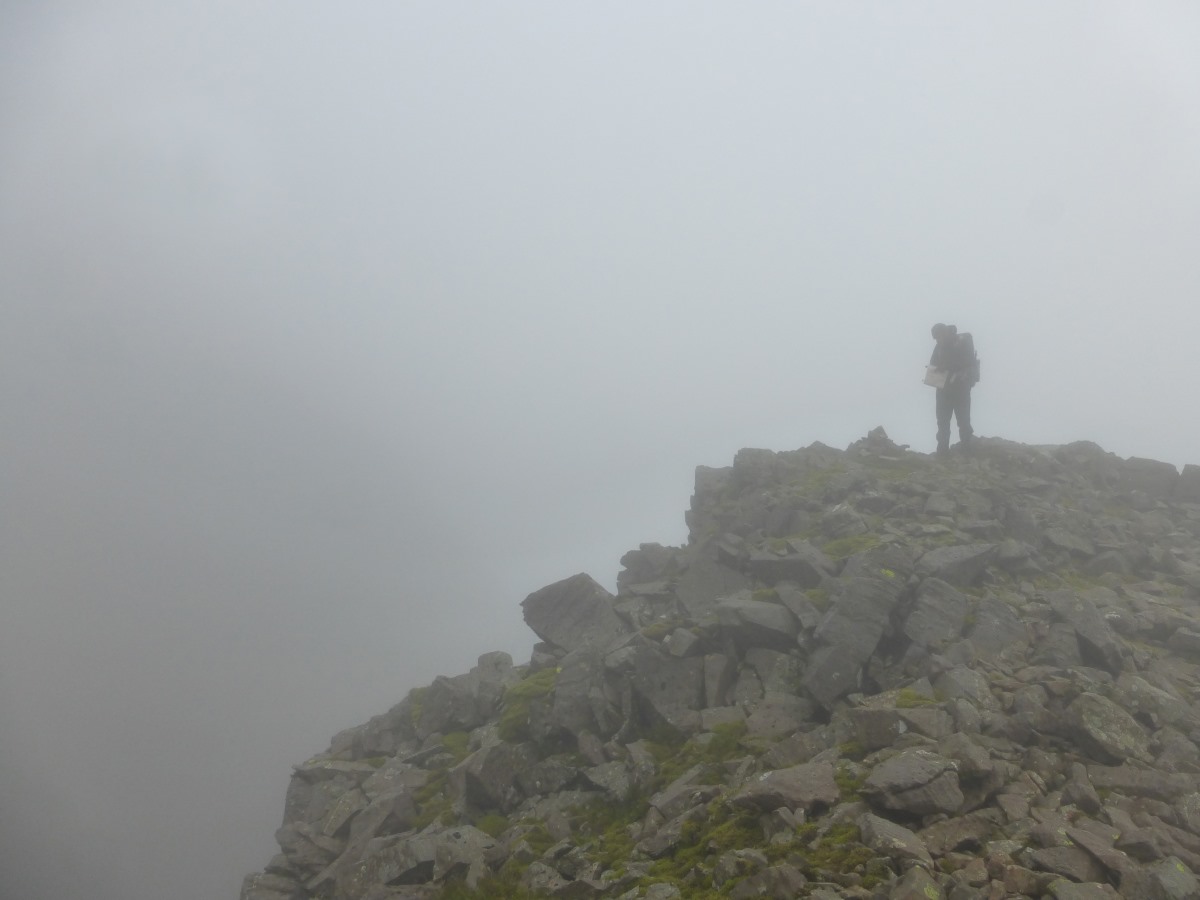
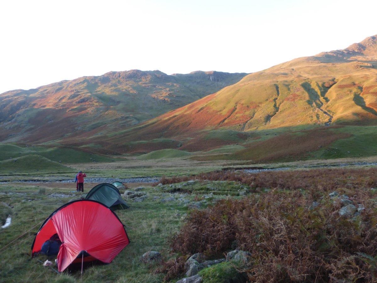
Thursday The cloud is still with us when we emerge from the tents this morning and I make an excellent job of burning my porridge while watching it race across the tops. Packing up we head off back past the features we found in the dark last night. We’ve changed maps today and are on the 1:40,000 Harvey’s and doing much longer navigation legs. We head up to a ring contour on a broad ridge, then I take us down to a path junction at the base of Dow Crag. The stream is small enough to not pose any issues but we have a snack stop and talk through how to do river crossings. From here it’s off up a gully but not for long because then we curl round over the top of Dow Crag and do a series of micro-nav legs on some quite tricky ground to re-enter the cloud and eventually end up on top of Scafell Pike. It’s slow going with gusty winds and greasy rocks underfoot though we break it up spotting different types of moss and speculating on the geology of some interesting rocks. From here we stick to the main ridge and feature-by-feature head down to Angle Tarn where we’re supposed to be camping. The wind is only getting stronger and there are distinct waves on the surface of the tarn so we quickly abandon that plan! We have dinner while waiting to see if the other group shows up then head down into the top of Langdale where we pitch the tents in extreme haste as the rain finally starts to fall. Sheltering in my tent I get the welcome news that I don’t need to demonstrate any more night nav though I do feel rather sorry for the one member of our group who has to head back out with our instructor into the pouring rain.
Friday Sunshine! It’s a beautiful clear sky with the sun breaking across the valley and hardly any wind. A short walk gets us back to the ODG where Chris has organised bacon butties (and veggie sausages) as a finishing treat. Then it’s time for debriefs and we all get an individual chat with our three instructors with our results (mostly passes but a couple deferred on navigation) and chance to talk about our next steps. We’re finished before 12 which leaves plenty of time for me to head up for a quick and very refreshing dip in Stickle Tarn and head home.
Written October 2021